Millhill

Settlement in Devon West Devon

England

Millhill

One of the paths in the Tamar Trails The positions are a best guess and are on the path heading towards the site of Wheal Emma.
One of the paths in the Tamar Trails Credit: Chris Allen

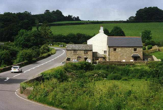
Millhill is a small village located in the county of Devon, England. Situated in the South West of the country, it is nestled in the rolling hills and picturesque countryside that Devon is renowned for. The village is part of the West Devon district and is approximately 7 miles north of the bustling market town of Tavistock.

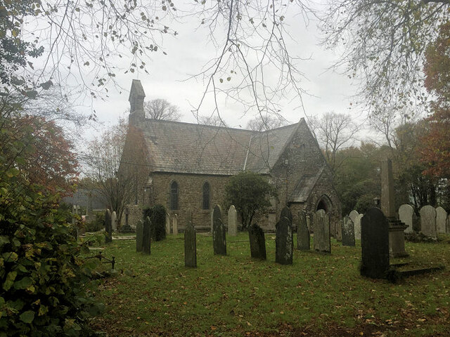
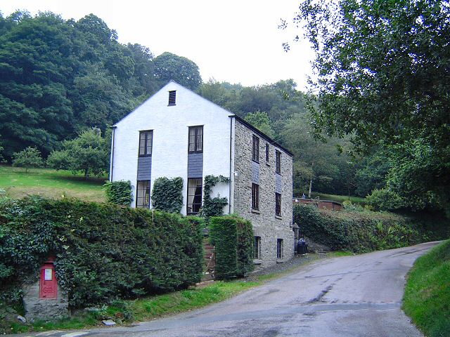
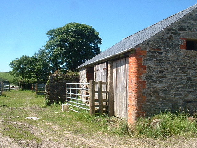
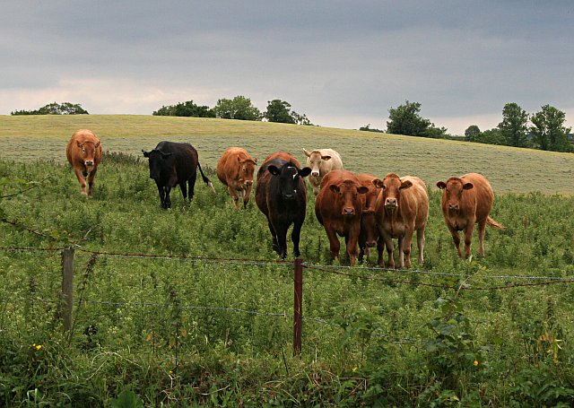
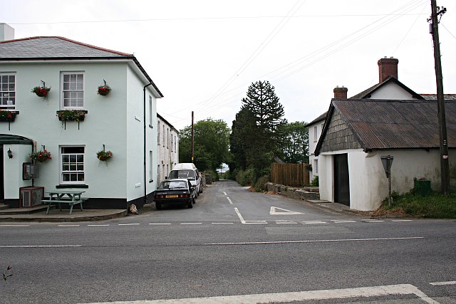
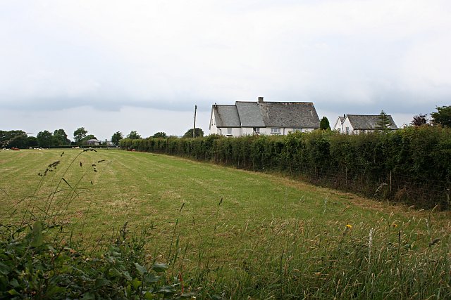
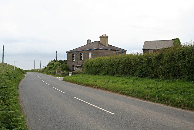
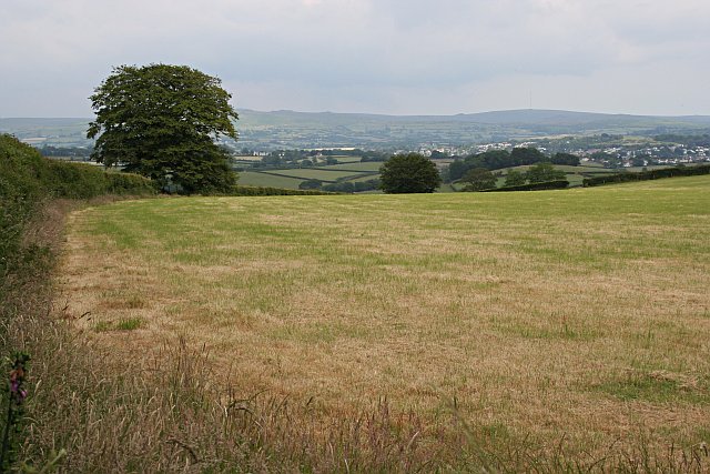
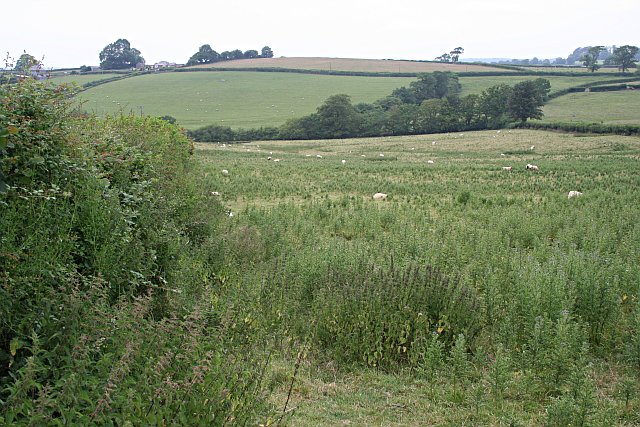
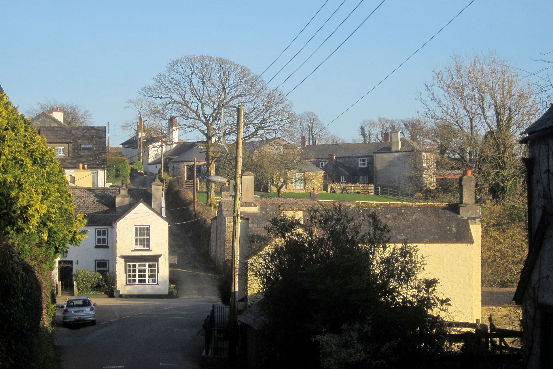
With a population of around 500 residents, Millhill has a close-knit community feel. The village is characterized by its charming thatched cottages, stone walls, and traditional architecture, giving it a timeless and idyllic appearance. The surrounding landscape is predominantly agricultural, dotted with fields, farmland, and patches of woodland.

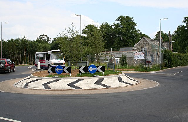
The village itself boasts a range of amenities to cater to the needs of its residents. These include a local primary school, a community hall, and a small convenience store. Millhill also benefits from excellent transport links, with regular bus services connecting it to neighboring towns and villages, as well as major cities such as Plymouth and Exeter.

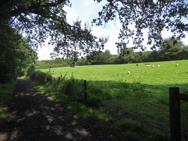
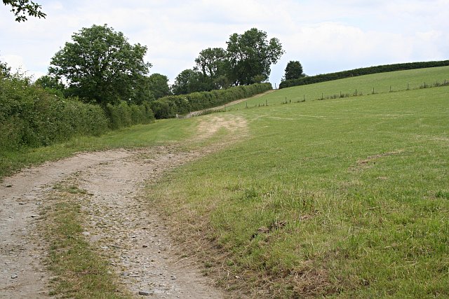
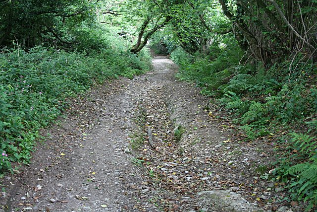
For outdoor enthusiasts, Millhill offers ample opportunities for exploring the natural beauty of the area. The village is surrounded by numerous walking and cycling trails, allowing visitors to immerse themselves in the stunning countryside. Additionally, the nearby Dartmoor National Park provides endless possibilities for outdoor activities, including hiking, horse riding, and birdwatching.

In summary, Millhill is a tranquil and picturesque village in Devon, offering a peaceful rural lifestyle amidst stunning natural surroundings.

If you have any feedback on the listing, please let us know in the comments section below.

Millhill Images

Images are sourced within 2km of 50.549702/-4.183643 or Grid Reference SX4574. Thanks to Geograph Open Source API. All images are credited.

One of the paths in the Tamar Trails The positions are a best guess and are on the path heading towards the site of Wheal Emma.
One of the paths in the Tamar Trails
The positions are a best guess and are on the path heading towards the site of Wheal Emma.
St Paul's Church
St Paul's Church
Old Guide Stone by Old Launceston Road, north west of Tavistock Flat top granite guidestone North West of Tavistock, in parish of Tavistock (West Devon District), at junction with UC road to Mill Hill, 250m North West of old tollhouse, on grass bank by hedge, by sign to 'The Coachouse Hotel'(sic).

Inscription: Mill / Hill / and / Chip / Shop // Milton / Abbot / and / Launce / Ston

Milestone Society National ID: DV_XTAV03
Old Guide Stone by Old Launceston Road, north west of Tavistock
Flat top granite guidestone North West of Tavistock, in parish of Tavistock (West Devon District), at junction with UC road to Mill Hill, 250m North West of old tollhouse, on grass bank by hedge, by sign to 'The Coachouse Hotel'(sic). Inscription: Mill / Hill / and / Chip / Shop // Milton / Abbot / and / Launce / Ston Milestone Society National ID: DV_XTAV03
House at Millhill
House at Millhill
Outbuildings at Stilesweek In the farmland around Tavistock above the river Lumburn.
Outbuildings at Stilesweek
In the farmland around Tavistock above the river Lumburn.
Gulworthy: Lumburn Mill Now a house conversion. A branch of the Tavistock Canal used to run behind the buildings to quarries at Millhill. The road is the A390 from Tavistock to Callington
Gulworthy: Lumburn Mill
Now a house conversion. A branch of the Tavistock Canal used to run behind the buildings to quarries at Millhill. The road is the A390 from Tavistock to Callington
Footpath along a Field Edge The line of the path seems to be marked more by the movement of agricultural vehicles than by people.
Footpath along a Field Edge
The line of the path seems to be marked more by the movement of agricultural vehicles than by people.
The Welcoming Committee I was glad there was a fence between me and these cattle as they looked quite frisky and aggressive.
The Welcoming Committee
I was glad there was a fence between me and these cattle as they looked quite frisky and aggressive.
Tornado This twister was seen from the western edge of Tavistock.  The funnel cloud itself was somewhere over the western edge of Dartmoor between Princetown and Yelverton. The mast on the left side of the picture is on North Hessary Tor.  The weather conditions at the time were hot and humid with cloud and showers building up over the land and a light breeze. There were no reports of damage.  As photographed here it is not actually a tornado, just a funnel cloud, as it is not touching the ground although a photograph of this storm printed in a local newspaper the following day did appear to show this happening.
Tornado
This twister was seen from the western edge of Tavistock. The funnel cloud itself was somewhere over the western edge of Dartmoor between Princetown and Yelverton. The mast on the left side of the picture is on North Hessary Tor. The weather conditions at the time were hot and humid with cloud and showers building up over the land and a light breeze. There were no reports of damage. As photographed here it is not actually a tornado, just a funnel cloud, as it is not touching the ground although a photograph of this storm printed in a local newspaper the following day did appear to show this happening.
Chipshop There is a pub, a farm and a few houses, but not a chipshop in sight!  The name for this hamlet may have come from old English words for log and workshop, either a log built workshop or a woodworker's shop (a chippies shop!).
Chipshop
There is a pub, a farm and a few houses, but not a chipshop in sight! The name for this hamlet may have come from old English words for log and workshop, either a log built workshop or a woodworker's shop (a chippies shop!).
Grass and Houses The field has been cut for silage, the houses are quite large in an sit on their own in this farming landscape.
Grass and Houses
The field has been cut for silage, the houses are quite large in an sit on their own in this farming landscape.
Three Oaks A farmhouse along a B road. This road runs roughly north to south along the flat high land which marks the watershed between the Tamar and Tavy valleys.
Three Oaks
A farmhouse along a B road. This road runs roughly north to south along the flat high land which marks the watershed between the Tamar and Tavy valleys.
Grass Field and View This grass field has been cut for silage.  The view looks east over the Tavy Valley to the hills of Dartmoor in the distance.  The houses of Tavistock can be seen on the right.
Grass Field and View
This grass field has been cut for silage. The view looks east over the Tavy Valley to the hills of Dartmoor in the distance. The houses of Tavistock can be seen on the right.
Gulworthy Cross Most people passing through here will just know this as a roundabout but perhaps don't realise that the roundabout was built, at considerable cost, to replace the previous simple junction due to there being a very bad accident record at this point. Eleven collisions were recorded on the junction in the space of just two years. There is also a school here, a few yards along the road to the right. The proposal document for the roundabout scheme can be read here <span class="nowrap"><a title="http://www.devon.gov.uk/loadtrimdocument?url=&filename=ED/04/37/LSO.CMR&rn=10/WD130&dg=Public" rel="nofollow ugc noopener" href="http://www.devon.gov.uk/loadtrimdocument?url=&filename=ED/04/37/LSO.CMR&rn=10/WD130&dg=Public">Link</a><img style="margin-left:2px;" alt="External link" title="External link - shift click to open in new window" src="https://s1.geograph.org.uk/img/external.png" width="10" height="10"/></span>
Gulworthy Cross
Most people passing through here will just know this as a roundabout but perhaps don't realise that the roundabout was built, at considerable cost, to replace the previous simple junction due to there being a very bad accident record at this point. Eleven collisions were recorded on the junction in the space of just two years. There is also a school here, a few yards along the road to the right. The proposal document for the roundabout scheme can be read here LinkExternal link
Unsuitable For Motors The modern A road zig-zags its way down the long hill from Gullworthy into the Tavy Valley but a much older road, of which this is a section, took a more direct approach, straight down the hill.  The modern road crosses this one in three places.
Unsuitable For Motors
The modern A road zig-zags its way down the long hill from Gullworthy into the Tavy Valley but a much older road, of which this is a section, took a more direct approach, straight down the hill. The modern road crosses this one in three places.
Undergrazed Field This field has sheep grazing in it, but the number of thistles growing in it suggests that it is not regularly used.
Undergrazed Field
This field has sheep grazing in it, but the number of thistles growing in it suggests that it is not regularly used.
Old Toll House This old turnpike toll house sits on the junction of Old Launceston Road and the main road, appropriately called New Launceston Road.
Old Toll House
This old turnpike toll house sits on the junction of Old Launceston Road and the main road, appropriately called New Launceston Road.
Grass Fields and Valley The field in the foreground has recently been cut to take the first silage of the year.
Grass Fields and Valley
The field in the foreground has recently been cut to take the first silage of the year.
Show me another place!

Millhill is located at Grid Ref: SX4574 (Lat: 50.549702, Lng: -4.183643)

Administrative County: Devon

District: West Devon

Police Authority: Devon and Cornwall

What 3 Words

///jubilant.package.clings. Near Tavistock, Devon

Nearby Locations

Millhill Ogbear Wood

Related Wikis

Chipshop

Chipshop is a hamlet in the civil parish of Lamerton in the West Devon district of Devon, England. Its nearest town is Tavistock, which lies approximately...

Lamerton

Lamerton is a village and civil parish located 3 miles north-west of the town of Tavistock, in the West Devon district, in the county of Devon, England...

Tavistock College

Tavistock College is a coeducational secondary school and sixth form located in Tavistock, Devon, England. It had (as of April 2020) approximately 1800...

Tavistock railway station

Tavistock railway station is a proposed new station to serve Tavistock in Devon, England, in order to reinstate a rail connection between the town and...

Nearby Amenities

Located within 500m of 50.549702,-4.183643
Millhill
Place: hamlet
Source: OS_OpenData_StreetView
Lat/Long: 50.5489933/-4.1857786
Power: pole
Lat/Long: 50.5481451/-4.1775647
Power: pole
Lat/Long: 50.5475349/-4.1792384
Power: pole
Lat/Long: 50.5467117/-4.1817972
Power: pole
Lat/Long: 50.5462975/-4.1830659
Power: pole
Lat/Long: 50.5454726/-4.1854182
Post Box
Brand: Royal Mail
Brand Wikidata: Q638098
Brand Wikipedia: en:Royal Mail
Collection Times: Mo-Fr 16:30; Sa 09:15; Su off
Operator: Royal Mail
Operator Wikidata: Q638098
Post Box Design: type_b
Post Box Mounting: brick_pillar
Post Box Type: wall
Ref: PL19 42
Royal Cypher: GR
Royal Cypher Wikidata: Q33102273
Source: survey;streetlevel imagery;aerial imagery
Lat/Long: 50.5512454/-4.1859742
The data included in this document is from www.openstreetmap.org. The data is made available under ODbL.

Have you been to Millhill?

Leave your review of Millhill below (or comments, questions and feedback).