Achadh na h-Àtha
Settlement in Argyllshire
Scotland
Achadh na h-Àtha
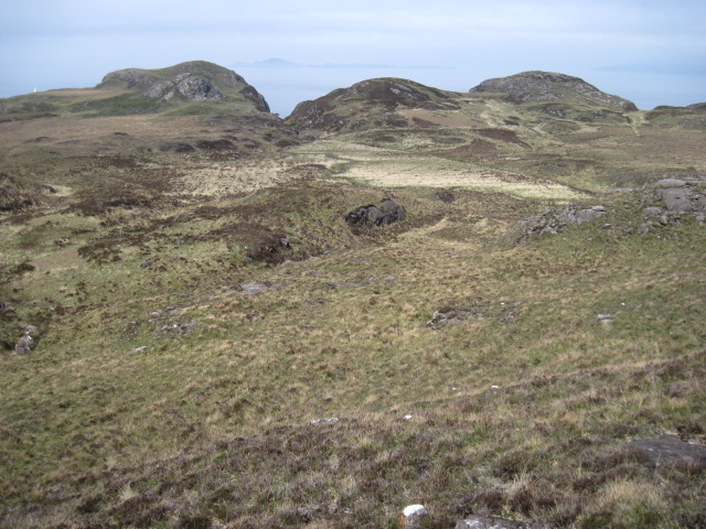
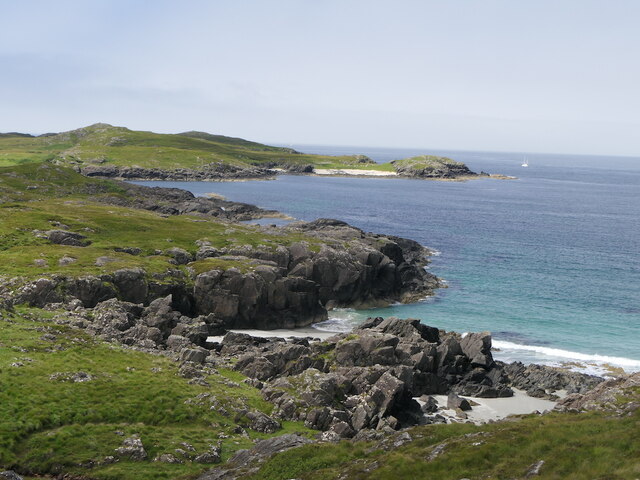
Achadh na h-Àtha is a small village located in the Argyllshire region of Scotland. Situated on the west coast of the country, it is known for its picturesque landscapes and stunning views of the surrounding countryside and sea.
The name Achadh na h-Àtha translates to "field by the ford" in English, referencing the historical crossing point on the river that runs through the village. This ford played a significant role in the village's development, as it provided a crucial transportation route for both locals and visitors.
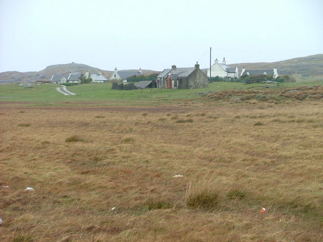
The village itself is characterized by its quaint and traditional Scottish charm. It features a cluster of cottages and houses, many of which are made of stone and retain their original architectural style. The local community is tight-knit and friendly, welcoming visitors with warmth and hospitality.
Achadh na h-Àtha is a popular destination for outdoor enthusiasts due to its proximity to the stunning Argyll Forest Park. This vast woodland offers a wide range of recreational activities, including hiking, cycling, and wildlife spotting. The village is also close to Loch Lomond and the Trossachs National Park, providing further opportunities for outdoor adventures.
Despite its small size, Achadh na h-Àtha is well-served by amenities such as a local shop, a pub, and a post office, ensuring residents have access to essential services. The village also has good transport links, with regular bus services connecting it to nearby towns and cities.
Overall, Achadh na h-Àtha offers a peaceful and idyllic setting, making it a perfect place for those seeking a tranquil escape in the heart of Scotland's natural beauty.
If you have any feedback on the listing, please let us know in the comments section below.
Achadh na h-Àtha Images
Images are sourced within 2km of 56.736782/-6.150149 or Grid Reference NM4668. Thanks to Geograph Open Source API. All images are credited.


Achadh na h-Àtha is located at Grid Ref: NM4668 (Lat: 56.736782, Lng: -6.150149)
Unitary Authority: Highland
Police Authority: Highlands and Islands
Also known as: Achnaha
What 3 Words
///hypnotist.hungry.swam. Near Kilchoan, Highland
Nearby Locations
Related Wikis

Achnaha
Achnaha (Scottish Gaelic: Achadh na h-Àtha) is a remote village in Ardnamurchan, Lochaber, in the Scottish council area of Highland. One of the local...
Sanna, Ardnamurchan
Sanna (Scottish Gaelic: Sanna) is a hamlet at the far western tip of the Scottish peninsula of Ardnamurchan, in Lochaber, Highland. It is one of the most...

Achosnich
Achosnich (Scottish Gaelic: Achadh Osnaich) is a crofting township in Ardnamurchan, Argyle within the Scottish council area of Highland. It is close to...

Portuairk
Portuairk (Scottish Gaelic: Port Uairce) is a crofting township, at the western end of the Ardnamurchan peninsula, Lochaber, Highland, Scotland. It is...
Nearby Amenities
Located within 500m of 56.736782,-6.150149Have you been to Achadh na h-Àtha?
Leave your review of Achadh na h-Àtha below (or comments, questions and feedback).