Denbighshire
Historic County in
Wales
Denbighshire

The requested URL returned error: 429 Too Many Requests
If you have any feedback on the listing, please let us know in the comments section below.
Denbighshire Images
Images are sourced within 2km of 53.11438/-3.31049 or Grid Reference SJ1258. Thanks to Geograph Open Source API. All images are credited.


Denbighshire is located at Grid Ref: SJ1258 (Lat: 53.11438, Lng: -3.31049)
Also known as: Sir Ddinbych
What 3 Words
///craters.replayed.panthers. Near Ruthin, Denbighshire
Nearby Locations
Related Wikis
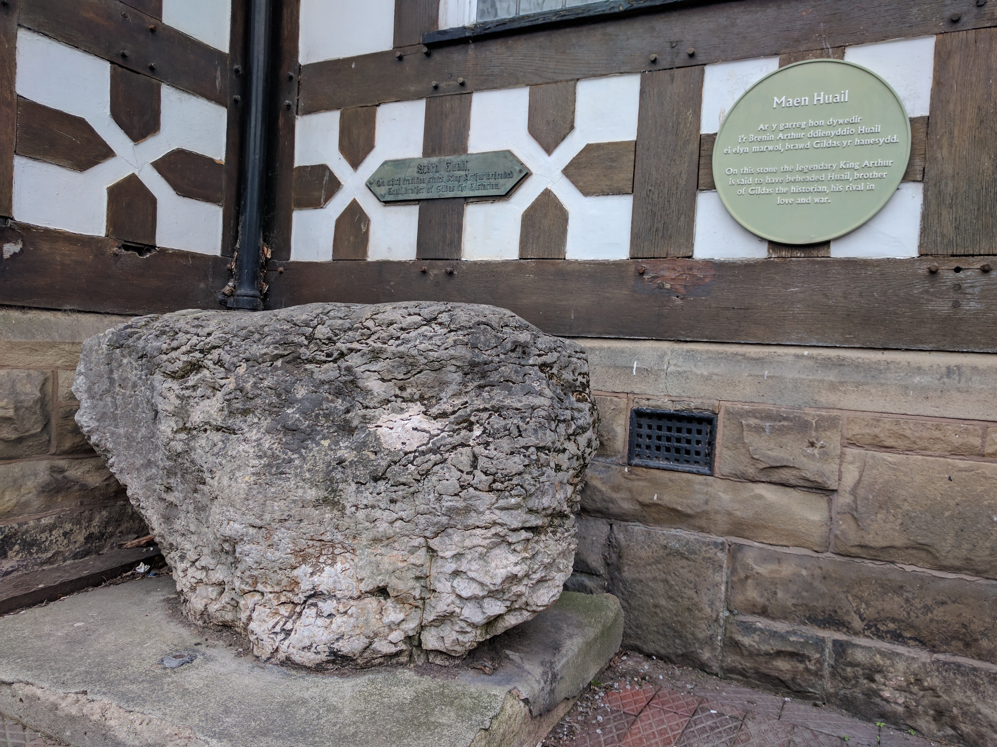
Maen Huail
Maen Huail is a stone block at St Peter's Square, in the centre of Ruthin, Denbighshire, North Wales. A circular plaque next to it states "Maen Huail on...
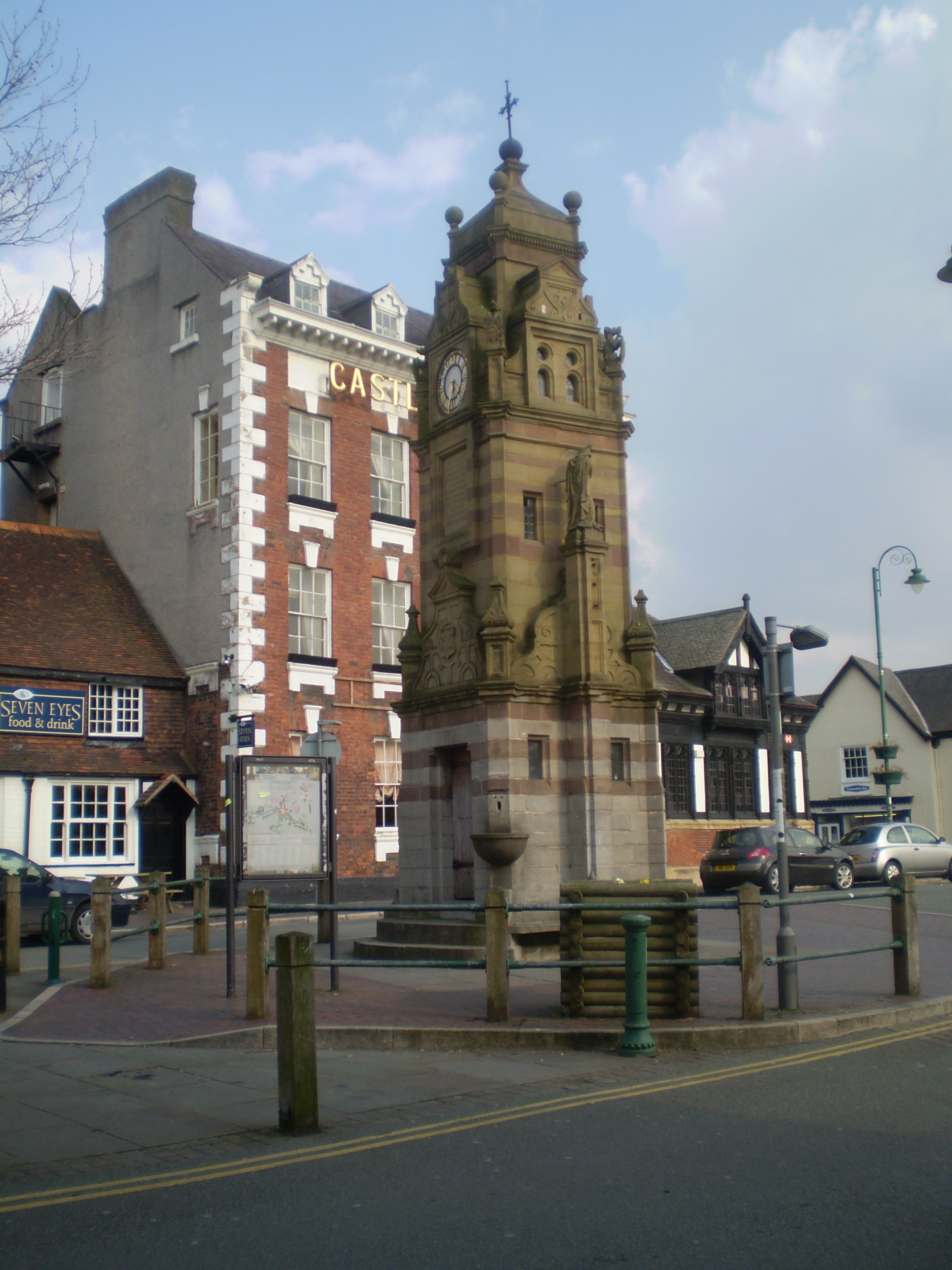
Peers Memorial, Ruthin
Peers Memorial is in St Peter's Square, Ruthin, Denbighshire, Wales. It is designated by Cadw as a Grade II listed building. == History == The memorial...
Siop Nain
Siop Nain is a Grade II Listed Building situated near the centre of Ruthin, Denbighshire and dates back to 1490. From 1850 Isaac Clarke used a building...

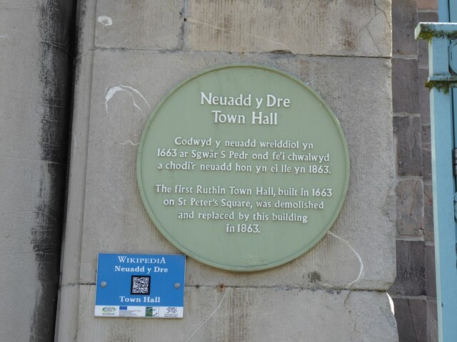
Ruthin Town Hall
Ruthin Town Hall (Welsh: Neuadd y Dref Rhuthun) is a municipal facility in Market Street, Ruthin, Denbighshire, Wales. It is a Grade II listed building...
Nearby Amenities
Located within 500m of 53.11438,-3.31049Have you been to Denbighshire?
Leave your review of Denbighshire below (or comments, questions and feedback).