Carmarthenshire

Historic County in

Wales

Carmarthenshire

Sticil Llanfynydd / Llanfynydd stile Llwybr troed cyhoeddus yn arwain o bentre Llanfynydd at y tir uchel.

Public footpath leading up to the high ground.
Sticil Llanfynydd / Llanfynydd stile Credit: Alan Richards

Carmarthenshire, a historic county located in southwest Wales, is characterized by its stunning landscapes, rich history, and vibrant culture. Covering an area of approximately 2,395 square kilometers, it is the third-largest county in Wales. The county is bordered by Ceredigion to the north, Powys to the northeast, and Pembrokeshire to the west.

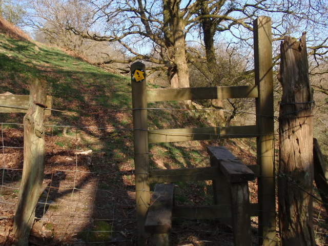
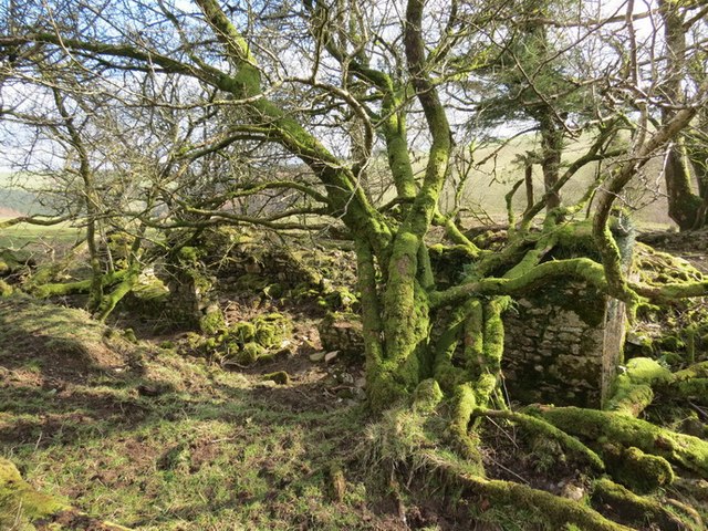
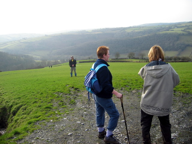
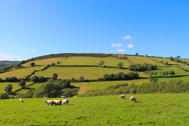
Carmarthenshire boasts a diverse range of landscapes, including expansive sandy beaches, rolling hills, and the western edge of the Brecon Beacons National Park. It is home to the River Towy, the longest river in Wales, which flows through the county's picturesque countryside.

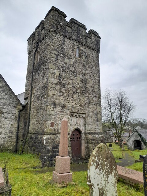
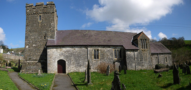
The county has a long and fascinating history, with evidence of human habitation dating back to prehistoric times. Carmarthen, the county town and the oldest town in Wales, was founded by the Romans in AD 75. Carmarthenshire is also known for its numerous castles, such as Carreg Cennen Castle, Kidwelly Castle, and Dinefwr Castle, which stand as reminders of its medieval past.

Carmarthenshire is a cultural hub, with a strong Welsh language heritage. It hosts various festivals and events throughout the year, including the Eisteddfod, a celebration of Welsh music, literature, and arts. The county is also famous for its traditional Welsh music and folk dances.

Additionally, Carmarthenshire offers a range of outdoor activities, including hiking, cycling, fishing, and water sports. The county's coastal areas, such as Pendine Sands and Llansteffan Beach, are popular destinations for beachgoers and watersports enthusiasts.

Carmarthenshire's charm lies in its combination of breathtaking landscapes, rich history, and vibrant culture, making it a must-visit destination for those seeking an authentic Welsh experience.

If you have any feedback on the listing, please let us know in the comments section below.

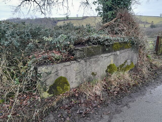
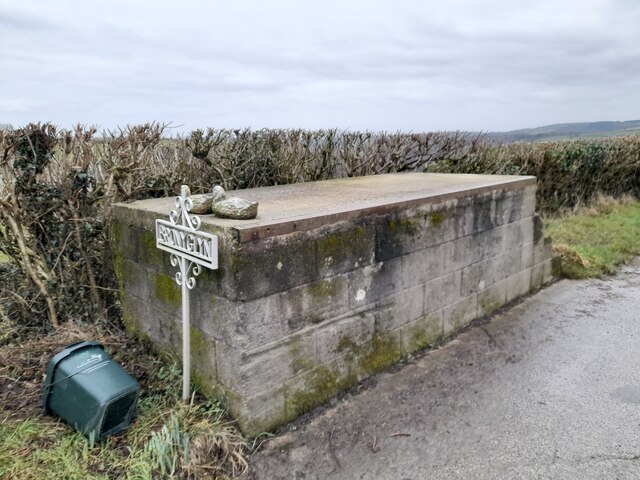
Carmarthenshire Images

Images are sourced within 2km of 51.927881/-4.097957 or Grid Reference SN5527. Thanks to Geograph Open Source API. All images are credited.

Sticil Llanfynydd / Llanfynydd stile Llwybr troed cyhoeddus yn arwain o bentre Llanfynydd at y tir uchel.

Public footpath leading up to the high ground.
Sticil Llanfynydd / Llanfynydd stile
Llwybr troed cyhoeddus yn arwain o bentre Llanfynydd at y tir uchel. Public footpath leading up to the high ground.
Ffarm Crach Gelli Fawr Farm, Llanfynydd Adefeilion o Ffarm Crach Gelli yn Llanfynydd / The ruined farmhouse of Crach Gelli Fawr in Llanfynydd
Ffarm Crach Gelli Fawr Farm, Llanfynydd
Adefeilion o Ffarm Crach Gelli yn Llanfynydd / The ruined farmhouse of Crach Gelli Fawr in Llanfynydd
Bron y Glyn Cerddwyr yn cael seibiant ar ol cyrraedd pen y bryn ger Ffarm Bron y Glyn.

Walkers having a breather on reaching the top of the hill near Bron y Glyn Farm.
Bron y Glyn
Cerddwyr yn cael seibiant ar ol cyrraedd pen y bryn ger Ffarm Bron y Glyn. Walkers having a breather on reaching the top of the hill near Bron y Glyn Farm.
Reservoir on the Sannan A reservoir with its own post box...
Reservoir on the Sannan
A reservoir with its own post box...
The Slopes of Cilganwr The slopes around the old farmhouse of Cilganwr, which gave its name to the medieval township in which the farm was situated.
The Slopes of Cilganwr
The slopes around the old farmhouse of Cilganwr, which gave its name to the medieval township in which the farm was situated.
Ordnance Survey Cut Mark This OS cut mark can be found on a stone at the road junction. It marks a point 146.570m above mean sea level.
Ordnance Survey Cut Mark
This OS cut mark can be found on a stone at the road junction. It marks a point 146.570m above mean sea level.
Ordnance Survey Cut Mark This OS cut mark can be found on the gatepost at the road junction. It marks a point 146.579m above mean sea level.
Ordnance Survey Cut Mark
This OS cut mark can be found on the gatepost at the road junction. It marks a point 146.579m above mean sea level.
Ordnance Survey Rivet This OS rivet can be found on the churn stand SE side of the road. It marks a point 124.921m above mean sea level. <a title="https://www.geograph.org.uk/photo/7397123" href="https://www.geograph.org.uk/photo/7397123">Link</a>
Ordnance Survey Rivet
This OS rivet can be found on the churn stand SE side of the road. It marks a point 124.921m above mean sea level. Link
Churn Stand There is an Ordnance Survey rivet on the top of the stand. <a title="https://www.geograph.org.uk/photo/7397121" href="https://www.geograph.org.uk/photo/7397121">Link</a>
Churn Stand
There is an Ordnance Survey rivet on the top of the stand. Link
Ordnance Survey Rivet This OS rivet can be found on the churn stand at Bronyglyn. It marks a point 234.958m above mean sea level. <a title="https://www.geograph.org.uk/photo/7397128" href="https://www.geograph.org.uk/photo/7397128">Link</a>
Ordnance Survey Rivet
This OS rivet can be found on the churn stand at Bronyglyn. It marks a point 234.958m above mean sea level. Link
Churn Stand There is an Ordnance Survey rivet on the top of the stand. <a title="https://www.geograph.org.uk/photo/7397125" href="https://www.geograph.org.uk/photo/7397125">Link</a>
Churn Stand
There is an Ordnance Survey rivet on the top of the stand. Link
Ordnance Survey Rivet This OS rivet can be found on the rock west side of the road. It marks a point 290.252m above mean sea level.
Ordnance Survey Rivet
This OS rivet can be found on the rock west side of the road. It marks a point 290.252m above mean sea level.
Ordnance Survey Cut Mark This inverted OS cut mark can be found on the south parapet of the bridge. It marks a point 190.582m above mean sea level.
Ordnance Survey Cut Mark
This inverted OS cut mark can be found on the south parapet of the bridge. It marks a point 190.582m above mean sea level.
Ordnance Survey Rivet This OS rivet can be found on the NE parapet of the bridge. It marks a point 171.464m above mean sea level.
Ordnance Survey Rivet
This OS rivet can be found on the NE parapet of the bridge. It marks a point 171.464m above mean sea level.
Church Tower
Church Tower
Ordnance Survey Cut Mark This OS cut mark can be found on the NE parapet of the bridge. It marks a point 141.533m above mean sea level.
Ordnance Survey Cut Mark
This OS cut mark can be found on the NE parapet of the bridge. It marks a point 141.533m above mean sea level.
Ordnance Survey Rivet This OS rivet can be found on the west parapet of the bridge. It marks a point 127.378m above mean sea level.
Ordnance Survey Rivet
This OS rivet can be found on the west parapet of the bridge. It marks a point 127.378m above mean sea level.
Ordnance Survey Cut Mark This OS cut mark can be found on the Farmers Arms PH. It marks a point 152.565m above mean sea level.
Ordnance Survey Cut Mark
This OS cut mark can be found on the Farmers Arms PH. It marks a point 152.565m above mean sea level.
Show me another place!

Carmarthenshire is located at Grid Ref: SN5527 (Lat: 51.927881, Lng: -4.097957)

Also known as: Sir Gaerfyrddin, Sir Gâr

What 3 Words

///nuggets.sketch.aunts. Near Llanfynydd, Carmarthenshire

Nearby Locations

Carmarthenshire Llanfynydd

Related Wikis

Llanfynydd

Llanfynydd is a village, parish and community in Carmarthenshire, Wales. The community population at the 2011 census was 499. It lies some 10 miles (16...

Carmarthen East and Dinefwr (Senedd constituency)

Carmarthen East and Dinefwr (Welsh: Dwyrain Caerfyrddin a Dinefwr) is a constituency of the Senedd. It elects one Member of the Senedd by the first past...

Carmarthen East and Dinefwr (UK Parliament constituency)

Carmarthen East and Dinefwr (Welsh: Dwyrain Caerfyrddin a Dinefwr) is a constituency of the House of Commons of the Parliament of the United Kingdom represented...

Afon Marlais, Carmarthenshire

The Afon Marlais is a right-bank tributary of the Afon Cothi in Carmarthenshire, West Wales. It rises on the slopes of Mynydd Llanfihangel-rhos-y-corn...

Nearby Amenities

Located within 500m of 51.927881,-4.097957
Place Of Worship
Religion: christian
Lat/Long: 51.9271919/-4.0989328
Llanfynydd
Place: village
Wikidata: Q770818
Lat/Long: 51.9284304/-4.0994896
Place Of Worship
Religion: christian
Lat/Long: 51.9283398/-4.0980745
Historic: memorial
Lat/Long: 51.9279946/-4.0982198
Pub
The Penybont Inn
Wikidata: Q80856091
Lat/Long: 51.9279216/-4.0978026
Waste Basket
Lat/Long: 51.9277876/-4.0980253
Bus Stop
Llanfynydd, Church
Name Cy: Llanfynydd, Eglwys
Naptan AtcoCode: 5220CMX16790
Naptan NaptanCode: crmgmaw
Lat/Long: 51.92813/-4.0982425
Place: farm
Lat/Long: 51.9307911/-4.0942798
Place: farm
Lat/Long: 51.932048/-4.0983997
Disused Amenity: post_box
Post Box Type: wall
Royal Cypher: EVIIR
Lat/Long: 51.9277282/-4.0979407
Post Box
Collection Times: Mo-Fr 15:30; Sa 12:00
Post Box Type: lamp
Ref: SA32 146
Royal Cypher: EIIR
Royal Cypher Wikidata: Q33102113
Lat/Long: 51.9279879/-4.0979606
Direction: 190
Generator Method: photovoltaic
Generator Output Electricity: yes
Generator Solar Modules: 16
Generator Source: solar
Generator Type: solar_photovoltaic_panel
Location: roof
Power: generator
Lat/Long: 51.9319659/-4.097367
Direction: SW
Generator Method: photovoltaic
Generator Output Electricity: yes
Generator Solar Modules: 11
Generator Source: solar
Generator Type: solar_photovoltaic_panel
Location: roof
Power: generator
Lat/Long: 51.9247887/-4.096849
Direction: SW
Generator Method: photovoltaic
Generator Output Electricity: yes
Generator Solar Modules: 10
Generator Source: solar
Generator Type: solar_photovoltaic_panel
Location: roof
Power: generator
Lat/Long: 51.9248334/-4.096916
Direction: SE
Generator Method: photovoltaic
Generator Output Electricity: yes
Generator Solar Modules: 7
Generator Source: solar
Generator Type: solar_photovoltaic_panel
Location: roof
Power: generator
Lat/Long: 51.9282874/-4.0976667
Direction: 195
Generator Method: photovoltaic
Generator Output Electricity: yes
Generator Solar Modules: 10
Generator Source: solar
Generator Type: solar_photovoltaic_panel
Location: roof
Power: generator
Lat/Long: 51.9280554/-4.0970609
Bench
Lat/Long: 51.9280871/-4.0981793
Advertising: board
Lat/Long: 51.9281091/-4.0982155
Telephone
Booth: K6
Covered: booth
Listed Status: Grade II
Phone: +44 1558 668382
Lat/Long: 51.9280719/-4.0981359
The data included in this document is from www.openstreetmap.org. The data is made available under ODbL.

Have you been to Carmarthenshire?

Leave your review of Carmarthenshire below (or comments, questions and feedback).