Worlebury
Heritage Site in Somerset
England
Worlebury

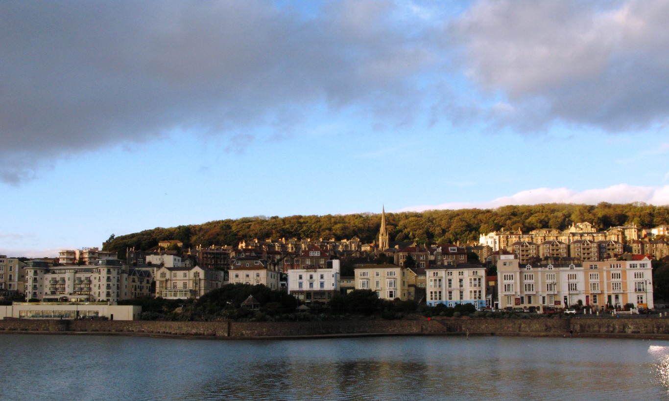
Worlebury is a picturesque village located in the county of Somerset, England. Situated on the northern outskirts of Weston-super-Mare, it is known for its rich history and stunning natural beauty. The village is nestled on the slopes of Worlebury Hill, which offers breathtaking views of the surrounding countryside and the Bristol Channel.
Worlebury is a designated heritage site due to its historical significance. The area is believed to have been inhabited since ancient times, with evidence of Iron Age hillforts found on Worlebury Hill. The hillforts are a testament to the village's strategic importance in the past, serving as defensive structures to protect its inhabitants.
The village's history can also be traced back to the Roman era when a villa was established in the area. Excavations have uncovered Roman pottery and coins, providing insight into the daily lives of the Romans who once resided here.
Worlebury is also home to St. Paul's Church, a Grade II listed building that dates back to the 13th century. The church is renowned for its medieval architecture and beautiful stained glass windows, attracting visitors from far and wide.
In addition to its historical significance, Worlebury boasts a wealth of natural beauty. The village is surrounded by lush woodlands, providing ample opportunities for scenic walks and exploration. Worlebury Hill is a popular spot for nature enthusiasts, offering panoramic views and a chance to spot local wildlife.
Overall, Worlebury in Somerset is a charming village that combines its rich heritage with stunning natural landscapes, making it a must-visit destination for history buffs and nature lovers alike.
If you have any feedback on the listing, please let us know in the comments section below.
Worlebury Images
Images are sourced within 2km of 51.357/-2.983 or Grid Reference ST3162. Thanks to Geograph Open Source API. All images are credited.


Worlebury is located at Grid Ref: ST3162 (Lat: 51.357, Lng: -2.983)
Unitary Authority: North Somerset
Police Authority: Avon and Somerset
What 3 Words
///recall.shuts.porch. Near Weston-super-Mare, Somerset
Nearby Locations
Related Wikis

Worlebury Camp
Worlebury Camp (also known as Worlebury Hillfort) is the site of an Iron Age hillfort on Worlebury Hill, north of Weston-super-Mare in Somerset, England...
Worlebury Hill
Worlebury Hill is the name given to an upland area lying between the flatlands of Weston-super-Mare and the Kewstoke area of North Somerset, England. Worlebury...
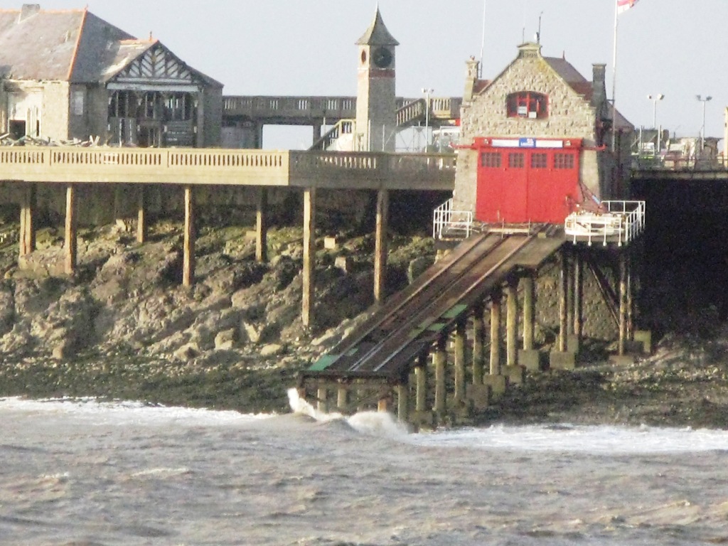
Weston-super-Mare Lifeboat Station
Weston-super-Mare Lifeboat Station is a lifeboat station at Weston-super-Mare in Somerset, England. For more than 100 years it was situated on Birnbeck...

St Joseph's Church, Weston-super-Mare
St Joseph's Church is a Roman Catholic parish church in Weston-super-Mare, Somerset, England. It was built in 1858, and was designed by Charles Francis...
Nearby Amenities
Located within 500m of 51.357,-2.983Have you been to Worlebury?
Leave your review of Worlebury below (or comments, questions and feedback).