Madeira Cove
Sea, Estuary, Creek in Somerset
England
Madeira Cove

Madeira Cove is a picturesque coastal area located in Somerset, England. Situated along the Bristol Channel, it offers breathtaking views of the sea, estuary, and surrounding natural beauty. The cove is known for its tranquil atmosphere and is a popular destination for both locals and tourists alike.
The main feature of Madeira Cove is its stunning seafront, which stretches for miles and provides a perfect spot for leisurely walks or picnics by the water. The clear blue waters of the Bristol Channel are ideal for swimming, fishing, and other water-based activities.
One of the highlights of Madeira Cove is its estuary, which is formed by the confluence of the River Axe and the Bristol Channel. The estuary is a haven for wildlife, attracting a variety of bird species, including herons, gulls, and waders. Nature enthusiasts can observe these birds in their natural habitat, making it a popular spot for birdwatching.
In addition to the sea and estuary, Madeira Cove is also home to a charming creek. The creek meanders through the landscape, creating a picturesque setting that is perfect for photography or simply enjoying the peaceful surroundings. The creek is also a great place for kayaking or paddleboarding, allowing visitors to explore the area from a different perspective.
Overall, Madeira Cove offers a unique blend of sea, estuary, and creek, making it a diverse and captivating destination. Whether you're looking to relax on the beach, observe wildlife, or engage in water activities, Madeira Cove has something for everyone.
If you have any feedback on the listing, please let us know in the comments section below.
Madeira Cove Images
Images are sourced within 2km of 51.353262/-2.9891849 or Grid Reference ST3162. Thanks to Geograph Open Source API. All images are credited.


Madeira Cove is located at Grid Ref: ST3162 (Lat: 51.353262, Lng: -2.9891849)
Unitary Authority: North Somerset
Police Authority: Avon and Somerset
What 3 Words
///stow.lonely.finger. Near Weston-super-Mare, Somerset
Nearby Locations
Related Wikis
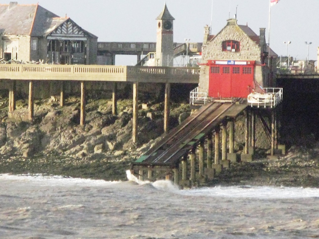
Weston-super-Mare Lifeboat Station
Weston-super-Mare Lifeboat Station is a lifeboat station at Weston-super-Mare in Somerset, England. For more than 100 years it was situated on Birnbeck...

St Joseph's Church, Weston-super-Mare
St Joseph's Church is a Roman Catholic parish church in Weston-super-Mare, Somerset, England. It was built in 1858, and was designed by Charles Francis...

Spring Cove Cliffs
Spring Cove Cliffs (grid reference ST310625) is a 2.0 hectare geological Site of Special Scientific Interest near the town of Weston-super-Mare, North...

Birnbeck Pier
Birnbeck Pier, also known as the 'Old Pier', is a pier situated on the Bristol Channel in Weston-super-Mare, North Somerset, England, approximately 18...

Worlebury Camp
Worlebury Camp (also known as Worlebury Hillfort) is the site of an Iron Age hillfort on Worlebury Hill, north of Weston-super-Mare in Somerset, England...

Weston College
Weston College of Further and Higher Education is a general college of further and higher education in Weston-super-Mare, Somerset, England. It provides...

University Centre Weston
University Centre Weston, also known as UCW, is a university centre based in the town of Weston-super-Mare, Somerset, England. The centre was formed by...
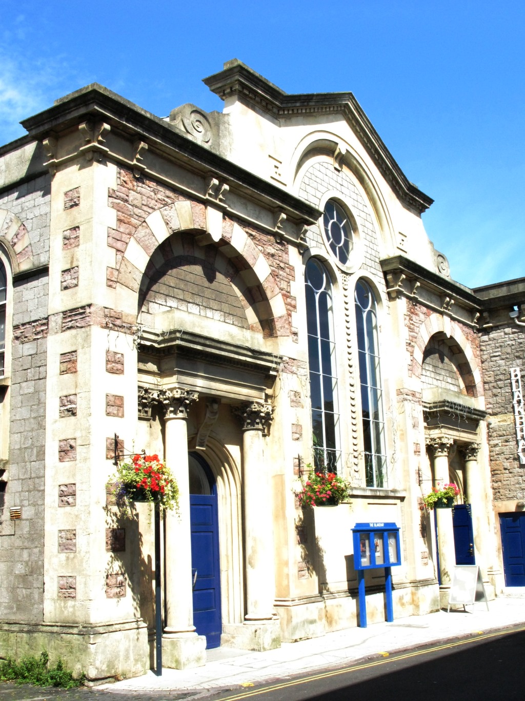
The Blakehay Theatre, Weston-super-Mare
The Blakehay Theatre is a 207-seat theatre in Weston-super-Mare, North Somerset, England. Its building was originally a 19th-century Baptist church....
Nearby Amenities
Located within 500m of 51.353262,-2.9891849Have you been to Madeira Cove?
Leave your review of Madeira Cove below (or comments, questions and feedback).