Mill Hill

Settlement in Essex Rochford

England

Mill Hill

Arable field off Lower Road, Hullbridge
Arable field off Lower Road, Hullbridge Credit: Roger Jones

Mill Hill is a prosperous suburban area located in the London Borough of Barnet, in the county of Essex, England. Situated approximately 9 miles northwest of central London, it forms part of the Greater London Urban Area. The area is renowned for its leafy green spaces and attractive residential neighborhoods, making it a desirable place to live.

Mill Hill is characterized by its mix of architectural styles, ranging from historic buildings to modern developments. The area is home to a diverse community, with a population of around 20,000 people. It offers a range of amenities and services, including schools, shops, restaurants, and recreational facilities.

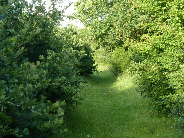
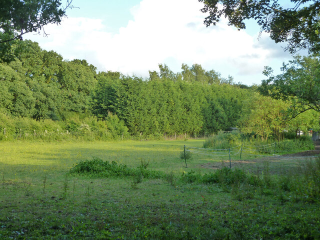
Green spaces are plentiful in Mill Hill, with popular parks such as Mill Hill Park and Arrandene Open Space providing residents with opportunities for outdoor activities and relaxation. The area is also home to the renowned Mill Hill School, an independent boarding and day school with a rich history dating back to 1807.

Transport links are excellent, with Mill Hill Broadway railway station providing regular services to central London and other destinations. The area is also well-connected by bus routes, allowing easy access to nearby towns and attractions.

Overall, Mill Hill offers a peaceful and picturesque setting within close proximity to the bustling city of London. Its combination of natural beauty, excellent amenities, and convenient transport links make it a sought-after location for both families and professionals.

If you have any feedback on the listing, please let us know in the comments section below.

Mill Hill Images

Images are sourced within 2km of 51.606419/0.62685883 or Grid Reference TQ8293. Thanks to Geograph Open Source API. All images are credited.

Arable field off Lower Road, Hullbridge
Railway to Hockley Looking towards Hockley station, this is on the Shenfield to Southend Line, built by the Great Eastern Railway in 1889.

Taken from the public footpath crossing.
Railway to Hockley
Looking towards Hockley station, this is on the Shenfield to Southend Line, built by the Great Eastern Railway in 1889. Taken from the public footpath crossing.
Open land near Victoria Road, Rayleigh <span class="nowrap"><a title="https://en.wikipedia.org/wiki/Rayleigh,_Essex" rel="nofollow ugc noopener" href="https://en.wikipedia.org/wiki/Rayleigh,_Essex">Link</a><img style="margin-left:2px;" alt="External link" title="External link - shift click to open in new window" src="https://s1.geograph.org.uk/img/external.png" width="10" height="10"/></span>
Open land near Victoria Road, Rayleigh
Paddocks near Goldsmith Drive, Rayleigh The light fencing here suggests use for horses in this semi-rural bit of land seen from a bridleway.
Paddocks near Goldsmith Drive, Rayleigh
The light fencing here suggests use for horses in this semi-rural bit of land seen from a bridleway.
Marylands Nature Reserve, Hockley View into a wooded section of Marylands Nature Reserve, which is managed by Hockley Parish Council: <span class="nowrap"><a title="https://www.hockley-essex.gov.uk/facilities/parks-and-open-spaces/marylands-nature-reserve/" rel="nofollow ugc noopener" href="https://www.hockley-essex.gov.uk/facilities/parks-and-open-spaces/marylands-nature-reserve/">Link</a><img style="margin-left:2px;" alt="External link" title="External link - shift click to open in new window" src="https://s1.geograph.org.uk/img/external.png" width="10" height="10"/></span>
Marylands Nature Reserve, Hockley
View into a wooded section of Marylands Nature Reserve, which is managed by Hockley Parish Council: LinkExternal link
Fence and hedge New "wildlife strip" bordering Bull Wood along the public footpath
Fence and hedge
New "wildlife strip" bordering Bull Wood along the public footpath
Hullbridge Road, Rayleigh A residential service road parallel with the main Hullbridge Road on the left, looking here, for the visible part, like the original course of the through route.
Hullbridge Road, Rayleigh
A residential service road parallel with the main Hullbridge Road on the left, looking here, for the visible part, like the original course of the through route.
Entrance to Ferndale Open Space With a child care establishment.
Entrance to Ferndale Open Space
With a child care establishment.
Back of houses on Ferndale Road Viewed from  Ferndale Open Space.
Back of houses on Ferndale Road
Viewed from Ferndale Open Space.
Child care premises, Ferndale Open Space
Bunker, Lords Golf and Country Club
Path towards golf course Not a public route.
Path towards golf course
Not a public route.
Field behind house on Ferndale Road A sort of extended back garden, apparently grazing for something.
Field behind house on Ferndale Road
A sort of extended back garden, apparently grazing for something.
Track to Ferndale Open Space
Hockley fingerpost Fingerpost with two remaining arms
Hockley fingerpost
Fingerpost with two remaining arms
Hockley Village Sign I have lived in the area for five years. Today is the first time I have noticed this village sign.
Hockley Village Sign
I have lived in the area for five years. Today is the first time I have noticed this village sign.
Hockley War Memorial Lists the fallen in WWI, WWII and the Afghanistan Campaign
Hockley War Memorial
Lists the fallen in WWI, WWII and the Afghanistan Campaign
Stump Puffballs Lycoperdon pyriforme (aka Pear-shaped Puffball). Young specimens on oak stump, Hockley Woods
Stump Puffballs
Lycoperdon pyriforme (aka Pear-shaped Puffball). Young specimens on oak stump, Hockley Woods
Show me another place!

Mill Hill is located at Grid Ref: TQ8293 (Lat: 51.606419, Lng: 0.62685883)

Administrative County: Essex

District: Rochford

Police Authority: Essex

What 3 Words

///shackles.hotels.taxed. Near Rayleigh, Essex

Nearby Locations

Mill Hill

Related Wikis

Hockley

Hockley is a large village and civil parish in Essex in the East of England located between Chelmsford and Southend-on-Sea, or, more specifically, between...

Hullbridge Sports F.C.

Hullbridge Sports Football Club is a football club based in Hullbridge, Essex, England. They are currently members of the Essex Senior League and play...

HM Prison Bullwood Hall

HM Prison Bullwood Hall is a former Category C women's prison and Young Offenders Institution, located in Hockley, Essex, England. The prison was operated...

Brandy Hole

Brandy Hole is the name of a large area of saltmarsh and saltings on the River Crouch in Rochford District in the County of Essex, England. It is located...

Nearby Amenities

Located within 500m of 51.606419,0.62685883
Crossing
Railway: crossing
Lat/Long: 51.6057179/0.6296533
Crossing
Railway: crossing
Lat/Long: 51.6057362/0.6296417
Railway: crossing
Lat/Long: 51.603784/0.6233936
The data included in this document is from www.openstreetmap.org. The data is made available under ODbL.

Have you been to Mill Hill?

Leave your review of Mill Hill below (or comments, questions and feedback).