White Barrow

Heritage Site in Hampshire Basingstoke and Deane

England

White Barrow

Welcome sunshine on Kennet Way After a week of grey skies and rain.
Sadly the sun didn't last!
Welcome sunshine on Kennet Way Credit: Mr Ignavy

White Barrow is an ancient burial mound located in Hampshire, England. Situated near the village of St. Mary Bourne, it is considered a significant heritage site due to its historical and archaeological importance. The barrow is believed to date back to the Neolithic period, making it over 5,000 years old.

The mound stands at an impressive height of around 5 meters and has a diameter of approximately 25 meters. It is surrounded by a circular ditch, which is now partially filled, but still visible. The construction of the barrow demonstrates the advanced engineering skills of the early inhabitants of the area, who built it using earth and stones.

Excavations conducted at White Barrow have revealed a range of fascinating artifacts, including pottery fragments, flint tools, and human remains. These discoveries provide valuable insights into the burial practices and lifestyles of the people who lived during the Neolithic era.

The barrow is believed to have served as a communal burial site for the local community, possibly for several generations. Its location suggests that it held significant cultural and religious importance to the ancient inhabitants of Hampshire. Today, White Barrow stands as a testament to the region's rich history and is protected as a Scheduled Ancient Monument.

Visitors to White Barrow can explore the site and marvel at its ancient construction. The barrow offers a unique opportunity to step back in time and gain a deeper understanding of the lives and beliefs of our Neolithic ancestors.

If you have any feedback on the listing, please let us know in the comments section below.
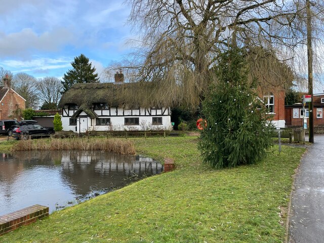
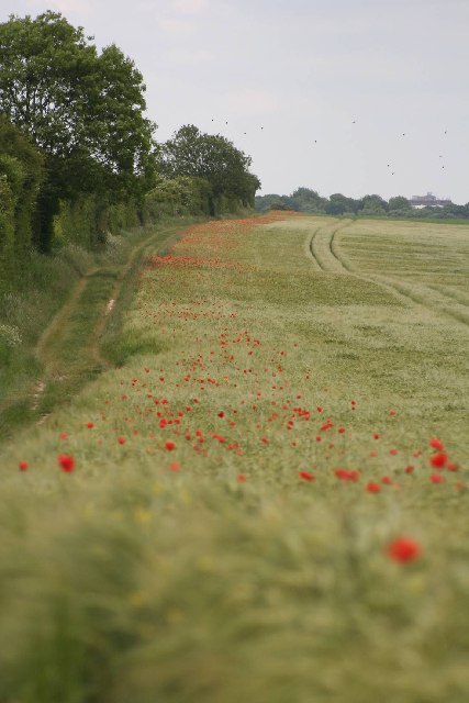
White Barrow Images

Images are sourced within 2km of 51.258/-1.162 or Grid Reference SU5851. Thanks to Geograph Open Source API. All images are credited.

Welcome sunshine on Kennet Way After a week of grey skies and rain.
Sadly the sun didn't last!
Welcome sunshine on Kennet Way
After a week of grey skies and rain. Sadly the sun didn't last!
Kings Orchard to The Drive
Bungalows along The Drive
Corner house - Kennet Way
Oakley Christmas Market - 2023 A worthy initiative. I found some excellent blackberry jam and apple juice.
Oakley Christmas Market - 2023
A worthy initiative. I found some excellent blackberry jam and apple juice.
Village pond & Christmas Tree by day And by night, <a href="https://www.geograph.org.uk/photo/7666389">SU5750 : Here we go again - 2023</a>.
Village pond & Christmas Tree by day
Battledown Farm Barley crop in Battledown farm outside Basingstoke.
Battledown Farm
Barley crop in Battledown farm outside Basingstoke.
Poppies Poppies in barley field in square SU5951, looking from S.W corner toward N.W. alongside London to Southampton railway line.
Poppies
Poppies in barley field in square SU5951, looking from S.W corner toward N.W. alongside London to Southampton railway line.
Battledown Flyover This is Hampshire's only flying junction. The line from Southampton crosses over the lines to and from the West of England. Nearby, both cross over the road, Pack Lane. Rail over rail over road!
The rail lines actually meet a mile to the north-east at Worting Junction.
Battledown Flyover
This is Hampshire's only flying junction. The line from Southampton crosses over the lines to and from the West of England. Nearby, both cross over the road, Pack Lane. Rail over rail over road! The rail lines actually meet a mile to the north-east at Worting Junction.
Oakley Pond Oakley village near Basingstoke boasts a large pond that thrives with ducks.
Oakley Pond
Oakley village near Basingstoke boasts a large pond that thrives with ducks.
Malshanger Lane Two majestic trees seem to guard the entrance to Malshanger Lane from the junction with the Andover Road in Oakley.
Malshanger Lane
Two majestic trees seem to guard the entrance to Malshanger Lane from the junction with the Andover Road in Oakley.
The Fox Public House at Newfound near Basingstoke.
The Fox
Public House at Newfound near Basingstoke.
Church at Wootton St. Lawrence The Church of St. Lawrence was rebuilt in 1864, incorporating many original features of the earlier mediaeval building. The north arcade dates from the twelfth century and the tower and some of the windows are early fourteenth century.
Church at Wootton St. Lawrence
The Church of St. Lawrence was rebuilt in 1864, incorporating many original features of the earlier mediaeval building. The north arcade dates from the twelfth century and the tower and some of the windows are early fourteenth century.
Wootton Copse
Wootton Copse
Marvel Row Copse
Marvel Row Copse
The Firs
The Firs
Looking East
Looking East
Show me another place!

White Barrow is located at Grid Ref: SU5851 (Lat: 51.258, Lng: -1.162)

Administrative County: Hampshire

District: Basingstoke and Deane

Police Authority: Hampshire

What 3 Words

///tender.festivity.lies. Near Basingstoke, Hampshire

Related Wikis

Newfound, Hampshire

Newfound is a hamlet in the Basingstoke and Deane district of Hampshire, England. Its nearest town is Basingstoke, which lies approximately 4.1 miles...

Oakley, Hampshire

Oakley is a village in the borough of Basingstoke and Deane in Hampshire, England, located around 4.5 miles (7 km) west of Basingstoke. In the 2001 Census...

Worting

Worting is a former village and now a district of Basingstoke, Hampshire, that was formed around 1970 as part of the Basingstoke Town Centre Development...

Oakley railway station (Hampshire)

Oakley was a railway station on the West of England Main Line in Hampshire, England which served the village of Oakley. == History == The station was opened...

Oakley Hall, Hampshire

Oakley Hall is a Georgian manor in Oakley, Hampshire, located 10 km (6.2 mi) to the west of Basingstoke. Completed in 1795 by Wither Bramston, the building...

Malshanger

Malshanger is a small village in the Basingstoke and Deane district of Hampshire, England. Its nearest town is Basingstoke, which lies approximately 4...

Wootton St Lawrence

Wootton St Lawrence is a small village in the civil parish of Wootton St Lawrence with Ramsdell, in Hampshire, England, 2.5 miles (4.0 km) west of Basingstoke...

Kempshott

Kempshott is a ward of Basingstoke on the western edge of the town, to the south of Pack Lane (part of the Harrow Way)and north of Winchester Road. The...

Nearby Amenities

Located within 500m of 51.258,-1.162
Newfound
Is In: Hampshire, England, UK
Place: neighbourhood
Wikidata: Q7017797
Lat/Long: 51.2588011/-1.1671205
Post Box
Mapillary: 992753854796891
Post Box Mounting: pier
Post Box Type: lamp
Postal Code: RG23
Ref: RG23 10
Survey Date: 2020-05-09
Lat/Long: 51.2576999/-1.168426
Bus Stop
Wooton St Lawrence Turn
Bench: no
Bin: no
Bus: yes
Lit: no
Naptan AtcoCode: 1900HA010199
Naptan Bearing: W
Naptan CommonName: Wooton St Lawrence Turn
Naptan Crossing: Road to Village
Naptan NaptanCode: hamdtpwd
Naptan Street: Worting Road
Naptan Verified: no
Public Transport: platform
Shelter: no
Source: naptan_import
Tactile Paving: no
Lat/Long: 51.2614516/-1.1582114
Bus Stop
Methodist Church
Bench: no
Bin: no
Bus: yes
Lit: no
Naptan AtcoCode: 1900HA010200
Naptan Bearing: NE
Naptan CommonName: Newfound Church
Naptan Crossing: Andover Road
Naptan NaptanCode: hamdtpda
Naptan Street: B3400 Worting Road
Naptan Verified: no
Public Transport: platform
Shelter: no
Source: naptan_import
Tactile Paving: no
Lat/Long: 51.2605743/-1.1614983
Bus Stop
Methodist Church
Bench: no
Bin: no
Bus: yes
Lit: no
Naptan AtcoCode: 1900HA010201
Naptan Bearing: SW
Naptan CommonName: Newfound Church
Naptan Crossing: Worting Road
Naptan NaptanCode: hamdtpag
Naptan Street: B3400 Andover Road
Naptan Verified: no
Public Transport: platform
Shelter: no
Source: naptan_import
Tactile Paving: no
Lat/Long: 51.2601524/-1.1623355
Bus Stop
The Fox
Bench: no
Bin: yes
Bus: yes
Naptan AtcoCode: 1900HA010202
Naptan Bearing: E
Naptan CommonName: The Fox Ph
Naptan Crossing: Opp Fox Lane
Naptan NaptanCode: hamdtjta
Naptan Street: B3400 Andover Road
Naptan Verified: no
Public Transport: platform
Shelter: yes
Source: naptan_import
Tactile Paving: no
Lat/Long: 51.2588269/-1.1671591
Bus Stop
The Fox
Bench: no
Bin: no
Bus: yes
Lit: yes
Naptan AtcoCode: 1900HA010203
Naptan Bearing: SW
Naptan CommonName: The Fox Ph
Naptan Crossing: Fox Lane
Naptan NaptanCode: hamdtjpd
Naptan Street: B3400 Andover Road
Naptan Verified: no
Public Transport: platform
Shelter: no
Source: naptan_import
Tactile Paving: no
Lat/Long: 51.2586846/-1.1673767
White Barrow
Historic: archaeological_site
Source: NPE
Wikidata: Q7994453
Lat/Long: 51.2567316/-1.1584564
Give Way
Lat/Long: 51.258486/-1.1679768
Material: wood
Power: pole
Lat/Long: 51.2619199/-1.1596477
Defibrillator
Defibrillator Location: Attached to the side of the building in a yellow box.
Emergency: defibrillator
Indoor: no
Lat/Long: 51.2585251/-1.1674153
Bicycle Parking
Bicycle Parking: wall_loops
Capacity: 5
Covered: no
Lat/Long: 51.2585265/-1.1673014
The data included in this document is from www.openstreetmap.org. The data is made available under ODbL.

Have you been to White Barrow?

Leave your review of White Barrow below (or comments, questions and feedback).