Weston Hall

Heritage Site in Derbyshire

England

Weston Hall

The River Trent near Weston-on-Trent Seen from the Trent & Mersey canal, which runs much closer to the village than the river does.
The River Trent near Weston-on-Trent Credit: Christine Johnstone

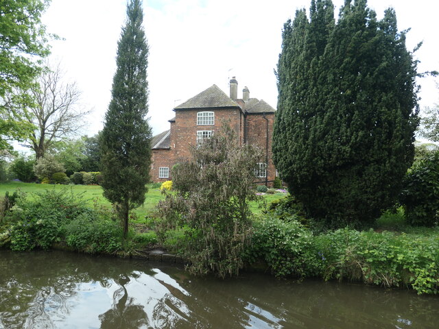
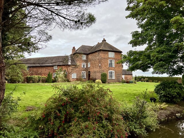
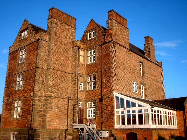
Weston Hall is a historic country house located in Weston-on-Trent, Derbyshire, England. Originally built in the 17th century, the hall has a rich history and is considered a significant heritage site in the region.

The hall's architecture is a beautiful blend of Elizabethan and Jacobean styles, featuring stunning stone façades and intricate detailing. It is surrounded by picturesque gardens and landscaped grounds, providing a serene and tranquil setting. The interior of the hall is equally impressive, with grand reception rooms, ornate ceilings, and elegant furnishings showcasing the opulence of its past.

Over the years, Weston Hall has been home to several notable families, including the Long family and the Chandos-Pole family. It has also witnessed significant historical events, such as hosting King Charles I during the English Civil War. The hall has survived various renovations and alterations, with each generation leaving its mark on the building.

Today, Weston Hall is open to the public as a luxury hotel and event venue. Visitors can explore the hall's public rooms, which have been carefully restored to preserve their historical charm. The surrounding gardens offer a peaceful retreat and are often used for weddings and special events.

With its rich heritage and architectural beauty, Weston Hall continues to be a popular destination for history enthusiasts, architecture lovers, and those seeking a unique and elegant backdrop for their special occasions.

If you have any feedback on the listing, please let us know in the comments section below.

Weston Hall Images

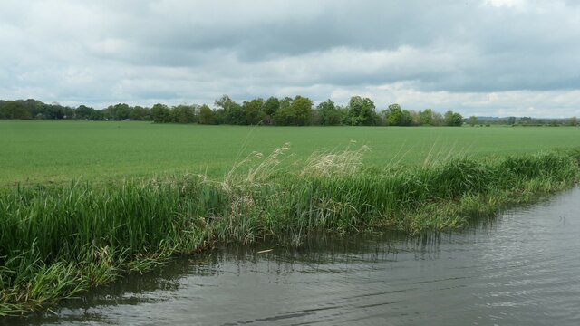
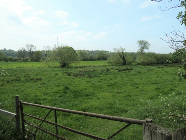
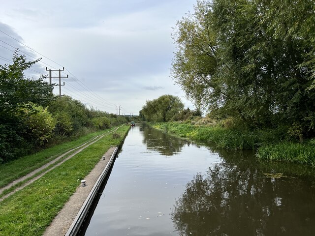
Images are sourced within 2km of 52.852/-1.398 or Grid Reference SK4028. Thanks to Geograph Open Source API. All images are credited.
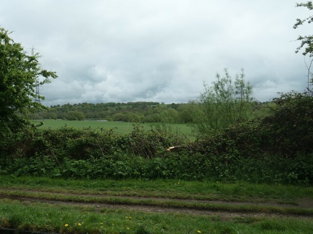
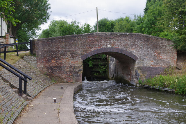
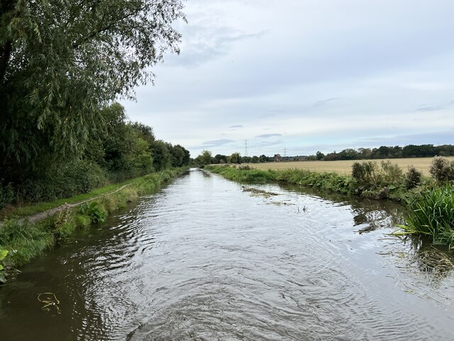
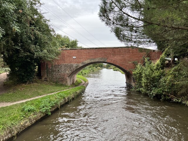
The River Trent near Weston-on-Trent Seen from the Trent & Mersey canal, which runs much closer to the village than the river does.
The River Trent near Weston-on-Trent
Seen from the Trent & Mersey canal, which runs much closer to the village than the river does.
Paddocks, Weston-on-Trent On the north bank of the Trent & Mersey canal.
Paddocks, Weston-on-Trent
On the north bank of the Trent & Mersey canal.
Water point, Weston Lock, Trent & Mersey canal Where you can fill a boat's water tank.
Water point, Weston Lock, Trent & Mersey canal
Where you can fill a boat's water tank.
Trees on a former field boundary On the north bank of the Trent & Mersey canal, just east of Weston-on-Trent.
Trees on a former field boundary
On the north bank of the Trent & Mersey canal, just east of Weston-on-Trent.
Willow on the bank of the Trent & Mersey canal Not yet a hazard to boaters.
Willow on the bank of the Trent & Mersey canal
Not yet a hazard to boaters.
Bridge 7B, Trent & Mersey canal A railway bridge, east of Weston-on-Trent.
Bridge 7B, Trent & Mersey canal
A railway bridge, east of Weston-on-Trent.
Cow Pasture Bridge [no 7], from the east Carrying a bridleway over the Trent & Mersey canal.
Cow Pasture Bridge [no 7], from the east
Carrying a bridleway over the Trent & Mersey canal.
Weston Grange On the canal bank, east of Weston-on-Trent.  This may be the site of a medieval grange of Chester Abbey. The house is at the south corner of a farmyard, which it was separated from in 1980.
Weston Grange
On the canal bank, east of Weston-on-Trent. This may be the site of a medieval grange of Chester Abbey. The house is at the south corner of a farmyard, which it was separated from in 1980.
Birdcage Wood, from the south A small triangular wood on the boundary between Weston-on-Trent and Aston-on-Trent civil parishes.
Birdcage Wood, from the south
A small triangular wood on the boundary between Weston-on-Trent and Aston-on-Trent civil parishes.
Sheepfield, off Kings Mill Lane At the eastern edge of Weston-on-Trent.
Sheepfield, off Kings Mill Lane
At the eastern edge of Weston-on-Trent.
Willows along a drain, west of King's Mills Lane The flat and floodable floor of the Trent valley.
Willows along a drain, west of King's Mills Lane
The flat and floodable floor of the Trent valley.
Weston Lock The locks at the eastern end of the Trent & Mersey Canal are all broad, allowing widebeam vessels to travel up to Burton on Trent. Most of them are deep - in this case with a fall of 10ft 11in - making them slow to fill and empty with stiff paddles and heavy gates; they therefore tend to be unpopular with boaters. Here the lock is being emptied causing a lot of turbulence by the lock landing.
Weston Lock
The locks at the eastern end of the Trent & Mersey Canal are all broad, allowing widebeam vessels to travel up to Burton on Trent. Most of them are deep - in this case with a fall of 10ft 11in - making them slow to fill and empty with stiff paddles and heavy gates; they therefore tend to be unpopular with boaters. Here the lock is being emptied causing a lot of turbulence by the lock landing.
The Trent and Mersey Canal Looking towards Aston-on-Trent.
The Trent and Mersey Canal
Looking towards Aston-on-Trent.
The Trent and Mersey Canal Looking towards Aston-on-Trent.
The Trent and Mersey Canal
Looking towards Aston-on-Trent.
Bridge 7 on the Trent and Mersey Canal Near Weston Grange.
Bridge 7 on the Trent and Mersey Canal
Near Weston Grange.
Weston Grange From the Trent and Mersey Canal.
Weston Grange
From the Trent and Mersey Canal.
Bridge 9 on the Trent and Mersey Canal Known as Scotch Bridge. Grade II listed. Listing number 1205892. Canal bridge. 1770 by engineer James Brindley with minor later repairs.
Bridge 9 on the Trent and Mersey Canal
Known as Scotch Bridge. Grade II listed. Listing number 1205892. Canal bridge. 1770 by engineer James Brindley with minor later repairs.
Weston Road, Aston-on-Trent Aston-on-Trent has a population of about 1,700 (2011 census) making it slightly larger than its neighbour Weston-on-Trent. It is not particularly close to the River Trent, having been established away from the flood plain. In this Sunday lunchtime view traffic cones were in place in connection with the village well-dressing festival which was taking place over the weekend. Wandering around, several of the locals could be heard complaining of a sore head, so it sounds as though a good time was had by all the previous evening.
Weston Road, Aston-on-Trent
Aston-on-Trent has a population of about 1,700 (2011 census) making it slightly larger than its neighbour Weston-on-Trent. It is not particularly close to the River Trent, having been established away from the flood plain. In this Sunday lunchtime view traffic cones were in place in connection with the village well-dressing festival which was taking place over the weekend. Wandering around, several of the locals could be heard complaining of a sore head, so it sounds as though a good time was had by all the previous evening.
Show me another place!

Weston Hall is located at Grid Ref: SK4028 (Lat: 52.852, Lng: -1.398)

Police Authority: Derbyshire

What 3 Words

///deeper.clouds.obstinate. Near Aston-on-Trent, Derbyshire

Related Wikis

Weston-on-Trent

Weston-on-Trent is a village and civil parish in the South Derbyshire district of Derbyshire. The population of the civil parish at the 2011 census was...

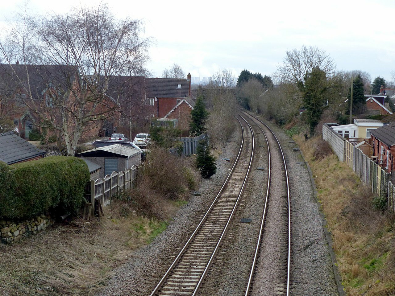
Weston-on-Trent railway station

Weston on Trent railway station served the village of Weston-on-Trent, Derbyshire from 1869 to 1930. == History == The station was opened on 6 December...

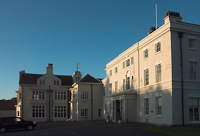
Aston Hall, Aston-on-Trent

Aston Hall is an 18th-century country house, now converted to residential apartments, at Aston-on-Trent, Derbyshire. It is a Grade II* listed building...

All Saints' Church, Aston-upon-Trent

All Saints’ Church, Aston upon Trent is a Grade I listed parish church in the Church of England in Aston-on-Trent, Derbyshire. == History == The church...
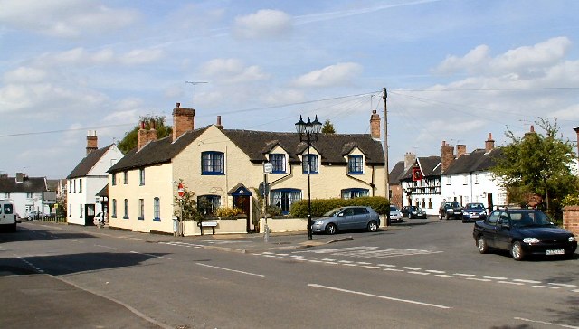
Aston-on-Trent

Aston-on-Trent is a village and civil parish in the South Derbyshire district, in the county of Derbyshire, England. The parish had a population of 1,682...

King's Mill, Castle Donington

King's Mill is the traditional crossing point of the River Trent between Castle Donington in Leicestershire and Weston-on-Trent in Derbyshire. The Mill...

St Mary the Virgin's Church, Weston-on-Trent

St Mary the Virgin's Church, Weston-on-Trent is a Grade I listed parish church in the Church of England in Weston-on-Trent, Derbyshire. == History... ==

Donington Park SSSI

Donington Park is a 32.9-hectare (81-acre) biological Site of Special Scientific Interest west of Castle Donington in Leicestershire. It is separate from...

Nearby Amenities

Located within 500m of 52.852,-1.398
Power: tower
Source: OS OpenData VectorMap District
Lat/Long: 52.8510157/-1.3935758
Power: tower
Source: OS OpenData VectorMap District
Lat/Long: 52.851811/-1.398926
Power: tower
Source: OS OpenData VectorMap District
Lat/Long: 52.852496/-1.4035607
Fixme: Need to check position of PF in relation to field boundary
Lat/Long: 52.8495409/-1.4038654
Bus Stop
Main Street / Kings Mill Lane
Both Ways: yes
Bus: yes
Public Transport: platform
Shelter: no
Source: survey
Lat/Long: 52.8486875/-1.401199
Bus Stop
The Green
Bus: yes
Naptan AtcoCode: 1000DWTM5106
Naptan NaptanCode: dbsdgajg
Public Transport: platform
Route Ref: 73
Shelter: yes
Lat/Long: 52.8503335/-1.3998311
Advertising: board
Operator: Weston on Trent Parish Council
Lat/Long: 52.8497984/-1.4005671
Bench
Lat/Long: 52.8498178/-1.4005858
Grit Bin
Lat/Long: 52.8500126/-1.4008701
Bench
Source: survey
Lat/Long: 52.8552281/-1.3945022
Bus Stop
Weston Road
Bus: yes
Public Transport: platform
Route Ref: 73
Shelter: no
Lat/Long: 52.8526316/-1.3971391
Bus Stop
Weston Road
Bus: yes
Public Transport: platform
Route Ref: 73
Shelter: no
Lat/Long: 52.8530648/-1.3968503
Bus Stop
The Green
Bus: yes
Public Transport: platform
Route Ref: 73
Shelter: no
Lat/Long: 52.8501891/-1.3999018
Traffic Calming: bump
Lat/Long: 52.8507061/-1.401028
Bench
Backrest: yes
Lat/Long: 52.8481753/-1.3981611
Capacity: 1
Check Date: 2024-02-19
Leisure: pitch
Sport: table_tennis
Lat/Long: 52.8482158/-1.3981637
Generator Method: photovoltaic
Generator Output Electricity: yes
Generator Source: solar
Generator Type: solar_photovoltaic_panel
Location: roof
Power: generator
Lat/Long: 52.8479509/-1.3971351
Generator Method: photovoltaic
Generator Output Electricity: yes
Generator Source: solar
Generator Type: solar_photovoltaic_panel
Location: roof
Power: generator
Lat/Long: 52.8479307/-1.398031
Generator Method: photovoltaic
Generator Output Electricity: yes
Generator Source: solar
Generator Type: solar_photovoltaic_panel
Location: roof
Power: generator
Lat/Long: 52.8479002/-1.4007212
Generator Method: photovoltaic
Generator Output Electricity: yes
Generator Source: solar
Generator Type: solar_photovoltaic_panel
Location: roof
Power: generator
Lat/Long: 52.8488069/-1.3999085
Generator Method: photovoltaic
Generator Output Electricity: yes
Generator Source: solar
Generator Type: solar_photovoltaic_panel
Location: roof
Power: generator
Lat/Long: 52.8489494/-1.4002224
Generator Method: photovoltaic
Generator Output Electricity: yes
Generator Source: solar
Generator Type: solar_photovoltaic_panel
Location: roof
Power: generator
Lat/Long: 52.8489948/-1.4001955
Generator Method: photovoltaic
Generator Output Electricity: yes
Generator Source: solar
Generator Type: solar_photovoltaic_panel
Location: roof
Power: generator
Lat/Long: 52.8500954/-1.3985366
Generator Method: photovoltaic
Generator Output Electricity: yes
Generator Source: solar
Generator Type: solar_photovoltaic_panel
Location: roof
Power: generator
Lat/Long: 52.8523458/-1.3969849
Generator Method: photovoltaic
Generator Output Electricity: yes
Generator Source: solar
Generator Type: solar_photovoltaic_panel
Location: roof
Power: generator
Lat/Long: 52.8523328/-1.3969474
Generator Method: photovoltaic
Generator Output Electricity: yes
Generator Source: solar
Generator Type: solar_photovoltaic_panel
Location: roof
Power: generator
Lat/Long: 52.8525928/-1.3964458
Generator Method: photovoltaic
Generator Output Electricity: yes
Generator Source: solar
Generator Type: solar_photovoltaic_panel
Location: roof
Power: generator
Lat/Long: 52.8533762/-1.3955352
Generator Method: photovoltaic
Generator Output Electricity: yes
Generator Source: solar
Generator Type: solar_photovoltaic_panel
Location: roof
Power: generator
Lat/Long: 52.8542006/-1.395385
Generator Method: photovoltaic
Generator Output Electricity: yes
Generator Source: solar
Generator Type: solar_photovoltaic_panel
Location: roof
Power: generator
Lat/Long: 52.8544306/-1.3950202
Generator Method: photovoltaic
Generator Output Electricity: yes
Generator Source: solar
Generator Type: solar_photovoltaic_panel
Location: roof
Power: generator
Lat/Long: 52.8544274/-1.395149
Give Way
Direction: backward
Lat/Long: 52.8484559/-1.3995331
Give Way
Direction: backward
Lat/Long: 52.8479455/-1.3999782
Give Way
Direction: forward
Lat/Long: 52.850078/-1.4000908
Leisure: picnic_table
Lat/Long: 52.8507727/-1.402401
Leisure: picnic_table
Lat/Long: 52.85078/-1.4024319
Leisure: picnic_table
Lat/Long: 52.8508489/-1.4024654
Leisure: picnic_table
Lat/Long: 52.8508594/-1.402507
Leisure: picnic_table
Lat/Long: 52.8508707/-1.4025579
Leisure: picnic_table
Lat/Long: 52.850878/-1.4026009
Leisure: picnic_table
Lat/Long: 52.8508537/-1.4026223
Leisure: picnic_table
Lat/Long: 52.8508489/-1.4025821
Leisure: picnic_table
Lat/Long: 52.8508432/-1.4025566
Leisure: picnic_table
Lat/Long: 52.8508351/-1.402519
Leisure: picnic_table
Lat/Long: 52.850827/-1.4024815
Leisure: picnic_table
Lat/Long: 52.8508181/-1.4024426
Leisure: picnic_table
Lat/Long: 52.8508051/-1.4024051
Leisure: picnic_table
Lat/Long: 52.8507849/-1.4024614
Leisure: picnic_table
Lat/Long: 52.8507922/-1.4025083
Leisure: picnic_table
Lat/Long: 52.8508035/-1.4025499
Leisure: picnic_table
Lat/Long: 52.8508092/-1.4025874
Leisure: picnic_table
Lat/Long: 52.8508205/-1.402621
Leisure: picnic_table
Lat/Long: 52.8508311/-1.4026625
Leisure: picnic_table
Lat/Long: 52.85084/-1.4027041
Leisure: picnic_table
Lat/Long: 52.8508829/-1.4026371
Entrance: main
Lat/Long: 52.8510555/-1.402682
Waste Basket
Material: metal
Operator: South Derbyshire District Council
Waste: trash
Lat/Long: 52.8481656/-1.3982255
Waste Basket
Colour: black
Material: metal
Operator: South Derbyshire District Council
Waste: trash
Lat/Long: 52.8503252/-1.3998473
Waste Basket
Colour: green
Material: plastic
Operator: South Derbyshire District Council
Waste: trash
Lat/Long: 52.8552486/-1.3944845
Waste Basket
Colour: red
Operator: South Derbyshire District Council
Waste: dog_excrement
Lat/Long: 52.8520076/-1.3977066
The data included in this document is from www.openstreetmap.org. The data is made available under ODbL.

Have you been to Weston Hall?

Leave your review of Weston Hall below (or comments, questions and feedback).