Westenhanger Castle
Heritage Site in Kent Shepway
England
Westenhanger Castle

Westenhanger Castle, located in Kent, England, is a historical site with a rich and fascinating past. The castle, also known as Westenhanger Manor, is a Grade I listed building and is considered a significant heritage site in the region.
Originally built in the 14th century as a fortified manor house, Westenhanger Castle has undergone various transformations throughout its history. The castle features a mix of architectural styles, reflecting its evolution over the centuries. The oldest parts of the castle include the gatehouse and the curtain walls, which still stand today and offer a glimpse into its medieval origins.
During the Tudor period, the castle was expanded and renovated, acquiring a more luxurious and grand appearance. The addition of elegant windows, chimneys, and decorative elements transformed the castle into a lavish residence. It served as a residence for several prominent figures, including Henry VIII's Lord Warden of the Cinque Ports.
In later years, Westenhanger Castle played a significant role in military history. During the English Civil War, it was used as a strategic military base and saw extensive damage. However, the castle was restored in the 19th century, preserving its historical significance.
Today, Westenhanger Castle serves as a venue for various events and functions. The castle's interior has been beautifully restored and is a popular location for weddings, conferences, and cultural events. Visitors can explore the castle's grounds, including its gardens and moat, and experience the unique blend of medieval and Tudor architecture.
Westenhanger Castle stands as a testament to the rich history of Kent and offers visitors a chance to step back in time and immerse themselves in its fascinating past.
If you have any feedback on the listing, please let us know in the comments section below.
Westenhanger Castle Images
Images are sourced within 2km of 51.097/1.035 or Grid Reference TR1237. Thanks to Geograph Open Source API. All images are credited.


Westenhanger Castle is located at Grid Ref: TR1237 (Lat: 51.097, Lng: 1.035)
Administrative County: Kent
District: Shepway
Police Authority: Kent
What 3 Words
///venturing.marzipan.command. Near Lympne, Kent
Nearby Locations
Related Wikis
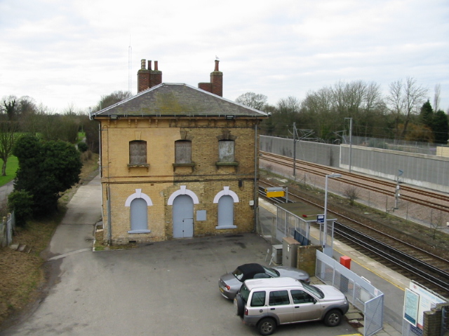
Westenhanger railway station
Westenhanger railway station is on the South Eastern Main Line in England, serving the villages of Westenhanger and Stanford, and was near the now-closed...

Folkestone Racecourse
Folkestone Racecourse was a thoroughbred horse racing venue in southeast England, until it closed in 2012. It is located in Westenhanger, by junction 11...

Westenhanger Castle
Westenhanger Castle is a fortified manor house once owned by royalty, located next to Westenhanger railway station and the grandstand of Folkestone Racecourse...

Stanford Windmill
Stanford Windmill is a Grade II* listed tower mill in Stanford, Kent, England that was built in 1857. It stands on Kennett Lane in Stanford. == History... ==
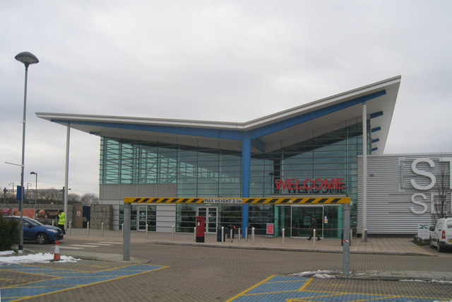
Folkestone services
Folkestone services is a motorway service station on the M20 motorway at Westenhanger, seven miles from Folkestone in Kent, England. They are the second...

Stanford, Kent
Stanford is a village and civil parish in Kent, England. It is part of the Folkestone and Hythe district. The village developed along the ancient Roman...

Newingreen
Newingreen is a village near Folkestone in Kent, England. It is situated on the junction of the A20 and the historic Stone Street between Lympne and Canterbury...
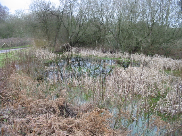
Gibbin's Brook
Gibbin's Brook is a 16.8-hectare (42-acre) biological Site of Special Scientific Interest in Sellindge in Kent.This site is mainly marshy grassland, but...
Nearby Amenities
Located within 500m of 51.097,1.035Have you been to Westenhanger Castle?
Leave your review of Westenhanger Castle below (or comments, questions and feedback).