West Lanyon Quoit

Heritage Site in Cornwall

England

West Lanyon Quoit

Chimney and shaft buildings as part of Ding Dong Mines in Penwith
Chimney and shaft buildings as part of Ding Dong Mines in Penwith Credit: Tom Page

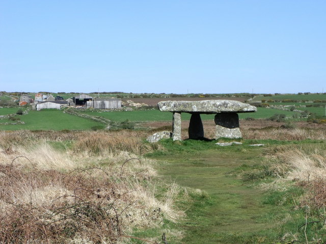
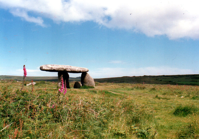
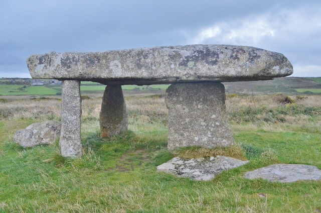
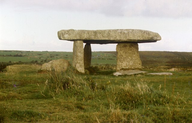
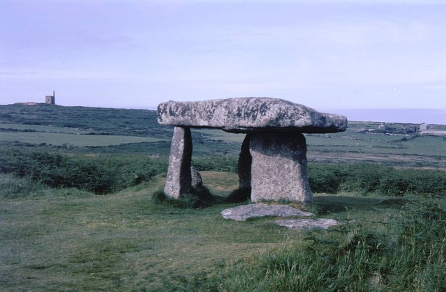
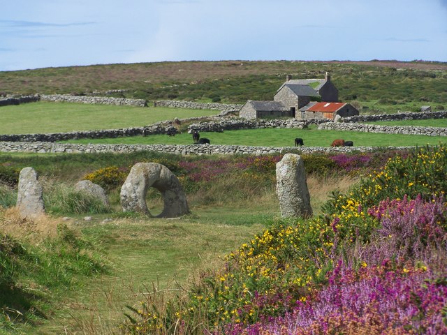
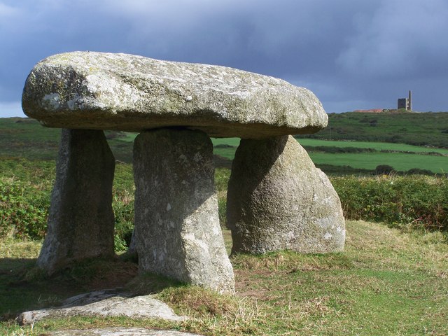
West Lanyon Quoit is a well-preserved ancient burial chamber located in Cornwall, England. This megalithic monument is considered to be a significant heritage site due to its historical and archaeological importance.

Dating back to the Neolithic period, around 3500-2500 BC, West Lanyon Quoit is one of the few remaining examples of its kind in the region. The monument consists of several large granite stones, carefully arranged to form a chamber and a capstone. The capstone, estimated to weigh around 12 tons, rests on top of three upright stones, creating a sheltered space within the chamber.

The purpose of West Lanyon Quoit is believed to be a communal burial site, where the deceased were placed alongside their possessions and possibly ritually prepared. It is also thought to have had ceremonial significance within the local community.

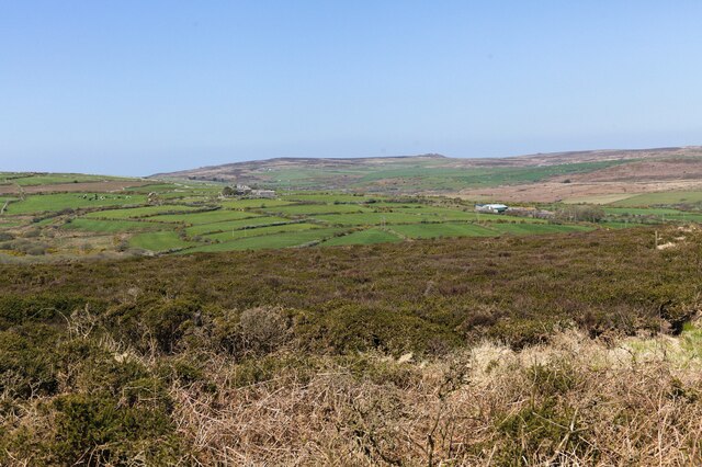
The site is situated in a picturesque rural location, surrounded by rolling hills and farmland. It is accessible via a footpath, allowing visitors to approach the monument and appreciate its grandeur up close. Despite its age, the structure remains remarkably intact, thanks to ongoing conservation efforts.

West Lanyon Quoit has attracted the attention of archaeologists and historians, who have carefully studied its construction and significance. It provides valuable insights into the rituals and beliefs of the Neolithic people who inhabited the area thousands of years ago.

As a heritage site, West Lanyon Quoit is protected by legislation, ensuring its preservation for future generations to explore and appreciate the rich history of Cornwall's ancient past.

If you have any feedback on the listing, please let us know in the comments section below.

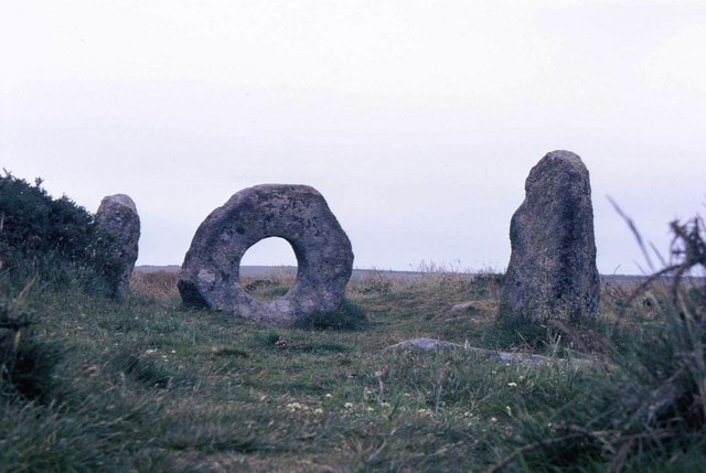
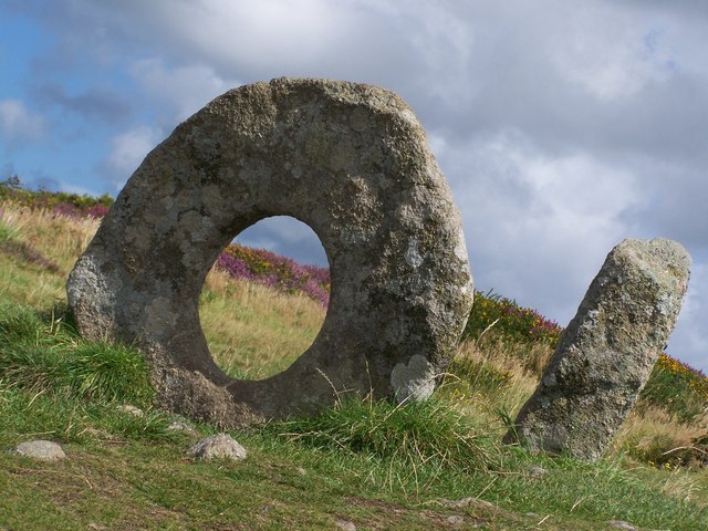
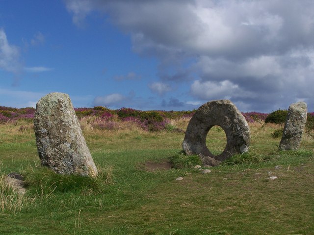
West Lanyon Quoit Images

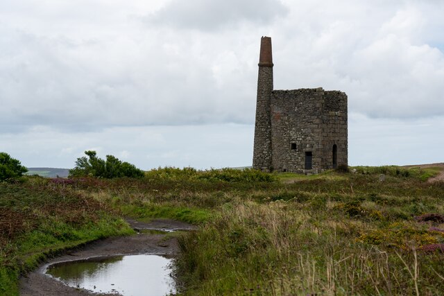
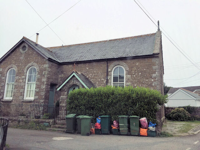
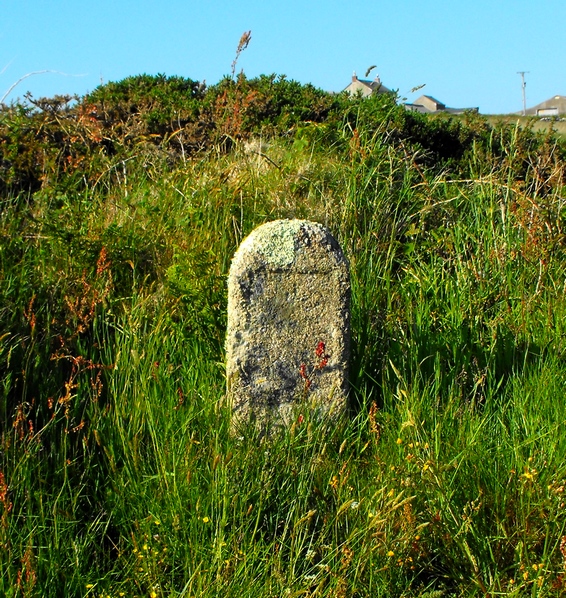
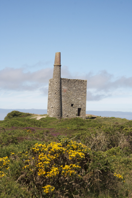
Images are sourced within 2km of 50.145/-5.605 or Grid Reference SW4233. Thanks to Geograph Open Source API. All images are credited.

Chimney and shaft buildings as part of Ding Dong Mines in Penwith
Newbridge Methodist Church
View from Bosvenning Common 2 Another look across the common to distant farms. The far distant rocky outcrop is Carn Galver. See also <a href="https://www.geograph.org.uk/photo/7460419">SW4131 : View from Bosvenning Common 1</a>.
View from Bosvenning Common 2
Another look across the common to distant farms. The far distant rocky outcrop is Carn Galver. See also SW4131 : View from Bosvenning Common 1.
Faceless Defaced milestone on Bosullow Common.
Faceless
Defaced milestone on Bosullow Common.
Lanyon Quoit, Cornwall
Engine house at Ding Dong mine, Cornwall
Trewern Round Iron Age enclosure near Newbridge.
Trewern Round
Iron Age enclosure near Newbridge.
Standing out Another redundant milk-churn stand in Penwith.
Standing out
Another redundant milk-churn stand in Penwith.
Ding Dong Mine Engine House
Lanyon Quoit 1987
Lanyon Quoit 1987
Lanyon Quoit The giant's table; the top is 13 tonnes. This is an ancient burial chamber.
Lanyon Quoit
The giant's table; the top is 13 tonnes. This is an ancient burial chamber.
Lanyon Quoit
Lanyon Quoit
Lanyon Quoit On 19 October, 1815, Lanyon Quoit, a dolmen, was torn down by a storm. Nine years later enough money was raised by local inhabitants to re-erect the structure. During the storm one of the uprights was broken in half. Thus, there are only three uprights today and the structure does not stand as high as it once did.
Lanyon Quoit
On 19 October, 1815, Lanyon Quoit, a dolmen, was torn down by a storm. Nine years later enough money was raised by local inhabitants to re-erect the structure. During the storm one of the uprights was broken in half. Thus, there are only three uprights today and the structure does not stand as high as it once did.
Men-An-Tol The name Men-an-Tol in the Cornish Language literally means "the hole stone".
Men-An-Tol
The name Men-an-Tol in the Cornish Language literally means "the hole stone".
Holed stone of Men-an-Tol
Four stones of Men-an-Tol Rain clouds passing over the megalithic structures known as Men-an-Tol
Four stones of Men-an-Tol
Rain clouds passing over the megalithic structures known as Men-an-Tol
Colourful Men-an-Tol Looking towards farm buildings from the colourful heather beds that surround Men-an-Tol
Colourful Men-an-Tol
Looking towards farm buildings from the colourful heather beds that surround Men-an-Tol
Storm brewing up over Lanyon Quoit From Lanyon Quoit towards disused tin mine
Storm brewing up over Lanyon Quoit
From Lanyon Quoit towards disused tin mine
Show me another place!

West Lanyon Quoit is located at Grid Ref: SW4233 (Lat: 50.145, Lng: -5.605)

Unitary Authority: Cornwall

Police Authority: Devon and Cornwall

What 3 Words

///weaved.owner.chum. Near Penzance, Cornwall

Nearby Locations

West Lanyon Quoit

Related Wikis

West Lanyon Quoit

West Lanyon Quoit, also known as Lower Lanyon Quoit, is the remains of a prehistoric dolmen situated in the parish of Madron in Cornwall grid reference...

Lanyon Quoit

Lanyon Quoit is a dolmen in Cornwall, England, United Kingdom, 2 miles southeast of Morvah. It collapsed in a storm in 1815 and was re-erected nine years...

Lanyon (Madron)

Lanyon is a hamlet in the parish of Madron in Cornwall, England, UK. It is situated on a north facing slope on the Madron to Morvah road. The nearest town...

Bosiliack Barrow

Bosiliack Barrow is a barrow on the Penwith Moors between Madron and Morvah near the hamlet of Bosiliack in Cornwall, UK. The barrow is Neolithic and was...

Nearby Amenities

Located within 500m of 50.145,-5.605
Lanyon Quoit
Archaeological Site: megalith
Heritage: yes
Historic: archaeological_site
Megalith Type: dolmen
Tourism: attraction
Url: http://en.wikipedia.org/wiki/Lanyon_Quoit
Wikidata: Q1725167
Wikipedia: en:Lanyon Quoit
Lat/Long: 50.147356/-5.5990624
Boswarva Carn
Archaeological Site: hut_circle
Fixme: if there is more than one, map them separately as areas, preferably
Historic: archaeological_site
Lat/Long: 50.1430182/-5.5988104
Heritage: yes
Historic: archaeological_site
Wikidata: Q15949919
Wikipedia: en:West Lanyon Quoit
Lat/Long: 50.1479764/-5.6084293
The data included in this document is from www.openstreetmap.org. The data is made available under ODbL.

Have you been to West Lanyon Quoit?

Leave your review of West Lanyon Quoit below (or comments, questions and feedback).