West Kennett Long Barrow

Heritage Site in Wiltshire

England

West Kennett Long Barrow

Silbury Hill Silbury Hill is the tallest prehistoric man-made mound in Europe.
Silbury Hill Credit: Alan Hughes

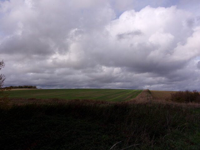
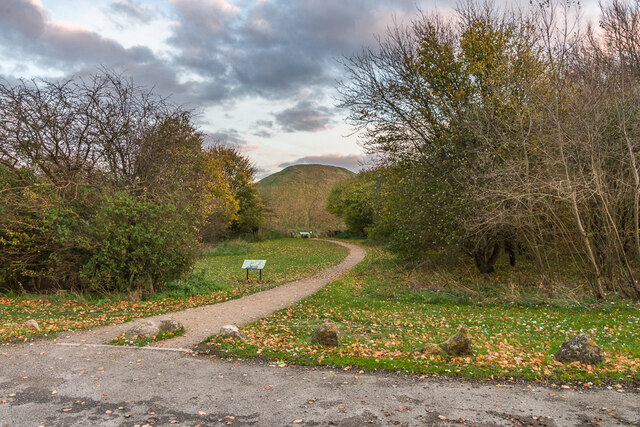
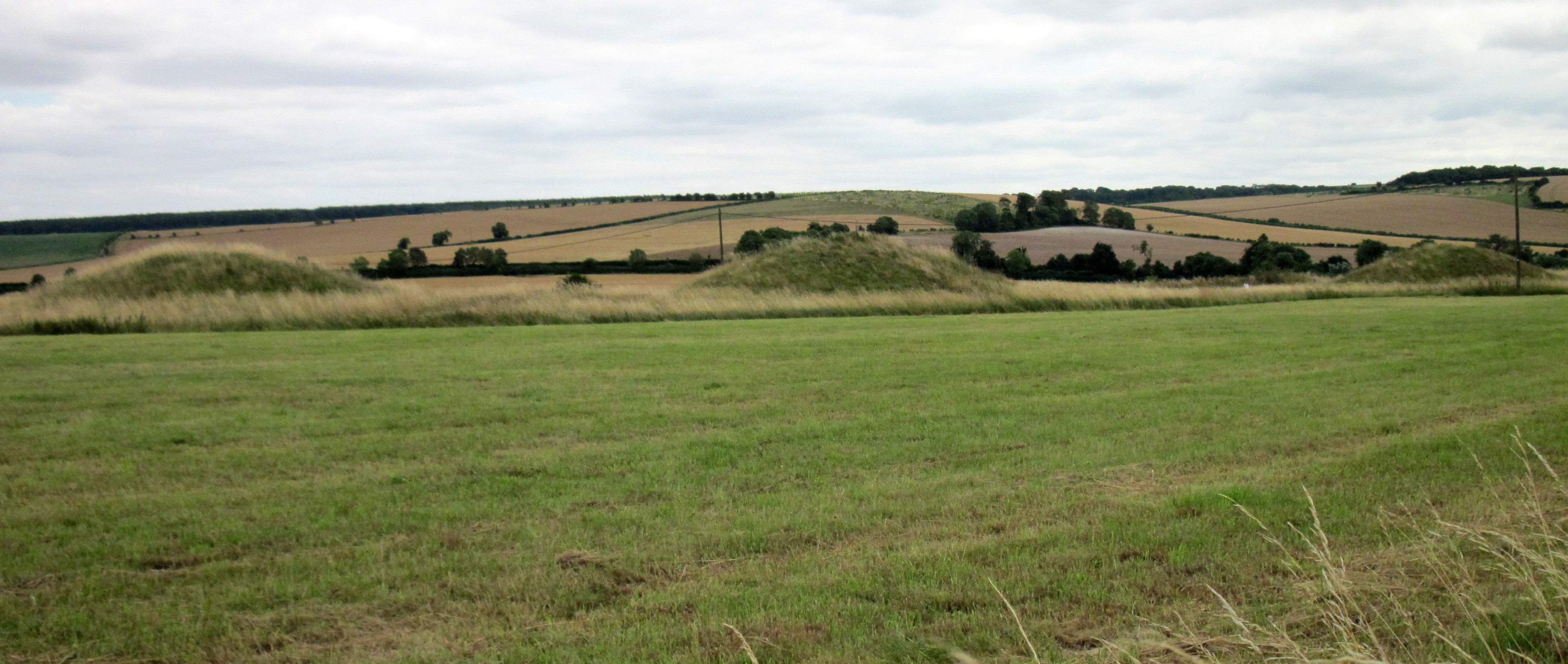
West Kennett Long Barrow is a prehistoric burial mound located near the village of Avebury in Wiltshire, England. This heritage site, dating back to the Neolithic period, is one of the most iconic and well-preserved examples of a chambered long barrow in the country.

The barrow is constructed from large sarsen stones, which were brought from a nearby quarry and arranged to form the structure. It consists of a long, narrow mound that measures around 100 feet in length and is approximately 30 feet wide. The entrance to the barrow is located at the eastern end, leading to a passage that leads to five burial chambers. These chambers were used for collective burials, with the remains of several individuals found within.

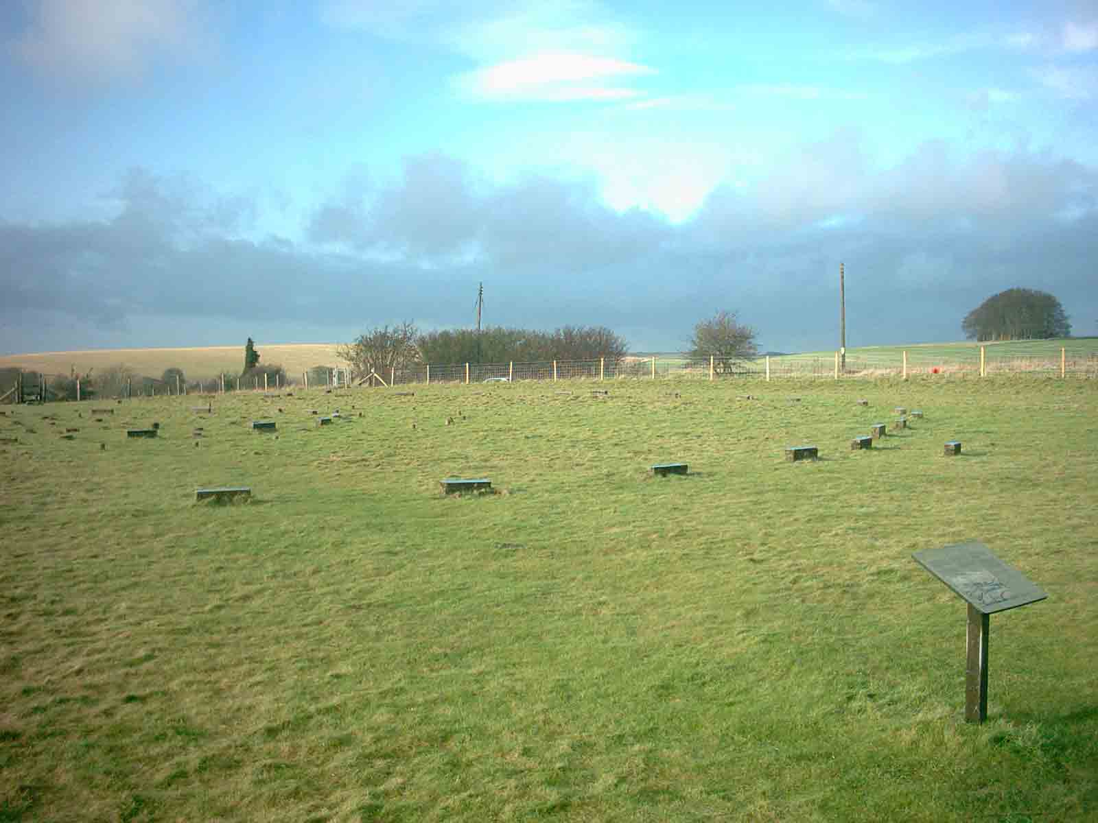
The site was likely in use for several centuries, with evidence of multiple burials and ritual activities. Excavations have revealed various artifacts, such as pottery, flint tools, and animal bones, providing insights into the daily lives and customs of the Neolithic people who built and used the barrow.

West Kennett Long Barrow occupies a prominent position on the landscape and is surrounded by stunning views of the Wiltshire countryside. It is part of a broader complex of prehistoric sites in the area, including the famous Avebury Stone Circle and Silbury Hill. The site is managed by English Heritage and is open to the public, allowing visitors to explore and experience this ancient monument firsthand.

If you have any feedback on the listing, please let us know in the comments section below.

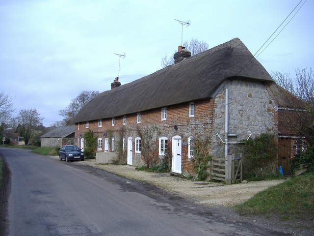
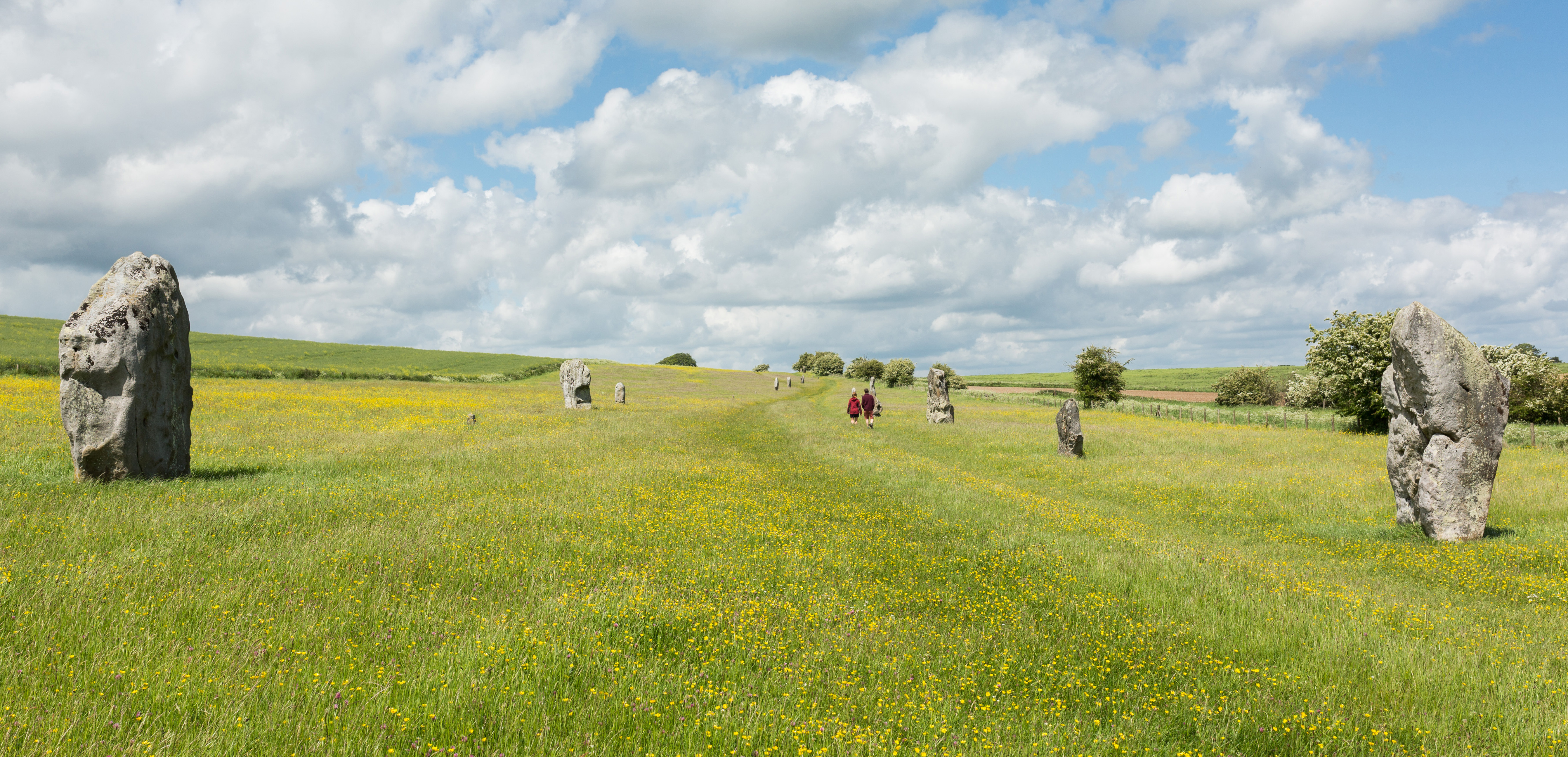
West Kennett Long Barrow Images

Images are sourced within 2km of 51.407/-1.848 or Grid Reference SU1067. Thanks to Geograph Open Source API. All images are credited.

Silbury Hill Silbury Hill is the tallest prehistoric man-made mound in Europe.
Silbury Hill
Silbury Hill is the tallest prehistoric man-made mound in Europe.
Wiltshire landscape Hillside near Avebury.
Wiltshire landscape
Hillside near Avebury.
The Prehistoric chalk mound, Silbury Hill, near Avebury The mound, and some of the surrounding landscape, bears witness to the lack of rain through the summer of 2022. The drought was less harsh in the Western side of the UK than in the South-East, but it is clear from this photo that there still is a lot of parched grassland even here.
The Prehistoric chalk mound, Silbury Hill, near Avebury
The mound, and some of the surrounding landscape, bears witness to the lack of rain through the summer of 2022. The drought was less harsh in the Western side of the UK than in the South-East, but it is clear from this photo that there still is a lot of parched grassland even here.
Silbury Hill, near Avebury, with interpretive information in the foreground
Approaching a slight bend in the footpath around Silbury Hill, near Avebury
The footpath around Silbury Hill, looking towards gated field boundary
Silbury Hill The largest man-made prehistoric mound in Europe.
Silbury Hill
The largest man-made prehistoric mound in Europe.
Silbury Hill: October 2022 For more information see <span class="nowrap"><a title="https://en.wikipedia.org/wiki/Silbury_Hill" rel="nofollow ugc noopener" href="https://en.wikipedia.org/wiki/Silbury_Hill">Link</a><img style="margin-left:2px;" alt="External link" title="External link - shift click to open in new window" src="https://s1.geograph.org.uk/img/external.png" width="10" height="10"/></span>
Silbury Hill: October 2022
For more information see LinkExternal link
Farmland to the west of Silbury Hill
Looking from an information board towards Silbury Hill
Silbury Hill The setting sun lighting up the top of the Neolithic Silbury Hill.
Silbury Hill
The setting sun lighting up the top of the Neolithic Silbury Hill.
Silbury Hill The Neolithic Silbury Hill seen from the adjacent car park on the A4 just after sunset.
Silbury Hill
The Neolithic Silbury Hill seen from the adjacent car park on the A4 just after sunset.
Old Milestone by the A4, Beckhampton Beckhampton waist by the A4, in parish of Avebury (Kennet District), 400m East of Waggon & Horses PH, Beckhampton, on grass verge between road and wire fence. An earlier photograph can be found here <a title="https://www.geograph.org.uk/photo/6114902" href="https://www.geograph.org.uk/photo/6114902">Link</a>.

Inscription reads:-
: MARLBRO / 6 : : LONDON / 81 : : CALNE / 6 :
Rivet benchmark on top.

Grade II listed.
List Entry Number: 1286399 <span class="nowrap"><a title="https://historicengland.org.uk/listing/the-list/list-entry/1286399" rel="nofollow ugc noopener" href="https://historicengland.org.uk/listing/the-list/list-entry/1286399">Link</a><img style="margin-left:2px;" alt="External link" title="External link - shift click to open in new window" src="https://s1.geograph.org.uk/img/external.png" width="10" height="10"/></span>

Milestone Society National ID: WI_LB81
Old Milestone by the A4, Beckhampton
Beckhampton waist by the A4, in parish of Avebury (Kennet District), 400m East of Waggon & Horses PH, Beckhampton, on grass verge between road and wire fence. An earlier photograph can be found here Link. Inscription reads:- : MARLBRO / 6 : : LONDON / 81 : : CALNE / 6 : Rivet benchmark on top. Grade II listed. List Entry Number: 1286399 LinkExternal link Milestone Society National ID: WI_LB81
Silbury Hill The largest man-made earthwork in Europe, and no-one knows what it was built for! Sadly dilapidated now, and sorely in need of attention - see <span class="nowrap"><a title="http://www.heritageaction.org" rel="nofollow ugc noopener" href="http://www.heritageaction.org">Link</a><img style="margin-left:2px;" alt="External link" title="External link - shift click to open in new window" src="https://s1.geograph.org.uk/img/external.png" width="10" height="10"/></span> for details.
Silbury Hill
The largest man-made earthwork in Europe, and no-one knows what it was built for! Sadly dilapidated now, and sorely in need of attention - see LinkExternal link for details.
Silbury Hill Sibury Hill, constructed roughly 4,600 years ago, the purpose is still unknown
Silbury Hill
Sibury Hill, constructed roughly 4,600 years ago, the purpose is still unknown
Field, Nr. Silbury Hill A crop field to the south of Silbury Hill, a man-made Saxon mound
Field, Nr. Silbury Hill
A crop field to the south of Silbury Hill, a man-made Saxon mound
Moon over Silbury Hill An early evening view of Silbury Hill taken from the parking area, looking more or less south east at the west face of the hill.
Moon over Silbury Hill
An early evening view of Silbury Hill taken from the parking area, looking more or less south east at the west face of the hill.
Chalk arable land east of Beckhampton Looking north from the bridleway just north of the Silbury Hill car park.
Chalk arable land east of Beckhampton
Looking north from the bridleway just north of the Silbury Hill car park.
Show me another place!

West Kennett Long Barrow is located at Grid Ref: SU1067 (Lat: 51.407, Lng: -1.848)

What 3 Words

///paint.appraised.brittle. Near Avebury, Wiltshire

Nearby Locations

West Kennett Long Barrow

Related Wikis

West Kennet Long Barrow

The West Kennet Long Barrow, also known as South Long Barrow, is a chambered long barrow near the village of Avebury in the south-western English county...

Silbury Hill

Silbury Hill is a prehistoric artificial chalk mound near Avebury in the English county of Wiltshire. It is part of the Stonehenge, Avebury and Associated...

Overton Hill

Overton Hill is a 571 ft (174 m) hill at the southern edge of the Marlborough Downs in Wiltshire, England. It lies just west of the village of West Overton...

The Sanctuary

The Sanctuary was a stone and timber circle near the village of Avebury in the south-western English county of Wiltshire. Excavation has revealed the location...

East Kennett

East Kennett is a small village and civil parish in Wiltshire, England, 5 miles (8.0 km) west of Marlborough. The United Kingdom Census 2011 recorded a...

Falkner's Circle

Falkner's Circle was a stone circle near the village of Avebury in the south-western English county of Wiltshire. Built from twelve sarsen megaliths, it...

Kennet Avenue

Kennet Avenue or West Kennet Avenue is a prehistoric site in the English county of Wiltshire. It was an avenue of two parallel lines of stones 25m wide...

South Street barrow

The South Street barrow is a Neolithic long barrow in the English county of Wiltshire, near Beckhampton. It lies around 70 metres southeast of the cove...

Nearby Amenities

Located within 500m of 51.407,-1.848
West Kennet Long Barrow
Archaeological Site: megalith
Heritage: yes
Historic: archaeological_site
Historic Civilization: prehistoric
Material: stone
Megalith Type: long_barrow
Wikidata: Q541312
Lat/Long: 51.4086455/-1.8504375
Entrance: yes
Lat/Long: 51.408609/-1.8502987
The data included in this document is from www.openstreetmap.org. The data is made available under ODbL.

Have you been to West Kennett Long Barrow?

Leave your review of West Kennett Long Barrow below (or comments, questions and feedback).