Wansdyke
Heritage Site in Somerset
England
Wansdyke

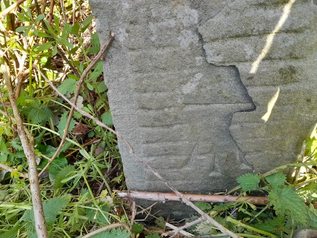
Wansdyke is a historic earthwork located in Somerset, England. This ancient monument stretches over 50 miles from the Avon valley near Bristol to the edge of the Salisbury Plain. Believed to have been constructed during the Early Middle Ages, Wansdyke is a remarkable feat of engineering that served as a defensive barrier and territorial boundary.
The earthwork consists of a ditch and bank, with the ditch on the northern side and the bank on the southern side. The ditch measures up to 20 feet wide and 6 feet deep, while the bank is around 20 feet wide and 3 feet high. The construction of Wansdyke utilized the natural topography, following hills and ridges to maximize its defensive capabilities.
There are several theories regarding the purpose of Wansdyke. Some researchers suggest that it was built as a territorial boundary, marking the extent of West Saxon control. Others propose that it served as a defensive fortification against potential invaders from the west. Additionally, it has been suggested that Wansdyke may have been used for controlling livestock or providing a route for communication and trade.
Wansdyke, recognized as a Scheduled Monument, is a popular heritage site attracting visitors who are fascinated by its historical significance. The earthwork offers a unique opportunity to explore the region's past and appreciate the ingenuity of its construction. Visitors can walk along various sections of Wansdyke, experiencing the landscape and imagining the challenges faced by its builders. The site also provides panoramic views of the surrounding countryside, showcasing the natural beauty of Somerset.
If you have any feedback on the listing, please let us know in the comments section below.
Wansdyke Images
Images are sourced within 2km of 51.368/-2.438 or Grid Reference ST6963. Thanks to Geograph Open Source API. All images are credited.


Wansdyke is located at Grid Ref: ST6963 (Lat: 51.368, Lng: -2.438)
Unitary Authority: Bath and North East Somerset
Police Authority: Avon and Somerset
What 3 Words
///piglets.collected.impulsive. Near Corston, Somerset
Nearby Locations
Related Wikis

Newton St Loe Castle
Newton St Loe Castle was a fortified manor house in the village of Newton St Loe, Somerset, England. Parts of it survive: a 14th-century keep and 15th...
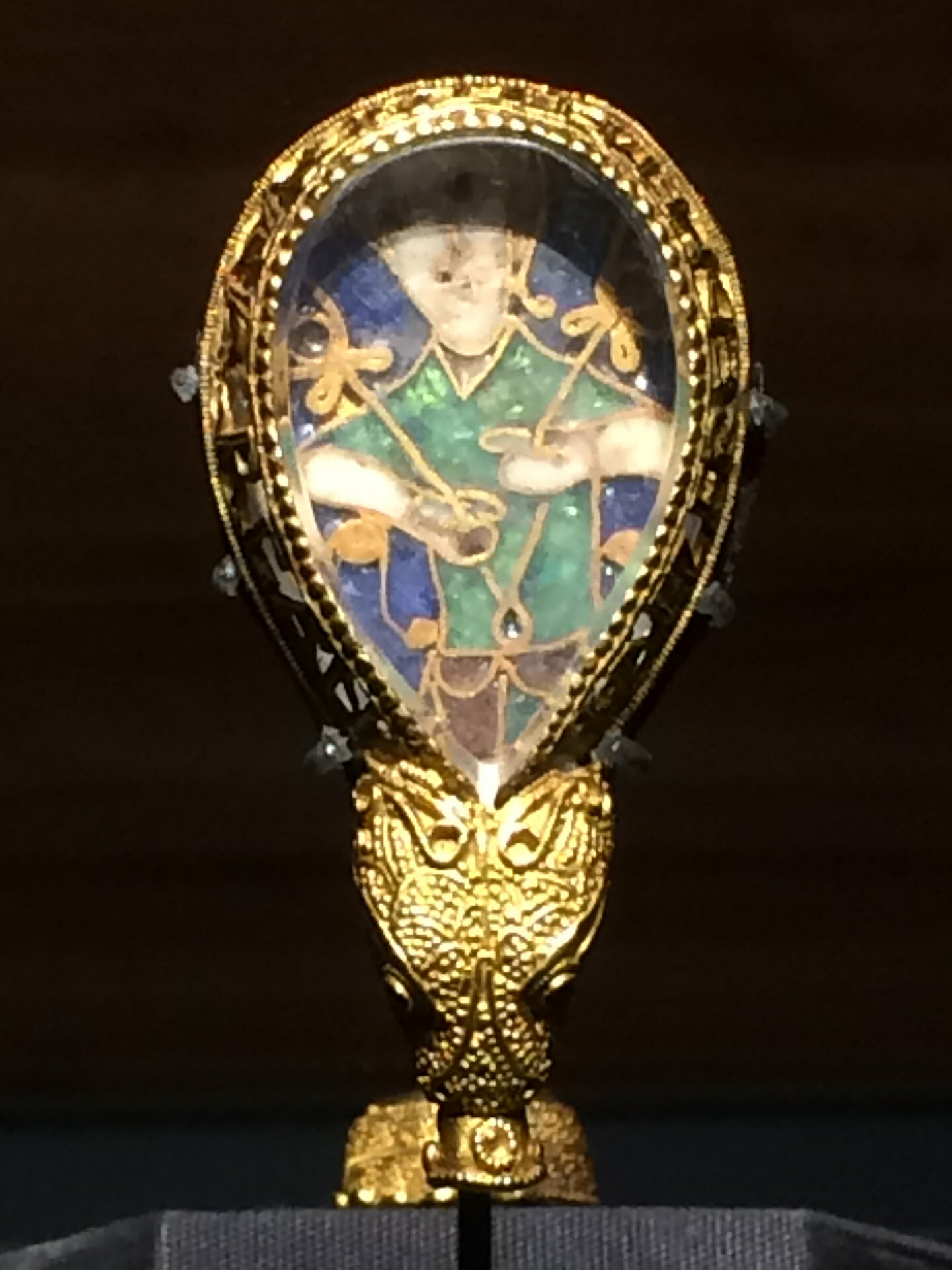
Alfred Jewel
The Alfred Jewel is a piece of Anglo-Saxon goldsmithing work made of enamel and quartz enclosed in gold. It was discovered in 1693, in North Petherton...

Wilmington, Somerset
Wilmington is a hamlet in the civil parish of Priston within the unitary authority of Bath and North East Somerset, England. It is nestled in the hilly...
Bath Spa University
Bath Spa University is a public university in Bath, England, with its main campus at Newton Park, about 3+1⁄2 miles (5.6 km) west of the centre of the...
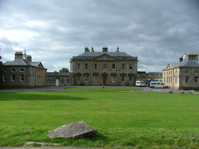
Newton Park
Newton Park is an 18th-century Grade I listed country house in the parish of Newton St Loe, Somerset, England, situated 4 miles (6.4 km) west of Bath....

Church of the Holy Trinity, Newton St Loe
The Anglican Church of the Holy Trinity in Newton St Loe within the English county of Somerset is a Grade II* listed building.A church has stood on the...
Newton St Loe
Newton St Loe is a small Somerset village and civil parish located close to the villages of Corston and Stanton Prior, between Bath and Bristol in England...
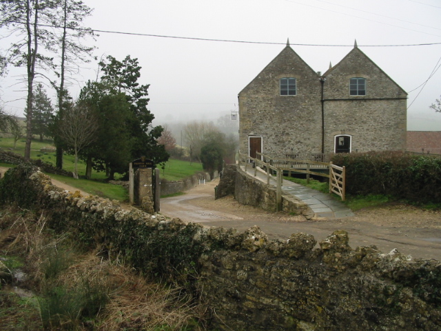
Priston Mill
Priston Mill is a watermill in the district of Somerset, England. A Grade II listed building, it is near the city of Bath and currently serves as a venue...
Nearby Amenities
Located within 500m of 51.368,-2.438Have you been to Wansdyke?
Leave your review of Wansdyke below (or comments, questions and feedback).