Valence House

Heritage Site in Essex

England

Valence House

Cambeys Rd
Cambeys Rd Credit: N Chadwick

Valence House is a historic building located in Dagenham, Essex, England. It is considered one of the oldest buildings in the borough and is renowned as a local heritage site. The house dates back to the 13th century, although parts of it have been renovated and added to over the centuries.

The house was originally built as a manor house and has a rich and varied history. It has served as a residence for several important families over the years, including the Fanshawe and Parsloes families. Today, Valence House is home to the Valence House Museum, which showcases the history and heritage of the borough of Barking and Dagenham.

The museum houses a diverse collection of artifacts and exhibits, ranging from archaeological finds to documents and photographs that depict the local area's past. Visitors can explore the various rooms of the house, including the Victorian kitchen, Tudor parlour, and Georgian bedrooms, which have been meticulously restored to showcase the different periods of the house's history.

In addition to its historical significance, Valence House also boasts beautiful gardens and surrounding parkland, providing a tranquil and picturesque setting for visitors to enjoy. The gardens feature a range of plant species, including a herb garden and a sensory garden designed to engage all five senses.

Valence House is open to the public and offers guided tours, educational programs, and temporary exhibitions. It is not only a popular destination for history enthusiasts but also serves as a community hub, hosting events and activities for people of all ages to engage with and learn from the rich heritage of the area.

If you have any feedback on the listing, please let us know in the comments section below.

Valence House Images

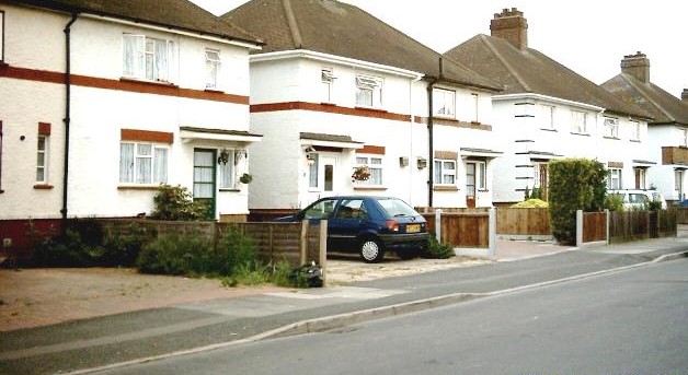
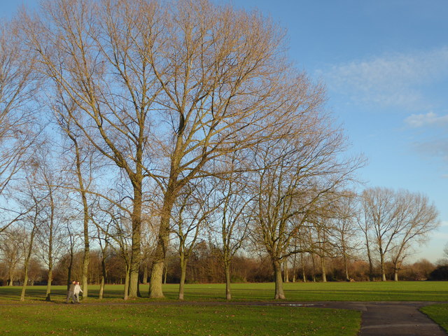
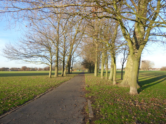
Images are sourced within 2km of 51.557/0.142 or Grid Reference TQ4886. Thanks to Geograph Open Source API. All images are credited.

Cambeys Rd
Cambeys Rd
Meadow Road, Romford
Victoria Road, Dagenham Victoria Road, Dagenham home to Dagenham & Redbridge FC.
Victoria Road, Dagenham
Victoria Road, Dagenham home to Dagenham & Redbridge FC.
Central Park Central Park is situated between Rainham Road North and Rush Green Road, and was laid out behind Dagenham Civic Centre which is a superb example of late-1930s civic architecture. It was built in 1937, as was the fire station beyond it. The grand scale of Central Park reflects the dramatic increase in size of Dagenham between the Wars. There are a number of straight paths lined by trees such as the one just ahead.
Central Park
Central Park is situated between Rainham Road North and Rush Green Road, and was laid out behind Dagenham Civic Centre which is a superb example of late-1930s civic architecture. It was built in 1937, as was the fire station beyond it. The grand scale of Central Park reflects the dramatic increase in size of Dagenham between the Wars. There are a number of straight paths lined by trees such as the one just ahead.
Avenue of trees in Central Park Central Park is situated between Rainham Road North and Rush Green Road, and was laid out behind Dagenham Civic Centre which is a superb example of late-1930s civic architecture. It was built in 1937, as was the fire station beyond it. The grand scale of Central Park reflects the dramatic increase in size of Dagenham between the Wars. There are a number of straight paths lined by trees such as the one here.
Avenue of trees in Central Park
Central Park is situated between Rainham Road North and Rush Green Road, and was laid out behind Dagenham Civic Centre which is a superb example of late-1930s civic architecture. It was built in 1937, as was the fire station beyond it. The grand scale of Central Park reflects the dramatic increase in size of Dagenham between the Wars. There are a number of straight paths lined by trees such as the one here.
Looking across Central Park Central Park is situated between Rainham Road North and Rush Green Road, and was laid out behind Dagenham Civic Centre which is a superb example of late-1930s civic architecture. It was built in 1937, as was the fire station beyond it. The grand scale of Central Park reflects the dramatic increase in size of Dagenham between the Wars. There are a number of straight paths lined by trees. The view from this path looks across to the Civic Centre which is in front of the right hand block of flats and shows the scale of the park.
Looking across Central Park
Central Park is situated between Rainham Road North and Rush Green Road, and was laid out behind Dagenham Civic Centre which is a superb example of late-1930s civic architecture. It was built in 1937, as was the fire station beyond it. The grand scale of Central Park reflects the dramatic increase in size of Dagenham between the Wars. There are a number of straight paths lined by trees. The view from this path looks across to the Civic Centre which is in front of the right hand block of flats and shows the scale of the park.
Playground in Central Park Central Park is situated between Rainham Road North and Rush Green Road, and was laid out behind Dagenham Civic Centre which is a superb example of late-1930s civic architecture. It was built in 1937, as was the fire station beyond it. The grand scale of Central Park reflects the dramatic increase in size of Dagenham between the Wars. This playground is in the far north-east corner of the park near the entrance from Legon Avenue.
Playground in Central Park
Central Park is situated between Rainham Road North and Rush Green Road, and was laid out behind Dagenham Civic Centre which is a superb example of late-1930s civic architecture. It was built in 1937, as was the fire station beyond it. The grand scale of Central Park reflects the dramatic increase in size of Dagenham between the Wars. This playground is in the far north-east corner of the park near the entrance from Legon Avenue.
Pitch and putt golf course, Central Park Central Park is situated between Rainham Road North and Rush Green Road, and was laid out behind Dagenham Civic Centre which is a superb example of late-1930s civic architecture. It was built in 1937, as was the fire station beyond it. The grand scale of Central Park reflects the dramatic increase in size of Dagenham between the Wars. The pitch and putt golf course is along the northern boundary of the park.
Pitch and putt golf course, Central Park
Central Park is situated between Rainham Road North and Rush Green Road, and was laid out behind Dagenham Civic Centre which is a superb example of late-1930s civic architecture. It was built in 1937, as was the fire station beyond it. The grand scale of Central Park reflects the dramatic increase in size of Dagenham between the Wars. The pitch and putt golf course is along the northern boundary of the park.
Eastbrook School on Dagenham Road
Shops on Dagenham Road
Crow Lane, Rush Green
The entrance to Romford and Gidea Park RFC
Eastbrook School On Dagenham Road.
Eastbrook School
On Dagenham Road.
Dagenham Road Looking north east.
Dagenham Road
Looking north east.
Shops on Dagenham Road
Speed camera on A124 Rush Green Road Heading west.
Speed camera on A124 Rush Green Road
Heading west.
A124 Rush Green Road Heading west with Clayton Road bus stop on the left.
A124 Rush Green Road
Heading west with Clayton Road bus stop on the left.
Show me another place!

Valence House is located at Grid Ref: TQ4886 (Lat: 51.557, Lng: 0.142)

What 3 Words

///storms.nights.body. Near Becontree, London

Nearby Locations

Valence House

Related Wikis

Valence House Museum

Valence House Museum is the only surviving of the five manor houses of Dagenham. The timber-framed museum building, partially surrounded by a moat, is...

Robert Clack School

Robert Clack School is a sixth form entry comprehensive school in the London Borough of Barking and Dagenham. Russell Taylor is the Headteacher of Robert...

All Saints Catholic School, Dagenham

All Saints Catholic School is a Roman Catholic secondary school located on Terling Road, Dagenham in the London Borough of Barking and Dagenham, England...

Becontree

Becontree or is an area of approximately 4 square miles (10 km2) in the London Borough of Barking and Dagenham. It is located 11 miles (17.7 km) east...

Nearby Amenities

Located within 500m of 51.557,0.142
Traffic Signals
Traffic Signals Direction: backward
Lat/Long: 51.5610006/0.1440407
Ref GB Tflcid: RWG167155
Traffic Calming: hump
Lat/Long: 51.5591237/0.1412808
Turning Circle
Lat/Long: 51.5607776/0.1455177
Ref GB Tflcid: RWG167170
Traffic Calming: hump
Lat/Long: 51.5568677/0.1396107
Ref GB Tflcid: RWG170824
Traffic Calming: hump
Lat/Long: 51.5567576/0.1423858
Ref GB Tflcid: RWG167163
Traffic Calming: hump
Lat/Long: 51.5584554/0.1395229
Ref GB Tflcid: RWG170823
Traffic Calming: hump
Lat/Long: 51.5572382/0.1423581
Turning Circle
Lat/Long: 51.5528136/0.142185
Post Box
Brand: Royal Mail
Brand Wikidata: Q638098
Collection Times: Mo-Fr 17:00; Sa 12:00
Operator: Royal Mail
Operator Wikidata: Q638098
Post Box Design: type_k
Post Box Type: pillar
Ref: RM8 437
Royal Cypher: EIIR
Lat/Long: 51.55427/0.1420445
Bus Stop
Winmill Road
Bench: yes
Bin: yes
Bus: yes
Lit: yes
Local Ref: N
Naptan AtcoCode: 490006865E
Naptan Bearing: E
Naptan CommonName: Winmill Road Boxoll Road
Naptan Indicator: Stop N
Public Transport: platform
Ref: 71751
Shelter: yes
Source Ref: naptan
Tactile Paving: no
Lat/Long: 51.5543088/0.1422038
Crossing
Crossing: uncontrolled
Crossing Island: yes
Kerb: lowered
Tactile Paving: yes
Lat/Long: 51.5544865/0.1433056
Post Box
Lat/Long: 51.559399/0.1477266
Bus Stop
Connor Road
Bench: yes
Bin: yes
Lit: yes
Local Ref: J
Naptan AtcoCode: 490005557N
Naptan Bearing: N
Naptan CommonName: Connor Road
Naptan Indicator: Stop J
Naptan Verified: no
Public Transport: platform
Shelter: yes
Tactile Paving: yes
Lat/Long: 51.5542881/0.1471063
Bus Stop
Boxoll Road
Bench: yes
Bin: yes
Bus: yes
Lit: yes
Local Ref: M
Naptan AtcoCode: 490006865W
Naptan Bearing: W
Naptan CommonName: Winmill Road Boxoll Road
Naptan Indicator: Stop M
Naptan Street: WOOD LANE
Naptan Verified: no
Operator: TfL
Public Transport: platform
Ref: 51039
Shelter: yes
Source Ref: naptan
Tactile Paving: yes
Lat/Long: 51.5537884/0.1407341
Bus Stop
Five Elms School
Bench: yes
Bin: yes
Lit: yes
Local Ref: L
Naptan AtcoCode: 490006867W
Naptan Bearing: W
Naptan CommonName: Five Elms School
Naptan Indicator: Stop L
Naptan Street: WOOD LANE
Naptan Verified: no
Public Transport: platform
Shelter: yes
Tactile Paving: no
Lat/Long: 51.554853/0.1441255
Bus Stop
Heathway
Local Ref: K
Naptan AtcoCode: 490008033N
Naptan Bearing: N
Naptan CommonName: Heathway Wood Lane
Naptan Indicator: Stop K
Naptan Verified: no
Public Transport: platform
Lat/Long: 51.5579547/0.1472163
Bus Stop
Winifred Road
Bus: yes
Naptan AtcoCode: 490013456E
Naptan Bearing: E
Naptan CommonName: Winifred Road
Naptan Verified: no
Public Transport: platform
Ref: 55809
Source Ref: naptan
Lat/Long: 51.5612538/0.1417188
Bus Stop
Winifred Road
Bus: yes
Naptan AtcoCode: 490013456W
Naptan Bearing: W
Naptan CommonName: Winifred Road
Naptan Verified: no
Public Transport: platform
Ref: 48453
Source Ref: naptan
Lat/Long: 51.5611541/0.1409863
Bus Stop
Morris Road
Bench: yes
Bus: yes
Local Ref: E
Naptan AtcoCode: 490003762E
Naptan Bearing: S
Naptan CommonName: Morris Road
Naptan Indicator: Stop E
Naptan Street: Morris Road
Naptan Verified: no
Public Transport: platform
Ref: 57270
Shelter: yes
Source: gps+mapnoter
Source Ref: naptan
Lat/Long: 51.5592346/0.1478888
Ref GB Tflcid: RWG220877
Traffic Calming: hump
Lat/Long: 51.5578098/0.1357016
Ref GB Tflcid: RWG220878
Traffic Calming: hump
Lat/Long: 51.5587329/0.1360317
Ref GB Tflcid: RWG170804
Traffic Calming: cushion
Lat/Long: 51.5602859/0.1468763
Crossing
Crossing: marked
Crossing Island: no
Kerb: lowered
Tactile Paving: yes
Lat/Long: 51.5555265/0.1470771
Man Made: street_cabinet
Lat/Long: 51.5556023/0.1471943
Crossing
Button Operated: yes
Crossing: traffic_signals
Crossing Island: no
Crossing Ref: pelican
Sloped Curb: both
Tactile Paving: yes
Traffic Signals Sound: yes
Traffic Signals Vibration: yes
Lat/Long: 51.5555816/0.144996
Ref GB Tflcid: RWG170828
Traffic Calming: hump
Lat/Long: 51.555778/0.1446256
Bus Stop
Oglethorpe Road
Bench: yes
Bin: yes
Check Date Shelter: 2023-06-03
Lit: yes
Local Ref: A
Naptan AtcoCode: 490010519S
Naptan Bearing: S
Naptan CommonName: Oglethorpe Road
Naptan Indicator: Stop A
Naptan Street: HEATHWAY
Naptan Verified: no
Public Transport: platform
Shelter: yes
Tactile Paving: yes
Lat/Long: 51.5551369/0.1471942
Bicycle Parking
Bicycle Parking: stands
Capacity: 8
Lat/Long: 51.5577382/0.1357997
Bicycle Parking
Bicycle Parking: stands
Capacity: 10
Covered: yes
Lat/Long: 51.55892/0.1357081
Bicycle Parking
Bicycle Parking: stands
Capacity: 6
Covered: no
Lat/Long: 51.5544701/0.1415706
Bicycle Parking
Bicycle Parking: stands
Capacity: 4
Covered: no
Lat/Long: 51.5546503/0.1432928
Bicycle Parking
Bicycle Parking: stands
Capacity: 2
Covered: no
Lat/Long: 51.5543833/0.1416321
Bicycle Parking
Bicycle Parking: stands
Capacity: 4
Lat/Long: 51.5613512/0.1404948
Bicycle Parking
Bicycle Parking: stands
Capacity: 4
Lat/Long: 51.5613161/0.1408236
Traffic Calming: hump
Lat/Long: 51.5557635/0.1438418
Traffic Calming: hump
Lat/Long: 51.5557025/0.1392707
Traffic Calming: cushion
Lat/Long: 51.5600406/0.1465351
Traffic Calming: cushion
Lat/Long: 51.5590479/0.1371218
Traffic Calming: hump
Lat/Long: 51.5590203/0.1422749
Traffic Calming: hump
Lat/Long: 51.5585111/0.1443749
Traffic Calming: hump
Lat/Long: 51.5585922/0.142302
Traffic Calming: hump
Lat/Long: 51.5559558/0.1396576
Traffic Calming: cushion
Lat/Long: 51.5593451/0.1454814
Traffic Calming: cushion
Lat/Long: 51.5596719/0.1459977
Traffic Calming: cushion
Lat/Long: 51.5591352/0.1420088
Traffic Calming: hump
Lat/Long: 51.5557245/0.1401481
Traffic Calming: hump
Lat/Long: 51.5564547/0.1396313
Traffic Calming: cushion
Lat/Long: 51.5591795/0.143824
Traffic Calming: hump
Lat/Long: 51.5556422/0.1360187
Traffic Calming: cushion
Lat/Long: 51.5590087/0.1355548
Traffic Calming: hump
Lat/Long: 51.5556557/0.1370056
Traffic Calming: hump
Lat/Long: 51.5576953/0.1395711
Traffic Calming: hump
Lat/Long: 51.5584745/0.1425307
Traffic Calming: hump
Lat/Long: 51.5572365/0.1395877
Traffic Calming: hump
Lat/Long: 51.5607747/0.1433138
Traffic Calming: hump
Lat/Long: 51.5594383/0.1433687
Traffic Calming: cushion
Lat/Long: 51.5590264/0.136286
Traffic Calming: hump
Lat/Long: 51.5577001/0.1423302
Traffic Calming: hump
Lat/Long: 51.5586164/0.1395176
Traffic Calming: cushion
Lat/Long: 51.5590827/0.1397186
Traffic Calming: cushion
Lat/Long: 51.5590609/0.1379723
Traffic Calming: cushion
Lat/Long: 51.559194/0.1446455
Traffic Calming: hump
Lat/Long: 51.559843/0.143346
Traffic Calming: hump
Lat/Long: 51.5588895/0.139503
Traffic Calming: hump
Lat/Long: 51.5585185/0.1449629
Traffic Calming: hump
Lat/Long: 51.5603068/0.1433204
Traffic Calming: hump
Lat/Long: 51.5560758/0.1424283
Traffic Calming: hump
Lat/Long: 51.5582714/0.1423136
Traffic Calming: hump
Lat/Long: 51.5556289/0.1352458
Traffic Calming: hump
Lat/Long: 51.559104/0.1405312
Traffic Calming: cushion
Lat/Long: 51.5591575/0.1428759
Traffic Calming: hump
Lat/Long: 51.5580513/0.1395484
Traffic Calming: cushion
Lat/Long: 51.5590718/0.1390569
Traffic Calming: hump
Lat/Long: 51.5557559/0.1430179
Traffic Calming: hump
Lat/Long: 51.5556813/0.1381171
Traffic Calming: hump
Lat/Long: 51.5557287/0.1409435
Traffic Calming: hump
Lat/Long: 51.5584916/0.1433702
Traffic Calming: hump
Lat/Long: 51.5557333/0.1418145
Noexit: yes
Lat/Long: 51.5529527/0.1441082
Fitness Station: exercise_bike
Leisure: fitness_station
Sport: fitness
Lat/Long: 51.5580068/0.1361036
Fitness Station: parallel_bars
Leisure: fitness_station
Sport: fitness
Lat/Long: 51.5580405/0.1361448
Fitness Station: rower
Leisure: fitness_station
Sport: fitness
Lat/Long: 51.5579974/0.1361729
Fitness Station: horizontal_ladder
Leisure: fitness_station
Sport: fitness
Lat/Long: 51.5580284/0.1360322
Access: yes
Leisure: pitch
Lit: no
Sport: table_tennis
Lat/Long: 51.5579503/0.1363569
Playground: basketswing
Playground Theme: playground
Lat/Long: 51.5578036/0.1359542
Capacity: 3
Playground: swing
Lat/Long: 51.5577996/0.1360084
Playground: structure
Lat/Long: 51.5577861/0.1360863
Bench
Backrest: yes
Colour: blue
Material: wood
Seats: 4
Lat/Long: 51.5577942/0.135885
Waste Basket
Colour: green
Material: metal
Waste: trash;dog_excrement
Lat/Long: 51.5578097/0.1358523
Baby: yes
Capacity: 2
Playground: basketswing
Lat/Long: 51.5579153/0.1359391
Playground: roundabout
Lat/Long: 51.557918/0.1362292
Bench
Backrest: yes
Colour: blue
Material: wood
Seats: 4
Lat/Long: 51.5578642/0.1362638
Bench: yes
Colour: green
Leisure: picnic_table
Lit: no
Material: wood
Lat/Long: 51.5578449/0.1363101
Playground: structure
Lat/Long: 51.5578969/0.1360839
Entrance: yes
Lat/Long: 51.5577897/0.1358059
Barrier: swing_gate
Lat/Long: 51.5573989/0.1361203
Barrier: cycle_barrier
Lat/Long: 51.5574066/0.1361482
Crossing
Crossing: unmarked
Crossing Island: no
Crossing Markings: no
Kerb: flush
Tactile Paving: yes
Lat/Long: 51.5542223/0.1418242
Shop: pet_grooming
Lat/Long: 51.5548004/0.1416036
Barrier: bollard
Bollard: fixed
Lat/Long: 51.5551414/0.1441524
Post Office
Dagenham Post Office
Addr Postcode: RM8 3NH
Branch: Dagenham
Brand: Post Office
Brand Wikidata: Q1783168
Check Date: 2020-02-20
Contact Website: https://www.postoffice.co.uk/branch-finder/0810266/dagenham
Operator: Post Office
Operator Wikidata: Q1783168
Ref Pol Id: 18399
Lat/Long: 51.5543824/0.1420866
Crossing
Crossing: marked
Crossing Island: yes
Kerb: lowered
Tactile Paving: yes
Lat/Long: 51.5541297/0.1417685
Co-op Wood Lane
Brand: Co-op Food
Brand Wikidata: Q3277439
Brand Wikipedia: en:Co-op Food
Operator: Chelmsford Star Co-operative Society
Operator Wikidata: Q5089972
Shop: convenience
Website: https://www.chelmsfordstar.coop/store/14899/
Lat/Long: 51.5544487/0.1416622
Local express day 1
Shop: convenience
Lat/Long: 51.554332/0.141854
Bicycle Parking
Bicycle Parking: stands
Capacity: 8
Covered: no
Lat/Long: 51.5540985/0.1419143
Pharmacy
Lloyds Pharmacy
Brand: Lloyds Pharmacy
Brand Wikidata: Q6662870
Brand Wikipedia: en:LloydsPharmacy
Dispensing: yes
Healthcare: pharmacy
Lat/Long: 51.5544037/0.1421718
Noexit: yes
Lat/Long: 51.5530538/0.143312
Access: yes
Entrance: yes
Lat/Long: 51.5535958/0.1411542
Post Box
Brand: Royal Mail
Brand Wikidata: Q638098
Collection Times: Mo-Fr 16:45; Sa 11:45
Operator: Royal Mail
Operator Wikidata: Q638098
Post Box Type: pillar
Ref: RM9 258
Royal Cypher: EIIR
Royal Cypher Wikidata: Q33102113
Lat/Long: 51.5535696/0.1411119
Crossing
Crossing: unmarked
Crossing Island: yes
Crossing Markings: no
Tactile Paving: yes
Lat/Long: 51.5586484/0.1476346
Turning Circle
Lat/Long: 51.5578535/0.1478052
Barrier: bollard
Lat/Long: 51.5578373/0.1479055
Crossing
Crossing: marked
Crossing Island: yes
Tactile Paving: yes
Lat/Long: 51.5577002/0.1472932
Traffic Signals
Traffic Signals: signal
Traffic Signals Direction: forward
Lat/Long: 51.5566813/0.1468739
Traffic Signals
Traffic Signals: signal
Traffic Signals Direction: forward
Lat/Long: 51.5566396/0.1463858
Traffic Signals
Traffic Signals: signal
Traffic Signals Direction: backward
Lat/Long: 51.5570747/0.1468885
Cycleway: asl
Direction: backward
Lat/Long: 51.5570536/0.1468668
Cycleway: asl
Direction: forward
Lat/Long: 51.5566596/0.1464115
Cycleway: asl
Direction: forward
Lat/Long: 51.5567015/0.1468492
Barrier: kerb
Kerb: flush
Tactile Paving: yes
Lat/Long: 51.5571794/0.1471283
Crossing
Crossing: unmarked
Crossing Island: no
Tactile Paving: yes
Lat/Long: 51.5571475/0.1471051
Barrier: kerb
Kerb: flush
Tactile Paving: yes
Lat/Long: 51.5578649/0.1475322
Crossing
Crossing: unmarked
Crossing Island: no
Tactile Paving: yes
Lat/Long: 51.5578952/0.147547
Barrier: kerb
Kerb: flush
Tactile Paving: yes
Lat/Long: 51.556641/0.1467198
Crossing
Crossing: unmarked
Crossing Island: no
Tactile Paving: yes
Lat/Long: 51.554671/0.1468777
Crossing
Crossing: marked
Crossing Island: yes
Tactile Paving: yes
Lat/Long: 51.554142/0.147181
Barrier: kerb
Kerb: flush
Tactile Paving: yes
Lat/Long: 51.5543994/0.1472615
Barrier: kerb
Kerb: lowered
Tactile Paving: yes
Lat/Long: 51.5543078/0.1472696
Crossing
Crossing: unmarked
Tactile Paving: yes
Lat/Long: 51.5543584/0.1472651
Barrier: kerb
Kerb: flush
Tactile Paving: yes
Lat/Long: 51.5548389/0.1473011
Barrier: kerb
Kerb: flush
Tactile Paving: yes
Lat/Long: 51.5549201/0.147264
Crossing
Crossing: unmarked
Crossing Island: no
Tactile Paving: yes
Lat/Long: 51.5548737/0.1472852
Barrier: kerb
Kerb: lowered
Tactile Paving: yes
Lat/Long: 51.5540105/0.1472966
Crossing
Crossing: unmarked
Lat/Long: 51.5539675/0.1473
Traffic Signals
Traffic Signals Direction: backward
Lat/Long: 51.5612909/0.1402133
Traffic Signals
Traffic Signals Direction: forward
Lat/Long: 51.5612851/0.1403389
Crossing
Crossing: traffic_signals
Lat/Long: 51.5612881/0.1402755
Crossing
Crossing: unmarked
Crossing Markings: no
Lat/Long: 51.5609546/0.1433196
Traffic Signals
Traffic Signals Direction: forward
Lat/Long: 51.5610002/0.144186
Crossing
Crossing: traffic_signals
Crossing Island: yes
Lat/Long: 51.5610004/0.1441103
Traffic Calming: choker
Lat/Long: 51.5591321/0.1405707
Barrier: bollard
Bollard: fixed
Lat/Long: 51.5548997/0.1442445
Post Box
Operator: Royal Mail
Operator Wikidata: Q638098
Post Box Type: pillar
Source: bing;streetside
Lat/Long: 51.5556708/0.1397466
Post Box
Operator: Royal Mail
Operator Wikidata: Q638098
Post Box Type: pillar
Source: bing;streetside
Lat/Long: 51.5590497/0.1423196
Entrance: yes
Lat/Long: 51.5588695/0.1355696
Man Made: flagpole
Lat/Long: 51.5591434/0.1365327
Communication Mobile Phone: yes
Man Made: mast
Tower Type: communication
Lat/Long: 51.5613662/0.1403271
Man Made: street_cabinet
Lat/Long: 51.5613662/0.1402932
Man Made: street_cabinet
Lat/Long: 51.5613645/0.1403056
Man Made: street_cabinet
Lat/Long: 51.5613615/0.1403575
Man Made: street_cabinet
Lat/Long: 51.5613619/0.1403361
Advertising: totem
Lat/Long: 51.5613699/0.1404294
Crossing
Crossing: unmarked
Crossing Markings: no
Lat/Long: 51.5613439/0.1406461
Restaurant
Upper Grill
Addr City: Dagenham
Addr Housenumber: 931
Addr Postcode: RM8 1DJ
Addr Street: Green Lane
Lat/Long: 51.5614242/0.1408163
Solar Plumbing & Heating
Addr City: Dagenham
Addr Housenumber: 933-935
Addr Postcode: RM8 1DJ
Addr Street: Green Lane
Shop: trade
Lat/Long: 51.5614194/0.1409546
Portland Tyres
Addr City: Dagenham
Addr Housenumber: 937
Addr Postcode: RM8 1DJ
Addr Street: Green Lane
Shop: tyres
Lat/Long: 51.561411/0.1410848
Restaurant
New China Gold
Addr City: Dagenham
Addr Housenumber: 939
Addr Postcode: RM8 1DJ
Addr Street: Green Lane
Cuisine: chinese
Lat/Long: 51.561406/0.1411734
Bajwa Foods
Addr City: Dagenham
Addr Housenumber: 941
Addr Postcode: RM8 1DJ
Addr Street: Green Lane
Shop: greengrocer
Lat/Long: 51.5614027/0.1412607
Advertising: totem
Lat/Long: 51.5613201/0.1412942
Entrance: yes
Lat/Long: 51.5613158/0.1416616
Crossing
Crossing: unmarked
Crossing Island: yes
Crossing Markings: no
Tactile Paving: yes
Lat/Long: 51.558374/0.1475582
Crossing
Crossing: unmarked
Crossing Island: yes
Crossing Markings: no
Tactile Paving: yes
Lat/Long: 51.5584728/0.1477275
Crossing
Crossing: unmarked
Crossing Markings: no
Tactile Paving: yes
Lat/Long: 51.5585684/0.1474467
Addr Housenumber: 533
Addr Street: Becontree Avenue
Source: NLS - OS 1:1,250/1:2,500 National Grid maps, 1947-1963
Lat/Long: 51.5591886/0.13617
Addr Housenumber: 512
Addr Street: Becontree Avenue
Source: NLS - OS 1:1,250/1:2,500 National Grid maps, 1947-1963
Lat/Long: 51.5587807/0.1362506
Addr Housenumber: 514
Addr Street: Becontree Avenue
Source: NLS - OS 1:1,250/1:2,500 National Grid maps, 1947-1963
Lat/Long: 51.5588433/0.1363133
Addr Housenumber: 572
Addr Street: Becontree Avenue
Source: NLS - OS 1:1,250/1:2,500 National Grid maps, 1947-1963
Lat/Long: 51.5589408/0.1392467
Addr Housenumber: 575
Addr Street: Becontree Avenue
Source: NLS - OS 1:1,250/1:2,500 National Grid maps, 1947-1963
Lat/Long: 51.559263/0.1392907
Addr Housenumber: 577
Addr Street: Becontree Avenue
Source: NLS - OS 1:1,250/1:2,500 National Grid maps, 1947-1963
Lat/Long: 51.5592741/0.1396848
Addr Housenumber: 574
Addr Street: Becontree Avenue
Source: NLS - OS 1:1,250/1:2,500 National Grid maps, 1947-1963
Lat/Long: 51.5589428/0.1397385
Addr Housenumber: 584
Addr Street: Becontree Avenue
Source: NLS - OS 1:1,250/1:2,500 National Grid maps, 1947-1963
Lat/Long: 51.558965/0.1402356
Addr Housenumber: 607
Addr Street: Becontree Avenue
Source: NLS - OS 1:1,250/1:2,500 National Grid maps, 1947-1963
Lat/Long: 51.5592825/0.1409835
Addr Housenumber: 633
Addr Street: Becontree Avenue
Source: NLS - OS 1:1,250/1:2,500 National Grid maps, 1947-1963
Lat/Long: 51.5593047/0.1416508
Addr Housenumber: 590
Addr Street: Becontree Avenue
Source: NLS - OS 1:1,250/1:2,500 National Grid maps, 1947-1963
Lat/Long: 51.5589915/0.1415366
Addr Housenumber: 600
Addr Street: Becontree Avenue
Source: NLS - OS 1:1,250/1:2,500 National Grid maps, 1947-1963
Lat/Long: 51.5589915/0.1420337
Addr Housenumber: 602
Addr Street: Becontree Avenue
Source: NLS - OS 1:1,250/1:2,500 National Grid maps, 1947-1963
Lat/Long: 51.5590068/0.1425129
Addr Housenumber: 663
Addr Street: Becontree Avenue
Source: NLS - OS 1:1,250/1:2,500 National Grid maps, 1947-1963
Lat/Long: 51.5593576/0.1431914
Addr Housenumber: 665
Addr Street: Becontree Avenue
Source: NLS - OS 1:1,250/1:2,500 National Grid maps, 1947-1963
Lat/Long: 51.5593674/0.1435811
Addr Housenumber: 648
Addr Street: Becontree Avenue
Source: NLS - OS 1:1,250/1:2,500 National Grid maps, 1947-1963
Lat/Long: 51.5590583/0.1446649
Addr Housenumber: 697
Addr Street: Becontree Avenue
Source: NLS - OS 1:1,250/1:2,500 National Grid maps, 1947-1963
Lat/Long: 51.5593841/0.1450343
Addr Housenumber: 707
Addr Street: Becontree Avenue
Source: NLS - OS 1:1,250/1:2,500 National Grid maps, 1947-1963
Lat/Long: 51.5596124/0.1455135
Addr Housenumber: 658
Addr Street: Becontree Avenue
Source: NLS - OS 1:1,250/1:2,500 National Grid maps, 1947-1963
Lat/Long: 51.559405/0.1458785
Addr Housenumber: 650
Addr Street: Becontree Avenue
Source: NLS - OS 1:1,250/1:2,500 National Grid maps, 1947-1963
Lat/Long: 51.5591613/0.1457643
Addr Housenumber: 717
Addr Street: Becontree Avenue
Source: NLS - OS 1:1,250/1:2,500 National Grid maps, 1947-1963
Lat/Long: 51.5598032/0.1457913
Addr Housenumber: 668
Addr Street: Becontree Avenue
Source: NLS - OS 1:1,250/1:2,500 National Grid maps, 1947-1963
Lat/Long: 51.5595992/0.1461497
Addr Housenumber: 743
Addr Street: Becontree Avenue
Source: NLS - OS 1:1,250/1:2,500 National Grid maps, 1947-1963
Lat/Long: 51.560116/0.1462512
Addr Housenumber: 670
Addr Street: Becontree Avenue
Source: NLS - OS 1:1,250/1:2,500 National Grid maps, 1947-1963
Lat/Long: 51.5599119/0.146614
Addr Housenumber: 682
Addr Street: Becontree Avenue
Source: NLS - OS 1:1,250/1:2,500 National Grid maps, 1947-1963
Lat/Long: 51.5601428/0.1469616
Addr Housenumber: 755
Addr Street: Becontree Avenue
Source: NLS - OS 1:1,250/1:2,500 National Grid maps, 1947-1963
Lat/Long: 51.5603576/0.1465924
Crossing
Crossing: unmarked
Crossing Island: yes
Crossing Markings: no
Tactile Paving: yes
Lat/Long: 51.5534318/0.1387191
Crossing
Crossing: unmarked
Crossing Island: yes
Crossing Markings: no
Kerb: lowered
Tactile Paving: yes
Lat/Long: 51.5541377/0.1414142
Crossing
Crossing: unmarked
Crossing Island: no
Crossing Markings: no
Tactile Paving: no
Lat/Long: 51.552649/0.1407454
Noexit: yes
Lat/Long: 51.5527684/0.1432129
The data included in this document is from www.openstreetmap.org. The data is made available under ODbL.

Have you been to Valence House?

Leave your review of Valence House below (or comments, questions and feedback).