Upton House, Poole

Heritage Site in Dorset

England

Upton House, Poole

On Broadstone Way Broadstone Way, laid on the trackbed of the former London & South Western Railway line.
On Broadstone Way Credit: Peter Kazmierczak

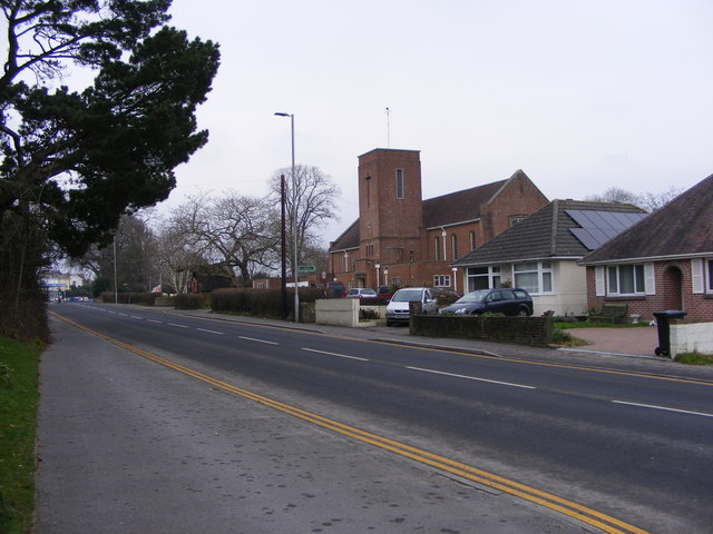
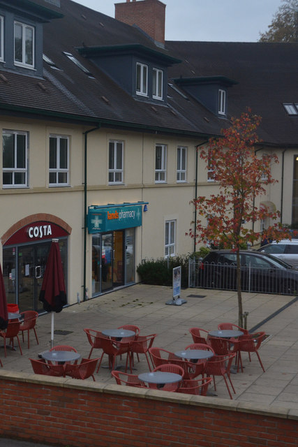
Upton House, located in Poole, Dorset, is a historic heritage site that offers visitors a glimpse into the rich history and cultural significance of the area. The house is situated within Upton Country Park, a beautiful parkland that spans over 100 acres and features stunning gardens, woodlands, and open spaces.

Originally built in the early 19th century, Upton House has undergone several transformations over the years. It was initially constructed as a Georgian-style mansion and later expanded with Victorian additions. The house showcases a blend of architectural styles, reflecting the changing tastes and trends of the time.

Visitors to Upton House can explore its magnificent interiors, which have been carefully restored to their former glory. The rooms are adorned with exquisite period furniture, artwork, and decorative objects, providing an immersive experience into the past. The house also boasts a remarkable collection of ceramics, including pieces from renowned manufacturers such as Wedgwood and Royal Worcester.

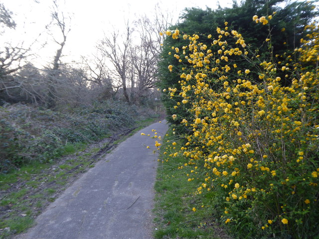
In addition to the house, Upton Country Park offers a range of activities and attractions to enjoy. Visitors can stroll through the picturesque gardens, which feature a walled garden, a rose garden, and a sensory garden. The park also offers walking and cycling trails, a children's play area, and a café where visitors can relax and enjoy refreshments.

Upton House is not only a popular tourist destination but also serves as a venue for various events and exhibitions throughout the year. With its rich history, stunning surroundings, and diverse offerings, Upton House is a must-visit heritage site for locals and tourists alike.

If you have any feedback on the listing, please let us know in the comments section below.

Upton House, Poole Images

Images are sourced within 2km of 50.737/-2.011 or Grid Reference SY9993. Thanks to Geograph Open Source API. All images are credited.

On Broadstone Way Broadstone Way, laid on the trackbed of the former London & South Western Railway line.
On Broadstone Way
Broadstone Way, laid on the trackbed of the former London & South Western Railway line.
Woodpecker Drive, Creekmoor Suburban housing estate on the edge of Poole.
Woodpecker Drive, Creekmoor
Suburban housing estate on the edge of Poole.
Blandford Road in Hamworthy
The Red Lion on Blandford Road
St Michaels View The view of St Michaels Church on Blandford Road, Hamworthy.
St Michaels View
The view of St Michaels Church on Blandford Road, Hamworthy.
Footpath off Tarn Drive Leading to Creekmoor ponds.
Footpath off Tarn Drive
Leading to Creekmoor ponds.
Footpath at the rear of houses in Honeysuckle Lane
Pond on Creekmoor The smaller of two flooded former sandpits in this 14 acre nature reserve.
Pond on Creekmoor
The smaller of two flooded former sandpits in this 14 acre nature reserve.
Poole : Upton Bypass A350 Looking along the Upton Bypass Road.
Poole : Upton Bypass A350
Looking along the Upton Bypass Road.
Poole : Upton Country Park An entrance into Upton Country Park from Poole Road.
Poole : Upton Country Park
An entrance into Upton Country Park from Poole Road.
Purbeck : Country Lane A small lane heading off from Poole Road.
Purbeck : Country Lane
A small lane heading off from Poole Road.
Upton : Poole Road Looking along Poole Road as it heads out from Upton.
Upton : Poole Road
Looking along Poole Road as it heads out from Upton.
Upton : Poole Road Houses A small access road and homes on Poole Road.
Upton : Poole Road Houses
A small access road and homes on Poole Road.
Upton : Construction Site A small construction site seen off Poole Road.
Upton : Construction Site
A small construction site seen off Poole Road.
Upton : The Co-Operative Food A convenience store located on Poole Road.
Upton : The Co-Operative Food
A convenience store located on Poole Road.
Upton : St Dunstan's Church Looking towards the church on Poole Road.
Upton : St Dunstan's Church
Looking towards the church on Poole Road.
Upton : Costa Coffee The coffee shop is next to a Lloyds Pharmacy.
Upton : Costa Coffee
The coffee shop is next to a Lloyds Pharmacy.
Upton : Dorchester Road B3067 Looking along Dorchester Road as it heads through Upton.
Upton : Dorchester Road B3067
Looking along Dorchester Road as it heads through Upton.
Show me another place!

Upton House, Poole is located at Grid Ref: SY9993 (Lat: 50.737, Lng: -2.011)

Unitary Authority: Bournemouth, Christchurch and Poole

Police Authority: Dorset

What 3 Words

///venue.chef.port. Near Broadstone, Dorset

Related Wikis

Holes Bay Nature Park

Holes Bay Nature Park is a protected area, 286 hectares in size, on and around Holes Bay, an embayment of Poole Harbour within the Borough of Poole that...

Upton House, Dorset

Upton House is a country house in the grounds of Upton Country Park on the northwestern shoreline of Holes Bay in the county of Dorset on the south coast...

Pergins Island

Pergins Island is a small, uninhabited island in Holes Bay, an embayment off Poole Harbour in Dorset on the south coast of England. It is not accessible...

Holes Bay

Holes Bay is an intertidal embayment off Poole Harbour in the county of Dorset on the south coast of England. It lies mostly within the Borough of Poole...

Creekmoor

Creekmoor is a suburb of Poole in Dorset, England, with a population of 9,257, reducing to 9,180 at the 2011 census. Bordered by the Upton Heath Nature...

Upton, Dorset

Upton is a town in south-east Dorset, England. Upton is to the east of Holton Heath and Upton Heath, and to the north of the Poole suburb of Hamworthy...

Upton Clock Tower

The Upton Clock Tower is a landmark in Upton, Dorset. == History == The clock tower was built to celebrate the new millennium in 2000. In 2014, a Armistice...

Creekmoor Light Railway

The Creekmoor Light Railway was a small, privately run, 2 ft (610 mm) narrow gauge railway. It was situated off Creekmoor Lane, to the north of Poole,...

Nearby Amenities

Located within 500m of 50.737,-2.011
Source: PGS
Lat/Long: 50.7328937/-2.0096376
Source: PGS
Lat/Long: 50.7329062/-2.0094056
Source: PGS
Lat/Long: 50.7329103/-2.0083616
Source: PGS
Lat/Long: 50.7334528/-2.0078165
Source: PGS
Lat/Long: 50.7337486/-2.0070034
Source: PGS
Lat/Long: 50.7339111/-2.0069613
Source: PGS
Lat/Long: 50.7342146/-2.0071943
Source: PGS
Lat/Long: 50.734455/-2.0072818
Source: PGS
Lat/Long: 50.7343331/-2.0069004
Source: PGS
Lat/Long: 50.7341211/-2.0066244
Source: PGS
Lat/Long: 50.7345256/-2.0061461
Source: PGS
Lat/Long: 50.7345842/-2.0059726
Motorway Junction
Lat/Long: 50.7387773/-2.010666
Barrier: entrance
Lat/Long: 50.7382898/-2.016736
Barrier: swing_gate
Lat/Long: 50.7387998/-2.0123868
Barrier: entrance
Description: Gateway with gate removed
Lat/Long: 50.73334/-2.0109069
Marker: plate
Orienteering: marker
Ref: D
Sport: orienteering
Lat/Long: 50.7380235/-2.0130516
Tourism: viewpoint
Lat/Long: 50.7339878/-2.0094457
Toilets
Fee: no
Lat/Long: 50.7350586/-2.0123863
Bench
Backrest: yes
Lat/Long: 50.7363814/-2.0113373
Bench
Backrest: yes
Lat/Long: 50.736402/-2.0112418
Bench
Backrest: yes
Lat/Long: 50.7365253/-2.0109639
Bench
Backrest: yes
Lat/Long: 50.7361569/-2.0115488
Bench
Lat/Long: 50.7356042/-2.0091084
Bench
Lat/Long: 50.7340449/-2.0121961
Bench
Lat/Long: 50.7336203/-2.0114981
Leisure: picnic_table
Lat/Long: 50.7344631/-2.0166465
Leisure: picnic_table
Lat/Long: 50.7344355/-2.0167571
Leisure: picnic_table
Lat/Long: 50.7343471/-2.016636
Leisure: picnic_table
Lat/Long: 50.734325/-2.0165396
Barrier: entrance
Description: Gateway with gate removed
Lat/Long: 50.7353299/-2.0065214
Bench
Lat/Long: 50.7352528/-2.006546
Bench
Lat/Long: 50.7344025/-2.0109869
Bench
Lat/Long: 50.7344278/-2.0109877
Bench
Lat/Long: 50.7344349/-2.0109533
Bench
Lat/Long: 50.7346201/-2.0108154
Leisure: picnic_table
Lat/Long: 50.7343972/-2.0121571
Leisure: picnic_table
Lat/Long: 50.7344673/-2.0119343
Bench
Lat/Long: 50.734507/-2.0100582
Bench
Lat/Long: 50.7345947/-2.0115687
Bench
Lat/Long: 50.7345607/-2.0114551
Bench
Lat/Long: 50.7351395/-2.0109459
Bench
Lat/Long: 50.7351938/-2.0109143
Bicycle Parking
Bicycle Parking: stands
Lat/Long: 50.735322/-2.0120335
Bench
Lat/Long: 50.7354847/-2.0093597
Bench
Lat/Long: 50.738057/-2.0130404
Bench
Lat/Long: 50.7381104/-2.0130319
Bench
Lat/Long: 50.7381579/-2.0130242
Bench
Lat/Long: 50.7384686/-2.0168278
Bench
Lat/Long: 50.7371652/-2.0128524
Bench
Lat/Long: 50.7370951/-2.0128973
Marker: post
Orienteering: marker
Ref: J
Sport: orienteering
Lat/Long: 50.7370282/-2.0121602
Bench
Lat/Long: 50.7384343/-2.0114422
Marker: plate
Orienteering: marker
Ref: R
Sport: orienteering
Lat/Long: 50.7369764/-2.0080507
Marker: plate
Orienteering: marker
Ref: G
Sport: orienteering
Lat/Long: 50.7373764/-2.0111155
Bench
Lat/Long: 50.7365149/-2.0107117
Bench
Lat/Long: 50.7364863/-2.0105893
Bench
Lat/Long: 50.7362788/-2.0102286
Bench
Lat/Long: 50.7364707/-2.0104305
Bench
Lat/Long: 50.7363277/-2.0116422
Bench
Lat/Long: 50.7362927/-2.0118884
Bench
Lat/Long: 50.7363351/-2.0119642
Bench
Lat/Long: 50.7363406/-2.0121077
Bicycle Parking
Bicycle Parking: wall_loops
Lat/Long: 50.7362779/-2.0127081
Bench
Lat/Long: 50.7363036/-2.0121803
Bench
Lat/Long: 50.7361391/-2.0122534
Bench
Lat/Long: 50.7359998/-2.0122104
Bench
Lat/Long: 50.7359168/-2.0121354
Bench
Lat/Long: 50.7358698/-2.0119802
Bench
Lat/Long: 50.7357734/-2.0118403
Bench
Lat/Long: 50.7361018/-2.0118053
Leisure: picnic_table
Lat/Long: 50.7362069/-2.0117157
Clock
Display: sundial
Lat/Long: 50.7362466/-2.0113084
Bench
Lat/Long: 50.736081/-2.0112181
Bench
Lat/Long: 50.7359611/-2.011245
Leisure: picnic_table
Lat/Long: 50.7360035/-2.0109966
Bench
Lat/Long: 50.7359542/-2.0106929
Bench
Lat/Long: 50.7359198/-2.0106061
Bench
Lat/Long: 50.7358454/-2.0104407
Bench
Lat/Long: 50.7356125/-2.0107401
Bench
Lat/Long: 50.7355788/-2.0103298
Bench
Lat/Long: 50.7356384/-2.0101923
Bench
Lat/Long: 50.7356837/-2.0100869
Bench
Lat/Long: 50.7352934/-2.0097978
Bench
Lat/Long: 50.7353161/-2.0097767
Bench
Lat/Long: 50.735189/-2.0103373
Bench
Lat/Long: 50.735239/-2.0105665
Bench
Lat/Long: 50.7354359/-2.0107487
Bench
Lat/Long: 50.7352584/-2.0109876
Bench
Lat/Long: 50.7352363/-2.0109308
Natural: rootstock
Lat/Long: 50.7340276/-2.0152626
Bench
Lat/Long: 50.7347421/-2.0153041
Bench
Lat/Long: 50.736166/-2.0174867
Natural: spring
Lat/Long: 50.7360642/-2.0169701
Bicycle Parking
Bicycle Parking: stands
Lat/Long: 50.7363455/-2.0116104
Colour: white
Marker: post
Material: plastic
Pressure: high
Utility: gas
Lat/Long: 50.74118/-2.013539
Barrier: swing_gate
Lat/Long: 50.7349826/-2.013631
Bench
Lat/Long: 50.7357183/-2.0115122
Bench
Lat/Long: 50.7360388/-2.0111202
Bench
Lat/Long: 50.7359188/-2.0119067
Leisure: picnic_table
Lat/Long: 50.7346767/-2.0122533
Leisure: picnic_table
Lat/Long: 50.7347764/-2.0125178
Bench
Lat/Long: 50.7345527/-2.0123479
Bench
Lat/Long: 50.734574/-2.0123085
Leisure: picnic_table
Lat/Long: 50.7345448/-2.0120651
Bench
Lat/Long: 50.7346022/-2.011283
Natural: shrub
Lat/Long: 50.7349489/-2.0109772
Bench
Lat/Long: 50.7349637/-2.0108277
Bench
Lat/Long: 50.7350414/-2.0107918
Note: Continues
Lat/Long: 50.7409548/-2.0140541
Marker: post
Operator: Wessex Orienteering Club
Orienteering: marker
Ref: F
Sport: orienteering
Lat/Long: 50.7385765/-2.0129938
Marker: post
Orienteering: marker
Ref: C
Sport: orienteering
Lat/Long: 50.7383166/-2.0118423
Marker: post
Orienteering: marker
Ref: E
Sport: orienteering
Lat/Long: 50.7383812/-2.0112289
Orienteering: marker
Ref: A
Sport: orienteering
Lat/Long: 50.7373438/-2.0132376
Marker: post
Orienteering: marker
Ref: Start/Finish
Sport: orienteering
Lat/Long: 50.7371873/-2.0127589
Marker: post
Orienteering: marker
Ref: T
Sport: orienteering
Lat/Long: 50.7369549/-2.0128163
Marker: post
Orienteering: marker
Ref: H
Sport: orienteering
Lat/Long: 50.7370313/-2.0111951
Marker: post
Orienteering: marker
Ref: K
Sport: orienteering
Lat/Long: 50.7367069/-2.0081111
Marker: plate
Orienteering: marker
Ref: N
Sport: orienteering
Lat/Long: 50.7366983/-2.0093926
Marker: post
Orienteering: marker
Ref: M
Sport: orienteering
Lat/Long: 50.7362787/-2.0101566
Marker: plate
Orienteering: marker
Ref: P
Sport: orienteering
Lat/Long: 50.736573/-2.0107474
Marker: post
Orienteering: marker
Ref: S
Sport: orienteering
Lat/Long: 50.7350802/-2.0084984
Marker: post
Orienteering: marker
Ref: G
Sport: orienteering
Lat/Long: 50.7355092/-2.0079767
Marker: post
Orienteering: marker
Ref: M
Sport: orienteering
Lat/Long: 50.7359027/-2.0064879
Marker: post
Orienteering: marker
Ref: B
Sport: orienteering
Lat/Long: 50.7377123/-2.0122669
Marker: post
Orienteering: marker
Ref: P
Sport: orienteering
Lat/Long: 50.7353191/-2.006694
Marker: post
Orienteering: marker
Ref: C
Sport: orienteering
Lat/Long: 50.7351829/-2.0103275
Marker: post
Orienteering: marker
Ref: N
Sport: orienteering
Lat/Long: 50.7344843/-2.0093366
Marker: post
Orienteering: marker
Ref: U
Sport: orienteering
Lat/Long: 50.7347304/-2.0105014
Marker: post
Orienteering: marker
Ref: E
Sport: orienteering
Lat/Long: 50.7342861/-2.0106658
Marker: post
Orienteering: marker
Ref: R
Sport: orienteering
Lat/Long: 50.7336308/-2.0105654
Marker: post
Orienteering: marker
Ref: L
Sport: orienteering
Lat/Long: 50.7360291/-2.0123564
Marker: plate
Orienteering: marker
Ref: D
Sport: orienteering
Lat/Long: 50.7342473/-2.0113654
Upton House
Design: one-level
Location Transition: yes
Power: pole
Ref: SY9920092967
Transformer: distribution
Voltage Primary: 11000
Voltage Secondary: 400
Voltage Tertiary: 230
Lat/Long: 50.736316/-2.0126745
Material: wood
Power: pole
Lat/Long: 50.7364176/-2.0137182
Material: wood
Power: pole
Transformer: minor_distribution
Voltage Primary: 11000
Voltage Secondary: 400
Voltage Tertiary: 230
Lat/Long: 50.7365966/-2.0163169
Power: pole
Source: bing
Lat/Long: 50.7366784/-2.0173846
Power: pole
Source: bing
Lat/Long: 50.7365078/-2.0148969
Bus Stop
Upton Country Park, entrance
Bench: no
Bin: no
Bus: yes
Lit: no
Naptan AtcoCode: 1200POA11156
Naptan Bearing: W
Naptan CommonName: Upton Country Park
Naptan Indicator: W-bound
Naptan NaptanCode: dordamdm
Naptan PlusbusZoneRef: BOMO
Naptan Street: Poole Road
Naptan Verified: no
Public Transport: platform
Shelter: no
Tactile Paving: no
Lat/Long: 50.7384616/-2.0155245
Bus Stop
Upton Country Park, entrance
Bench: no
Bin: no
Bus: yes
Lit: no
Naptan AtcoCode: 1200POA11155
Naptan Bearing: E
Naptan CommonName: Upton Country Park
Naptan Indicator: opp
Naptan NaptanCode: dordamdt
Naptan PlusbusZoneRef: BOMO
Naptan Street: Poole Road
Naptan Verified: no
Public Transport: platform
Shelter: no
Tactile Paving: no
Lat/Long: 50.7386738/-2.0150417
Bicycle Rental
Upton House
Bicycle Rental: dropoff_point
Capacity: 5
Email: support@beryl.cc
Fee: yes
Name Signed: no
Network: Beryl - Bournemouth Poole Christchurch
Official Name: Upton House
Operator: Beryl
Operator Wikidata: Q106575369
Payment App: yes
Payment App Android: cc.beryl.basis
Payment App Ios: 1386768364
Payment Cash: no
Payment Credit Cards: no
Payment Cryptocurrencies: no
Payment Debit Cards: no
Payment Electronic Purses: no
Phone: +44 20 3003 5044
Ref Gbfs: beryl_bcp:3072
Rental: city_bike
Website: https://beryl.cc/scheme/bournemouth-christchurch-and-poole
Lat/Long: 50.735321/-2.012887
The data included in this document is from www.openstreetmap.org. The data is made available under ODbL.

Have you been to Upton House, Poole?

Leave your review of Upton House, Poole below (or comments, questions and feedback).