Theatre Royal

Heritage Site in Suffolk

England

Theatre Royal

Preparing to demolish Opus Cars This garage site has had several incarnations over the years, selling in turn Nissans, Volvos, Mazdas, White Vans, and sports cars but has now been vacant for years. It was growing huge weeds, and many of the windows were smashed. There were squatters in outbuildings. While the neighbours would have liked to see it back in use, demolition looks like a good alternative. And here we see preparations by a demolition company.
Preparing to demolish Opus Cars Credit: John Goldsmith

The Theatre Royal in Suffolk, England, is a renowned heritage site with a rich history dating back over two centuries. Located in the town of Bury St Edmunds, it is one of the oldest working theatres in the country. The theatre was originally built in 1819 and has since undergone various renovations and restorations, preserving its architectural and historical significance.

The Theatre Royal boasts a beautiful Georgian-style exterior and an elegant interior, with a seating capacity of around 350. The main auditorium features a classic horseshoe shape, providing excellent views from every seat. Over the years, the theatre has been home to a wide range of performances, including plays, musicals, operas, and ballets.

In addition to its theatrical productions, the Theatre Royal also hosts educational programs and community events, engaging with local schools and organizations. It offers workshops, tours, and talks, allowing visitors to learn more about the theatre's past and the performing arts.

The heritage site is not only a cultural hub but also an important landmark in the community. Its significance extends beyond the stage, as it serves as a symbol of the town's history and heritage. The Theatre Royal in Suffolk continues to play a vital role in promoting the arts and preserving the region's cultural legacy.

If you have any feedback on the listing, please let us know in the comments section below.

Theatre Royal Images

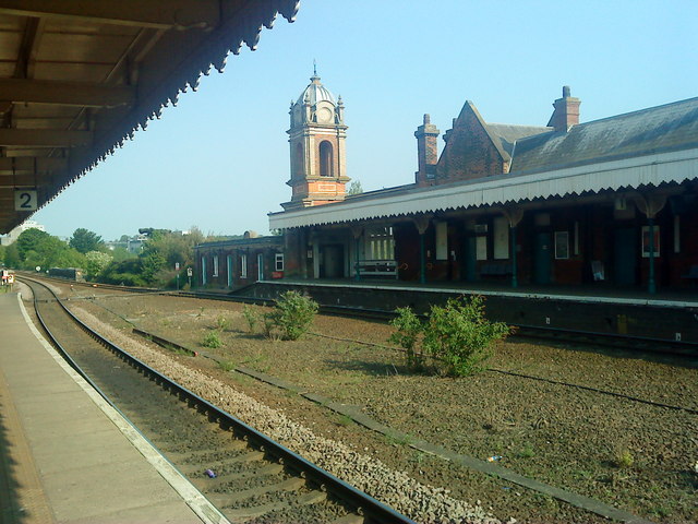
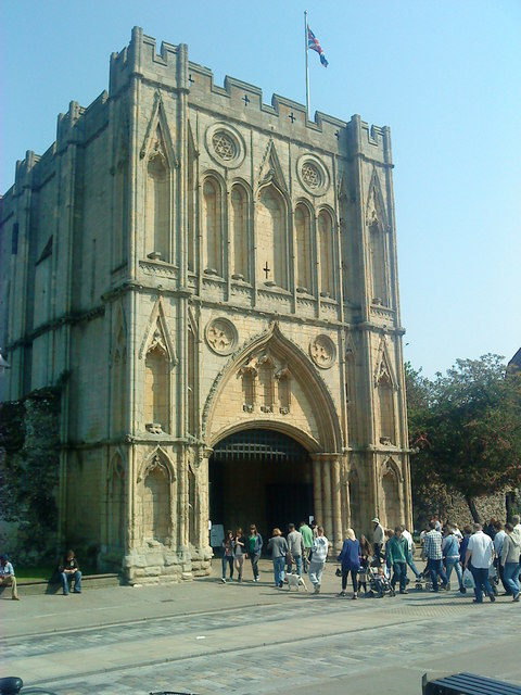
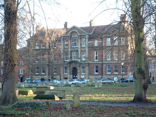
Images are sourced within 2km of 52.24/0.717 or Grid Reference TL8563. Thanks to Geograph Open Source API. All images are credited.

Preparing to demolish Opus Cars This garage site has had several incarnations over the years, selling in turn Nissans, Volvos, Mazdas, White Vans, and sports cars but has now been vacant for years. It was growing huge weeds, and many of the windows were smashed. There were squatters in outbuildings. While the neighbours would have liked to see it back in use, demolition looks like a good alternative. And here we see preparations by a demolition company.
Preparing to demolish Opus Cars
This garage site has had several incarnations over the years, selling in turn Nissans, Volvos, Mazdas, White Vans, and sports cars but has now been vacant for years. It was growing huge weeds, and many of the windows were smashed. There were squatters in outbuildings. While the neighbours would have liked to see it back in use, demolition looks like a good alternative. And here we see preparations by a demolition company.
First bite at Opus Cars demolition See preceding stage at <a href="https://www.geograph.org.uk/photo/2327622">TL8464 : Preparing to demolish Opus Cars</a>.
First bite at Opus Cars demolition
Outside toilet Opus Cars showroom half demolished. The showroom itself has already gone, leaving the toilet very exposed! A small office and the workshop remain. Work had to stop at this point while the air conditioner was cleared of freon.
Outside toilet
Opus Cars showroom half demolished. The showroom itself has already gone, leaving the toilet very exposed! A small office and the workshop remain. Work had to stop at this point while the air conditioner was cleared of freon.
Demolition nears completion The demolition of Opus Cars nears completion, with just a short piece of the workshop to go. Most of this was gone a few minutes later, as an attempt to remove a roof beam nudged the wall enough to send a giant crack running through the breeze blocks. The next move caused most of the wall to fall - which I'm sure was appreciated by anyone snoozing at 8 am in the Trinity Mews flats opposite.

The building demolition has revealed the scene beyond, from left to right: the Tayfen estate, the Peach Maltings flats, Burlingham's Mill (behind a tree) and Burlingham's office building. How long before these last two are also demolished, having lain unused for a decade or more?
Demolition nears completion
The demolition of Opus Cars nears completion, with just a short piece of the workshop to go. Most of this was gone a few minutes later, as an attempt to remove a roof beam nudged the wall enough to send a giant crack running through the breeze blocks. The next move caused most of the wall to fall - which I'm sure was appreciated by anyone snoozing at 8 am in the Trinity Mews flats opposite. The building demolition has revealed the scene beyond, from left to right: the Tayfen estate, the Peach Maltings flats, Burlingham's Mill (behind a tree) and Burlingham's office building. How long before these last two are also demolished, having lain unused for a decade or more?
Demolition complete - tidying up stage The excavator had a very powerful cutting tool that was able to snip long girders into lengths that fitted in a skip.
Demolition complete - tidying up stage
The excavator had a very powerful cutting tool that was able to snip long girders into lengths that fitted in a skip.
Cowslip carpet This meadow west of Moreton Hall Preparatory School is covered with cowslips at this time of year. Permissive paths have been provided around this field.
Cowslip carpet
This meadow west of Moreton Hall Preparatory School is covered with cowslips at this time of year. Permissive paths have been provided around this field.
Demolition complete The demolition of the Opus Cars site is now complete, leaving a small mound of broken white bricks.
Demolition complete
The demolition of the Opus Cars site is now complete, leaving a small mound of broken white bricks.
Trinity Mews from demolition site The demolition of the Opus Cars site has created an opportunity for a much better view of the flats of Trinity Mews. Block 1 in the middle, 2 on the left, and 5 on the right (the others are hidden).

The entrance to the site, on the left, has become a popular free parking spot. This is one of the nearest spots to the town centre providing free parking, on or off the road.

Some years ago this site was to be used for an Aldi store and hotel, but the latest rumour is a Lidl store.
Trinity Mews from demolition site
The demolition of the Opus Cars site has created an opportunity for a much better view of the flats of Trinity Mews. Block 1 in the middle, 2 on the left, and 5 on the right (the others are hidden). The entrance to the site, on the left, has become a popular free parking spot. This is one of the nearest spots to the town centre providing free parking, on or off the road. Some years ago this site was to be used for an Aldi store and hotel, but the latest rumour is a Lidl store.
Victorian Exhuberance Ornate turret on Bury St Edmunds Station.
Victorian Exhuberance
Ornate turret on Bury St Edmunds Station.
Last Game of the Season Football match at Ram Lane. Bury Utd vs Wealdstone in the Ryman Premiership. A sell out crowd of 694! The game finished 1-0 to the home team.
Last Game of the Season
Football match at Ram Lane. Bury Utd vs Wealdstone in the Ryman Premiership. A sell out crowd of 694! The game finished 1-0 to the home team.
Abbey Gate House Fabulous spectacle of medieval masonry in all its glory.
Abbey Gate House
Fabulous spectacle of medieval masonry in all its glory.
The Bushel Surprisingly closed on a saturday lunchtime.
The Bushel
Surprisingly closed on a saturday lunchtime.
Advert For Your Local Billboard add in the Tesco carpark for the local National Trust property Ickworth. See <a title="https://www.geograph.org.uk/photo/2872735" href="https://www.geograph.org.uk/photo/2872735">Link</a> for 2012 billboard
Advert For Your Local
Billboard add in the Tesco carpark for the local National Trust property Ickworth. See Link for 2012 billboard
Old gatehouse, on Sicklesmere Road
Spread Eagle, Out Westgate, Bury St Edmunds
New house, 21 Ely Close
Demolition of tyre centre Continuing my theme of tracking the demolition and building in Bury St. Edmunds, here we see the former tyre centre in Out Risbygate Street going in favour of an extension to St. Peter's House care home. 

The site appeared to be designed as a filling station, with a forecourt for the pumps, but it never operated in this form. As far as I remember it has only ever sold tyres or used cars. It had a large shed with glass showroom/office at its front, in a sea of concrete.
Demolition of tyre centre
Continuing my theme of tracking the demolition and building in Bury St. Edmunds, here we see the former tyre centre in Out Risbygate Street going in favour of an extension to St. Peter's House care home. The site appeared to be designed as a filling station, with a forecourt for the pumps, but it never operated in this form. As far as I remember it has only ever sold tyres or used cars. It had a large shed with glass showroom/office at its front, in a sea of concrete.
Last parts of demolished tyre centre For the main details of this operation, see <a href="https://www.geograph.org.uk/photo/2548000">TL8464 : Demolition of tyre centre</a>.
Here the last parts of the building survive overnight as the workers have parked their Caterpillar excavator and gone home. 

I was tempted to mark this as a historical site, as this area was the home of St. Peter's Hospital in the Middle Ages, but before the demolition started some wide trenches were dug in the concrete surrounds which I guess were archaeological test pits. Nothing was said about any finds so I guess there were not any.
Last parts of demolished tyre centre
For the main details of this operation, see TL8464 : Demolition of tyre centre. Here the last parts of the building survive overnight as the workers have parked their Caterpillar excavator and gone home. I was tempted to mark this as a historical site, as this area was the home of St. Peter's Hospital in the Middle Ages, but before the demolition started some wide trenches were dug in the concrete surrounds which I guess were archaeological test pits. Nothing was said about any finds so I guess there were not any.
Show me another place!

Theatre Royal is located at Grid Ref: TL8563 (Lat: 52.24, Lng: 0.717)

What 3 Words

///according.dorms.cloak. Near Bury St Edmunds, Suffolk

Nearby Locations

Theatre Royal

Related Wikis

St Mary's Church, Bury St Edmunds

St Mary's Church is the civic church of Bury St Edmunds in Suffolk, England and is one of the largest parish churches in England. It claims to have the...

St Edmund's Church, Bury St Edmunds

St Edmund's Church is a Roman Catholic parish church in Bury St Edmunds, Suffolk. It was founded by the Jesuits in 1763 and the current church was built...

Shire Hall Complex, Bury St Edmunds

The Shire Hall Complex is a group of municipal buildings in Bury St Edmunds, Suffolk, England. The complex, which was the headquarters of West Suffolk...

The Norman Tower (Bury St Edmunds)

The Norman Tower, also known as St James' Gate, is the detached bell tower of St Edmundsbury Cathedral, Bury St Edmunds, Suffolk. Originally constructed...

Nearby Amenities

Located within 500m of 52.24,0.717
Walled Garden
Tourism: attraction
Wheelchair: yes
Lat/Long: 52.2441289/0.7179724
Bury St Edmunds Abbey
Historic: ruins
Wikidata: Q334286
Lat/Long: 52.244221/0.7194845
Crossing
Crossing: island
Lat/Long: 52.2377854/0.7139573
Traffic Signals
Lat/Long: 52.2415287/0.7112355
Crossing
Button Operated: yes
Crossing: traffic_signals
Lat/Long: 52.2412997/0.7115566
Crossing
Lat/Long: 52.2375548/0.715969
Barrier: bollard
Lat/Long: 52.2396707/0.7226776
Bicycle Parking
Bicycle Parking: stands
Covered: no
Lat/Long: 52.2425318/0.7203171
Parking
Capacity: 55
Parking: surface
Lat/Long: 52.2417004/0.7194166
Post Box
Collection Times: Mo-Fr 17:00, Sa 11:30
Post Box Design: type_b
Post Box Type: pillar
Ref: IP33 2058
Royal Cypher: VR
Royal Cypher Wikidata: Q33102356
Lat/Long: 52.2421907/0.7167989
Post Box
Collection Times: Mo-Fr 09:00; Sa 07:00
Post Box Mounting: wall
Post Box Type: wall
Ref: IP33 2164D
Royal Cypher: GR
Royal Cypher Wikidata: Q33102273
Lat/Long: 52.2409248/0.7194154
Chantry Hotel
Addr City: Bury St Edmunds
Addr Postcode: IP33 1RY
Addr Street: Sparhawk Street
Dog: yes
Fhrs Id: 1674615
Source Addr: FSA Food Hygiene Ratings Database
Tourism: hotel
Wikidata: Q26604976
Lat/Long: 52.2418884/0.7182677
Pub
The West Gate
Accommodation: yes
Addr City: Bury St Edmunds
Addr Housenumber: 65
Addr Postcode: IP33 1QD
Addr Street: Guildhall Street
Brand: Greene King
Brand Wikidata: Q5564162
Brand Wikipedia: en:Greene King
Fhrs Id: 1674965
Old Name: The Black Boy
Opening Hours: Mo,Tu 14:00-22:00; We,Th 14:00-23:00; Fr 13:00-24:00; Sa 12:00-24:00; Su 12:00-18:00
Outdoor Seating: yes
Source Addr: FSA Food Hygiene Ratings Database
Website: https://www.thewestgatepub.co.uk/
Lat/Long: 52.2422401/0.7121635
Crossing
Button Operated: yes
Crossing: traffic_signals
Lat/Long: 52.241214/0.71144
Post Box
Collection Times: Mo-Fr 09:00; Sa 07:00
Operator: Royal Mail
Post Box Type: lamp
Ref: IP33 2001D
Royal Cypher: EIIR
Royal Cypher Wikidata: Q33102113
Lat/Long: 52.2413142/0.7117583
Pub
Rose & Crown
Addr City: Bury St Edmunds
Addr Housenumber: 48
Addr Postcode: IP33 1NP
Addr Street: Whiting Street
Brand: Greene King
Brand Wikidata: Q5564162
Brand Wikipedia: en:Greene King
Contact Facebook: https://www.facebook.com/roseandcrownbse/
Opening Hours: Mo,Tu,Th 15:30-21:00; We 12:00-21:00; Fr,Sa 12:00-23:00; Su 12:00-17:00
Source Addr: FSA Food Hygiene Ratings Database
Wikidata: Q26389039
Lat/Long: 52.2411133/0.7135253
Barrier: bollard
Lat/Long: 52.2425484/0.7147495
Barrier: bollard
Bicycle: yes
Motorcycle: yes
Vehicle: no
Lat/Long: 52.2424425/0.7143563
Post Box
Collection Times: Mo-Fr 09:00; Sa 07:00
Post Box Mounting: pier
Post Box Type: lamp
Ref: IP33 2301D
Royal Cypher: EIIR
Royal Cypher Wikidata: Q33102113
Lat/Long: 52.242432/0.713111
Restaurant
Queen's Bar & Grill
Addr City: Bury St Edmunds
Addr Housename: Queens Head
Addr Housenumber: 39
Addr Postcode: IP33 1RG
Addr Street: Churchgate Street
Fhrs Id: 1673906
Old Name: The Queen's Head
Source Addr: FHRS Open Data
Website: https://www.queensbse.co.uk/
Lat/Long: 52.243414/0.7156217
Fast Food
Hung Tao (chinese)
Lat/Long: 52.2405318/0.7127594
Crossing
Crossing: traffic_signals
Crossing Island: no
Tactile Paving: yes
Lat/Long: 52.2409391/0.7121612
Saxon Gate Nature Reserve
Leisure: nature_reserve
Lat/Long: 52.2367356/0.7200341
Abbey Hotel
Addr City: Bury St Edmunds
Addr Housenumber: 35
Addr Postcode: IP33 2AZ
Addr Street: Southgate Street
Fhrs Id: 1114098
Source Addr: FSA Food Hygiene Ratings Database
Tourism: hotel
Lat/Long: 52.2386403/0.7221968
Veterinary
Swayne & partners Veterniary Surgeons
Lat/Long: 52.2390293/0.7217552
Out Westgate
Naptan AtcoCode: 390050902
Naptan Bearing: N
Naptan BusStopType: CUS
Naptan CommonName: Out Westgate
Naptan Indicator: adj
Naptan Landmark: Out Westgate
Naptan NaptanCode: sufgmamt
Naptan PlusbusZoneRef: BSTEDMS
Naptan Street: Cullum Road
Naptan Verified: no
Source: naptan_import
Lat/Long: 52.2398532/0.7119182
Bus Stop
Out Westgate
Bench: no
Bin: no
Lit: yes
Naptan AtcoCode: 390050903
Naptan Bearing: S
Naptan CommonName: Out Westgate
Naptan Indicator: opp
Naptan Landmark: Out Westgate
Naptan NaptanCode: sufgmamw
Naptan PlusbusZoneRef: BSTEDMS
Naptan Street: Cullum Road
Naptan Verified: no
Shelter: no
Source: naptan_import
Tactile Paving: no
Lat/Long: 52.240099/0.7119481
Bus Stop
Albert Buildings
Naptan AtcoCode: 390050905
Naptan Bearing: E
Naptan CommonName: Albert Buildings
Naptan Indicator: adj
Naptan Landmark: Albert Buildings
Naptan NaptanCode: sufgmapd
Naptan PlusbusZoneRef: BSTEDMS
Naptan Street: Out Westgate
Naptan Verified: no
Public Transport: platform
Source: naptan_import
Lat/Long: 52.2405891/0.7103715
Bus Stop
Albert Buildings
Naptan AtcoCode: 390050906
Naptan Bearing: W
Naptan CommonName: Albert Buildings
Naptan Indicator: opp
Naptan Landmark: Albert Buildings
Naptan NaptanCode: sufgmapg
Naptan PlusbusZoneRef: BSTEDMS
Naptan Street: Out Westgate
Naptan Verified: no
Public Transport: platform
Source: naptan_import
Lat/Long: 52.2404463/0.7103723
Bus Stop
Brewery
Naptan AtcoCode: 390050927
Naptan Bearing: SE
Naptan CommonName: Brewery
Naptan Indicator: adj
Naptan Landmark: Brewery
Naptan NaptanCode: sufgmdag
Naptan PlusbusZoneRef: BSTEDMS
Naptan Street: Sparhawk Road
Naptan Verified: no
Source: naptan_import
Lat/Long: 52.2413577/0.7188366
Bus Stop
Government Offices
Naptan AtcoCode: 390050928
Naptan Bearing: SE
Naptan CommonName: Government Offices
Naptan Indicator: adj
Naptan Landmark: Government Offices
Naptan NaptanCode: sufgmdaj
Naptan PlusbusZoneRef: BSTEDMS
Naptan Street: Southgate
Naptan Verified: no
Source: naptan_import
Lat/Long: 52.2380745/0.7227667
Bus Stop
Government Offices
Naptan AtcoCode: 390050929
Naptan Bearing: NW
Naptan CommonName: Government Offices
Naptan Indicator: opp
Naptan Landmark: Government Offices
Naptan NaptanCode: sufgmdam
Naptan PlusbusZoneRef: BSTEDMS
Naptan Street: Southgate
Naptan Verified: no
Public Transport: platform
Source: naptan_import
Lat/Long: 52.2376743/0.7229619
Bus Stop
Theatre Royal
Bench: no
Bin: no
Naptan AtcoCode: 390050987
Naptan Bearing: W
Naptan BusStopType: CUS
Naptan CommonName: Theatre Royal
Naptan Indicator: o/s
Naptan Landmark: Theatre Royal
Naptan NaptanCode: sufgmgdm
Naptan PlusbusZoneRef: BSTEDMS
Naptan Street: Westgate Street
Naptan Verified: no
Public Transport: platform
Shelter: no
Source: naptan_import
Tactile Paving: no
Lat/Long: 52.2407228/0.7173213
Bus Stop
St Edmunds RC Primary
Bench: no
Bin: no
Lit: yes
Naptan AtcoCode: 390051106
Naptan Bearing: W
Naptan BusStopType: CUS
Naptan CommonName: St Edmunds RC Primary
Naptan Indicator: o/s
Naptan Landmark: St Edmunds RC Primary School
Naptan NaptanCode: sufjgwga
Naptan PlusbusZoneRef: BSTEDMS
Naptan Street: Westgate
Naptan Verified: no
Public Transport: platform
Shelter: no
Source: naptan_import
Tactile Paving: no
Lat/Long: 52.2409275/0.7133022
Bus Stop
Chequer Sq
Bus: yes
Naptan AtcoCode: 390051125
Naptan Bearing: N
Naptan BusStopType: CUS
Naptan CommonName: Chequer Sq
Naptan Indicator: adj
Naptan Landmark: Chequer Sq
Naptan NaptanCode: sufjpgpg
Naptan PlusbusZoneRef: BSTEDMS
Naptan Street: Crown Street
Naptan Verified: no
Public Transport: platform
Source: naptan_import
Lat/Long: 52.2434019/0.7164779
Bus Stop
Chequer Sq
Bus: yes
Naptan AtcoCode: 390051126
Naptan Bearing: S
Naptan BusStopType: CUS
Naptan CommonName: Chequer Sq
Naptan Indicator: opp
Naptan Landmark: Chequer Sq
Naptan NaptanCode: sufjpgpj
Naptan PlusbusZoneRef: BSTEDMS
Naptan Street: Crown Street
Naptan Verified: no
Public Transport: platform
Source: naptan_import
Lat/Long: 52.2434084/0.7165744
Power: pole
Lat/Long: 52.2404481/0.7229546
Power: pole
Lat/Long: 52.2401787/0.723153
Power: tower
Lat/Long: 52.2399307/0.7239175
Power: pole
Lat/Long: 52.2403898/0.7229421
Barrier: bollard
Lat/Long: 52.2427197/0.7191079
Power: pole
Lat/Long: 52.2405215/0.72286
Power: pole
Lat/Long: 52.240568/0.7227829
Power: pole
Lat/Long: 52.2402004/0.7230207
Power: pole
Lat/Long: 52.2404975/0.7239443
Power: pole
Lat/Long: 52.2403216/0.7230082
Power: tower
Lat/Long: 52.2406863/0.7239014
Power: pole
Lat/Long: 52.2405697/0.7240033
Power: pole
Lat/Long: 52.2404834/0.7229166
Bury St Edmunds Abbey Ruins
Historic: ruins
Lat/Long: 52.2441935/0.7191671
Tourism: artwork
Lat/Long: 52.2436639/0.7173327
Elimayboo
Addr City: Bury St Edmunds
Addr Housenumber: 2
Addr Parentstreet: Hatter Street
Addr Postcode: IP33 1NE
Addr Street: Langton Place
Fhrs Id: 1114467
Old Name: Abbey News
Shop: antiques
Source: survey
Source Addr: FHRS Open Data
Lat/Long: 52.2441202/0.7141483
Cafe
Hatters
Addr City: Bury St Edmunds
Addr Housenumber: 20A
Addr Postcode: IP33 1NE
Addr Street: Hatter Street
Contact Facebook: https://www.facebook.com/hatterssandwichbar/
Cuisine: sandwich
Fhrs Id: 1673890
Source: survey
Source Addr: FHRS Open Data
Lat/Long: 52.2438748/0.7141663
No Man's Meadows Local Nature Reserve
Board Type: wildlife; history
Information: board
Tourism: information
Lat/Long: 52.2429953/0.721605
Telephone
Booth: K6
Check Date: 2021-06-08
Covered: booth
Listed Status: Grade II
Phone: +44 1284 752897
Source: survey
Lat/Long: 52.243471/0.7156097
Telephone
Booth: K6
Covered: booth
Listed Status: Grade II
Operator: BT
Phone: +44 1284 753684
Lat/Long: 52.2410967/0.7125638
Bar
Hunter Club
Addr City: Bury St Edmunds
Addr Housenumber: 65
Addr Postcode: IP33 1QF
Addr Street: Guildhall Street
Fhrs Id: 1674815
Fixme: Check precise location
Source Addr: FSA Food Hygiene Ratings Database
Website: https://www.hunterclub.org.uk/
Lat/Long: 52.2418835/0.711941
Information: office
Tourism: information
Lat/Long: 52.2441845/0.7164346
Waste Basket
Check Date: 2023-03-30
Lat/Long: 52.2423106/0.7132744
Barrier: bollard
Bicycle: yes
Bollard: fixed
Motorcycle: yes
Vehicle: no
Lat/Long: 52.2422931/0.7131341
Post Box
Collection Times: Mo-Fr 09:00; Sa 07:00
Post Box Mounting: wall
Post Box Type: wall
Ref: IP33 2092D
Royal Cypher: VR
Royal Cypher Wikidata: Q33102356
Lat/Long: 52.2433946/0.7183251
Post Box
Post Box Type: wall
Ref: IP33 2087
Royal Cypher: EVIIR
Royal Cypher Wikidata: Q33102324
Lat/Long: 52.2379681/0.7229221
Telephone
Booth: KX100
Covered: booth
Lat/Long: 52.2378153/0.7228041
Cafe
Pilgrims' Kitchen
Addr City: Bury St Edmunds
Addr Housename: Cathedral
Addr Postcode: IP33 1LS
Addr Street: Angel Hill
Fhrs Id: 1674704
Source Addr: FHRS Open Data
Lat/Long: 52.2442646/0.7173359
Toilets
Lat/Long: 52.2442071/0.7174416
Entrance: main
Level: 0
Wheelchair: yes
Lat/Long: 52.242491/0.7202926
Access: private
Entrance: yes
Level: 0
Wheelchair: yes
Lat/Long: 52.2424731/0.7200517
Service Vehicle Restoration: yes
Shop: car_repair
Lat/Long: 52.2408442/0.71036
Barrier: lift_gate
Motor Vehicle: private
Lat/Long: 52.2406544/0.7098399
Waste Basket
Lat/Long: 52.2409038/0.7113007
Fast Food
West End Fish & Chips
Addr City: Bury St Edmunds
Addr Housenumber: 1
Addr Postcode: IP33 3NZ
Addr Street: Out Westgate
Cuisine: fish_and_chips
Drive Through: no
Fhrs Id: 1674715
Indoor Seating: no
Opening Hours: Mo-Sa 16:30-21:00
Outdoor Seating: no
Source Addr: FSA Food Hygiene Ratings Database
Takeaway: only
Lat/Long: 52.2408759/0.7111347
V N Flowers
Addr City: Bury St Edmunds
Addr Housenumber: 149
Addr Postcode: IP33 2AF
Addr Street: Southgate Street
Not Addr Postcode: IP33 2AA
Opening Hours: Mo-Fr 09:30-17:00
Shop: florist
Source Addr Postcode: ons_uprn_directory
Lat/Long: 52.2406334/0.7201042
Barrier: lift_gate
Lat/Long: 52.2408217/0.7181805
Mortimer & Gausden
Addr City: Bury St Edmunds
Addr Housenumber: 7
Addr Parentstreet: Hatter Street
Addr Postcode: IP33 1NE
Addr Street: Langton Place
Dog: yes
Office: estate_agent
Website: https://www.mortimerandgausden.co.uk/
Lat/Long: 52.2439888/0.7136928
Daydreams
Addr City: Bury St Edmunds
Addr Housenumber: 5
Addr Parentstreet: Hatter Street
Addr Postcode: IP33 1NE
Addr Street: Langton Place
Shop: beauty
Website: https://www.daydreamsbeauty.co.uk/
Lat/Long: 52.24399/0.7138357
Bar
So Bar & Caffé
Addr City: Bury St Edmunds
Addr Housenumber: 1-3
Addr Parentstreet: Hatter Street
Addr Postcode: IP33 1NE
Addr Street: Langton Place
Check Date: 2019-10-13
Contact Facebook: https://www.facebook.com/SoBarBSE
Fhrs Id: 1673797
Source Addr: FHRS Open Data
Lat/Long: 52.2439968/0.7139759
Idolise
Addr City: Bury St Edmunds
Addr Housenumber: 20
Addr Postcode: IP33 1NE
Addr Street: Hatter Street
Contact Facebook: https://www.facebook.com/Idolisehairandbeauty/
Shop: hairdresser
Lat/Long: 52.2439356/0.7141616
Restaurant
Maison Bleue
Addr City: Bury St Edmunds
Addr Housenumber: 30-31
Addr Postcode: IP33 1RG
Addr Street: Churchgate Street
Fhrs Id: 1674983
Source Addr: FHRS Open Data
Website: https://www.maisonbleue.co.uk/
Lat/Long: 52.2435636/0.7154004
Bench
Backrest: yes
Lat/Long: 52.2391267/0.7098439
Waste Basket
Lat/Long: 52.2391168/0.710198
Fixme: incomplete
Lat/Long: 52.238073/0.7146042
Fixme: incomplete
Lat/Long: 52.2378546/0.7142816
Barrier: bollard
Lat/Long: 52.2390586/0.7147464
Bench
Lat/Long: 52.2390881/0.7148194
Addr City: Bury St Edmunds
Addr Housename: The New Forge
Addr Street: Friar's Lane
Lat/Long: 52.2400662/0.7148033
Addr City: Bury St Edmunds
Addr Housename: Kennel Cottage
Addr Street: Friar's Lane
Lat/Long: 52.2403742/0.7147309
Bench
Backrest: yes
Material: metal
Lat/Long: 52.2410703/0.7126597
Waste Basket
Lat/Long: 52.2390056/0.7235105
Crossing
Crossing: unmarked
Lat/Long: 52.2402288/0.7119768
Waste Basket
Waste: cigarettes;dog_excrement;trash
Lat/Long: 52.2385644/0.7126511
Bicycle Parking
Bicycle Parking: stands
Capacity: 6
Covered: no
Lat/Long: 52.2442358/0.7159404
Defibrillator
Emergency: defibrillator
Indoor: yes
Lat/Long: 52.2432874/0.7205784
Place Of Worship
Bury St Edmunds Unitarian Congregation
Addr City: Bury St Edmunds
Addr Postcode: IP33 1RH
Addr Street: Churchgate Street
Denomination: unitarian
Religion: christian
Source Addr Postcode: ons_uprn_lookup
Website: https://www.ukunitarians.org.uk/burystedmunds/
Lat/Long: 52.2434578/0.7136708
BuryPhysio
Addr City: Bury St Edmunds
Addr Postcode: IP33 2AB
Addr Street: Maynewater Lane
Contact Facebook: https://www.facebook.com/buryphysio/
Contact Instagram: https://www.instagram.com/buryphysioclinic/
Contact Twitter: https://twitter.com/Bury_Physio
Currency GBP: yes
Currency XBT: yes
Email: admin@buryphysio.co.uk
Healthcare: physiotherapist
Payment Lightning: yes
Payment Lightning Contactless: yes
Payment Onchain: yes
Phone: +44 1284 748200
Survey Date: 2022-11-07
Website: https://www.buryphysio.co.uk/
Lat/Long: 52.2391007/0.7199359
Bedfords
Addr City: Bury St Edmunds
Addr Housenumber: 15
Addr Postcode: IP33 1QD
Addr Street: Guildhall Street
Office: estate_agent
Website: https://www.bedfords.co.uk/bury-st-edmunds.html
Lat/Long: 52.2431383/0.7122499
Whatley Lane
Addr City: Bury St Edmunds
Addr Housenumber: 1
Addr Postcode: IP33 1RL
Addr Street: Churchgate Street
Office: estate_agent
Opening Hours: Mo-Fr 09:00-17:00; Sa-Su "by appointment"
Website: https://whatley-lane.co.uk/
Lat/Long: 52.2432697/0.7122244
Map Lettings
Addr City: Bury St Edmunds
Addr Housenumber: 79
Addr Postcode: IP33 1PR
Addr Street: Guildhall Street
Check Date Opening Hours: 2024-03-11
Office: estate_agent
Opening Hours: Mo-Th 09:00-17:30; Fr 09:00-16:00; Sa 10:00-12:30
Website: https://maplettings.co.uk/
Lat/Long: 52.2432574/0.7120031
Board Type: history
Information: board
Tourism: information
Lat/Long: 52.2436829/0.7165746
Board Type: history
Information: board
Tourism: information
Lat/Long: 52.2435616/0.7170714
Waste Basket
Waste: cigarettes;dog_excrement;trash
Lat/Long: 52.2435833/0.7170188
Generator Method: photovoltaic
Generator Output Electricity: yes
Generator Source: solar
Generator Type: solar_photovoltaic_panel
Location: roof
Power: generator
Lat/Long: 52.2420626/0.7108846
The Westgate
Board Type: history
Information: board
Tourism: information
Lat/Long: 52.2411046/0.7125925
Bench
Backrest: yes
Material: metal
Lat/Long: 52.2410474/0.7127109
Waste Basket
Waste: trash;cigarettes
Lat/Long: 52.2432094/0.7120755
Defibrillator
Defibrillator Location: On exterior wall of United Reformed Church on Whiting Street, to the right of the main entrance.
Emergency: defibrillator
Indoor: no
Ref GB The Circuit: 858CF9EA-9DAC-4298-8514-AF4400F258B5
Lat/Long: 52.2425965/0.7129801
Door A
Entrance: yes
Lat/Long: 52.2426013/0.71303
Door B
Entrance: yes
Lat/Long: 52.2425952/0.7129669
Bar
Whitings Bar
Addr City: Bury St Edmunds
Addr Housenumber: 74-75
Addr Postcode: IP33 1NX
Addr Street: Whiting Street
Fhrs Id: 1674203
Source Addr: FHRS Open Data
Website: https://www.whitingsbar.co.uk/
Lat/Long: 52.2433453/0.7129057
Farthings
Addr City: Bury St Edmunds
Addr Housenumber: 17
Addr Postcode: IP33 1NR
Addr Street: Whiting Street
Shop: dry_cleaning
Website: https://www.farthingsbury.com/
Lat/Long: 52.2432139/0.7131591
Music School
TF Music School
Addr City: Bury St Edmunds
Addr Housename: The Rehersal Rooms
Addr Housenumber: 4
Addr Postcode: IP33 3PH
Addr Street: St Andrews Street South
Website: https://www.tfmusicschool.com/
Lat/Long: 52.2424329/0.7116625
Hair Design
Addr City: Bury St Edmunds
Addr Housenumber: 6
Addr Postcode: IP33 3PH
Addr Street: St Andrews Street South
Shop: hairdresser
Source Addr Postcode: ons_uprn_lookup
Website: https://www.facebook.com/hairdesignbse/
Lat/Long: 52.2420248/0.7116383
Fast Food
Golden House
Addr City: Bury St Edmunds
Addr Housenumber: 68
Addr Postcode: IP33 1QF
Addr Street: Guildhall Street
Cuisine: chinese
Fhrs Id: 1674640
Source Addr: FHRS Open Data
Lat/Long: 52.2421677/0.7121915
Audiologist
Bloom Hearing Specialists
Addr City: Bury St Edmunds
Addr Housenumber: 64
Addr Postcode: IP33 1RL
Addr Street: Churchgate Street
Healthcare: audiologist
Source Addr Postcode: ons_uprn_lookup
Lat/Long: 52.2431835/0.7128648
Lash Queen
Addr City: Bury St Edmunds
Addr Housenumber: 72
Addr Postcode: IP33 1NR
Addr Street: Whiting Street
Check Date Opening Hours: 2024-03-04
Opening Hours Signed: no
Shop: beauty
Website: https://lashqueenburysteds.co.uk/
Lat/Long: 52.243142/0.7129332
Merrifields
Addr City: Bury St Edmunds
Addr Housenumber: 63
Addr Postcode: IP33 1RL
Addr Street: Churchgate Street
Office: estate_agent
Source Addr Postcode: ons_uprn_lookup
Website: https://www.merrifields.co.uk/
Lat/Long: 52.2431884/0.7129204
Meredith Grainger Funeral Services
Opening Hours: Mo-Fr 09:00-17:00
Shop: funeral_directors
Lat/Long: 52.2410311/0.711291
Mr.
Addr City: Bury St Edmunds
Addr Street: St Andrews Street South
Shop: hairdresser
Website: https://mrbarbers.co.uk/bury-st-edmunds-st-andrews-st/
Lat/Long: 52.2411937/0.7119133
Fast Food
Noodle King
Addr City: Bury St Edmunds
Addr Housenumber: 37
Addr Postcode: IP33 1QG
Addr Street: Westgate Street
Cuisine: noodle
Fhrs Id: 1674134
Source Addr: FHRS Open Data
Lat/Long: 52.241041/0.7123438
AH Hair
Addr City: Bury St Edmunds
Addr Postcode: IP33 1RG
Addr Street: Churchgate Street
Contact Facebook: https://www.facebook.com/AbigailHaydenHair/
Shop: hairdresser
Source Addr Postcode: ons_uprn_lookup
Lat/Long: 52.2433723/0.714983
Wayne Hurr Hair
Addr City: Bury St Edmunds
Addr Housenumber: 49a
Addr Postcode: IP33 1RG
Addr Street: Churchgate Street
Shop: hairdresser
Source Addr Postcode: ons_uprn_lookup
Website: https://www.waynehurrhair.com/
Lat/Long: 52.2433453/0.7144962
Fast Food
Zen Noodle Bar
Addr City: Bury St Edmunds
Addr Housenumber: 6
Addr Postcode: IP33 1RF
Addr Street: Angel Lane
Fhrs Id: 1674928
Source Addr: FHRS Open Data
Lat/Long: 52.2438388/0.7154632
ReallyVeryNice
Addr City: Bury St Edmunds
Addr Housenumber: 29
Addr Postcode: IP33 1RG
Addr Street: Churchgate Street
Contact Facebook: https://www.facebook.com/reallyverynice/
Shop: art
Website: https://reallyverynice.co.uk/
Lat/Long: 52.2435538/0.7152084
Gavin Ashley
Addr City: Bury St Edmunds
Addr Postcode: IP33 1RG
Addr Street: Churchgate Street
Shop: hairdresser
Source Addr Postcode: ons_uprn_lookup
Website: https://www.gavinashley.com/
Lat/Long: 52.2435456/0.7151239
Cafe
Little Woodworms
Addr City: Bury St Edmunds
Addr Housenumber: 22-23
Addr Postcode: IP33 1RG
Addr Street: Churchgate Street
Leisure: indoor_play
Opening Hours: We-Fr 10:30-12:30; Tu 10:30-12:30,13:00-15:00; Sa 10:00-12:00,12:30-14:30
Smoking: no
Website: http://www.littlewoodworms.co.uk/
Lat/Long: 52.243505/0.7147081
Goymour Homes
Addr City: Bury St Edmunds
Addr Street: Hatter Street
Office: estate_agent
Website: https://www.goymourhomes.co.uk/branches/bury-st-edmunds
Lat/Long: 52.2435871/0.7144768
Claire's House Studio & Shop
Addr City: Bury St Edmunds
Addr Housenumber: 21
Addr Postcode: IP33 1RG
Addr Street: Churchgate Street
Craft: pottery
Shop: houseware
Website: https://www.claireshouse.co.uk/
Lat/Long: 52.2435095/0.7144969
Anna & Devonia
Addr City: Bury St Edmunds
Addr Street: Hatter Street
Contact Facebook: https://www.facebook.com/p/AnnaDevonia-BeautyHair-100057468638451/
Shop: hairdresser
Lat/Long: 52.2436491/0.7142159
Addr City: Bury St Edmunds
Addr Street: Hatter Street
Fixme: What is this?
Shop: yes
Lat/Long: 52.2435555/0.7142454
House of Snow
Addr City: Bury St Edmunds
Addr Housenumber: 5a
Addr Postcode: IP33 1LZ
Addr Street: Hatter Street
Clothes: wedding
Shop: clothes
Website: https://houseofsnow.co.uk/
Lat/Long: 52.2441229/0.7143728
Cinema
Abbeygate Cinema
Addr City: Bury St Edmunds
Addr Housenumber: 4
Addr Postcode: IP33 1LZ
Addr Street: Hatter Street
Website: https://www.abbeygatecinema.co.uk/
Lat/Long: 52.2442264/0.7145794
Bicycle Parking
Bicycle Parking: stands
Capacity: 6
Covered: no
Lat/Long: 52.2434968/0.714338
Waste Basket
Waste: trash;cigarettes;dog_excrement
Lat/Long: 52.2434656/0.714346
Waste Basket
Waste: trash;cigarettes;dog_excrement
Lat/Long: 52.2440071/0.7142186
Covered: no
Leisure: picnic_table
Lat/Long: 52.2440157/0.714109
Covered: no
Leisure: picnic_table
Lat/Long: 52.2440186/0.7141452
Covered: no
Leisure: picnic_table
Lat/Long: 52.244021/0.7141771
Barrier: bollard
Bollard: fixed
Lat/Long: 52.2440601/0.7142062
Waste Basket
Waste: dog_excrement;cigarettes;trash
Lat/Long: 52.2433391/0.7129861
Barrier: bollard
Bollard: removable
Material: metal
Lat/Long: 52.2436101/0.7160678
Barrier: bollard
Bollard: fixed
Material: metal
Lat/Long: 52.242543/0.7166046
Barrier: bollard
Lat/Long: 52.2425098/0.7162342
Camera Mount: pole
Camera Type: panning
Man Made: surveillance
Operator: West Suffolk Council
Surveillance: public
Surveillance Type: camera
Surveillance Zone: town
Lat/Long: 52.2422728/0.7169176
Camera Mount: wall
Camera Type: dome
Man Made: surveillance
Surveillance: outdoor
Surveillance Type: camera
Lat/Long: 52.2410798/0.7113581
Camera Mount: wall
Camera Type: fixed
Man Made: surveillance
Surveillance: outdoor
Surveillance Type: camera
Lat/Long: 52.2422191/0.7115862
Camera Mount: wall
Camera Type: fixed
Man Made: surveillance
Surveillance: outdoor
Surveillance Type: camera
Lat/Long: 52.2423132/0.7115583
Camera Mount: wall
Camera Type: dome
Man Made: surveillance
Surveillance Type: camera
Lat/Long: 52.2410981/0.711361
Colour: black
Door: hinged
Entrance: yes
Material: metal
Lat/Long: 52.2418628/0.7162064
Access: private
Colour: green
Door: hinged
Entrance: yes
Material: metal
Lat/Long: 52.2407729/0.7180964
Access: private
Colour: green
Door: hinged
Entrance: yes
Material: metal
Lat/Long: 52.2407763/0.7182822
Door: hinged
Entrance: yes
Lat/Long: 52.2409445/0.7165552
Entrance: yes
Lat/Long: 52.2409866/0.7170902
Door: hinged
Entrance: yes
Wheelchair: yes
Lat/Long: 52.2408759/0.7171947
Entrance: yes
Lat/Long: 52.2408625/0.7173904
Loading Dock
Lat/Long: 52.2405541/0.7181602
Addr Housenumber: 62
Addr Street: Westgate Street
Lat/Long: 52.2411108/0.7152687
Camera Mount: wall
Camera Type: fixed
Man Made: surveillance
Surveillance: public
Surveillance Type: camera
Lat/Long: 52.24192/0.7117498
Camera Mount: pole
Camera Type: panning
Man Made: surveillance
Operator: West Suffolk Council
Surveillance: public
Surveillance Type: camera
Surveillance Zone: town
Lat/Long: 52.2409416/0.7134553
Addr Housenumber: 6
Addr Street: Athanaeum Lane
Lat/Long: 52.2438579/0.7160766
Addr Housenumber: 1,2
Addr Street: Athanaeum Lane
Lat/Long: 52.2441519/0.7158377
Camera Mount: pole
Camera Type: panning
Man Made: surveillance
Operator: West Suffolk Council
Surveillance: public
Surveillance Type: camera
Surveillance Zone: town
Lat/Long: 52.2435713/0.7157546
Addr Housenumber: 5
Addr Street: Athanaeum Lane
Lat/Long: 52.2438275/0.7160852
Addr Housenumber: 36a
Addr Street: Churchgate Street
Entrance: yes
Lat/Long: 52.2436582/0.7160856
Camera Mount: wall
Camera Type: fixed
Man Made: surveillance
Surveillance: public
Surveillance Type: camera
Lat/Long: 52.2424126/0.7116122
Camera Mount: wall
Camera Type: fixed
Man Made: surveillance
Surveillance: public
Surveillance Type: camera
Lat/Long: 52.2422337/0.7117578
The data included in this document is from www.openstreetmap.org. The data is made available under ODbL.

Have you been to Theatre Royal?

Leave your review of Theatre Royal below (or comments, questions and feedback).