The Manor House

Heritage Site in Dorset

England

The Manor House

Storage area near sewage works
Storage area near sewage works Credit: JThomas

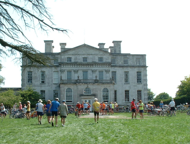
The Manor House, located in Dorset, England, is a historic site that dates back to the 13th century. It is a Grade I listed building and has been recognized as a heritage site of significant cultural and historical importance.

The Manor House is a stunning example of medieval architecture and is known for its well-preserved features and unique design. The building is constructed with local stone and has a distinctive Gothic style, with intricate carvings and decorative elements. The interior of the house boasts impressive timberwork and original medieval features, including a grand fireplace, ornate ceilings, and leaded windows.

The Manor House has a rich and fascinating history. It was originally built as a hunting lodge for King John, and over the centuries, it has been owned by several prominent families, including the Hastings and Trenchard families. During the English Civil War in the 17th century, the house served as a garrison for Parliamentarian forces.

Today, The Manor House is open to the public as a heritage site, offering visitors a chance to explore its fascinating history and architectural beauty. Guided tours are available, allowing visitors to discover the various rooms and learn about the different periods of its history. The site also hosts special events, such as medieval reenactments and educational workshops, providing a unique and immersive experience for visitors of all ages.

In conclusion, The Manor House in Dorset is a remarkable heritage site that showcases the rich history and architectural beauty of the region. With its well-preserved medieval features and fascinating stories, it is a must-visit destination for history enthusiasts and those interested in experiencing the charm of the past.

If you have any feedback on the listing, please let us know in the comments section below.

The Manor House Images

Images are sourced within 2km of 50.703/-2.39 or Grid Reference SY7289. Thanks to Geograph Open Source API. All images are credited.

Storage area near sewage works
Grazing and drain near Keeper's Cottage
Minor road towards Lower Bockhampton
Lower Bockhampton: the telephone box A traditional red phone box at the north end of the village.
Lower Bockhampton: the telephone box
A traditional red phone box at the north end of the village.
Defending Dorset in 1940: the Maiden Newton - Poole Harbour Stop Line (45) -
Pillbox (variant): DoB ID: S0000080

Lower Bockhampton -Rectangular Variant Pillbox.  The Stop Line is continued east of Dorchester with this pillbox sited literally within 3 ft of the river. It must have been uninhabitable for much of the year, particularly during the winter months. Currently it is a fixture within the river itself rather than on the river bank, and therefore remains inaccessible. It has a grenade throwing entrance that leads to 3 steps down inside which has an anti-ricochet wall. Its construction appears to be of brick, with a concrete roof.

<a href="https://www.geograph.org.uk/photo/4842324">SY7290 : Defending Dorset in 1940: the Maiden Newton - Poole Harbour Stop Line (46)</a>
Defending Dorset in 1940: the Maiden Newton - Poole Harbour Stop Line (45)
- Pillbox (variant): DoB ID: S0000080 Lower Bockhampton -Rectangular Variant Pillbox. The Stop Line is continued east of Dorchester with this pillbox sited literally within 3 ft of the river. It must have been uninhabitable for much of the year, particularly during the winter months. Currently it is a fixture within the river itself rather than on the river bank, and therefore remains inaccessible. It has a grenade throwing entrance that leads to 3 steps down inside which has an anti-ricochet wall. Its construction appears to be of brick, with a concrete roof. SY7290 : Defending Dorset in 1940: the Maiden Newton - Poole Harbour Stop Line (46)
Defending Dorset in 1940: the Maiden Newton - Poole Harbour Stop Line (46) -
Pillbox (variant): DoB ID: S0000080

Lower Bockhampton -Rectangular Variant Pillbox.  Water, water everywhere in this second view of this pillbox beside the Frome (currently within), whose interior is inaccessible due to flood water and encroaching vegetation.

<a href="https://www.geograph.org.uk/photo/4842330">SY7290 : Defending Dorset in 1940: the Maiden Newton - Poole Harbour Stop Line (47)</a>
Defending Dorset in 1940: the Maiden Newton - Poole Harbour Stop Line (46)
- Pillbox (variant): DoB ID: S0000080 Lower Bockhampton -Rectangular Variant Pillbox. Water, water everywhere in this second view of this pillbox beside the Frome (currently within), whose interior is inaccessible due to flood water and encroaching vegetation. SY7290 : Defending Dorset in 1940: the Maiden Newton - Poole Harbour Stop Line (47)
Defending Dorset in 1940: the Maiden Newton - Poole Harbour Stop Line (47) -
Pillbox (variant): DoB ID: S0000080

Lower Bockhampton - Rectangular Variant Pillbox.  Situated on a bend of the River Frome by a bridge on the road south to West Stafford.

<a href="https://www.geograph.org.uk/photo/4842335">SY7290 : Defending Dorset in 1940: the Maiden Newton - Poole Harbour Stop Line (48)</a>
Defending Dorset in 1940: the Maiden Newton - Poole Harbour Stop Line (47)
- Pillbox (variant): DoB ID: S0000080 Lower Bockhampton - Rectangular Variant Pillbox. Situated on a bend of the River Frome by a bridge on the road south to West Stafford. SY7290 : Defending Dorset in 1940: the Maiden Newton - Poole Harbour Stop Line (48)
Defending Dorset in 1940: the Maiden Newton - Poole Harbour Stop Line (48) -
Pillbox (type FW3/22): DoB ID: S0000097

West Stafford - W of Stafford House - Type 22 Pillbox.  This pillbox under a canopy of brambles and small trees south of Lower Bockhampton, stands in a corner of a field at the junction of the West Stafford to Dorchester road. It has a brick frontage with a concrete roof, and 6 embrasures. The roof was created by first covering the top of the brick walls with asbestos sheets, and then concrete was poured on top. There is also a concrete floor, a T-shape anti-ricochet wall, and a 4 ft deep walled entrance 3 steps down, with an embrasure.

<a href="https://www.geograph.org.uk/photo/4842337">SY7290 : Defending Dorset in 1940: the Maiden Newton - Poole Harbour Stop Line (49)</a>
Defending Dorset in 1940: the Maiden Newton - Poole Harbour Stop Line (48)
- Pillbox (type FW3/22): DoB ID: S0000097 West Stafford - W of Stafford House - Type 22 Pillbox. This pillbox under a canopy of brambles and small trees south of Lower Bockhampton, stands in a corner of a field at the junction of the West Stafford to Dorchester road. It has a brick frontage with a concrete roof, and 6 embrasures. The roof was created by first covering the top of the brick walls with asbestos sheets, and then concrete was poured on top. There is also a concrete floor, a T-shape anti-ricochet wall, and a 4 ft deep walled entrance 3 steps down, with an embrasure. SY7290 : Defending Dorset in 1940: the Maiden Newton - Poole Harbour Stop Line (49)
Defending Dorset in 1940: the Maiden Newton - Poole Harbour Stop Line (49) -
Pillbox (type FW3/22): DoB ID: S0000097

West Stafford - W of Stafford House - Type 22 Pillbox.  Slowly being destroyed by the small trees that are undermining it.

<a href="https://www.geograph.org.uk/photo/4842341">SY7389 : Defending Dorset in 1940: the Maiden Newton - Poole Harbour Stop Line (50)</a>
Defending Dorset in 1940: the Maiden Newton - Poole Harbour Stop Line (49)
- Pillbox (type FW3/22): DoB ID: S0000097 West Stafford - W of Stafford House - Type 22 Pillbox. Slowly being destroyed by the small trees that are undermining it. SY7389 : Defending Dorset in 1940: the Maiden Newton - Poole Harbour Stop Line (50)
Church Lane, Stinsford A delightful wooded lane beside the River Frome.
Church Lane, Stinsford
A delightful wooded lane beside the River Frome.
Footpath south of Norris Mill Farm
Lonely lane near Norris Mill Farm The footpath south from the farm just dips into this gridsquare, but I'm not sure where the lane leads to. It's quite an empty gridsquare.
Lonely lane near Norris Mill Farm
The footpath south from the farm just dips into this gridsquare, but I'm not sure where the lane leads to. It's quite an empty gridsquare.
Bridge over River Frome at Lower Bockhampton
Water meadows south of Lower Bockhampton
River Frome at Lower Bockhampton
Boundary Stone on Hardy Way east of Dorchester
Hardy Way east of Dorchester
Old Bridge Marker on Bockhampton Bridge, Lower Bockhampton Bridge Weight Plate by the UC road, in parish of Stinsford (West Dorset District), Bockhampton Bridge, Bockhampton Lane.

Surveyed

Milestone Society National ID: DO_WEIBOCbr.
Old Bridge Marker on Bockhampton Bridge, Lower Bockhampton
Bridge Weight Plate by the UC road, in parish of Stinsford (West Dorset District), Bockhampton Bridge, Bockhampton Lane. Surveyed Milestone Society National ID: DO_WEIBOCbr.
Show me another place!

The Manor House is located at Grid Ref: SY7289 (Lat: 50.703, Lng: -2.39)

Unitary Authority: Dorset

Police Authority: Dorset

What 3 Words

///graduated.rebirth.rejoiced. Near Dorchester, Dorset

Related Wikis

West Stafford

West Stafford is a village and civil parish in southwest Dorset, England, situated in the Frome valley 2 miles (3.2 km) east of Dorchester. In the 2011...

Frome Billet

Frome Billet is a former village in Dorset, just to the north of West Stafford.It is mentioned in the Domesday Book. There is slight archaeological evidence...

Whitcombe Church

Whitcombe Church in Whitcombe, Dorset, England was built in the 12th century. It is recorded in the National Heritage List for England as a designated...

Whitcombe, Dorset

Whitcombe is a small village and civil parish in the Dorset unitary authority area of Dorset, England, situated 2 miles (3.2 km) southeast of Dorchester...

Old Came Rectory

Old Came Rectory is a former rectory on the A352 road in Winterborne Came, Dorset, England. It was built in the 19th century for the Reverend William England...

Mount Pleasant henge

Mount Pleasant henge is a Neolithic henge enclosure in the English county of Dorset. It lies southeast of Dorchester in the civil parish of West Stafford...

West Knighton, Dorset

West Knighton is a village and civil parish in Dorset, England, situated 3 miles (4.8 km) southeast of the county town Dorchester. It has an 11th-century...

Kingston Maurward House

Kingston Maurward House is a large Grade I listed Georgian English country house set in a 750-acre (3 square km) estate in Dorset situated in the Frome...

Nearby Amenities

Located within 500m of 50.703,-2.39
Source: Landsat photo
Lat/Long: 50.7040652/-2.3936355
Source: Landsat photo
Lat/Long: 50.7036766/-2.3910296
Source: Landsat photo
Lat/Long: 50.7035239/-2.387799
Source: Landsat photo
Lat/Long: 50.7035949/-2.3855733
Source: Landsat photo
Lat/Long: 50.7037411/-2.3830522
Turning Circle
Lat/Long: 50.7057259/-2.3886666
Turning Circle
Lat/Long: 50.7062822/-2.3862697
West Stafford
Place: village
Lat/Long: 50.7047451/-2.3895243
Fixme: Should connect to other side of road
Lat/Long: 50.7037653/-2.3929461
Material: wood
Power: pole
Source: bing
Lat/Long: 50.7045556/-2.3834267
Material: wood
Power: pole
Source: bing
Lat/Long: 50.7045556/-2.3843719
Material: wood
Power: pole
Source: bing
Lat/Long: 50.7045765/-2.3852626
Material: wood
Power: pole
Source: bing
Lat/Long: 50.7046578/-2.3862563
Material: wood
Power: pole
Source: bing
Lat/Long: 50.7068252/-2.388981
Material: wood
Power: pole
Source: bing
Lat/Long: 50.7070255/-2.3869568
Material: wood
Power: pole
Source: bing
Lat/Long: 50.707205/-2.3879494
Fire Hydrant
Emergency: fire_hydrant
Fire Hydrant Type: underground
Ref: 6793
Source: GPS+GLONASS
Lat/Long: 50.705088/-2.387716
Material: wood
Power: pole
Source: bing
Lat/Long: 50.7055744/-2.3921003
Material: wood
Power: pole
Source: bing
Lat/Long: 50.705779/-2.3933721
Material: wood
Power: pole
Source: bing
Lat/Long: 50.707095/-2.3915793
Bench
Lat/Long: 50.7050171/-2.3888658
Telephone
Defibrillator
Booth: K6
Covered: booth
Defibrillator Location: inside old red phone box, West Stafford
Emergency: defibrillator
Man Made: telephone_box
Source: survey
Lat/Long: 50.7050457/-2.3886926
Fire Hydrant
Emergency: fire_hydrant
Fire Hydrant Diameter: 3 inch
Fire Hydrant Type: underground
Fixme: Position aproximate
Source: GPS+GLONASS
Lat/Long: 50.7054619/-2.3902274
Material: wood
Power: pole
Source: bing
Lat/Long: 50.7024351/-2.3847095
Material: wood
Power: pole
Source: bing
Lat/Long: 50.7032298/-2.3848558
Material: wood
Power: pole
Source: bing
Lat/Long: 50.7035261/-2.3849489
Post Box
Post Box Type: lamp
Ref: DT2 55
Royal Cypher: EIIR
Royal Cypher Wikidata: Q33102113
Lat/Long: 50.7058954/-2.3897181
Direction: 185
Generator Method: photovoltaic
Generator Output Electricity: yes
Generator Solar Modules: 2
Generator Source: solar
Generator Type: solar_photovoltaic_panel
Location: roof
Power: generator
Lat/Long: 50.7039358/-2.390835
Direction: 185
Generator Method: photovoltaic
Generator Output Electricity: yes
Generator Solar Modules: 3
Generator Source: solar
Generator Type: solar_photovoltaic_panel
Location: roof
Power: generator
Lat/Long: 50.7039392/-2.3908943
Direction: 185
Generator Method: photovoltaic
Generator Output Electricity: yes
Generator Solar Modules: 10
Generator Source: solar
Generator Type: solar_photovoltaic_panel
Location: roof
Power: generator
Lat/Long: 50.7039279/-2.3907273
Direction: SSE
Generator Method: photovoltaic
Generator Output Electricity: yes
Generator Solar Modules: 20
Generator Source: solar
Generator Type: solar_photovoltaic_panel
Location: roof
Power: generator
Lat/Long: 50.7044738/-2.3917224
Shelter
Shelter Type: public_transport
Lat/Long: 50.705017/-2.3889412
Entrance: main
Lat/Long: 50.705554/-2.3901017
The data included in this document is from www.openstreetmap.org. The data is made available under ODbL.

Have you been to The Manor House?

Leave your review of The Manor House below (or comments, questions and feedback).