The Avenue

Heritage Site in Wiltshire

England

The Avenue

Track to farm off Stonehenge Road
Track to farm off Stonehenge Road Credit: Helen Steed

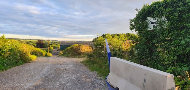
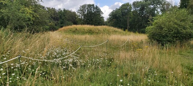
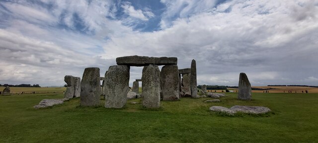
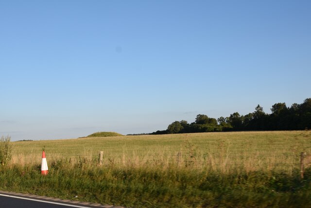
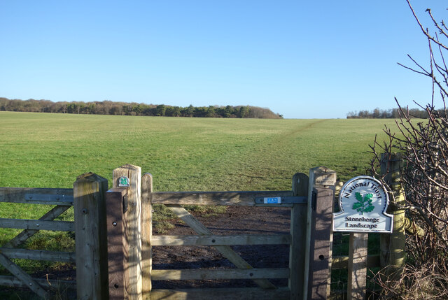
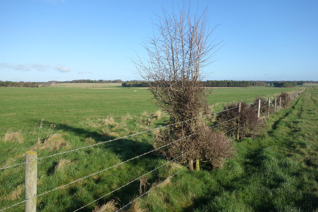
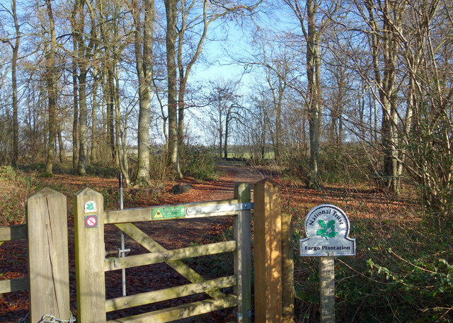
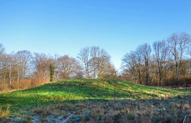
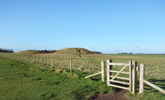
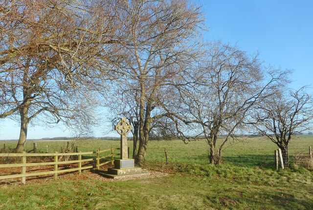
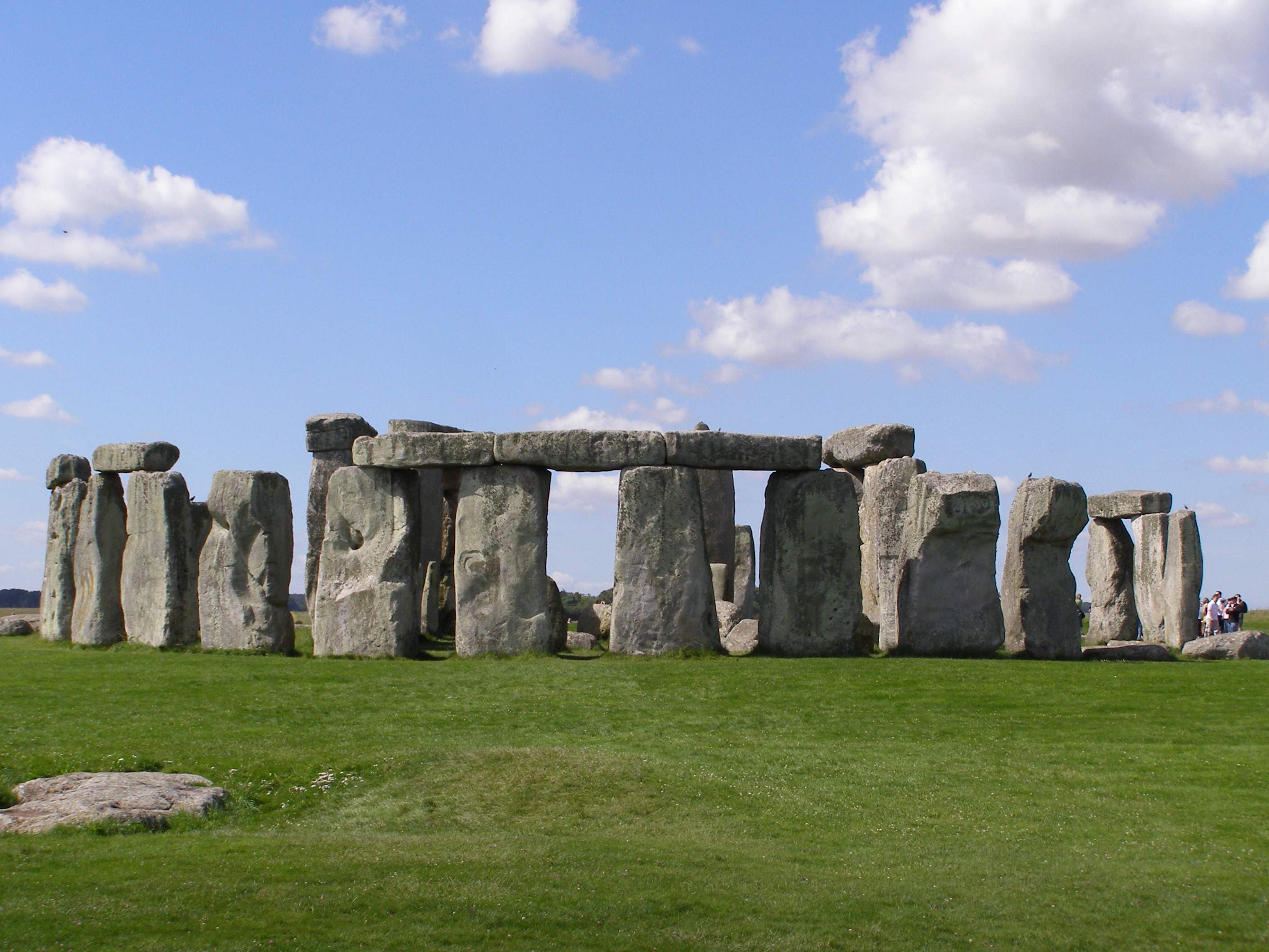
The Avenue, located in Wiltshire, England, is a historic heritage site that holds great significance in the country's cultural and archaeological history. This ancient monument is believed to have been constructed around 2500 BCE during the Neolithic period. It stretches for approximately 2.5 miles, connecting the famous Stonehenge to the River Avon.

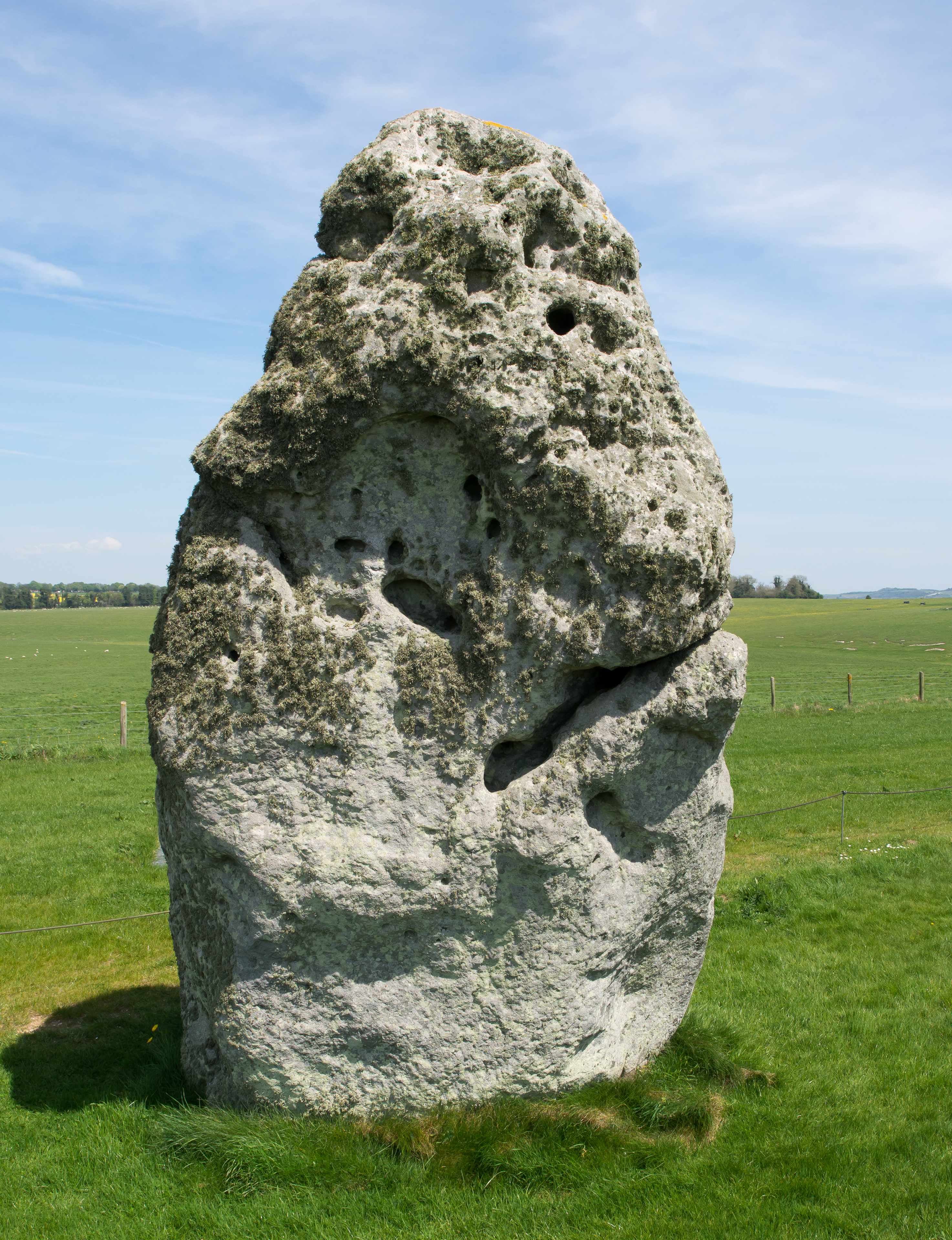
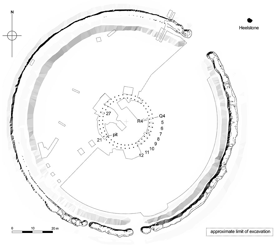
The Avenue is a remarkable structure consisting of a large earthen embankment flanked by parallel ditches. It is aligned with the midsummer sunrise, suggesting its importance in ancient religious ceremonies and astronomical observations. The embankment itself is over 80 feet wide, creating an impressive visual spectacle for those who visit.

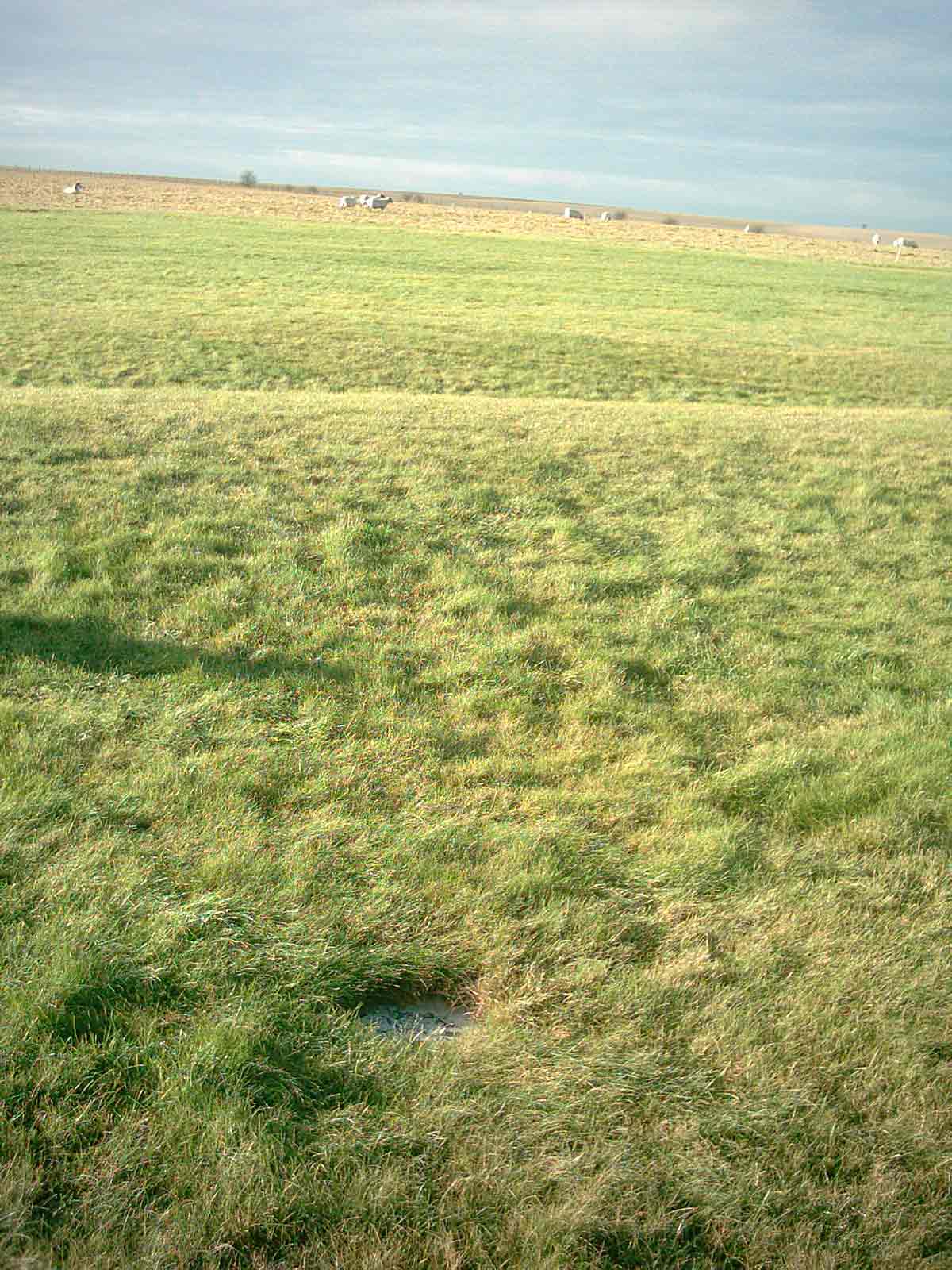
Archaeological excavations have revealed that this site was once adorned with timber posts and stones, which have since eroded or been removed. The purpose of The Avenue remains a subject of ongoing debate among historians and archaeologists. Some theories suggest that it served as a ceremonial pathway leading to Stonehenge, while others propose that it may have been used for processions or as a way to control access to the sacred site.

Despite the mysteries surrounding its purpose, The Avenue provides a unique glimpse into the lives and beliefs of our ancient ancestors. Its preservation and accessibility to the public allow visitors to experience the awe-inspiring scale and historical significance of this Neolithic monument. The Avenue continues to attract tourists, historians, and archaeologists alike, contributing to our understanding of prehistoric cultures and their relationship with the landscape.

If you have any feedback on the listing, please let us know in the comments section below.
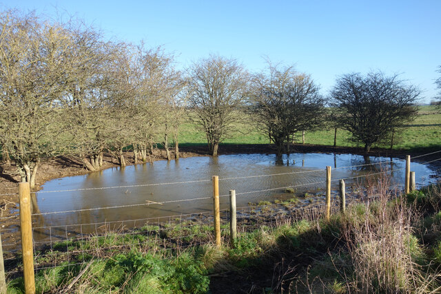
The Avenue Images

Images are sourced within 2km of 51.182/-1.822 or Grid Reference SU1242. Thanks to Geograph Open Source API. All images are credited.

Track to farm off Stonehenge Road
Tumulus near Stonehenge
Heel Stone and Stonehenge
Stonehenge with approaching storm
Stonehenge
Stonehenge
Tumulus on Normanton Down Seen from the A303.
Tumulus on Normanton Down
Seen from the A303.
Students sitting on Stonehenge stones, 1926 Original 127 size print shows one upright sarsen with no cap, but there are heavy fingerprints on the top of the stone in the print, so it has been cropped. The people are students from University College London, at the time it was normal to touch and even sit on the stones.
Students sitting on Stonehenge stones, 1926
Original 127 size print shows one upright sarsen with no cap, but there are heavy fingerprints on the top of the stone in the print, so it has been cropped. The people are students from University College London, at the time it was normal to touch and even sit on the stones.
Heel Stone with Cut Benchmark Visible A cut Ordnance Survey benchmark is visible in this shot about 0.3m up from the ground, slightly right of centre (central to and slightly above the grey and yellow patches of lichen). There is at least one other cut benchmark on the main stone circle too. They were carved in the days before such acts were considered to be vandalism.
Heel Stone with Cut Benchmark Visible
A cut Ordnance Survey benchmark is visible in this shot about 0.3m up from the ground, slightly right of centre (central to and slightly above the grey and yellow patches of lichen). There is at least one other cut benchmark on the main stone circle too. They were carved in the days before such acts were considered to be vandalism.
A Wiltshire Gate I don't know how the name came about, but these moveable barriers are often called Wiltshire Gates.
This one is in its home county on National Trust access land near to Stonehenge.
Buildings at Greenland Farm are just visible on the horizon.
A Wiltshire Gate
I don't know how the name came about, but these moveable barriers are often called Wiltshire Gates. This one is in its home county on National Trust access land near to Stonehenge. Buildings at Greenland Farm are just visible on the horizon.
Stonehenge Landscape The National Trust manages 827 hectares of mostly chalk grassland with some small woods around the main site of Stonehenge.
Rich in plant and animal species, the site also contains many of the large number of prehistoric remains which surround the Henge.
Stonehenge Landscape
The National Trust manages 827 hectares of mostly chalk grassland with some small woods around the main site of Stonehenge. Rich in plant and animal species, the site also contains many of the large number of prehistoric remains which surround the Henge.
Fence along The Cursus The fence follows the line of The Cursus, a low level Neolithic linear earthwork
presumed to have been made for some sort of ceremonial purpose.
The field on the other side is part of the National Trust's access land surrounding Stonehenge. There is not a lot to see there.
For a view in the opposite direction see <a href="https://www.geograph.org.uk/photo/2819457">SU1143 : Northern edge of The Cursus</a>
Fence along The Cursus
The fence follows the line of The Cursus, a low level Neolithic linear earthwork presumed to have been made for some sort of ceremonial purpose. The field on the other side is part of the National Trust's access land surrounding Stonehenge. There is not a lot to see there. For a view in the opposite direction see SU1143 : Northern edge of The Cursus
Dew Pond near Stonehenge Once a common sight on dry downland pastures, you can still find dew ponds from time to time. Clay lined to collect rainfall, they were often the only source of drinking water for livestock.
Dew Pond near Stonehenge
Once a common sight on dry downland pastures, you can still find dew ponds from time to time. Clay lined to collect rainfall, they were often the only source of drinking water for livestock.
Fargo Plantation Part of the National Trust's Stonehenge Landscape site. This area is not very well wooded, and what trees there are tend to be confined into small plantations like this one.
Fargo Plantation
Part of the National Trust's Stonehenge Landscape site. This area is not very well wooded, and what trees there are tend to be confined into small plantations like this one.
Tumulus in Fargo Plantation There are dozens of these Bronze Age burial mounds all around Stonehenge, which is why the whole area is a protected landscape in the care of the National Trust.
Tumulus in Fargo Plantation
There are dozens of these Bronze Age burial mounds all around Stonehenge, which is why the whole area is a protected landscape in the care of the National Trust.
Tumulus and Gate There are dozens of these burial mounds all around Stonehenge. They come in various shapes and sizes. These two are some of the larger ones and are fenced off in their own enclosure.
Tumulus and Gate
There are dozens of these burial mounds all around Stonehenge. They come in various shapes and sizes. These two are some of the larger ones and are fenced off in their own enclosure.
Bus To The Stones One of the buses which take visitors on the 2 km trip between Stonehenge and the Visitor Centre.
Quite a few people go on foot, especially on a nice day like this, hence the walkway along the roadside.
The buses are the only regular traffic along what used to be the A344, a former main road which has now been closed.
Bus To The Stones
One of the buses which take visitors on the 2 km trip between Stonehenge and the Visitor Centre. Quite a few people go on foot, especially on a nice day like this, hence the walkway along the roadside. The buses are the only regular traffic along what used to be the A344, a former main road which has now been closed.
Memorial to an Aviator A short distance away from a similar memorial outside the Stonehenge Visitor Centre to two pioneer airmen who crashed near there in 1912, this roadside cross is in memory of Major Alexander William Hewetson who was killed whilst flying on the 17th July 1913.
Memorial to an Aviator
A short distance away from a similar memorial outside the Stonehenge Visitor Centre to two pioneer airmen who crashed near there in 1912, this roadside cross is in memory of Major Alexander William Hewetson who was killed whilst flying on the 17th July 1913.
English Heritage Land Rover at Stonehenge A very clean looking vehicle belonging to English Heritage who look after Stonehenge.
English Heritage Land Rover at Stonehenge
A very clean looking vehicle belonging to English Heritage who look after Stonehenge.
Show me another place!

The Avenue is located at Grid Ref: SU1242 (Lat: 51.182, Lng: -1.822)

What 3 Words

///lunges.elsewhere.mute. Near Lark Hill, Wiltshire

Nearby Locations

Stonehenge The Avenue

Related Wikis

Heel Stone

The Heel Stone is a single large block of sarsen stone standing within the Avenue outside the entrance of the Stonehenge earthwork in Wiltshire, England...

Stonehenge Avenue

Stonehenge Avenue is an ancient avenue on Salisbury Plain, Wiltshire, England. It is part of the Stonehenge, Avebury and Associated Sites UNESCO World...

Aubrey holes

The Aubrey holes are a ring of 56 chalk pits at Stonehenge, named after seventeenth-century antiquarian John Aubrey. They date to the earliest phases of...

Stonehenge, Avebury and Associated Sites

Stonehenge, Avebury and Associated Sites is a UNESCO World Heritage Site (WHS) in Wiltshire, England. The WHS covers two large areas of land separated...

Stonehenge

Stonehenge is a prehistoric monument on Salisbury Plain in Wiltshire, England, two miles (3 km) west of Amesbury. It consists of an outer ring of vertical...

Stonehenge Free Festival

The Stonehenge Free Festival was a British free festival from 1974 to 1984 held at the prehistoric monument Stonehenge in England during the month of June...

Q and R Holes

The Q and R Holes are a series of concentric sockets which currently represent the earliest known evidence for a stone structure on the site of Stonehenge...

Altar Stone (Stonehenge)

The Altar Stone is a recumbent central megalith at Stonehenge in England, dating to Stonehenge phase 3i, around 2600 BCE. It is identified as Stone 80...

Nearby Amenities

Located within 500m of 51.182,-1.822
Addr Street: Byway 12
Board Type: geology
Description: Stonehenge Cursus
Information: board
Tourism: information
Lat/Long: 51.1862387/-1.824326
Barrier: kissing_gate
Source: survey;gps
Lat/Long: 51.1810112/-1.8288817
Mesolitihic Wooden Post Hole
Alt Name: Totem Pole
Historic: memorial
Memorial: plaque
Url: http://www.pastscape.org.uk/hob.aspx?hob_id=219856
Lat/Long: 51.1804458/-1.8287292
Stonehenge Avenue
Information: board
Tourism: information
Lat/Long: 51.1826007/-1.8196645
Station Stone
Fixme: location approximated
Historic: memorial
Memorial: plaque
Name De: Markierung, Stationsstein
Ref: 92
Lat/Long: 51.1784607/-1.825968
Station Stone
Fixme: location approximated
Historic: memorial
Memorial: plaque
Name De: Markierung, Stationsstein
Ref: 94
Lat/Long: 51.179186/-1.8263671
Stone Hole 97
Fixme: location approximated
Historic: memorial
Memorial: plaque
Name De: Steinlochmarkierung
Ref: 97
Lat/Long: 51.1793149/-1.8253396
Mesolitihic Wooden Post Hole
Alt Name: Totem Pole
Historic: memorial
Memorial: plaque
Url: http://www.pastscape.org.uk/hob.aspx?hob_id=219856
Lat/Long: 51.1804645/-1.8285557
Bench
Backrest: no
Check Date: 2023-06-26
Fixme: location approximated by Mapillary
Material: wood
Lat/Long: 51.1787115/-1.8250119
A Dramatic Entrance
Board Type: history
Check Date: 2021-06-26
Information: board
Tourism: information
Lat/Long: 51.1793639/-1.825455
Waste Basket
Check Date: 2021-06-26
Lat/Long: 51.1797859/-1.8270987
Welcome to Stonehenge
Board Type: history
Check Date: 2021-06-26
Fixme: location approximated by Mapillary
Information: board
Tourism: information
Lat/Long: 51.1800919/-1.8284694
Barrier: kissing_gate
Lat/Long: 51.1833795/-1.8267374
Historic: milestone
Wikidata: Q26424051
Lat/Long: 51.1794395/-1.8254382
Why was Stonehenge built here?
Board Type: history
Information: board
Tourism: information
Lat/Long: 51.1793946/-1.8254581
Defibrillator
Emergency: defibrillator
Indoor: no
Mapillary: https://www.mapillary.com/app/?pKey=893675148666429
Lat/Long: 51.1799529/-1.8278232
Bench
Backrest: yes
Lat/Long: 51.179405/-1.8265693
Barrier: kissing_gate
Lat/Long: 51.1841256/-1.8262365
Barrier: kissing_gate
Lat/Long: 51.1780116/-1.8194241
Barrier: kissing_gate
Lat/Long: 51.1839875/-1.8261863
The data included in this document is from www.openstreetmap.org. The data is made available under ODbL.

Have you been to The Avenue?

Leave your review of The Avenue below (or comments, questions and feedback).