Tap o' Noth

Heritage Site in Aberdeenshire

Scotland

Tap o' Noth

Cat Craigs Summit Cat Craigs 456m (Trump) 
Heather covering  the summit with no indication of the summit apart from nothing higher to stand on.
Cat Craigs Summit Credit: Ralph Greig

Tap o' Noth is a significant heritage site located in Aberdeenshire, Scotland. It is renowned for its ancient hillfort, which stands atop the summit of the Tap o' Noth hill, reaching an impressive height of 562 meters (1,844 feet). This hillfort is considered one of the largest and most impressive in Scotland.

The hillfort at Tap o' Noth dates back to the Iron Age, with evidence suggesting that it was constructed around 400 BCE. It consists of a series of concentric stone walls, which enclose an area of approximately 1.2 hectares (3 acres). The walls were built using massive boulders, some of which weigh several tons, and are remarkably well-preserved.

The summit of Tap o' Noth is crowned by the remains of a centrally located stone fort, believed to have been the residence of a high-status individual or tribal leader. The fort would have offered commanding views of the surrounding landscape, allowing for strategic control over the area.

Visitors to Tap o' Noth can explore the ancient hillfort and its impressive stone walls, experiencing firsthand the historical significance of the site. The climb to the summit is steep but rewarding, offering breathtaking panoramic views of the surrounding countryside. The site also provides a unique opportunity to gain insights into the lives and culture of the Iron Age inhabitants of Aberdeenshire.

Tap o' Noth is a cherished heritage site, attracting both history enthusiasts and nature lovers alike, who are captivated by its rich historical significance and stunning natural beauty.

If you have any feedback on the listing, please let us know in the comments section below.

Tap o' Noth Images

Images are sourced within 2km of 57.3513/-2.8583 or Grid Reference NJ4829. Thanks to Geograph Open Source API. All images are credited.

Cat Craigs Summit Cat Craigs 456m (Trump) 
Heather covering  the summit with no indication of the summit apart from nothing higher to stand on.
Cat Craigs Summit
Cat Craigs 456m (Trump) Heather covering the summit with no indication of the summit apart from nothing higher to stand on.
Tap O' Noth from  Dunnideer A view over 12 Km to Tap O' Noth by Rhyinie. It has a vitrified fort on its summit too, similar to Dunnideer. Others in the area include Bennachie and Barra Hill.
Tap O' Noth from Dunnideer
A view over 12 Km to Tap O' Noth by Rhyinie. It has a vitrified fort on its summit too, similar to Dunnideer. Others in the area include Bennachie and Barra Hill.
Looking towards Tap o'Noth... ...some 3 km north-west of the Craw Stane.
Looking towards Tap o'Noth...
...some 3 km north-west of the Craw Stane.
Nearing the summit of Tap o' Noth
Path to the summit of Tap o' Noth
View towards Tap o'Noth... ...from about 1 km to the south.
View towards Tap o'Noth...
...from about 1 km to the south.
Heading up the hill... ...towards Tap o'Noth.
Heading up the hill...
...towards Tap o'Noth.
Deer fence and gate on the path to Tap o'Noth
Looking up at Tap o'Noth
Looking north from Tap o'Noth
Tap o'Noth It's a strenuous climb to the 563-m peak but the fascinating remains of the Iron Age hill fort and its vitrified fortifications (Canmore listing 1716: <span class="nowrap"><a title="https://canmore.org.uk/site/17169/tap-o-noth" rel="nofollow ugc noopener" href="https://canmore.org.uk/site/17169/tap-o-noth">Link</a><img style="margin-left:2px;" alt="External link" title="External link - shift click to open in new window" src="https://s1.geograph.org.uk/img/external.png" width="10" height="10"/></span> ) and the spectacular views for up to 50 km around are worth the effort.
Tap o'Noth
It's a strenuous climb to the 563-m peak but the fascinating remains of the Iron Age hill fort and its vitrified fortifications (Canmore listing 1716: LinkExternal link ) and the spectacular views for up to 50 km around are worth the effort.
View towards Hill of Noth… ...from Tap o'Noth with (I think) a saddle (<span class="nowrap"><a title="https://en.wikipedia.org/wiki/Saddle_(landform)" rel="nofollow ugc noopener" href="https://en.wikipedia.org/wiki/Saddle_(landform)">Link</a><img style="margin-left:2px;" alt="External link" title="External link - shift click to open in new window" src="https://s1.geograph.org.uk/img/external.png" width="10" height="10"/></span> ) in the middle.  The valley of the Water of Bogie is just visible in the right background.
View towards Hill of Noth…
...from Tap o'Noth with (I think) a saddle (LinkExternal link ) in the middle. The valley of the Water of Bogie is just visible in the right background.
Trig point at Tap o'Noth This is a 'secondary' trig point, reference number TP6317; for more on trig points, see: <span class="nowrap"><a title="https://en.wikipedia.org/wiki/Triangulation_station" rel="nofollow ugc noopener" href="https://en.wikipedia.org/wiki/Triangulation_station">Link</a><img style="margin-left:2px;" alt="External link" title="External link - shift click to open in new window" src="https://s1.geograph.org.uk/img/external.png" width="10" height="10"/></span> .   Scree and rubble from the remains of the walls of the iron Age hill fort can be seen in the foreground.
Trig point at Tap o'Noth
This is a 'secondary' trig point, reference number TP6317; for more on trig points, see: LinkExternal link . Scree and rubble from the remains of the walls of the iron Age hill fort can be seen in the foreground.
View towards Old Merdrum from Tap o' Noth Some of the fields in this photograph have now become forested especially to the south west of Old Merdrum.
View towards Old Merdrum from Tap o' Noth
Some of the fields in this photograph have now become forested especially to the south west of Old Merdrum.
View towards the Mains of Lesmoir and the A941 from Tap o' Noth The prominent hill in the distance is The Buck.
View towards the Mains of Lesmoir and the A941 from Tap o' Noth
The prominent hill in the distance is The Buck.
Tap o' Noth - vitrified fort
Nether Ord The farm of Nether Ord immediately to the west of Rhynie.
Nether Ord
The farm of Nether Ord immediately to the west of Rhynie.
Tap o'Noth Summit Tap o'Noth 563m (Marilyn)
The second highest  hill fort in Scotland
Tap o'Noth Summit
Tap o'Noth 563m (Marilyn) The second highest hill fort in Scotland
Show me another place!

Tap o' Noth is located at Grid Ref: NJ4829 (Lat: 57.3513, Lng: -2.8583)

Unitary Authority: Aberdeenshire

Police Authority: North East

What 3 Words

///obeyed.replied.trickled. Near Huntly, Aberdeenshire

Nearby Locations

Tap o' Noth Tap o' Noth

Related Wikis

Tap o' Noth

The Tap o' Noth is a hill and the name of a Pictish hill fort on its summit, 8 miles south of Huntly in Aberdeenshire, Scotland at grid reference NJ485293...

Lesmoir Castle

Lesmoir Castle was a 16th-century castle, about 2.0 miles (3.2 km) west of Rhynie, Aberdeenshire, Scotland, south-west of Tap o' Noth, at Mains of Lesmoir...
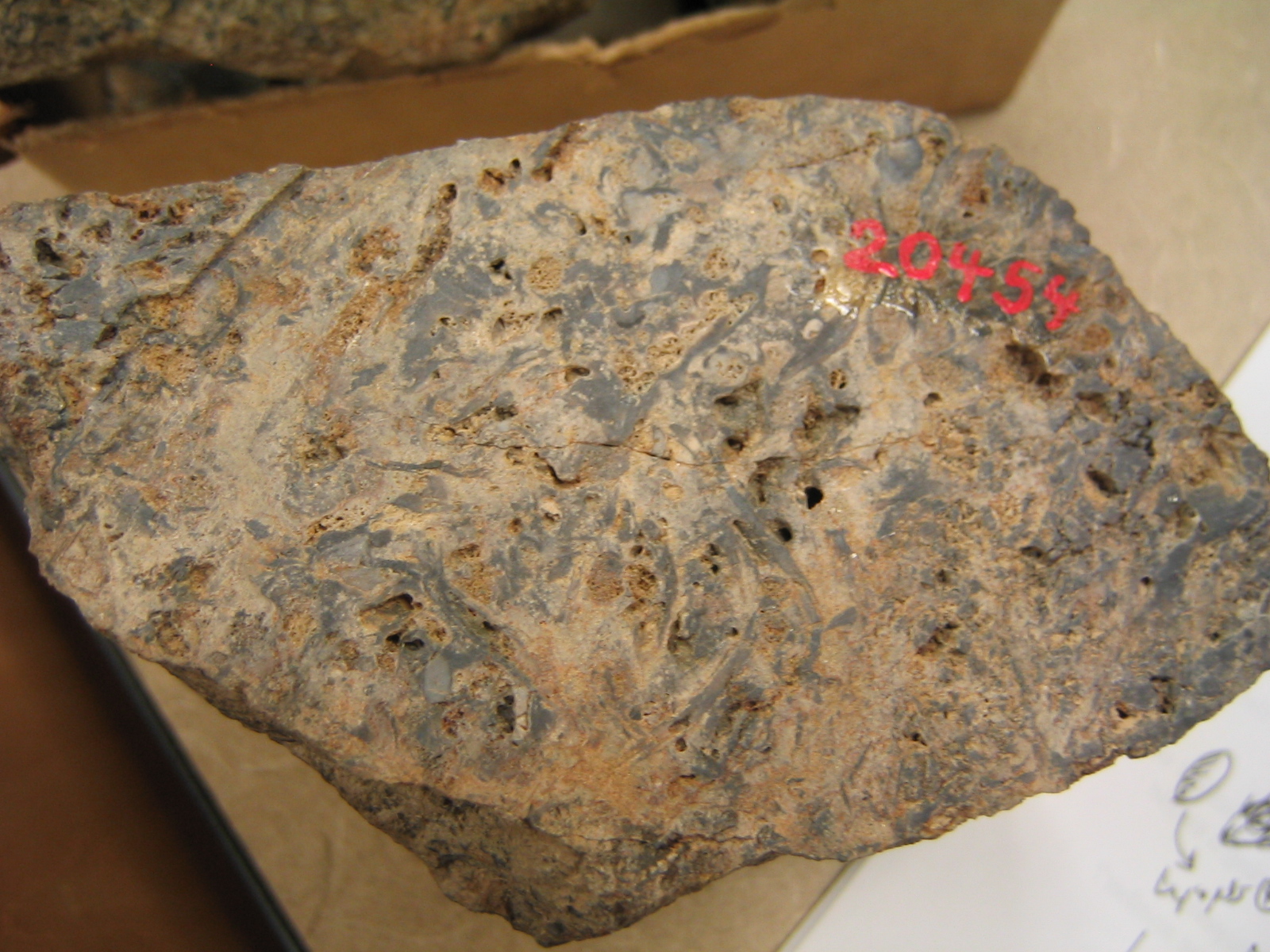
Rhynie chert

The Rhynie chert is a Lower Devonian sedimentary deposit exhibiting extraordinary fossil detail or completeness (a Lagerstätte). It is exposed near the...

Rhynie, Aberdeenshire

Rhynie () (Scottish Gaelic: Roinnidh) is a village in Aberdeenshire, Scotland. It is on the A97 road, 14 miles (23 km) northwest of Alford. The Rhynie...

Related Videos

Tap o' Noth Hill Fort Walk

The Tap o' Noth is a hill and fort, 8 miles south of Huntly in Aberdeenshire, Scotland. It is the second highest fort in Scotland and ...

Tap O'Noth | Scotland's Best Preserved Hill Fort | Aberdeenshire | Vitrification | Before Caledonia

'Before Caledonia' A journey through 'Scotland's Ancient Sites'. ---------- PATREON - https://www.patreon.com/user?u=21567811 ...

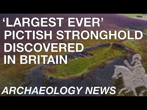
BREAKING NEWS - 'Largest Ever' Pictish Hillfort Discovered in Scotland

What an incredible time for Archaeology! Subscribe to our other YouTube channels:- - History Time:- ...

Tap O'Noth Hillfort just outside of Rhynie.

After seeing the Hillfort at Tap O'Noth Rhynie featuring in an episode of BBC Scotland's Landward, we went for a Ramble. Rain ...

Nearby Amenities

Located within 500m of 57.3513,-2.8583
Tap o' Noth
Corbett: no
Ele: 562
Graham: no
Marilyn: yes
Munro: no
Natural: peak
Prominence: 247
Source: NPE
Wikidata: Q1690932
Wikipedia: en:Tap o' Noth
Lat/Long: 57.3515246/-2.8591973
Man Made: survey_point
Lat/Long: 57.3512913/-2.8589606
Direction: 180
Information: map
Map Size: region
Map Type: topo
Tourism: information
Lat/Long: 57.3505842/-2.8574684
The data included in this document is from www.openstreetmap.org. The data is made available under ODbL.

Have you been to Tap o' Noth ?

Leave your review of Tap o' Noth below (or comments, questions and feedback).