Staunton Harold Hall

Heritage Site in Leicestershire North West Leicestershire

England

Staunton Harold Hall

A42 sweeping through Leicestershire
A42 sweeping through Leicestershire Credit: Peter Whatley

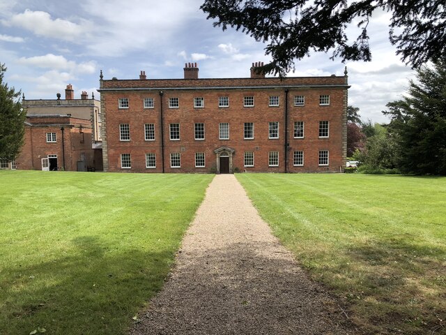
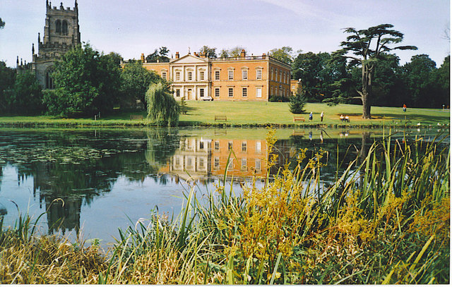
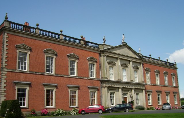
Staunton Harold Hall is a magnificent heritage site located in Leicestershire, England. This historic building is a Grade II* listed country mansion, renowned for its architectural splendor and rich history. The hall is situated within the picturesque Staunton Harold Estate, which spans over 2,000 acres of beautiful parkland.

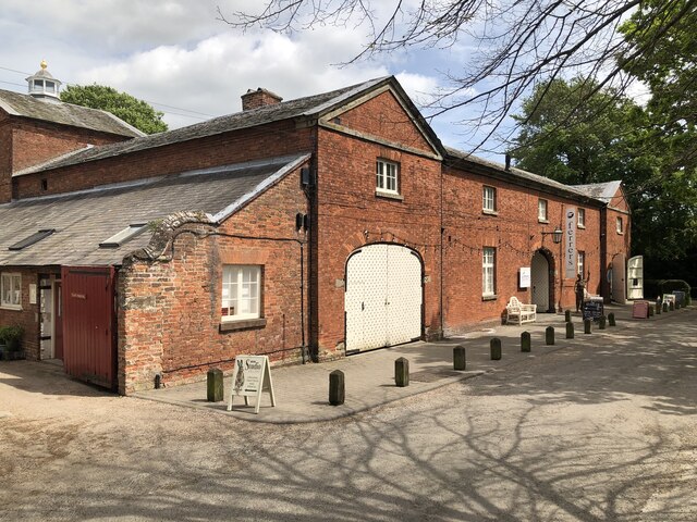
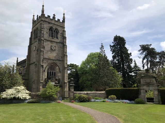
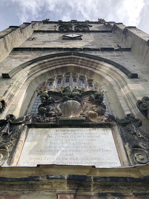
Originally built in the 17th century, Staunton Harold Hall is a fine example of Jacobean architecture. The mansion features an impressive facade adorned with classical columns and intricate stone carvings. Its grand interior boasts elegant reception rooms, ornate ceilings, and a stunning central staircase. Visitors can marvel at the opulent decor and admire the period furniture and artwork displayed throughout the house.

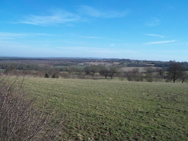
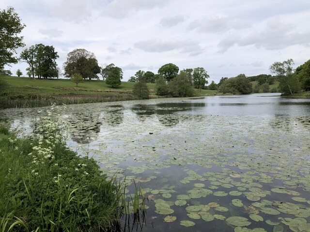
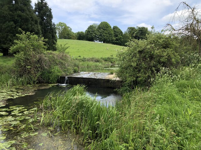
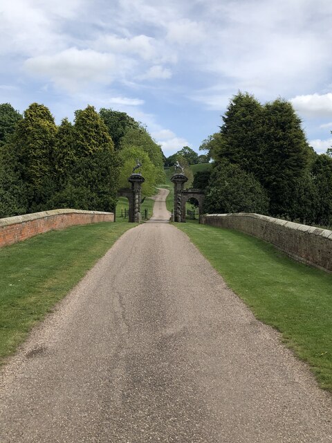
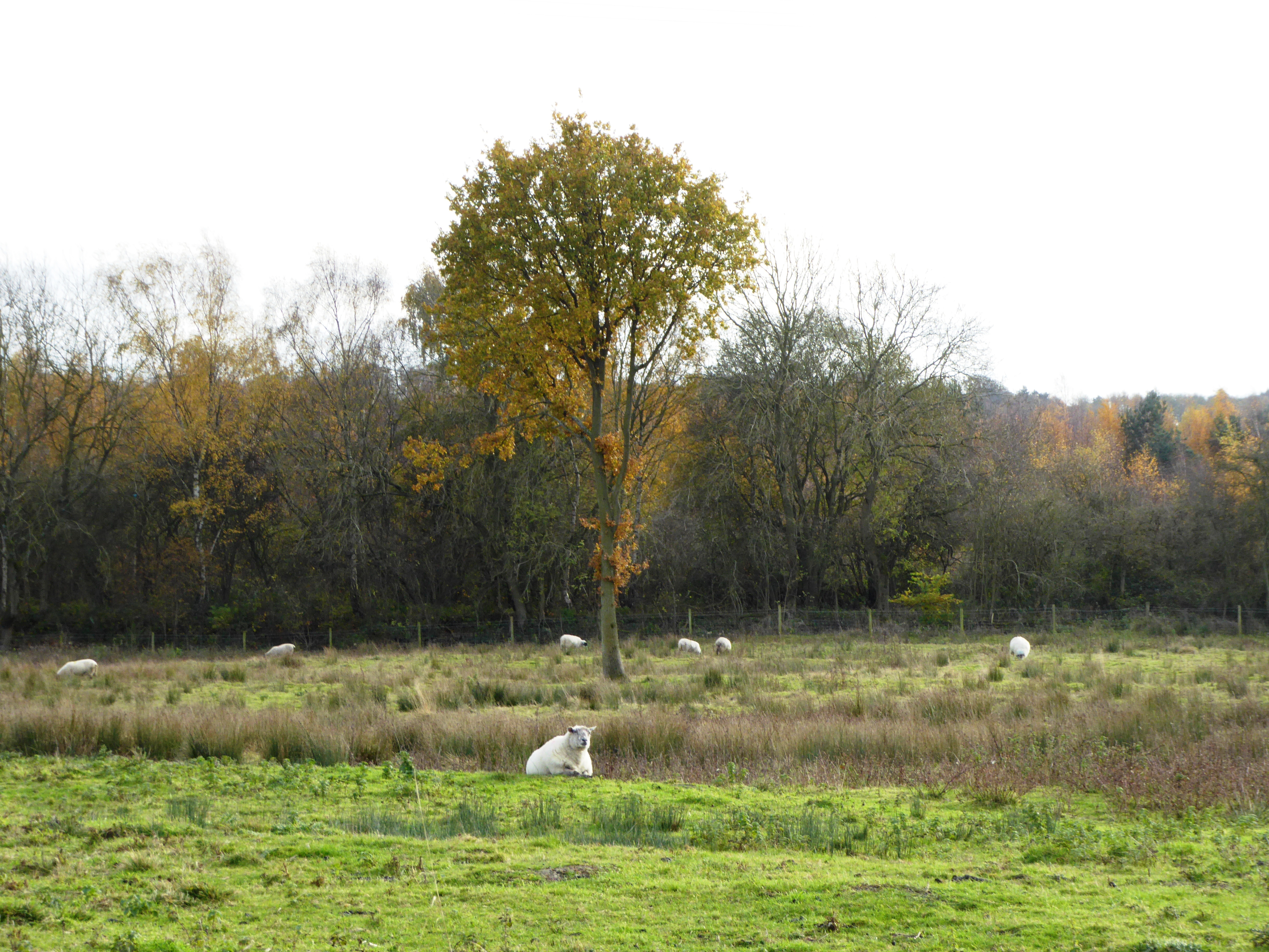
The estate surrounding the hall offers visitors an opportunity to explore the meticulously landscaped gardens and parkland. The formal gardens are meticulously maintained, featuring vibrant flower beds, neatly trimmed hedges, and serene water features. Beyond the gardens, visitors can wander through the tranquil woodlands and enjoy the peaceful atmosphere.

Staunton Harold Hall is not only a remarkable architectural gem but also an important historical site. The estate has been owned by the same family for over 300 years and has witnessed significant events throughout its existence. Today, the hall welcomes visitors who can immerse themselves in its rich heritage, learn about the estate's history, and appreciate the beauty of its surroundings. Whether it's exploring the grand house, strolling through the gardens, or simply enjoying the tranquility of the estate, Staunton Harold Hall offers a fascinating glimpse into England's past.

If you have any feedback on the listing, please let us know in the comments section below.

Staunton Harold Hall Images

Images are sourced within 2km of 52.78/-1.443 or Grid Reference SK3720. Thanks to Geograph Open Source API. All images are credited.

A42 sweeping through Leicestershire
A42 near Lount
A42 near Lount
A42 about to bridge Melbourne Road Parapets reveal the bridge location.
A42 about to bridge Melbourne Road
Parapets reveal the bridge location.
Bridge MJS2/39 Bridge MJS2/39 takes the road from Melbourne to Coleorton over the closed Ashby de la Zouch to Derby branch railway, built by the Midland railway in 1874 and closed in 1968.
Bridge MJS2/39
Bridge MJS2/39 takes the road from Melbourne to Coleorton over the closed Ashby de la Zouch to Derby branch railway, built by the Midland railway in 1874 and closed in 1968.
WW2 Tank Trap Remains of a WW2 Tank trap, erected by the local Detachment of the Home Guard during the war.  The idea was to connect metal cables across the road and capture the German Tanks as they came over the brow of the adjacent railway bridge.
WW2 Tank Trap
Remains of a WW2 Tank trap, erected by the local Detachment of the Home Guard during the war. The idea was to connect metal cables across the road and capture the German Tanks as they came over the brow of the adjacent railway bridge.
Western Old Parks Farm Farm buildings from the bridleway that runs to the south
Western Old Parks Farm
Farm buildings from the bridleway that runs to the south
Fields near Old Parks Farm Attractive area of countryside to the east of Smisby. Leicestershire supersedes Derbyshire beyond the stand of trees.
Fields near Old Parks Farm
Attractive area of countryside to the east of Smisby. Leicestershire supersedes Derbyshire beyond the stand of trees.
Fish pond by the Beaumont Way This fishing lake or fish pond is marked on 19th century Ordnance Survey maps.
Fish pond by the Beaumont Way
This fishing lake or fish pond is marked on 19th century Ordnance Survey maps.
Footpath to Worthington and a birch wood The footpath runs up the field to a stile on the left edge of the wood but most walkers follow the field margin instead. The wood is quite new.
Footpath to Worthington and a birch wood
The footpath runs up the field to a stile on the left edge of the wood but most walkers follow the field margin instead. The wood is quite new.
The Ferrers Centre, Staunton Harold The former stable block of Staunton Harold Hall now hosts a variety of craft shops, studios, and a café.
The Ferrers Centre, Staunton Harold
The former stable block of Staunton Harold Hall now hosts a variety of craft shops, studios, and a café.
Staunton Harold Hall (Rear) Grade I listed country house, current form from a rebuild in 1763. The house was built by the Shirley family, the Earls Ferrers, and remained in the family until 1955. Subsequently a care home, the house returned to private ownership as a family home in 2003. The grounds are open to the public (except for a private family area) and contain a grade I listed C17th church.
Staunton Harold Hall (Rear)
Grade I listed country house, current form from a rebuild in 1763. The house was built by the Shirley family, the Earls Ferrers, and remained in the family until 1955. Subsequently a care home, the house returned to private ownership as a family home in 2003. The grounds are open to the public (except for a private family area) and contain a grade I listed C17th church.
Staunton Harold Lake
Weir separating lakes at Staunton Harold
Bridge and gated entrance to Staunton Harold
Holy Trinity Chapel, Staunton Harold Grade I listed church built 1653 in Gothic survival style, unusual in the austere Commonwealth era. The church was part of the Staunton Harold estate until it was gifted to the National Trust when the estate was put up for auction in the 1950s. Now a redundant church, it is occasionally open to the public.
Holy Trinity Chapel, Staunton Harold
Grade I listed church built 1653 in Gothic survival style, unusual in the austere Commonwealth era. The church was part of the Staunton Harold estate until it was gifted to the National Trust when the estate was put up for auction in the 1950s. Now a redundant church, it is occasionally open to the public.
Holy Trinity Chapel detail Building detail on the front of Holy Trinity Chapel (Staunton Harold Church). The inscription reads:
In the yeare 1653 When all things sacred were throughout ye nation Either demollisht or profaned Sir Robert Shirley Barronet founded this Church whose singular praise it is to have done ye best things in ye worst times And hoped them in the most callamitous. The righteous shall be had in everlasting remembrance.
Holy Trinity Chapel detail
Building detail on the front of Holy Trinity Chapel (Staunton Harold Church). The inscription reads: In the yeare 1653 When all things sacred were throughout ye nation Either demollisht or profaned Sir Robert Shirley Barronet founded this Church whose singular praise it is to have done ye best things in ye worst times And hoped them in the most callamitous. The righteous shall be had in everlasting remembrance.
Calke Village The Gables. dating from 1880.
Calke Village
The Gables. dating from 1880.
Welcome to Leicestershire sign near Calke Abbey
Show me another place!

Staunton Harold Hall is located at Grid Ref: SK3720 (Lat: 52.78, Lng: -1.443)

Administrative County: Leicestershire

District: North West Leicestershire

Police Authority: Leicestershire

What 3 Words

///success.coarser.lordship. Near Ashby de la Zouch, Leicestershire

Related Wikis

Staunton Harold

Staunton Harold is a civil parish in North West Leicestershire about 3 miles (5 km) north of Ashby-de-la-Zouch. The parish is on the county boundary with...

Staunton Harold Hall

Staunton Harold Hall is a large 18th-century Grade I listed country house built by the Earls Ferrers, situated within the 2,000-acre (810 ha) Staunton...

Dimminsdale

Dimminsdale is a 37 hectare geological biological and Site of Special Scientific Interest partly in Derbyshire and partly in Leicestershire. It is located...

Lount

Lount is a hamlet near Ashby de la Zouch in north-west Leicestershire, England. It has a population of 50 (approx). At the 2011 census the population...

Lount Meadows

Lount Meadows is a 8.5 hectares (21 acres) biological Site of Special Scientific Interest south of Lount in Leicestershire, England.This slightly acidic...

Calke

Calke is a small village and civil parish in the South Derbyshire district of Derbyshire, England. It includes the historic house Calke Abbey, a National...

Calke Abbey

Calke Abbey is a Grade I listed country house near Ticknall, Derbyshire, England, in the care of the charitable National Trust. The site was an Augustinian...

A42 road (England)

The A42 is a major trunk road in the East Midlands region of the United Kingdom. It links junction 23A of the M1 motorway to junction 11 of the M42 motorway...

Nearby Amenities

Located within 500m of 52.78,-1.443
The data included in this document is from www.openstreetmap.org. The data is made available under ODbL.

Have you been to Staunton Harold Hall?

Leave your review of Staunton Harold Hall below (or comments, questions and feedback).