Stanton Post Mill

Heritage Site in Suffolk West Suffolk

England

Stanton Post Mill

Summer Road, Hepworth
Summer Road, Hepworth Credit: David Howard

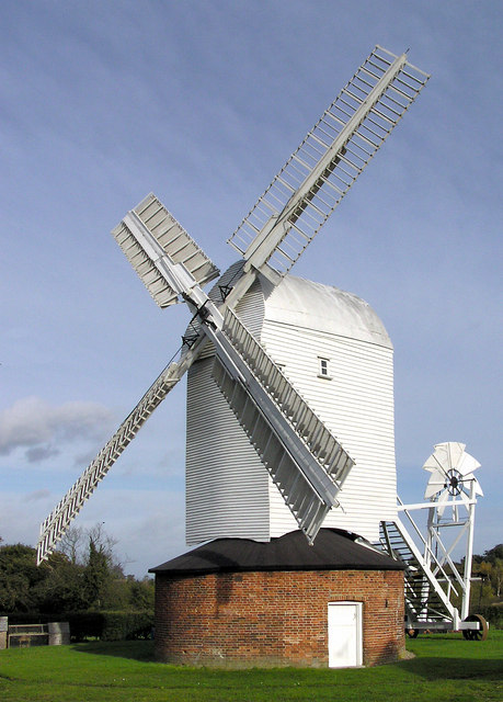
Stanton Post Mill, located in Suffolk, England, is a historic heritage site that offers a glimpse into the region's rich agricultural history. This well-preserved post mill stands as a testament to the ingenuity of its builders and the importance of wind power in traditional milling processes.

The mill dates back to the early 18th century and was originally constructed to grind grain into flour. It consists of a timber-framed structure perched atop a central post, allowing it to rotate with the wind. The mill's wooden sails, which can still be seen today, were designed to harness the power of the wind and turn the grinding stones inside the mill.

Stanton Post Mill operated for over two centuries, serving the local farming community and providing a crucial service for the production of flour. However, advancements in technology eventually rendered the mill obsolete, and it fell into disrepair.

Thanks to the efforts of dedicated preservationists, the mill was restored to its former glory in the late 20th century. Today, visitors can explore the mill and learn about the fascinating history of milling in the region. The interior of the mill showcases the original grinding machinery, providing an immersive experience of the milling process.

Stanton Post Mill is not only a fascinating historical site but also a picturesque landmark set amidst the beautiful Suffolk countryside. Its unique design and functioning mechanism make it a valuable representation of traditional wind-powered milling, giving visitors a window into the past and an appreciation for the ingenuity of previous generations.

If you have any feedback on the listing, please let us know in the comments section below.

Stanton Post Mill Images

Images are sourced within 2km of 52.323/0.898 or Grid Reference TL9773. Thanks to Geograph Open Source API. All images are credited.

Summer Road, Hepworth
The entrance to Suffolk Mushrooms in Hepworth This is on the Scaseshole Farm Industrial Estate which has a number of other businesses around the mushroom depot.
The entrance to Suffolk Mushrooms in Hepworth
This is on the Scaseshole Farm Industrial Estate which has a number of other businesses around the mushroom depot.
Diss Road, Stanton
Diss Road, Stanton
Field by Diss Road, Stanton
Bury Road at the end of George Hill
Power lines across Barningham
Hilltop Way, Barningham From George Hill
Hilltop Way, Barningham
From George Hill
George Hill, Barningham
Hepworth village sign Suffolk has 400 villages and towns with village or town signs, give or take one or two. 
The tradition of village signs is believed to have started in Norfolk early in the 20th century when Edward VII suggested that village signs would aid motorists and give a feature of interest on the Sandringham Estate.
Many of the signs  were made by Harry Carter, an art and woodwork master at Hamond’s Grammar School, in Swaffham.
Many have now been replaced with fibreglass or modern plastics. The story behind the sign is given as accurately as possible.
Hepworth village sign
Suffolk has 400 villages and towns with village or town signs, give or take one or two. The tradition of village signs is believed to have started in Norfolk early in the 20th century when Edward VII suggested that village signs would aid motorists and give a feature of interest on the Sandringham Estate. Many of the signs were made by Harry Carter, an art and woodwork master at Hamond’s Grammar School, in Swaffham. Many have now been replaced with fibreglass or modern plastics. The story behind the sign is given as accurately as possible.
Stanton Post Mill A working windmill supplying the local community with fine stoneground flours. (Makes lovely bread!)
Stanton Post Mill
A working windmill supplying the local community with fine stoneground flours. (Makes lovely bread!)
Stanton post mill Sadly not a first geograph but does show this fine mill from the other side. The miller is very pleasant and enthusiastic. It is worth a detour just to enjoy his company. Visited on a Heritage open Day. These are a jolly good idea but industrial heritage coverage is incredibly variable across the country.
Stanton post mill
Sadly not a first geograph but does show this fine mill from the other side. The miller is very pleasant and enthusiastic. It is worth a detour just to enjoy his company. Visited on a Heritage open Day. These are a jolly good idea but industrial heritage coverage is incredibly variable across the country.
Hepworth Church St Peter's church was largely re-built following a fire in the late 19th century.
Hepworth Church
St Peter's church was largely re-built following a fire in the late 19th century.
Footpath to Hepworth This public footpath leads west from Clay Lane.
Footpath to Hepworth
This public footpath leads west from Clay Lane.
Shepherds Grove Industrial Estate One of the many entrances to this industrial estate, to the east of Stanton.
Shepherds Grove Industrial Estate
One of the many entrances to this industrial estate, to the east of Stanton.
Shepherds Grove Industrial Estate The north end of this estate, built on a former airfield to the east of Stanton.
Shepherds Grove Industrial Estate
The north end of this estate, built on a former airfield to the east of Stanton.
St John's Church, Stanton At first glance a normal church.  But look again; it has no roof.  The church was derelicted in the early 1960s, and is now in the hands of the Churches Conservation Trust.
St John's Church, Stanton
At first glance a normal church. But look again; it has no roof. The church was derelicted in the early 1960s, and is now in the hands of the Churches Conservation Trust.
The inside of St John's Church, Stanton See <a href="https://www.geograph.org.uk/gridref/TL9673">TL9673</a> for a view of the church.
The inside of St John's Church, Stanton
See TL9673 for a view of the church.
St John's Churchyard, Stanton Although the church is ruined, the churchyard is still used as the main burial ground for the village of Stanton.
St John's Churchyard, Stanton
Although the church is ruined, the churchyard is still used as the main burial ground for the village of Stanton.
Show me another place!

Stanton Post Mill is located at Grid Ref: TL9773 (Lat: 52.323, Lng: 0.898)

Administrative County: Suffolk

District: West Suffolk

Police Authority: Suffolk

What 3 Words

///crabmeat.hobbies.tutored. Near Ixworth, Suffolk

Related Wikis

Upthorpe Mill, Stanton

Upthorpe Mill is a Grade II* listed post mill and scheduled monument at Stanton, Suffolk, England, which has been restored to working order. == History... ==
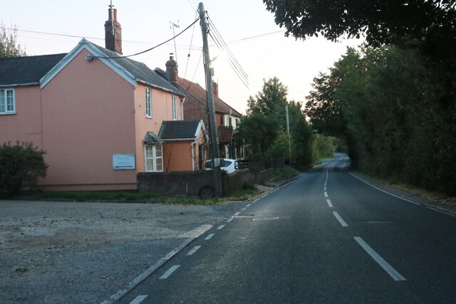
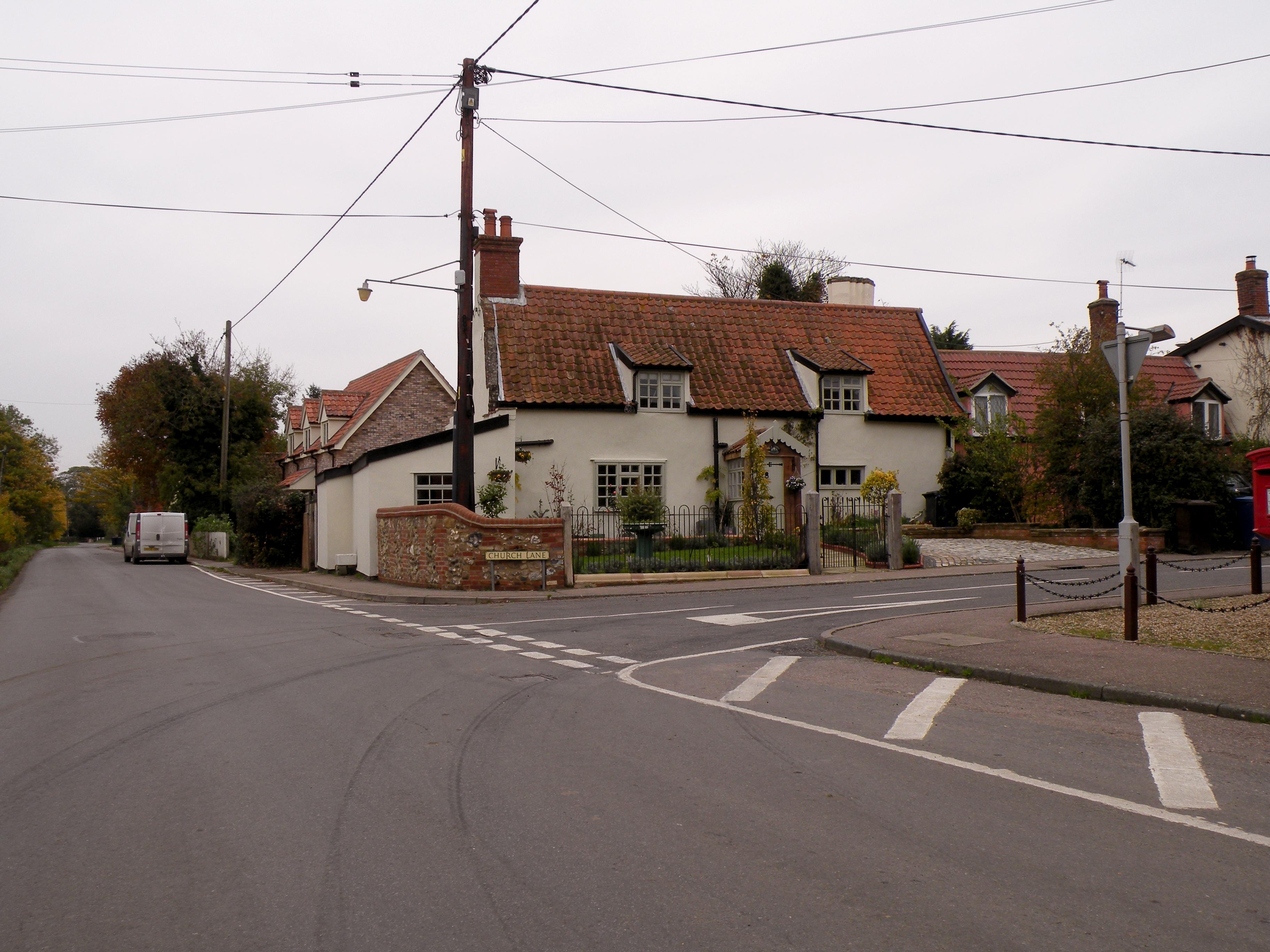
Stanton, Suffolk

Stanton is a village and civil parish in the West Suffolk district of Suffolk in eastern England, about nine miles north-east of Bury St Edmunds, on the...

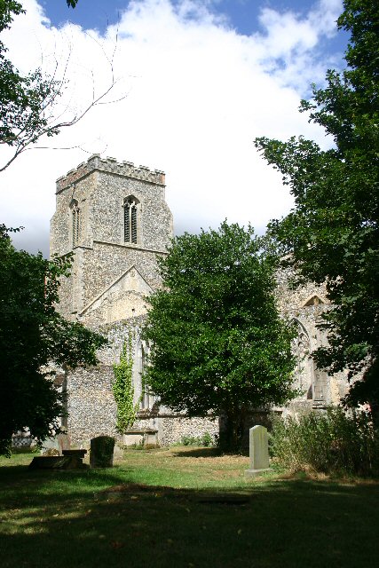
St John the Baptist's Church, Stanton

St John the Baptist's Church is a redundant Anglican church in the village of Stanton, Suffolk, England. It is recorded in the National Heritage List...

Hepworth, Suffolk

Hepworth is a village and civil parish in the West Suffolk district of the English county of Suffolk. Nearby settlements include the villages of Stanton...

Nearby Amenities

Located within 500m of 52.323,0.898
Bus Stop
Cafe
Naptan AtcoCode: 390050092
Naptan Bearing: W
Naptan CommonName: Cafe
Naptan Indicator: adj
Naptan Landmark: Cafe
Naptan NaptanCode: sufgdjap
Naptan Street: Grove Lane
Shelter: yes
Source: naptan_import
Lat/Long: 52.320727/0.9022853
Cafe
Naptan AtcoCode: 390051228
Naptan Bearing: E
Naptan BusStopType: CUS
Naptan CommonName: Cafe
Naptan Indicator: opp
Naptan Landmark: Cafe
Naptan NaptanCode: sufjtjmw
Naptan Street: Grove lane
Naptan Verified: no
Source: naptan_import
Lat/Long: 52.3209166/0.902146
Traffic Calming: bump
Lat/Long: 52.3252847/0.9014422
Traffic Calming: bump
Lat/Long: 52.3232298/0.8978387
Traffic Calming: bump
Lat/Long: 52.3256773/0.8981739
Traffic Calming: bump
Lat/Long: 52.3260081/0.8969158
Traffic Calming: bump
Lat/Long: 52.3239212/0.8968368
Addr Postcode: IP31 2AW
Addr Street: Upthorpe Road
Man Made: windmill
Source Addr: FSA Food Hygiene Ratings Database
Lat/Long: 52.3223951/0.8911412
Traffic Calming: bump
Lat/Long: 52.325388/0.8997135
Hall Farm
Place: farm
Lat/Long: 52.3234355/0.900096
Post Box
Collection Times: Mo-Fr 16:15; Sa 11:15
Post Box Type: lamp
Ref: IP31 2036
Royal Cypher: EIIR
Royal Cypher Wikidata: Q33102113
Lat/Long: 52.3207452/0.9022336
Fixme: incomplete
Lat/Long: 52.3203173/0.8972043
Traffic Calming: bump
Lat/Long: 52.3235404/0.896299
Traffic Calming: bump
Lat/Long: 52.3227298/0.8957036
Power: pole
Lat/Long: 52.3204788/0.8981672
Power: pole
Lat/Long: 52.3213387/0.8985883
Material: wood
Power: pole
Lat/Long: 52.3196009/0.8977327
Material: wood
Power: pole
Lat/Long: 52.3188368/0.897333
Give Way
Lat/Long: 52.3210936/0.8936343
The data included in this document is from www.openstreetmap.org. The data is made available under ODbL.

Have you been to Stanton Post Mill?

Leave your review of Stanton Post Mill below (or comments, questions and feedback).