Stanton Moor Edge

Heritage Site in Derbyshire Derbyshire Dales

England

Stanton Moor Edge

Path down from Stanton Moor
Path down from Stanton Moor Credit: David Lally

Stanton Moor Edge is a historic heritage site located in Derbyshire, England. Situated on the edge of Stanton Moor, this area holds great cultural and archaeological significance. The site is a designated Scheduled Monument and has been recognized for its outstanding natural beauty and historical importance.

The most notable feature of Stanton Moor Edge is the large collection of Bronze Age standing stones, known as the Nine Ladies Stone Circle. This ancient stone circle is believed to have been constructed around 4,000 years ago and is a popular attraction for visitors interested in prehistoric monuments. The circle consists of nine upright stones, each approximately 1.2 meters tall, arranged in a circular pattern. The purpose of the stone circle remains a mystery, with theories ranging from religious rituals to astronomical alignments.

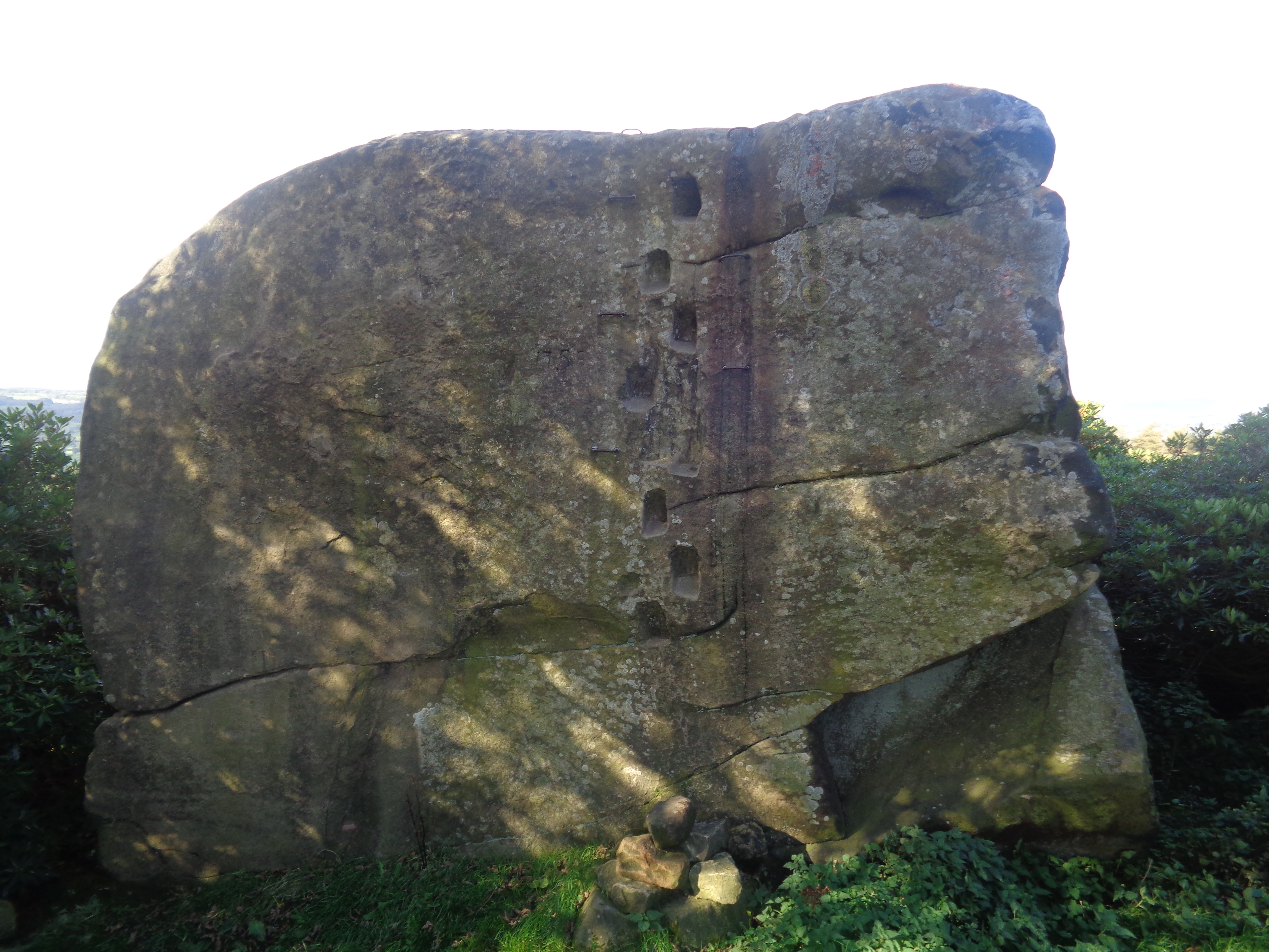
In addition to the stone circle, Stanton Moor Edge also contains several other archaeological features. These include burial cairns, embankments, and an ancient burial mound known as the Cork Stone. The area is rich in history, offering visitors a glimpse into the lives and practices of the people who lived here thousands of years ago.

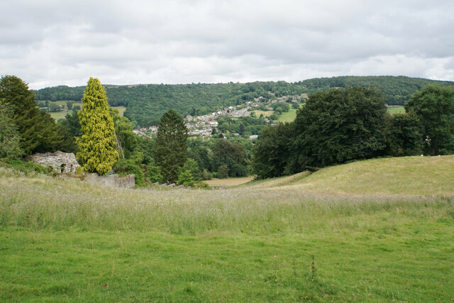
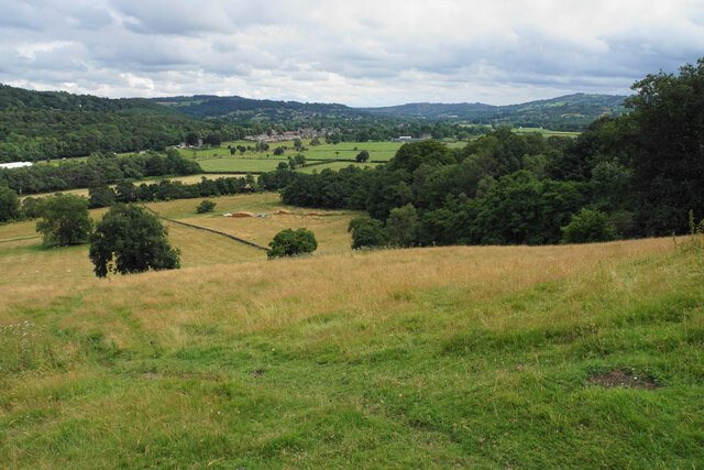
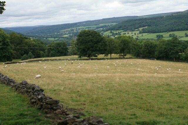
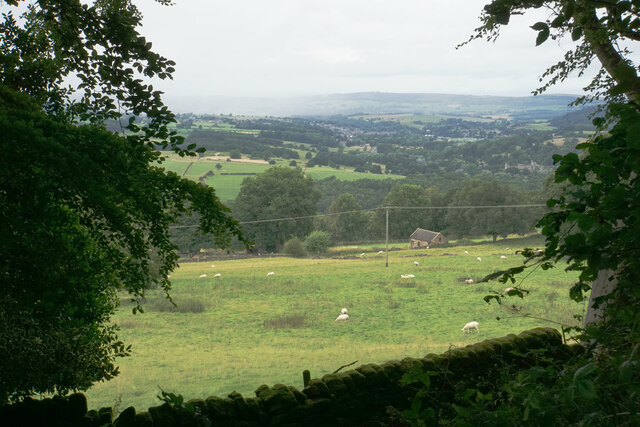
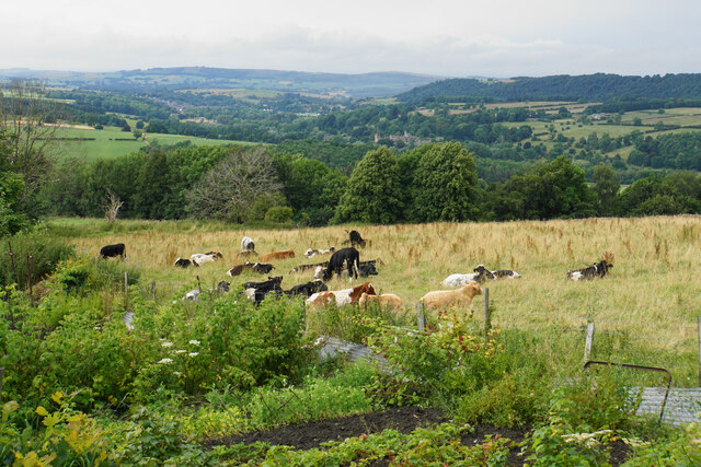
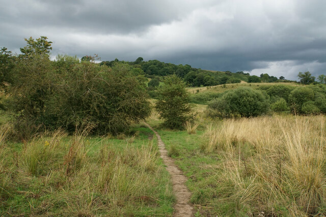
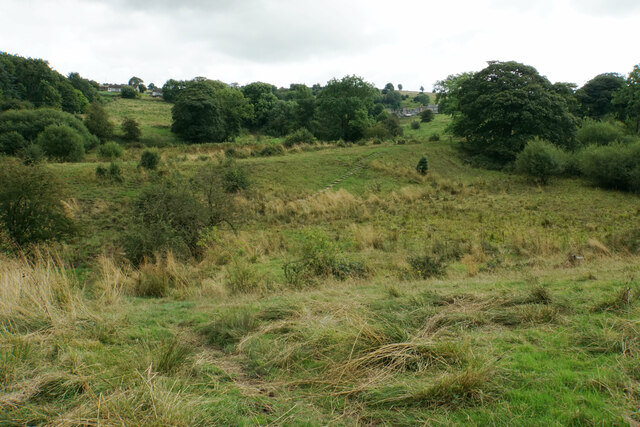
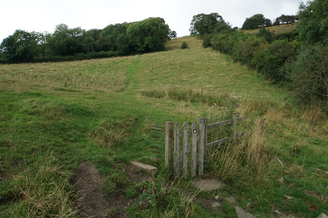
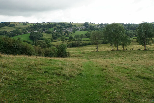
Aside from its historical significance, Stanton Moor Edge boasts breathtaking views of the surrounding countryside. The elevated position of the site provides panoramic vistas across the Peak District National Park, making it a popular spot for nature lovers and hikers.

Overall, Stanton Moor Edge is a remarkable heritage site that combines ancient history, natural beauty, and a sense of mystery. It offers visitors a unique opportunity to explore the remnants of a bygone era and appreciate the stunning landscapes of Derbyshire.

If you have any feedback on the listing, please let us know in the comments section below.

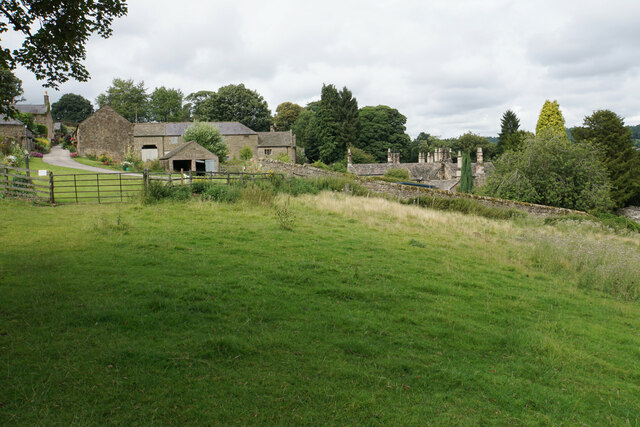
Stanton Moor Edge Images

Images are sourced within 2km of 53.162/-1.628 or Grid Reference SK2462. Thanks to Geograph Open Source API. All images are credited.

Path down from Stanton Moor
Leaning oak Wind-blown on Stanton Moor.
Leaning oak
Wind-blown on Stanton Moor.
Hillside below Stanton Woodhouse The western side of the Derwent valley. The village of Northwood is seen on the other side.
Hillside below Stanton Woodhouse
The western side of the Derwent valley. The village of Northwood is seen on the other side.
Stanton Woodhouse A manor house and farm in the Haddon estate.
Stanton Woodhouse
A manor house and farm in the Haddon estate.
Hillside above the Derwent valley A hillside near Stanton Woodhouse. The next visible community is Darley Dale.
Hillside above the Derwent valley
A hillside near Stanton Woodhouse. The next visible community is Darley Dale.
Sheep above Stanton Woodhouse Looking up the Derwent valley.
Sheep above Stanton Woodhouse
Looking up the Derwent valley.
Cottages in Stanton in Peak A long thin village climbing the hillside. A shower is passing a couple of miles to the north.
Cottages in Stanton in Peak
A long thin village climbing the hillside. A shower is passing a couple of miles to the north.
Field near Stanton in Peak A view from the top of the village, which is off to the left.
Field near Stanton in Peak
A view from the top of the village, which is off to the left.
Cottages in Stanton in Peak Near the bottom of the long thin village.
Cottages in Stanton in Peak
Near the bottom of the long thin village.
Field at Stanton in Peak Right at the bottom of the village.
Field at Stanton in Peak
Right at the bottom of the village.
Stanton in Peak From the bottom of the village looking up. The spire of Holy Trinity Church is seen but the village continues quite a long way past that.
Stanton in Peak
From the bottom of the village looking up. The spire of Holy Trinity Church is seen but the village continues quite a long way past that.
Stanton in Peak The village pub, the Flying Childers, is straight ahead, and the spire of Holy Trinity Church is behind.
Stanton in Peak
The village pub, the Flying Childers, is straight ahead, and the spire of Holy Trinity Church is behind.
Allotments and cattle at Stanton in Peak Looking down on the valley of the River Wye where Haddon Hall can be seen.
Allotments and cattle at Stanton in Peak
Looking down on the valley of the River Wye where Haddon Hall can be seen.
Path from Winster to Birchover Necessarily paved because the ground can be soggy. It is crossing rough grazing land which does not seem to be currently grazed.
Path from Winster to Birchover
Necessarily paved because the ground can be soggy. It is crossing rough grazing land which does not seem to be currently grazed.
Footpath to Winster It crosses an area of rough grazing with a propensity to be very soft when damp. It is fine in the summer months.
Footpath to Winster
It crosses an area of rough grazing with a propensity to be very soft when damp. It is fine in the summer months.
Path to Birchover It is necessary to climb up Birchover Edge.
Path to Birchover
It is necessary to climb up Birchover Edge.
Path to Winster The village of Winster is seen on the hill ahead.
Path to Winster
The village of Winster is seen on the hill ahead.
Fields near Birchover The village is seen in the background from this point on Birchover Edge.
Fields near Birchover
The village is seen in the background from this point on Birchover Edge.
Show me another place!

Stanton Moor Edge is located at Grid Ref: SK2462 (Lat: 53.162, Lng: -1.628)

Administrative County: Derbyshire

District: Derbyshire Dales

Police Authority: Derbyshire

What 3 Words

///skills.dress.shortens. Near Youlgreave, Derbyshire

Related Wikis

Stanton Moor

Stanton Moor is a small upland area in the Derbyshire Peak District of central northern England, lying between Matlock and Bakewell near the villages of...

Nine Ladies

The Nine Ladies is a stone circle located on Stanton Moor in Derbyshire in the English East Midlands. The Nine Ladies is part of a tradition of stone circle...

Andle Stone

The Andle Stone is a large gritstone boulder on Stanton Moor in Derbyshire. The stone block is 6m long, 4m high and lies within a low, circular, dry stone...

Doll Tor

Doll Tor is a stone circle located just to the west of Stanton Moor, near the village of Birchover, Derbyshire in the English East Midlands. Doll Tor is...

Old Millclose Mine

Old Millclose Mine was a lead mine near Wensley, in Derbyshire, England. The engine house of the mine survives as a ruin; it is a scheduled monument....

St Michael's Church, Birchover

St Michael's Church, Birchover, also known as Rowtor Chapel, is a Grade II listed parish church in the Church of England in Birchover, Derbyshire. Located...

Stanton Hall, Stanton in Peak

Stanton Hall is a privately owned country house at Stanton in Peak in the Derbyshire Peak District, the home of the Davie-Thornhill family. It is a Grade...

Holy Trinity Church, Stanton-in-Peak

Holy Trinity Church, Stanton-in-Peak is a Grade II listed parish church in the Church of England in Stanton in Peak, Derbyshire. == History == The church...

Nearby Amenities

Located within 500m of 53.162,-1.628
Parking
Description: A bit of rough ground north of the road
Lat/Long: 53.1592104/-1.6320175
Barrier: stile
Lat/Long: 53.1586106/-1.631521
Stanton Moor - a resource through the ages
Board Type: history
Information: board
Tourism: information
Lat/Long: 53.1599612/-1.6336547
T2 Bronze age cairn
Historic: archaeological_site
Lat/Long: 53.1616794/-1.6323868
T55 large cairn
Historic: archaeological_site
Lat/Long: 53.1647351/-1.6302126
Board Type: history
Information: board
Tourism: information
Lat/Long: 53.1611467/-1.630167
Cat Stone (EIN 1831)
Historic: archaeological_site
Lat/Long: 53.1657778/-1.6243056
Tourism: viewpoint
Lat/Long: 53.1608445/-1.6297466
T43 Ring cairn
Historic: archaeological_site
Lat/Long: 53.1626699/-1.6319205
Duchess of Sutherland Stone (HS 1830)
Historic: archaeological_site
Lat/Long: 53.1626181/-1.6265434
Place Of Worship
Ele: 194.0000000
Religion: christian
Lat/Long: 53.1639973/-1.6233195
Fixme: Seem to be obstructed by fence. Could not find gate or stile. Reproted to DCC for investigation.
Lat/Long: 53.159777/-1.6318895
Barrier: stile
Material: wood
Source: survey;bing;gps
Stile: stepover
Lat/Long: 53.1611307/-1.6301779
Stanton Moor
Ele: 323
Natural: peak
Lat/Long: 53.1627977/-1.6350449
Natural: stone
Lat/Long: 53.1609792/-1.6300039
Man Made: survey_point
Tpuk Ref: S4151
Lat/Long: 53.1627679/-1.6350091
Direction: 112
Tourism: viewpoint
Lat/Long: 53.1620969/-1.6267341
The data included in this document is from www.openstreetmap.org. The data is made available under ODbL.

Have you been to Stanton Moor Edge?

Leave your review of Stanton Moor Edge below (or comments, questions and feedback).