St Merin's Church

Heritage Site in Caernarfonshire

Wales

St Merin's Church

Porth Oer, or Whistling Sands A view from the north end of the beach which is claimed to be one of only two places in Europe where the shape of the sand particles produces a squeaking noise when walked upon.
Porth Oer, or Whistling Sands Credit: Peter Barr

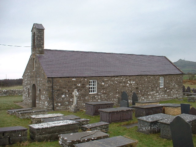
St Merin's Church, located in Caernarfonshire, is a historic heritage site that holds significant religious and architectural importance. Built in the 12th century, this church stands as a testament to the rich history and cultural heritage of the area.

The church is constructed using local stone and showcases a stunning combination of Romanesque and Gothic architectural styles. Its prominent features include a square tower, lancet windows, and a nave with a beautiful vaulted ceiling. The exterior is adorned with intricate carvings, displaying the craftsmanship of the medieval period.

Inside, visitors can admire the well-preserved medieval wall paintings that depict biblical scenes and saints. These paintings provide a glimpse into the religious practices and beliefs of the time. The church also houses a collection of ancient artifacts, including a 13th-century font and a medieval rood screen.

St Merin's Church has played a central role in the religious life of the local community for centuries. It continues to be an active place of worship, holding regular services and special events throughout the year. The churchyard surrounding the building is the final resting place for many generations of Caernarfonshire residents.

As a heritage site, St Merin's Church offers visitors a chance to step back in time and experience the rich history of the region. Its architectural beauty and historical significance make it a popular destination for tourists and history enthusiasts alike. It stands as a testament to the enduring legacy of faith and craftsmanship in Caernarfonshire.

If you have any feedback on the listing, please let us know in the comments section below.

St Merin's Church Images

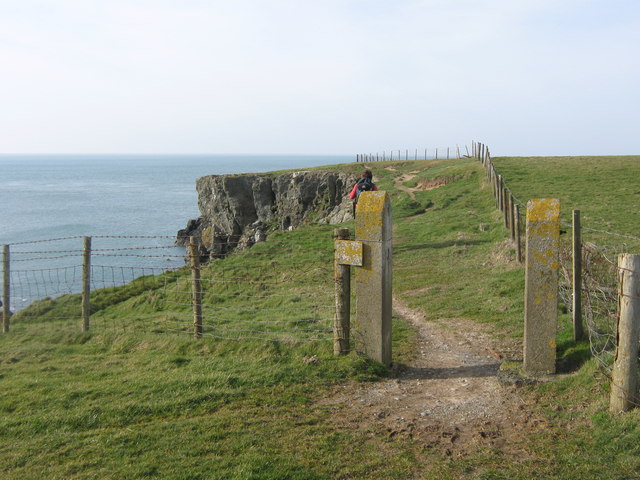
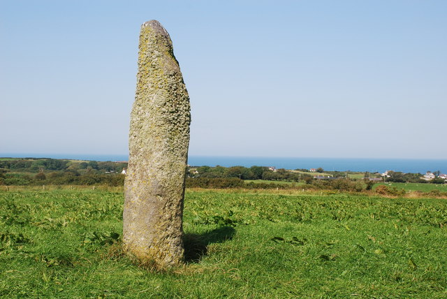
Images are sourced within 2km of 52.85/-4.71 or Grid Reference SH1731. Thanks to Geograph Open Source API. All images are credited.

Porth Oer, or Whistling Sands A view from the north end of the beach which is claimed to be one of only two places in Europe where the shape of the sand particles produces a squeaking noise when walked upon.
Porth Oer, or Whistling Sands
A view from the north end of the beach which is claimed to be one of only two places in Europe where the shape of the sand particles produces a squeaking noise when walked upon.
The Site of St Merin's Church The earthworks in the field are all that is left of the church.  Ty-mawr farm is in the distance.
The Site of St Merin's Church
The earthworks in the field are all that is left of the church. Ty-mawr farm is in the distance.
Ruined Agricultural Buildings, Methlem
Porth Oer....Whistling Sands, Llyn Peninsula, Wales Close to the village of Methlem and just under 3 miles from Aberdaron on the Llyn Peninsula, North Wales - Porth Oer is a small inlet off the Irish Sea that was once a busy port.
It is part of a National Trust estate.
Porth Oer is also known as Whistling Sands due to the unique sound it makes as you walk on the dry sand once the tide has receded. 
The sands (perfectly spherical silica crystals) really do squeak & whistle but it has to be at the right humidity and warm temperature - so don't expect it every time you visit.
The sound is produced by a combination of the unique shape of the sand particles and the pressure they are put under when stamping or sliding your feet on the sand.  This only occurs on two beaches in the whole of Europe. 
An ideal beach for surfing, body-boarding, or simply relaxing and enjoying some quiet time.  
Oh - and a coffee and maybe something to eat from the cafe by the beach (the chips are good!)  Food with a wonderful view!
Porth Oer....Whistling Sands, Llyn Peninsula, Wales
Close to the village of Methlem and just under 3 miles from Aberdaron on the Llyn Peninsula, North Wales - Porth Oer is a small inlet off the Irish Sea that was once a busy port. It is part of a National Trust estate. Porth Oer is also known as Whistling Sands due to the unique sound it makes as you walk on the dry sand once the tide has receded. The sands (perfectly spherical silica crystals) really do squeak & whistle but it has to be at the right humidity and warm temperature - so don't expect it every time you visit. The sound is produced by a combination of the unique shape of the sand particles and the pressure they are put under when stamping or sliding your feet on the sand. This only occurs on two beaches in the whole of Europe. An ideal beach for surfing, body-boarding, or simply relaxing and enjoying some quiet time. Oh - and a coffee and maybe something to eat from the cafe by the beach (the chips are good!) Food with a wonderful view!
A lane leaving Methlem
The former chapel at Rhydlios Built in 1904, it seems to have had a useful life of only 100 years or so. There is no sign of conversion, either of the chapel or of what I assume to be the incumbent's house (attached, on the right): both still appear derelict.
The former chapel at Rhydlios
Built in 1904, it seems to have had a useful life of only 100 years or so. There is no sign of conversion, either of the chapel or of what I assume to be the incumbent's house (attached, on the right): both still appear derelict.
North Wales WWII defences: Methlem Beach, Porth Oer - loopholed wall (1) -
Loopholed wall: EDoB ID: e35602

A wall with a single loop at the base and created with local rock, it effectively closed off the exit from the beach at this point. Previously identified from a distance as a buried type 26 pillbox, it has since been confirmed as a loopholed wall.

<a href="https://www.geograph.org.uk/photo/5410868">SH1630 : North Wales WWII defences: Methlem Beach, Porth Oer - loopholed wall (2)</a>
North Wales WWII defences: Methlem Beach, Porth Oer - loopholed wall (1)
- Loopholed wall: EDoB ID: e35602 A wall with a single loop at the base and created with local rock, it effectively closed off the exit from the beach at this point. Previously identified from a distance as a buried type 26 pillbox, it has since been confirmed as a loopholed wall. SH1630 : North Wales WWII defences: Methlem Beach, Porth Oer - loopholed wall (2)
North Wales WWII defences: Methlem Beach, Porth Oer - loopholed wall (2) -
Loopholed wall: EDoB ID: e35602

The wall partially blocks the footpath, and has an opening at the base that is assumed to be a firing position. The castellated top of local stone is often found on 'mini Welsh Castle' pillboxes.

<a href="https://www.geograph.org.uk/photo/5410874">SH1630 : North Wales WWII defences: Methlem Beach, Porth Oer - loopholed wall (3)</a>
North Wales WWII defences: Methlem Beach, Porth Oer - loopholed wall (2)
- Loopholed wall: EDoB ID: e35602 The wall partially blocks the footpath, and has an opening at the base that is assumed to be a firing position. The castellated top of local stone is often found on 'mini Welsh Castle' pillboxes. SH1630 : North Wales WWII defences: Methlem Beach, Porth Oer - loopholed wall (3)
North Wales WWII defences: Methlem Beach, Porth Oer - loopholed wall (3) -
Loopholed wall: EDoB ID: e35602

A close-up view of the wall with its castellated top.

<a href="https://www.geograph.org.uk/photo/5410860">SH1630 : North Wales WWII defences: Methlem Beach, Porth Oer - loopholed wall (1)</a>
North Wales WWII defences: Methlem Beach, Porth Oer - loopholed wall (3)
- Loopholed wall: EDoB ID: e35602 A close-up view of the wall with its castellated top. SH1630 : North Wales WWII defences: Methlem Beach, Porth Oer - loopholed wall (1)
Curious structure at Methlem Beach - Porth Oer (4) Just a few yards uphill above the wall and the footpath is another curiosity. I would welcome any suggestions as to what it might be. It appears to be included on a children's educational itinerary of the area (label attached to blue string on left).

Update: I have since discovered that this particular structure is an C18 lime kiln: <span class="nowrap"><a title="http://map.coflein.gov.uk/index.php?action=do_details&cache_name=cG5tcnNuYW1lLFBvcnRoIE9lcl9zZWFyY2h0eXBlLGFkdmFuY2VkX29yYQ==&numlink=420802#tabs-4" rel="nofollow ugc noopener" href="http://map.coflein.gov.uk/index.php?action=do_details&cache_name=cG5tcnNuYW1lLFBvcnRoIE9lcl9zZWFyY2h0eXBlLGFkdmFuY2VkX29yYQ==&numlink=420802#tabs-4">Link</a><img style="margin-left:2px;" alt="External link" title="External link - shift click to open in new window" src="https://s1.geograph.org.uk/img/external.png" width="10" height="10"/></span>
Curious structure at Methlem Beach - Porth Oer (4)
Just a few yards uphill above the wall and the footpath is another curiosity. I would welcome any suggestions as to what it might be. It appears to be included on a children's educational itinerary of the area (label attached to blue string on left). Update: I have since discovered that this particular structure is an C18 lime kiln: LinkExternal link
The classic view of Porth Iago from the Coast Path
Rocks and cliffs at Porth Iago
Looking in to Porth Iago from Dinas
Rocks at Dinas, Porth Iago Looking towards Maen Mellt (which translates as Lightning Rock).
Rocks at Dinas, Porth Iago
Looking towards Maen Mellt (which translates as Lightning Rock).
Maen Mellt seen from Dinas Maen Mellt translates as Lightning Rock.
Maen Mellt seen from Dinas
Maen Mellt translates as Lightning Rock.
The rocks and cliffs of Dyllborth
The Coast Path above Dyllborth
The grassland of Pen y Borth
Show me another place!

St Merin's Church is located at Grid Ref: SH1731 (Lat: 52.85, Lng: -4.71)

What 3 Words

///attaching.punk.shunning. Near Nefyn, Gwynedd

Nearby Locations

St Merin's Church

Related Wikis

Bodferin

Bodferin is a former civil parish in the Welsh county of Gwynedd. It was abolished in 1934, and incorporated into Aberdaron. == References ==

Llangwnnadl

Llangwnnadl is a village and former civil parish in the Welsh county of Gwynedd. The parish was abolished in 1934, and incorporated into Tudweiliog....

Aberdaron

Aberdaron is a community, electoral ward and former fishing village at the western tip of the Llŷn Peninsula in the Welsh county of Gwynedd. It lies 14...

Bryncroes

Bryncroes is a hamlet and former civil parish in Gwynedd in Wales, and lies on the Llŷn Peninsula approximately 2 km west of Sarn Meyllteyrn. The parish...

St Hywyn's Church, Aberdaron

The Church of St Hywyn, Aberdaron, Gwynedd, Wales, is a parish church dating from the 12th century. Its origins are earlier, as a clas church from the...

St Mary's Church, Penllech

St Mary's Church, Penllech, is a redundant church in the village of Penllech, Gwynedd, Wales. It is designated by Cadw as a Grade II* listed building...

Llanfaelrhys

Llanfaelrhys is a village and former civil parish in the Welsh county of Gwynedd, located on the Llŷn Peninsula. The parish was abolished in 1934 and...

Penllech

Penllech is a hamlet and former civil parish in the Welsh county of Gwynedd. The parish was abolished in 1934, and incorporated into Tudweiliog. ��2...

Nearby Amenities

Located within 500m of 52.85,-4.71
Vending Machine
Description: Payment for access to track / campsite.
Vending: parking_tickets
Lat/Long: 52.8488/-4.7165125
Power: pole
Source: bing
Lat/Long: 52.8532533/-4.715019
Power: pole
Source: bing
Lat/Long: 52.8513834/-4.716749
Power: pole
Source: bing
Lat/Long: 52.8503978/-4.716454
Power: pole
Source: bing
Lat/Long: 52.8495692/-4.7162005
Power: pole
Source: bing
Lat/Long: 52.8489424/-4.7160047
Power: pole
Source: bing
Lat/Long: 52.8486233/-4.7149614
Power: pole
Source: bing
Lat/Long: 52.8484183/-4.7142895
Power: pole
Source: bing
Lat/Long: 52.8480012/-4.7129148
Power: pole
Source: bing
Lat/Long: 52.8475995/-4.7116086
Power: pole
Source: bing
Lat/Long: 52.8472277/-4.7103895
Power: pole
Source: bing
Lat/Long: 52.8468041/-4.7089988
Power: pole
Source: bing
Lat/Long: 52.846387/-4.7076094
Man Made: utility_pole
Source: bing
Lat/Long: 52.8467401/-4.7080278
Man Made: utility_pole
Source: bing
Lat/Long: 52.8460225/-4.706794
Man Made: utility_pole
Source: bing
Lat/Long: 52.8461157/-4.707305
Man Made: utility_pole
Source: bing
Lat/Long: 52.8464996/-4.7075611
Man Made: utility_pole
Source: bing
Lat/Long: 52.8462955/-4.7111727
Man Made: utility_pole
Source: bing
Lat/Long: 52.8462606/-4.7106349
Man Made: utility_pole
Source: bing
Lat/Long: 52.8462072/-4.7096653
Man Made: utility_pole
Source: bing
Lat/Long: 52.8461424/-4.7089921
Man Made: utility_pole
Source: bing
Lat/Long: 52.8461019/-4.7084798
Man Made: utility_pole
Source: bing
Lat/Long: 52.8457706/-4.7088003
The data included in this document is from www.openstreetmap.org. The data is made available under ODbL.

Have you been to St Merin's Church?

Leave your review of St Merin's Church below (or comments, questions and feedback).