Spellow Hills

Heritage Site in Lincolnshire

England

Spellow Hills

The Hills of the Slain: Spellow Hills Long Barrow, near Langton-by-Partney, aerial 2021
The Hills of the Slain: Spellow Hills Long Barrow, near Langton-by-Partney, aerial 2021 Credit: Simon Tomson

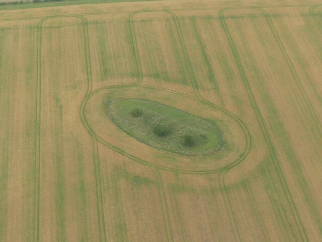
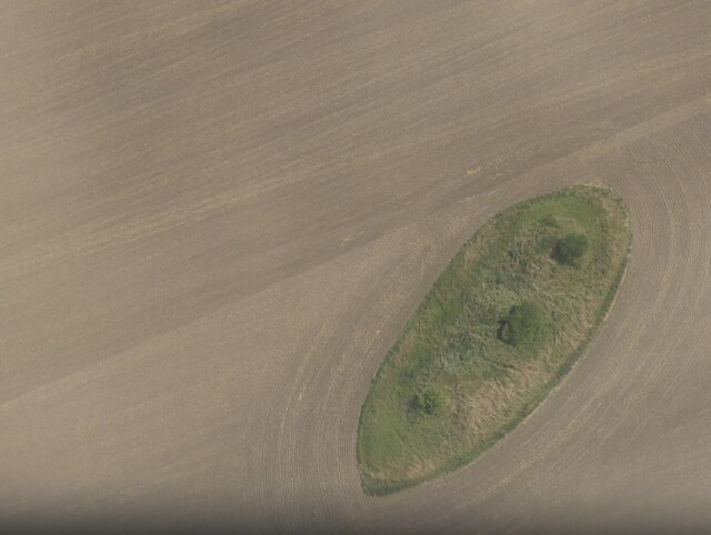
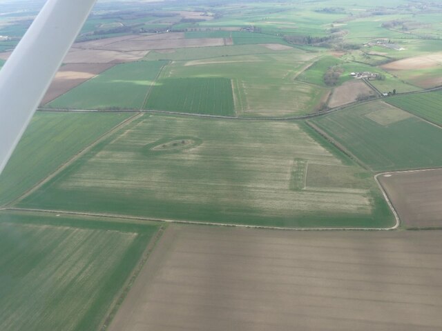
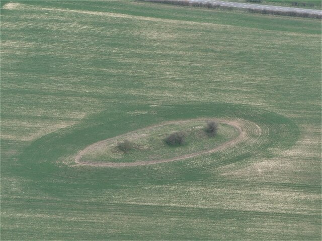
Spellow Hills in Lincolnshire is a designated heritage site that holds significant historical and cultural importance. This site is located near the village of Spalding and is known for its well-preserved ancient burial mounds, which date back to the Bronze Age. These burial mounds, also known as barrows, are believed to have been used as burial grounds for important individuals in the community during ancient times.

In addition to the burial mounds, Spellow Hills also contains remnants of ancient settlements, including traces of Iron Age roundhouses and other archaeological features. The site provides valuable insights into the lives and beliefs of the people who inhabited this area thousands of years ago.

Visitors to Spellow Hills can explore the site on foot and discover the rich history and heritage that is preserved within its boundaries. Interpretive signage and information boards provide visitors with additional context and information about the site's significance.

Overall, Spellow Hills in Lincolnshire is a fascinating heritage site that offers a glimpse into the ancient past of the region and provides a unique opportunity to connect with the history and culture of the area.

If you have any feedback on the listing, please let us know in the comments section below.

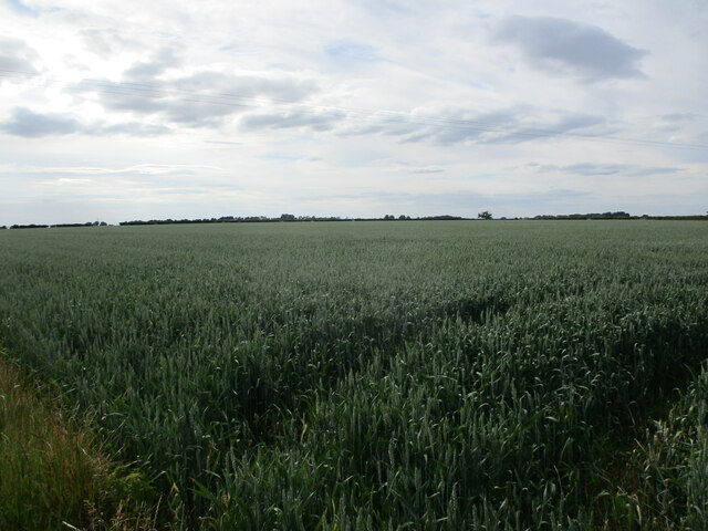
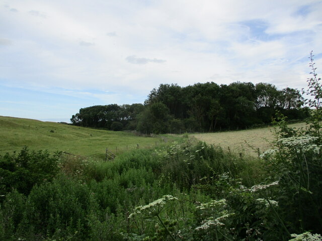
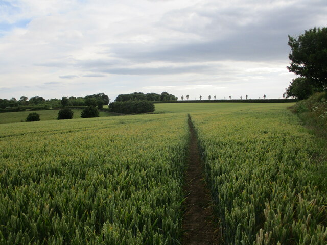
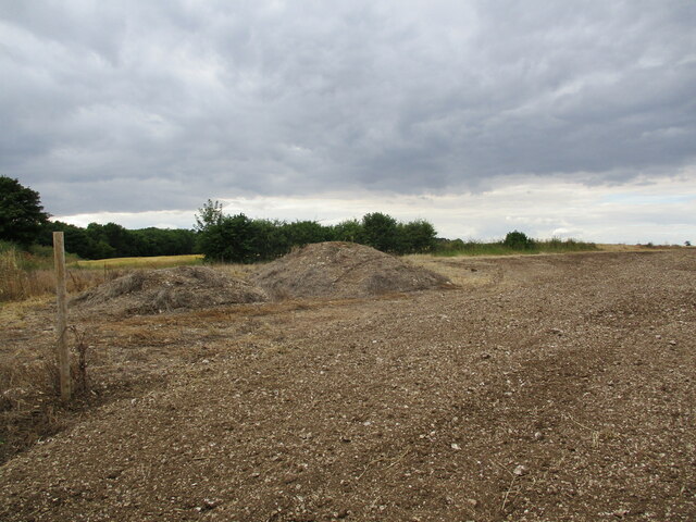
Spellow Hills Images

Images are sourced within 2km of 53.23/0.105 or Grid Reference TF4072. Thanks to Geograph Open Source API. All images are credited.

The Hills of the Slain: Spellow Hills Long Barrow, near Langton-by-Partney, aerial 2021
Spellow Hills Long Barrow, aka the Hills of the Slain: aerial 2021 See also <a href="https://www.geograph.org.uk/photo/5466404">TF4072 : Spellow Hills, near Langton-by-Partney: aerial 2017</a> and <a href="https://www.geograph.org.uk/photo/5466428">TF4072 : Spellow Hills long barrow, looking towards Langton: aerial 2017</a>.

Badly mutilated by antiquarian investigations of the nineteenth century, and was thus previously mistaken for a group of round barrows. 

The name 'Spellow Hills' is derived from the Old English 'spel' and 'hlaw' or 'haugr' which means 'assembly mound'. The earliest recorded instance of the name is in the early twelfth century. The barrow lies just below the crest of a gentle rise 200m to the west of the A16 which marks the boundary with Dalby parish. The land rises gently to a point 1.2km north where the wapentakes of Hill, Calcewath and Candleshoe and the parishes of Langton, Driby, Ulceby and Dalby meet <a href="https://www.geograph.org.uk/gridref/TF+406+733">TF 406 733</a>. From here there is an extensive view in all directions. It seems highly likely that this was a meeting place for the people from all three wapentakes rather than that of a single unit. 

See <span class="nowrap"><a title="https://www.heritagegateway.org.uk/Gateway/Results_Single.aspx?uid=MLI43619&resourceID=1006" rel="nofollow ugc noopener" href="https://www.heritagegateway.org.uk/Gateway/Results_Single.aspx?uid=MLI43619&resourceID=1006">Link</a><img style="margin-left:2px;" alt="External link" title="External link - shift click to open in new window" src="https://s1.geograph.org.uk/img/external.png" width="10" height="10"/></span>
Spellow Hills Long Barrow, aka the Hills of the Slain: aerial 2021
See also TF4072 : Spellow Hills, near Langton-by-Partney: aerial 2017 and TF4072 : Spellow Hills long barrow, looking towards Langton: aerial 2017. Badly mutilated by antiquarian investigations of the nineteenth century, and was thus previously mistaken for a group of round barrows. The name 'Spellow Hills' is derived from the Old English 'spel' and 'hlaw' or 'haugr' which means 'assembly mound'. The earliest recorded instance of the name is in the early twelfth century. The barrow lies just below the crest of a gentle rise 200m to the west of the A16 which marks the boundary with Dalby parish. The land rises gently to a point 1.2km north where the wapentakes of Hill, Calcewath and Candleshoe and the parishes of Langton, Driby, Ulceby and Dalby meet TF 406 733. From here there is an extensive view in all directions. It seems highly likely that this was a meeting place for the people from all three wapentakes rather than that of a single unit. See LinkExternal link
Farmland between Ulceby and Fordington: aerial 2021
Road near Ulceby Heading down to Skendelby Psalter.
Road near Ulceby
Heading down to Skendelby Psalter.
Barley field near Ulceby
Farm buildings. Ulceby Grange
Maize amidst the plastic The plastic will have protected the young plants.
Maize amidst the plastic
The plastic will have protected the young plants.
Wheat field near Ulceby
Overgrown drain and Low Plantation
Bridleway to Dalby The route is kept clear but not to the required width for a bridleway.
Bridleway to Dalby
The route is kept clear but not to the required width for a bridleway.
Route of the Viking Link Work here is complete after the installation of the Viking Link Interconnector joining the British and Danish electricity grids. <span class="nowrap"><a title="https://viking-link.com/" rel="nofollow ugc noopener" href="https://viking-link.com/">Link</a><img style="margin-left:2px;" alt="External link" title="External link - shift click to open in new window" src="https://s1.geograph.org.uk/img/external.png" width="10" height="10"/></span>
Route of the Viking Link
Work here is complete after the installation of the Viking Link Interconnector joining the British and Danish electricity grids. LinkExternal link
Spellow Hills Long Barrow: aerial 2023 (1) The Hills of the Slain: see <span class="nowrap"><a title="https://www.heritagegateway.org.uk/Gateway/Results_Single.aspx?uid=MLI43619&resourceID=1006" rel="nofollow ugc noopener" href="https://www.heritagegateway.org.uk/Gateway/Results_Single.aspx?uid=MLI43619&resourceID=1006">Link</a><img style="margin-left:2px;" alt="External link" title="External link - shift click to open in new window" src="https://s1.geograph.org.uk/img/external.png" width="10" height="10"/></span> and 
<a href="https://www.geograph.org.uk/photo/5466404">TF4072 : Spellow Hills, near Langton-by-Partney: aerial 2017</a>.
Spellow Hills Long Barrow: aerial 2023 (1)
Spellow Hills Long Barrow: aerial 2023 (2) The Hills of the Slain: see <span class="nowrap"><a title="https://www.heritagegateway.org.uk/Gateway/Results_Single.aspx?uid=MLI43619&resourceID=1006" rel="nofollow ugc noopener" href="https://www.heritagegateway.org.uk/Gateway/Results_Single.aspx?uid=MLI43619&resourceID=1006">Link</a><img style="margin-left:2px;" alt="External link" title="External link - shift click to open in new window" src="https://s1.geograph.org.uk/img/external.png" width="10" height="10"/></span> and 
<a href="https://www.geograph.org.uk/photo/5466404">TF4072 : Spellow Hills, near Langton-by-Partney: aerial 2017</a>.
Spellow Hills Long Barrow: aerial 2023 (2)
Cropmarks on field near Ulceby Cross: aerial 2023 Geological, but less easy to see is the National Grid Viking Link cable trench running from Sandilands to Bicker Fen. See: <a href="https://www.geograph.org.uk/photo/6830970">TF5379 : Viking Link cable run from Sandilands: aerial 2021</a>.
Cropmarks on field near Ulceby Cross: aerial 2023
Geological, but less easy to see is the National Grid Viking Link cable trench running from Sandilands to Bicker Fen. See: TF5379 : Viking Link cable run from Sandilands: aerial 2021.
Strawstack near Langton Grange Farm
Prepared field near Ulceby Cross
Farm track and strawstack near Langton Grange Farm
All Saints' church, Ulceby, Lincs. A lovely location for an unattractive red brick church of 1826. Inside, an octagonal Perpendicular font from the medieval church.
All Saints' church, Ulceby, Lincs.
A lovely location for an unattractive red brick church of 1826. Inside, an octagonal Perpendicular font from the medieval church.
Show me another place!

Spellow Hills is located at Grid Ref: TF4072 (Lat: 53.23, Lng: 0.105)

Division: Parts of Lindsey

What 3 Words

///shampoos.stay.cheaper. Near Alford, Lincolnshire

Nearby Locations

Spellow Hills

Related Wikis

Dexthorpe

Dexthorpe is a deserted medieval village in the East Lindsey district of Lincolnshire, England. It is in the parish of Dalby, and 3.5 miles (5.6 km) north...

Fordington, Lincolnshire

Fordington is a hamlet in the East Lindsey district of Lincolnshire in England. It is situated within Ulceby with Fordington civil parish. == References... ==

Ulceby with Fordington

Ulceby with Fordington is a civil parish in the East Lindsey district of Lincolnshire, England. The parish is situated 27 miles (43 km) east from the city...

Ulceby, East Lindsey

Ulceby is a village in the East Lindsey district of Lincolnshire in England. It is situated next to the A1028 road, 11 miles (18 km) east from Horncastle...

Related Videos

The Stables barn to holiday cottage conversion - Rigsby Wold Holiday Cottages, Lincolnshire

A 12 minute video showing the barn conversion we performed on an old disused barn dating from 1800s on our family farm in ...

Pheasant Holliday Cottage Rigsby, Alford, Lincolnshire Wolds UK

On our family farm we have 3 holiday cottages: Pheasant, Owl and Stables. This short video is about Pheasant - it is our first short ...

Off Road Wild Camp, Lincolnshire Wolds: 29th July 2023

Escaping The Matrix with an Off Road Wild Camp in Rigsby, on the edge of the Lincolnshire Wolds, an Area of Natural Beauty, ...

St John the Baptist, Sutterby. Patronal Celebration 2021

Spirit of Sutterby St John the Baptist, Sutterby Lincolnshire celebrating Patronal day 24th June 2021 - in words and song.

Nearby Amenities

Located within 500m of 53.23,0.105
Ele: 103
Lat/Long: 53.234219/0.1046897
Scotland Farm
Place: farm
Source: Bing
Lat/Long: 53.2343958/0.1060047
Spellow Hills
Place: locality
Source: Bing
Lat/Long: 53.2287557/0.0979619
Power: pole
Lat/Long: 53.2295762/0.1122878
Power: pole
Lat/Long: 53.2299738/0.1113744
Power: pole
Lat/Long: 53.2304857/0.1101984
Power: pole
Lat/Long: 53.2309971/0.1090236
Power: pole
Lat/Long: 53.231498/0.1078595
Power: pole
Lat/Long: 53.2319026/0.1033453
Power: pole
Lat/Long: 53.2320102/0.1066954
Power: pole
Lat/Long: 53.2320359/0.1038013
Power: pole
Lat/Long: 53.2320503/0.1023315
Power: pole
Lat/Long: 53.2322719/0.1009689
Power: pole
Lat/Long: 53.2324934/0.0996037
Power: pole
Lat/Long: 53.2325448/0.1054723
Power: pole
Lat/Long: 53.2333395/0.1061697
Power: pole
Lat/Long: 53.2339849/0.1064996
The data included in this document is from www.openstreetmap.org. The data is made available under ODbL.

Have you been to Spellow Hills ?

Leave your review of Spellow Hills below (or comments, questions and feedback).