Robin Hood's Butts

Heritage Site in Somerset

England

Robin Hood's Butts

Yarcombe: Stout Mill Looking south-south-west. There was a watermill here, amongst the farm buildings, powered by a leat tapping a tributary of the river Otter
Yarcombe: Stout Mill Credit: Martin Bodman

Robin Hood's Butts, located in Somerset, England, is a significant heritage site that holds historical and cultural importance. It is believed to be the location where the legendary figure Robin Hood, a heroic outlaw of English folklore, practiced his archery skills.

Situated near the village of Holford in the Quantock Hills, Robin Hood's Butts consists of a series of ancient mounds or earthworks. These mounds are thought to have been used as targets for archery practice during medieval times. The site offers stunning views of the surrounding countryside, adding to its appeal.

The origins of the name "Robin Hood's Butts" are somewhat unclear. One theory suggests that the term "butts" refers to the targets used in archery, while the association with Robin Hood may have been added later to enhance the site's allure. Nevertheless, the site's connection to the legendary figure has made it a popular destination for history enthusiasts and fans of Robin Hood's tales.

Visitors to Robin Hood's Butts can explore the mounds and imagine the archery skills that were honed in this very spot centuries ago. The site also provides an opportunity to immerse oneself in the natural beauty of the Quantock Hills, with its rolling landscapes and picturesque views.

As a heritage site, Robin Hood's Butts offers a glimpse into England's rich cultural past and the enduring legacy of Robin Hood. It serves as a reminder of the folklore and legends that have shaped the nation's history and continues to attract visitors who are intrigued by the tales of this iconic outlaw.

If you have any feedback on the listing, please let us know in the comments section below.

Robin Hood's Butts Images

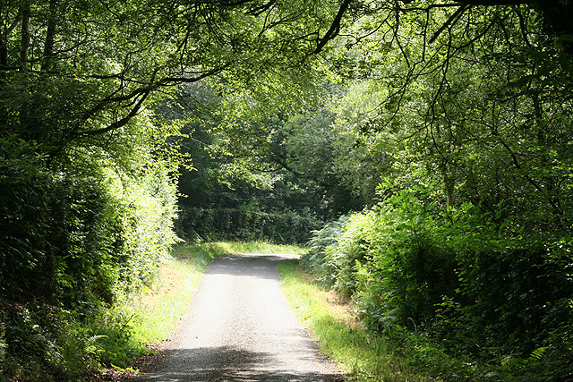
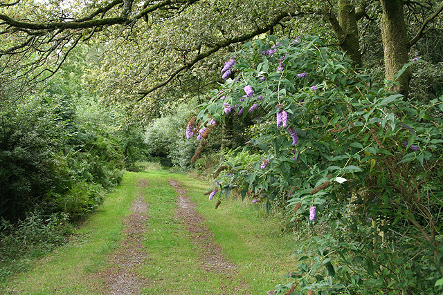
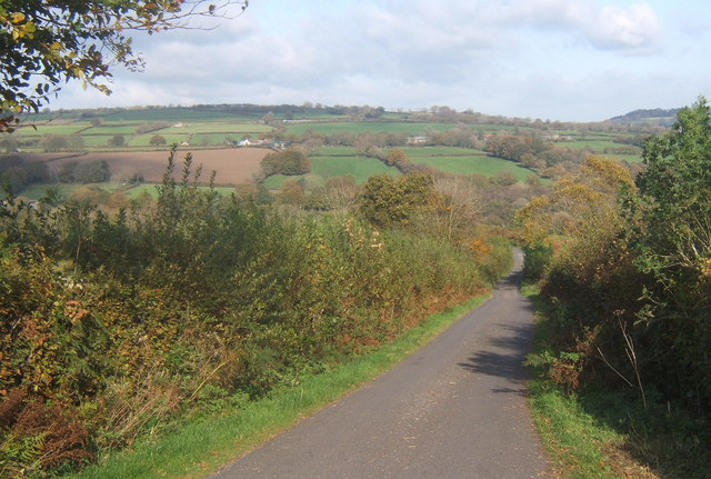
Images are sourced within 2km of 50.907/-3.088 or Grid Reference ST2312. Thanks to Geograph Open Source API. All images are credited.

Yarcombe: Stout Mill Looking south-south-west. There was a watermill here, amongst the farm buildings, powered by a leat tapping a tributary of the river Otter
Yarcombe: Stout Mill
Looking south-south-west. There was a watermill here, amongst the farm buildings, powered by a leat tapping a tributary of the river Otter
Yarcombe: copse by the lane to Fry’s Moor Overlooking the Otter valley; looking north west
Yarcombe: copse by the lane to Fry’s Moor
Overlooking the Otter valley; looking north west
Otterford: near Fry’s Moor Looking south west
Otterford: near Fry’s Moor
Looking south west
Otterford: Otterford Mill Now a private residence; once a working watermill serving Otterford parish. Looking east-south-east
Otterford: Otterford Mill
Now a private residence; once a working watermill serving Otterford parish. Looking east-south-east
Otterford: Christmas Farm At Birch Wood, looking east-north-east
Otterford: Christmas Farm
At Birch Wood, looking east-north-east
Otterford: bridleway to Owlhayes Looking north west along a track open to the public
Otterford: bridleway to Owlhayes
Looking north west along a track open to the public
Otterford: the B3170 near Brown Down Looking south in the Honiton direction by the turning to Otterford Mill. In the other direction the road runs to Taunton via Corfe
Otterford: the B3170 near Brown Down
Looking south in the Honiton direction by the turning to Otterford Mill. In the other direction the road runs to Taunton via Corfe
Otterford: near Royston Water Looking north on a public footpath leading to Otterford hamlet
Otterford: near Royston Water
Looking north on a public footpath leading to Otterford hamlet
Otterford: Robin Hood’s Butts A tumulus stands by the road to Churchingford with another by the wood beyond. Looking north-north-west
Otterford: Robin Hood’s Butts
A tumulus stands by the road to Churchingford with another by the wood beyond. Looking north-north-west
Otterford: crossroads at Robin Hood’s Butts The route from Bishopswood to Churchingford crosses the B3170 Honiton to Corfe and Taunton road here. Looking north west
Otterford: crossroads at Robin Hood’s Butts
The route from Bishopswood to Churchingford crosses the B3170 Honiton to Corfe and Taunton road here. Looking north west
Otterford: by Whatley Lane Looking south-south-east across a field adjoining the lane
Otterford: by Whatley Lane
Looking south-south-east across a field adjoining the lane
Buckland St Mary: by Madgeon Lane Looking north-north-west over rough pasture adjoining Madgeon Lane
Buckland St Mary: by Madgeon Lane
Looking north-north-west over rough pasture adjoining Madgeon Lane
Yarcombe: Clifthayne Farm The farm stands high up above the Yarty valley although just sheltered from the prevailing winds. Looking north east
Yarcombe: Clifthayne Farm
The farm stands high up above the Yarty valley although just sheltered from the prevailing winds. Looking north east
Yarcombe: triangulation pillar Looking south east. The spot height at the triangulation post is 258m
Yarcombe: triangulation pillar
Looking south east. The spot height at the triangulation post is 258m
Yarcombe: by Broadways Head Looking west near Brown Down
Yarcombe: by Broadways Head
Looking west near Brown Down
Yarcombe: towards Dennington Lane By Dennington Lane a side valley runs down to a confluence with the Otter below Stout Mill, where water from the stream once powered a waterwheel and machinery. Looking north-north-west from the B3170 Honiton to Corfe and Taunton road
Yarcombe: towards Dennington Lane
By Dennington Lane a side valley runs down to a confluence with the Otter below Stout Mill, where water from the stream once powered a waterwheel and machinery. Looking north-north-west from the B3170 Honiton to Corfe and Taunton road
Whatley Lane Descending into the valley of the River Yarty in the Blackdown Hills.
Whatley Lane
Descending into the valley of the River Yarty in the Blackdown Hills.
B3170 near the Drake Arms Gently curving past hedge backed by woodland.
B3170 near the Drake Arms
Gently curving past hedge backed by woodland.
Show me another place!

Robin Hood's Butts is located at Grid Ref: ST2312 (Lat: 50.907, Lng: -3.088)

What 3 Words

///served.protester.caveman. Near Chard, Somerset

Nearby Locations

Robin Hood's Butts

Related Wikis

Robin Hood's Butts

Robin Hood's Butts are a group of nine Bronze Age barrows near Otterford on the Blackdown Hills in Somerset, England. They have been scheduled as ancient...

Otterhead Lakes

Otterhead Lakes are a pair of reservoirs in the Blackdown Hills Area of Outstanding Natural Beauty south of Otterford in Somerset, England. They are fed...

Bishopswood Meadows

Bishopswood Meadows is a nature reserve situated within the Blackdown Hills Area of Outstanding Natural Beauty in the county of Somerset, England. The...

Church of St Leonard, Otterford

The Anglican Church of St Leonard in Otterford, Somerset, England was built in the 14th century. It is a Grade II* listed building. == History == The church...

Nearby Amenities

Located within 500m of 50.907,-3.088
Robin Hood's Butts
Archaeological Site: tumulus
Historic: archaeological_site
Lat/Long: 50.9095204/-3.0859787
Robin Hood's Butts
Archaeological Site: tumulus
Historic: archaeological_site
Lat/Long: 50.9066032/-3.0853151
The data included in this document is from www.openstreetmap.org. The data is made available under ODbL.

Have you been to Robin Hood's Butts ?

Leave your review of Robin Hood's Butts below (or comments, questions and feedback).