Robie's Knowe

Heritage Site in Orkney

Scotland

Robie's Knowe

Castlehill, Evie, Orkney The Ordnance Survey Name Book of 1879-80 describes Castlehill as a croft house.  At that time it had a thatched roof and was in good repair.  It was owned by a Dr Still.
Castlehill, Evie, Orkney Credit: Claire Pegrum

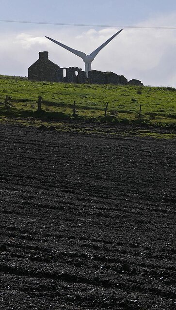
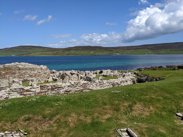
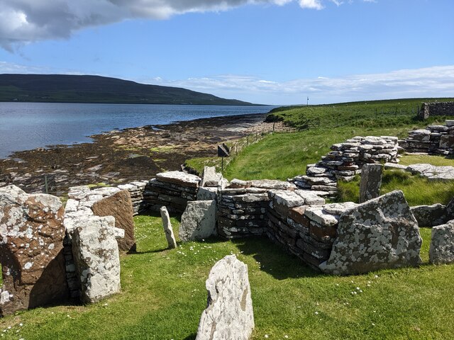
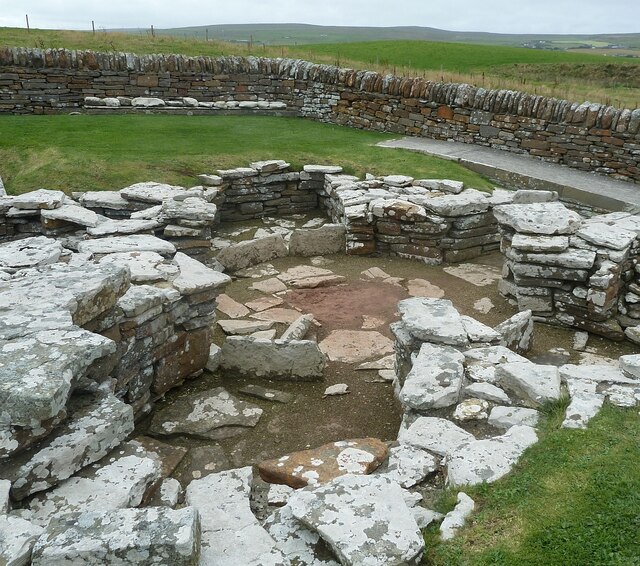
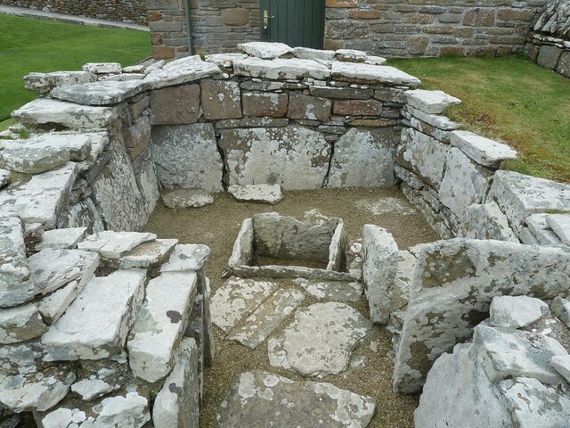
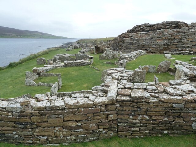
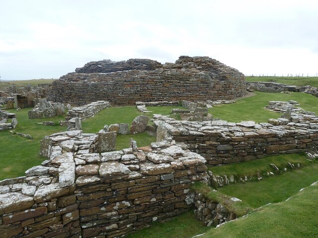
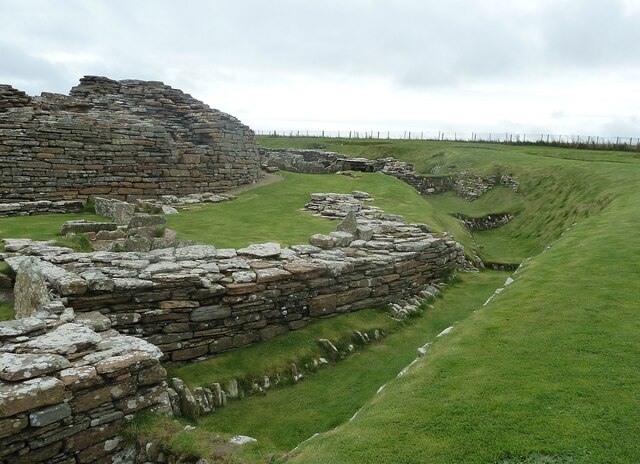
Robie's Knowe is a significant heritage site located in Orkney, a group of islands in Scotland. Situated on the island of Rousay, this ancient burial mound holds great archaeological and historical importance. Dating back to the Neolithic period, it is estimated to have been constructed around 3000 BC, making it one of the oldest surviving structures in the region.

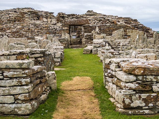
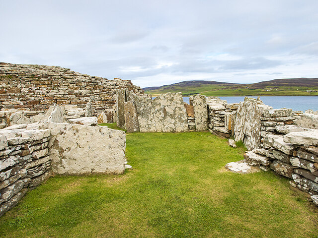
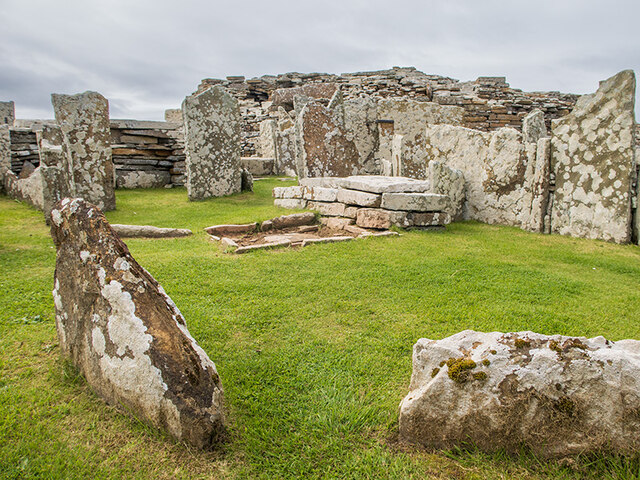
The mound stands at an impressive height of approximately 6 meters and has a diameter of 30 meters. Its unique design features a central chamber, accessible through a narrow passage. The chamber itself contains a collection of stone compartments, believed to have been used for burials and rituals. The structure's remarkable preservation has allowed archaeologists to gain valuable insights into the burial practices and beliefs of the people who lived during this era.

Robie's Knowe is also notable for its strategic location, offering breathtaking panoramic views of the surrounding landscape, including the neighboring islands of Egilsay and Wyre. This suggests that the site may have held some symbolic or ceremonial significance, serving as a focal point for the community.

As a designated heritage site, Robie's Knowe attracts visitors from around the world who come to marvel at its ancient architecture and learn about the history of the Orkney Islands. The site is carefully maintained by local authorities to ensure its preservation for future generations. Guided tours and information boards help visitors understand the significance of this remarkable Neolithic monument, offering a glimpse into the lives of our distant ancestors.

If you have any feedback on the listing, please let us know in the comments section below.

Robie's Knowe Images

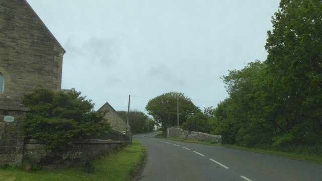
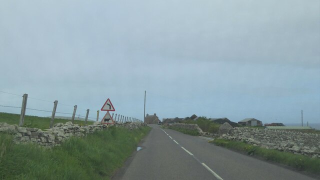
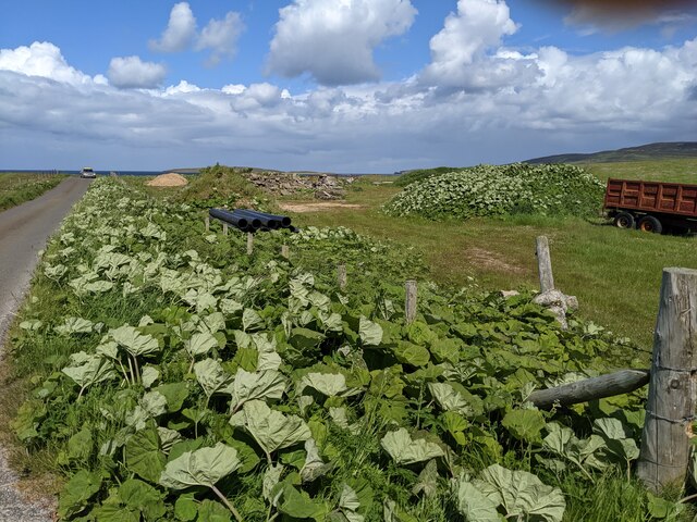
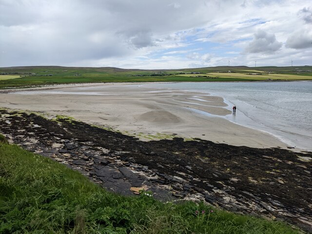
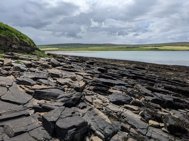
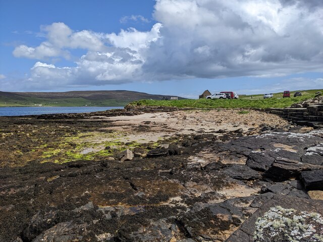
Images are sourced within 2km of 59.12/-3.11 or Grid Reference HY3626. Thanks to Geograph Open Source API. All images are credited.

Castlehill, Evie, Orkney The Ordnance Survey Name Book of 1879-80 describes Castlehill as a croft house.  At that time it had a thatched roof and was in good repair.  It was owned by a Dr Still.
Castlehill, Evie, Orkney
The Ordnance Survey Name Book of 1879-80 describes Castlehill as a croft house. At that time it had a thatched roof and was in good repair. It was owned by a Dr Still.
Entrance to the Broch of Gurness The broch is surrounded by the stonework of neolithic dwellings.
Entrance to the Broch of Gurness
The broch is surrounded by the stonework of neolithic dwellings.
Neolithic dwellings at the Broch of Gurness Looking across Eynhallow Sound to Rousay.
Neolithic dwellings at the Broch of Gurness
Looking across Eynhallow Sound to Rousay.
Neolithic dwellings at the Broch of Gurness
A966 at Evie, Orkney
A966 at Georth, Orkney
A966 by Burgar House, Orkney
A vegetated verge by the storage area
Two figures on the Sands of Evie
Shattered sandstone slabs at the Point of Hellia
Sand and slabs below the car park
The wall and ditch of the Broch of Gurness
The complex interior of the Broch of Gurness With Eynhallow Sound in the background.
The complex interior of the Broch of Gurness
With Eynhallow Sound in the background.
Broch of Gurness - Ancillary building - foundations These foundations belong to an ancillary building on the western edge of the Broch of Gurness site near to the (modern) reception building. They are roughly circular in shape and probably belong to the Viking period of around 500AD as opposed to the Broch itself which is around a thousand years older.
See also shared description below:
Broch of Gurness - Ancillary building - foundations
These foundations belong to an ancillary building on the western edge of the Broch of Gurness site near to the (modern) reception building. They are roughly circular in shape and probably belong to the Viking period of around 500AD as opposed to the Broch itself which is around a thousand years older. See also shared description below:
Broch of Gurness - Ancillary building with cist-like chamber This building is near to the entrance to the Broch of Gurness site. The most interesting feature of this structure is the stone-lined 'box' in the midst of it. It looks like a cist (see shared description below) but may have actually been for storage or some other purpose.
Broch of Gurness - Ancillary building with cist-like chamber
This building is near to the entrance to the Broch of Gurness site. The most interesting feature of this structure is the stone-lined 'box' in the midst of it. It looks like a cist (see shared description below) but may have actually been for storage or some other purpose.
Broch of Gurness - Northern aspect Looking from near to <a href="https://www.geograph.org.uk/photo/7561702">HY3826 : Broch of Gurness - Ancillary building with cist-like chamber</a> eastwards along the northern side of the Broch of Gurness complex with the coast along Eynhallow Sound to the left.
Broch of Gurness - Northern aspect
Looking from near to HY3826 : Broch of Gurness - Ancillary building with cist-like chamber eastwards along the northern side of the Broch of Gurness complex with the coast along Eynhallow Sound to the left.
Broch of Gurness - Site from the west Looking from near to the entrance to the Broch of Gurness site (but on the opposite side to the entrance to the broch itself) directly eastwards with the central mound of the broch directly ahead. The Pictish/Iron Age broch is the oldest known part of the site with the mainly Viking "village" having grown up around it.
See shared descriptions below for more information and links:
Broch of Gurness - Site from the west
Looking from near to the entrance to the Broch of Gurness site (but on the opposite side to the entrance to the broch itself) directly eastwards with the central mound of the broch directly ahead. The Pictish/Iron Age broch is the oldest known part of the site with the mainly Viking "village" having grown up around it. See shared descriptions below for more information and links:
Broch of Gurness - View along southern aspect with ditch There are several ditches which surround the central Pictish/Iron Age broch at the Broch of Gurness site with the Viking village interspersed among them. This view is along the mid-southern section of the site, there is a further outer ditch beyond this one.
Broch of Gurness - View along southern aspect with ditch
There are several ditches which surround the central Pictish/Iron Age broch at the Broch of Gurness site with the Viking village interspersed among them. This view is along the mid-southern section of the site, there is a further outer ditch beyond this one.
Show me another place!

Robie's Knowe is located at Grid Ref: HY3626 (Lat: 59.12, Lng: -3.11)

Unitary Authority: Orkney Islands

Police Authority: Highlands and Islands

What 3 Words

///clicker.sparkle.twilight. Near Evie, Orkney Islands

Related Wikis

Aikerness Bay

Aikerness Bay is an embayment of Eynhallow Sound on the northwest coast of Mainland Orkney, Scotland. The headlands of Point of Hellia at the east and...

Sands of Evie

The Sands of Evie is a sandy beach landform near the village of Evie on Mainland Orkney, Scotland, protected by the Point of Hellia headland. This beach...

Evie, Orkney

Evie (pronounced ) is a parish and village on Mainland, Orkney, Scotland. The parish is located in the north-west of the Mainland, between Birsay and Rendall...

Point of Hellia

The Point of Hellia is a headland on the northwest coast of the Orkney Mainland, Scotland. This landform extends into the southern part of Eynhallow Sound...

Nearby Amenities

Located within 500m of 59.12,-3.11
Power: pole
Lat/Long: 59.1173546/-3.1161711
Power: pole
Lat/Long: 59.1175912/-3.1157959
Power: pole
Lat/Long: 59.1167435/-3.11297
Power: pole
Lat/Long: 59.1164499/-3.1134912
Power: pole
Lat/Long: 59.116161/-3.1139985
Generator Method: photovoltaic
Generator Output Electricity: yes
Generator Source: solar
Generator Type: solar_photovoltaic_panel
Power: generator
Lat/Long: 59.1174789/-3.1153582
Generator Method: photovoltaic
Generator Output Electricity: yes
Generator Source: solar
Generator Type: solar_photovoltaic_panel
Power: generator
Lat/Long: 59.1175217/-3.1153288
The data included in this document is from www.openstreetmap.org. The data is made available under ODbL.

Have you been to Robie's Knowe?

Leave your review of Robie's Knowe below (or comments, questions and feedback).