Middleton

Settlement in Yorkshire

England

Middleton

Common Lane Allotments, East Ardsley
Common Lane Allotments, East Ardsley Credit: habiloid

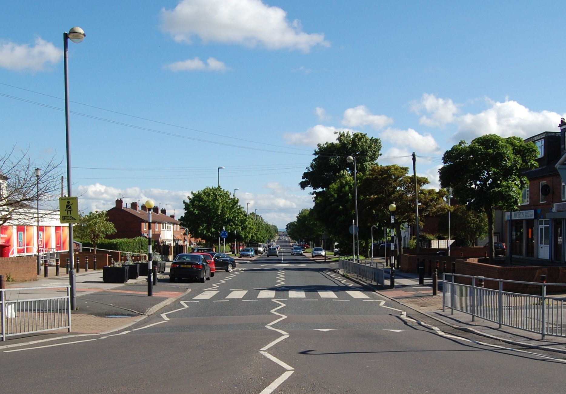
Middleton is a small village located in the heart of Yorkshire, England. Situated in the Ryedale district, it is nestled amidst picturesque countryside and is known for its natural beauty and charming rural appeal. With a population of around 500 residents, Middleton offers a peaceful and serene atmosphere, perfect for those seeking tranquility away from the hustle and bustle of city life.

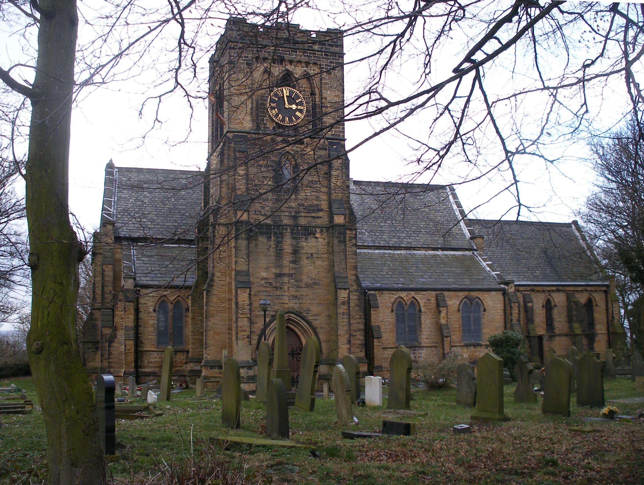
The village is steeped in history, with evidence of human habitation dating back to the Roman times. The ruins of a Roman villa can still be found in the surrounding area, attracting history enthusiasts from far and wide. Middleton is also home to the All Saints' Church, a magnificent medieval structure that has stood for centuries, serving as a reminder of the village's rich heritage.

Nature lovers are drawn to Middleton for its stunning landscapes and ample outdoor recreational opportunities. The village is surrounded by rolling hills, lush green meadows, and idyllic woodland, making it an ideal destination for hiking, cycling, and horse riding. The nearby River Dove offers fishing enthusiasts a chance to catch trout and salmon, adding to the village's charm.

Despite its small size, Middleton boasts a close-knit community that takes pride in organizing various events and activities throughout the year. These include village fairs, music festivals, and sports competitions, fostering a sense of camaraderie among residents and visitors alike.

With its historic significance, breathtaking scenery, and vibrant community spirit, Middleton, Yorkshire offers a delightful escape into the countryside, providing a sanctuary for those seeking a slower pace of life and a chance to immerse themselves in nature's beauty.

If you have any feedback on the listing, please let us know in the comments section below.
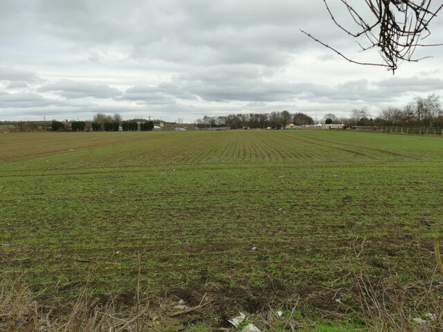
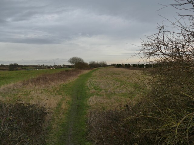
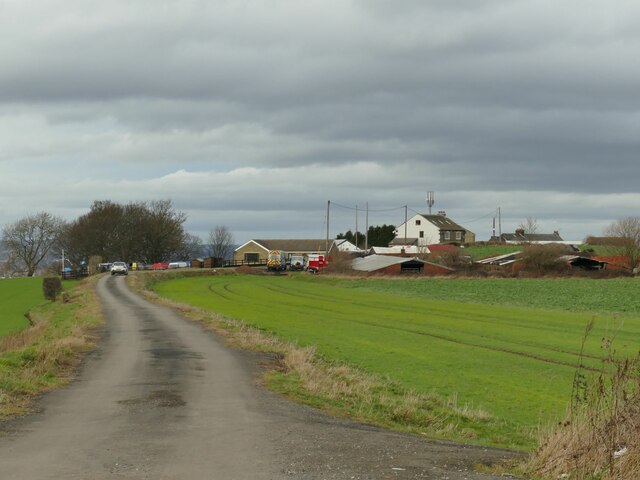
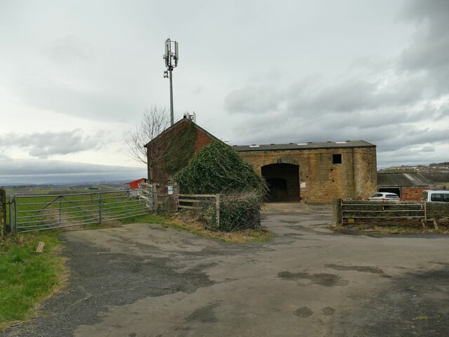
Middleton Images

Images are sourced within 2km of 53.743136/-1.554193 or Grid Reference SE2927. Thanks to Geograph Open Source API. All images are credited.

Common Lane Allotments, East Ardsley
Common Lane, East Ardsley A close-up of the post box can be seen in <a href="https://www.geograph.org.uk/photo/7687397">SE3026 : Post box, Common Lane, East Ardsley</a>.
Common Lane, East Ardsley
A close-up of the post box can be seen in SE3026 : Post box, Common Lane, East Ardsley.
Post box, Common Lane, East Ardsley This post box can be seen in context in <a href="https://www.geograph.org.uk/photo/7687395">SE3026 : Common Lane, East Ardsley</a>.
Post box, Common Lane, East Ardsley
This post box can be seen in context in SE3026 : Common Lane, East Ardsley.
Houses, Common Lane, East Ardsley
Common Lane, East Ardsley
Station Lane crossing the railway, East Ardsley
The railway seen from Station Lane, East Ardsley
Crop field off Thorpe Lane Probably a cereal crop, but the shoots are too small at this time in the year to tell which.
Crop field off Thorpe Lane
Probably a cereal crop, but the shoots are too small at this time in the year to tell which.
Course of former railway east of Dunningley Lane Old maps show a four-track line in a shallow cutting here, which was the Great Northern's line branching off the Leeds main line and serving Bradford and Shipley via Laisterdayke. It would probably have been used mainly by goods trains; Tingley station was a short way west of here, but closed in 1954. The cutting has been filled in to ground level, but surprisingly the surface has not been turned to agricultural use and there is an unofficial footpath along the route.
Course of former railway east of Dunningley Lane
Old maps show a four-track line in a shallow cutting here, which was the Great Northern's line branching off the Leeds main line and serving Bradford and Shipley via Laisterdayke. It would probably have been used mainly by goods trains; Tingley station was a short way west of here, but closed in 1954. The cutting has been filled in to ground level, but surprisingly the surface has not been turned to agricultural use and there is an unofficial footpath along the route.
Dunningley Lane The single-track road is shown as a public footpath along its full length, so probably a private one as far as motor traffic is concerned. A locked gate across it beyond the group of houses in the distance prevents through traffic to the A653 anyway.
Dunningley Lane
The single-track road is shown as a public footpath along its full length, so probably a private one as far as motor traffic is concerned. A locked gate across it beyond the group of houses in the distance prevents through traffic to the A653 anyway.
Saxton Cottage, Dunningley Lane The name is explained by a plaque on the wall of the house claiming that Christopher Saxton, cartographer to Elizabeth I, was born in 1542 on or near this site. His Wikipedia entry, however, says that Saxton was probably born in Sowood near Ossett but later moved to Dunningley. The present house is modern.
Saxton Cottage, Dunningley Lane
The name is explained by a plaque on the wall of the house claiming that Christopher Saxton, cartographer to Elizabeth I, was born in 1542 on or near this site. His Wikipedia entry, however, says that Saxton was probably born in Sowood near Ossett but later moved to Dunningley. The present house is modern.
Old house at Dunningley Hill One of only a handful of properties comprising the hamlet of Dunningley Hill, this one has a datestone of 1773 <a href="https://www.geograph.org.uk/photo/7413538">SE2827 : Old house at Dunningley Hill - datestone</a> but is not listed.
Old house at Dunningley Hill
One of only a handful of properties comprising the hamlet of Dunningley Hill, this one has a datestone of 1773 SE2827 : Old house at Dunningley Hill - datestone but is not listed.
Old house at Dunningley Hill - datestone A datestone of 1773, see <a href="https://www.geograph.org.uk/photo/7413537">SE2827 : Old house at Dunningley Hill</a> for context.
Old house at Dunningley Hill - datestone
A datestone of 1773, see SE2827 : Old house at Dunningley Hill for context.
Old barn at Dunningley Hill A stone-built, L-shaped barn. contrast with <a href="https://www.geograph.org.uk/photo/7413543">SE2827 : New barn at Dunningley Hill</a>.
Old barn at Dunningley Hill
A stone-built, L-shaped barn. contrast with SE2827 : New barn at Dunningley Hill.
New barn at Dunningley Hill An open-fronted structure of steel frame and corrugated roof. Contrast with <a href="https://www.geograph.org.uk/photo/7413540">SE2827 : Old barn at Dunningley Hill</a>.
New barn at Dunningley Hill
An open-fronted structure of steel frame and corrugated roof. Contrast with SE2827 : Old barn at Dunningley Hill.
Crop field at Dunningley Hill I think either cabbage or kale.
Crop field at Dunningley Hill
I think either cabbage or kale.
Power lines at Dunningley Hill A pair of medium-voltage (11kV?) lines across a field.
Power lines at Dunningley Hill
A pair of medium-voltage (11kV?) lines across a field.
Show me another place!

Middleton is located at Grid Ref: SE2927 (Lat: 53.743136, Lng: -1.554193)

Division: West Riding

Unitary Authority: Leeds

Police Authority: West Yorkshire

What 3 Words

///catch.daring.signal. Near Morley, West Yorkshire

Nearby Locations

Middleton Sissons Wood

Related Wikis

Middleton, Leeds

Middleton is a largely residential suburb of Leeds in West Yorkshire, England and historically a village in the West Riding of Yorkshire. It is situated...

St Cross Church, Middleton

The Church of St Cross is in Middleton, Leeds, West Yorkshire, England. It is an active Anglican church and part of the Armley deanery in the archdeaconry...

St Mary the Virgin's Church, Middleton

The Church of St Mary the Virgin in Middleton, West Yorkshire, England is an active Anglican parish church in the Armley deanery in the archdeaconry of...

Tingley railway station

Tingley railway station served the settlement of Tingley, West Yorkshire, England, from 1857 to 1966 on the Leeds, Bradford and Halifax Junction Railway...

Nearby Amenities

Located within 500m of 53.743136,-1.554193
Traffic Calming: table
Lat/Long: 53.7461271/-1.5511935
Mini Roundabout
Lat/Long: 53.7417601/-1.5476319
Mini Roundabout
Lat/Long: 53.743802/-1.547703
Middleton
Is In: Leeds, West Yorkshire, United Kingdom
Place: suburb
Wikidata: Q6841985
Wikipedia: en:Middleton, Leeds
Lat/Long: 53.7431373/-1.5503178
Turning Circle
Lat/Long: 53.7397181/-1.5531598
Post Box
Brand: Royal Mail
Brand Wikidata: Q638098
Brand Wikipedia: en:Royal Mail
Operator: Royal Mail
Operator Wikidata: Q638098
Post Box Type: pillar
Ref: LS10 52
Royal Cypher: EIIR
Royal Cypher Wikidata: Q33102113
Lat/Long: 53.7462877/-1.5571315
Noexit: yes
Lat/Long: 53.7455807/-1.5559101
Fast Food
Hoang Phuong
Addr City: Leeds
Addr Housenumber: 22
Addr Postcode: LS10 4LA
Addr Street: Sissons Avenue
Cuisine: chinese
Fhrs Id: 650680
Lat/Long: 53.7445602/-1.5508686
Sissons Stores
Addr City: Leeds
Addr Housenumber: 24-26
Addr Postcode: LS10 4LA
Addr Street: Sissons Avenue
Fhrs Id: 801125
Shop: supermarket
Lat/Long: 53.7445699/-1.5506234
Telephone
Booth: KX300
Covered: booth
Lat/Long: 53.7446507/-1.5504233
Turning Circle
Lat/Long: 53.743371/-1.5520589
Turning Circle
Lat/Long: 53.7420953/-1.5520881
Premier Bhambra Convenience Store
Addr City: Leeds
Addr Housenumber: 93-95
Addr Postcode: LS10 4JD
Addr Street: Throstle Lane
Brand: Premier
Brand Wikidata: Q7240340
Brand Wikipedia: en:Premier Stores
Shop: convenience
Website: https://www.premier-stores.co.uk/our-stores/kps-local
Lat/Long: 53.7415875/-1.5497046
Post Box
Brand: Royal Mail
Brand Wikidata: Q638098
Brand Wikipedia: en:Royal Mail
Operator: Royal Mail
Operator Wikidata: Q638098
Post Box Type: pillar
Ref: LS10 519
Royal Cypher: GR
Royal Cypher Wikidata: Q33102273
Lat/Long: 53.7416773/-1.5499865
Priority: backward
Traffic Calming: choker
Lat/Long: 53.7410256/-1.5476063
Bus Stop
Bodmin Road Padstow Place
Bus: yes
Local Ref: 45010003
Naptan AtcoCode: 450010003
Naptan Bearing: N
Naptan CommonName: Bodmin Road Padstow Place
Naptan Crossing: Padstow Place
Naptan Indicator: Stop 45010003
Naptan Landmark: Unknown
Naptan PlusbusZoneRef: LEEDS
Naptan ShortCommonName: Padstow Place
Naptan Street: Bodmin Road
Naptan Verified: no
Public Transport: platform
Source: naptan_import
Lat/Long: 53.7464151/-1.5574032
Bus Stop
Bodmin Crescent Sissons Terrace
Bus: yes
Local Ref: 45010004
Naptan AtcoCode: 450010004
Naptan Bearing: SW
Naptan CommonName: Bodmin Crescent Sissons Terrace
Naptan Crossing: Sissons Terrace
Naptan Indicator: Stop 45010004
Naptan Notes: New TF shelter installed on 8/11/07.
Naptan PlusbusZoneRef: LEEDS
Naptan ShortCommonName: Sissons Terrace
Naptan Street: Bodmin Crescent
Naptan Verified: no
Public Transport: platform
Source: naptan_import
Lat/Long: 53.7451118/-1.5549757
Bus Stop
Middleton Park Avenue Throstle Lane
Bus: yes
Local Ref: 45010013
Naptan AtcoCode: 450010013
Naptan Bearing: N
Naptan CommonName: Middleton Park Avenue Throstle Lane
Naptan Crossing: Throstle Lane
Naptan Indicator: Stop 45010013
Naptan Landmark: Middleton Primary School
Naptan PlusbusZoneRef: LEEDS
Naptan ShortCommonName: Throstle Lane
Naptan Street: Middleton Park Avenue
Naptan Verified: no
Public Transport: platform
Source: naptan_import
Lat/Long: 53.7422895/-1.5477731
Bus Stop
Sissons Terrace Throstle Lane
Bus: yes
Local Ref: 45010015
Naptan AtcoCode: 450010015
Naptan Bearing: S
Naptan CommonName: Sissons Terrace Throstle Lane
Naptan Crossing: Throstle Lane
Naptan Indicator: Stop 45010015
Naptan PlusbusZoneRef: LEEDS
Naptan ShortCommonName: Throstle Lane
Naptan Street: Sissons Terrace
Naptan Verified: no
Public Transport: platform
Source: naptan_import
Lat/Long: 53.7423439/-1.5526851
Bus Stop
Acre Road Sissons Lane
Bus: yes
Local Ref: 45010016
Naptan AtcoCode: 450010016
Naptan Bearing: W
Naptan CommonName: Acre Road Sissons Lane
Naptan Crossing: Sissons Lane
Naptan Indicator: Stop 45010016
Naptan Landmark: Playing Fields
Naptan PlusbusZoneRef: LEEDS
Naptan ShortCommonName: Sissons Lane
Naptan Street: Acre Road
Naptan Verified: no
Public Transport: platform
Source: naptan_import
Lat/Long: 53.7437451/-1.5500319
Bus Stop
Middleton Park Avenue
Bus: yes
Local Ref: 45011897
Naptan AtcoCode: 450011897
Naptan Bearing: S
Naptan CommonName: Middleton Park Avenue
Naptan Crossing: Throstle Lane
Naptan Indicator: Stop 45011897
Naptan Landmark: Middleton Primary School
Naptan PlusbusZoneRef: LEEDS
Naptan ShortCommonName: Middleton Pk Av Ch
Naptan Street: Middleton Park Avenue
Naptan Verified: yes
Public Transport: platform
Source: naptan_import
Lat/Long: 53.7422976/-1.5475304
Bus Stop
Sissons Road Throstle Street
Bus: yes
Local Ref: 45011901
Naptan AtcoCode: 450011901
Naptan Bearing: E
Naptan CommonName: Sissons Road Throstle Street
Naptan Crossing: Throstle Street
Naptan Indicator: Stop 45011901
Naptan PlusbusZoneRef: LEEDS
Naptan ShortCommonName: Throstle Street
Naptan Street: Sissons Road
Naptan Verified: no
Public Transport: platform
Source: naptan_import
Lat/Long: 53.7397976/-1.5495889
Bus Stop
Sissons Road Sissons Green
Bus: yes
Local Ref: 45011902
Naptan AtcoCode: 450011902
Naptan Bearing: SW
Naptan CommonName: Sissons Road Sissons Green
Naptan Crossing: Sissons Green
Naptan Indicator: Stop 45011902
Naptan PlusbusZoneRef: LEEDS
Naptan ShortCommonName: Sissons Green
Naptan Street: Sissons Road
Naptan Verified: no
Public Transport: platform
Source: naptan_import
Lat/Long: 53.7459972/-1.5513574
Bus Stop
Acre Road Sissons Avenue
Bus: yes
Local Ref: 45011903
Naptan AtcoCode: 450011903
Naptan Bearing: E
Naptan CommonName: Acre Road Sissons Avenue
Naptan Crossing: Sissons Avenue
Naptan Indicator: Stop 45011903
Naptan Landmark: Social Club
Naptan PlusbusZoneRef: LEEDS
Naptan ShortCommonName: Sissons Avenue
Naptan Street: Acre Road
Naptan Verified: no
Public Transport: platform
Source: naptan_import
Lat/Long: 53.7438146/-1.5493791
Bus Stop
Sissons Terrace Sissons Crescent
Bus: yes
Local Ref: 45011904
Naptan AtcoCode: 450011904
Naptan Bearing: SE
Naptan CommonName: Sissons Terrace Sissons Crescent
Naptan Crossing: Sissons Crescent
Naptan Indicator: Stop 45011904
Naptan PlusbusZoneRef: LEEDS
Naptan ShortCommonName: Sissons Crescent
Naptan Street: Sissons Terrace
Naptan Verified: no
Public Transport: platform
Source: naptan_import
Lat/Long: 53.7444211/-1.5529359
Bus Stop
Bodmin Crescent Sissons Terrace
Bus: yes
Local Ref: 45012114
Naptan AtcoCode: 450012114
Naptan Bearing: NE
Naptan CommonName: Bodmin Crescent Sissons Terrace
Naptan Crossing: Sissons Terrace
Naptan Indicator: Stop 45012114
Naptan PlusbusZoneRef: LEEDS
Naptan ShortCommonName: Sissons Terrace
Naptan Street: Bodmin Crescent
Naptan Verified: no
Public Transport: platform
Source: naptan_import
Lat/Long: 53.7451841/-1.5550659
Bus Stop
Bodmin Road
Bus: yes
Local Ref: 45012163
Naptan AtcoCode: 450012163
Naptan Bearing: SE
Naptan CommonName: Bodmin Road
Naptan Crossing: Bodmin Crescent
Naptan Indicator: Stop 45012163
Naptan Landmark: School
Naptan PlusbusZoneRef: LEEDS
Naptan ShortCommonName: Bodmin Crescent
Naptan Street: Bodmin Road
Naptan Verified: no
Public Transport: platform
Source: naptan_import
Lat/Long: 53.7469732/-1.5576248
Power: pole
Lat/Long: 53.7441522/-1.5610661
Power: pole
Lat/Long: 53.7442018/-1.556721
Power: pole
Lat/Long: 53.7442076/-1.5574349
Power: pole
Lat/Long: 53.7442155/-1.5592605
Power: pole
Lat/Long: 53.7442228/-1.5601436
Power: pole
Lat/Long: 53.7442454/-1.5583449
Power: pole
Lat/Long: 53.7442691/-1.5610852
Power: pole
Lat/Long: 53.7443251/-1.5565739
Power: pole
Lat/Long: 53.7443315/-1.5595009
Power: pole
Lat/Long: 53.7443324/-1.5572656
Power: pole
Lat/Long: 53.744333/-1.5602981
Power: pole
Lat/Long: 53.7443368/-1.5584577
Power: pole
Lat/Long: 53.7444937/-1.559489
Power: pole
Lat/Long: 53.745105/-1.5600996
Crossing
Bicycle: yes
Crossing: traffic_signals
Lat/Long: 53.7426525/-1.5476629
Post Office
Throstle Lane Post Office
Addr City: Leeds
Addr Housenumber: 99-101
Addr Postcode: LS10 4JD
Addr Street: Throstle Lane
Brand: Post Office
Brand Wikidata: Q1783168
Brand Wikipedia: en:Post Office Ltd
Contact Website: https://www.postoffice.co.uk/branch-finder/3283232/throstle-lane
Fhrs Id: 320231
Opening Hours: Mo-Fr 08:30-17:30; Sa 09:00-12:30
Ref Pol Id: 12963
Lat/Long: 53.7415765/-1.5500428
Fast Food
Middleton Fisheries
Addr City: Leeds
Addr Housenumber: 103
Addr Postcode: LS10 4JD
Addr Street: Throstle Lane
Cuisine: fish_and_chips
Fhrs Id: 1379789
Lat/Long: 53.7415796/-1.5501688
Pharmacy
Well Pharmacy
Addr City: Leeds
Addr Housename: Middleton Park Health Centre
Addr Postcode: LS10 4HT
Addr Street: Middleton Park Avenue
Addr Suburb: Middleton
Brand: Well Pharmacy
Brand Wikidata: Q7726524
Brand Wikipedia: en:Well Pharmacy
Healthcare: pharmacy
Lat/Long: 53.7428792/-1.5470928
Cafe
Middleton Elderly Aid
Addr City: Leeds
Addr Postcode: LS10 4LF
Addr Street: Acre Road
Addr Suburb: Middleton
Fhrs Id: 1077526
Lat/Long: 53.7435177/-1.5482622
Waste Basket
Collection Times: Tu
Condition: GOOD
Ref UK Leedscc Bin: 4385
Waste Basket Model: METAL SQUARE
Lat/Long: 53.746805/-1.551953
Waste Basket
Collection Times: Fr
Condition: GOOD
Ref UK Leedscc Bin: 8264
Waste Basket Model: METAL SQUARE
Lat/Long: 53.744637/-1.547548
Waste Basket
Collection Times: Tu
Condition: GOOD
Ref UK Leedscc Bin: 2115
Waste Basket Model: METAL SQUARE
Lat/Long: 53.744655/-1.547911
Waste Basket
Collection Times: Tu
Condition: GOOD
Ref UK Leedscc Bin: 8272
Waste Basket Model: METAL SQUARE
Lat/Long: 53.747371/-1.556685
Waste Basket
Collection Times: Tu
Condition: GOOD
Ref UK Leedscc Bin: 2905
Waste Basket Model: METAL SQUARE
Lat/Long: 53.744722/-1.550862
Waste Basket
Collection Times: Tu
Condition: GOOD
Ref UK Leedscc Bin: 2114
Waste Basket Model: METAL SQUARE
Lat/Long: 53.743616/-1.547883
Waste Basket
Collection Times: Tu
Condition: GOOD
Ref UK Leedscc Bin: 4389
Waste Basket Model: METAL SQUARE
Lat/Long: 53.745422/-1.554903
Waste Basket
Collection Times: Tu
Condition: FAIR
Ref UK Leedscc Bin: 273
Waste Basket Model: METAL TWIN
Lat/Long: 53.746814/-1.557362
Waste Basket
Collection Times: Fr
Condition: GOOD
Ref UK Leedscc Bin: 8260
Waste Basket Model: METAL SQUARE
Lat/Long: 53.743494/-1.547447
Waste Basket
Collection Times: Tu
Condition: GOOD
Ref UK Leedscc Bin: 4391
Waste Basket Model: METAL SQUARE
Lat/Long: 53.74477/-1.553816
Waste Basket
Collection Times: Tu
Condition: GOOD
Ref UK Leedscc Bin: 4388
Waste Basket Model: METAL SQUARE
Lat/Long: 53.746296/-1.557083
Waste Basket
Collection Times: Tu
Condition: GOOD
Ref UK Leedscc Bin: 8267
Waste Basket Model: METAL SQUARE
Lat/Long: 53.743664/-1.550885
Waste Basket
Collection Times: Tu
Condition: GOOD
Ref UK Leedscc Bin: 2113
Waste Basket Model: METAL SQUARE
Lat/Long: 53.742513/-1.547821
Waste Basket
Collection Times: Fr
Condition: GOOD
Ref UK Leedscc Bin: 2112
Waste Basket Model: METAL SQUARE
Lat/Long: 53.742253/-1.547423
Waste Basket
Collection Times: Tu
Condition: GOOD
Ref UK Leedscc Bin: 8262
Waste Basket Model: METAL SQUARE
Lat/Long: 53.741902/-1.550072
Waste Basket
Collection Times: Mo-Fr
Condition: GOOD
Ref UK Leedscc Bin: 4392
Waste Basket Model: METAL SQUARE
Lat/Long: 53.741605/-1.549713
Waste Basket
Collection Times: Mo-Fr
Ref UK Leedscc Bin: 3247
Waste Basket Model: METAL SQUARE
Lat/Long: 53.741615/-1.550201
Waste Basket
Collection Times: Tu
Condition: FAIR
Ref UK Leedscc Bin: 3248
Waste Basket Model: METAL TWIN
Lat/Long: 53.741992/-1.552565
Waste Basket
Collection Times: Tu
Condition: FAIR
Ref UK Leedscc Bin: 2908
Waste Basket Model: METAL TWIN
Lat/Long: 53.740087/-1.553114
Barrier: motorcycle_barrier
Lat/Long: 53.7437228/-1.5493529
Barrier: squez
Informal: entrance
Lat/Long: 53.7418023/-1.5503287
Defibrillator
Defibrillator Location: outside St Cross Church, facing Middleton Park Avenue
Emergency: defibrillator
Indoor: no
Lat/Long: 53.7435728/-1.5472839
Entrance: yes
Lat/Long: 53.7435907/-1.5472563
The data included in this document is from www.openstreetmap.org. The data is made available under ODbL.

Have you been to Middleton?

Leave your review of Middleton below (or comments, questions and feedback).