Plym

Heritage Site in Devon South Hams

England

Plym

West Devon Way viaduct
West Devon Way viaduct Credit: Matthew Chadwick

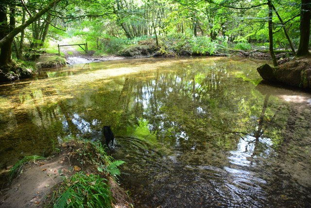
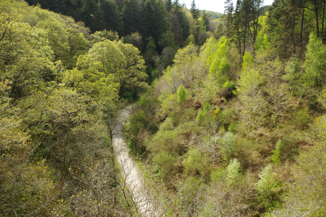
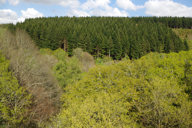
Plym is a historic village located in the county of Devon, England. Situated on the banks of the River Plym, it is renowned for its rich heritage and picturesque surroundings. The village is nestled within the stunning Plym Valley, which is designated as an Area of Outstanding Natural Beauty.

Plym boasts a long and fascinating history, dating back to the Roman times. The area was once an important trading center, thanks to its strategic location near the river and its proximity to the nearby city of Plymouth. Evidence of its ancient past can still be seen today, with remnants of Roman settlements and a Roman fort known as 'Isca Dumnoniorum' located nearby.

One of Plym's most notable landmarks is the Grade I listed St. Mary's Church. This beautiful medieval church dates back to the 12th century and features stunning architectural details, including a striking tower and intricate stained glass windows. The church is known for its historical significance and attracts visitors from far and wide.

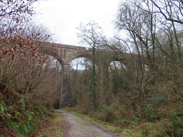
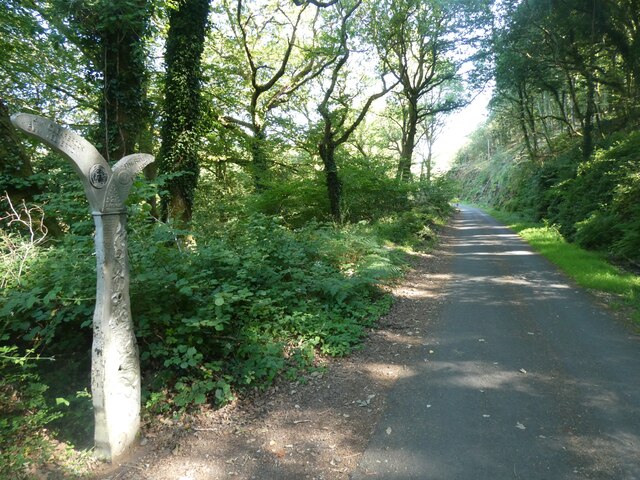
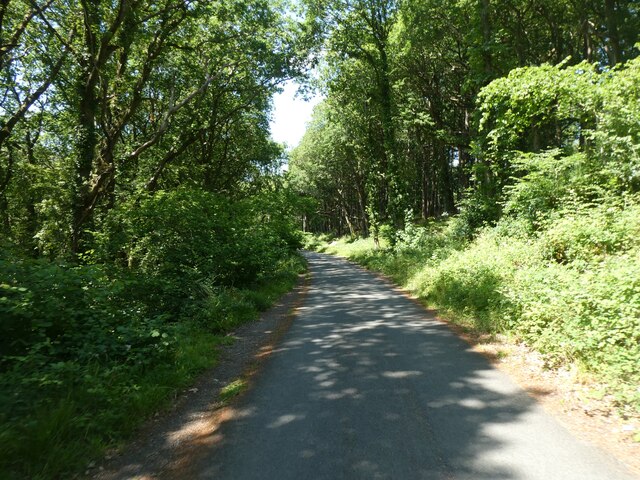
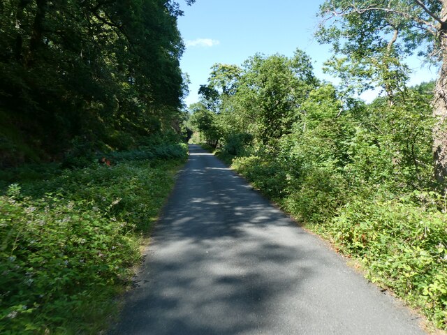
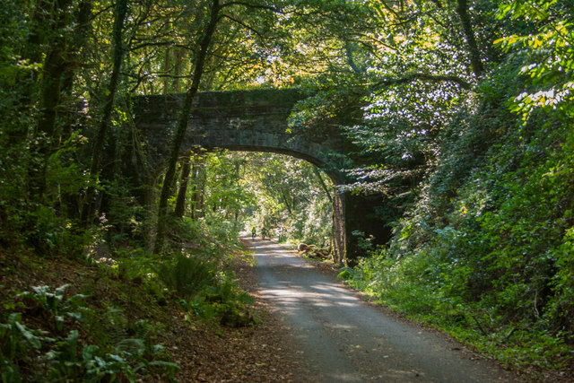
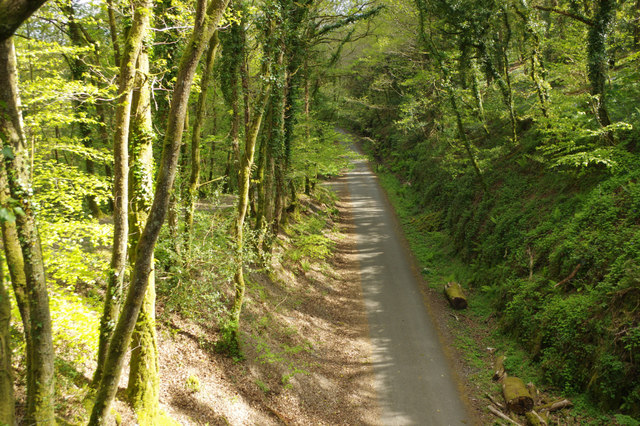
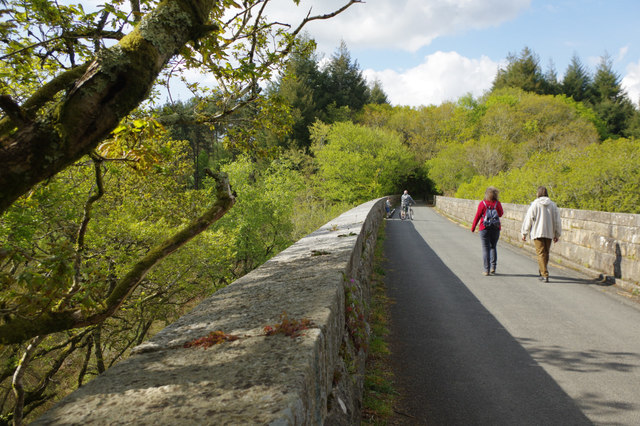
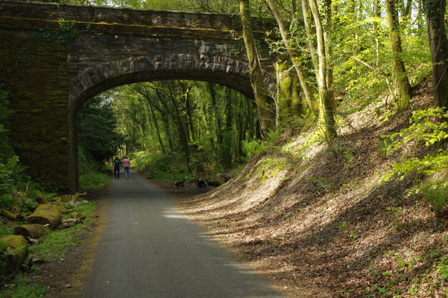
In addition to its historic charm, Plym offers a range of outdoor activities for nature enthusiasts. The Plym Valley Trail, a popular walking and cycling route, winds its way through the village, offering breathtaking views of the surrounding countryside. The area is also home to a diverse range of wildlife, making it a haven for birdwatchers and nature lovers.

Overall, Plym is a charming heritage site that offers a unique blend of history, natural beauty, and outdoor recreational opportunities. It is a must-visit destination for those seeking to explore the rich heritage and stunning landscapes of Devon.

If you have any feedback on the listing, please let us know in the comments section below.
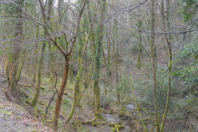
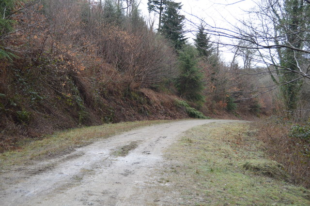
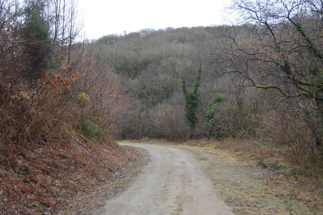
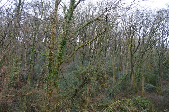
Plym Images

Images are sourced within 2km of 50.417/-4.082 or Grid Reference SX5259. Thanks to Geograph Open Source API. All images are credited.

West Devon Way viaduct
Wooded Plym valley
Wooded Plym valley
Sustrans millennium milepost by NCN27, Colwill Wood National Cycle Network Route 27 is a 99 miles long route between Ilfracombe and Plymouth, of which 71 miles are traffic-free. The route combines the beaches and estuaries of North Devon with the lush green valleys of the Torridge, the Tavy, the Walkham and other evocative West Country rivers. The route also skirts round the western flank of Dartmoor offering superb views of Cornwall and the surrounding area. There is also many local links and spurs to explore. Largely tracing the course of former railway lines, the route takes you through tunnels and across the breathtaking viaducts and bridges bequeathed by Victorian railway engineers.
Sustrans millennium milepost by NCN27, Colwill Wood
National Cycle Network Route 27 is a 99 miles long route between Ilfracombe and Plymouth, of which 71 miles are traffic-free. The route combines the beaches and estuaries of North Devon with the lush green valleys of the Torridge, the Tavy, the Walkham and other evocative West Country rivers. The route also skirts round the western flank of Dartmoor offering superb views of Cornwall and the surrounding area. There is also many local links and spurs to explore. Largely tracing the course of former railway lines, the route takes you through tunnels and across the breathtaking viaducts and bridges bequeathed by Victorian railway engineers.
Wintery showers near Asda Wintery weather in the courtyard near Asda
Wintery showers near Asda
Wintery weather in the courtyard near Asda
Plym Valley Trail (NCN27) National Cycle Network Route 27 is a 99 miles long route between Ilfracombe and Plymouth, of which 71 miles are traffic-free. The route combines the beaches and estuaries of North Devon with the lush green valleys of the Torridge, the Tavy, the Walkham and other evocative West Country rivers. The route also skirts round the western flank of Dartmoor offering superb views of Cornwall and the surrounding area. There is also many local links and spurs to explore. Largely tracing the course of former railway lines, the route takes you through tunnels and across the breathtaking viaducts and bridges bequeathed by Victorian railway engineers.
Plym Valley Trail (NCN27)
National Cycle Network Route 27 is a 99 miles long route between Ilfracombe and Plymouth, of which 71 miles are traffic-free. The route combines the beaches and estuaries of North Devon with the lush green valleys of the Torridge, the Tavy, the Walkham and other evocative West Country rivers. The route also skirts round the western flank of Dartmoor offering superb views of Cornwall and the surrounding area. There is also many local links and spurs to explore. Largely tracing the course of former railway lines, the route takes you through tunnels and across the breathtaking viaducts and bridges bequeathed by Victorian railway engineers.
Plym Valley Trail (NCN27) in Colwill Wood National Cycle Network Route 27 is a 99 miles long route between Ilfracombe and Plymouth, of which 71 miles are traffic-free. The route combines the beaches and estuaries of North Devon with the lush green valleys of the Torridge, the Tavy, the Walkham and other evocative West Country rivers. The route also skirts round the western flank of Dartmoor offering superb views of Cornwall and the surrounding area. There is also many local links and spurs to explore. Largely tracing the course of former railway lines, the route takes you through tunnels and across the breathtaking viaducts and bridges bequeathed by Victorian railway engineers.
Plym Valley Trail (NCN27) in Colwill Wood
National Cycle Network Route 27 is a 99 miles long route between Ilfracombe and Plymouth, of which 71 miles are traffic-free. The route combines the beaches and estuaries of North Devon with the lush green valleys of the Torridge, the Tavy, the Walkham and other evocative West Country rivers. The route also skirts round the western flank of Dartmoor offering superb views of Cornwall and the surrounding area. There is also many local links and spurs to explore. Largely tracing the course of former railway lines, the route takes you through tunnels and across the breathtaking viaducts and bridges bequeathed by Victorian railway engineers.
Ford on the West Devon Way This ford is found on the River Plym beside the West Devon Way close to Bickleigh Bridge.
Ford on the West Devon Way
This ford is found on the River Plym beside the West Devon Way close to Bickleigh Bridge.
Bickleigh Ford This ford on the River Plym is found below Riverford Viaduct on the West Devon Way.
<span class="nowrap"><a title="https://youtu.be/tP4qnXBRzpM" rel="nofollow ugc noopener" href="https://youtu.be/tP4qnXBRzpM">Link</a><img style="margin-left:2px;" alt="External link" title="External link - shift click to open in new window" src="https://s1.geograph.org.uk/img/external.png" width="10" height="10"/></span>
Bickleigh Ford
This ford on the River Plym is found below Riverford Viaduct on the West Devon Way. LinkExternal link
Drake's Trail On the path of the disused Tavistock and Launceston Branch railway.
Drake's Trail
On the path of the disused Tavistock and Launceston Branch railway.
Cycleway above the River Plym Looking down on to the old railway route, now a cycleway and footpath, from an overbridge.
Cycleway above the River Plym
Looking down on to the old railway route, now a cycleway and footpath, from an overbridge.
Riverford Viaduct Two walkers and a cyclist make their way across the viaduct which once carried the Great Western Railway's Plymouth - Launceston line but is now part of the West Devon Way.
Riverford Viaduct
Two walkers and a cyclist make their way across the viaduct which once carried the Great Western Railway's Plymouth - Launceston line but is now part of the West Devon Way.
Looking down from Riverford Viaduct The viaduct which once carried the Great Western Railway's Plymouth - Launceston railway now offers walkers and cyclists on the West Devon Way a spectacular view over Common Wood and Darklake Wood.
Looking down from Riverford Viaduct
The viaduct which once carried the Great Western Railway's Plymouth - Launceston railway now offers walkers and cyclists on the West Devon Way a spectacular view over Common Wood and Darklake Wood.
View from Riverford Viaduct Looking across the Plym Valley to Great Shaugh Wood.
View from Riverford Viaduct
Looking across the Plym Valley to Great Shaugh Wood.
Cycleway through the Plym Valley Part of the former Great Western Railway's Plymouth - Launceston line, now the West Devon Way.
Cycleway through the Plym Valley
Part of the former Great Western Railway's Plymouth - Launceston line, now the West Devon Way.
Woodland stream, West Wood
Track through West Wood
Track in West Wood
Track in West Wood
West Wood
West Wood
Show me another place!

Plym is located at Grid Ref: SX5259 (Lat: 50.417, Lng: -4.082)

Administrative County: Devon

District: South Hams

Police Authority: Devon and Cornwall

What 3 Words

///cube.hints.rushed. Near Plympton, Devon

Nearby Locations

Bickleigh Vale Plym

Related Wikis

Plymbridge Woods

Plymbridge Woods is a woodland in Plympton, Devon, England managed by The National Trust. The woods are named after the historic Plymbridge, a Grade II...

Cann Quarry Canal

The Cann Quarry canal was a canal in Devon, England which ran for just under 2 miles (3.2 km) from Cann Quarry to the River Plym at Marsh Mills. It opened...

Tor Bridge High

Tor Bridge High (formerly Estover Community College) is a mixed secondary school and sixth form located in the Estover area of Plymouth in the English...

Estover, Plymouth

Estover is a district in Devon, England, within the Plymouth boundary area. The original hamlet was extensively developed during the 1970s, into what became...

Nearby Amenities

Located within 500m of 50.417,-4.082
Fixme: Some mountain bike trails around Colwill Wood, to be traced out.
Lat/Long: 50.4186622/-4.080728
Peregrine Falcon viewing spot
Tourism: viewpoint
Lat/Long: 50.4175055/-4.0799069
Note: Cann Woods Down Hill Jumps
Sport: cycling
Lat/Long: 50.4198696/-4.0766927
Colwill Wood
Natural: wood
Lat/Long: 50.4200967/-4.0830242
Description: Plym Peregrine Project - for viewing the Peregrine Falcons in the area and learning about them from National Trust volunteers during opening hours. During summer months, there is a raised wooden platform for better viewing experience.
Direction: 100
Opening Hours: Mo-Su 10:00-16:00
Tourism: viewpoint
Lat/Long: 50.4177574/-4.0803236
Barrier: stile
Lat/Long: 50.4158732/-4.0778724
Natural: cave_entrance
Lat/Long: 50.4167867/-4.0835211
Waste Basket
Survey Date: 2022-02-21
Lat/Long: 50.4169704/-4.0884968
Bus Stop
Wrigleys
Bench: no
Bin: yes
Bus: yes
Lit: yes
Naptan AtcoCode: 1180PLA10341
Naptan Bearing: SW
Naptan CommonName: Wrigleys
Naptan Indicator: adj
Naptan NaptanCode: plymgdj
Naptan PlusbusZoneRef: PLYMTH
Public Transport: platform
Shelter: no
Survey Date: 2022-02-21
Tactile Paving: no
Lat/Long: 50.4169354/-4.0885983
Bus Stop
Wrigleys
Bench: no
Bin: no
Bus: yes
Lit: yes
Naptan AtcoCode: 1180PLA01837
Naptan Bearing: NE
Naptan CommonName: Wrigleys
Naptan Indicator: opp
Naptan NaptanCode: plypgjw
Naptan PlusbusZoneRef: PLYMTH
Naptan Street: Estover Road
Public Transport: platform
Shelter: no
Survey Date: 2022-02-21
Tactile Paving: no
Lat/Long: 50.4171713/-4.0885145
Street Lamp
Survey Date: 2022-02-21
Lat/Long: 50.4171685/-4.0885089
Street Lamp
Survey Date: 2022-02-21
Lat/Long: 50.4175844/-4.0878063
Street Lamp
Survey Date: 2022-02-21
Lat/Long: 50.4176528/-4.0873609
Street Lamp
Survey Date: 2022-02-21
Lat/Long: 50.4184192/-4.0877005
Bus Stop
Estover Road
Bench: no
Bus: yes
Naptan AtcoCode: 1180PLA10340
Naptan Bearing: SE
Naptan CommonName: Estover Road
Naptan Indicator: SE-bound
Naptan NaptanCode: plymgdt
Naptan PlusbusZoneRef: PLYMTH
Naptan Street: Estover Road
Public Transport: platform
Shelter: no
Survey Date: 2022-02-21
Lat/Long: 50.4188346/-4.0884133
Grit Bin
Survey Date: 2022-02-21
Lat/Long: 50.4176104/-4.0877642
Fire Hydrant
Emergency: fire_hydrant
Fire Hydrant Diameter: 6"
Fire Hydrant Position: sidewalk
Fire Hydrant Type: underground
Survey Date: 2022-02-21
Lat/Long: 50.4169641/-4.0888596
Street Lamp
Survey Date: 2022-02-21
Lat/Long: 50.4178636/-4.0872015
Street Lamp
Survey Date: 2022-02-21
Lat/Long: 50.4173032/-4.0879916
Fire Hydrant
Emergency: fire_hydrant
Fire Hydrant Type: underground
Survey Date: 2022-02-21
Lat/Long: 50.4175421/-4.0879213
Street Lamp
Survey Date: 2022-02-21
Lat/Long: 50.4188369/-4.0884122
Fire Hydrant
Emergency: fire_hydrant
Survey Date: 2022-02-21
Lat/Long: 50.4183369/-4.0876171
Street Lamp
Survey Date: 2022-02-21
Lat/Long: 50.4168506/-4.0887305
Street Lamp
Survey Date: 2022-02-21
Lat/Long: 50.41812/-4.0873624
Street Lamp
Survey Date: 2022-02-21
Lat/Long: 50.4184782/-4.0881939
Fire Hydrant
Emergency: fire_hydrant
Fire Hydrant Type: underground
Survey Date: 2022-02-25
Lat/Long: 50.4142366/-4.0856432
Fire Hydrant
Emergency: fire_hydrant
Survey Date: 2022-02-25
Lat/Long: 50.4153596/-4.0884674
Grit Bin
Survey Date: 2022-02-25
Lat/Long: 50.414198/-4.0856864
Post Box
Collection Times: Mo-Fr 09:00, Sa 07:00
Post Box Type: lamp
Ref: PL6 71D
Royal Cypher: EIIR
Royal Cypher Wikidata: Q33102113
Survey Date: 2022-02-25
Lat/Long: 50.4142323/-4.0856729
Screwfix
Brand: Screwfix
Brand Wikidata: Q7439115
Shop: doityourself
Website: https://www.screwfix.com/stores/GC4/plymouth-estover
Lat/Long: 50.417599/-4.0889178
The data included in this document is from www.openstreetmap.org. The data is made available under ODbL.

Have you been to Plym?

Leave your review of Plym below (or comments, questions and feedback).