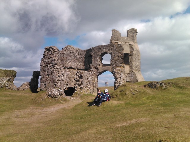
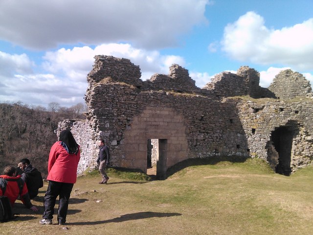
Pennard Castle

Heritage Site in Glamorgan

Wales

Pennard Castle

Cathole Cave Cathole cave in Park Wood is a natural limestone cave. Occupied between 20,000 and 10,000 years ago. Deposits include bones of bear, hyena, woolly rhinoceros, mammoth, reindeer and the extinct Irish deer. None of these animals were present on the day of our visit!
Cathole Cave Credit: John Duckfield

The requested URL returned error: 429 Too Many Requests

If you have any feedback on the listing, please let us know in the comments section below.

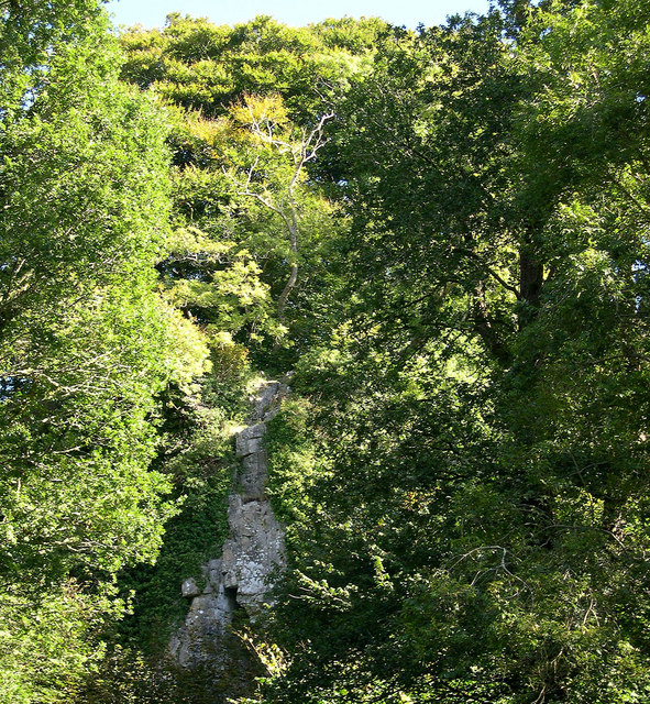
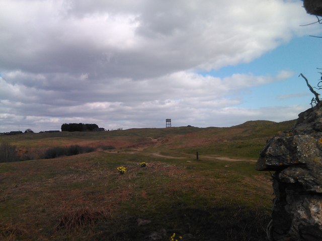
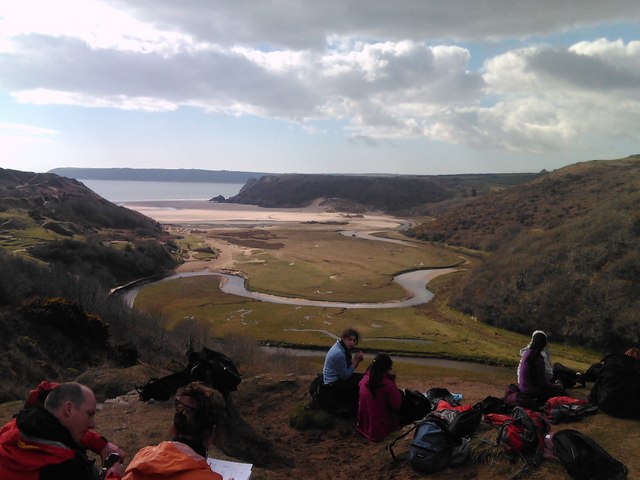
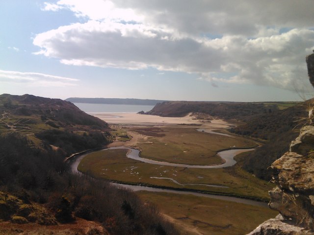
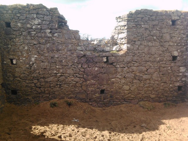
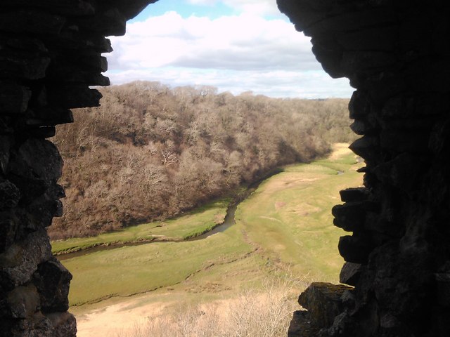
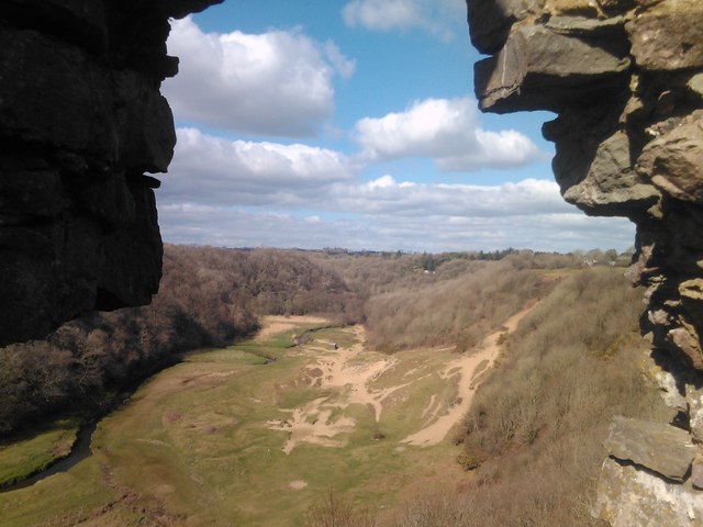
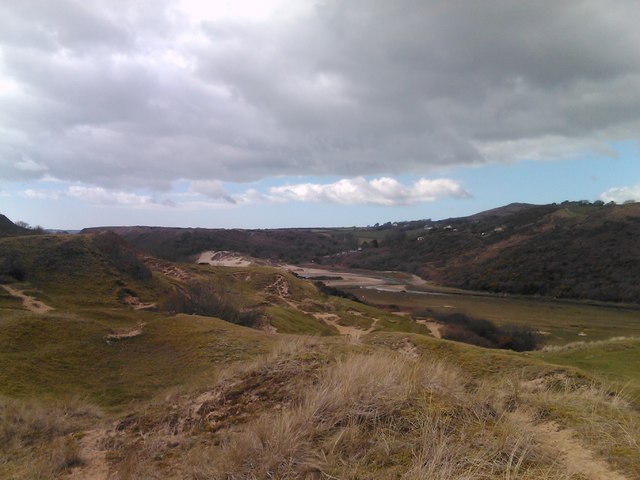
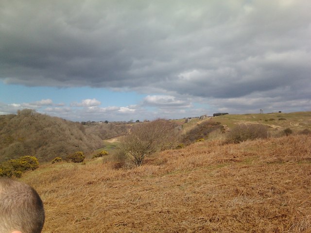
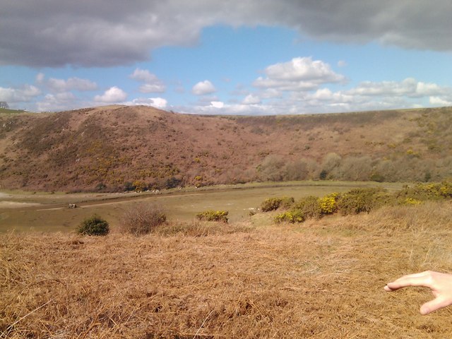
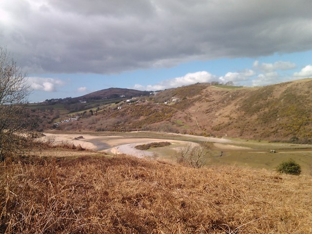
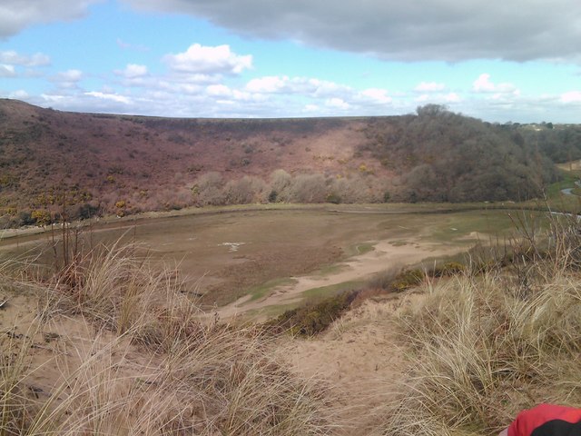
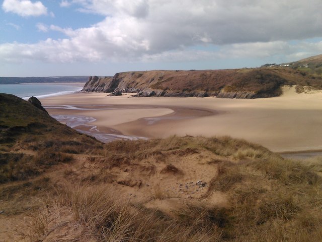
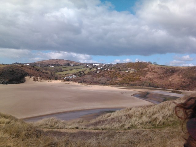
Pennard Castle Images

Images are sourced within 2km of 51.575/-4.1 or Grid Reference SS5488. Thanks to Geograph Open Source API. All images are credited.

Cathole Cave Cathole cave in Park Wood is a natural limestone cave. Occupied between 20,000 and 10,000 years ago. Deposits include bones of bear, hyena, woolly rhinoceros, mammoth, reindeer and the extinct Irish deer. None of these animals were present on the day of our visit!
Cathole Cave
Cathole cave in Park Wood is a natural limestone cave. Occupied between 20,000 and 10,000 years ago. Deposits include bones of bear, hyena, woolly rhinoceros, mammoth, reindeer and the extinct Irish deer. None of these animals were present on the day of our visit!
View of the water tower in Southgate from the church ruins at Pennard Pill Looking north-northeast.
View of the water tower in Southgate from the church ruins at Pennard Pill
Looking north-northeast.
View of the Pennard Pill from the cliff by the church ruins Looking west-southwest.
View of the Pennard Pill from the cliff by the church ruins
Looking west-southwest.
View of the Pennard Pill from the cliff by the church ruins #2 Looking southwest.
View of the Pennard Pill from the cliff by the church ruins #2
Looking southwest.
View of a section of the church ruins on top of the cliff above the Pennard Pill Looking west-southwest towards the Pennard Pill.
View of a section of the church ruins on top of the cliff above the Pennard Pill
Looking west-southwest towards the Pennard Pill.
View of the Pennard Pill and Northill Wood from the church ruins Looking west-northwest.
View of the Pennard Pill and Northill Wood from the church ruins
Looking west-northwest.
View of the Pennard Pill and Northill Wood from the church ruins #2 Looking north-northwest.
View of the Pennard Pill and Northill Wood from the church ruins #2
Looking north-northwest.
View of a section of the church ruins on top of the cliff above the Pennard Pill #2 Looking northwest.
View of a section of the church ruins on top of the cliff above the Pennard Pill #2
Looking northwest.
View of a section of the church ruins on top of the cliff above the Pennard Pill #3 Looking northwest.
View of a section of the church ruins on top of the cliff above the Pennard Pill #3
Looking northwest.
View of sand channels on the cliff face from the path leading to Pennard Looking west-southwest.
View of sand channels on the cliff face from the path leading to Pennard
Looking west-southwest.
View of the church ruins from the path leading to Three Cliffs Looking north.
View of the church ruins from the path leading to Three Cliffs
Looking north.
View of Northill Wood from the path leading to Three Cliffs Looking west-northwest.
View of Northill Wood from the path leading to Three Cliffs
Looking west-northwest.
Channel braiding in the Pennard Pill, viewed from the cliff top path Looking west-northwest.
Channel braiding in the Pennard Pill, viewed from the cliff top path
Looking west-northwest.
View of the Pennard Pill from the cliff top path Looking west-northwest.
View of the Pennard Pill from the cliff top path
Looking west-northwest.
View of Three Cliffs Bay from the cliff top Looking west-southwest.
View of Three Cliffs Bay from the cliff top
Looking west-southwest.
View of Three Cliffs Bay from the cliff top #2 Looking west-southwest.
View of Three Cliffs Bay from the cliff top #2
Looking west-southwest.
View of the Pennard Pill running through Three Cliffs Bay Looking west-southwest.
View of the Pennard Pill running through Three Cliffs Bay
Looking west-southwest.
View of a cliff arch on Three Cliffs Bay Looking southeast.
View of a cliff arch on Three Cliffs Bay
Looking southeast.
Show me another place!

Pennard Castle is located at Grid Ref: SS5488 (Lat: 51.575, Lng: -4.1)

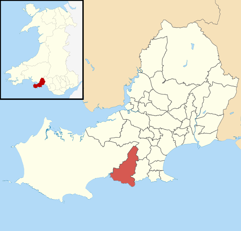
Unitary Authority: Swansea

Police Authority: South Wales

What 3 Words

///fakes.factually.siblings. Near Southgate, Swansea

Related Wikis

Pennard (electoral ward)

Pennard is the name of an electoral ward in the City and County of Swansea, Wales, United Kingdom. It is coterminous with the community of Pennard.The...

Parkmill

Parkmill (Welsh: Melin y Parc) is a village in the Gower Peninsula, South Wales, midway between the villages of Penmaen and Ilston, about eight miles...

La Charrette

La Charrette was for several decades the smallest cinema in the UK. It closed in February 2008. A tiny, 23-seat venue, sited in a back garden in the town...

A4118 road

The A4118 road is in Swansea, Wales, connecting Dyfatty Street in Swansea City Centre with Port Eynon in the Gower Peninsula. The route runs through suburban...

Nearby Amenities

Located within 500m of 51.575,-4.1
Disused Man Made: water_tower
Lat/Long: 51.5783154/-4.0963857
Bench
Backrest: yes
Material: wood
Lat/Long: 51.5714537/-4.0991508
Waste Basket
Waste: dog_excrement
Lat/Long: 51.5728133/-4.0944965
Golf: tee
Source: bing
Lat/Long: 51.5731667/-4.0956014
Golf: pin
Lat/Long: 51.5760608/-4.0962775
Golf: pin
Source: Bing
Lat/Long: 51.5777641/-4.098733
Golf: tee
Source: Bing
Lat/Long: 51.5755485/-4.0957788
Golf: pin
Source: Bing
Lat/Long: 51.5789653/-4.0994439
Golf: tee
Source: Bing
Lat/Long: 51.579045/-4.0982374
Golf: tee
Source: Bing
Lat/Long: 51.5775795/-4.0984741
Golf: pin
Source: Bing
Lat/Long: 51.5758589/-4.1018697
Fixme: resurvey
Golf: tee
Source: Bing
Lat/Long: 51.5745349/-4.0942287
Golf: pin
Source: Bing
Lat/Long: 51.5731773/-4.1000031
Golf: tee
Source: Bing
Lat/Long: 51.5740547/-4.1025595
Golf: pin
Source: Bing
Lat/Long: 51.5728609/-4.1045279
Golf: tee
Source: Bing
Lat/Long: 51.5726823/-4.0999218
Golf: pin
Source: Bing
Lat/Long: 51.5740017/-4.0948721
Golf: pin
Source: Bing
Lat/Long: 51.5717288/-4.0994422
Fixme: resurvey
Golf: tee
Source: Bing
Lat/Long: 51.5737506/-4.1004357
Golf: pin
Source: Bing
Lat/Long: 51.5746958/-4.0986514
Golf: tee
Source: Bing
Lat/Long: 51.573746/-4.1015717
Golf: pin
Source: Bing
Lat/Long: 51.5726999/-4.1004085
Fixme: resurvey
Golf: tee
Source: Bing
Lat/Long: 51.5721356/-4.0999889
Fixme: resurvey
Golf: tee
Source: Bing
Lat/Long: 51.5750777/-4.0993195
Golf: pin
Source: Bing
Lat/Long: 51.5735925/-4.1023774
Golf: pin
Source: Bing
Lat/Long: 51.573245/-4.1014012
Fixme: resurvey
Golf: tee
Source: Bing
Lat/Long: 51.575711/-4.1019003
Golf: pin
Source: Bing
Lat/Long: 51.5771813/-4.0981766
Golf: tee
Source: Bing
Lat/Long: 51.5774945/-4.0980693
Golf: pin
Source: Bing
Lat/Long: 51.5746574/-4.0949892
Information: guidepost
Tourism: information
Lat/Long: 51.5734325/-4.0942004
Information: guidepost
Tourism: information
Lat/Long: 51.5775989/-4.0975423
Direction: SSE
Generator Method: photovoltaic
Generator Output Electricity: yes
Generator Solar Modules: 6
Generator Source: solar
Generator Type: solar_photovoltaic_panel
Location: roof
Power: generator
Lat/Long: 51.5718401/-4.096331
Direction: 260
Generator Method: photovoltaic
Generator Output Electricity: yes
Generator Solar Modules: 14
Generator Source: solar
Generator Type: solar_photovoltaic_panel
Location: roof
Power: generator
Lat/Long: 51.5787931/-4.0976181
Direction: 235
Generator Method: photovoltaic
Generator Output Electricity: yes
Generator Solar Modules: 10
Generator Source: solar
Generator Type: solar_photovoltaic_panel
Location: roof
Power: generator
Lat/Long: 51.5718984/-4.0950171
Direction: SSE
Generator Method: photovoltaic
Generator Output Electricity: yes
Generator Solar Modules: 12
Generator Source: solar
Generator Type: solar_photovoltaic_panel
Location: roof
Power: generator
Lat/Long: 51.5718585/-4.0962817
Direction: 235
Generator Method: photovoltaic
Generator Output Electricity: yes
Generator Solar Modules: 8
Generator Source: solar
Generator Type: solar_photovoltaic_panel
Location: roof
Power: generator
Lat/Long: 51.5723401/-4.0953375
The data included in this document is from www.openstreetmap.org. The data is made available under ODbL.

Have you been to Pennard Castle?

Leave your review of Pennard Castle below (or comments, questions and feedback).