Old Sarum

Heritage Site in Wiltshire

England

Old Sarum

Devizes Road Cemetery
Devizes Road Cemetery Credit: David Martin

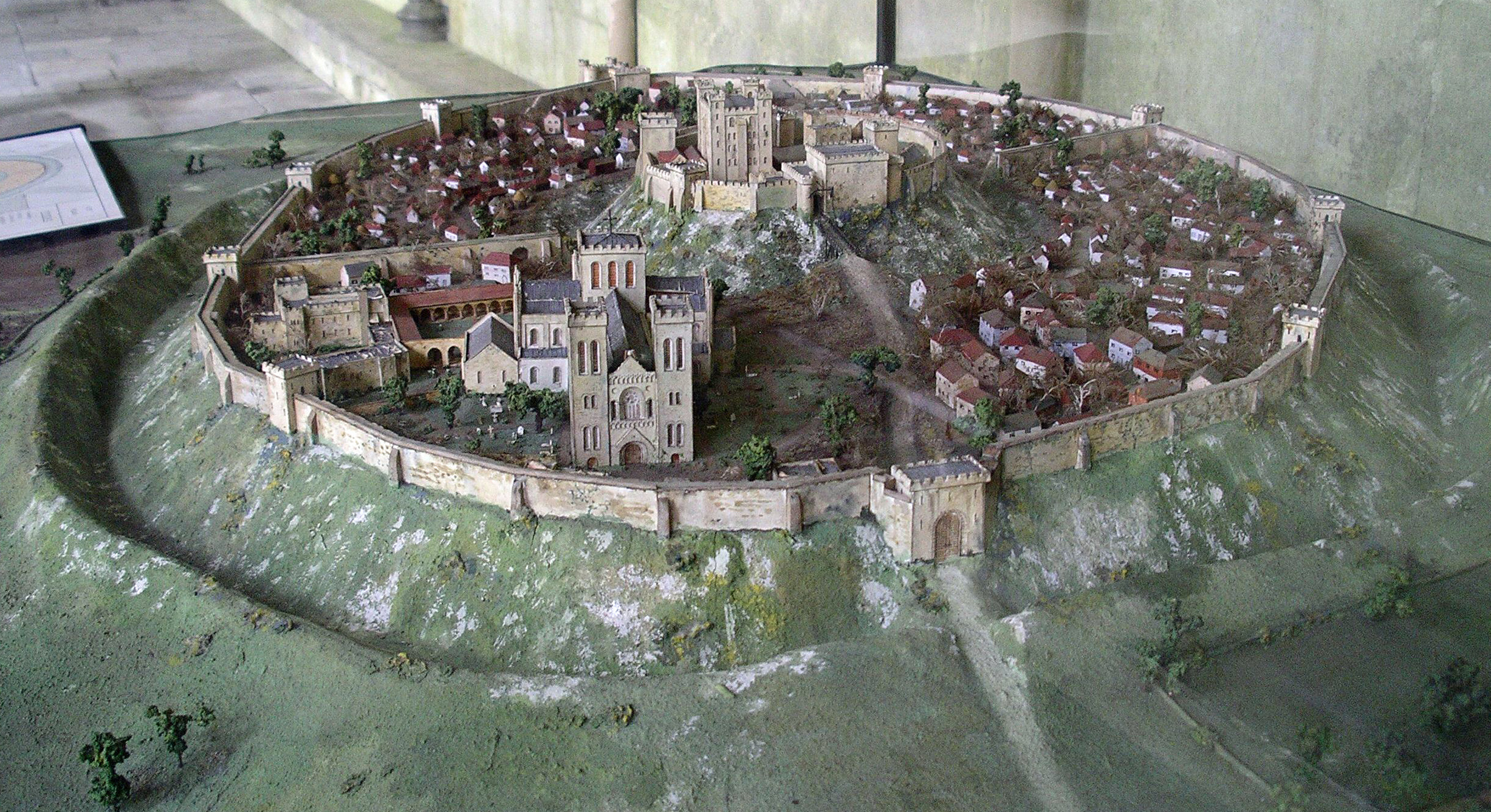
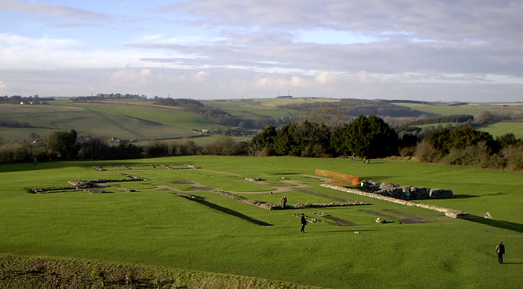
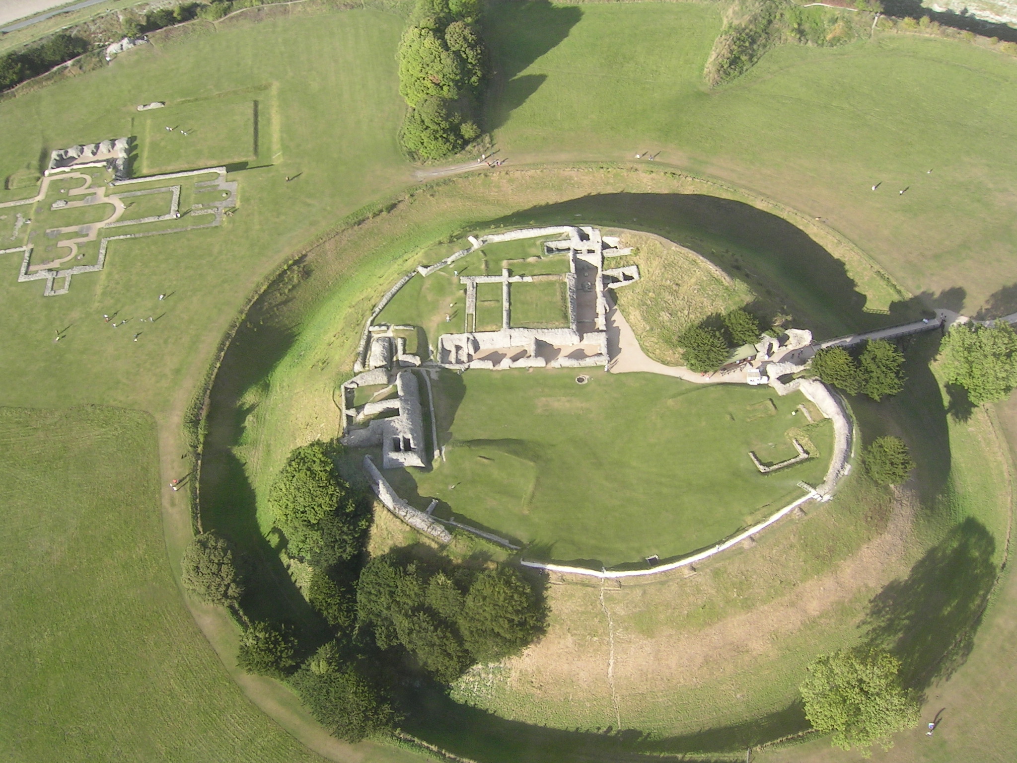
Old Sarum is an ancient hill fort and settlement located in Wiltshire, England. It is situated about 2 miles north of Salisbury, on a high chalk plateau overlooking the River Avon. This historic site holds significant archaeological and historical importance, dating back to as early as the Iron Age.

Old Sarum was initially occupied by the Iron Age Britons, who established a hill fort on the site around 400 BC. The fort was later adapted by the Romans who built a temple and a settlement within its walls. In the 11th century, William the Conqueror constructed a motte-and-bailey castle at Old Sarum, establishing it as a major political center.

During the medieval period, the site became the location of Salisbury Cathedral, before it was relocated to its current position in the 13th century. Old Sarum continued to be a significant administrative and military center until the 14th century, after which it gradually declined in importance.

Today, Old Sarum is maintained as a heritage site by English Heritage. Visitors can explore the remains of the Iron Age hill fort, the foundations of the medieval cathedral, and the ruins of the castle. The site offers panoramic views of the surrounding countryside and provides a fascinating insight into the history and development of the area over thousands of years. It is a popular destination for tourists, history enthusiasts, and those interested in archaeology.

If you have any feedback on the listing, please let us know in the comments section below.
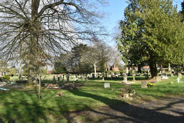
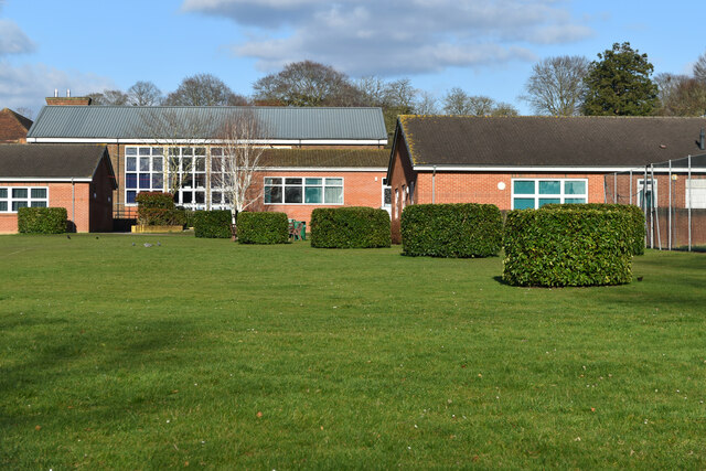
Old Sarum Images

Images are sourced within 2km of 51.092/-1.807 or Grid Reference SU1332. Thanks to Geograph Open Source API. All images are credited.

Devizes Road Cemetery
Devizes Road Cemetery and Chapel With a very substantial fallen tree.
Devizes Road Cemetery and Chapel
With a very substantial fallen tree.
Houses in Palmer Road, with tennis courts below
Devizes Road, descending into Salisbury
The Avon valley from Kingsland Road
Playing fields at South Wilts Grammar School
Playing fields at South Wilts Grammar School Looking into the centre of the athletics track.
Playing fields at South Wilts Grammar School
Looking into the centre of the athletics track.
Buildings at South Wilts Grammar School
River Avon by Ashley Road Open Space
Houses in Hulse Road, overlooking the River Avon
St Gregory's Avenue Passing the church.
St Gregory's Avenue
Passing the church.
St Gregory's Avenue
St Gregory's Avenue
Roman Road Passing the Devizes Road Cemetery.
Roman Road
Passing the Devizes Road Cemetery.
Outline of cathedral Outline of the cathedral at Old Sarum, demolished when the new cathedral in Salisbury was built in the 13th Century.
Outline of cathedral
Outline of the cathedral at Old Sarum, demolished when the new cathedral in Salisbury was built in the 13th Century.
Towards New Sarum from Old Sarum Looking towards New Sarum (i.e. Salisbury) from Old Sarum, with Salisbury Cathedral in the centre background.
Towards New Sarum from Old Sarum
Looking towards New Sarum (i.e. Salisbury) from Old Sarum, with Salisbury Cathedral in the centre background.
Footbridge over River Avon Footbridge over River Avon, carrying the footpath connecting Mill Lane in Stratford sub Castle with Devizes Road in Bemerton Heath.
Footbridge over River Avon
Footbridge over River Avon, carrying the footpath connecting Mill Lane in Stratford sub Castle with Devizes Road in Bemerton Heath.
Houses on Roman Road
Roman Road
Roman Road
Show me another place!

Old Sarum is located at Grid Ref: SU1332 (Lat: 51.092, Lng: -1.807)

Unitary Authority: Wiltshire

Police Authority: Wiltshire

What 3 Words

///assemble.flicks.blacken. Near Salisbury, Wiltshire

Related Wikis

Old Sarum

Old Sarum, in Wiltshire, South West England, is the ruined and deserted site of the earliest settlement of Salisbury. Situated on a hill about two miles...

Old Sarum Cathedral

Old Sarum Cathedral was a Catholic and Norman cathedral at old Salisbury, now known as Old Sarum, between 1092 and 1220. Only its foundations remain, in...

Stratford-sub-Castle

Stratford-sub-Castle in Wiltshire, England, was anciently a separate village and civil parish, but since 1954 has been a northern suburb of the city of...

Old Sarum Castle

Old Sarum Castle, formerly known as Seresberi Castle, is an 11th century motte-and-bailey castle built in Old Sarum, Wiltshire. It was originally built...

Nearby Amenities

Located within 500m of 51.092,-1.807
Barrier: bollard
Lat/Long: 51.0918985/-1.8002364
Toilets
Lat/Long: 51.0934603/-1.8019813
Barrier: kissing_gate
Foot: yes
Source: survey
Lat/Long: 51.0916367/-1.8062612
Barrier: kissing_gate
Foot: yes
Source: survey
Lat/Long: 51.0947009/-1.8079081
Barrier: stile
Lat/Long: 51.0934955/-1.8020359
Putting England on the Map
Board Type: history
Information: board
Tourism: information
Lat/Long: 51.0942429/-1.8026123
Barrier: stile
Lat/Long: 51.0895975/-1.8087378
Barrier: stile
Lat/Long: 51.0954826/-1.8076396
Barrier: stile
Foot: yes
Source: survey
Lat/Long: 51.0942614/-1.8028519
Barrier: stile
Lat/Long: 51.0930215/-1.800898
Barrier: stile
Lat/Long: 51.095741/-1.8052737
Barrier: stile
Lat/Long: 51.0934227/-1.8005751
Board Type: history
Information: board
Tourism: information
Lat/Long: 51.0931381/-1.8032735
Board Type: history
Information: board
Tourism: information
Lat/Long: 51.0935796/-1.803689
Board Type: history
Check Date: 2023-04-01
Information: board
Tourism: information
Lat/Long: 51.0938092/-1.8064169
Board Type: history
Check Date: 2023-04-01
Information: board
Tourism: information
Lat/Long: 51.0939957/-1.8049827
Stratford-sub-Castle
Historic Name: Sorviodunum
Place: village
Wikidata: Q7621929
Wikipedia: en:Stratford-sub-Castle
Lat/Long: 51.0888197/-1.8115317
Post Box
Post Box Type: wall
Ref: SP1 272
Royal Cypher: GR
Royal Cypher Wikidata: Q33102273
Lat/Long: 51.0904204/-1.8129239
Waste Basket
Type: trash
Lat/Long: 51.0917206/-1.8000557
Street Lamp
Lamp Mount: straight_mast
Lamp Type: led
Lat/Long: 51.0913364/-1.8000263
Street Lamp
Lamp Mount: straight_mast
Lamp Type: led
Lat/Long: 51.0918405/-1.8000265
Street Lamp
Lamp Mount: straight_mast
Lamp Type: led
Lat/Long: 51.0916432/-1.8000414
Tourism: viewpoint
Lat/Long: 51.0949136/-1.8050908
Old Sarum
Ele: 122
Natural: peak
Lat/Long: 51.0931758/-1.8047911
Chapel
Historic: ruins
Lat/Long: 51.0933466/-1.8047684
Bakehouse
Historic: ruins
Lat/Long: 51.0929782/-1.8043006
Shop: gift
Lat/Long: 51.0932395/-1.8042989
Eastgate
Historic: ruins
Lat/Long: 51.0931721/-1.8040425
Great Chamber
Historic: ruins
Lat/Long: 51.0935582/-1.8047268
Information: office
Tourism: information
Lat/Long: 51.0932381/-1.8043344
Cloister
Historic: ruins
Lat/Long: 51.0934735/-1.8048038
Tower above Postern
Historic: ruins
Lat/Long: 51.0934479/-1.8052669
New Hall
Historic: ruins
Lat/Long: 51.0929959/-1.8051606
Well
Historic: ruins
Lat/Long: 51.0932707/-1.8047423
Herlewin’s Tower
Historic: ruins
Lat/Long: 51.0936489/-1.8049924
Postern Gate
Historic: ruins
Lat/Long: 51.0933925/-1.8053689
Kitchen Tower
Historic: ruins
Lat/Long: 51.0936078/-1.8045606
Great Tower
Historic: ruins
Lat/Long: 51.0932975/-1.8054025
East Turret
Historic: ruins
Lat/Long: 51.0934933/-1.8044577
Putting England on the map
Board Type: history
Information: board
Subject Wikidata: Q8015901
Subject Wikipedia: en:William Mudge
Tourism: information
Lat/Long: 51.0935362/-1.8019484
The data included in this document is from www.openstreetmap.org. The data is made available under ODbL.

Have you been to Old Sarum?

Leave your review of Old Sarum below (or comments, questions and feedback).