Nun's Well

Heritage Site in Yorkshire Ryedale

England

Nun's Well

Cleveland Way in Boltby Forest (1) The National Trail clips the eastern edge of Boltby Forest as it heads northwards along the line of an ancient track - once used as a drovers road.
Cleveland Way in Boltby Forest (1) Credit: Chris Heaton

Nun's Well, located in the picturesque county of Yorkshire, is a historic heritage site that holds great significance in the region. Nestled within a tranquil wooded area near the village of Nunburnholme, this well is shrouded in legend and has captivated visitors for centuries.

The origins of Nun's Well can be traced back to medieval times when it was believed to have been used by the nuns of Nunburnholme Priory for their daily water supply. The well consists of a stone structure with a small pool of water fed by a natural spring. The water is crystal clear and has been known for its purity and taste.

Surrounded by lush greenery and ancient trees, Nun's Well exudes an air of mysticism. It is said that the well possesses healing properties, attracting pilgrims seeking relief from various ailments. This belief has led to the well being adorned with numerous votive offerings over the years, such as small trinkets and religious tokens.

The area around Nun's Well is also home to a variety of wildlife, making it a popular spot for nature enthusiasts. The serene atmosphere, coupled with the sound of trickling water and the chirping of birds, creates a peaceful ambiance that draws visitors seeking solace and tranquility.

Nun's Well is an important cultural and historical landmark in Yorkshire, attracting tourists from far and wide. Its rich heritage, natural beauty, and spiritual aura make it a must-visit destination for those looking to delve into the past and experience the enchanting allure of Yorkshire's countryside.

If you have any feedback on the listing, please let us know in the comments section below.

Nun's Well Images

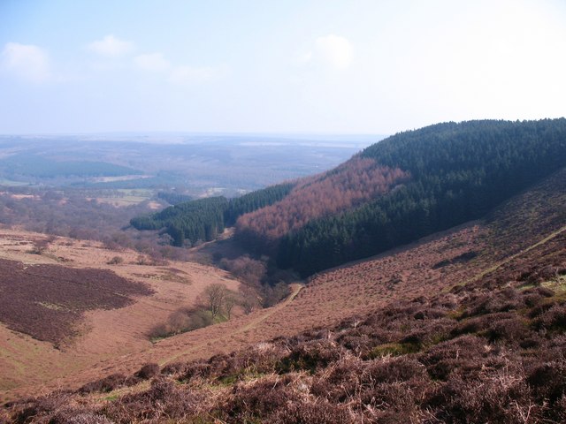
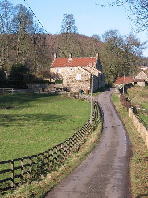
Images are sourced within 2km of 54.307/-1.208 or Grid Reference SE5190. Thanks to Geograph Open Source API. All images are credited.

Cleveland Way in Boltby Forest (1) The National Trail clips the eastern edge of Boltby Forest as it heads northwards along the line of an ancient track - once used as a drovers road.
Cleveland Way in Boltby Forest (1)
The National Trail clips the eastern edge of Boltby Forest as it heads northwards along the line of an ancient track - once used as a drovers road.
Grouse moor management In March, moorland fires are common on the North York Moors and eastern side of the Pennines. Controlled burning of heather encourages new growth and provides tasty shoots for grouse.
Grouse moor management
In March, moorland fires are common on the North York Moors and eastern side of the Pennines. Controlled burning of heather encourages new growth and provides tasty shoots for grouse.
Track junction, Harker Yates Ridge Neither of these tracks are public rights of way, the little used footpath line being somewhere in the heather just beyond the track. The left branch descends rapidly into the head of Thorodale, a little of which can be seen in the background.
Track junction, Harker Yates Ridge
Neither of these tracks are public rights of way, the little used footpath line being somewhere in the heather just beyond the track. The left branch descends rapidly into the head of Thorodale, a little of which can be seen in the background.
Track to North Moor Track heading east towards North Moor and the conifer plantation of Blueberry Wood. The wall in the distance marks the boundary between grouse moor and improved land and is close to the boundary between limestones and acid sandstone.
Track to North Moor
Track heading east towards North Moor and the conifer plantation of Blueberry Wood. The wall in the distance marks the boundary between grouse moor and improved land and is close to the boundary between limestones and acid sandstone.
Head of Eskerdale The view into the head of Eskerdale from the moor edge.
Head of Eskerdale
The view into the head of Eskerdale from the moor edge.
Eskerdale Remote and little visited side branch of Ryedale. View from the moor edge looking towards the plantations of Blueberry Wood.
Eskerdale
Remote and little visited side branch of Ryedale. View from the moor edge looking towards the plantations of Blueberry Wood.
Head of Eskerdale Like many of the valleys that begin on the flanks of these moors, Eskerdale starts life as a narrow, steep sided gill where a few stunted trees cling to the sides.
Head of Eskerdale
Like many of the valleys that begin on the flanks of these moors, Eskerdale starts life as a narrow, steep sided gill where a few stunted trees cling to the sides.
View over Eskerdale and Ryedale View from the moor edge over Eskerdale and into upper Ryedale. In the valley bottom is recently cleared woodland below Blueberry Wood.
View over Eskerdale and Ryedale
View from the moor edge over Eskerdale and into upper Ryedale. In the valley bottom is recently cleared woodland below Blueberry Wood.
Tracks  in  North  Moor  Wood  Thorodale
Tracks in North Moor Wood Thorodale
Footpath  to  Harker  Gates From Mount Pleasant Farm
Footpath to Harker Gates
From Mount Pleasant Farm
Harker Gates And Blueberry Wood A majestic Ash tree grows in the pasture below Harker Gates cottage.
Harker Gates And Blueberry Wood
A majestic Ash tree grows in the pasture below Harker Gates cottage.
The road to Kepwick The road from Hawnby to Kepwick on the approach to New Hall. Motorists would be well advised not to attempt to drive this way to Kepwick as the tarmac finishes at Arden Hall, after which there is about 3 miles of rough track before tarmac reappears at the top of Kepwick Bank. The photographer does admit to driving a VW Beetle across here several decades ago.
The road to Kepwick
The road from Hawnby to Kepwick on the approach to New Hall. Motorists would be well advised not to attempt to drive this way to Kepwick as the tarmac finishes at Arden Hall, after which there is about 3 miles of rough track before tarmac reappears at the top of Kepwick Bank. The photographer does admit to driving a VW Beetle across here several decades ago.
Path to St Agnes House Track and public footpath following the woodland edge between New Hall and St Agnes House.
Path to St Agnes House
Track and public footpath following the woodland edge between New Hall and St Agnes House.
St Agnes House Hillside farm in upper Ryedale.
St Agnes House
Hillside farm in upper Ryedale.
St Agnes House From this direction the farmhouse is largely hidden behind the barns. The view is across upper Ryedale towards Hawnby Hill.
St Agnes House
From this direction the farmhouse is largely hidden behind the barns. The view is across upper Ryedale towards Hawnby Hill.
Hillsides above the Rye The little River Rye is hidden amongst the trees at the bottom of the hill, but the view extends further towards the northern end of Hawnby Hill, beyond which is its 'twin' of Easterside. Improved grassland contrasts with open heather moorland on the higher slopes.
Hillsides above the Rye
The little River Rye is hidden amongst the trees at the bottom of the hill, but the view extends further towards the northern end of Hawnby Hill, beyond which is its 'twin' of Easterside. Improved grassland contrasts with open heather moorland on the higher slopes.
Old limestone quarries, North Moor This area of North Moor is currently open access land through the countryside stewardship scheme. The sheep sits amongst old shallow limestone quarries, whilst in the distance are the twin hills of Hawnby Hill and Easterside with Rievaulx Bank beyond.
Old limestone quarries, North Moor
This area of North Moor is currently open access land through the countryside stewardship scheme. The sheep sits amongst old shallow limestone quarries, whilst in the distance are the twin hills of Hawnby Hill and Easterside with Rievaulx Bank beyond.
The view into Eskerdale Autumnal colours in Eskerdale, as seen from the moor edge.
The view into Eskerdale
Autumnal colours in Eskerdale, as seen from the moor edge.
Show me another place!

Nun's Well is located at Grid Ref: SE5190 (Lat: 54.307, Lng: -1.208)

Division: North Riding

Administrative County: North Yorkshire

District: Ryedale

Police Authority: North Yorkshire

What 3 Words

///fillings.divorcing.scam. Near Bilsdale, North Yorkshire

Related Wikis

Hawnby

Hawnby is a small crossroads village and civil parish in Ryedale in the North York Moors National Park, North Yorkshire, England. The village is about...

Holy Trinity Church, Boltby

Holy Trinity Church, Boltby is a parish church in the Church of England: 81  in Boltby. == History == The first chapel was founded in 1409 and was rebuilt...

Boltby

Boltby is a village and civil parish in the Hambleton District of North Yorkshire, England. It is on the edge of the North York Moors National Park at...

Laskill

Laskill is a small hamlet in Bilsdale, 5 miles (8 km) north-west of Helmsley, North Yorkshire, England, on the road from Helmsley to Stokesley and is located...

Nearby Amenities

Located within 500m of 54.307,-1.208
Turning Circle
Lat/Long: 54.3086585/-1.2032436
Arden Hall
Historic: manor
Lat/Long: 54.3085242/-1.2031688
Arden Bank
Place: locality
Lat/Long: 54.3066844/-1.2126207
Stoney Gill Hole
Place: locality
Lat/Long: 54.3052573/-1.2081941
Turning Circle
Lat/Long: 54.307344/-1.2030264
Information: guidepost
Tourism: information
Lat/Long: 54.3072992/-1.2030352
Guidepost Type: PROW
Information: guidepost
Tourism: information
Lat/Long: 54.3080703/-1.2046226
Bench
Lat/Long: 54.3092099/-1.2046684
The data included in this document is from www.openstreetmap.org. The data is made available under ODbL.

Have you been to Nun's Well?

Leave your review of Nun's Well below (or comments, questions and feedback).