Norbury

Heritage Site in Buckinghamshire

England

Norbury

Bridleway to Kinsbridge Farm
Bridleway to Kinsbridge Farm Credit: Philip Jeffrey

Norbury is a charming village located in the county of Buckinghamshire, England. Situated approximately 6 miles west of the market town of Aylesbury, Norbury is renowned for its historical significance and is considered a heritage site.

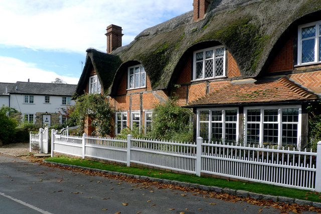
The village is known for its picturesque setting, nestled amidst rolling hills and lush countryside. It boasts several well-preserved heritage buildings, including a 12th-century Norman church, St. Mary's, which is a prominent feature and a testament to the village's rich history. The church's architecture showcases a combination of Norman and Gothic styles, and its beautifully carved stone details are a sight to behold.

Norbury is also home to a striking manor house, Norbury Manor, which dates back to the 16th century. This Grade II listed building has an intriguing history and offers visitors a glimpse into the past with its well-preserved interiors and stunning gardens. The manor's architecture is a blend of Tudor and Jacobean styles, and it has been lovingly restored to retain its original charm.

Aside from its architectural treasures, Norbury offers visitors the opportunity to explore the surrounding countryside through various walking trails and nature reserves. The village is also known for its vibrant community spirit, with regular events and festivals taking place throughout the year.

In conclusion, Norbury is a delightful heritage site that showcases the best of Buckinghamshire's history and natural beauty. With its historic buildings, picturesque landscapes, and welcoming community, it is a must-visit destination for those seeking an authentic English countryside experience.

If you have any feedback on the listing, please let us know in the comments section below.

Norbury Images

Images are sourced within 2km of 51.968/-0.958 or Grid Reference SP7130. Thanks to Geograph Open Source API. All images are credited.

Bridleway to Kinsbridge Farm
Cottages in Adstock Village These cottages are on the main road through the village and close to the church.
Cottages in Adstock Village
These cottages are on the main road through the village and close to the church.
The Thatched Inn and Restaurant, Adstock The date on the signboard is c1645.
The Thatched Inn and Restaurant, Adstock
The date on the signboard is c1645.
The Thatched Inn and Restaurant in Adstock village
St. Cecilia, Adstock
The Church of St. Cecilia, Adstock
Cottage by the Churchyard, Adstock
St. Cecilia, Adstock
The Parish Church of St. Cecilia, Adstock
Adstock Village from the Churchyard
Cottage next to the Churchyard, Adstock
Snowy cottages on Main Street
The Old Thatched Inn, Adstock
Footpath to Adstock Manor
Bridleway to Padbury Hill Farm
Footpath into Padbury
Oxlane Bridge over Padbury Brook
Footpath by Padbury Brook
Show me another place!

Norbury is located at Grid Ref: SP7130 (Lat: 51.968, Lng: -0.958)

Unitary Authority: Buckinghamshire

Police Authority: Thames Valley

What 3 Words

///daydream.pans.bedspread. Near Steeple Claydon, Buckinghamshire

Nearby Locations

Padbury Norbury

Related Wikis

Padbury railway station

Padbury railway station served the village of Padbury in the English county of Buckinghamshire. It opened in 1878 as part of the Buckinghamshire Railway...

Padbury

Padbury is a village and civil parish in north Buckinghamshire, England. It is located on the A413 main road that links Buckingham with Winslow. ��2�...

Lenborough Hoard

The Lenborough Hoard is a hoard of more than 5,000 late Anglo-Saxon silver coins, dating to the eleventh century, that was found at Lenborough in Buckinghamshire...

Lenborough

Lenborough is a hamlet in the parish of Buckingham next to Gawcott, in Buckinghamshire, England. It is in the civil parish of Gawcott with Lenborough....

Nearby Amenities

Located within 500m of 51.968,-0.958
Padbury
Created By: POI Editor
Place: village
Source: npe
Lat/Long: 51.9690504/-0.9529609
Padbury
Historic Railway: station
Railway: site
Source: NPE
Wikidata: Q7123300
Wikipedia: en:Padbury railway station
Lat/Long: 51.9672081/-0.962448
Bus Stop
Bus: yes
Public Transport: platform
Lat/Long: 51.9701376/-0.9517682
Turning Circle
Turning Circle: knuckle
Lat/Long: 51.967528/-0.962718
Turning Circle
Turning Circle: knuckle
Lat/Long: 51.966586/-0.9618869
Turning Circle
Turning Circle: hammer
Lat/Long: 51.9674768/-0.9560174
Padbury Meats
Addr Postcode: MK18 2AY
Addr Street: Main Street
Shop: butcher
Lat/Long: 51.9689155/-0.9553569
Post Box
Brand: Royal Mail
Brand Wikidata: Q638098
Brand Wikipedia: en:Royal Mail
Collection Times: Mo-Fr 09:00; Sa 07:00
Operator: Royal Mail
Operator Wikidata: Q638098
Post Box Type: pillar
Ref: MK18 245
Royal Cypher: GR
Royal Cypher Wikidata: Q33102273
Source: survey
Survey Date: 2015-05-04
Lat/Long: 51.9673555/-0.9593589
Post Box
Brand: Royal Mail
Brand Wikidata: Q638098
Brand Wikipedia: en:Royal Mail
Collection Times: Mo-Fr 16:30; Sa 09:30
Operator: Royal Mail
Operator Wikidata: Q638098
Post Box Type: lamp
Ref: MK18 246
Royal Cypher: EIIR
Royal Cypher Wikidata: Q33102113
Source: survey
Survey Date: 2015-05-04
Lat/Long: 51.9706377/-0.9525801
Bus Stop
Bus: yes
Public Transport: platform
Lat/Long: 51.9708386/-0.9524591
Power: pole
Lat/Long: 51.9670709/-0.964855
Power: pole
Lat/Long: 51.9663206/-0.9640184
Power: pole
Lat/Long: 51.9653658/-0.9629545
Power: pole
Lat/Long: 51.9655103/-0.9590963
Power: pole
Lat/Long: 51.9649797/-0.9604059
Power: pole
Lat/Long: 51.9646627/-0.96091
Power: pole
Lat/Long: 51.9643365/-0.9599866
Power: pole
Lat/Long: 51.9659264/-0.9580886
Power: pole
Lat/Long: 51.9666863/-0.9582834
Direction: 140
Generator Method: photovoltaic
Generator Output Electricity: yes
Generator Solar Modules: 16
Generator Source: solar
Generator Type: solar_photovoltaic_panel
Location: roof
Power: generator
Lat/Long: 51.9672987/-0.9560794
Direction: 180
Generator Method: photovoltaic
Generator Output Electricity: yes
Generator Solar Modules: 40
Generator Source: solar
Generator Type: solar_photovoltaic_panel
Location: ground
Power: generator
Lat/Long: 51.9720565/-0.9555248
Turning Circle
Turning Circle: knuckle
Lat/Long: 51.9670363/-0.9619753
Direction: 160
Generator Method: photovoltaic
Generator Output Electricity: yes
Generator Solar Modules: 16
Generator Source: solar
Generator Type: solar_photovoltaic_panel
Location: roof
Power: generator
Lat/Long: 51.9674042/-0.9624084
Turning Circle
Turning Circle: knuckle
Lat/Long: 51.9676242/-0.9625082
Direction: 170
Generator Method: photovoltaic
Generator Output Electricity: yes
Generator Solar Modules: 16
Generator Source: solar
Generator Type: solar_photovoltaic_panel
Location: roof
Power: generator
Lat/Long: 51.9675847/-0.9613772
Direction: 150
Generator Method: photovoltaic
Generator Output Electricity: yes
Generator Solar Modules: 9
Generator Source: solar
Generator Type: solar_photovoltaic_panel
Location: roof
Power: generator
Lat/Long: 51.9669285/-0.9611156
Power: pole
Lat/Long: 51.965502/-0.9631011
Power: pole
Lat/Long: 51.9646155/-0.9613227
Power: pole
Lat/Long: 51.9647049/-0.961081
Man Made: utility_pole
Lat/Long: 51.9662214/-0.9575759
Crossing
Lat/Long: 51.9706486/-0.9523742
The data included in this document is from www.openstreetmap.org. The data is made available under ODbL.

Have you been to Norbury?

Leave your review of Norbury below (or comments, questions and feedback).