Nether Alderley Mill

Heritage Site in Cheshire

England

Nether Alderley Mill

A34 The A34 is a 200 mile long major trunk road that runs from Salford to Winchester via The Potteries, Birmingham and Oxford. It is divided into two sections <span class="nowrap"><a title="http://www.sabre-roads.org.uk/wiki/index.php?title=A34" rel="nofollow ugc noopener" href="http://www.sabre-roads.org.uk/wiki/index.php?title=A34">Link</a><img style="margin-left:2px;" alt="External link" title="External link - shift click to open in new window" src="https://s1.geograph.org.uk/img/external.png" width="10" height="10"/></span> 
Wikipedia: <span class="nowrap"><a title="http://en.wikipedia.org/wiki/A34_road" rel="nofollow ugc noopener" href="http://en.wikipedia.org/wiki/A34_road">Link</a><img style="margin-left:2px;" alt="External link" title="External link - shift click to open in new window" src="https://s1.geograph.org.uk/img/external.png" width="10" height="10"/></span>
A34 Credit: N Chadwick

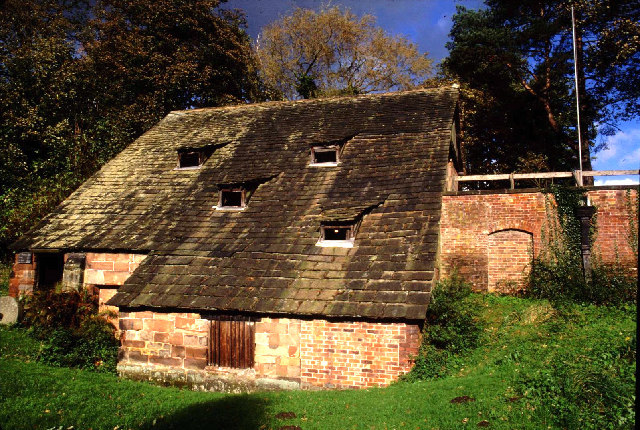
Nether Alderley Mill, located in Cheshire, England, is a historic heritage site that holds great cultural and historical significance. The mill, believed to have been built in the early 19th century, stands as a testament to the region's industrial past.

The mill is a striking example of a water-powered corn mill, which was once a common sight throughout the country. It was constructed using local sandstone and features a traditional timber-framed structure. The mill's machinery, including a waterwheel and grinding stones, has been preserved and is still in working condition.

Visitors to Nether Alderley Mill can explore the site and gain insight into the milling process that was vital for the local community. The mill showcases the different stages of grain processing, from grinding the corn to producing flour. Educational displays and exhibits provide detailed information about the history and significance of the mill.

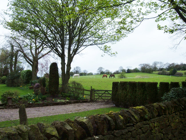
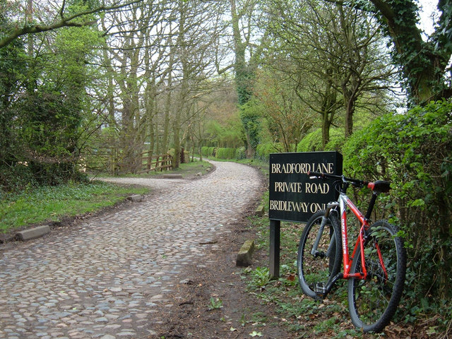
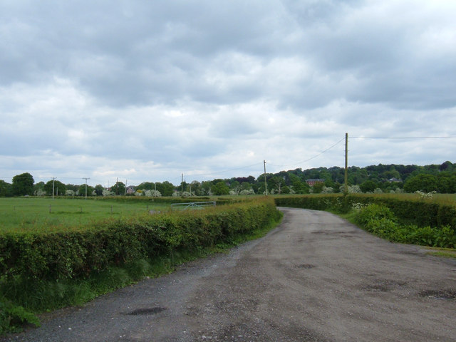
In addition to the mill itself, the site is surrounded by beautiful countryside, offering visitors the opportunity to enjoy a peaceful and picturesque setting. There are also walking trails and picnic areas available for visitors to enjoy.

Nether Alderley Mill is managed by the National Trust, ensuring its preservation and accessibility for future generations. The site serves as a valuable educational resource, providing a glimpse into the traditional methods of milling that played a crucial role in the development of the region.

If you have any feedback on the listing, please let us know in the comments section below.

Nether Alderley Mill Images

Images are sourced within 2km of 53.283/-2.236 or Grid Reference SJ8476. Thanks to Geograph Open Source API. All images are credited.

A34 The A34 is a 200 mile long major trunk road that runs from Salford to Winchester via The Potteries, Birmingham and Oxford. It is divided into two sections <span class="nowrap"><a title="http://www.sabre-roads.org.uk/wiki/index.php?title=A34" rel="nofollow ugc noopener" href="http://www.sabre-roads.org.uk/wiki/index.php?title=A34">Link</a><img style="margin-left:2px;" alt="External link" title="External link - shift click to open in new window" src="https://s1.geograph.org.uk/img/external.png" width="10" height="10"/></span> 
Wikipedia: <span class="nowrap"><a title="http://en.wikipedia.org/wiki/A34_road" rel="nofollow ugc noopener" href="http://en.wikipedia.org/wiki/A34_road">Link</a><img style="margin-left:2px;" alt="External link" title="External link - shift click to open in new window" src="https://s1.geograph.org.uk/img/external.png" width="10" height="10"/></span>
A34
The A34 is a 200 mile long major trunk road that runs from Salford to Winchester via The Potteries, Birmingham and Oxford. It is divided into two sections LinkExternal link Wikipedia: LinkExternal link
Corbishley
Corbishley
In Alderley Edge (5) Premises on London Road
In Alderley Edge (5)
Premises on London Road
In Alderley Edge (6) Preparing for the big day
In Alderley Edge (6)
Preparing for the big day
In Alderley Edge (7) A Royal Cut!
In Alderley Edge (7)
A Royal Cut!
In Alderley Edge (8) Cheshire fashion
In Alderley Edge (8)
Cheshire fashion
In Alderley Edge (9) Italian eatery
In Alderley Edge (9)
Italian eatery
In Alderley Edge (10) Afternoon tea
In Alderley Edge (10)
Afternoon tea
In Alderley Edge (15) Approaching the road junction for Over Alderley and Prestbury
In Alderley Edge (15)
Approaching the road junction for Over Alderley and Prestbury
Alderley Edge Woodland on Alderley Edge. The hill here was worked for copper, there are many pits and mounds from the mining days.
Alderley Edge
Woodland on Alderley Edge. The hill here was worked for copper, there are many pits and mounds from the mining days.
Nether Alderley Mill. (NT) Working Mediaeval Mill.
Nether Alderley Mill. (NT)
Working Mediaeval Mill.
Lodge, Alderley Edge Home of the rich and famous, Alderley Edge has some modest properties, but this would not be cheap...
Lodge, Alderley Edge
Home of the rich and famous, Alderley Edge has some modest properties, but this would not be cheap...
Farmland near Alderley Edge Looking SE from a point on the minor road near Finlow Hill Farm.
Farmland near Alderley Edge
Looking SE from a point on the minor road near Finlow Hill Farm.
Pasture, Bradford House Farm This attractive farmstead is about one kilometre west of the A34 at Nether Alderley on Bradford Lane, a lovely secluded bridleway.
Pasture, Bradford House Farm
This attractive farmstead is about one kilometre west of the A34 at Nether Alderley on Bradford Lane, a lovely secluded bridleway.
Bradford Lane , Nether Alderley Bradford Lane is now a bridleway but is shown on the 1940s OS map as a coloured motor road. These cobbles soon peter out and the surface becomes broken and muddy at Bradford House Farm where the gradient steepens. Lovely.
Bradford Lane , Nether Alderley
Bradford Lane is now a bridleway but is shown on the 1940s OS map as a coloured motor road. These cobbles soon peter out and the surface becomes broken and muddy at Bradford House Farm where the gradient steepens. Lovely.
Higher House Farm Situated on Hocker Lane, a bridleway linking Slade Lane with Bradford Lane. The building in the picture is The Farm House; there are other substantial residential conversions adjacent.
Higher House Farm
Situated on Hocker Lane, a bridleway linking Slade Lane with Bradford Lane. The building in the picture is The Farm House; there are other substantial residential conversions adjacent.
Farm track from Field's Farm Looking NE towards the outskirts of Alderley Edge.
Farm track from Field's Farm
Looking NE towards the outskirts of Alderley Edge.
Show me another place!

Nether Alderley Mill is located at Grid Ref: SJ8476 (Lat: 53.283, Lng: -2.236)

Unitary Authority: Cheshire East

Police Authority: Cheshire

What 3 Words

///copycat.segregate.ritual. Near Alderley Edge, Cheshire

Related Wikis

Nether Alderley Mill

Nether Alderley Mill is a 16th-century watermill located in Congleton Road (the A34), to the south of the village of Nether Alderley, Cheshire, England...

Alderley Old Hall

Alderley Old Hall is the remaining part of a former 17th-century manor house near the village of Nether Alderley, Cheshire, England. It stands adjacent...

Nether Alderley

Nether Alderley is a village and civil parish in Cheshire, England, on the A34 a mile and a half south of Alderley Edge. The civil parish includes the...

Alderley, Cheshire

Alderley was one of the eight ancient parishes of the Macclesfield Hundred of Cheshire, England. It included the following townships: Over Alderley Nether...

Nearby Amenities

Located within 500m of 53.283,-2.236
Bus Stop
Nether Alderley, Congleton Road / Bradford Lane
Bus: yes
Naptan AtcoCode: 0600MA0280
Naptan Bearing: S
Naptan CommonName: Bradford Lane
Naptan Crossing: Bradford Lane
Naptan Indicator: cnr
Naptan Landmark: School
Naptan LocalityName: Nether Alderley
Naptan NaptanCode: chempmw
Naptan ShortCommonName: Bradford Lane
Naptan Street: Congleton Road
Naptan Verified: no
Network: Cheshire East Council
Operator: Ansa Transport
Public Transport: platform
Source: naptan_import
Lat/Long: 53.2863241/-2.2371626
Bus Stop
Nether Alderley, Congleton Road / Primary School
Bus: yes
Naptan AtcoCode: 0600MA0281
Naptan Bearing: N
Naptan BusStopType: CUS
Naptan CommonName: Primary School
Naptan Crossing: Bradford Lane
Naptan Indicator: opp
Naptan Landmark: School
Naptan LocalityName: Nether Alderley
Naptan NaptanCode: chempta
Naptan ShortCommonName: Nether Ald'ley Sch
Naptan Street: Congleton Road
Naptan Verified: no
Network: Cheshire East Council
Operator: Ansa Transport
Public Transport: platform
Source: naptan_import
Lat/Long: 53.2862744/-2.237504
Bus Stop
Nether Alderley, Congleton Road / Nether Alderley Mill
Bus: yes
Naptan AtcoCode: 0600MA0282
Naptan Bearing: NW
Naptan CommonName: Nether Alderley Mill
Naptan Indicator: opp
Naptan Landmark: Nether Alderley Mill
Naptan LocalityName: Nether Alderley
Naptan NaptanCode: chemptd
Naptan ShortCommonName: Nether A'ley Mill
Naptan Street: Congleton Road
Naptan Verified: no
Network: Cheshire East Council
Operator: Ansa Transport
Public Transport: platform
Source: naptan_import
Lat/Long: 53.2825913/-2.2365938
Bus Stop
Nether Alderley, Congleton Road / AstraZeneca Main Gate
Bus: yes
Naptan AtcoCode: 0600MA0284
Naptan Bearing: N
Naptan CommonName: AstraZeneca Main Gate
Naptan Indicator: opp
Naptan Landmark: AstraZeneca
Naptan LocalityName: Nether Alderley
Naptan NaptanCode: chemptj
Naptan ShortCommonName: AstraZeneca Entr
Naptan Street: Congleton Road
Naptan Verified: no
Network: Cheshire East Council
Operator: Ansa Transport
Public Transport: platform
Source: naptan_import
Lat/Long: 53.279818/-2.2368965
Barrier: kissing_gate
Material: metal
Lat/Long: 53.2855283/-2.2410615
Barrier: kissing_gate
Material: metal
Lat/Long: 53.2822358/-2.2395995
Entrance: main
Lat/Long: 53.2819758/-2.2389147
Barrier: kissing_gate
Material: metal
Lat/Long: 53.2849369/-2.2409609
Barrier: kissing_gate
Material: metal
Lat/Long: 53.2841595/-2.2408703
Traffic Signals
Lat/Long: 53.2795843/-2.2368655
Traffic Calming: hump
Lat/Long: 53.2789028/-2.2353736
Barrier: lift_gate
Lat/Long: 53.2790436/-2.2356384
Crossing: unmarked
Crossing Island: yes
Lat/Long: 53.2795092/-2.2362063
Turning Circle
Lat/Long: 53.2817774/-2.2385902
Nether Alderley
Place: village
Lat/Long: 53.2848371/-2.238392
Post Box
Collection Times: Mo-Fr 09:00; Sa 07:00
Ref: SK9 128
Lat/Long: 53.2825773/-2.2365397
Turning Loop
Lat/Long: 53.2853463/-2.2367688
Bus Stop
Nether Alderley, Congleton Road / Nether Alderley Mill
Bus: yes
Naptan AtcoCode: 0600MA19136
Naptan Bearing: SE
Naptan BusStopType: CUS
Naptan CommonName: Nether Alderley Mill
Naptan Indicator: o/s
Naptan Landmark: Nether Alderley Mill
Naptan LocalityName: Nether Alderley
Naptan NaptanCode: cheadpwt
Naptan ShortCommonName: Nether A'ley Mill
Naptan Street: Congleton Road
Network: Cheshire East Council
Operator: Ansa Transport
Public Transport: platform
Source: naptan_import
Lat/Long: 53.2825823/-2.2364002
Listed Status: Grade II
Man Made: obelisk
Wikidata: Q26564806
Lat/Long: 53.283589/-2.2323516
Information: guidepost
Operator: Peak & Northern Footpaths Society
Ref: 211
Tourism: information
Lat/Long: 53.282752/-2.2401977
Bus Stop
Nether Alderley, Bradford Lane / Nether Alderley Primary
Bus: yes
Naptan AtcoCode: 0600MA5132
Naptan Bearing: E
Naptan BusStopType: CUS
Naptan CommonName: Nether Alderley Primary
Naptan Indicator: o/s
Naptan Landmark: School
Naptan LocalityName: Nether Alderley
Naptan NaptanCode: cheadpam
Naptan ShortCommonName: Nether Alderley Sch
Naptan Street: Bradford Lane
Network: Cheshire East Council
Operator: Ansa Transport
Public Transport: platform
Source: naptan_import
Lat/Long: 53.2861172/-2.236161
Bus Stop
Nether Alderley, Congleton Road / AstraZeneca Main Gate
Bus: yes
Naptan AtcoCode: 0600MA0283
Naptan Bearing: S
Naptan CommonName: AstraZeneca Main Gate
Naptan Indicator: o/s
Naptan Landmark: AstraZeneca
Naptan LocalityName: Nether Alderley
Naptan NaptanCode: chemptg
Naptan ShortCommonName: AstraZeneca Entr
Naptan Street: Congleton Road
Network: Cheshire East Council
Operator: Ansa Transport
Public Transport: platform
Source: naptan_import
Lat/Long: 53.2793113/-2.2368465
Barrier: lift_gate
Lift Gate Type: double
Lat/Long: 53.279774/-2.2334701
The data included in this document is from www.openstreetmap.org. The data is made available under ODbL.

Have you been to Nether Alderley Mill?

Leave your review of Nether Alderley Mill below (or comments, questions and feedback).