Mynachdy'r Graig

Heritage Site in Cardiganshire

Wales

Mynachdy'r Graig

Trac i Ffos-lâs The track down to the old Ffos-lâs farmhouse, its hawthorns blasted by the prevailing south-west winds off the ocean.
Trac i Ffos-lâs Credit: Mike Parker

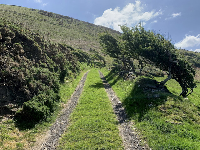
Mynachdy'r Graig, located in Cardiganshire, Wales, is a historic heritage site that holds great cultural and historical significance. The site is situated on a hillside overlooking the beautiful Teifi Valley, adding to its natural charm and appeal.

Dating back to the 12th century, Mynachdy'r Graig was originally a Cistercian grange, serving as an agricultural estate for nearby Strata Florida Abbey. The grange was responsible for farming and providing sustenance for the abbey, making it an essential part of the local economy.

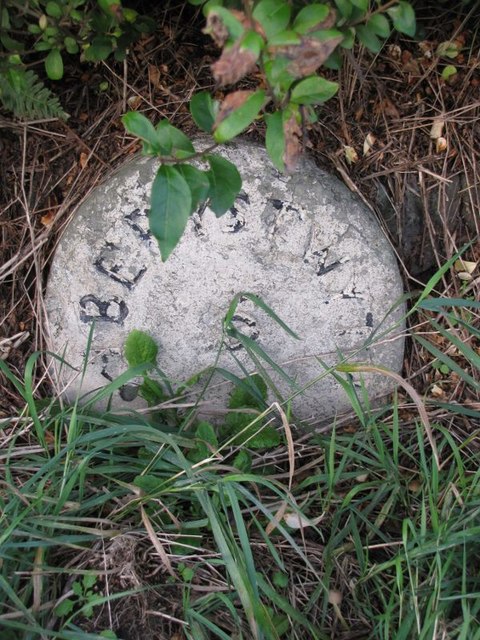
The site features several well-preserved structures, including a medieval hall-house, a granary, and a dovecote. These buildings showcase the architectural styles of their respective periods and provide valuable insights into the region's history.

Visitors to Mynachdy'r Graig can explore the grounds and marvel at the stunning views of the surrounding countryside. The site offers guided tours, allowing visitors to learn about the fascinating history and daily life of the Cistercian monks who once inhabited the area.

In addition, Mynachdy'r Graig hosts various cultural events and exhibitions throughout the year, providing visitors with a deeper understanding of the site's historical and cultural significance. The site is also used as a venue for educational programs, offering schoolchildren and researchers the opportunity to delve into the rich heritage of the area.

Overall, Mynachdy'r Graig is a must-visit destination for history enthusiasts, offering a captivating glimpse into the past and the chance to appreciate the natural beauty of the Welsh countryside.

If you have any feedback on the listing, please let us know in the comments section below.

Mynachdy'r Graig Images

Images are sourced within 2km of 52.35/-4.117 or Grid Reference SN5574. Thanks to Geograph Open Source API. All images are credited.

Trac i Ffos-lâs The track down to the old Ffos-lâs farmhouse, its hawthorns blasted by the prevailing south-west winds off the ocean.
Trac i Ffos-lâs
The track down to the old Ffos-lâs farmhouse, its hawthorns blasted by the prevailing south-west winds off the ocean.
Pa ffordd nawr? Which way now? A footpath signpost on the Wales Coastal Path at Ffos-lâs.
Pa ffordd nawr?
Which way now? A footpath signpost on the Wales Coastal Path at Ffos-lâs.
Fferm Ffos-lâs For years, Ffos-lâs was an intriguing ruin along the Wales Coast Path. It's currently undergoing major restoration work. Whether the sheep sheltering from the sun in its shadow will be quite so welcome in the future is yet to be seen.
Fferm Ffos-lâs
For years, Ffos-lâs was an intriguing ruin along the Wales Coast Path. It's currently undergoing major restoration work. Whether the sheep sheltering from the sun in its shadow will be quite so welcome in the future is yet to be seen.
Pencwm Mawr farm North of Llanddeiniol
Pencwm Mawr farm
North of Llanddeiniol
The A487 Heading north towards Blaenplwyf
The A487
Heading north towards Blaenplwyf
Blaenplwyf Transmitter It was originally built by the BBC, entering service in October 1956 acting as a main transmitter for BBC Band II VHF FM radio. It currently carries all six UK digital television multiplexes.
Blaenplwyf Transmitter
It was originally built by the BBC, entering service in October 1956 acting as a main transmitter for BBC Band II VHF FM radio. It currently carries all six UK digital television multiplexes.
Cairn at Pen Glôg
Cairn at Pen Glôg
Mynachdy'r-graig Farm
Cliff and fish trap at Ffos-lâs
Lane leading towards Ffos-lâs
A windswept hillside at Cwm-ceirw
A487 near Y Meini
A487 near Y Meini
A487 near Glan-rhos
A487 near Glan-rhos
Milestone - Aberystwyth 6
Old Milestone by the A487, Brynhaulwen, Llanfarian Parish Aberystwyth tombstone by the A487, in parish of Llanfarian (Ceredigion District), Blaenplwyf, near Brynhaulwen.

Inscription reads:-
ABERYSTWYTH
5
Miles

Grade II Listed by Cadw.
Reference Number 82506: <span class="nowrap"><a title="https://cadwpublic-api.azurewebsites.net/reports/listedbuilding/FullReport?lang=&id=82506" rel="nofollow ugc noopener" href="https://cadwpublic-api.azurewebsites.net/reports/listedbuilding/FullReport?lang=&id=82506">Link</a><img style="margin-left:2px;" alt="External link" title="External link - shift click to open in new window" src="https://s1.geograph.org.uk/img/external.png" width="10" height="10"/></span>

Surveyed

Milestone Society National ID: CRD_AYCA05
Old Milestone by the A487, Brynhaulwen, Llanfarian Parish
Aberystwyth tombstone by the A487, in parish of Llanfarian (Ceredigion District), Blaenplwyf, near Brynhaulwen. Inscription reads:- ABERYSTWYTH 5 Miles Grade II Listed by Cadw. Reference Number 82506: LinkExternal link Surveyed Milestone Society National ID: CRD_AYCA05
Old Milestone by the A487, Y Meini, Llanfarian Parish Aberystwyth tombstone by the A487, in parish of Llanfarian (Ceredigion District),  near Y Meini, in embankment, West side of road.

Inscription reads:-
ABERYSTWYTH
6
Miles
OSBM bench mark recorded on this stone.

Grade II Listed by Cadw.
Reference Number 82508: <span class="nowrap"><a title="https://cadwpublic-api.azurewebsites.net/reports/listedbuilding/FullReport?lang=&id=82508" rel="nofollow ugc noopener" href="https://cadwpublic-api.azurewebsites.net/reports/listedbuilding/FullReport?lang=&id=82508">Link</a><img style="margin-left:2px;" alt="External link" title="External link - shift click to open in new window" src="https://s1.geograph.org.uk/img/external.png" width="10" height="10"/></span>

Surveyed

Milestone Society National ID: CRD_AYCA06
Old Milestone by the A487, Y Meini, Llanfarian Parish
Aberystwyth tombstone by the A487, in parish of Llanfarian (Ceredigion District), near Y Meini, in embankment, West side of road. Inscription reads:- ABERYSTWYTH 6 Miles OSBM bench mark recorded on this stone. Grade II Listed by Cadw. Reference Number 82508: LinkExternal link Surveyed Milestone Society National ID: CRD_AYCA06
Chapel at Blaenplwyf beside the main road Dated 16th August 1878. Its hey day must have been before the Great War and its decline gradual since and now a headlong rush to low attendance now I assume.
Chapel at Blaenplwyf beside the main road
Dated 16th August 1878. Its hey day must have been before the Great War and its decline gradual since and now a headlong rush to low attendance now I assume.
Blaenplwyf Houses in Blaenplwyf on the A487. The village was known as Pont-llanio until 1957.
Blaenplwyf
Houses in Blaenplwyf on the A487. The village was known as Pont-llanio until 1957.
Show me another place!

Mynachdy'r Graig is located at Grid Ref: SN5574 (Lat: 52.35, Lng: -4.117)

Unitary Authority: Ceredigion

Police Authority: Dyfed Powys

What 3 Words

///rapport.cashiers.restores. Near Llanilar, Ceredigion

Nearby Locations

Mynachdy'r Graig

Related Wikis

Blaenplwyf transmitting station

The Blaenplwyf transmitting station (sometimes written "Blaen Plwyf" or "Blaen-Plwyf") is a broadcasting and telecommunications facility located near the...

Blaenplwyf

Blaenplwyf (Pontllanio previously) is a village in Ceredigion, to the southwest of Aberystwyth. It is noted for the Blaenplwyf transmitting station, which...

Rhos Blaen Carrog

Rhos Blaen Carrog is a Site of Special Scientific Interest in Ceredigion, west Wales, due to its population of Wavy St. John's Wort (Hypericum undulatum...

Chancery, Ceredigion

Chancery (Welsh: Rhydgaled) is a hamlet in Llanfarian community, in the district county of Ceredigion, Mid-Wales, south of the administrative centre Aberystwyth...
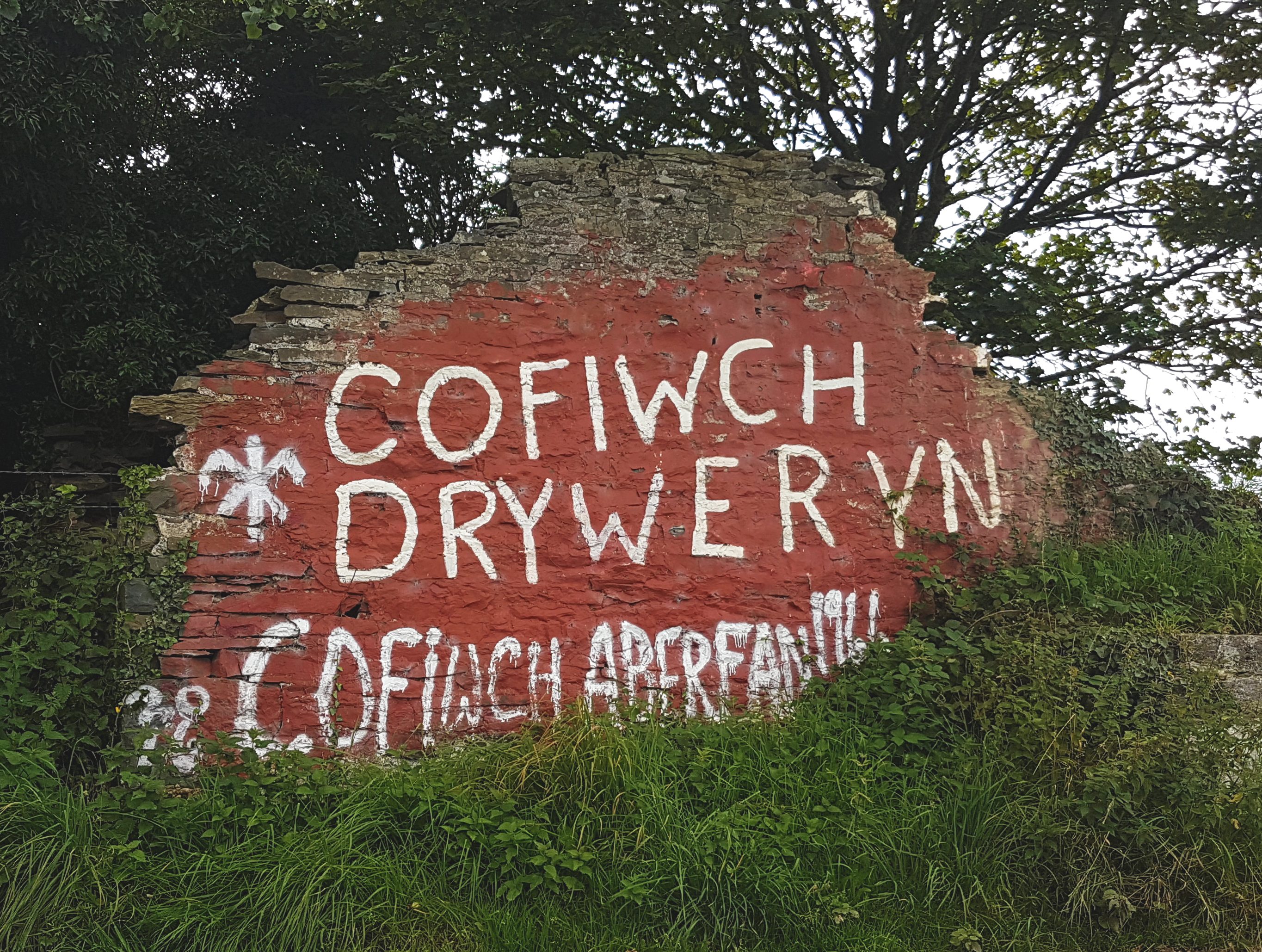
Cofiwch Dryweryn

Cofiwch Dryweryn (English: "Remember Tryweryn") is a graffitied stone wall near Llanrhystud, Ceredigion, Wales. Author and journalist Meic Stephens originally...

Llanfarian

Llanfarian is a village, electoral ward and community in the district county of Ceredigion, Mid-Wales, south of the administrative centre Aberystwyth....

Llanrhystyd Road railway station

Llanrhystyd Road railway station was located on the Carmarthen to Aberystwyth Line, originally called the Manchester and Milford Railway, before being...

Gaer Penrhôs

Gaer Penrhôs, in Ceredigion, Wales, was a ringwork castle at the summit of a steep hill near the village of Llanrhystud; now all that remains are the outlines...

Nearby Amenities

Located within 500m of 52.35,-4.117
Created By: dmgroom_coastlines
Source: PGS
Lat/Long: 52.353891/-4.119323
Created By: dmgroom_coastlines
Source: PGS
Lat/Long: 52.353119/-4.119722
Source: PGS
Lat/Long: 52.352312/-4.1202289
Source: PGS
Lat/Long: 52.3516924/-4.1204187
Source: PGS
Lat/Long: 52.3512573/-4.1208033
Source: PGS
Lat/Long: 52.3509121/-4.1210355
Created By: dmgroom_coastlines
Source: PGS
Lat/Long: 52.350281/-4.121743
Created By: dmgroom_coastlines
Source: PGS
Lat/Long: 52.35002/-4.122154
Source: PGS
Lat/Long: 52.3479326/-4.1228751
Source: PGS
Lat/Long: 52.3471875/-4.1226727
Barrier: kissing_gate
Lat/Long: 52.3541647/-4.1190528
Monks Cave
Description: Eroded
Fee: no
Natural: cave_entrance
Lat/Long: 52.3490213/-4.1225832
Direction: 195
Generator Method: photovoltaic
Generator Output Electricity: yes
Generator Solar Modules: 20
Generator Source: solar
Generator Type: solar_photovoltaic_panel
Location: roof
Power: generator
Lat/Long: 52.3498107/-4.1125901
Barrier: kissing_gate
Lat/Long: 52.3528681/-4.1186915
Barrier: cattle_grid
Lat/Long: 52.349645/-4.1126578
Barrier: cattle_grid
Lat/Long: 52.3481384/-4.1120153
The data included in this document is from www.openstreetmap.org. The data is made available under ODbL.

Have you been to Mynachdy'r Graig?

Leave your review of Mynachdy'r Graig below (or comments, questions and feedback).