Mulfra Quoit

Heritage Site in Cornwall

England

Mulfra Quoit

Chysauster - Looking over House 6 Taken from the wooden viewing stand to the east of House 6 looking across its interior.
Chysauster - Looking over House 6 Credit: Rob Farrow

Mulfra Quoit is a prehistoric dolmen located near the village of Penzance, Cornwall, in the southwest of England. This ancient monument is considered one of the most significant megalithic structures in the region and is recognized as a Scheduled Ancient Monument and a Grade II listed building.

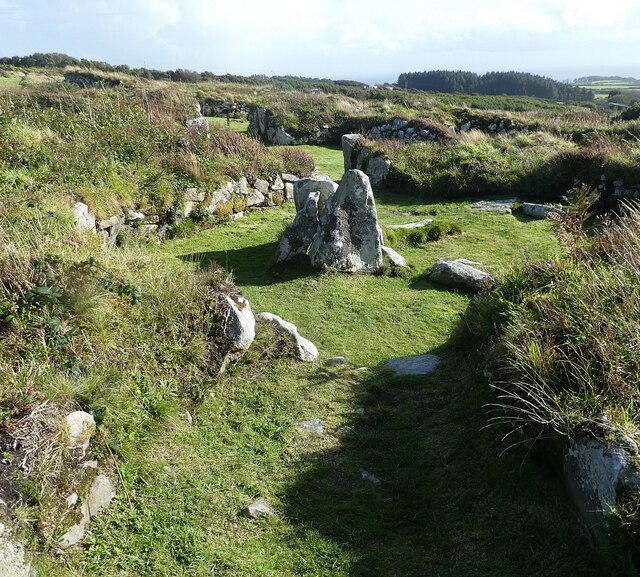
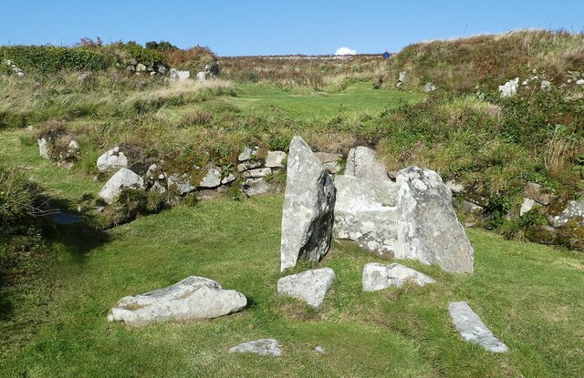
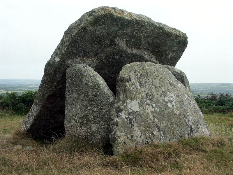
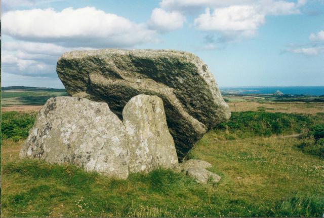
The dolmen is believed to have been constructed during the Neolithic period around 3,500 to 2,500 BC. It consists of three large granite stones, with the two vertical stones supporting a massive capstone, creating a chamber-like structure. The capstone measures approximately 3 meters in length and weighs several tons, making it an impressive feat of engineering for its time.

Mulfra Quoit is situated on a hilltop, providing panoramic views of the surrounding landscape, including the nearby Mount's Bay and the Atlantic Ocean. It is believed that the site was chosen for its prominent location, possibly for ceremonial or burial purposes, as dolmens like this were commonly used as burial chambers during the Neolithic period.

Over the years, the monument has suffered from weathering and deterioration, and only a portion of the original structure remains standing today. Nevertheless, Mulfra Quoit continues to attract visitors and archaeology enthusiasts who are fascinated by its ancient history and the mystery surrounding its purpose and construction.

Access to Mulfra Quoit is relatively easy, with a short walk from the nearest road leading to the site. The dolmen stands as a testament to the ingenuity and craftsmanship of our prehistoric ancestors, offering a glimpse into the distant past and the rich archaeological heritage of Cornwall.

If you have any feedback on the listing, please let us know in the comments section below.
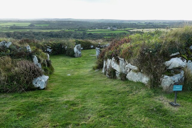
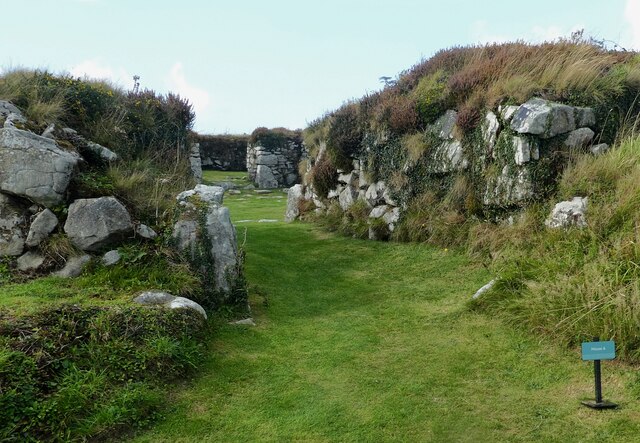
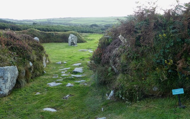
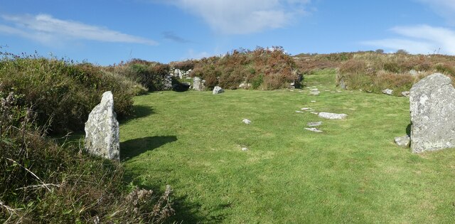
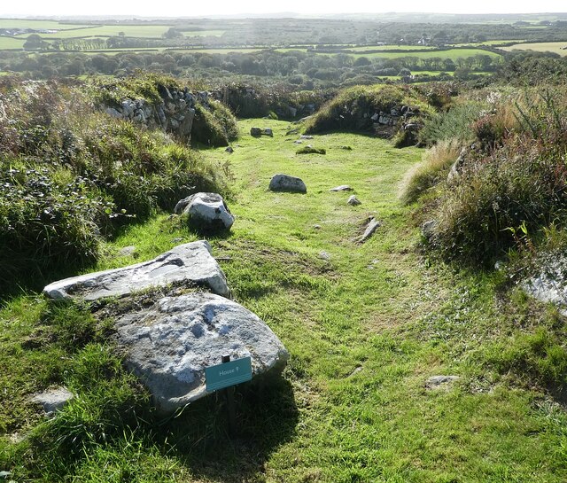
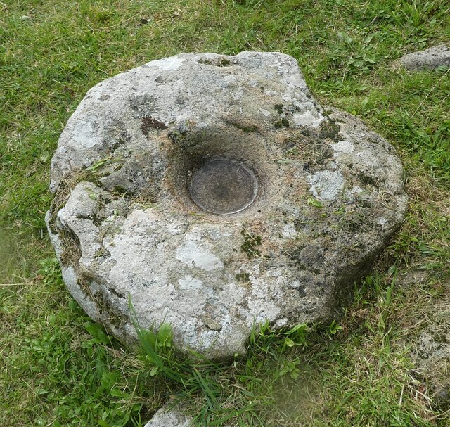
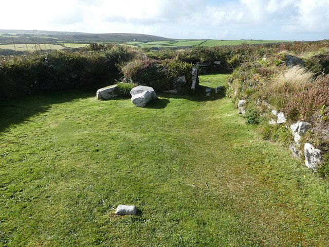
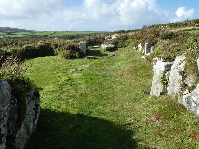
Mulfra Quoit Images

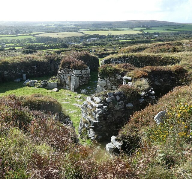
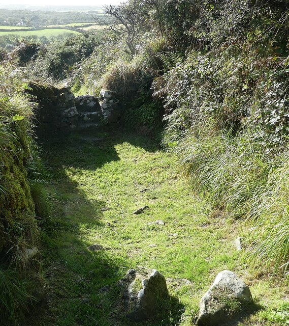
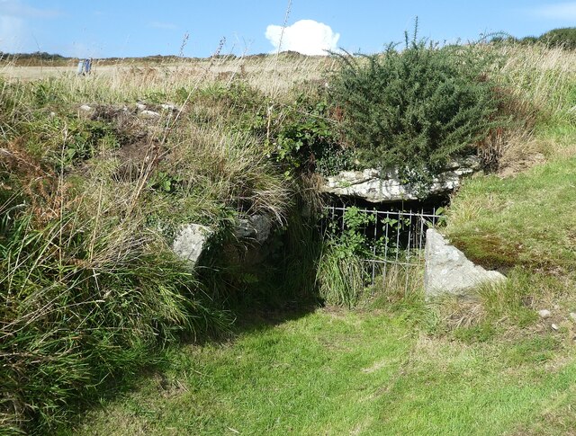
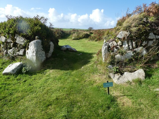
Images are sourced within 2km of 50.165/-5.563 or Grid Reference SW4535. Thanks to Geograph Open Source API. All images are credited.

Chysauster - Looking over House 6 Taken from the wooden viewing stand to the east of House 6 looking across its interior.
Chysauster - Looking over House 6
Taken from the wooden viewing stand to the east of House 6 looking across its interior.
Chysauster - pathway and ancient stile This pathway is at the northern perimeter of the ancient village and is 'stopped' by an ancient stone stile at each end, this one is at the western end.
Chysauster - pathway and ancient stile
This pathway is at the northern perimeter of the ancient village and is 'stopped' by an ancient stone stile at each end, this one is at the western end.
Chysauster - Fogou A Fogou is an underground passage which takes its name from the Cornish for 'Cave'. This one at Chysauster was described as 'partly destroyed' in 1865 and further damage was noted in 1938. It remained open to the public until as recently as 1984, but at that time it became unstable so the grille seen here was installed to prevent access.
To get an idea of what it would originally have looked like, see this far better preserved example at (comparatively) nearby Carn Euny <a href="https://www.geograph.org.uk/photo/6982172">SW4028 : Carn Euny - Fogou</a>
Chysauster - Fogou
A Fogou is an underground passage which takes its name from the Cornish for 'Cave'. This one at Chysauster was described as 'partly destroyed' in 1865 and further damage was noted in 1938. It remained open to the public until as recently as 1984, but at that time it became unstable so the grille seen here was installed to prevent access. To get an idea of what it would originally have looked like, see this far better preserved example at (comparatively) nearby Carn Euny SW4028 : Carn Euny - Fogou
Chysauster - House 1 - Entrance The entranceway into House 1 at Chysauster. This is the northernmost of the nine houses in the ancient village.
Chysauster - House 1 - Entrance
The entranceway into House 1 at Chysauster. This is the northernmost of the nine houses in the ancient village.
Chysauster - House 2 House 2 in the ancient village of Chysauster is the least intact of all the nine former dwellings. It lies at the northeast of the site.
Chysauster - House 2
House 2 in the ancient village of Chysauster is the least intact of all the nine former dwellings. It lies at the northeast of the site.
Chysauster - House 3a - Entrance House 3 at Chysauster is unique in being effectively a pair of semi-detached houses. This view is into the left-hand one known as 3a. (Cf. 3b <a href="https://www.geograph.org.uk/photo/6989461">SW4735 : Chysauster - House 3b - Interior from 3a</a>).
Chysauster - House 3a - Entrance
House 3 at Chysauster is unique in being effectively a pair of semi-detached houses. This view is into the left-hand one known as 3a. (Cf. 3b SW4735 : Chysauster - House 3b - Interior from 3a).
Chysauster - House 3b - Interior from 3a House 3 at Chysauster is a pair of 'semi-detached' dwellings known as 3a and 3b. This is a view into the latter from the former.
For its twin see <a href="https://www.geograph.org.uk/photo/6989459">SW4735 : Chysauster - House 3a - Entrance</a>
Chysauster - House 3b - Interior from 3a
House 3 at Chysauster is a pair of 'semi-detached' dwellings known as 3a and 3b. This is a view into the latter from the former. For its twin see SW4735 : Chysauster - House 3a - Entrance
Chysauster - House 4 - Entrance The entrance into House 4 at Chysauster. This is a well-preserved house in the middle of the site; houses 1 & 2 are to its north, 3 is to its WSW, 6 is to its SE and 5 to its south.
Chysauster - House 4 - Entrance
The entrance into House 4 at Chysauster. This is a well-preserved house in the middle of the site; houses 1 & 2 are to its north, 3 is to its WSW, 6 is to its SE and 5 to its south.
Chysauster - House 5 - Entrance House 5 is one of the smaller houses at Chysauster, but has substantial remains and walls to a good height. It is positioned towards the south of the village. In common with the other houses it has several rooms around a central area which was probably a courtyard as being too large for a room it is thought.
Chysauster - House 5 - Entrance
House 5 is one of the smaller houses at Chysauster, but has substantial remains and walls to a good height. It is positioned towards the south of the village. In common with the other houses it has several rooms around a central area which was probably a courtyard as being too large for a room it is thought.
Chysauster - House 6 - Entrance House 6 is the 'showhouse' of Chysauster, being the best preserved and most complete. As with the other houses it is arranged as a number of rooms around a central courtyard. First excavated by Cornish antiquary William Copeland Borlase in 1873, in 1931 its exterior walls were exposed for the first time since antiquity. There is a wooden platform on the eastern side of the house that allows visitors to look down into this house (see <a href="https://www.geograph.org.uk/photo/6987276">SW4735 : Chysauster - Looking over House 6</a> for example)
Chysauster - House 6 - Entrance
House 6 is the 'showhouse' of Chysauster, being the best preserved and most complete. As with the other houses it is arranged as a number of rooms around a central courtyard. First excavated by Cornish antiquary William Copeland Borlase in 1873, in 1931 its exterior walls were exposed for the first time since antiquity. There is a wooden platform on the eastern side of the house that allows visitors to look down into this house (see SW4735 : Chysauster - Looking over House 6 for example)
Chysauster - House 7 - Entrance House 7 is the southernmost of the houses at Chysauster. On excavation a huge quantity of artefacts were discovered, such as 1,322 items of pottery. It is thought that perhaps this house had been abandoned before the others and had subsequently been used as a refuse pit, hence the quantity of finds.
Chysauster - House 7 - Entrance
House 7 is the southernmost of the houses at Chysauster. On excavation a huge quantity of artefacts were discovered, such as 1,322 items of pottery. It is thought that perhaps this house had been abandoned before the others and had subsequently been used as a refuse pit, hence the quantity of finds.
Chysauster - House 8 House 8 is after House 2 the second least well preserved of the houses at Chysauster. It lies in the southwestern corner of the site and is the westernmost of all the former dwellings. It does contain a number of notable standing stones but little of its former plan can be easily discerned.
Chysauster - House 8
House 8 is after House 2 the second least well preserved of the houses at Chysauster. It lies in the southwestern corner of the site and is the westernmost of all the former dwellings. It does contain a number of notable standing stones but little of its former plan can be easily discerned.
Chysauster - House 9 - Entrance House 9 appears rather different from the other houses on the site being less circular, though it is thought that it probably conformed to the same plan as the others with several rooms around a central courtyard. What remains however is rather more 'long and thin' than the others. It is the easternmost of all the houses at Chysauster.
Chysauster - House 9 - Entrance
House 9 appears rather different from the other houses on the site being less circular, though it is thought that it probably conformed to the same plan as the others with several rooms around a central courtyard. What remains however is rather more 'long and thin' than the others. It is the easternmost of all the houses at Chysauster.
Chysauster - Hollowed stone in House 6 This hollowed stone was perhaps used as an ancient mortar for grinding food with the aid of a pestle. It is to be found in House 6 - the most complete of all the remnant houses at Chysauster.
Chysauster - Hollowed stone in House 6
This hollowed stone was perhaps used as an ancient mortar for grinding food with the aid of a pestle. It is to be found in House 6 - the most complete of all the remnant houses at Chysauster.
Chysauster - House 3a - Interior Inside the left-hand of the two semi-detached dwellings that comprise House 3a at Chysauster. (see <a href="https://www.geograph.org.uk/photo/6989459">SW4735 : Chysauster - House 3a - Entrance</a>)
Chysauster - House 3a - Interior
Inside the left-hand of the two semi-detached dwellings that comprise House 3a at Chysauster. (see SW4735 : Chysauster - House 3a - Entrance)
Chysauster - House 3b - Interior courtyard area A view of the courtyard of House 3b (see <a href="https://www.geograph.org.uk/photo/6989461">SW4735 : Chysauster - House 3b - Interior from 3a</a>)
Chysauster - House 3b - Interior courtyard area
A view of the courtyard of House 3b (see SW4735 : Chysauster - House 3b - Interior from 3a)
Chysauster - House 3b - Looking back towards entrance This view is from the northern end of House 3b looking back.
The large structure in mid photo is <a href="https://www.geograph.org.uk/photo/6990868">SW4735 : Chysauster - House 3b - Probable hearth or forge</a>
Chysauster - House 3b - Looking back towards entrance
This view is from the northern end of House 3b looking back. The large structure in mid photo is SW4735 : Chysauster - House 3b - Probable hearth or forge
Chysauster - House 3b - Probable hearth or forge It is thought that this stone structure in the centre of the large circular room at the north end of House 3b was probably either a hearth or possibly a forge - however excavations and analysis have discovered no evidence of intense burning. So it remains something of a mystery.
Chysauster - House 3b - Probable hearth or forge
It is thought that this stone structure in the centre of the large circular room at the north end of House 3b was probably either a hearth or possibly a forge - however excavations and analysis have discovered no evidence of intense burning. So it remains something of a mystery.
Show me another place!

Mulfra Quoit is located at Grid Ref: SW4535 (Lat: 50.165, Lng: -5.563)

Unitary Authority: Cornwall

Police Authority: Devon and Cornwall

What 3 Words

///arena.natively.assure. Near Penzance, Cornwall

Related Wikis

Mulfra Quoit

Mulfra Quoit (grid reference SW451353) is a Neolithic dolmen in the county of Cornwall in England. It stands on Mulfra Hill to the north of the hamlet...

Mulfra

Mulfra is a hamlet in the parish of Madron, Cornwall, England and is on the southern slope of Mulfra Hill. Nearby is the Scheduled monument, Mulfra Quoit...
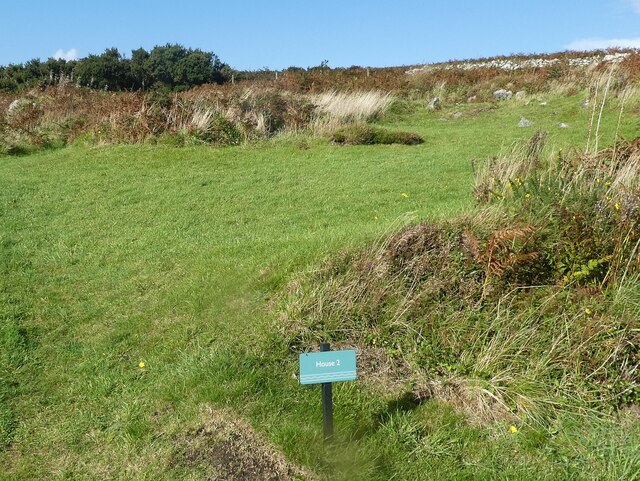
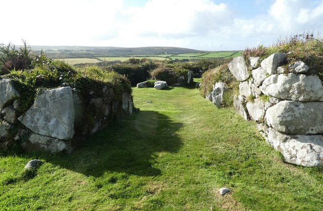
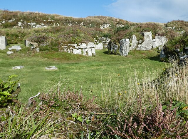
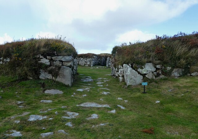
Bodrifty

Bodrifty is the modern name of an Iron Age village, now in ruins, in Cornwall, England, United Kingdom. It is 700 yards west of Mulfra Hill in Penwith...

New Mill, Cornwall

New Mill (Newmill on Ordnance Survey maps) is a small settlement in west Cornwall, England. It is approximately 2 miles (3.2 km) north of Penzance on the...

Nearby Amenities

Located within 500m of 50.165,-5.563
Mulfra Quoit
Archaeological Site: megalith
Historic: archaeological_site
Megalith Type: menhir
Tourism: attraction
Wikidata: Q1952135
Lat/Long: 50.1633334/-5.5693207
Power: pole
Lat/Long: 50.1676592/-5.5577302
Power: pole
Lat/Long: 50.1671043/-5.5578348
Power: pole
Lat/Long: 50.1655923/-5.5580601
Power: pole
Lat/Long: 50.164826/-5.5581754
Power: pole
Lat/Long: 50.1639781/-5.5582921
Power: pole
Transformer: distribution
Lat/Long: 50.1630477/-5.5589667
Power: pole
Lat/Long: 50.1623192/-5.5596104
Power: pole
Lat/Long: 50.1615923/-5.5591491
Power: pole
Lat/Long: 50.1690431/-5.5642185
Power: pole
Lat/Long: 50.1689916/-5.5618729
The data included in this document is from www.openstreetmap.org. The data is made available under ODbL.

Have you been to Mulfra Quoit?

Leave your review of Mulfra Quoit below (or comments, questions and feedback).