Belhaven

Settlement in East Lothian

Scotland

Belhaven

East Lothian Townscape : Do androids dream of the electric scheme? Nope, well, not this one, they won't.

Thankfully, you won't find any bleak, gritty, futuristic urbanism (or androids) here in sunny Dunbar. 

Dunbar's "electric scheme" (so-named because of the electric heating), which includes the sunlit maisonettes of Floors Terrace and Wingate Crescent, is  a planned housing neighbourhood of about 150 dwellings, in a variety of house types, probably built circa 1965-70 and likely to be to the designs of the architects Wheeler and Sproson.
East Lothian Townscape : Do androids dream of the electric scheme? Credit: Richard West

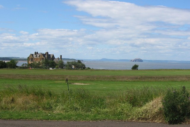
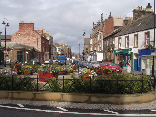
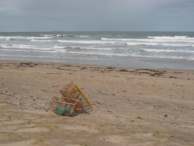
Belhaven is a picturesque coastal village located in East Lothian, Scotland. Situated approximately two miles west of Dunbar, it is nestled on the southern banks of the Firth of Forth. Belhaven is renowned for its stunning sandy beach, which stretches for nearly two miles and offers breathtaking panoramic views of the surrounding landscape.

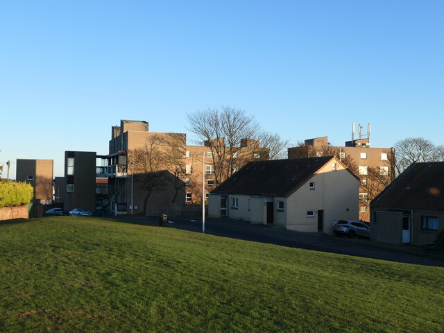
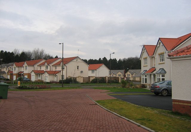
The village itself exhibits a charming character, with traditional stone cottages, quaint streets, and a tranquil atmosphere. Belhaven is home to a tight-knit community, fostering a warm and welcoming environment for residents and visitors alike.

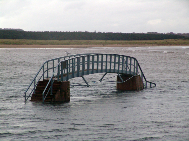
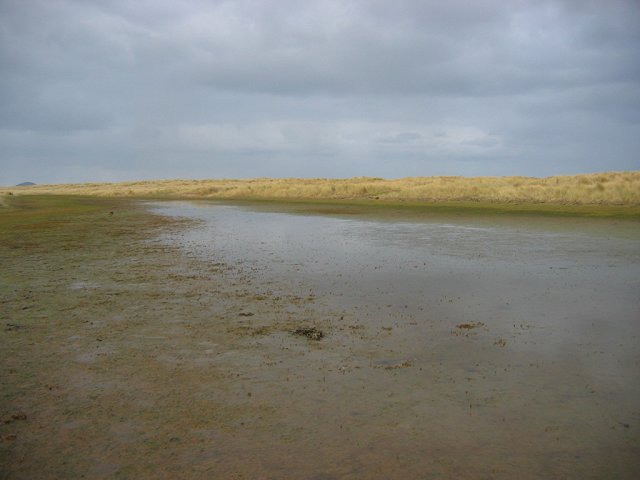
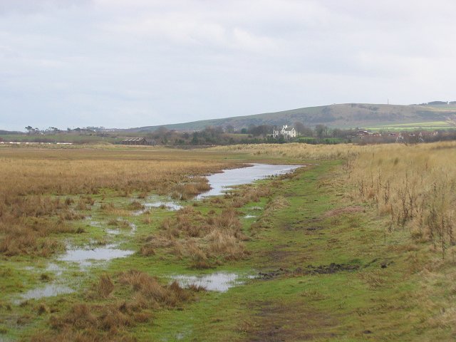
Belhaven's beach is a popular destination for outdoor enthusiasts, offering opportunities for sunbathing, picnicking, and a range of water sports such as surfing and windsurfing. The area is also rich in wildlife, attracting birdwatchers who come to observe the diverse species that inhabit the nearby salt marshes.

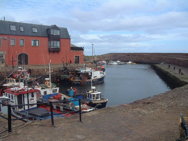
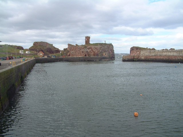
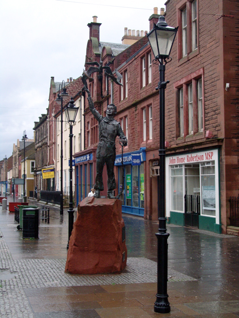
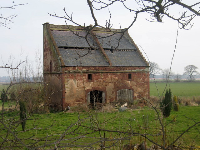
History enthusiasts will find interest in Belhaven's past, as the village holds significant historical importance. It was once a bustling port, playing a crucial role in the region's trade and fishing industries. The remnants of its maritime heritage can still be seen in the harbor, which is now primarily used by local fishermen.

For those seeking cultural experiences, Belhaven is conveniently located near Dunbar, where historical landmarks, museums, and art galleries can be found. Additionally, the village hosts several annual events and festivals, including the Belhaven Arts Festival, showcasing local talent and creativity.

In conclusion, Belhaven offers a unique blend of natural beauty, historical significance, and a strong sense of community, making it an idyllic destination for those seeking a peaceful retreat or an exploration of East Lothian's diverse offerings.

If you have any feedback on the listing, please let us know in the comments section below.

Belhaven Images

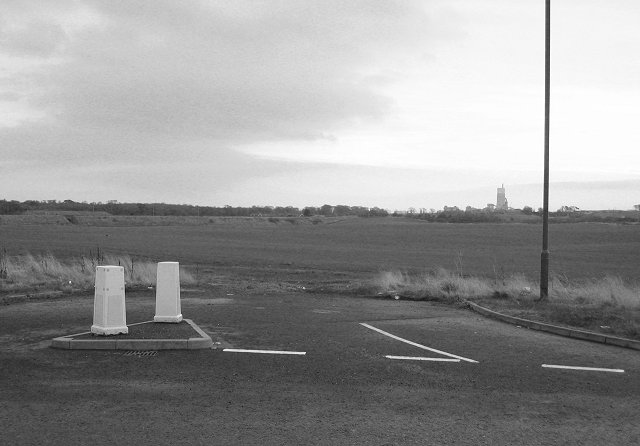
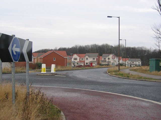
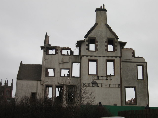
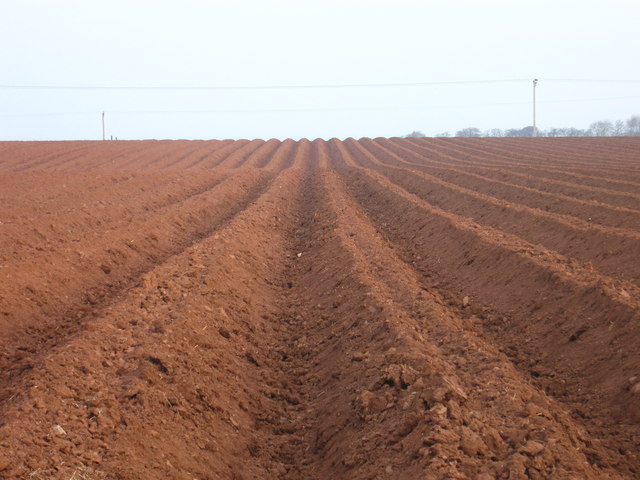
Images are sourced within 2km of 55.997512/-2.534034 or Grid Reference NT6678. Thanks to Geograph Open Source API. All images are credited.

East Lothian Townscape : Do androids dream of the electric scheme? Nope, well, not this one, they won't.

Thankfully, you won't find any bleak, gritty, futuristic urbanism (or androids) here in sunny Dunbar. 

Dunbar's "electric scheme" (so-named because of the electric heating), which includes the sunlit maisonettes of Floors Terrace and Wingate Crescent, is  a planned housing neighbourhood of about 150 dwellings, in a variety of house types, probably built circa 1965-70 and likely to be to the designs of the architects Wheeler and Sproson.
East Lothian Townscape : Do androids dream of the electric scheme?
Nope, well, not this one, they won't. Thankfully, you won't find any bleak, gritty, futuristic urbanism (or androids) here in sunny Dunbar. Dunbar's "electric scheme" (so-named because of the electric heating), which includes the sunlit maisonettes of Floors Terrace and Wingate Crescent, is a planned housing neighbourhood of about 150 dwellings, in a variety of house types, probably built circa 1965-70 and likely to be to the designs of the architects Wheeler and Sproson.
Winterfield GC Golf course in Dunbar. View of the Bass Rock and Fife.
Winterfield GC
Golf course in Dunbar. View of the Bass Rock and Fife.
Cromwell Harbour, Dunbar The older of the two harbours at Dunbar.
Cromwell Harbour, Dunbar
The older of the two harbours at Dunbar.
Victoria Harbour, Dunbar The newer of the two harbours at Dunbar.
Victoria Harbour, Dunbar
The newer of the two harbours at Dunbar.
Centre of Dunbar
Centre of Dunbar
John Muir Statue, Dunbar John Muir (1838-1914) was America's most famous and influential naturalist and conservationist. He is one of California's most important historical personalities. He has been called "The Father of the National Parks," "Wilderness Prophet," and "Citizen of the Universe." He once described himself more humorously, and perhaps most accurately, as, a "poetico-trampo-geologist-botanist and ornithologist-naturalist etc. etc. !!!!" Legendary librarian and author Lawrence Clark Powell (1906-2001) said of him: "If I were to choose a single Californian to occupy the Hall of Fame, it would be this tenacious Scot who became a Californian during the final forty-six years of his life."
John Muir Statue, Dunbar
John Muir (1838-1914) was America's most famous and influential naturalist and conservationist. He is one of California's most important historical personalities. He has been called "The Father of the National Parks," "Wilderness Prophet," and "Citizen of the Universe." He once described himself more humorously, and perhaps most accurately, as, a "poetico-trampo-geologist-botanist and ornithologist-naturalist etc. etc. !!!!" Legendary librarian and author Lawrence Clark Powell (1906-2001) said of him: "If I were to choose a single Californian to occupy the Hall of Fame, it would be this tenacious Scot who became a Californian during the final forty-six years of his life."
Belhaven Brewery Great beer since 1719
Belhaven Brewery
Great beer since 1719
Belhaven Bay I don't see the point of this bridge but it has been there for years.
Belhaven Bay
I don't see the point of this bridge but it has been there for years.
Lobster pots, Belhaven Bay Pots on the edge of the beach. A northerly wind meant some big waves.
Lobster pots, Belhaven Bay
Pots on the edge of the beach. A northerly wind meant some big waves.
Dune slacks, John Muir Country Park. This square was once all tidal according to the old maps.  Now a new line of dunes has formed, leaving the old beach as a flat low lying area of flooded grassland and salt marsh.  Looking north across this new land to the current frontline dunes.

Sandy shorelines can change in an instant.
Dune slacks, John Muir Country Park.
This square was once all tidal according to the old maps. Now a new line of dunes has formed, leaving the old beach as a flat low lying area of flooded grassland and salt marsh. Looking north across this new land to the current frontline dunes. Sandy shorelines can change in an instant.
The old shoreline, Belhaven Bay This was once the highwater mark, but changes in the dunes meant new land forming offshore turning a once tidal beach into wetland. Looking east towards Dunbar.
The old shoreline, Belhaven Bay
This was once the highwater mark, but changes in the dunes meant new land forming offshore turning a once tidal beach into wetland. Looking east towards Dunbar.
Lochend Lochend Wood, looked like a small wood surrounded by farmland on the OS map. Now the woods are becoming surrounded by new houses. The woodland remains though and I have recently visited it for orienteering.
Lochend
Lochend Wood, looked like a small wood surrounded by farmland on the OS map. Now the woods are becoming surrounded by new houses. The woodland remains though and I have recently visited it for orienteering.
Road to nowhere The ghost exit of this roundabout at Lochend suggests that the field will not be growing winter barley for much longer. Dunbar is expanding fast because folk can no longer afford to live in Edinburgh. With the new A1 pseudo-motorway the East Lothian towns are being rapidly developed. Whether many can afford Dunbar is a good question. Looking east towards the cement works.  Development of the site has begun, and there is now a supermarket here.
Road to nowhere
The ghost exit of this roundabout at Lochend suggests that the field will not be growing winter barley for much longer. Dunbar is expanding fast because folk can no longer afford to live in Edinburgh. With the new A1 pseudo-motorway the East Lothian towns are being rapidly developed. Whether many can afford Dunbar is a good question. Looking east towards the cement works. Development of the site has begun, and there is now a supermarket here.
Lochend. Estate from an access roundabout. Looking west. The exit behind me just leads to a field, but soon this roundabout will be in the middle of a lot of houses, and not a safe place for casual photographers to lurk.
Lochend.
Estate from an access roundabout. Looking west. The exit behind me just leads to a field, but soon this roundabout will be in the middle of a lot of houses, and not a safe place for casual photographers to lurk.
Last day for the Bellevue The Dunbar hotel devastated by fire in 1986 was finally demolished in February 2006 after a decade of arguments over whether the building should be preserved or torn down. A fine hotel in its hey day with 365 windows (days), 53 bedrooms (weeks), 12 public rooms (months) and 4 floors (seasons). Retirement homes will be built on the site.
Last day for the Bellevue
The Dunbar hotel devastated by fire in 1986 was finally demolished in February 2006 after a decade of arguments over whether the building should be preserved or torn down. A fine hotel in its hey day with 365 windows (days), 53 bedrooms (weeks), 12 public rooms (months) and 4 floors (seasons). Retirement homes will be built on the site.
Deep furrows at Eweford, near Dunbar Recently a Neolithic mortuary structure was excavated at Eweford. Subsequently, the site was also used for burials during the Bronze Age.
Deep furrows at Eweford, near Dunbar
Recently a Neolithic mortuary structure was excavated at Eweford. Subsequently, the site was also used for burials during the Bronze Age.
Doocot at Bowerhouse, near Dunbar, East Lothian This doocot is of the rectangular lectern type that superseded the beehive design <a href="https://www.geograph.org.uk/photo/137466">NT5977 : Phantassie 'Doocot'</a> and <a href="https://www.geograph.org.uk/photo/137838">NT5680 : Early morning at Waughton doocot</a> in the late 16th century. As typical of this type, the doocot has a sloping roof with stepped gables to provide perches for the pigeons. The roofs usually face south to give the birds a sunny surface to rest on, while sheltering them from northerly winds. 

This one appears to be two-storey, the ground floor would have been used for other purposes and the pigeon quarters on the upper floor.
Doocot at Bowerhouse, near Dunbar, East Lothian
This doocot is of the rectangular lectern type that superseded the beehive design NT5977 : Phantassie 'Doocot' and NT5680 : Early morning at Waughton doocot in the late 16th century. As typical of this type, the doocot has a sloping roof with stepped gables to provide perches for the pigeons. The roofs usually face south to give the birds a sunny surface to rest on, while sheltering them from northerly winds. This one appears to be two-storey, the ground floor would have been used for other purposes and the pigeon quarters on the upper floor.
Mist by Miles West Barns plains near East Links Family Park and John Muir Country Park.  Looking over Belhaven Bay toward the clubhouse of Winterfield Golf Club near St Margaret's.
Mist by Miles
West Barns plains near East Links Family Park and John Muir Country Park. Looking over Belhaven Bay toward the clubhouse of Winterfield Golf Club near St Margaret's.
Show me another place!

Belhaven is located at Grid Ref: NT6678 (Lat: 55.997512, Lng: -2.534034)

Unitary Authority: East Lothian

Police Authority: The Lothians and Scottish Borders

What 3 Words

///tiptoes.decompose.tissue. Near Dunbar, East Lothian

Nearby Locations

Belhaven

Related Wikis

Belhaven, Scotland

Belhaven is a village in East Lothian, Scotland, and was originally the ancient port of Dunbar of which town the village has always been a part. Belhaven...

Belhaven Hospital

Belhaven Hospital is a community hospital in Beveridge Row, Dunbar, East Lothian. The hospital is managed by NHS Lothian. == History == The hospital was...

Belhaven Hill School

Belhaven Hill School is an independent, co-educational preparatory school for boarding and day pupils aged 5 to 13 in Dunbar, East Lothian, Scotland...

Dunbar United F.C.

Dunbar United Football Club is a Scottish football club from the town of Dunbar, East Lothian. The club operates on a semi-professional basis, playing...

Nearby Amenities

Located within 500m of 55.997512,-2.534034
Traffic Calming: cushion
Lat/Long: 55.9983677/-2.5377131
Traffic Calming: cushion
Lat/Long: 55.9975424/-2.5349163
Traffic Calming: cushion
Lat/Long: 55.998172/-2.5372142
Traffic Calming: cushion
Lat/Long: 55.9973794/-2.5342939
Traffic Calming: cushion
Lat/Long: 55.9971191/-2.5362888
Traffic Calming: cushion
Lat/Long: 55.9969018/-2.5358639
Traffic Calming: cushion
Lat/Long: 55.9980852/-2.5304326
Traffic Calming: cushion
Lat/Long: 55.9975141/-2.5362441
Traffic Calming: cushion
Lat/Long: 55.9978948/-2.5369724
Bus Stop
Old Police Station
Bus: yes
Naptan AtcoCode: 627010010030
Naptan Bearing: E
Naptan CommonName: Old Police Station
Naptan Indicator: opposite Felbrigg
Naptan NaptanCode: 58234564
Naptan Street: Edinburgh Road
Naptan Verified: no
Public Transport: platform
Source: naptan_import
Lat/Long: 55.9974284/-2.5419767
Bus Stop
High Street
Bus: yes
Naptan AtcoCode: 627010010040
Naptan Bearing: E
Naptan CommonName: High Street
Naptan Indicator: at Belhaven Villa
Naptan NaptanCode: 58234565
Naptan Street: High Street
Naptan Verified: no
Public Transport: platform
Source: naptan_import
Lat/Long: 55.998634/-2.5395725
Bus Stop
Summerfield Road
Bus: yes
Naptan AtcoCode: 627010010100
Naptan Bearing: E
Naptan CommonName: Summerfield Road
Naptan Indicator: at 36 Summerfield Road
Naptan NaptanCode: 58234568
Naptan Street: Summerfield Road
Naptan Verified: no
Public Transport: platform
Source: naptan_import
Lat/Long: 55.9983221/-2.5286012
Bus Stop
Pine Street
Bus: yes
Naptan AtcoCode: 627010010170
Naptan Bearing: E
Naptan CommonName: Pine Street
Naptan Indicator: at 37-39 Pine Street
Naptan NaptanCode: 58234567
Naptan Street: Pine Street
Naptan Verified: no
Public Transport: platform
Source: naptan_import
Lat/Long: 55.9971005/-2.5353076
Bus Stop
Old Police Station
Bus: yes
Naptan AtcoCode: 627010020030
Naptan Bearing: W
Naptan CommonName: Old Police Station
Naptan Indicator: opposite Shore Road
Naptan NaptanCode: 58234634
Naptan Street: Edinburgh Road
Naptan Verified: no
Public Transport: platform
Source: naptan_import
Lat/Long: 55.9988197/-2.5393759
Bus Stop
High Street
Bus: yes
Naptan AtcoCode: 627010020040
Naptan Bearing: W
Naptan CommonName: High Street
Naptan Indicator: at Belhaven Villa
Naptan NaptanCode: 58234576
Naptan Street: High Street
Naptan Verified: no
Public Transport: platform
Source: naptan_import
Lat/Long: 55.9986595/-2.5391556
Bus Stop
Summerfield Road
Bus: yes
Naptan AtcoCode: 627010020100
Naptan Bearing: W
Naptan CommonName: Summerfield Road
Naptan Indicator: at 36 Summerfield Road
Naptan NaptanCode: 58234574
Naptan Street: Summerfield Road
Naptan Verified: no
Public Transport: platform
Source: naptan_import
Lat/Long: 55.9983244/-2.5280561
Bus Stop
Elm Street
Bus: yes
Naptan AtcoCode: 627010020220
Naptan Bearing: W
Naptan CommonName: Elm Street
Naptan Indicator: at 8 Pine Street
Naptan NaptanCode: 58234575
Naptan Street: Pine Street
Naptan Verified: no
Public Transport: platform
Source: naptan_import
Lat/Long: 55.9979211/-2.5319948
Bus Stop
Dunbar Grammar School
Bus: yes
Naptan AtcoCode: 627010050125
Naptan Bearing: W
Naptan BusStopType: CUS
Naptan CommonName: Dunbar Grammar School
Naptan Landmark: at school
Naptan NaptanCode: 58234932
Naptan Street: Summerfield Road
Naptan Verified: no
Public Transport: platform
Source: naptan_import
Lat/Long: 55.9992843/-2.5318951
Traffic Calming: cushion
Lat/Long: 56.0008728/-2.5313395
Traffic Calming: cushion
Lat/Long: 55.9975506/-2.5356214
Traffic Calming: cushion
Lat/Long: 55.9995426/-2.5270251
Traffic Calming: cushion
Lat/Long: 55.9989778/-2.5288195
Traffic Calming: cushion
Lat/Long: 55.9975589/-2.5338739
Traffic Calming: cushion
Lat/Long: 55.9974604/-2.5308865
Traffic Calming: cushion
Lat/Long: 55.9975245/-2.5343415
Traffic Calming: cushion
Lat/Long: 55.9979369/-2.5314589
Crossing
Crossing: uncontrolled
Lat/Long: 55.9989501/-2.5308907
Post Box
Ref: EH42 210
Lat/Long: 55.9983915/-2.5309855
Post Box
Ref: EH42 224
Lat/Long: 56.000823/-2.5313985
Post Box
Access: yes
Collection Times: Mo-Fr 09:00; Sa 07:00
Colour: red
Covered: no
Drive Through: no
Indoor: no
Level: 0
Operator: Royal Mail
Post Box Type: wall
Ref: EH42 202
Royal Cypher: scottish_crown
Support: wall_mounted
Wheelchair: yes
Lat/Long: 55.998862/-2.5390019
Bicycle Parking
Covered: yes
Lat/Long: 55.9955999/-2.5278777
Bicycle Parking
Lat/Long: 55.9969949/-2.5272554
Bicycle Parking
Lat/Long: 55.996947/-2.5274166
Bicycle Parking
Lat/Long: 55.997034/-2.527127
Belhaven
Place: suburb
Lat/Long: 55.9982968/-2.5350544
Material: wood
Power: pole
Source: Bing
Lat/Long: 55.9947042/-2.536306
Traffic Calming: cushion
Lat/Long: 56.0015895/-2.5314952
Kindergarten
Pumpkin Patch Children's Nursery
Website: https://www.thepumpkinpatchnursery.co.uk/
Lat/Long: 55.999191/-2.5392151
Bench
Backrest: yes
Colour: black
Material: metal
Seats: 4
Lat/Long: 55.9984267/-2.5399385
Bench
Backrest: yes
Colour: black
Material: metal
Seats: 4
Lat/Long: 55.9984676/-2.5400302
Bench
Backrest: yes
Colour: black
Material: metal
Seats: 4
Lat/Long: 55.9985088/-2.5399645
Traffic Calming: cushion
Lat/Long: 55.9971958/-2.534849
Traffic Calming: cushion
Lat/Long: 55.9975452/-2.5366614
Traffic Calming: cushion
Lat/Long: 55.9979225/-2.5326509
Traffic Calming: cushion
Lat/Long: 55.9977955/-2.533279
Crossing Island: yes
Crossing Markings: surface
Traffic Calming: island
Lat/Long: 56.0008613/-2.5297253
Traffic Calming: cushion
Lat/Long: 56.0012264/-2.5315501
Traffic Calming: cushion
Lat/Long: 56.0013535/-2.5306584
Traffic Calming: cushion
Lat/Long: 56.0016844/-2.5318244
Traffic Calming: cushion
Lat/Long: 55.9987304/-2.5293768
Crossing
Crossing: uncontrolled
Lat/Long: 55.9989627/-2.5303726
Crossing
Crossing: uncontrolled
Lat/Long: 55.9990932/-2.5305318
Traffic Calming: cushion
Lat/Long: 55.9991829/-2.5283515
Traffic Calming: cushion
Lat/Long: 55.9993965/-2.5276993
Traffic Calming: cushion
Lat/Long: 55.9976895/-2.5324559
Traffic Calming: cushion
Lat/Long: 55.9980473/-2.5319203
Traffic Calming: cushion
Lat/Long: 55.9982833/-2.5311522
Traffic Calming: cushion
Lat/Long: 55.9970186/-2.5318726
Traffic Calming: cushion
Lat/Long: 55.9971584/-2.532337
Traffic Calming: cushion
Lat/Long: 55.9971904/-2.5312591
Railway: switch
Lat/Long: 55.996925/-2.5308692
Railway: switch
Lat/Long: 55.9973337/-2.5297981
Cafe
Haven Cafe
Lat/Long: 55.9961047/-2.5372153
Material: wood
Power: pole
Source: Bing
Lat/Long: 55.9942082/-2.5368638
Pilgrims way
Tourism: chalet
Lat/Long: 55.99715/-2.5402834
old school house
Tourism: chalet
Lat/Long: 55.9973298/-2.5406606
Elm bank
Tourism: chalet
Lat/Long: 55.9970873/-2.540139
Material: wood
Power: pole
Lat/Long: 55.994937/-2.5364792
Material: wood
Power: pole
Lat/Long: 55.9945799/-2.5370371
Material: wood
Power: pole
Lat/Long: 55.9942949/-2.5381905
Material: wood
Power: pole
Lat/Long: 55.9948131/-2.5369515
Material: wood
Power: pole
Lat/Long: 55.9945649/-2.5381422
Material: wood
Power: pole
Lat/Long: 55.9943114/-2.5393894
Dunbar West
Railway: crossover
Lat/Long: 55.9971292/-2.530333
Golf: pin
Lat/Long: 56.0018007/-2.5364323
Material: wood
Power: pole
Lat/Long: 55.9930877/-2.5354046
Material: wood
Power: pole
Lat/Long: 55.9934829/-2.5342734
Material: wood
Power: pole
Lat/Long: 55.9938941/-2.5331444
Material: wood
Power: pole
Lat/Long: 55.9943065/-2.5320307
Material: wood
Power: pole
Lat/Long: 55.9948927/-2.5302715
Material: wood
Power: pole
Lat/Long: 55.9947629/-2.5360763
Material: wood
Power: pole
Lat/Long: 55.9940079/-2.53577
Barrier: cycle_barrier
Lat/Long: 55.9954508/-2.5407205
Emergency Ward Entrance
Emergency: emergency_ward_entrance
Entrance: yes
Lat/Long: 55.9959583/-2.5361957
Parking
Access: private
Lat/Long: 55.9977909/-2.5408096
Bicycle Parking
Bicycle Parking: wall_loops
Capacity: 8
Lat/Long: 55.9978426/-2.5377911
Bicycle Parking
Lat/Long: 56.000603/-2.53298
Bicycle Parking
Lat/Long: 55.9994975/-2.5318609
Bicycle Parking
Lat/Long: 55.9993469/-2.530587
Bicycle Parking
Lat/Long: 55.9993243/-2.5306785
Bicycle Parking
Lat/Long: 55.9993755/-2.5305115
Bicycle Parking
Lat/Long: 55.9993981/-2.5304388
Bicycle Parking
Lat/Long: 55.9995321/-2.5314111
Bicycle Parking
Bicycle Parking: front_wheel
Capacity: 6
Lat/Long: 55.9963392/-2.5279458
Crossing Island: yes
Crossing Markings: lines
Traffic Calming: island
Lat/Long: 55.9998257/-2.5351938
Crossing Island: yes
Crossing Markings: lines
Traffic Calming: island
Lat/Long: 55.9994143/-2.5367523
Traffic Calming: cushion
Lat/Long: 55.9984474/-2.5308926
Traffic Calming: cushion
Lat/Long: 55.9988684/-2.5314391
Traffic Calming: cushion
Lat/Long: 55.9993164/-2.5320186
Traffic Calming: cushion
Lat/Long: 55.9996905/-2.5324959
Traffic Calming: cushion
Lat/Long: 56.0000095/-2.5328451
Waste Basket
Colour: gray
Covered: no
Indoor: no
Material: metal
Waste: trash
Lat/Long: 55.998463/-2.5397767
The data included in this document is from www.openstreetmap.org. The data is made available under ODbL.

Have you been to Belhaven?

Leave your review of Belhaven below (or comments, questions and feedback).