Meini Gwyr

Heritage Site in Carmarthenshire

Wales

Meini Gwyr

Hillside below reservoir next to A478 Grass fields predominate here in rural Carmarthenshire.
Hillside below reservoir next to A478 Credit: M J Roscoe

Meini Gwyr, located in Carmarthenshire, Wales, is a significant heritage site that holds historical and cultural importance. Also known as the Gorsedd Stones, it is a collection of standing stones that form part of the National Eisteddfod of Wales, a Welsh-language festival celebrating literature, music, and performance.

The site consists of four large stones, each approximately seven feet tall, arranged in a circular formation. These stones, made of local dolerite, are believed to have been erected around 3000 BC during the Neolithic period. They are thought to have served as a ceremonial site or a meeting place for ancient communities.

The Gorsedd Stones gained prominence in the 19th century when they became associated with the Eisteddfod, a tradition dating back to the 12th century. The Eisteddfod, held annually, attracts poets, musicians, and artists who compete for prestigious awards and recognition. During the festival, the stones become the focal point of the Eisteddfod's opening and closing ceremonies, where the Gorsedd of Bards, a group of Welsh-language poets and scholars, gather to honor Welsh culture and language.

Meini Gwyr is not only a testament to Wales' rich history but also an enduring symbol of Welsh identity and pride. Its inclusion in the Eisteddfod festivities ensures that the site remains relevant and cherished in contemporary Welsh society. Visitors to Meini Gwyr can experience the mystical ambiance of the ancient stones and witness the vibrant cultural celebrations that take place during the Eisteddfod, making it a must-visit destination for history enthusiasts and those interested in Welsh heritage.

If you have any feedback on the listing, please let us know in the comments section below.

Meini Gwyr Images

Images are sourced within 2km of 51.905/-4.697 or Grid Reference SN1426. Thanks to Geograph Open Source API. All images are credited.

Hillside below reservoir next to A478 Grass fields predominate here in rural Carmarthenshire.
Hillside below reservoir next to A478
Grass fields predominate here in rural Carmarthenshire.
A478 road southwest of reservoir The road to Glandy Cross, just visible in the distance runs along top of a hillside.
A478 road southwest of reservoir
The road to Glandy Cross, just visible in the distance runs along top of a hillside.
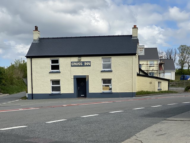
Cross Inn, Glandy Cross
Ordnance Survey Cut Mark This OS cut mark can be found on the stone gatepost south side of the road. It marks a point 185.023m above mean sea level.
Ordnance Survey Cut Mark
This OS cut mark can be found on the stone gatepost south side of the road. It marks a point 185.023m above mean sea level.
Agricultural buildings at Glandy-mawr Old and new buildings at Glandy Mawr Livery Stables.
Agricultural buildings at Glandy-mawr
Old and new buildings at Glandy Mawr Livery Stables.
Track opposite Glandy-mawr Muddy track, lined by recently cut high hedges, to fields.
Track opposite Glandy-mawr
Muddy track, lined by recently cut high hedges, to fields.
Minor road at Glandy-mawr Unclassified country road, flanked by grassy banks, to Mynachlog-ddu.
Minor road at Glandy-mawr
Unclassified country road, flanked by grassy banks, to Mynachlog-ddu.
Damp field near Glandy Cross
Ordnance Survey Cut Mark This OS cut mark can be found on the east angle of the school. It marks a point 187.784m above mean sea level.
Ordnance Survey Cut Mark
This OS cut mark can be found on the east angle of the school. It marks a point 187.784m above mean sea level.
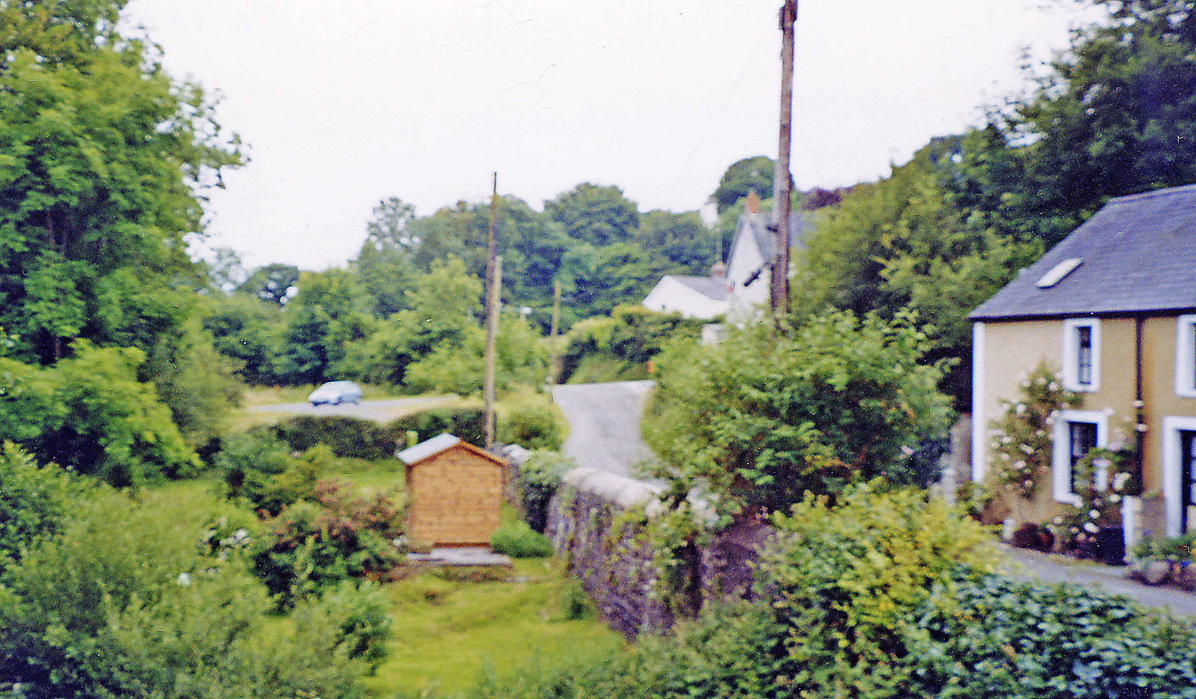
Pant yr Hufen Cottage in Pant y Caws.
Pant yr Hufen
Cottage in Pant y Caws.
Farm buildings Farm in Pant y Caws.
Farm buildings
Farm in Pant y Caws.
Pant y Caws Cattle grazing in Pant y Caws.
Pant y Caws
Cattle grazing in Pant y Caws.
Cross Inn The Cross Inn, Glandy Cross.
Cross Inn
The Cross Inn, Glandy Cross.
Road junction T junction with Efailwen to the left and Maenclochog to the right.
Road junction
T junction with Efailwen to the left and Maenclochog to the right.
Troed y Rhiw House set in woodland.
Troed y Rhiw
House set in woodland.
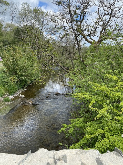
Pont Hywel View of the Eastern Cleddau from Pont Hywel.
Pont Hywel
View of the Eastern Cleddau from Pont Hywel.
Country road north of Glandy Cross View of the country road to Mynachlog-ddu north of Glandy Cross, near Ffynnon-lwyd.
Country road north of Glandy Cross
View of the country road to Mynachlog-ddu north of Glandy Cross, near Ffynnon-lwyd.
Approaching the road junction, Glandy Cross A view looking south along the minor road from Mynachlog-ddu  as it approaches the junction with the A478 road at Glandy Cross.
Approaching the road junction, Glandy Cross
A view looking south along the minor road from Mynachlog-ddu as it approaches the junction with the A478 road at Glandy Cross.
Show me another place!

Meini Gwyr is located at Grid Ref: SN1426 (Lat: 51.905, Lng: -4.697)

Unitary Authority: Carmarthenshire

Police Authority: Dyfed Powys

What 3 Words

///caps.deed.objecting. Near Glandwr, Pembrokeshire

Related Wikis

Kingdom of Dyfed

The Kingdom of Dyfed (Welsh pronunciation: ['dəvɛd]), one of several Welsh petty kingdoms that emerged in 5th-century sub-Roman Britain in southwest Wales...

Cilymaenllwyd

Cilymaenllwyd is a community on the extreme northwest of Carmarthenshire in Wales. The community population at the 2011 census was 742. It lies about 25...

A478 road

The A478 road is a major road in Wales. The route is from its junction with the A487 at Cardigan, Ceredigion, to Tenby, Pembrokeshire. It crosses the Preseli...

Llangolman

Llangolman () is a village and parish in the southeastern Preseli Hills in Pembrokeshire, Wales. It is part of the community of Mynachlog-ddu. There are...

Login, Carmarthenshire

Login is a hamlet in Carmarthenshire, Wales, in the Taf valley and sits on both sides of the meandering River Taf. A stone bridge crosses the river approximately...

Llanglydwen railway station

Llanglydwen railway station served the village of Llanglydwen, Carmarthenshire, Wales, from 1875 to 1963 on the Whitland and Cardigan Railway. == History... ==

Login Halt railway station

Login Halt railway station served the hamlet of Login, Carmarthenshire, Wales, from 1875 to 1962 on the Whitland and Cardigan Railway. == History == The...

Mynachlog-ddu

Mynachlog-ddu (SN143306) is a village, parish and community in the Preseli Hills, Pembrokeshire, Wales. The community includes the parish of Llangolman...

Nearby Amenities

Located within 500m of 51.905,-4.697
Pant-y-caws
Place: village
Lat/Long: 51.9036519/-4.6917121
Glandy Cross
Place: hamlet
Source: OS OpenData StreetView
Lat/Long: 51.906927/-4.7005747
Fuel
Fuel GTL Diesel: yes
Fuel Octane 95: yes
Operator: Oil4Wales
Lat/Long: 51.907016/-4.7003832
Shop: convenience
Lat/Long: 51.9070922/-4.700174
Pub
The Cross Inn
Wikidata: Q80856199
Lat/Long: 51.9072092/-4.7004974
Give Way
Direction: backward
Lat/Long: 51.9029132/-4.6934708
Give Way
Direction: forward
Lat/Long: 51.9035718/-4.6918603
Give Way
Direction: backward
Lat/Long: 51.9069013/-4.7006095
Give Way
Direction: forward
Lat/Long: 51.9069133/-4.7007672
Give Way
Direction: forward
Lat/Long: 51.9070003/-4.7006619
Direction: 215
Generator Method: photovoltaic
Generator Output Electricity: yes
Generator Solar Modules: 18
Generator Source: solar
Generator Type: solar_photovoltaic_panel
Location: roof
Power: generator
Lat/Long: 51.9069605/-4.6982311
The data included in this document is from www.openstreetmap.org. The data is made available under ODbL.

Have you been to Meini Gwyr?

Leave your review of Meini Gwyr below (or comments, questions and feedback).