Margaret's Camp

Heritage Site in Gloucestershire

England

Margaret's Camp

Field entrance (footpath) near Southend Farm
Field entrance (footpath) near Southend Farm Credit: JThomas

Margaret's Camp, situated in Gloucestershire, is a renowned heritage site that holds significant historical and cultural importance. This ancient campsite dates back to the Iron Age, making it over 2,000 years old. It is believed to have been inhabited by the Dobunni tribe, an Iron Age Celtic people who resided in the area.

The camp is located on a hilltop, providing a strategic advantage for its inhabitants to monitor the surrounding landscape. Its elevated position offers breathtaking panoramic views of the picturesque Gloucestershire countryside. The site covers a vast area, encompassing multiple defensive banks and ditches that were once used for protection against potential invaders.

Archaeological excavations conducted at Margaret's Camp have uncovered numerous artifacts, including pottery, tools, and animal bones. These findings have provided valuable insights into the daily lives and activities of the Dobunni people. The camp's location and the artifacts discovered suggest that it was a vibrant and thriving community during its occupation.

Today, Margaret's Camp attracts visitors from all over the world, eager to explore its rich history and immerse themselves in the ancient past. The site offers guided tours, allowing visitors to learn about the camp's significance and its role in Iron Age society. The surrounding landscape provides ample opportunities for leisurely walks, picnics, and photography, making it a popular destination for nature enthusiasts as well.

Margaret's Camp stands as a testament to the enduring legacy of the Dobunni tribe and serves as a valuable resource for scholars and history enthusiasts alike, ensuring that their stories and contributions are not forgotten.

If you have any feedback on the listing, please let us know in the comments section below.

Margaret's Camp Images

Images are sourced within 2km of 51.982/-2.153 or Grid Reference SO8931. Thanks to Geograph Open Source API. All images are credited.

Field entrance (footpath) near Southend Farm
Minor road towards Tredington Park
Southend Farm
Southend Farm
Road to Hoo Farm from A38
Bus stop by A38 with overgrown hedge Obviously a place where you stand where you can see the bus and not have leaves and branches down your neck
Bus stop by A38 with overgrown hedge
Obviously a place where you stand where you can see the bus and not have leaves and branches down your neck
Approaching junction with the A38 south of Tewkesbury
Fields west of Tredington
A38 South of Tewkesbury Crossroads
Odessa Inn, near Tewkesbury
Ophelia at Odessa Park The map shows this site as a caravan park but it contains quite substantial structures, certainly not a touristy site. The Odessa Inn, in the background, was closed on this visit. Viewed in the crazy light that came with ex-Hurricane “Ophelia”.
Ophelia at Odessa Park
The map shows this site as a caravan park but it contains quite substantial structures, certainly not a touristy site. The Odessa Inn, in the background, was closed on this visit. Viewed in the crazy light that came with ex-Hurricane “Ophelia”.
Hoo House Nursery A specialist perennial and alpine plant nursery near Tewkesbury. See <span class="nowrap"><a title="http://www.hoohouse.co.uk/" rel="nofollow ugc noopener" href="http://www.hoohouse.co.uk/">Link</a><img style="margin-left:2px;" alt="External link" title="External link - shift click to open in new window" src="https://s1.geograph.org.uk/img/external.png" width="10" height="10"/></span>
Hoo House Nursery
A specialist perennial and alpine plant nursery near Tewkesbury. See LinkExternal link
Footpath near Southend Farm The first buildings of the village of Tredington are to the left. In this field you have to make sure you do not step in a cowpat.
Footpath near Southend Farm
The first buildings of the village of Tredington are to the left. In this field you have to make sure you do not step in a cowpat.
Footpath to Tewkesbury The path crosses several fields, most with much longer grass than this. Though a bit misty, you can make out the tower of Tewkesbury Abbey.
Footpath to Tewkesbury
The path crosses several fields, most with much longer grass than this. Though a bit misty, you can make out the tower of Tewkesbury Abbey.
Bridleway near Tredington Park Quite overgrown and enclosed by foliage.
Bridleway near Tredington Park
Quite overgrown and enclosed by foliage.
A38 dual carriageway south of Odessa Farm There is a farm track for the Odessa Farm across the central reservation just beyond the large sign
A38 dual carriageway south of Odessa Farm
There is a farm track for the Odessa Farm across the central reservation just beyond the large sign
The A38, Tredington
The A38, Tredington
A38 northbound at Tredington
Southwick Farm View across farmland to Southwick Farm with the Malvern Hills in the distance.
Southwick Farm
View across farmland to Southwick Farm with the Malvern Hills in the distance.
Show me another place!

Margaret's Camp is located at Grid Ref: SO8931 (Lat: 51.982, Lng: -2.153)

Police Authority: Gloucestershire

What 3 Words

///stew.tidal.nerves. Near Tewkesbury, Gloucestershire

Related Wikis

Wheatpieces

Wheatpieces is a large housing estate and civil parish in Gloucestershire, England. It lies immediately east of Tewkesbury, and is in effect a suburb...

Battle of Tewkesbury

The Battle of Tewkesbury, which took place on 4 May 1471, was one of the most decisive battles of the Wars of the Roses in England. King Edward IV and...
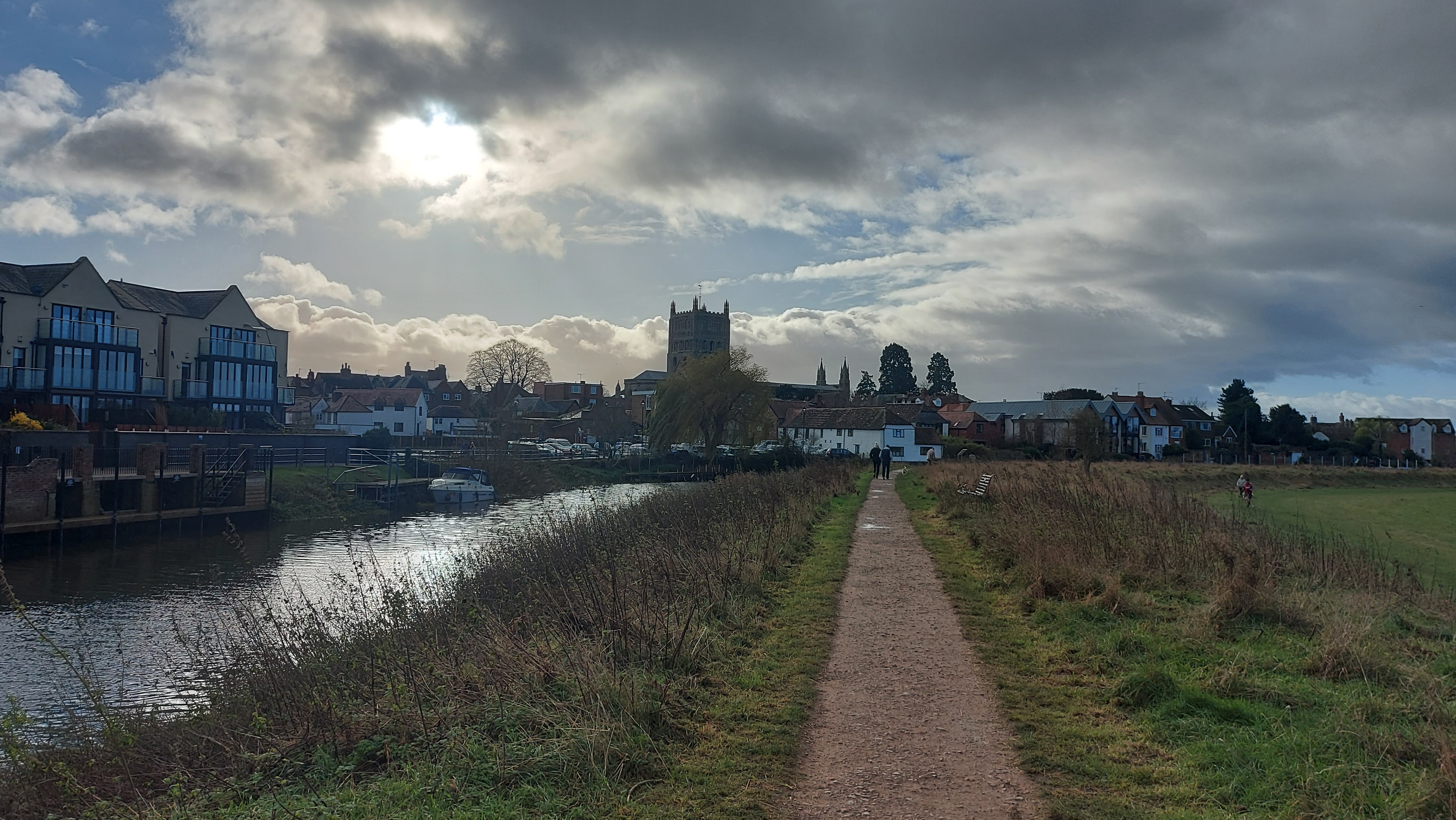
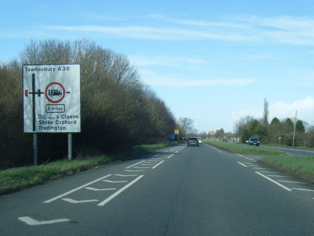
Tewkesbury

Tewkesbury ( TEWKS-bər-ee) is a medieval market town and civil parish in the north of Gloucestershire, England. The town grew following the construction...

Swilgate

Swilgate is a cricket ground in Tewkesbury, Gloucestershire. The first recorded match on the ground was in 1893, when Tewkesbury played Handsworth Wood...

Eleanor de Clare

Eleanor de Clare, suo jure 6th Lady of Glamorgan (3 October 1292 – 30 June 1337) was a powerful Anglo-Welsh noblewoman who married Hugh Despenser the Younger...

Tewkesbury Abbey

The Abbey Church of St Mary the Virgin, Tewkesbury, commonly known as Tewkesbury Abbey, is located in the English county of Gloucestershire. A former Benedictine...

River Swilgate

The River Swilgate is a small river that flows through Gloucestershire, England. Formed by the confluence at Elmstone Hardwicke of the Hyde Brook which...

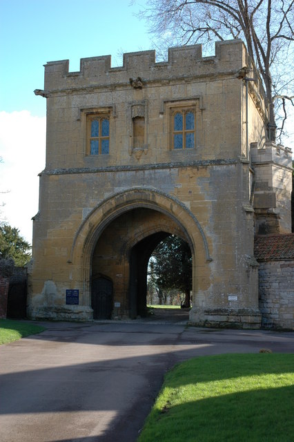
Abbey Gatehouse, Tewkesbury

Abbey Gatehouse is a gatehouse building to Tewkesbury Abbey, in Tewkesbury, Gloucestershire, England. It is a Grade I listed building.The building was...

Related Videos

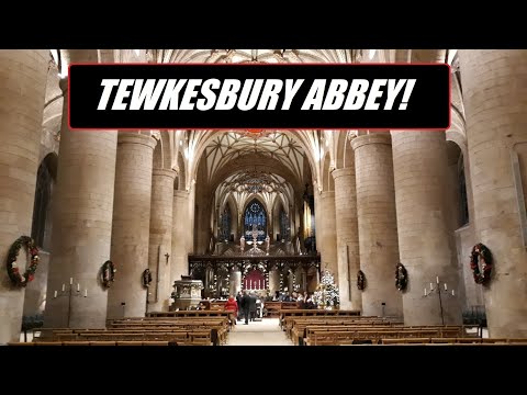
Tewkesbury Abbey Walking Tour! ⛪ #TEWKESBURY

A walking tour around the spectacular Tewkesbury Abbey, this video was filmed in a single take using my phone. Sorry for the ...

Tewkesbury Abbey UK 🇬🇧

short clip of Tewkesbury Abbey courtesy of Mari who's on holiday in the UK with her husband Bob. mil gracias Mari Music ...

Early Morning Walk In Medieval Tewkesbury

Out and about Walking in Tewkesbury. We start today's walk from within the grounds of Tewkesbury Abbey with a good look ...

Norman Abbey, Medieval alleys & waterways in Tewkesbury | English town 4k walk

A sunny morning walk around through medieval Tewkesbury SUBSCRIBE FOR MORE VIDEOS LIKE THIS: ...

Nearby Amenities

Located within 500m of 51.982,-2.153
Pub
Gupshill Manor
Addr City: Tewkesbury
Addr Postcode: GL20 5SG
Addr Street: Gloucester Road
Fhrs Id: 106489
Source: Bing
Url: http://www.gupshillmanor.com/
Lat/Long: 51.9813326/-2.1561015
Priors Park
Is In: Tewkesbury
Place: suburb
Source: NPE
Lat/Long: 51.9842496/-2.153646
Post Box
Collection Times: Mo-Fr 09:00; Sa 07:00
Post Box Design: type_b
Post Box Type: pillar
Ref: GL20 50D
Royal Cypher: GR
Royal Cypher Wikidata: Q33102273
Lat/Long: 51.9844249/-2.1570252
Bus Stop
Gupshill Manor
Bench: yes
Bin: yes
Bus: yes
Departures Board: timetable
Flag: yes
Kerb: no
Lit: no
Naptan AtcoCode: 1600GL4663
Naptan Bearing: NW
Naptan CommonName: Gupshill Manor
Naptan Indicator: after
Naptan NaptanCode: glodmgdw
Naptan Street: Gloucester Road
Naptan Verified: yes
Passenger Information Display: no
Pole: yes
Public Transport: platform
Shelter: yes
Source: naptan_import;survey
Tactile Paving: no
Lat/Long: 51.9827657/-2.1574032
Bus Stop
Gupshill Manor
Bench: yes
Bin: yes
Bus: yes
Departures Board: timetable
Flag: yes
Kerb: no
Lit: no
Naptan AtcoCode: 1600GL4664
Naptan Bearing: SE
Naptan CommonName: Gupshill Manor
Naptan Indicator: before
Naptan NaptanCode: glodmgjt
Naptan Street: Gloucester Road
Naptan Verified: yes
Passenger Information Display: no
Pole: yes
Public Transport: platform
Shelter: yes
Source: naptan_import;survey
Tactile Paving: no
Lat/Long: 51.9826265/-2.156726
Bus Stop
Foresters Road
Bus: yes
Naptan AtcoCode: 1600GL5824
Naptan Bearing: E
Naptan CommonName: Foresters Road
Naptan Indicator: corner of
Naptan NaptanCode: glodmgjm
Naptan Street: Abbot's Road
Public Transport: platform
Source: naptan_import;Bing;survey
Lat/Long: 51.9843625/-2.156916
Bus Stop
Post Office
Bus: yes
Naptan AtcoCode: 1600GL5830
Naptan Bearing: N
Naptan CommonName: Post Office
Naptan Indicator: opp
Naptan NaptanCode: glodmjgp
Naptan Street: Queen's Road
Naptan Verified: no
Public Transport: platform
Source: naptan_import
Lat/Long: 51.9856618/-2.1521714
Bus Stop
Jubilee Way
Bus: yes
Naptan AtcoCode: 1600GLA26334
Naptan Bearing: E
Naptan CommonName: Jubilee Way
Naptan Indicator: on
Naptan NaptanCode: glogpjmg
Naptan Street: A38
Naptan Verified: no
Public Transport: platform
Source: naptan_import
Lat/Long: 51.9801133/-2.1466604
Bus Stop
Vine Way Path
Bus: yes
Naptan AtcoCode: 1600GLA36629
Naptan Bearing: NE
Naptan CommonName: Vine Way Path
Naptan Indicator: by
Naptan NaptanCode: glogmdtm
Naptan Street: A38
Naptan Verified: no
Public Transport: platform
Source: naptan_import
Lat/Long: 51.9788855/-2.1499209
Bus Stop
Mowbray Avenue Path
Bus: yes
Naptan AtcoCode: 1600GLA36630
Naptan Bearing: SW
Naptan CommonName: Mowbray Avenue Path
Naptan Indicator: opp
Naptan NaptanCode: glogmdtp
Naptan Street: Jubilee Way
Naptan Verified: no
Public Transport: platform
Source: naptan_import
Lat/Long: 51.9780406/-2.1512134
Bus Stop
Mowbray Avenue
Bench: yes
Bin: no
Bus: yes
Departures Board: timetable
Flag: yes
Kerb: no
Lit: yes
Naptan AtcoCode: 1600GLT058
Naptan Bearing: S
Naptan CommonName: Mowbray Avenue
Naptan Indicator: after
Naptan NaptanCode: glodmgtw
Naptan Street: Gloucester Road
Naptan Verified: yes
Passenger Information Display: no
Pole: no
Public Transport: platform
Shelter: yes
Source: naptan_import;survey
Tactile Paving: no
Lat/Long: 51.9779709/-2.1550433
Bus Stop
Clarence Road
Bus: yes
Naptan AtcoCode: 1600GLT098
Naptan Bearing: E
Naptan CommonName: Clarence Road
Naptan Indicator: corner of
Naptan NaptanCode: glodmgpm
Naptan Street: Abbot's Road
Naptan Verified: no
Public Transport: platform
Source: naptan_import
Lat/Long: 51.9843807/-2.1555599
Bus Stop
Queen Margaret School
Bus: yes
Naptan AtcoCode: 1600GLT100
Naptan Bearing: S
Naptan CommonName: Queen Margaret School
Naptan Indicator: opp
Naptan NaptanCode: glodmgwg
Naptan Street: York Road
Naptan Verified: no
Public Transport: platform
Source: naptan_import
Lat/Long: 51.9832489/-2.1547406
Bus Stop
Tudor Place
Bench: no
Bin: no
Bus: yes
Departures Board: timetable
Flag: yes
Kerb: no
Naptan AtcoCode: 1600GLT102
Naptan Bearing: E
Naptan CommonName: Tudor Place
Naptan Indicator: nr
Naptan NaptanCode: glodmjdm
Naptan Street: Queen's Road
Naptan Verified: yes
Passenger Information Display: no
Pole: yes
Public Transport: platform
Shelter: no
Source: naptan_import;survey
Tactile Paving: no
Lat/Long: 51.9831828/-2.153643
Bus Stop
Devonshire Place
Bus: yes
Naptan AtcoCode: 1600GLT104
Naptan Bearing: N
Naptan CommonName: Devonshire Place
Naptan Indicator: corner of
Naptan NaptanCode: glodmjgm
Naptan Street: Queen's Road
Naptan Verified: no
Public Transport: platform
Source: naptan_import
Lat/Long: 51.9841242/-2.1523264
Costcutter
Addr City: Tewkesbury
Addr Housenumber: 109-113
Addr Postcode: GL20 5EN
Addr Street: Queens Road
Brand: Costcutter
Brand Wikidata: Q5175072
Brand Wikipedia: en:Costcutter
Contact Website: https://store-locator.costcutter.co.uk/costcutter-7ffcf4df08e8
Fhrs Id: 106506;1542597
Shop: convenience
Source Addr: FSA Food Hygiene Ratings Database
Lat/Long: 51.9854361/-2.1519166
Fixme: incomplete
Lat/Long: 51.9809823/-2.150211
Crossing
Crossing Island: yes
Lat/Long: 51.9828118/-2.1572317
Telephone
Booth: KX100
Covered: booth
Lat/Long: 51.9857602/-2.1520072
Post Box
Collection Times: Mo-Fr 09:00; Sa 07:00
Post Box Design: type_b
Post Box Type: pillar
Ref: GL20 65D
Royal Cypher: GVIR
Royal Cypher Wikidata: Q33102169
Lat/Long: 51.9857816/-2.1520072
Crossing
Source: Bing
Traffic Calming: choker
Lat/Long: 51.9852227/-2.1521329
Source: Bing
Traffic Calming: raised_table
Lat/Long: 51.9856448/-2.1520877
Barrier: yes
Lat/Long: 51.9857391/-2.1542255
Marker: aerial
Operator: CLH
Operator Old: GPSS
Ref: MP 2961
Source: survey
Utility: oil
Lat/Long: 51.9824545/-2.1600815
Pharmacy
Badham Pharmacy
Addr City: Tewkesbury
Addr Housenumber: 105
Addr Postcode: GL20 5EN
Addr Street: Queens Road
Drive Through: no
Email: pharmacy.fnw96@nhs.net
Healthcare: pharmacy
Opening Hours: Mo-Fr 08:30-13:00,14:00-17:30
Operator: Badham Pharmacy Ltd
Phone: +44 1684 290659
Website: https://www.badhampharmacy.co.uk/pharmacies/priors-park-pharmacy
Lat/Long: 51.9855326/-2.1519075
Gloucester Road
Power: pole
Transformer: distribution
Voltage Primary: 11000
Lat/Long: 51.9835933/-2.1589194
Power: pole
Lat/Long: 51.981862/-2.1597469
Power: pole
Lat/Long: 51.9804929/-2.159427
Power: pole
Lat/Long: 51.9813805/-2.1584286
Gupshill
Power: pole
Transformer: distribution
Voltage Primary: 11000
Lat/Long: 51.9808973/-2.1570969
Power: pole
Lat/Long: 51.9798437/-2.1558
Cochise Lodge
Power: pole
Transformer: distribution
Voltage Primary: 11000
Lat/Long: 51.9792452/-2.1555633
Power: pole
Lat/Long: 51.9805123/-2.1560535
Location Transition: yes
Power: pole
Lat/Long: 51.9801034/-2.1549337
Power: pole
Lat/Long: 51.9811211/-2.1461977
Power: pole
Lat/Long: 51.9817927/-2.1466269
Power: pole
Lat/Long: 51.9824943/-2.1470721
Power: pole
Lat/Long: 51.9830544/-2.1474335
Power: pole
Lat/Long: 51.9838047/-2.1479244
Power: pole
Lat/Long: 51.9845593/-2.1484132
Power: pole
Lat/Long: 51.9852667/-2.1488122
Power: pole
Lat/Long: 51.9853138/-2.1500185
Location Transition: yes
Power: pole
Lat/Long: 51.9856573/-2.1510766
Barrier: swing_gate
Material: metal
Lat/Long: 51.9835321/-2.1524
Barrier: swing_gate
Material: metal
Lat/Long: 51.9836674/-2.1523541
Entrance: main
Lat/Long: 51.9836347/-2.1520855
Board Type: notice
Information: board
Operator: Priors Park Community Church
Tourism: information
Lat/Long: 51.98368/-2.1523319
Grit Bin
Lat/Long: 51.9830692/-2.1546138
Defibrillator
Defibrillator Location: On the external side of the fence, to the right of the gate, next to the Priors Park Neighbourhood Project building
Emergency: defibrillator
Lat/Long: 51.9832691/-2.1549323
Post Box
Collection Times: Mo-Fr 09:00; Sa 07:00
Operator: Royal Mail
Post Box Type: lamp
Ref: GL20 369D
Lat/Long: 51.9794492/-2.151884
Post Box
Collection Times: Mo-Fr 09:00; Sa 07:00
Operator: Royal Mail
Post Box Type: lamp
Ref: GL20 55D
Lat/Long: 51.9820665/-2.1536147
Waste Basket
Waste: trash
Lat/Long: 51.9825941/-2.1567016
Board Type: notice
Information: board
Operator: Tewkesbury Town Council
Tourism: information
Lat/Long: 51.9794071/-2.151947
Waste Basket
Waste: trash
Lat/Long: 51.9827731/-2.1574214
Waste Basket
Waste: dog_excrement
Lat/Long: 51.983286/-2.1524526
Waste Basket
Waste: dog_excrement
Lat/Long: 51.9793534/-2.1517593
The data included in this document is from www.openstreetmap.org. The data is made available under ODbL.

Have you been to Margaret's Camp?

Leave your review of Margaret's Camp below (or comments, questions and feedback).