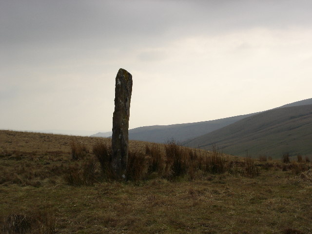
Maen Mawr

Heritage Site in Brecknockshire

Wales

Maen Mawr

Standing stone on Waun Leuci Little is known about this particular stone, it doesn't even appear to have a common name. It sits on a slight platform on the tussocky western slopes of Cefn Cul.
Standing stone on Waun Leuci Credit: Alan Bowring

The requested URL returned error: 429 Too Many Requests

If you have any feedback on the listing, please let us know in the comments section below.
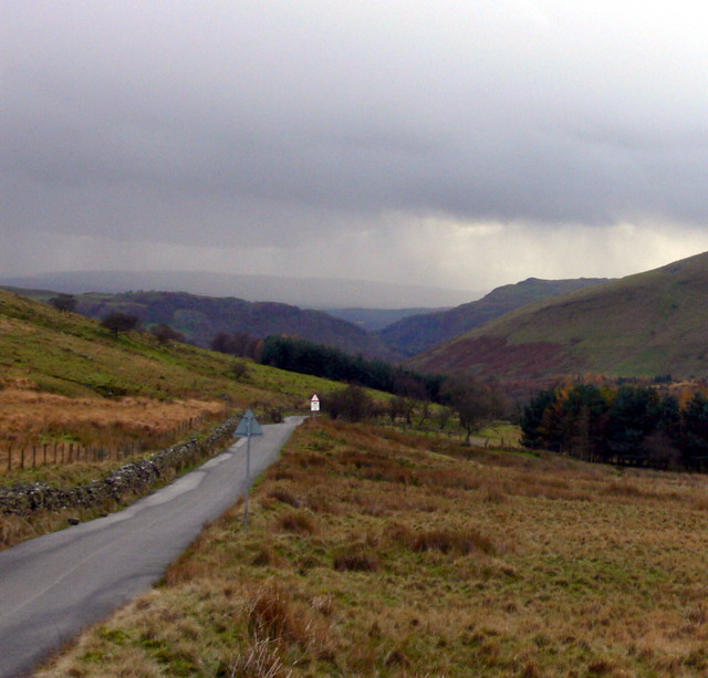
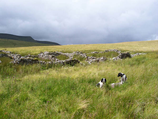
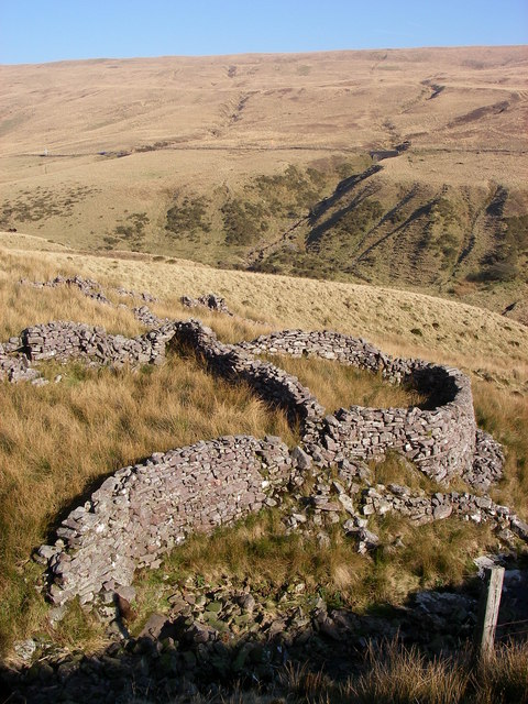
Maen Mawr Images

Images are sourced within 2km of 51.87/-3.663 or Grid Reference SN8520. Thanks to Geograph Open Source API. All images are credited.

Standing stone on Waun Leuci Little is known about this particular stone, it doesn't even appear to have a common name. It sits on a slight platform on the tussocky western slopes of Cefn Cul.
Standing stone on Waun Leuci
Little is known about this particular stone, it doesn't even appear to have a common name. It sits on a slight platform on the tussocky western slopes of Cefn Cul.
Ordnance Survey Rivet This OS rivet can be found on a stone at the base of the dry-stone wall to the east of the road. It marks a point 364.934m above mean sea level.
Ordnance Survey Rivet
This OS rivet can be found on a stone at the base of the dry-stone wall to the east of the road. It marks a point 364.934m above mean sea level.
Ordnance Survey Pivot This OS pivot can be found on a stone at the base of the dry-stone wall to the east of the road. It marks a point 380.214m above mean sea level.
Ordnance Survey Pivot
This OS pivot can be found on a stone at the base of the dry-stone wall to the east of the road. It marks a point 380.214m above mean sea level.
Ordnance Survey Rivet This OS rivet can be found on a stone at the base of the dry-stone wall to the east of the road. It marks a point 395.749m above mean sea level.
Ordnance Survey Rivet
This OS rivet can be found on a stone at the base of the dry-stone wall to the east of the road. It marks a point 395.749m above mean sea level.
Ordnance Survey Rivet This OS rivet can be found on the large stone at the base of the dry-stone wall to the east of the road. It marks a point 408.478m above mean sea level.
Ordnance Survey Rivet
This OS rivet can be found on the large stone at the base of the dry-stone wall to the east of the road. It marks a point 408.478m above mean sea level.
Maen Mawr Maenhir o'r Oes Efydd a elwir Maen Mawr. Tu hwnt iddo mae cylch cerrig hefyd o'r un cyfnod.

A Bronze Age standing stone known as Maen Mawr (trans. big stone). Just beyond is a stone circle also from the same period.
Maen Mawr
Maenhir o'r Oes Efydd a elwir Maen Mawr. Tu hwnt iddo mae cylch cerrig hefyd o'r un cyfnod. A Bronze Age standing stone known as Maen Mawr (trans. big stone). Just beyond is a stone circle also from the same period.
Cerrig Duon Stone Circle with Maen Mawr Standing Stone To get to this circle with its three rows of tiny stones you have to jump over the Afon Tawe - quite scary.
Cerrig Duon Stone Circle with Maen Mawr Standing Stone
To get to this circle with its three rows of tiny stones you have to jump over the Afon Tawe - quite scary.
Waen Lleuci Standing Stone A skinny but wide slab that points down the valley of the Afon Tawe past Cerrig Duon Stone Circle
Waen Lleuci Standing Stone
A skinny but wide slab that points down the valley of the Afon Tawe past Cerrig Duon Stone Circle
Maen Mawr standing stone and circle This circle of small stones and one large one are on a hill at the side of the road from Glyntawe to Trecastle.
Maen Mawr standing stone and circle
This circle of small stones and one large one are on a hill at the side of the road from Glyntawe to Trecastle.
Beneath Fan Fechan ... ... looking south west.
Beneath Fan Fechan ...
... looking south west.
Tower southwest of Cray reservoir A curious tower, much bigger than a trig pillar. It seems to be marked on the 1940 map too. I don't know what its genuine purpose is but I found it useful for navigating my way off Fan Gyhirych back to the lay-by I'd parked in.
Tower southwest of Cray reservoir
A curious tower, much bigger than a trig pillar. It seems to be marked on the 1940 map too. I don't know what its genuine purpose is but I found it useful for navigating my way off Fan Gyhirych back to the lay-by I'd parked in.
Upper Tawe Valley Cattle grid ahead. Minor mountain road from Trecastle to Glyntawe
Upper Tawe Valley
Cattle grid ahead. Minor mountain road from Trecastle to Glyntawe
Ford Heavy rain has made the entire hillside a sheet of water in this exceptionally wet Summer. The track at this ford has become an alternative water course.
Ford
Heavy rain has made the entire hillside a sheet of water in this exceptionally wet Summer. The track at this ford has become an alternative water course.
Sheepfold The purpose of the track was originally for access to this sheepfold, a multi-chambered affair for segregating the common flocks grazing the area.
Sheepfold
The purpose of the track was originally for access to this sheepfold, a multi-chambered affair for segregating the common flocks grazing the area.
Waterfall The wet conditions make the waterfalls much more spectacular, despite the fact that this was supposed to be Summer! This is near to the source of the Afon Tawe and below Llyn y Fan Fawr (but not connected directly).
Waterfall
The wet conditions make the waterfalls much more spectacular, despite the fact that this was supposed to be Summer! This is near to the source of the Afon Tawe and below Llyn y Fan Fawr (but not connected directly).
Tower on the Slopes of Cefn Cul This tower is sited South West of Crai (Cray) Reservoir, on the Eastern slope of Cefn Cul.
Tower on the Slopes of Cefn Cul
This tower is sited South West of Crai (Cray) Reservoir, on the Eastern slope of Cefn Cul.
Maen Mawr This lichen-encrusted standing stone is accompanied by the twenty stones of Cerrig Duon - one of several stone circles around the Black Mountain/Y Mynydd Du
Maen Mawr
This lichen-encrusted standing stone is accompanied by the twenty stones of Cerrig Duon - one of several stone circles around the Black Mountain/Y Mynydd Du
Sheepfold beside Nant Coetgae The remains of this stone enclosure sit next to the Nant Coetgae - the 'stream of the woodfield/enclosure' in English.  Old Red Sandstone blocks are abundant here on the hillside east of Fan Hir.  The minor road from Glyntawe to Trecastle/Trecastell is seen beyond the valley of the Afon Tawe.
Sheepfold beside Nant Coetgae
The remains of this stone enclosure sit next to the Nant Coetgae - the 'stream of the woodfield/enclosure' in English. Old Red Sandstone blocks are abundant here on the hillside east of Fan Hir. The minor road from Glyntawe to Trecastle/Trecastell is seen beyond the valley of the Afon Tawe.
Show me another place!

Maen Mawr is located at Grid Ref: SN8520 (Lat: 51.87, Lng: -3.663)

What 3 Words

///joined.defrost.swells. Near Cray, Powys

Nearby Locations

Maen Mawr

Related Wikis

Cefn Cul

Cefn Cul is a hill in the Fforest Fawr sector of the Brecon Beacons National Park in Powys, southern Wales. It is a broad north-northeast to south-southwest...

Fan Hir

Fan Hir is a peak at the eastern end of the Black Mountain (Y Mynydd Du) in the Brecon Beacons National Park (Parc Cenedlaethol Bannau Brycheiniog) in...

Fan Gyhirych

Fan Gyhirych is a mountain in the Fforest Fawr section of Brecon Beacons National Park in south Wales. It lies within the county of Breconshire, and administered...
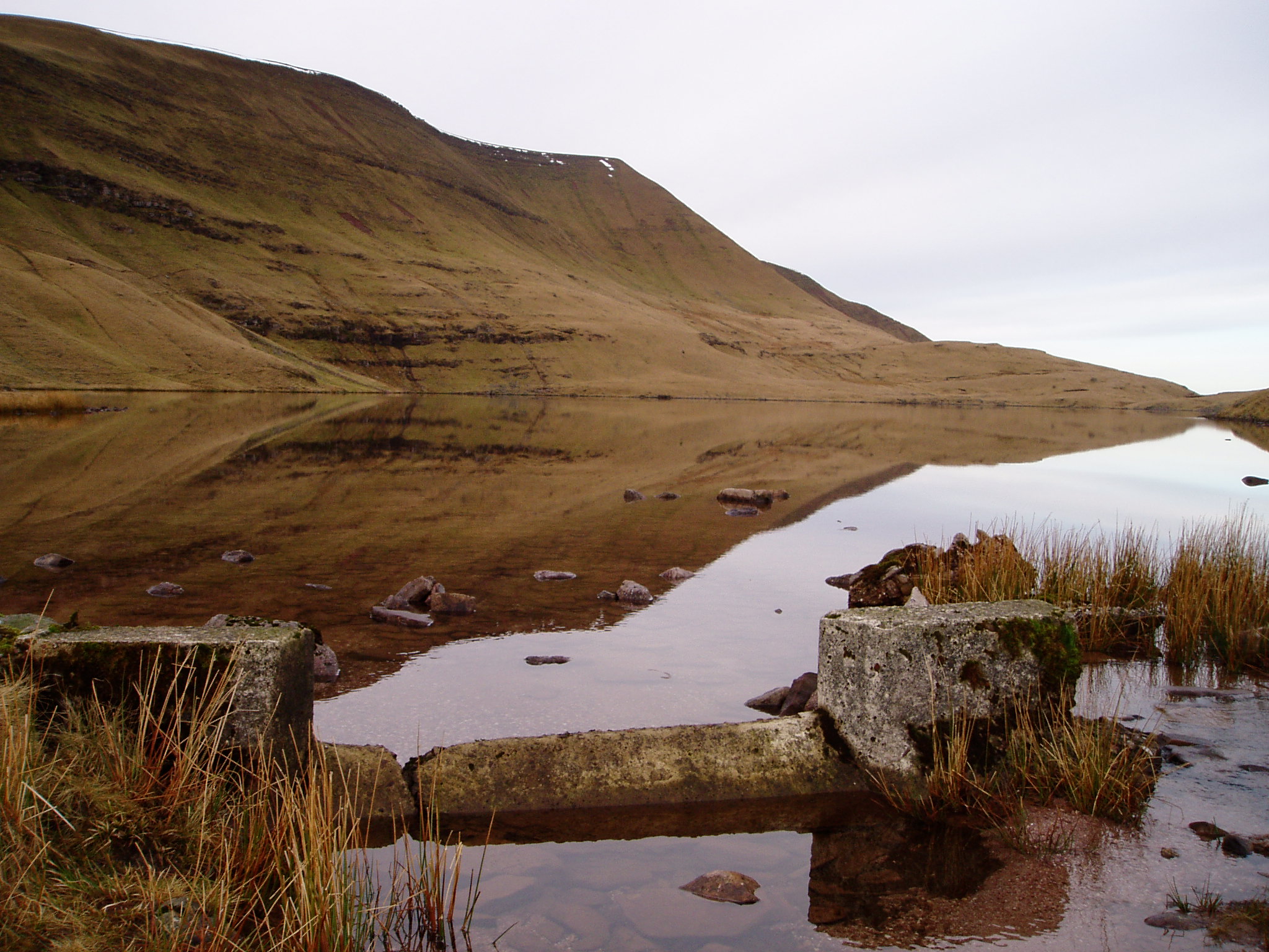
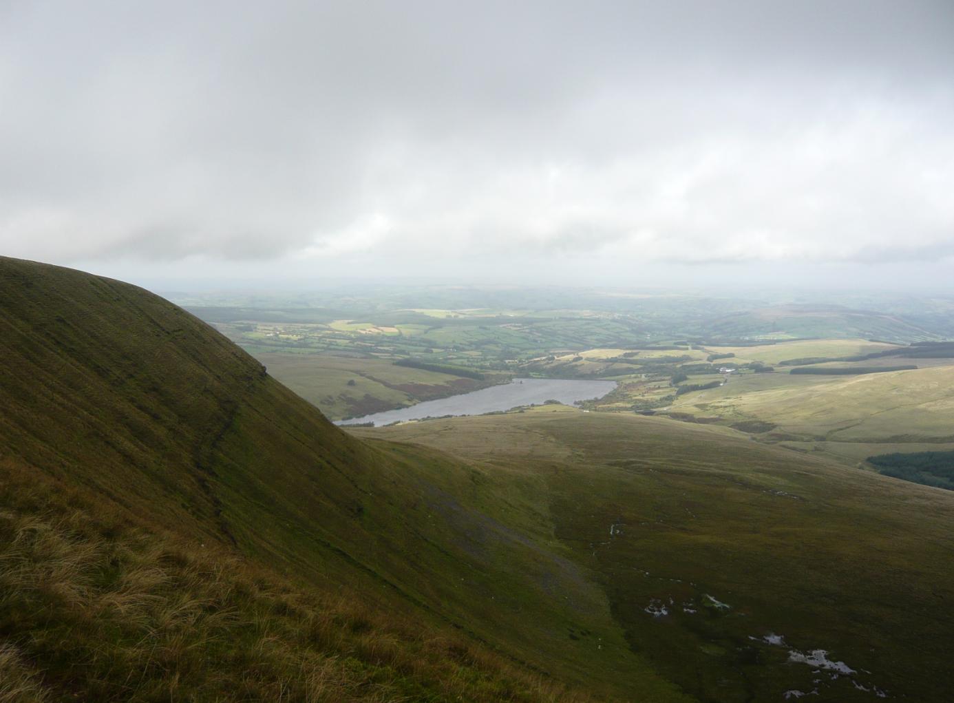
Llyn y Fan Fawr

Llyn y Fan Fawr (Welsh for 'great lake (near) the peak') is a natural lake in the county of Powys, Wales. It lies at the foot of Fan Brycheiniog, the highest...

Have you been to Maen Mawr?

Leave your review of Maen Mawr below (or comments, questions and feedback).