Kirkby Hall

Heritage Site in Lancashire

England

Kirkby Hall

A595 at Ellermire Bridge
A595 at Ellermire Bridge Credit: Colin Pyle

Kirkby Hall, located in Lancashire, England, is a prestigious heritage site that holds immense historical significance. Built in the 17th century, the hall stands as a testament to the architectural prowess of that era. The building is a fine example of Jacobean style, characterized by its symmetrical design, ornamental motifs, and mullioned windows.

The hall was originally constructed as a residence for the local gentry and has since witnessed several significant events. Over the centuries, it has been home to various prominent families, each leaving their mark on the building. The interiors of Kirkby Hall are adorned with exquisite woodwork, intricate plasterwork, and grand fireplaces, showcasing the craftsmanship of the period.

The surrounding grounds of Kirkby Hall are equally enchanting. Lush gardens, manicured lawns, and a picturesque lake contribute to the overall charm of the site. The hall itself is nestled amidst a sprawling estate, providing a tranquil and idyllic setting.

Today, Kirkby Hall serves as a popular tourist attraction, offering visitors a glimpse into Lancashire's rich history. The site also hosts a wide range of cultural events and exhibitions, further enhancing its appeal. Preservation efforts have ensured that the hall remains meticulously maintained, allowing visitors to experience the grandeur and elegance of a bygone era.

Overall, Kirkby Hall stands as a proud testament to Lancashire's architectural heritage, attracting visitors from far and wide who are captivated by its beauty and historical significance.

If you have any feedback on the listing, please let us know in the comments section below.
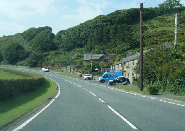
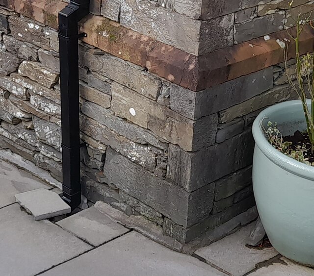
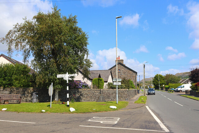
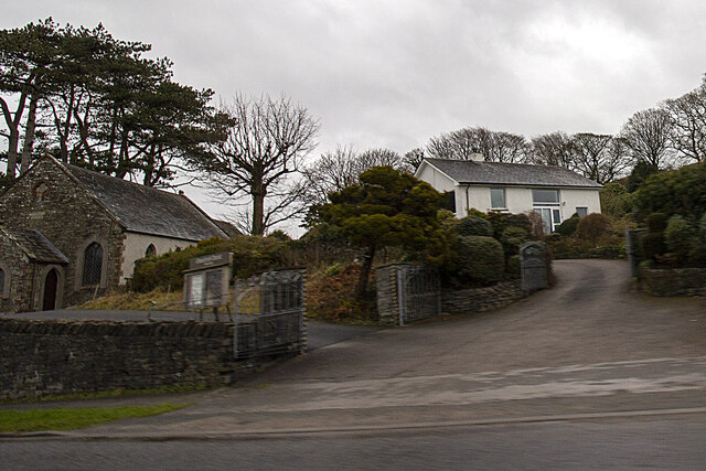
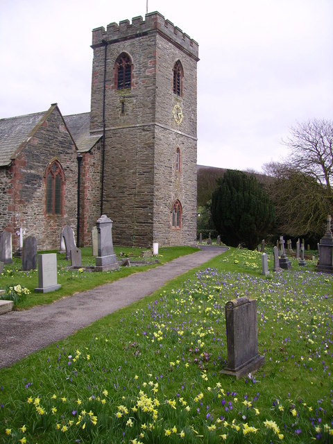
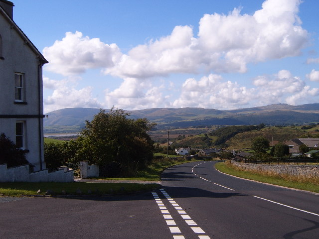
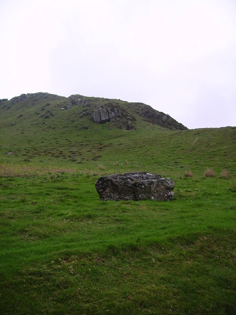
Kirkby Hall Images

Images are sourced within 2km of 54.242/-3.173 or Grid Reference SD2383. Thanks to Geograph Open Source API. All images are credited.

A595 at Ellermire Bridge
Ordnance Survey Flush Bracket (S7106) This OS Flush Bracket can be found on old school building which is now a private property. It marks a point 14.673m above mean sea level.
Ordnance Survey Flush Bracket (S7106)
This OS Flush Bracket can be found on old school building which is now a private property. It marks a point 14.673m above mean sea level.
Ordnance Survey Cut Mark This OS cut mark can be found on the NE parapet of Ellermire Bridge. It marks a point 11.408m above mean sea level.
Ordnance Survey Cut Mark
This OS cut mark can be found on the NE parapet of Ellermire Bridge. It marks a point 11.408m above mean sea level.
Ordnance Survey Cut Mark This OS cut mark can be found on the house which was once the Mission Church. It marks a point 12.722m above mean sea level.
Ordnance Survey Cut Mark
This OS cut mark can be found on the house which was once the Mission Church. It marks a point 12.722m above mean sea level.
Ordnance Survey Cut Mark This OS cut mark can be found on the gatepost east side of Woodlands Road. It marks a point 34.203m above mean sea level.
Ordnance Survey Cut Mark
This OS cut mark can be found on the gatepost east side of Woodlands Road. It marks a point 34.203m above mean sea level.
Ordnance Survey Cut Mark This OS cut mark can be found on the wall SE side of the road. It marks a point 6.417m above mean sea level.
Ordnance Survey Cut Mark
This OS cut mark can be found on the wall SE side of the road. It marks a point 6.417m above mean sea level.
Ordnance Survey Rivet This OS rivet can be found on the south angle of the chapel. It marks a point 7.616m above mean sea level.
Ordnance Survey Rivet
This OS rivet can be found on the south angle of the chapel. It marks a point 7.616m above mean sea level.
Ordnance Survey Rivet This OS rivet can be found on the wall north side of the road. It marks a point 22.275m above mean sea level.
Ordnance Survey Rivet
This OS rivet can be found on the wall north side of the road. It marks a point 22.275m above mean sea level.
Ordnance Survey Cut Mark This OS cut mark can be found on the roadside barn at Little Croft. It marks a point 76.828m above mean sea level.
Ordnance Survey Cut Mark
This OS cut mark can be found on the roadside barn at Little Croft. It marks a point 76.828m above mean sea level.
Ordnance Survey Cut Mark This OS rivet can be found on the boulder SW side of the road. It marks a point 110.591m above mean sea level.
Ordnance Survey Cut Mark
This OS rivet can be found on the boulder SW side of the road. It marks a point 110.591m above mean sea level.
Ordnance Survey Cut Mark This OS cut mark can be found on the gatepost NW side of the road. It marks a point 26.665m above mean sea level.
Ordnance Survey Cut Mark
This OS cut mark can be found on the gatepost NW side of the road. It marks a point 26.665m above mean sea level.
Ordnance Survey Cut Mark This damaged OS cut mark can be found on Waters Edge west side of the road. It marks a point 5.823m above mean sea level.
Ordnance Survey Cut Mark
This damaged OS cut mark can be found on Waters Edge west side of the road. It marks a point 5.823m above mean sea level.
Ordnance Survey Cut Mark This OS cut mark can be found on the gatepost of The Hermitage. It marks a point 29.942m above mean sea level.
Ordnance Survey Cut Mark
This OS cut mark can be found on the gatepost of The Hermitage. It marks a point 29.942m above mean sea level.
Ordnance Survey Cut Mark This hidden OS cut mark can be found on the wall SW side of the road. It marks a point 32.935m above mean sea level.
Ordnance Survey Cut Mark
This hidden OS cut mark can be found on the wall SW side of the road. It marks a point 32.935m above mean sea level.
Ordnance Survey Cut Mark This OS cut mark can be found on the NW face of the school. It marks a point 43.239m above mean sea level.
Ordnance Survey Cut Mark
This OS cut mark can be found on the NW face of the school. It marks a point 43.239m above mean sea level.
Askew Gate Road junction at Kirkby-in-Furness.
Askew Gate
Road junction at Kirkby-in-Furness.
Hallstead Farm
Hallstead Farm
Applegarth
Applegarth
Show me another place!

Kirkby Hall is located at Grid Ref: SD2383 (Lat: 54.242, Lng: -3.173)

Police Authority: Cumbria

What 3 Words

///treat.healers.stilted. Near Askam in Furness, Cumbria

Related Wikis

Angerton, South Lakeland

Angerton is a civil parish in the Westmorland and Furness district of the ceremonial county of Cumbria, England, historically part of the Furness portion...

Kirkby Slate Quarries

Kirkby Slate Quarries, formally known as Burlington Slate Quarries, are located near Kirkby-in-Furness in Cumbria, England. The quarries have produced...

Kirkby-in-Furness railway station

Kirkby-in-Furness is a railway station on the Cumbrian Coast Line, which runs between Carlisle and Barrow-in-Furness. The station, situated 9+1⁄4 miles...

Kirkby-in-Furness

Kirkby-in-Furness, generally referred to simply as Kirkby locally, is a village that is the major part of the parish of Kirkby Ireleth in the Furness district...

Kirkby Ireleth

Kirkby Ireleth is a civil parish in the South Lakeland district of the English county of Cumbria. It includes the villages of Grizebeck and Kirkby-in...

Beanthwaite

Beanthwaite is a hamlet in Cumbria, England.

Kirkby Moor

Kirkby Moor is a poorly defined moorland area in southern Cumbria, England, named after the village of Kirkby-in-Furness, but stretching both sides of...

Burney (hill)

Burney is a hill in Cumbria, England, to the north of the A5092 road between Greenodd and Broughton-in-Furness. It is the subject of a chapter of Wainwright...

Nearby Amenities

Located within 500m of 54.242,-3.173
Bus Stop
Wall End (N bound)
Bench: no
Bus: yes
Naptan AtcoCode: 090079394318
Naptan Bearing: N
Naptan CommonName: Wall End (N bound)
Naptan Indicator: n/bound
Naptan Landmark: 2 Wall End
Naptan NaptanCode: cumdtdjg
Naptan Street: A595
Naptan Verified: no
Public Transport: platform
Shelter: no
Source: naptan_import
Lat/Long: 54.2382378/-3.1763241
Bus Stop
Wall End (S bound)
Bus: yes
Naptan AtcoCode: 090079394319
Naptan Bearing: S
Naptan BusStopType: CUS
Naptan CommonName: Wall End (S bound)
Naptan Indicator: s/bound
Naptan Landmark: 2 Wall End
Naptan NaptanCode: cumdtdjm
Naptan Street: A595
Naptan Verified: no
Public Transport: platform
Shelter: no
Source: naptan_import
Lat/Long: 54.2382379/-3.1761712
Bus Stop
Marshside (N bound)
Bench: no
Bin: yes
Bus: yes
Lit: no
Local Ref: AT
Naptan AtcoCode: 090079394320
Naptan Bearing: N
Naptan CommonName: Marshside (N bound)
Naptan Indicator: at
Naptan Landmark: number 1
Naptan NaptanCode: cumdtdjp
Naptan Street: A595
Naptan Verified: no
Public Transport: platform
Shelter: yes
Source: naptan_import
Tactile Paving: no
Lat/Long: 54.2410356/-3.1766995
Barrier: kissing_gate
Lat/Long: 54.239449/-3.1764919
Turning Circle
Lat/Long: 54.2418135/-3.1776074
Post Box
Collection Times: Mo-Fr 16:00; Sa 11:00
Drive Through: no
Post Box Type: lamp
Ref: LA17 87
Lat/Long: 54.2402674/-3.1796657
Bench
Backrest: yes
Lat/Long: 54.2402407/-3.1797175
Give Way
Direction: backward
Lat/Long: 54.2452424/-3.1733898
Give Way
Direction: forward
Lat/Long: 54.2451064/-3.173392
Give Way
Direction: forward
Lat/Long: 54.2460119/-3.1735585
Give Way
Direction: backward
Lat/Long: 54.2457037/-3.1730928
Give Way
Direction: backward
Lat/Long: 54.2418469/-3.1762608
Give Way
Direction: forward
Lat/Long: 54.241257/-3.1764529
Give Way
Direction: forward
Lat/Long: 54.2411929/-3.1765958
Waste Basket
Lat/Long: 54.2410639/-3.1767176
Grit Bin
Lat/Long: 54.2411268/-3.1767263
Give Way
Direction: backward
Lat/Long: 54.2385804/-3.1763621
Grit Bin
Lat/Long: 54.2386089/-3.1764781
Bench
Backrest: yes
Lat/Long: 54.238678/-3.1764566
Give Way
Direction: backward
Lat/Long: 54.2387543/-3.1762576
Grit Bin
Lat/Long: 54.2419102/-3.176283
Post Box
Collection Times: Mo-Fr 16:00; Sa 08:30
Drive Through: no
Post Box Type: lamp
Ref: LA17 66
Lat/Long: 54.2450721/-3.1732947
Turning Circle
Lat/Long: 54.2397206/-3.1749409
Bus Stop
Marshside (S bound)
Bench: yes
Bin: no
Bus: yes
Public Transport: platform
Shelter: yes
Tactile Paving: no
Lat/Long: 54.2405477/-3.1764253
Grit Bin
Lat/Long: 54.2392709/-3.1743126
Grit Bin
Lat/Long: 54.2438489/-3.1700554
Barrier: cattle_grid
Lat/Long: 54.2405464/-3.171649
Barrier: cattle_grid
Lat/Long: 54.2394879/-3.1739454
Power: pole
Lat/Long: 54.2397501/-3.1669186
Power: pole
Lat/Long: 54.2405687/-3.1667906
Bench
Backrest: yes
Lat/Long: 54.2399734/-3.1763176
Barrier: entrance
Lat/Long: 54.2460801/-3.1703878
Generator Method: photovoltaic
Generator Output Electricity: yes
Generator Source: solar
Generator Type: solar_photovoltaic_panel
Location: roof
Power: generator
Lat/Long: 54.2420309/-3.1765274
Generator Method: photovoltaic
Generator Output Electricity: yes
Generator Source: solar
Generator Type: solar_photovoltaic_panel
Location: roof
Power: generator
Lat/Long: 54.2422645/-3.1773616
Barrier: kissing_gate
Lat/Long: 54.239449/-3.1764919
Power: pole
Lat/Long: 54.2414203/-3.1664836
Marsh Side
Place: village
Lat/Long: 54.2415355/-3.1781695
Wall End
Place: village
Lat/Long: 54.2381032/-3.1757985
Power: pole
Lat/Long: 54.2410252/-3.1788525
Power: pole
Lat/Long: 54.2413798/-3.1777266
Power: pole
Lat/Long: 54.2421279/-3.1797466
Power: pole
Lat/Long: 54.2431816/-3.1796688
Power: pole
Lat/Long: 54.2441429/-3.1796086
Power: pole
Lat/Long: 54.241947/-3.1668747
Power: pole
Lat/Long: 54.2426397/-3.1672007
Power: pole
Lat/Long: 54.2434084/-3.1673967
Power: pole
Lat/Long: 54.243812/-3.1664848
Power: pole
Lat/Long: 54.2419749/-3.1701803
Power: pole
Lat/Long: 54.2421614/-3.1702761
Power: pole
Lat/Long: 54.2436295/-3.1711333
Power: pole
Lat/Long: 54.2446526/-3.1716485
Power: pole
Lat/Long: 54.2452627/-3.1714729
Power: pole
Lat/Long: 54.2456956/-3.1713339
Power: pole
Lat/Long: 54.2461565/-3.1711857
Power: pole
Lat/Long: 54.2428289/-3.1687418
Power: pole
Lat/Long: 54.2418044/-3.1711971
Power: pole
Lat/Long: 54.2410584/-3.173201
Power: pole
Lat/Long: 54.2404948/-3.1747558
The data included in this document is from www.openstreetmap.org. The data is made available under ODbL.

Have you been to Kirkby Hall?

Leave your review of Kirkby Hall below (or comments, questions and feedback).