Kennox

Heritage Site in Ayrshire

Scotland

Kennox

Looking along the Glazert Burn The picture looks south along the burn near its meeting with the Annick Water. Through the trees the bridge that crosses the burn just before a 'T' junction can be spotted.
Looking along the Glazert Burn Credit: Alec MacKinnon

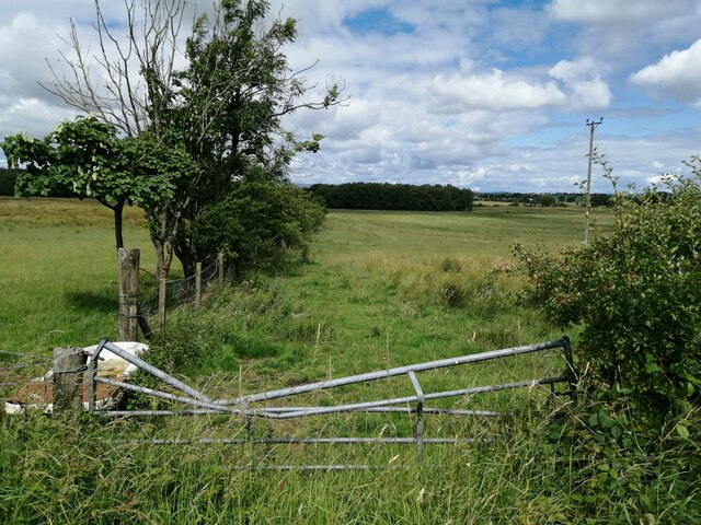
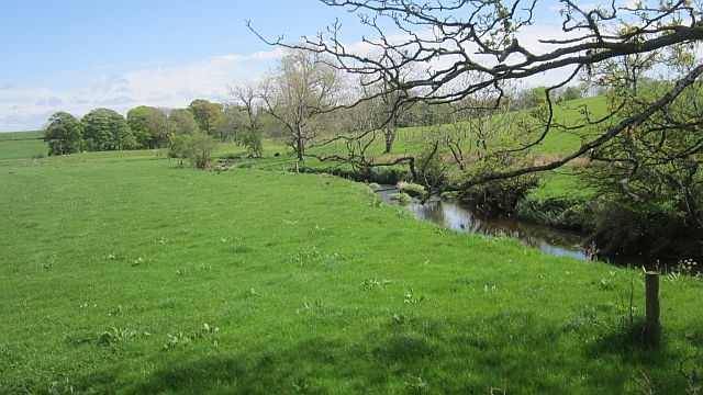
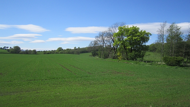
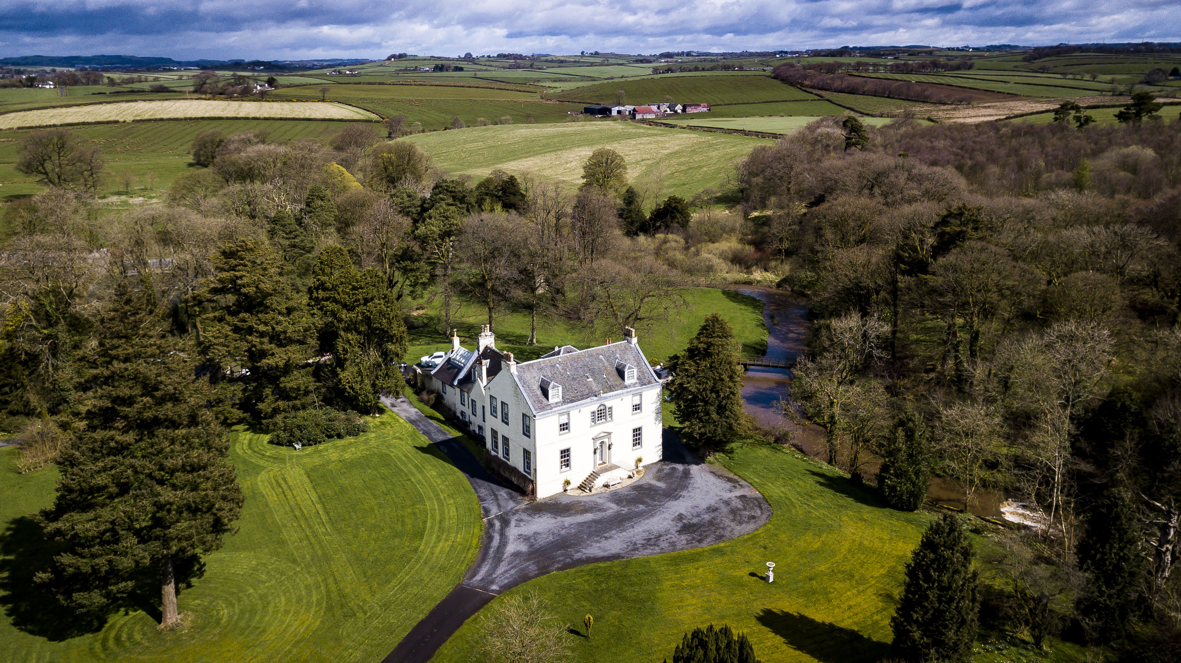
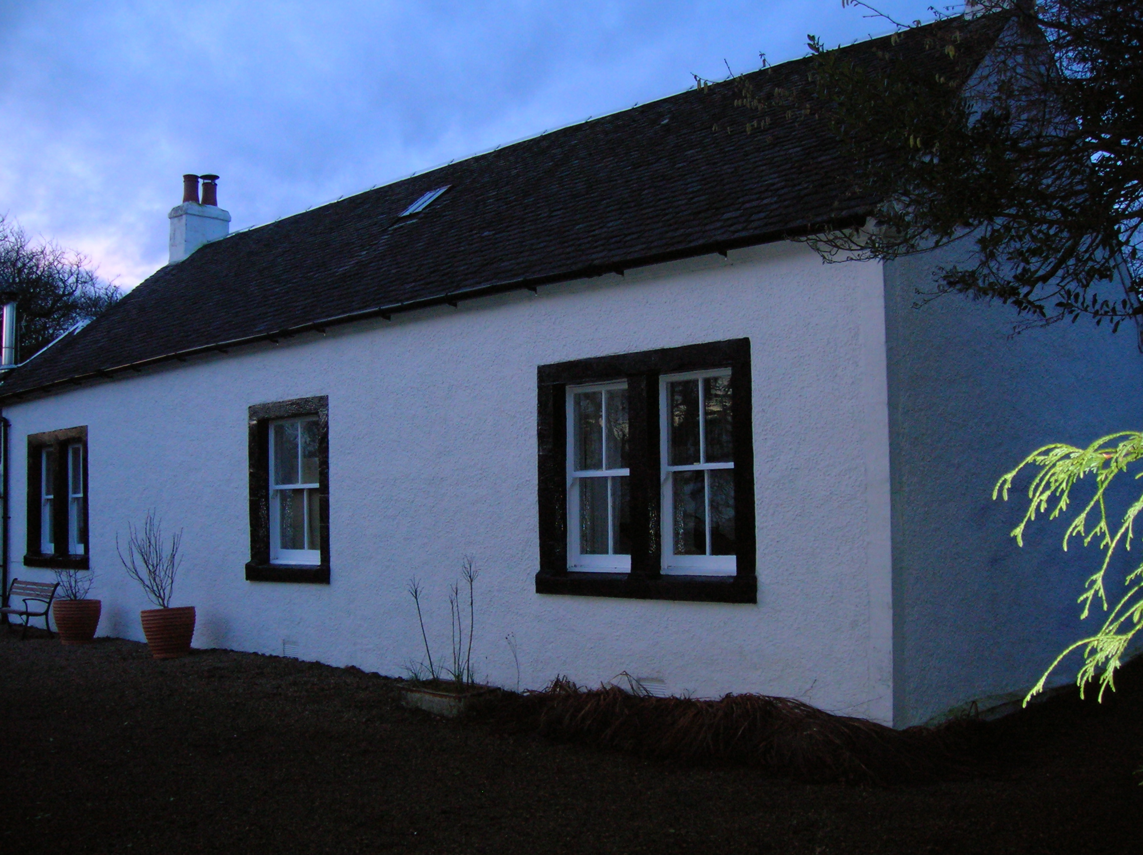
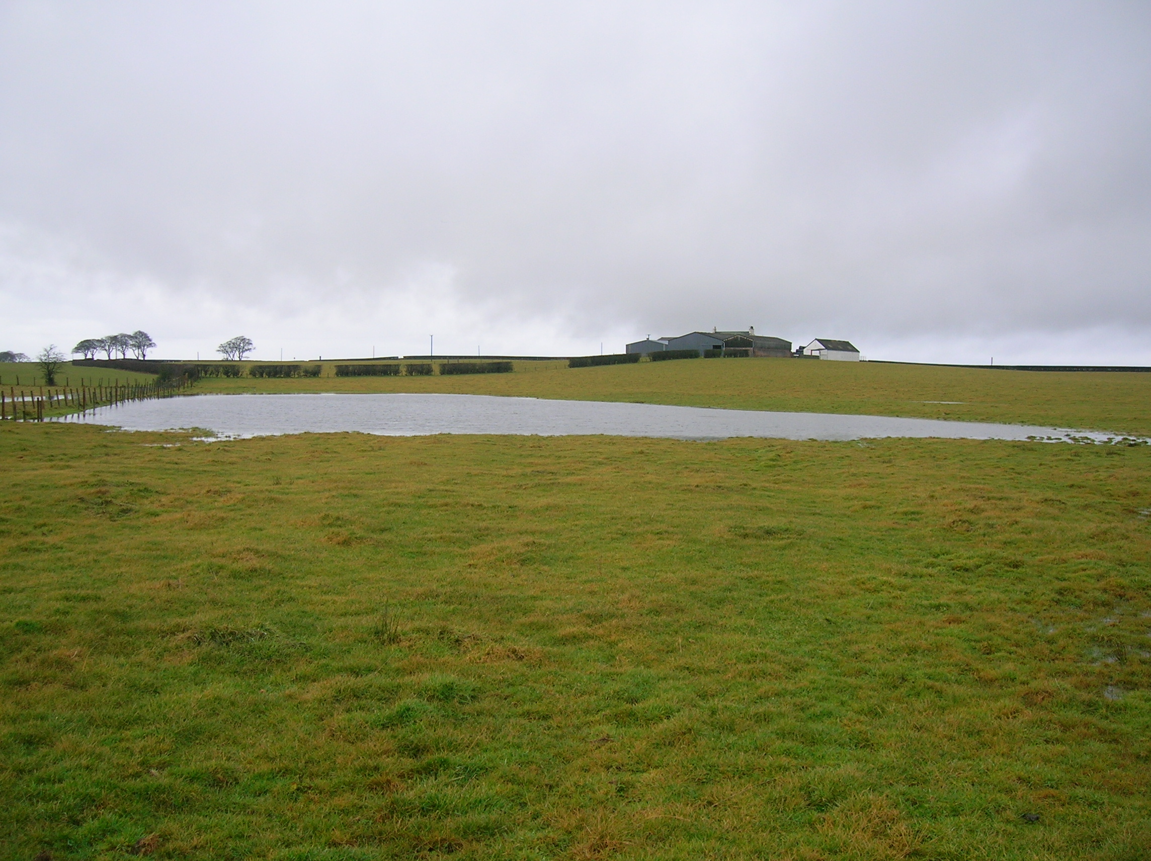
Kennox is a historic estate located in the region of Ayrshire, Scotland. Situated approximately 4 miles northeast of the town of Stewarton, it is regarded as a significant heritage site in the area. The estate encompasses a vast area of lush green land, comprising a mix of woodlands, meadows, and gardens.

The history of Kennox dates back centuries, with records indicating its existence as early as the 14th century. Over the years, it has witnessed various transformations and ownership changes. The current house on the estate was built in the 18th century, displaying stunning architectural features and grandeur.

The estate is renowned for its well-preserved gardens, which showcase a diverse range of flora and fauna. Visitors can explore the beautifully manicured lawns, vibrant flowerbeds, and peaceful woodland trails. The gardens also boast a walled garden, which houses an array of traditional Scottish plants and herbs.

In addition to its natural beauty, Kennox holds historical significance. The estate has been associated with notable figures throughout its history, including Scottish poet Robert Burns, who is said to have visited the estate on several occasions. The estate's connection to Burns adds to its cultural importance in the region.

Today, Kennox is open to the public, allowing visitors to immerse themselves in its rich history and natural splendor. It serves as a popular destination for nature enthusiasts, history buffs, and individuals seeking a peaceful retreat away from the hustle and bustle of city life.

If you have any feedback on the listing, please let us know in the comments section below.

Kennox Images

Images are sourced within 2km of 55.667/-4.568 or Grid Reference NS3844. Thanks to Geograph Open Source API. All images are credited.

Looking along the Glazert Burn The picture looks south along the burn near its meeting with the Annick Water. Through the trees the bridge that crosses the burn just before a 'T' junction can be spotted.
Looking along the Glazert Burn
The picture looks south along the burn near its meeting with the Annick Water. Through the trees the bridge that crosses the burn just before a 'T' junction can be spotted.
Glazert Burn and minor road The picture shows the Glazert Burn and accompanying minor road just north of its meeting with the Annick Water.
Glazert Burn and minor road
The picture shows the Glazert Burn and accompanying minor road just north of its meeting with the Annick Water.
Edge of the field In quiet Ayrshire farmland near Crossgates, the edge of this field is marked by both fence and hedgerow. The gate in the foreground opens - or possibly opened given its current state  - from the minor road that heads north towards Dunlop.
Edge of the field
In quiet Ayrshire farmland near Crossgates, the edge of this field is marked by both fence and hedgerow. The gate in the foreground opens - or possibly opened given its current state - from the minor road that heads north towards Dunlop.
Minor road from Crossgates We look south-west along this single track road which runs from the farm at Crossgates across the country towards Dunlop.
Minor road from Crossgates
We look south-west along this single track road which runs from the farm at Crossgates across the country towards Dunlop.
Bench in the wood A viewpoint in Lainshaw Wood which looks out towards the Firth of Clyde.
Bench in the wood
A viewpoint in Lainshaw Wood which looks out towards the Firth of Clyde.
Overgrown path In Lainshaw woodland, near Stewarton.
Overgrown path
In Lainshaw woodland, near Stewarton.
Path into the woods Northern entrance to Lainshaw Woods, Stewarton.
Path into the woods
Northern entrance to Lainshaw Woods, Stewarton.
Arable field North of Lainshaw woods, Stewarton.
Arable field
North of Lainshaw woods, Stewarton.
Grassland near Irvinehill View towards Arran.
Grassland near Irvinehill
View towards Arran.
Minor road near Irvinehill
Glazert Burn A tributary of the Annick Water.
Glazert Burn
A tributary of the Annick Water.
Waterhouse A ruin near Kennox.
Waterhouse
A ruin near Kennox.
Waterhouse The low remains of a ruin near Kennox.
Waterhouse
The low remains of a ruin near Kennox.
Kennox Moss The edge of a large wetland and bog area.
Kennox Moss
The edge of a large wetland and bog area.
Kennox Moss Some of the mossland is wooded.
Kennox Moss
Some of the mossland is wooded.
A wet gateway Mud near Crossgates.
A wet gateway
Mud near Crossgates.
Fence, Crossgates
Fence, Crossgates
Arable land near Kennox Beside the Glazert Burn. Most of the ground around here is under pasture.
Arable land near Kennox
Beside the Glazert Burn. Most of the ground around here is under pasture.
Show me another place!

Kennox is located at Grid Ref: NS3844 (Lat: 55.667, Lng: -4.568)

What 3 Words

///detained.frantic.narrating. Near Stewarton, East Ayrshire

Nearby Locations

Kennox

Related Wikis

Kennox House

Kennox House is situated on Kilwinning Road between Stewarton to Torranyard in North Ayrshire, Parish of Dunlop, Scotland. The house overlooks the Glazert...

Barony of Bonshaw

The Barony of Bonshaw, previously known as Bollingshaw, was in the old feudal Baillerie of Cunninghame, near Stewarton in what is now North Ayrshire, Scotland...

Lambroughton

Lambroughton is a village in the old Barony of Kilmaurs, Scotland. This is a rural area famous for its milk and cheese production and the Ayrshire or Dunlop...

Lambroughton Loch

Lambroughton Loch or Wheatrig Loch was situated in a low-lying area between the farms and dwellings of Hillhead, Lambroughton, Wheatrig, Titwood and Lochridge...

Girgenti House

Girgenti House (OS grid reference: NS 36502 43575) was a small, rather eccentric mansion built on part of the old Barony of Bonshaw in the parish of Stewarton...

Bloak

Bloak was a hamlet or clachan in East Ayrshire, Parish of Stewarton, Scotland. The habitation was situated between Auchentiber and Stewarton on the B778...

Lainshaw Castle

Lainshaw Castle was a 15th century castle about 1.0 mile (1.6 km) south-west of Stewarton, East Ayrshire, Scotland, to the north of Annick Water. The castle...

Cunninghamhead

Cunninghamhead is a hamlet on the Annick Water in the Parish of Dreghorn, North Ayrshire, Scotland. The area was part of the old Cunninghamhead estate...

Nearby Amenities

Located within 500m of 55.667,-4.568
Power: pole
Lat/Long: 55.6651703/-4.5646757
Power: pole
Lat/Long: 55.6650887/-4.5637047
Power: pole
Lat/Long: 55.6649691/-4.5625112
Power: pole
Lat/Long: 55.6660864/-4.5658371
Power: pole
Lat/Long: 55.6668821/-4.565416
Power: pole
Lat/Long: 55.6674569/-4.5650324
Power: pole
Lat/Long: 55.6681573/-4.5646221
Power: pole
Lat/Long: 55.6642036/-4.5738435
Power: pole
Lat/Long: 55.664429/-4.5722556
Power: pole
Lat/Long: 55.6646287/-4.5709172
Power: pole
Lat/Long: 55.664895/-4.5691335
Power: pole
Lat/Long: 55.6651356/-4.5675725
Power: pole
Lat/Long: 55.6653413/-4.5661992
Power: pole
Lat/Long: 55.6686648/-4.5675162
Power: pole
Lat/Long: 55.6687254/-4.5659819
Power: pole
Lat/Long: 55.6687677/-4.5642385
Power: pole
Lat/Long: 55.6693002/-4.5632863
Power: pole
Lat/Long: 55.6697177/-4.5624334
Power: pole
Lat/Long: 55.6701739/-4.5706548
Power: pole
Lat/Long: 55.669563/-4.570661
Power: pole
Lat/Long: 55.6692441/-4.5695258
Power: pole
Lat/Long: 55.6689263/-4.5683947
Power: pole
Lat/Long: 55.6684191/-4.563476
Power: pole
Lat/Long: 55.6678718/-4.5623095
Post Box
Post Box Type: wall
Lat/Long: 55.6700941/-4.5702727
The data included in this document is from www.openstreetmap.org. The data is made available under ODbL.

Have you been to Kennox?

Leave your review of Kennox below (or comments, questions and feedback).