Grange, Middle

Settlement in Aberdeenshire

Scotland

Grange, Middle

Inverugie Road, Peterhead I'm always saddened to see places where I used to play as a youngster being developed with yet more green space being lost forever, but that's progress I suppose.

This is the Inverugie Road in Peterhead, showing the security fencing that has been erected around a massive new housing development, and which currently blocks the road. Whether or not the road will be reinstated at a later date, I have no idea.

Leading off to the right is the pathway running alongside the Collie Burn.
Inverugie Road, Peterhead Credit: Iain Smith

Grange is a small village located in the Middle district of Aberdeenshire, Scotland. Situated in the northeastern region of the country, it is nestled amidst picturesque countryside and rolling hills. The village is known for its idyllic setting, offering residents and visitors a tranquil and scenic environment.

Grange is characterized by its charming rural atmosphere, with a population of approximately 500 people. The village is predominantly residential, with a few small businesses catering to the local community's needs. Despite its size, Grange boasts a close-knit community that takes pride in maintaining its heritage and traditions.

Surrounded by lush greenery, Grange offers ample opportunities for outdoor activities and exploration. The nearby countryside provides walking trails, cycling routes, and fishing spots, making it a popular destination for nature enthusiasts. Additionally, the village is within close proximity to the River Deveron, offering opportunities for water-based activities.

While Grange may be a quiet village, it benefits from its close proximity to larger towns and cities. The town of Huntly is just a short drive away, providing access to a wider range of amenities such as supermarkets, shops, and leisure facilities. Aberdeen, the region's largest city, is approximately 40 miles south of Grange and offers further employment and entertainment opportunities.

Overall, Grange is a charming and peaceful village that offers residents a close community, stunning natural surroundings, and convenient access to nearby towns and cities. It is an ideal location for those seeking a tranquil rural lifestyle while still enjoying the benefits of nearby amenities.

If you have any feedback on the listing, please let us know in the comments section below.

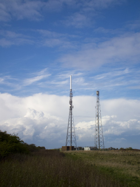
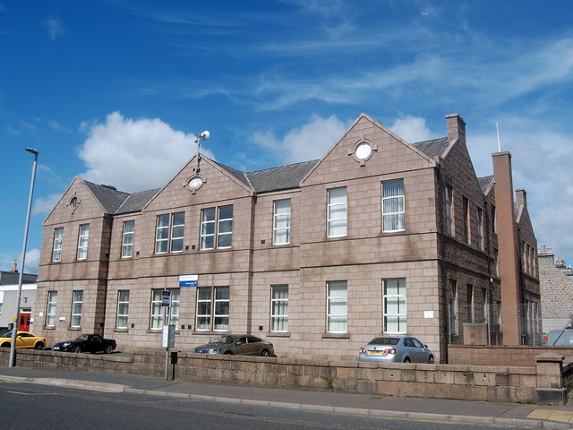
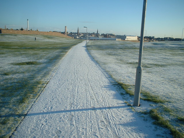
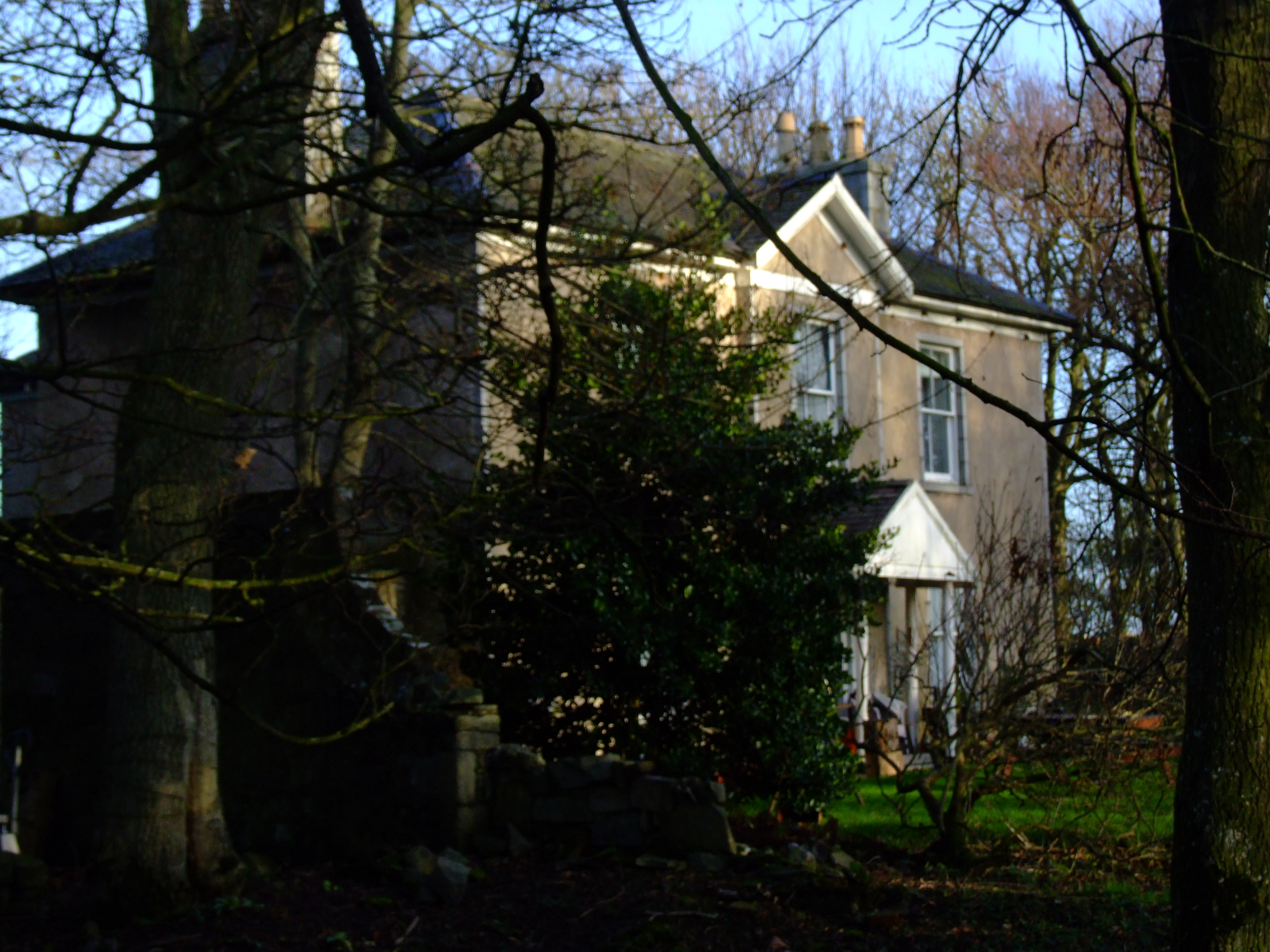
Grange, Middle Images

Images are sourced within 2km of 57.506486/-1.809311 or Grid Reference NK1146. Thanks to Geograph Open Source API. All images are credited.

Inverugie Road, Peterhead I'm always saddened to see places where I used to play as a youngster being developed with yet more green space being lost forever, but that's progress I suppose.

This is the Inverugie Road in Peterhead, showing the security fencing that has been erected around a massive new housing development, and which currently blocks the road. Whether or not the road will be reinstated at a later date, I have no idea.

Leading off to the right is the pathway running alongside the Collie Burn.
Inverugie Road, Peterhead
I'm always saddened to see places where I used to play as a youngster being developed with yet more green space being lost forever, but that's progress I suppose. This is the Inverugie Road in Peterhead, showing the security fencing that has been erected around a massive new housing development, and which currently blocks the road. Whether or not the road will be reinstated at a later date, I have no idea. Leading off to the right is the pathway running alongside the Collie Burn.
Buchanhaven Harbour In 1850 work started on a new pier, to replace an earlier small one to the west. This was to be the first stage in the building of a proper harbour basin for large herring boats. This plan was never completed. Buchanhaven Pier, as it stands today, did allow the fishermen to operate small-line boats. By the mid 1860s there were 27 boats working from the harbour.

The proximity of Peterhead and other larger fishing harbours eventually led to the demise of the harbour and nowadays only a few small boats use it.
Buchanhaven Harbour
In 1850 work started on a new pier, to replace an earlier small one to the west. This was to be the first stage in the building of a proper harbour basin for large herring boats. This plan was never completed. Buchanhaven Pier, as it stands today, did allow the fishermen to operate small-line boats. By the mid 1860s there were 27 boats working from the harbour. The proximity of Peterhead and other larger fishing harbours eventually led to the demise of the harbour and nowadays only a few small boats use it.
Meethill Transmitter The twin masts at Meethill, covering the greater Peterhead area.
Meethill Transmitter
The twin masts at Meethill, covering the greater Peterhead area.
Peterhead marina
Peterhead marina
Peterhead Bay Sands and grass by the shore with an industrial offshore skyline due to oil rig work.
<span class="nowrap"><a title="http://en.wikipedia.org/wiki/Peterhead" rel="nofollow ugc noopener" href="http://en.wikipedia.org/wiki/Peterhead">Link</a><img style="margin-left:2px;" alt="External link" title="External link - shift click to open in new window" src="https://s1.geograph.org.uk/img/external.png" width="10" height="10"/></span>
Peterhead Bay
Sands and grass by the shore with an industrial offshore skyline due to oil rig work. LinkExternal link
Peterhead Bay East-facing bay at the Lido, south of the town centre.
Peterhead Bay
East-facing bay at the Lido, south of the town centre.
Peterhead tolbooth
Peterhead tolbooth
Farmland west of Peterhead
Town House, Broad Street, Peterhead Dating from 1788 and B-listed: <span class="nowrap"><a title="http://data.historic-scotland.gov.uk/pls/htmldb/f?p=2200:15:0::::BUILDING:39674" rel="nofollow ugc noopener" href="http://data.historic-scotland.gov.uk/pls/htmldb/f?p=2200:15:0::::BUILDING:39674">Link</a><img style="margin-left:2px;" alt="External link" title="External link - shift click to open in new window" src="https://s1.geograph.org.uk/img/external.png" width="10" height="10"/></span> . The "bad" porch was added in 1881.   The statue of Field Marshal Keith in the foreground.
Town House, Broad Street, Peterhead
Dating from 1788 and B-listed: LinkExternal link . The "bad" porch was added in 1881. The statue of Field Marshal Keith in the foreground.
Field Marshal Keith statue, Peterhead James Francis Edward Keith (see: <span class="nowrap"><a title="https://en.wikipedia.org/wiki/James_Francis_Edward_Keith" rel="nofollow ugc noopener" href="https://en.wikipedia.org/wiki/James_Francis_Edward_Keith">Link</a><img style="margin-left:2px;" alt="External link" title="External link - shift click to open in new window" src="https://s1.geograph.org.uk/img/external.png" width="10" height="10"/></span> ), born at Inverugie Castle near Peterhead was a Jacobite who was forced to flee the country after the '15 rebellion was suppressed.  He served in the Spanish, Russian and Prussian armies and died at the battle of Hochkirch in 1758, where his heroics allowed Frederick the Great to retreat to safety.   His Jacobite past was evidently forgiven by 1868 when this statue was gifted to Peterhead by the King of Prussia.
Field Marshal Keith statue, Peterhead
James Francis Edward Keith (see: LinkExternal link ), born at Inverugie Castle near Peterhead was a Jacobite who was forced to flee the country after the '15 rebellion was suppressed. He served in the Spanish, Russian and Prussian armies and died at the battle of Hochkirch in 1758, where his heroics allowed Frederick the Great to retreat to safety. His Jacobite past was evidently forgiven by 1868 when this statue was gifted to Peterhead by the King of Prussia.
Central (Primary) School, St Peter St, Peterhead Originally single storey, but rebuilt ca. 1906.
Central (Primary) School, St Peter St, Peterhead
Originally single storey, but rebuilt ca. 1906.
Marischal Street, Peterhead Peterhead's pedestrianized main shopping street draws a decent number of a shoppers on a Saturday morning, but there are a worrying number of empty shops.
Marischal Street, Peterhead
Peterhead's pedestrianized main shopping street draws a decent number of a shoppers on a Saturday morning, but there are a worrying number of empty shops.
Royal Bank of Scotland, Peterhead The main branch at the junction of Marischal Street and Chapel Street.  The "Fisher Jessie" statue can also be seen.
Royal Bank of Scotland, Peterhead
The main branch at the junction of Marischal Street and Chapel Street. The "Fisher Jessie" statue can also be seen.
Gordon Highlander memorial, Errol Street, Peterhead The names of World War I battles adorn the monument.  The bronze plaque behind the monument lists the 850 Gordons who died in the conflict.
Gordon Highlander memorial, Errol Street, Peterhead
The names of World War I battles adorn the monument. The bronze plaque behind the monument lists the 850 Gordons who died in the conflict.
Gordon Highlander memorial plaque, Errol Street, Peterhead. The high-resolution photo lists the 850 or so Gordons killed in World War I.  In the right background is the tower of St Peter's Old Church.
Gordon Highlander memorial plaque, Errol Street, Peterhead.
The high-resolution photo lists the 850 or so Gordons killed in World War I. In the right background is the tower of St Peter's Old Church.
Peterhead Library Dating from ca. 1891, funded in part by Andrew Carnegie and incorporating the Arbuthnot Museum.   Peterhead Methodist Church to the right.
Peterhead Library
Dating from ca. 1891, funded in part by Andrew Carnegie and incorporating the Arbuthnot Museum. Peterhead Methodist Church to the right.
Aberdeenshire Council offices, Peterhead Sandwiched into the convergence of St Peter Street and Errol Street.
Aberdeenshire Council offices, Peterhead
Sandwiched into the convergence of St Peter Street and Errol Street.
Aberdeenshire Council offices, Peterhead The building must be almost new, as it didn't show in the Google Earth image of Peterhead in 2012.
Aberdeenshire Council offices, Peterhead
The building must be almost new, as it didn't show in the Google Earth image of Peterhead in 2012.
Show me another place!

Grange, Middle is located at Grid Ref: NK1146 (Lat: 57.506486, Lng: -1.809311)

Unitary Authority: Aberdeenshire

Police Authority: North East

What 3 Words

///remembers.promotes.dabbling. Near Peterhead, Aberdeenshire

Related Wikis

Waves Radio

Waves Radio was an Independent Local Radio station based in Peterhead, Scotland for Aberdeenshire with coverage across Peterhead and Fraserburgh on 101...

Clerkhill

Clerkhill is an area of the town of Peterhead in north east Scotland. Surrounded by the areas of Meethill, Dales Park and Coplandhill, it is one of the...

Howe o'Buchan House

The Howe o'Buchan House is a Category C listed building on Inverugie Road in Peterhead, Aberdeenshire, Scotland. It dates from 1840 (although an inscription...
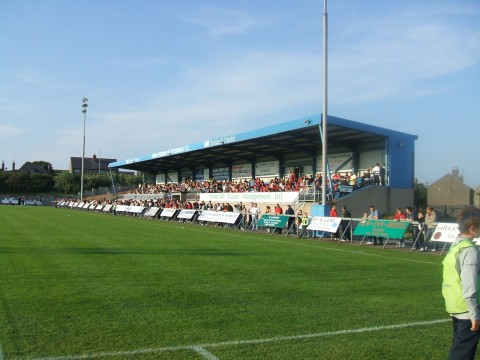
Balmoor Stadium

Balmoor (also known as Balmoor Stadium) is an association football ground in the Scottish town of Peterhead, Aberdeenshire. It is home to Peterhead. The...

Kirkburn House

Kirkburn House is a Category B listed building on South Road in Peterhead, Aberdeenshire, Scotland. It was the manse for the adjacent, now-ruined Old St...

Peterhead Community Hospital

Peterhead Community Hospital is located in Peterhead, a coastal town approximately 32 miles north of Aberdeen, Scotland. It is managed by NHS Grampian...

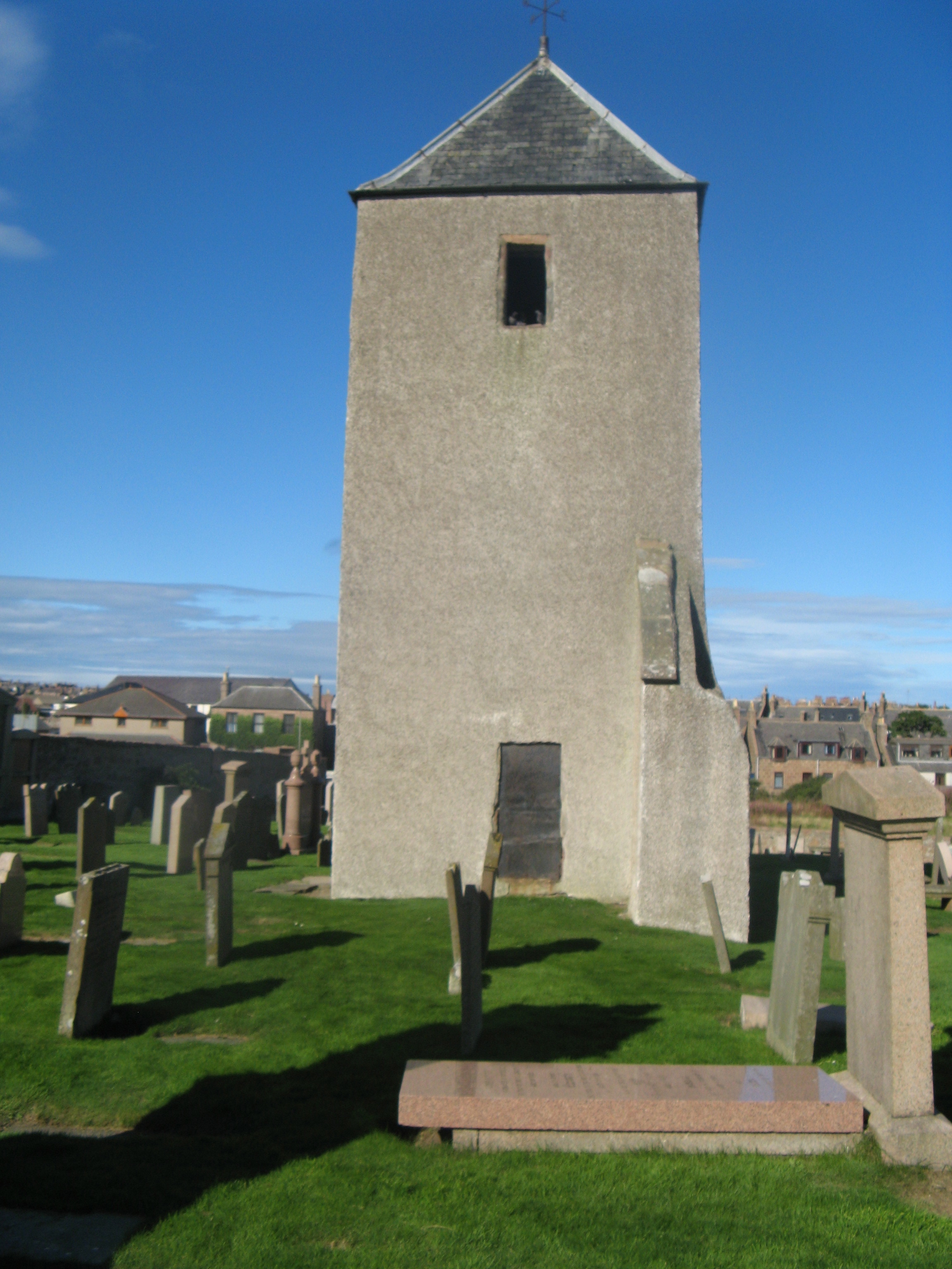
Old St Peter's Church, Peterhead

Old St Peter's Church (also known as St Peter's on the Links) is a scheduled monument in Peterhead, Aberdeenshire, Scotland. While the medieval main tower...
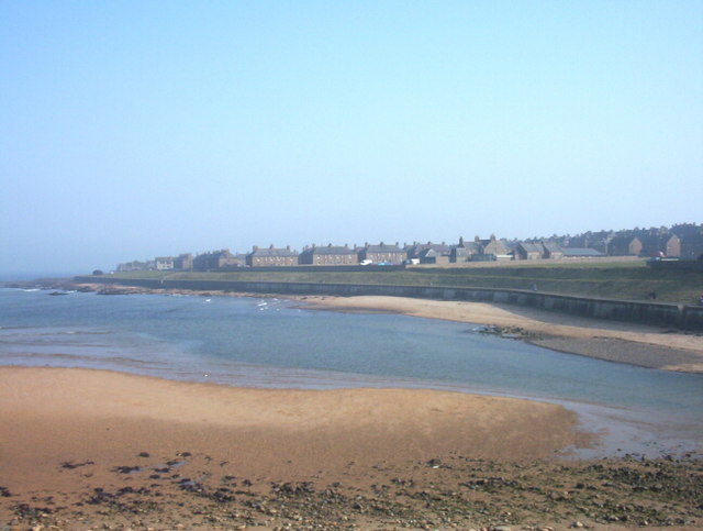
Buchanhaven

Buchanhaven is a village in Aberdeenshire, Scotland, dating to around 1739. It is one mile north of Peterhead town centre, and near to the mouth of the...

Nearby Amenities

Located within 500m of 57.506486,-1.809311
Traffic Calming: hump
Lat/Long: 57.5034772/-1.8033873
Power: tower
Lat/Long: 57.5086801/-1.8059371
Crossing
Crossing: uncontrolled
Crossing Island: yes
Tactile Paving: no
Lat/Long: 57.5102638/-1.8091087
Turning Circle
Lat/Long: 57.5092074/-1.8035172
Traffic Calming: hump
Lat/Long: 57.5063305/-1.8029345
Source: OS7
Lat/Long: 57.5066043/-1.8074688
Noexit: yes
Lat/Long: 57.5085678/-1.8157357
Noexit: yes
Lat/Long: 57.5080602/-1.8035769
Traffic Calming: hump
Lat/Long: 57.505729/-1.8032202
Noexit: yes
Lat/Long: 57.5083175/-1.8107977
Noexit: yes
Lat/Long: 57.5086421/-1.8162499
Noexit: yes
Lat/Long: 57.5080077/-1.8023525
Traffic Calming: hump
Lat/Long: 57.5054005/-1.8154638
Coplandhill
Is In: Peterhead
Place: suburb
Lat/Long: 57.5095119/-1.8113223
Crossing
Crossing: uncontrolled
Crossing Island: yes
Tactile Paving: yes
Lat/Long: 57.5050303/-1.8135593
Noexit: yes
Lat/Long: 57.5079464/-1.8152948
Noexit: yes
Lat/Long: 57.5080588/-1.8150768
Noexit: yes
Lat/Long: 57.5079014/-1.816312
Power: tower
Lat/Long: 57.5103477/-1.8079524
Middle Grange
Place: suburb
Lat/Long: 57.5048982/-1.8080456
Waste Basket
Waste: dog_excrement,trash
Lat/Long: 57.5084842/-1.8124315
Bench
Backrest: yes
Colour: brown
Material: plastic
Lat/Long: 57.5084837/-1.8124143
Bus Stop
Coplandhill Road
Bus: yes
Naptan AtcoCode: 630020821
Naptan Bearing: N
Naptan CommonName: Coplandhill Road
Naptan Indicator: opp
Naptan Landmark: Coplandhill Road
Naptan LocalityName: Peterhead
Naptan NaptanCode: 23627525
Naptan NptgLocalityCode: ES003011
Naptan Street: Windmill Road
Public Transport: platform
Ref: 23627525
Shelter: yes
Lat/Long: 57.5087692/-1.8101881
Bus Stop
Hayfield Place
Bus: yes
Naptan AtcoCode: 630020812
Naptan Bearing: E
Naptan CommonName: Hayfield Place
Naptan Indicator: opp
Naptan Landmark: Hayfield Place
Naptan LocalityName: Peterhead
Naptan NaptanCode: 23627856
Naptan NptgLocalityCode: ES003011
Naptan Street: Inverugie Road
Public Transport: platform
Ref: 23627856
Shelter: yes
Lat/Long: 57.5095623/-1.8104973
Bus Stop
Hayfield Place
Bus: yes
Naptan AtcoCode: 630020811
Naptan Bearing: W
Naptan CommonName: Hayfield Place
Naptan Indicator: at
Naptan Landmark: Hayfield Place
Naptan LocalityName: Peterhead
Naptan NaptanCode: 23627524
Naptan NptgLocalityCode: ES003011
Naptan Street: Inverugie Road
Public Transport: platform
Ref: 23627524
Lat/Long: 57.5095/-1.8105993
Bus Stop
Pentland Place
Bus: yes
Naptan AtcoCode: 630020802
Naptan Bearing: E
Naptan CommonName: Pentland Place
Naptan Indicator: opp
Naptan Landmark: Pentland Place
Naptan LocalityName: Peterhead
Naptan NaptanCode: 23627496
Naptan NptgLocalityCode: ES003011
Naptan Street: Richmond Avenue
Public Transport: platform
Ref: 23627496
Shelter: yes
Lat/Long: 57.5094544/-1.8126561
Bus Stop
Pentland Place
Bus: yes
Naptan AtcoCode: 630020801
Naptan Bearing: W
Naptan CommonName: Pentland Place
Naptan Indicator: at
Naptan Landmark: Pentland Place
Naptan LocalityName: Peterhead
Naptan NaptanCode: 23627495
Naptan NptgLocalityCode: ES003011
Naptan Street: Richmond Avenue
Public Transport: platform
Ref: 23627495
Lat/Long: 57.5093579/-1.8126998
Bus Stop
Fairwinds Place
Bus: yes
Naptan AtcoCode: 630020792
Naptan Bearing: N
Naptan CommonName: Fairwinds Place
Naptan Indicator: at
Naptan Landmark: Fairwinds Place
Naptan LocalityName: Peterhead
Naptan NaptanCode: 23627492
Naptan NptgLocalityCode: ES003011
Naptan Street: Richmond Avenue
Public Transport: platform
Ref: 23627492
Shelter: yes
Lat/Long: 57.5085864/-1.8146445
Bus Stop
Fairwinds Place
Bus: yes
Naptan AtcoCode: 630020791
Naptan Bearing: S
Naptan CommonName: Fairwinds Place
Naptan Indicator: opp
Naptan Landmark: Fairwinds Place
Naptan LocalityName: Peterhead
Naptan NaptanCode: 23627493
Naptan NptgLocalityCode: ES003011
Naptan Street: Richmond Avenue
Public Transport: platform
Ref: 23627493
Lat/Long: 57.5082026/-1.8144665
Bus Stop
Richmond Avenue
Bench: yes
Bin: no
Bus: yes
Lit: yes
Naptan AtcoCode: 630020784
Naptan Bearing: W
Naptan CommonName: Richmond Avenue
Naptan Indicator: opp
Naptan Landmark: Richmond Avenue
Naptan LocalityName: Peterhead
Naptan NaptanCode: 23632379
Naptan NptgLocalityCode: ES003011
Naptan Street: Longside Road
Public Transport: platform
Ref: 23632379
Shelter: yes
Tactile Paving: no
Lat/Long: 57.5074301/-1.8165308
Bus Stop
Richmond Avenue
Bench: no
Bin: no
Bus: yes
Lit: yes
Naptan AtcoCode: 630020783
Naptan Bearing: E
Naptan CommonName: Richmond Avenue
Naptan Indicator: at
Naptan Landmark: Richmond Avenue
Naptan LocalityName: Peterhead
Naptan NaptanCode: 23632367
Naptan NptgLocalityCode: ES003011
Naptan Street: Longside Road
Public Transport: platform
Ref: 23632367
Shelter: no
Tactile Paving: no
Lat/Long: 57.507522/-1.8165783
Bus Stop
Chevron Crescent
Bench: yes
Bin: no
Bus: yes
Lit: yes
Naptan AtcoCode: 630020782
Naptan Bearing: E
Naptan CommonName: Chevron Crescent
Naptan Indicator: at
Naptan Landmark: Windmill Road
Naptan LocalityName: Peterhead
Naptan NaptanCode: 23627497
Naptan NptgLocalityCode: ES003011
Naptan Street: A950
Public Transport: platform
Ref: 23627497
Shelter: yes
Tactile Paving: no
Lat/Long: 57.5075642/-1.8116735
Bus Stop
Chevron Crescent
Bench: yes
Bin: no
Bus: yes
Lit: yes
Naptan AtcoCode: 630020781
Naptan Bearing: W
Naptan CommonName: Chevron Crescent
Naptan Indicator: opp
Naptan Landmark: Windmill Road
Naptan LocalityName: Peterhead
Naptan NaptanCode: 23627498
Naptan NptgLocalityCode: ES003011
Naptan Street: A950
Public Transport: platform
Ref: 23627498
Shelter: yes
Tactile Paving: no
Lat/Long: 57.5073601/-1.8109507
Bus Stop
Petergrange Road
Bench: yes
Bin: no
Bus: yes
Lit: yes
Naptan AtcoCode: 630020772
Naptan Bearing: E
Naptan CommonName: Petergrange Road
Naptan Indicator: opp
Naptan Landmark: Petergrange Road
Naptan LocalityName: Peterhead
Naptan NaptanCode: 23627529
Naptan NptgLocalityCode: ES003011
Naptan Street: West Road
Public Transport: platform
Ref: 23627529
Shelter: yes
Tactile Paving: no
Lat/Long: 57.5071983/-1.8067248
Bus Stop
Petergrange Road
Bench: yes
Bin: yes
Bus: yes
Lit: yes
Naptan AtcoCode: 630020771
Naptan Bearing: W
Naptan CommonName: Petergrange Road
Naptan Indicator: at
Naptan Landmark: Petergrange Road
Naptan LocalityName: Peterhead
Naptan NaptanCode: 23627536
Naptan NptgLocalityCode: ES003011
Naptan Street: West Road
Public Transport: platform
Ref: 23627536
Shelter: yes
Tactile Paving: no
Lat/Long: 57.5071691/-1.8047361
Bus Stop
Glendale Road
Bench: yes
Bin: no
Bus: yes
Lit: yes
Naptan AtcoCode: 630020762
Naptan Bearing: E
Naptan CommonName: Glendale Road
Naptan Indicator: at
Naptan Landmark: Glendale Road
Naptan LocalityName: Peterhead
Naptan NaptanCode: 23627564
Naptan NptgLocalityCode: ES003011
Naptan Street: West Road
Public Transport: platform
Ref: 23627564
Shelter: yes
Tactile Paving: no
Lat/Long: 57.5073037/-1.802425
Bus Stop
Copeman Avenue
Bus: yes
Naptan AtcoCode: 630020361
Naptan Bearing: SW
Naptan CommonName: Copeman Avenue
Naptan Indicator: at
Naptan Landmark: Copeman Avenue
Naptan LocalityName: Peterhead
Naptan NaptanCode: 23627546
Naptan NptgLocalityCode: ES003011
Naptan Street: Cairntrodlie
Public Transport: platform
Ref: 23627546
Lat/Long: 57.5033896/-1.8034675
Bus Stop
Watson Crescent
Bus: yes
Naptan AtcoCode: 630020224
Naptan Bearing: NE
Naptan CommonName: Watson Crescent
Naptan Indicator: opp
Naptan Landmark: Watson Crescent
Naptan LocalityName: Peterhead
Naptan NaptanCode: 23632496
Naptan NptgLocalityCode: ES003011
Naptan Street: Abernethy Road
Public Transport: platform
Ref: 23632496
Lat/Long: 57.5051549/-1.813099
Bus Stop
Watson Crescent
Bus: yes
Naptan AtcoCode: 630020223
Naptan Bearing: SW
Naptan CommonName: Watson Crescent
Naptan Indicator: at
Naptan Landmark: Watson Crescent
Naptan LocalityName: Peterhead
Naptan NaptanCode: 23632495
Naptan NptgLocalityCode: ES003011
Naptan Street: Abernethy Road
Public Transport: platform
Ref: 23632495
Lat/Long: 57.5050782/-1.8130572
Bus Stop
Fairisle Crescent
Bus: yes
Naptan AtcoCode: 630020213
Naptan Bearing: E
Naptan CommonName: Fairisle Crescent
Naptan Indicator: at
Naptan Landmark: Fairisle Crescent
Naptan LocalityName: Peterhead
Naptan NaptanCode: 23632356
Naptan NptgLocalityCode: ES003011
Naptan Street: Abernethy Road
Public Transport: platform
Ref: 23632356
Lat/Long: 57.5045323/-1.81661
Bus Stop
Coral Gardens
Bus: yes
Naptan AtcoCode: 630020208
Naptan Bearing: SE
Naptan CommonName: Coral Gardens
Naptan Indicator: opp
Naptan Landmark: Coral Gardens
Naptan LocalityName: Peterhead
Naptan NaptanCode: 23632352
Naptan NptgLocalityCode: ES003011
Naptan Street: Abernethy Road
Public Transport: platform
Ref: 23632352
Lat/Long: 57.5036224/-1.815414
Bus Stop
Kinmundy Gardens
Bus: yes
Naptan AtcoCode: 630020206
Naptan Bearing: W
Naptan CommonName: Kinmundy Gardens
Naptan Indicator: opp
Naptan Landmark: Kinmundy Gardens
Naptan LocalityName: Peterhead
Naptan NaptanCode: 23632346
Naptan NptgLocalityCode: ES003011
Naptan Street: Kinmundy Road
Public Transport: platform
Ref: 23632346
Lat/Long: 57.502199/-1.8111135
Bus Stop
Grangepark
Bus: yes
Fixme: Exact position covered by trees
Naptan AtcoCode: 630020204
Naptan Bearing: S
Naptan CommonName: Grangepark
Naptan Indicator: at
Naptan Landmark: Grangepark
Naptan LocalityName: Peterhead
Naptan NaptanCode: 23632345
Naptan NptgLocalityCode: ES003011
Naptan Street: Meethill Road
Public Transport: platform
Ref: 23632345
Lat/Long: 57.505198/-1.808076
Bus Stop
Grangepark
Bus: yes
Naptan AtcoCode: 630020203
Naptan Bearing: N
Naptan CommonName: Grangepark
Naptan Indicator: opp
Naptan Landmark: Grangepark
Naptan LocalityName: Peterhead
Naptan NaptanCode: 23632343
Naptan NptgLocalityCode: ES003011
Naptan Street: Meethill Road
Public Transport: platform
Ref: 23632343
Lat/Long: 57.5050375/-1.8081587
Traffic Calming: hump
Lat/Long: 57.5066809/-1.8071745
Traffic Calming: hump
Lat/Long: 57.5067976/-1.8059528
Traffic Calming: hump
Lat/Long: 57.5068307/-1.8031646
Traffic Calming: hump
Lat/Long: 57.5059865/-1.8159491
Traffic Calming: hump
Lat/Long: 57.5064909/-1.8169327
Crossing
Crossing: unmarked
Crossing Island: no
Crossing Markings: no
Tactile Paving: yes
Lat/Long: 57.5093866/-1.8100552
Traffic Calming: hump
Lat/Long: 57.5048936/-1.8166564
Traffic Calming: hump
Lat/Long: 57.5066159/-1.8173798
Generator Method: photovoltaic
Generator Output Electricity: small_installation
Generator Source: solar
Generator Type: solar_photovoltaic_panel
Location: roof
Power: generator
Lat/Long: 57.5036324/-1.8147748
Generator Method: photovoltaic
Generator Output Electricity: small_installation
Generator Source: solar
Generator Type: solar_photovoltaic_panel
Location: roof
Power: generator
Lat/Long: 57.5031071/-1.8120985
Generator Method: photovoltaic
Generator Output Electricity: small_installation
Generator Source: solar
Generator Type: solar_photovoltaic_panel
Location: roof
Power: generator
Lat/Long: 57.5025304/-1.8116246
Generator Method: photovoltaic
Generator Output Electricity: small_installation
Generator Source: solar
Generator Type: solar_photovoltaic_panel
Location: roof
Power: generator
Lat/Long: 57.5060286/-1.8157796
Building: yes
Lat/Long: 57.5053185/-1.8144507
Crossing
Crossing: unmarked
Crossing Island: no
Crossing Markings: no
Tactile Paving: yes
Lat/Long: 57.5026857/-1.8062966
Grit Bin
Lat/Long: 57.5043862/-1.8119965
Grit Bin
Lat/Long: 57.5054089/-1.8081281
Grit Bin
Lat/Long: 57.5060959/-1.8105474
Grit Bin
Lat/Long: 57.5064049/-1.8128306
Generator Method: photovoltaic
Generator Output Electricity: small_installation
Generator Source: solar
Generator Type: solar_photovoltaic_panel
Location: roof
Power: generator
Lat/Long: 57.5065368/-1.8121541
Generator Method: photovoltaic
Generator Output Electricity: small_installation
Generator Source: solar
Generator Type: solar_photovoltaic_panel
Location: roof
Power: generator
Lat/Long: 57.5073257/-1.8145305
Generator Method: photovoltaic
Generator Output Electricity: small_installation
Generator Source: solar
Generator Type: solar_photovoltaic_panel
Location: roof
Power: generator
Lat/Long: 57.5065087/-1.8139686
Generator Method: photovoltaic
Generator Output Electricity: small_installation
Generator Source: solar
Generator Type: solar_photovoltaic_panel
Location: roof
Power: generator
Lat/Long: 57.5062817/-1.8133476
Generator Method: photovoltaic
Generator Output Electricity: small_installation
Generator Source: solar
Generator Type: solar_photovoltaic_panel
Location: roof
Power: generator
Lat/Long: 57.5060231/-1.8137124
Grit Bin
Lat/Long: 57.5064082/-1.8139873
Grit Bin
Lat/Long: 57.5070627/-1.8144956
Crossing
Crossing: unmarked
Crossing Island: no
Crossing Markings: no
Tactile Paving: yes
Lat/Long: 57.5064472/-1.813127
Crossing
Crossing: unmarked
Crossing Island: no
Crossing Markings: no
Tactile Paving: yes
Lat/Long: 57.5027593/-1.8067995
Traffic Calming: cushion
Lat/Long: 57.503344/-1.8110408
Crossing
Crossing: unmarked
Crossing Island: no
Crossing Markings: no
Tactile Paving: yes
Lat/Long: 57.5038527/-1.8072064
Traffic Calming: cushion
Lat/Long: 57.5038428/-1.8072694
Traffic Calming: cushion
Lat/Long: 57.503661/-1.8086524
Traffic Calming: cushion
Lat/Long: 57.5034758/-1.8100546
Grit Bin
Lat/Long: 57.5053639/-1.8098816
Grit Bin
Lat/Long: 57.5032716/-1.8132658
Generator Method: photovoltaic
Generator Output Electricity: small_installation
Generator Source: solar
Generator Type: solar_photovoltaic_panel
Location: roof
Power: generator
Lat/Long: 57.5044085/-1.8108237
Generator Method: photovoltaic
Generator Output Electricity: small_installation
Generator Source: solar
Generator Type: solar_photovoltaic_panel
Location: roof
Power: generator
Lat/Long: 57.5051528/-1.8099453
Generator Method: photovoltaic
Generator Output Electricity: small_installation
Generator Source: solar
Generator Type: solar_photovoltaic_panel
Location: roof
Power: generator
Lat/Long: 57.5022391/-1.8088174
Generator Method: photovoltaic
Generator Output Electricity: small_installation
Generator Source: solar
Generator Type: solar_photovoltaic_panel
Location: roof
Power: generator
Lat/Long: 57.5025756/-1.8092278
Generator Method: photovoltaic
Generator Output Electricity: small_installation
Generator Source: solar
Generator Type: solar_photovoltaic_panel
Location: roof
Power: generator
Lat/Long: 57.505812/-1.8104213
Generator Method: photovoltaic
Generator Output Electricity: small_installation
Generator Source: solar
Generator Type: solar_photovoltaic_panel
Location: roof
Power: generator
Lat/Long: 57.5058884/-1.8102215
Crossing
Crossing: unmarked
Crossing Island: no
Crossing Markings: no
Tactile Paving: yes
Lat/Long: 57.5022727/-1.8107431
Generator Method: photovoltaic
Generator Output Electricity: small_installation
Generator Source: solar
Generator Type: solar_photovoltaic_panel
Location: roof
Power: generator
Lat/Long: 57.5036044/-1.8101411
Generator Method: photovoltaic
Generator Output Electricity: small_installation
Generator Source: solar
Generator Type: solar_photovoltaic_panel
Location: roof
Power: generator
Lat/Long: 57.502657/-1.8059662
Traffic Calming: hump
Lat/Long: 57.5029113/-1.805474
Generator Method: photovoltaic
Generator Output Electricity: small_installation
Generator Source: solar
Generator Type: solar_photovoltaic_panel
Location: roof
Power: generator
Lat/Long: 57.5062198/-1.8062733
Generator Method: photovoltaic
Generator Output Electricity: small_installation
Generator Source: solar
Generator Type: solar_photovoltaic_panel
Location: roof
Power: generator
Lat/Long: 57.5059626/-1.8057865
Generator Method: photovoltaic
Generator Output Electricity: small_installation
Generator Source: solar
Generator Type: solar_photovoltaic_panel
Location: roof
Power: generator
Lat/Long: 57.5068113/-1.8041986
Generator Method: photovoltaic
Generator Output Electricity: small_installation
Generator Source: solar
Generator Type: solar_photovoltaic_panel
Location: roof
Power: generator
Lat/Long: 57.5066535/-1.8059152
Generator Method: photovoltaic
Generator Output Electricity: small_installation
Generator Source: solar
Generator Type: solar_photovoltaic_panel
Location: roof
Power: generator
Lat/Long: 57.5058725/-1.8084311
Generator Method: photovoltaic
Generator Output Electricity: small_installation
Generator Source: solar
Generator Type: solar_photovoltaic_panel
Location: roof
Power: generator
Lat/Long: 57.5064323/-1.8075594
Generator Method: photovoltaic
Generator Output Electricity: small_installation
Generator Source: solar
Generator Type: solar_photovoltaic_panel
Location: roof
Power: generator
Lat/Long: 57.5065807/-1.8068983
Traffic Calming: hump
Lat/Long: 57.5043413/-1.8025778
Traffic Calming: hump
Lat/Long: 57.5049967/-1.8028796
Generator Method: photovoltaic
Generator Output Electricity: small_installation
Generator Source: solar
Generator Type: solar_photovoltaic_panel
Location: roof
Power: generator
Lat/Long: 57.5106357/-1.8097674
Generator Method: photovoltaic
Generator Output Electricity: small_installation
Generator Source: solar
Generator Type: solar_photovoltaic_panel
Location: roof
Power: generator
Lat/Long: 57.5087067/-1.8161546
Generator Method: photovoltaic
Generator Output Electricity: small_installation
Generator Source: solar
Generator Type: solar_photovoltaic_panel
Location: roof
Power: generator
Lat/Long: 57.5079935/-1.8058629
Generator Method: photovoltaic
Generator Output Electricity: small_installation
Generator Source: solar
Generator Type: solar_photovoltaic_panel
Location: roof
Power: generator
Lat/Long: 57.5091108/-1.8115023
Generator Method: photovoltaic
Generator Output Electricity: small_installation
Generator Source: solar
Generator Type: solar_photovoltaic_panel
Location: roof
Power: generator
Lat/Long: 57.5096094/-1.8091916
Generator Method: photovoltaic
Generator Output Electricity: small_installation
Generator Source: solar
Generator Type: solar_photovoltaic_panel
Location: roof
Power: generator
Lat/Long: 57.5108628/-1.8095925
Crossing
Crossing: unmarked
Crossing Island: no
Crossing Markings: no
Tactile Paving: yes
Lat/Long: 57.5104048/-1.8090347
Crossing
Crossing: unmarked
Crossing Island: no
Crossing Markings: no
Tactile Paving: yes
Lat/Long: 57.5107966/-1.8084303
Grit Bin
Lat/Long: 57.5091969/-1.8106205
Grit Bin
Lat/Long: 57.5087535/-1.8081743
Grit Bin
Lat/Long: 57.5088962/-1.8126114
Noexit: yes
Lat/Long: 57.5082961/-1.8110342
Post Box
Addr City: Peterhead
Addr Country: GB
Addr Postcode: AB42 1ZB
Addr Street: Pentland Place
Lat/Long: 57.5086497/-1.8102545
Generator Method: photovoltaic
Generator Output Electricity: small_installation
Generator Source: solar
Generator Type: solar_photovoltaic_panel
Location: roof
Power: generator
Lat/Long: 57.5020693/-1.8108849
Generator Method: photovoltaic
Generator Output Electricity: small_installation
Generator Source: solar
Generator Type: solar_photovoltaic_panel
Location: roof
Power: generator
Lat/Long: 57.5093558/-1.810711
Generator Method: photovoltaic
Generator Output Electricity: small_installation
Generator Source: solar
Generator Type: solar_photovoltaic_panel
Location: roof
Power: generator
Lat/Long: 57.5094012/-1.8107915
Generator Method: photovoltaic
Generator Output Electricity: small_installation
Generator Source: solar
Generator Type: solar_photovoltaic_panel
Location: roof
Power: generator
Lat/Long: 57.5089567/-1.8105179
Generator Method: photovoltaic
Generator Output Electricity: small_installation
Generator Source: solar
Generator Type: solar_photovoltaic_panel
Location: roof
Power: generator
Lat/Long: 57.5085367/-1.8104361
Generator Method: photovoltaic
Generator Output Electricity: small_installation
Generator Source: solar
Generator Type: solar_photovoltaic_panel
Location: roof
Power: generator
Lat/Long: 57.5082183/-1.8112944
Generator Method: photovoltaic
Generator Output Electricity: small_installation
Generator Source: solar
Generator Type: solar_photovoltaic_panel
Location: roof
Power: generator
Lat/Long: 57.5082572/-1.8114486
Generator Method: photovoltaic
Generator Output Electricity: small_installation
Generator Source: solar
Generator Type: solar_photovoltaic_panel
Location: roof
Power: generator
Lat/Long: 57.5090734/-1.8109725
Generator Method: photovoltaic
Generator Output Electricity: small_installation
Generator Source: solar
Generator Type: solar_photovoltaic_panel
Location: roof
Power: generator
Lat/Long: 57.5085727/-1.8114862
Generator Method: photovoltaic
Generator Output Electricity: small_installation
Generator Source: solar
Generator Type: solar_photovoltaic_panel
Location: roof
Power: generator
Lat/Long: 57.508317/-1.8119998
Generator Method: photovoltaic
Generator Output Electricity: small_installation
Generator Source: solar
Generator Type: solar_photovoltaic_panel
Location: roof
Power: generator
Lat/Long: 57.5083342/-1.8121299
Generator Method: photovoltaic
Generator Output Electricity: small_installation
Generator Source: solar
Generator Type: solar_photovoltaic_panel
Location: roof
Power: generator
Lat/Long: 57.508603/-1.8119945
Generator Method: photovoltaic
Generator Output Electricity: small_installation
Generator Source: solar
Generator Type: solar_photovoltaic_panel
Location: roof
Power: generator
Lat/Long: 57.5086426/-1.8123539
Generator Method: photovoltaic
Generator Output Electricity: small_installation
Generator Source: solar
Generator Type: solar_photovoltaic_panel
Location: roof
Power: generator
Lat/Long: 57.5086858/-1.8136722
Generator Method: photovoltaic
Generator Output Electricity: small_installation
Generator Source: solar
Generator Type: solar_photovoltaic_panel
Location: roof
Power: generator
Lat/Long: 57.5087723/-1.8137071
Generator Method: photovoltaic
Generator Output Electricity: small_installation
Generator Source: solar
Generator Type: solar_photovoltaic_panel
Location: roof
Power: generator
Lat/Long: 57.5091584/-1.812256
Generator Method: photovoltaic
Generator Output Electricity: small_installation
Generator Source: solar
Generator Type: solar_photovoltaic_panel
Location: roof
Power: generator
Lat/Long: 57.5090907/-1.8134455
Generator Method: photovoltaic
Generator Output Electricity: small_installation
Generator Source: solar
Generator Type: solar_photovoltaic_panel
Location: roof
Power: generator
Lat/Long: 57.5092297/-1.8131384
Generator Method: photovoltaic
Generator Output Electricity: small_installation
Generator Source: solar
Generator Type: solar_photovoltaic_panel
Location: roof
Power: generator
Lat/Long: 57.5092175/-1.8130271
Generator Method: photovoltaic
Generator Output Electricity: small_installation
Generator Source: solar
Generator Type: solar_photovoltaic_panel
Location: roof
Power: generator
Lat/Long: 57.5091879/-1.8127468
Generator Method: photovoltaic
Generator Output Electricity: small_installation
Generator Source: solar
Generator Type: solar_photovoltaic_panel
Location: roof
Power: generator
Lat/Long: 57.5097642/-1.8148081
Generator Method: photovoltaic
Generator Output Electricity: small_installation
Generator Source: solar
Generator Type: solar_photovoltaic_panel
Location: roof
Power: generator
Lat/Long: 57.5097614/-1.8130727
Generator Method: photovoltaic
Generator Output Electricity: small_installation
Generator Source: solar
Generator Type: solar_photovoltaic_panel
Location: roof
Power: generator
Lat/Long: 57.5100243/-1.8131974
Generator Method: photovoltaic
Generator Output Electricity: small_installation
Generator Source: solar
Generator Type: solar_photovoltaic_panel
Location: roof
Power: generator
Lat/Long: 57.5099667/-1.8138881
Generator Method: photovoltaic
Generator Output Electricity: small_installation
Generator Source: solar
Generator Type: solar_photovoltaic_panel
Location: roof
Power: generator
Lat/Long: 57.5100156/-1.8139538
Generator Method: photovoltaic
Generator Output Electricity: small_installation
Generator Source: solar
Generator Type: solar_photovoltaic_panel
Location: roof
Power: generator
Lat/Long: 57.510056/-1.814045
Generator Method: photovoltaic
Generator Output Electricity: small_installation
Generator Source: solar
Generator Type: solar_photovoltaic_panel
Location: roof
Power: generator
Lat/Long: 57.5100985/-1.814096
Generator Method: photovoltaic
Generator Output Electricity: small_installation
Generator Source: solar
Generator Type: solar_photovoltaic_panel
Location: roof
Power: generator
Lat/Long: 57.5092902/-1.8143173
Generator Method: photovoltaic
Generator Output Electricity: small_installation
Generator Source: solar
Generator Type: solar_photovoltaic_panel
Location: roof
Power: generator
Lat/Long: 57.5093824/-1.8141429
Generator Method: photovoltaic
Generator Output Electricity: small_installation
Generator Source: solar
Generator Type: solar_photovoltaic_panel
Location: roof
Power: generator
Lat/Long: 57.5098838/-1.8136708
Generator Method: photovoltaic
Generator Output Electricity: small_installation
Generator Source: solar
Generator Type: solar_photovoltaic_panel
Location: roof
Power: generator
Lat/Long: 57.5097714/-1.8137003
Generator Method: photovoltaic
Generator Output Electricity: small_installation
Generator Source: solar
Generator Type: solar_photovoltaic_panel
Location: roof
Power: generator
Lat/Long: 57.5092484/-1.8154988
Generator Method: photovoltaic
Generator Output Electricity: small_installation
Generator Source: solar
Generator Type: solar_photovoltaic_panel
Location: roof
Power: generator
Lat/Long: 57.5092945/-1.8156463
Generator Method: photovoltaic
Generator Output Electricity: small_installation
Generator Source: solar
Generator Type: solar_photovoltaic_panel
Location: roof
Power: generator
Lat/Long: 57.5089696/-1.8157214
The data included in this document is from www.openstreetmap.org. The data is made available under ODbL.

Have you been to Grange, Middle?

Leave your review of Grange, Middle below (or comments, questions and feedback).