Hayes Castle

Heritage Site in Cumberland Copeland

England

Hayes Castle

A595 north east of Lowca
A595 north east of Lowca Credit: Colin Pyle

Hayes Castle, located in Cumberland, England, is a historic heritage site that holds significant cultural and architectural importance. Dating back to the 14th century, it stands as a testament to the region's rich history and medieval architecture.

The castle is situated on a hilltop, offering panoramic views of the surrounding countryside. It was originally built as a defensive structure, designed to protect the inhabitants from potential invasions. The castle's sturdy stone walls, fortified towers, and a moat reflect the defensive nature of its construction.

Over the centuries, Hayes Castle has undergone several modifications and additions, reflecting the changing architectural styles and needs of its occupants. In addition to its defensive features, the castle now boasts elegant living quarters, grand halls, and intricate stone carvings.

One of the most notable features of the castle is its imposing gatehouse, which has survived remarkably intact. The gatehouse is adorned with intricate detailing and showcases the craftsmanship of the period. Inside, visitors can explore the castle's various rooms, including the Great Hall, which retains its original timber roof.

Hayes Castle is open to the public, allowing visitors to step back in time and experience the medieval atmosphere firsthand. It also serves as a venue for cultural events, such as historical reenactments and exhibitions, which further bring the castle's rich history to life.

As a heritage site, Hayes Castle is an invaluable asset to the region, preserving the area's architectural and cultural heritage for future generations. Its historical significance, combined with its picturesque location, makes it a must-visit destination for history enthusiasts and visitors alike.

If you have any feedback on the listing, please let us know in the comments section below.
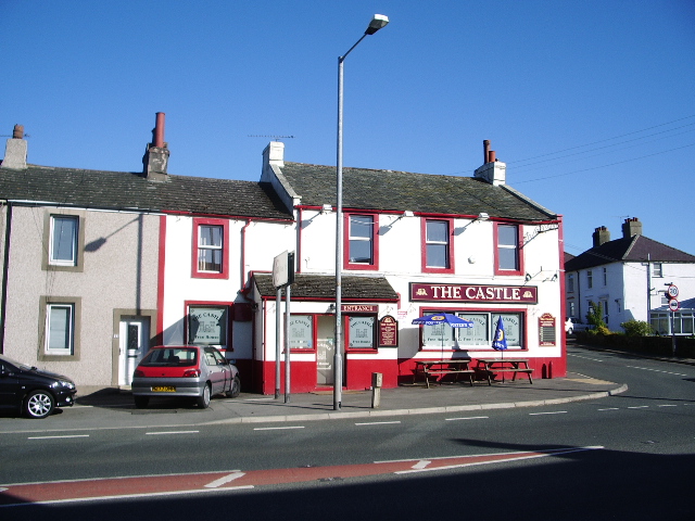
Hayes Castle Images

Images are sourced within 2km of 54.587/-3.54 or Grid Reference NY0022. Thanks to Geograph Open Source API. All images are credited.

A595 north east of Lowca
A595 at Distington
A595 at Distington
Distington War Memorial Distington War Memorial commemorates the fallen of Distington, Pica, Winscales and Dyonside. It was unveiled on 16th of April 1921 by Major C A Valentine TD, of Ellerkeld, Workington, and dedicated by the Reverend T Foster Edwards. The memorial commemorates 53 local servicemen who lost their lives in the First World War. It was made by Messrs Beattie and Co. and paid for by public subscription. Later, the monument was further dedicated to 21 local men who were killed in the Second World War. The memorial was restored in 1992 and was moved a short distance from its original location in 2001 due to road improvements.
Distington War Memorial
Distington War Memorial commemorates the fallen of Distington, Pica, Winscales and Dyonside. It was unveiled on 16th of April 1921 by Major C A Valentine TD, of Ellerkeld, Workington, and dedicated by the Reverend T Foster Edwards. The memorial commemorates 53 local servicemen who lost their lives in the First World War. It was made by Messrs Beattie and Co. and paid for by public subscription. Later, the monument was further dedicated to 21 local men who were killed in the Second World War. The memorial was restored in 1992 and was moved a short distance from its original location in 2001 due to road improvements.
Old Milestone by the A595, south of Distington Metal plate attached to stone post by the A595, in parish of DISTINGTON (COPELAND District), Common End, near first house and signs to Workington Crematorium; North of Boot Bridge, on grass verge, on West side of road. Whitehaven plate stone, erected by the Whitehaven turnpike trust in the 19th century. 

Inscription reads:-
: TO WORKINGTON / 4 / TO COCKERMOUTH / 10 MILES : : {plate missing} (WHITEHAVEN / 4) : 

Grade II Listed. List Entry Number: 1336037 <span class="nowrap"><a title="https://historicengland.org.uk/listing/the-list/list-entry/1336037" rel="nofollow ugc noopener" href="https://historicengland.org.uk/listing/the-list/list-entry/1336037">Link</a><img style="margin-left:2px;" alt="External link" title="External link - shift click to open in new window" src="https://s1.geograph.org.uk/img/external.png" width="10" height="10"/></span>

Milestone Society National ID: CU_WHWO04
Old Milestone by the A595, south of Distington
Metal plate attached to stone post by the A595, in parish of DISTINGTON (COPELAND District), Common End, near first house and signs to Workington Crematorium; North of Boot Bridge, on grass verge, on West side of road. Whitehaven plate stone, erected by the Whitehaven turnpike trust in the 19th century. Inscription reads:- : TO WORKINGTON / 4 / TO COCKERMOUTH / 10 MILES : : {plate missing} (WHITEHAVEN / 4) : Grade II Listed. List Entry Number: 1336037 LinkExternal link Milestone Society National ID: CU_WHWO04
Lay-by on A595 heading to Whitehaven
Trig point of Park House The trig point known to the OS as Park House stands in a field adjacent to a farm lane with a footpath close to the village of Distington. Beyond the pillar the town of Workington can be discerned with the Solway Firth and Criffel beyond that.
Trig point of Park House
The trig point known to the OS as Park House stands in a field adjacent to a farm lane with a footpath close to the village of Distington. Beyond the pillar the town of Workington can be discerned with the Solway Firth and Criffel beyond that.
Distington (Joint) station, with train 1951 View SW, towards Cleator Moor (Cleator & Workington Junction Railway, with excursion train returning to Carlisle from Egremont headed by LMS 4F 0-6-0 No. 44461 (built 5/28, withdrawn 9/64). The line to the left is to Rowrah and Kelton Fell.
Distington (Joint) station, with train 1951
View SW, towards Cleator Moor (Cleator & Workington Junction Railway, with excursion train returning to Carlisle from Egremont headed by LMS 4F 0-6-0 No. 44461 (built 5/28, withdrawn 9/64). The line to the left is to Rowrah and Kelton Fell.
Distington (Joint) station, 1951 View SW, towards Cleator Moor (ahead), left to Rowrah and Kelton Fell also WC&E line to Parton and Ullock. The station was closed finally 13/4/31 (goods C&WJ 1/7/63). Passenger services were withdrawn during the 1920s; goods gradually during the 20s and 30s, and to Cleator Moor until 9/61, then only as a diversionary route. (See also <a href="https://www.geograph.org.uk/photo/5325623">NY0124 : Distington (Joint) station, with train 1951</a>).
Distington (Joint) station, 1951
View SW, towards Cleator Moor (ahead), left to Rowrah and Kelton Fell also WC&E line to Parton and Ullock. The station was closed finally 13/4/31 (goods C&WJ 1/7/63). Passenger services were withdrawn during the 1920s; goods gradually during the 20s and 30s, and to Cleator Moor until 9/61, then only as a diversionary route. (See also NY0124 : Distington (Joint) station, with train 1951).
Old Milestone by the A595, south of Distington Metal plate attached to stone post by the A595, in parish of DISTINGTON (COPELAND District), Common End, near first house and signs to Workington Crematorium; North of Boot Bridge, on grass verge, on West side of road. Whitehaven plate stone, erected by the Whitehaven turnpike trust in the 19th century. 

Inscription reads:-
: TO WORKINGTON / 4 / TO COCKERMOUTH / 10 MILES : : {plate missing} (WHITEHAVEN / 4) : 

Grade II Listed. List Entry Number: 1336037
<span class="nowrap"><a title="https://historicengland.org.uk/listing/the-list/list-entry/1336037" rel="nofollow ugc noopener" href="https://historicengland.org.uk/listing/the-list/list-entry/1336037">Link</a><img style="margin-left:2px;" alt="External link" title="External link - shift click to open in new window" src="https://s1.geograph.org.uk/img/external.png" width="10" height="10"/></span>

Milestone Society National ID: CU_WHWO04.
Old Milestone by the A595, south of Distington
Metal plate attached to stone post by the A595, in parish of DISTINGTON (COPELAND District), Common End, near first house and signs to Workington Crematorium; North of Boot Bridge, on grass verge, on West side of road. Whitehaven plate stone, erected by the Whitehaven turnpike trust in the 19th century. Inscription reads:- : TO WORKINGTON / 4 / TO COCKERMOUTH / 10 MILES : : {plate missing} (WHITEHAVEN / 4) : Grade II Listed. List Entry Number: 1336037 LinkExternal link Milestone Society National ID: CU_WHWO04.
Old Milestone by the A595, north of Distington Metal plates attached to stone post by the A595, in parish of WINSCALES (ALLERDALE District), East of secondary school, Distington T-junction, in front of Toyota garage, on grass verge, on North West side of road, East of new roundabout. Whitehaven plate stone, erected by the Whitehaven turnpike trust in the 19th century. 

Inscription reads:-
: TO WORKINGTON / 3 / TO COCKERMOUTH / 9 MILES : : TO / WHITEHAVEN / 5 MILES :

Grade II Listed. List Entry Number: 1312130
<span class="nowrap"><a title="https://historicengland.org.uk/listing/the-list/list-entry/1312130" rel="nofollow ugc noopener" href="https://historicengland.org.uk/listing/the-list/list-entry/1312130">Link</a><img style="margin-left:2px;" alt="External link" title="External link - shift click to open in new window" src="https://s1.geograph.org.uk/img/external.png" width="10" height="10"/></span>

Milestone Society National ID: CU_WHWO05.
Old Milestone by the A595, north of Distington
Metal plates attached to stone post by the A595, in parish of WINSCALES (ALLERDALE District), East of secondary school, Distington T-junction, in front of Toyota garage, on grass verge, on North West side of road, East of new roundabout. Whitehaven plate stone, erected by the Whitehaven turnpike trust in the 19th century. Inscription reads:- : TO WORKINGTON / 3 / TO COCKERMOUTH / 9 MILES : : TO / WHITEHAVEN / 5 MILES : Grade II Listed. List Entry Number: 1312130 LinkExternal link Milestone Society National ID: CU_WHWO05.
Bungalow and farm buildings
Y Junction. The chevrons and double white lines are essential as you cannot see around the corner.
Y Junction.
The chevrons and double white lines are essential as you cannot see around the corner.
Cycle track bridge. The railway bridge had been taken down after the line was disused many years ago so a new bridge was required for cycling.
Cycle track bridge.
The railway bridge had been taken down after the line was disused many years ago so a new bridge was required for cycling.
Walled bridge. The design is most strange for this bridge with the rightangle only on one end.
Walled bridge.
The design is most strange for this bridge with the rightangle only on one end.
Railway without train. The farmer seems to have made good use of the embankments when choosing the site for the stockpen.
Railway without train.
The farmer seems to have made good use of the embankments when choosing the site for the stockpen.
Farm Machinery This neglected piece of farm machinery from another era is in a field adjacent to the A595 between Howgate and Distington. It would seem to be a prime candidate for restoration. View is looking north from the roadside, with the buildings of Lowca Lowhouse on the hillside in the distance.
Farm Machinery
This neglected piece of farm machinery from another era is in a field adjacent to the A595 between Howgate and Distington. It would seem to be a prime candidate for restoration. View is looking north from the roadside, with the buildings of Lowca Lowhouse on the hillside in the distance.
Road to Green House
Road to Green House
Road to Lowca Lowhouse
Show me another place!

Hayes Castle is located at Grid Ref: NY0022 (Lat: 54.587, Lng: -3.54)

Administrative County: Cumbria

District: Copeland

Police Authority: Cumbria

What 3 Words

///countries.amount.decoder. Near Distington, Cumbria

Nearby Locations

Hayes Castle Common End

Related Wikis

Common End, Cumbria

Common End is a hamlet within the civil parish of Distington in Cumbria, England. Common End was on the A595 road until it was by-passed. == References ==

Distington

Distington () is a large village and civil parish in Cumbria, England, 3 miles (4.8 km) south of Workington and 4 miles (6.4 km) north of Whitehaven. Historically...

Watch Hill (Whitehaven)

Watch Hill is a small hill lying on the western fringe of the Lake District in England, north east of Whitehaven. It should not be confused with another...

Distington railway station

Distington railway station was opened jointly by the Cleator and Workington Junction Railway (C&WJR) and the LNWR and Furness Joint Railway (The Joint...

Millgrove railway station (England)

Millgrove railway station was a private station on the Cleator and Workington Junction Railway (C&WJR) main line from Moor Row to Workington Central. It...

Oatlands railway station

Oatlands railway station served the village of Pica and Oatlands Colliery in the former English county of Cumberland, now part of Cumbria. == Location... ==

Lakes College

Lakes College is a further education institute located at Lillyhall, Cumberland, England, between the towns of Workington and Whitehaven. The college offers...

Micklam railway station

Micklam railway station served the fireclay mine and brickworks at Micklam, a short distance north of Lowca in the former county of Cumberland, England...

Nearby Amenities

Located within 500m of 54.587,-3.54
Bus Stop
Common End - The Castle (N bound)
Bench: no
Covered: yes
Naptan AtcoCode: 090050040262
Naptan Bearing: N
Naptan CommonName: Common End - The Castle (N bound)
Naptan Indicator: opp
Naptan Landmark: The Castle Pub
Naptan NaptanCode: cumatpad
Naptan Street: A595
Naptan Verified: no
Shelter: no
Source: naptan_import
Lat/Long: 54.5890027/-3.5424123
Bus Stop
Common End - The Castle (S bound)
Naptan AtcoCode: 090050041340
Naptan Bearing: S
Naptan CommonName: Common End - The Castle (S bound)
Naptan Indicator: near
Naptan Landmark: The Castle Pub
Naptan NaptanCode: cumatpat
Naptan Street: A595(T)
Naptan Verified: no
Source: naptan_import
Lat/Long: 54.5885238/-3.5426109
Parking
Parking: lane
Lat/Long: 54.5870378/-3.5450223
Post Box
Post Box Type: lamp
Ref: CA14 40
Lat/Long: 54.5885088/-3.5429507
Power: pole
Lat/Long: 54.5874342/-3.5476421
Power: pole
Lat/Long: 54.5880223/-3.5463497
Power: pole
Lat/Long: 54.58877/-3.5458008
Power: pole
Lat/Long: 54.5897183/-3.5451161
Power: pole
Lat/Long: 54.5849111/-3.5339912
Power: pole
Lat/Long: 54.5851024/-3.5356907
Power: pole
Lat/Long: 54.5852867/-3.5373234
Power: pole
Lat/Long: 54.5856213/-3.5393997
Power: pole
Lat/Long: 54.5862223/-3.5413281
Power: pole
Lat/Long: 54.5864441/-3.5420797
Power: pole
Lat/Long: 54.5867446/-3.5437144
Power: pole
Lat/Long: 54.5869536/-3.5448892
Power: pole
Lat/Long: 54.5871073/-3.5456934
Power: pole
Lat/Long: 54.5847597/-3.5380121
Power: pole
Lat/Long: 54.5843148/-3.5381418
Power: pole
Lat/Long: 54.5838429/-3.538395
Power: pole
Lat/Long: 54.5834355/-3.5386117
Power: pole
Lat/Long: 54.5831644/-3.538393
The data included in this document is from www.openstreetmap.org. The data is made available under ODbL.

Have you been to Hayes Castle?

Leave your review of Hayes Castle below (or comments, questions and feedback).