Hanbury Hall

Heritage Site in Worcestershire Wychavon

England

Hanbury Hall

Ordnance Survey Bench Mark This mark is located on railway bridge number 37 that spans the Worcester to Birmingham canal. These marks were used by Ordnance Survey for mapping purposes.
<a href="https://www.geograph.org.uk/photo/6961993">SO9263 : Bridge 37, Worcester to Birmingham canal</a>
Ordnance Survey Bench Mark Credit: V1ncenze

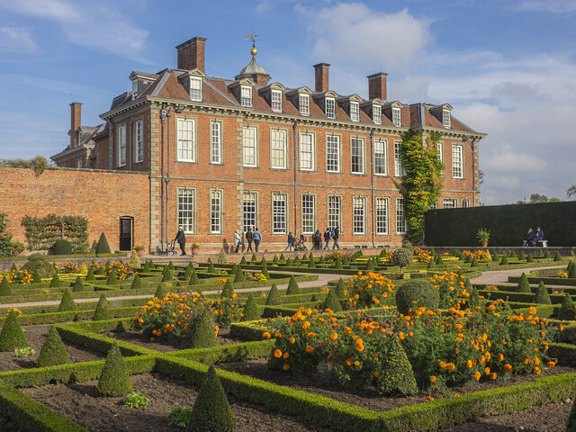
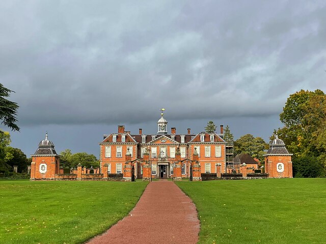
Hanbury Hall is a breathtaking 18th-century country house located in Worcestershire, England. This grand mansion, now a National Trust property, is a popular heritage site that attracts visitors from around the world.

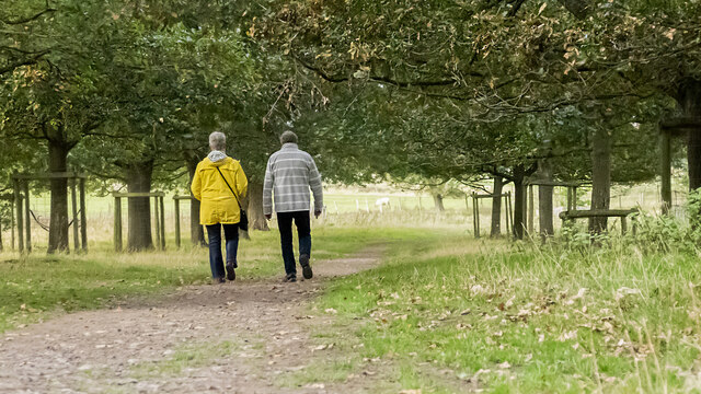
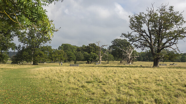
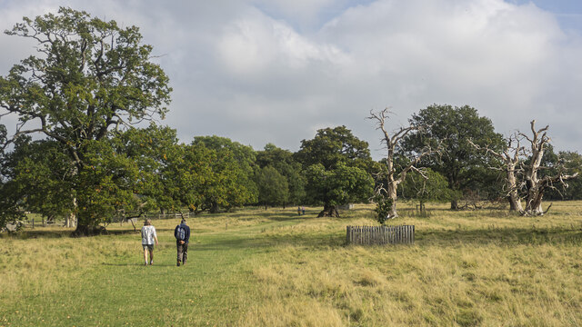
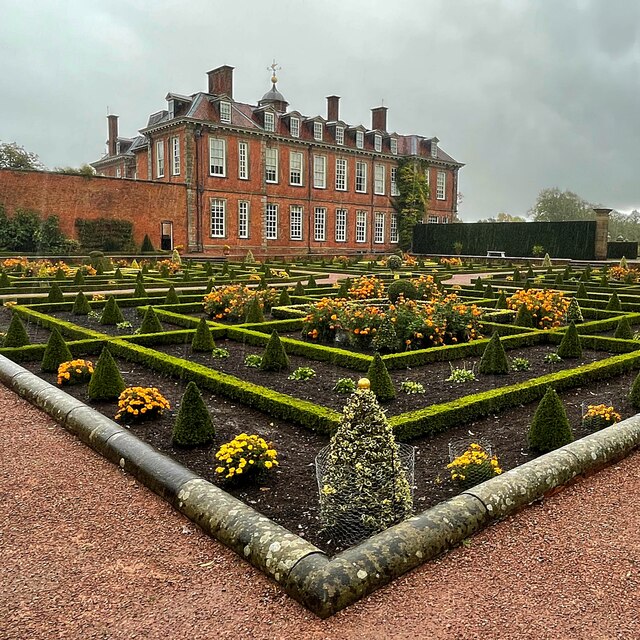
Built in 1701 by Thomas Vernon, Hanbury Hall showcases stunning examples of Baroque architecture. The exterior of the house boasts red brickwork, intricate decorative details, and elegant symmetry. The surrounding gardens and parkland cover over 400 acres and were designed by George London and Henry Wise, renowned landscape architects of the time. These gardens include features such as parterres, a formal wilderness, a cascade, and a walled garden.

Inside the house, visitors can explore the beautifully preserved rooms that display a mix of architectural styles, including Baroque, Rococo, and Georgian. The highlights of the house include the Great Hall, with its stunning plasterwork ceiling, and the Saloon, adorned with intricate wood carvings. The Long Gallery houses an impressive collection of paintings, while the Old Kitchen provides a glimpse into the lives of the servants who once worked in the house.

Hanbury Hall offers visitors a glimpse into the lives of the Vernon family, who lived in the house for over 250 years. The National Trust has carefully preserved the house, ensuring that it remains an authentic representation of its original splendor. With its impressive architecture, beautiful gardens, and fascinating history, Hanbury Hall is a must-visit destination for those interested in English heritage and culture.

If you have any feedback on the listing, please let us know in the comments section below.
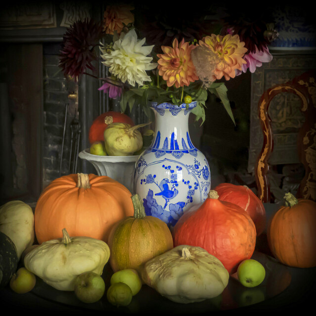
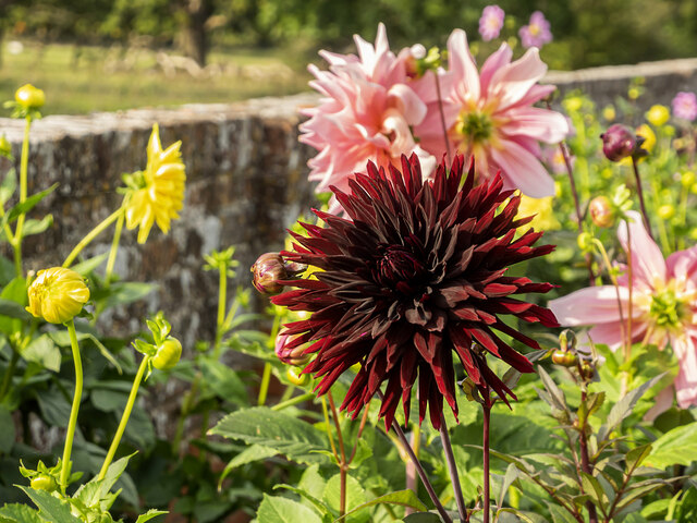
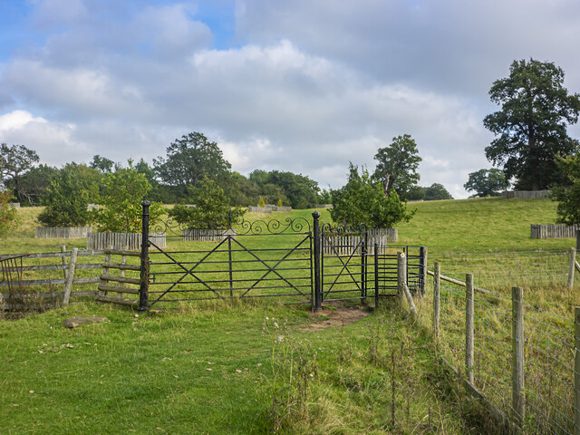
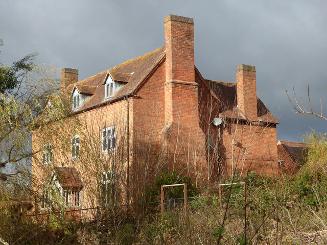
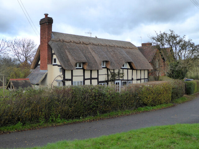
Hanbury Hall Images

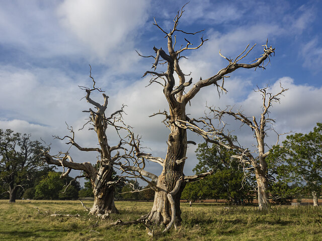
Images are sourced within 2km of 52.271/-2.085 or Grid Reference SO9463. Thanks to Geograph Open Source API. All images are credited.

Ordnance Survey Bench Mark This mark is located on railway bridge number 37 that spans the Worcester to Birmingham canal. These marks were used by Ordnance Survey for mapping purposes.
<a href="https://www.geograph.org.uk/photo/6961993">SO9263 : Bridge 37, Worcester to Birmingham canal</a>
Ordnance Survey Bench Mark
This mark is located on railway bridge number 37 that spans the Worcester to Birmingham canal. These marks were used by Ordnance Survey for mapping purposes. SO9263 : Bridge 37, Worcester to Birmingham canal
Bridge 37, Worcester to Birmingham canal This railway bridge spans the Worcester to Birmingham canal. This bridge also has an Ordnance Survey bench mark.
<a href="https://www.geograph.org.uk/photo/6961985">SO9263 : Ordnance Survey Bench Mark</a>
Bridge 37, Worcester to Birmingham canal
This railway bridge spans the Worcester to Birmingham canal. This bridge also has an Ordnance Survey bench mark. SO9263 : Ordnance Survey Bench Mark
Bridge 38 Worcester to Birmingham Canal This bridge spans the Worcester to Birmingham canal. The bridge also has an Ordnance Survey bench mark.
<a href="https://www.geograph.org.uk/photo/6962010">SO9363 : Ordnance Survey Bench Mark</a>
Bridge 38 Worcester to Birmingham Canal
This bridge spans the Worcester to Birmingham canal. The bridge also has an Ordnance Survey bench mark. SO9363 : Ordnance Survey Bench Mark
Ordnance Survey Bench Mark This mark is located on bridge number 38 which spans the Worcester to Birmingham canal. These marks were used by Ordnance Survey for mapping purposes.
<a href="https://www.geograph.org.uk/photo/6962006">SO9363 : Bridge 38 Worcester to Birmingham Canal</a>
Ordnance Survey Bench Mark
This mark is located on bridge number 38 which spans the Worcester to Birmingham canal. These marks were used by Ordnance Survey for mapping purposes. SO9363 : Bridge 38 Worcester to Birmingham Canal
Replacement Milestone, B4090, Salt Way, 20m West of Junction with Goosehill Lane The milestone is located on the verge by drive to farm on the north side of road. Parish of Hanbury (Wychavon District). Metal plate attached to concrete post, Bradley post design, erected by the County Council in the 21st century. Replacement milestone produced by the Milestone Society Worcestershire group in 2008.

Inscription reads:-
B4090 / ALCESTER 11¾ / 2 DROITWICH. / C.C.W.

Milestone Society National ID: WO_DWAC02R
Replacement Milestone, B4090, Salt Way, 20m West of Junction with Goosehill Lane
The milestone is located on the verge by drive to farm on the north side of road. Parish of Hanbury (Wychavon District). Metal plate attached to concrete post, Bradley post design, erected by the County Council in the 21st century. Replacement milestone produced by the Milestone Society Worcestershire group in 2008. Inscription reads:- B4090 / ALCESTER 11¾ / 2 DROITWICH. / C.C.W. Milestone Society National ID: WO_DWAC02R
NT Hanbury Hall View across the autumnal formal garden towards the South-west facade.
NT Hanbury Hall
View across the autumnal formal garden towards the South-west facade.
Still Life at Hanbury An autumnal display near the entrance to Hanbury Hall.
Still Life at Hanbury
An autumnal display near the entrance to Hanbury Hall.
Dahlia display Within the walled garden at Hanbury Hall.
Dahlia display
Within the walled garden at Hanbury Hall.
A walk in the park A fine autumn afternoon at NT Hanbury Hall.
A walk in the park
A fine autumn afternoon at NT Hanbury Hall.
Hanbury Hall parkland A fine walk around the park at NT Hanbury Hall.
Hanbury Hall parkland
A fine walk around the park at NT Hanbury Hall.
Hanbury Hall parkland There are several dead skeletal oaks within the estate.
Hanbury Hall parkland
There are several dead skeletal oaks within the estate.
Gate on the estate A fine piece of ironwork on a public path through the NT Hanbury Hall estate.
Gate on the estate
A fine piece of ironwork on a public path through the NT Hanbury Hall estate.
Skeletal oaks at Hanbury There are several dead skeletal oaks within the estate.
Skeletal oaks at Hanbury
There are several dead skeletal oaks within the estate.
The parterre garden at Hanbury Hall A recreation of the garden designed by George London in 1705.
The parterre garden at Hanbury Hall
A recreation of the garden designed by George London in 1705.
Hanbury Hall National Trust property in Worcestershire built in 1701.
Hanbury Hall
National Trust property in Worcestershire built in 1701.
Mere Green Farmhouse Grade II Listed. Listed as in Hanbury ward. The view from the public road. There are two further listed buildings in the complex but there are no good trespass free views.
Mere Green Farmhouse
Grade II Listed. Listed as in Hanbury ward. The view from the public road. There are two further listed buildings in the complex but there are no good trespass free views.
Mere Green Farmhouse Grade II Listed. This was the best view I could manage from a public place. The complex includes two further listed buildings but I could not get a meaningful view of those from public places.
Mere Green Farmhouse
Grade II Listed. This was the best view I could manage from a public place. The complex includes two further listed buildings but I could not get a meaningful view of those from public places.
Well Cottage, Hanbury A 17th century house with a thatched roof, Listed Grade II.
Well Cottage, Hanbury
A 17th century house with a thatched roof, Listed Grade II.
Show me another place!

Hanbury Hall is located at Grid Ref: SO9463 (Lat: 52.271, Lng: -2.085)

Administrative County: Worcestershire

District: Wychavon

Police Authority: West Mercia

What 3 Words

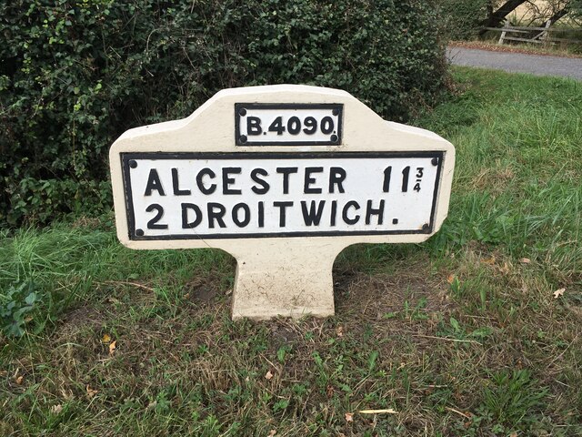
///contoured.graph.mourner. Near Wychbold, Worcestershire

Related Wikis

Hanbury Hall

Hanbury Hall is a large 18th-century stately home standing in parkland at Hanbury, Worcestershire. The main range has two storeys and is built of red brick...

St Mary the Virgin, Hanbury

The church of St Mary the Virgin is an Anglican parish church in the village of Hanbury, Worcestershire. Its earliest parts date from about 1210 and it...

Droitwich Road railway station

Droitwich Road railway station served the town of Droitwich Spa, Worcestershire, England, from 1840 to 1855 on the Birmingham and Gloucester Railway....

Mere Green, Worcestershire

Mere Green is a hamlet in the English county of Worcestershire. It is located south of the village of Hanbury roughly midway between Worcester and Redditch...

Hanbury, Worcestershire

Hanbury is a rural village in Worcestershire, England near Droitwich Spa and the M5 motorway. The population of Hanbury has remained around 1,000 since...

Stoke Works railway station

Stoke Works railway station was a station in the hamlet of Stoke Prior in the English county of Worcestershire, near Bromsgrove. It was located on the...

Dodderhill

Dodderhill is a civil parish, near Droitwich, Worcestershire, England, located on the River Salwarpe. The parish is bisected by the M5 motorway, constructed...

Hadzor

Hadzor is a small village near Droitwich, Worcestershire, England. There are around fourteen houses and a Roman Catholic church in the village, although...

Nearby Amenities

Located within 500m of 52.271,-2.085
Hanbury Hall
Naptan AtcoCode: 2000G019302
Naptan Bearing: N
Naptan BusStopType: CUS
Naptan CommonName: Hanbury Hall
Naptan Indicator: Adj
Naptan Landmark: Hanbury Hall
Naptan NaptanCode: wocdgatd
Naptan Street: Hanbury Hall
Naptan Verified: no
Source: naptan_import
Lat/Long: 52.2714318/-2.0805163
Post Box
Note: This appears to be the Hanbury Hall box
Note2: Have to go and check this one's still present !
Post Box Type: lamp
Ref: WR9 456
Lat/Long: 52.2692626/-2.0795986
Cafe
Stables Cafe
Cuisine: cake
Operator: National Trust
Outdoor Seating: yes
Lat/Long: 52.2722395/-2.0835832
Barrier: cattle_grid
Source: bing with photo survey 2011-02-18
Lat/Long: 52.2687809/-2.0806328
Barrier: kissing_gate
Foot: yes
Source: photo survey 2011-02-18
Lat/Long: 52.2709634/-2.0827188
Barrier: cattle_grid
Source: photo survey 2011-02-18
Lat/Long: 52.2713877/-2.0805274
Barrier: cattle_grid
Motorcar: yes
Motorcycle: yes
Source: photo survey 2011-02-18
Lat/Long: 52.2714431/-2.0823458
Entrance: main
Foot: yes
Source: photo survey 2011-02-18
Lat/Long: 52.2717788/-2.0831305
Restaurant
Servants' Hall Tea-room
Cuisine: regional
Internet Access: no
Level: 0
Opening Hours Url: http://www.nationaltrust.org.uk/hanbury-hall/eating-and-shopping/tea-room/
Operator: National Trust
Smoking: no
Lat/Long: 52.2717994/-2.0834795
Clock
Check Date: 2021-10-01
Display: analog
Source: photo survey 2011-02-18
Support: tower
Visibility: area
Lat/Long: 52.2718078/-2.0832111
Entrance: yes
Lat/Long: 52.2718019/-2.083589
Barrier: kissing_gate
Foot: yes
Source: photo survey 2011-02-18
Lat/Long: 52.2718582/-2.0815877
Barrier: cattle_grid
Motorcar: yes
Motorcycle: yes
Source: photo survey 2011-02-18
Lat/Long: 52.2725366/-2.0841378
Barrier: cattle_grid
Motorcar: yes
Motorcycle: yes
Source: photo survey 2011-02-18
Lat/Long: 52.2726459/-2.0833902
Clock
Check Date: 2024-04-04
Display: sundial
Heritage: 2
Heritage Operator: Historic England
Listed Status: Grade II
Support: pedestal
Wikidata: Q26474651
Wikimedia Commons: File:Sundial by The Orangery at Hanbury Hall.jpg
Lat/Long: 52.2712653/-2.0856341
Bench
Backrest: yes
Lat/Long: 52.2712808/-2.0858161
Bench
Backrest: yes
Lat/Long: 52.2713569/-2.0855389
Bicycle Parking
Bicycle Parking: stands
Capacity: 3
Covered: no
Note: Made from sturdy wood
Lat/Long: 52.2713989/-2.0804141
Board Type: history
Check Date: 2021-10-01
Information: board
Tourism: information
Lat/Long: 52.271513/-2.0804056
Barrier: kissing_gate
Lat/Long: 52.2729781/-2.0798476
Barrier: kissing_gate
Lat/Long: 52.273974/-2.0838983
Restaurant
Chambers
Level: 1
Lat/Long: 52.2717942/-2.083383
Entrance: yes
Source: visual survey;bing
Lat/Long: 52.2714932/-2.0805451
Barrier: sally_port
Lat/Long: 52.2721393/-2.0834014
Barrier: sally_port
Lat/Long: 52.2721966/-2.0833402
Entrance: yes
Source: survey
Lat/Long: 52.2722772/-2.0835507
Toilets
Fee: no
Source: survey
Wheelchair: yes
Lat/Long: 52.2722933/-2.083662
Clock
Check Date: 2021-10-01
Display: analog
Source: photo survey 2011-02-18
Support: tower
Visibility: area
Lat/Long: 52.2718209/-2.0832476
Entrance: yes
Source: visual survey;bing
Lat/Long: 52.271486/-2.080594
Entrance: yes
Foot: customers
Lat/Long: 52.271884/-2.0838923
Hanbury Hall
Location Transition: yes
Power: pole
Transformer: distribution
Voltage Primary: 11000
Lat/Long: 52.2729337/-2.0835346
Power: pole
Lat/Long: 52.2731142/-2.0839316
Material: wood
Power: pole
Lat/Long: 52.2725151/-2.0850715
Material: wood
Power: pole
Lat/Long: 52.2720219/-2.0859821
Hanbury Hall Gardeners Cottage
Power: pole
Transformer: distribution
Voltage Primary: 11000
Lat/Long: 52.2718685/-2.0869021
Power: pole
Lat/Long: 52.270037/-2.0782102
The Moorlands
Power: pole
Transformer: distribution
Voltage Primary: 11000
Lat/Long: 52.2699104/-2.0789266
Location Transition: yes
Power: pole
Lat/Long: 52.2719604/-2.0790044
Power: pole
Lat/Long: 52.2717963/-2.0787147
Becks Farm
Power: pole
Transformer: distribution
Voltage Primary: 11000
Lat/Long: 52.2715845/-2.0777169
Historic: millstone
Note: A horse mill style cider press, previously used in a different location within the Hanbury Hall grounds.
Wikimedia Commons: File:Circular stone cider mill trough.jpg
Lat/Long: 52.2715926/-2.0803885
Note: Secondhand bookstore.
Operator: National Trust
Shop: books
Lat/Long: 52.2721222/-2.0832621
Access: customers
Door: hinged
Entrance: exit
Lat/Long: 52.2718635/-2.083509
The data included in this document is from www.openstreetmap.org. The data is made available under ODbL.

Have you been to Hanbury Hall?

Leave your review of Hanbury Hall below (or comments, questions and feedback).