Hafod y Llan

Heritage Site in Caernarfonshire

Wales

Hafod y Llan

Winter birches on Nantgwynant The marshy land between the public footpath and Llyn Dinas on its southeast shore is dotted with Downy Birch - the species of birch (of our two natives) better adapted to such wet soils. On a wet day like this when the higher parts of Snowdonia are unattractive to walkers, lower level paths like this one present opportunties to have the trees stand out against the low-contrast background, and close examination shows that every twig is adorned with droplets of water catching the light from the low clouds.
Winter birches on Nantgwynant Credit: Andy Waddington

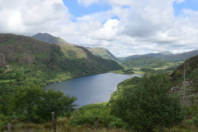
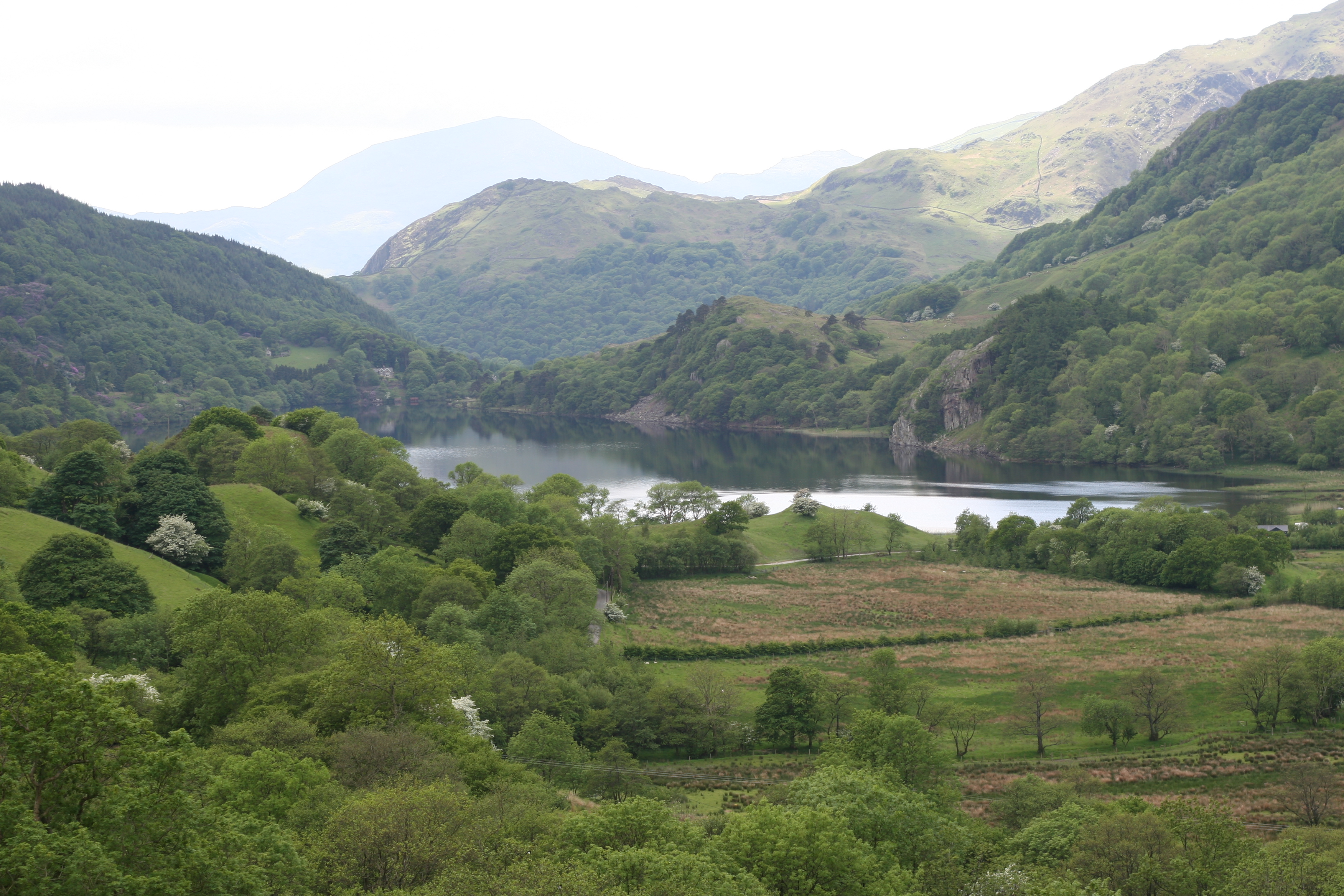
Hafod y Llan is a historic estate located in Caernarfonshire, Wales. Situated in the heart of Snowdonia National Park, it covers an area of approximately 4,000 acres and is renowned for its stunning natural beauty and rich cultural heritage. The estate is managed by the National Trust and is a popular destination for visitors interested in both history and outdoor activities.

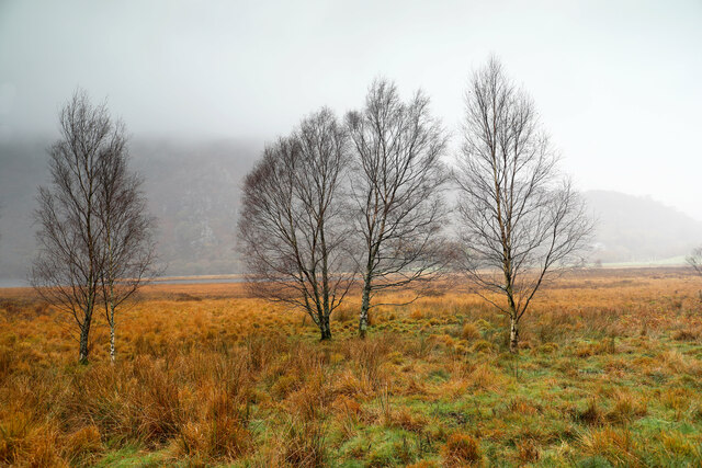
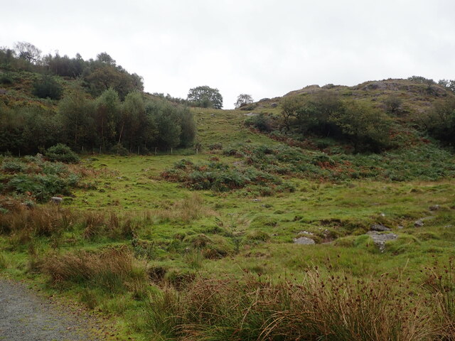
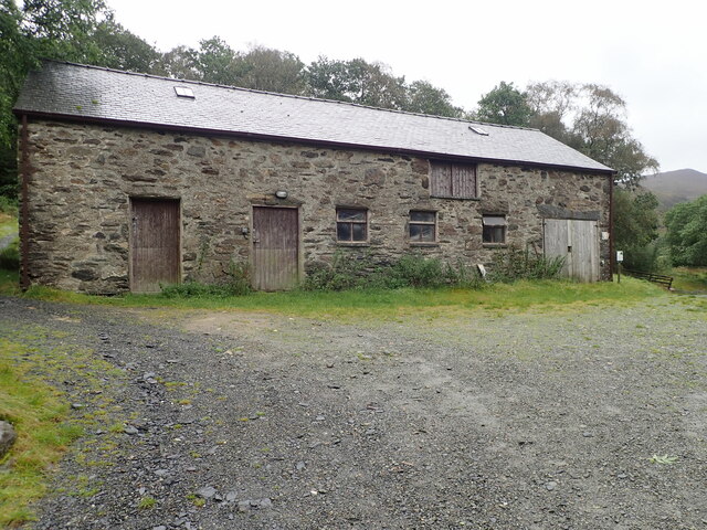
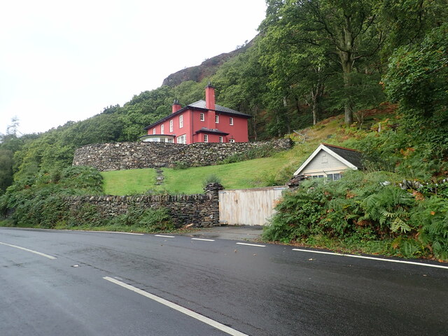
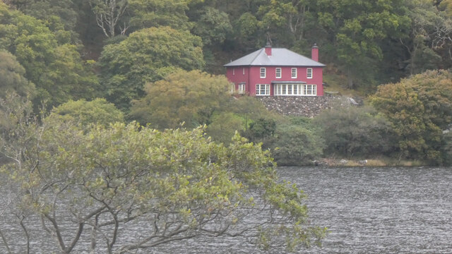
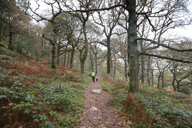
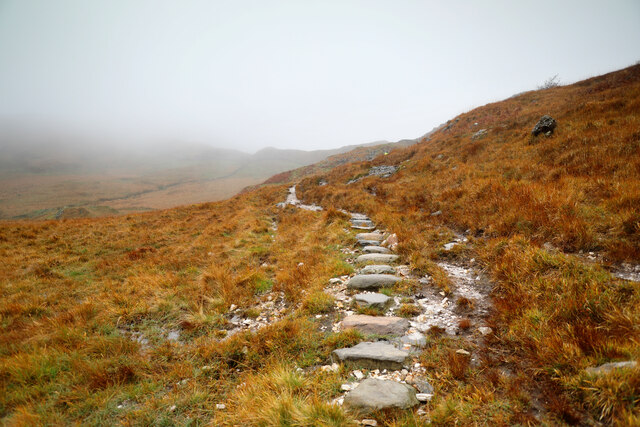
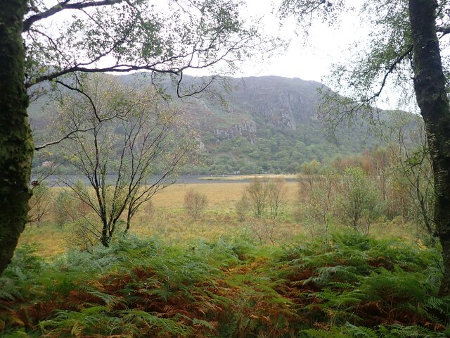
The centerpiece of Hafod y Llan is a grand Victorian farmhouse, which was built in the 1860s and serves as a gateway to the estate. The farmhouse offers self-catering accommodation for visitors who wish to stay and explore the surrounding landscape. The estate itself boasts a diverse range of habitats, including woodlands, meadows, and rivers, making it an ideal location for hiking, birdwatching, and photography.

One of the main attractions at Hafod y Llan is the famous Hafod y Llan Waterfall. This majestic waterfall cascades down a series of rock ledges and is a popular spot for picnics and photography. Additionally, the estate is home to a variety of wildlife, including red squirrels, otters, and rare birds such as the ring ouzel.

Hafod y Llan also has a significant historical and cultural significance. It is part of the UNESCO World Heritage site known as "The Castles and Town Walls of King Edward in Gwynedd," which includes several nearby castles such as Caernarfon Castle and Conwy Castle. The estate's rich history can be explored through guided tours, where visitors can learn about the traditional farming practices and the cultural heritage of the area.

In conclusion, Hafod y Llan is a captivating heritage site that offers a unique blend of natural beauty and historical significance. Its breathtaking landscape and diverse wildlife make it a haven for outdoor enthusiasts, while its historical buildings and cultural heritage provide a glimpse into the region's past.

If you have any feedback on the listing, please let us know in the comments section below.
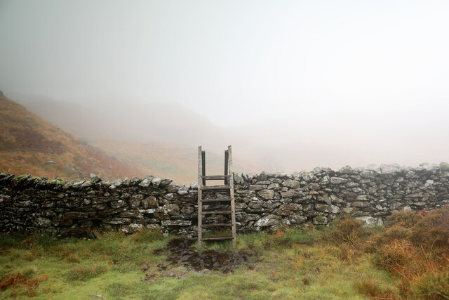
Hafod y Llan Images

Images are sourced within 2km of 53.04/-4.049 or Grid Reference SH6251. Thanks to Geograph Open Source API. All images are credited.

Winter birches on Nantgwynant The marshy land between the public footpath and Llyn Dinas on its southeast shore is dotted with Downy Birch - the species of birch (of our two natives) better adapted to such wet soils. On a wet day like this when the higher parts of Snowdonia are unattractive to walkers, lower level paths like this one present opportunties to have the trees stand out against the low-contrast background, and close examination shows that every twig is adorned with droplets of water catching the light from the low clouds.
Winter birches on Nantgwynant
The marshy land between the public footpath and Llyn Dinas on its southeast shore is dotted with Downy Birch - the species of birch (of our two natives) better adapted to such wet soils. On a wet day like this when the higher parts of Snowdonia are unattractive to walkers, lower level paths like this one present opportunties to have the trees stand out against the low-contrast background, and close examination shows that every twig is adorned with droplets of water catching the light from the low clouds.
Llyn Dinas North of Beddgelert in the Nant Gwynant Pass, Llyn Dinas is a mountain lake with a footpath around its eastern shore. It is a fairly shallow lake, covering an area of 60 acres. This is looking north from the footbridge which crosses the River Glaslyn
Llyn Dinas
North of Beddgelert in the Nant Gwynant Pass, Llyn Dinas is a mountain lake with a footpath around its eastern shore. It is a fairly shallow lake, covering an area of 60 acres. This is looking north from the footbridge which crosses the River Glaslyn
Moorland and hillocks, near Llyn Dinas
Barn at Llyndy Isaf
Barn at Llyndy Isaf
Glan Llyn Standing proud above the A498
Glan Llyn
Standing proud above the A498
Glan Llyn
Glan Llyn
Vista of Llyn Dinas
Vista of Llyn Dinas
Gorsaf drydan-dwr Llyndy Isaf / Llyndy Isaf Hydro-electric power station
Slate slab bridge on Afon Cwm Llan This bridge was built by miners to provide a short cut to the copper mines on slopes of Lliwedd.
Slate slab bridge on Afon Cwm Llan
This bridge was built by miners to provide a short cut to the copper mines on slopes of Lliwedd.
Waterfall on Afon Cwm Llan Afon Cwm Llan is a spate river.
Waterfall on Afon Cwm Llan
Afon Cwm Llan is a spate river.
Rhaeadr Cwm Llan waterfall
Cwm Llan waterfall in full spate
Ruined copper mine buildings near Plas Cwm Llan
The start of the Watkin path in Parc Hafod-y-llan From the road by the confluence of the Afon Llynedno with the Afon Glaslyn, the Watkin path is one of the classic routes up Snowdon. With cloudbase barely above the treetops, that's not an ideal destination for a day like this, but the track also gives access to various lower-level rooutes and industrial remains, so was far from deserted. The woodland is moderately natural, no plantation conifers, but plenty of invasive weed sycamore which no-one seems to be seeking to exterminate.
The start of the Watkin path in Parc Hafod-y-llan
From the road by the confluence of the Afon Llynedno with the Afon Glaslyn, the Watkin path is one of the classic routes up Snowdon. With cloudbase barely above the treetops, that's not an ideal destination for a day like this, but the track also gives access to various lower-level rooutes and industrial remains, so was far from deserted. The woodland is moderately natural, no plantation conifers, but plenty of invasive weed sycamore which no-one seems to be seeking to exterminate.
Hawthorns by the route to Cwm Llan Hawthorns stand out against the low contrast background of Cwm Llan in low cloud on a dreich November day. The Watkin path heads up there past the Afon Cwm Llan waterfalls, and straight into the clouds that are starting to bring the level up. The weather might mean a less crowded ascent to Snowdon, but the views would hardly be the most rewarding, so this was a lower-level walk aiming to stay below cloudbase and return to Llyn Dinas via a permissive path to Craflwyn.
Hawthorns by the route to Cwm Llan
Hawthorns stand out against the low contrast background of Cwm Llan in low cloud on a dreich November day. The Watkin path heads up there past the Afon Cwm Llan waterfalls, and straight into the clouds that are starting to bring the level up. The weather might mean a less crowded ascent to Snowdon, but the views would hardly be the most rewarding, so this was a lower-level walk aiming to stay below cloudbase and return to Llyn Dinas via a permissive path to Craflwyn.
Permissive path to Cwm y Bleiddiaid mines Leaving the Watkin path up Snowdon just below the point where it crosses an old mineral working incline, this path makes its way across bleak and soggy hillside above the Afon Gorsen via a (long) series of well-placed stepping stones through the most vulnerable bits of wetland. It eventually reaches a more substantial path in Cwm y Bleiddiaid, where there are more old mine workings, and then a choice of two routes down to Craflwyn, but no direct descent to the road near Llyn Dinas.
Permissive path to Cwm y Bleiddiaid mines
Leaving the Watkin path up Snowdon just below the point where it crosses an old mineral working incline, this path makes its way across bleak and soggy hillside above the Afon Gorsen via a (long) series of well-placed stepping stones through the most vulnerable bits of wetland. It eventually reaches a more substantial path in Cwm y Bleiddiaid, where there are more old mine workings, and then a choice of two routes down to Craflwyn, but no direct descent to the road near Llyn Dinas.
Stile to Afon Gorsen catchment The wall closely follows the limits of the catchment of the Afon Gorsen as it drains towards the Afon Glaslyn. The permissive footpath which crosses it by this stile comes from Craflwyn (by either of two routes to Cwm y Bleiddiaid) and climbs to cross a spur just behind the photographer. Over the wall, the path stays on the SE-facing slopes above the Gorsen, traversing to reach an area which drains to the Afon Cwm Llan, then descends to the Watkin path. Fortunately, in weather like this, the path is very clear on the ground all the way, and crosses various very boggy bits by a long series of well-placed stepping stones. I was still glad to be in wellies, though...
Stile to Afon Gorsen catchment
The wall closely follows the limits of the catchment of the Afon Gorsen as it drains towards the Afon Glaslyn. The permissive footpath which crosses it by this stile comes from Craflwyn (by either of two routes to Cwm y Bleiddiaid) and climbs to cross a spur just behind the photographer. Over the wall, the path stays on the SE-facing slopes above the Gorsen, traversing to reach an area which drains to the Afon Cwm Llan, then descends to the Watkin path. Fortunately, in weather like this, the path is very clear on the ground all the way, and crosses various very boggy bits by a long series of well-placed stepping stones. I was still glad to be in wellies, though...
View across Llyn Dinas Towards the cliffs of Craig y Llyn on the southern slopes of Snowdon
View across Llyn Dinas
Towards the cliffs of Craig y Llyn on the southern slopes of Snowdon
Show me another place!

Hafod y Llan is located at Grid Ref: SH6251 (Lat: 53.04, Lng: -4.049)

Unitary Authority: Gwynedd

Police Authority: North Wales

What 3 Words

///songbirds.standing.tangent. Near Blaenau-Ffestiniog, Gwynedd

Nearby Locations

Hafod y Llan Coed yr Allt

Related Wikis

Nant Gwynant

Nant Gwynant (also spelt Nantgwynant) is a valley in northern Wales. The A498 road descends 600 feet (180 m) into the valley in about two miles (3 km)...

Plas Gwynant

Plas Gwynant is an educational resort in Snowdonia, Wales. This country estate also includes a woodland and riverside walks, as well as a parkland and...
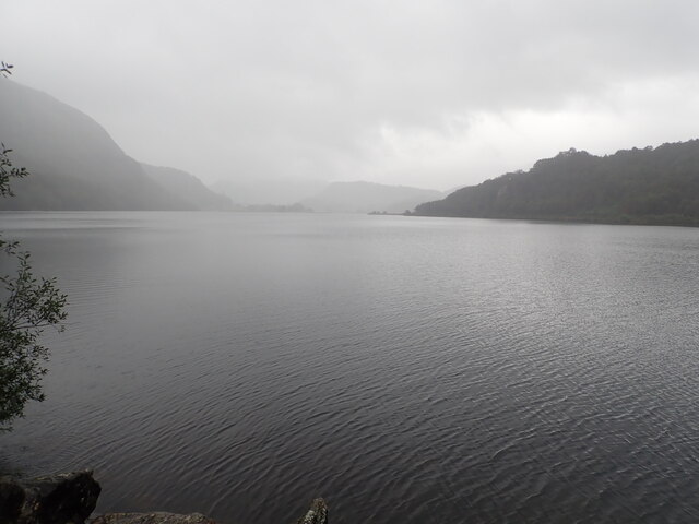
Llyn Gwynant

Llyn Gwynant is a lake in Snowdonia, Wales. Llyn Gwynant lies on the River Glaslyn, in the Nant Gwynant valley, and is about 1ΒΌ miles (2 km) north east...

Lliwedd Bach

Lliwedd Bach is a top of Y Lliwedd in the Snowdonia National Park, North Wales. It is the last "top" on the main ridge of Y Lliwedd, the other being Y...

Nearby Amenities

Located within 500m of 53.04,-4.049
Source: npe
Lat/Long: 53.0386429/-4.0455796
Source: npe
Lat/Long: 53.0378183/-4.0464062
Source: npe
Lat/Long: 53.0363412/-4.0489719
Source: npe
Lat/Long: 53.0428046/-4.0528248
Source: npe
Lat/Long: 53.0428038/-4.0539842
Ford: yes
Lat/Long: 53.041931/-4.045826
Nantgwynant
Place: hamlet
Source: OS_OpenData_StreetView
Lat/Long: 53.0402347/-4.0432231
Bus Stop
Nant Gwynant car park
Bus: yes
Public Transport: platform
Lat/Long: 53.0356847/-4.0482626
Bus Stop
Nant Gwynant car park
Bus: yes
Public Transport: platform
Lat/Long: 53.0363194/-4.0472377
Charging Station
Hafod Y Llan Farm, National Trust Campsite
Operator: Zero Carbon World
Socket Bs1363: 1
Socket Type2: 1
Lat/Long: 53.0415316/-4.0464511
Information: board
Tourism: information
Lat/Long: 53.0400351/-4.0512689
Toilets
Access: customers
Fee: no
Lat/Long: 53.0415886/-4.0465222
Shower
Access: customers
Fee: no
Lat/Long: 53.0415806/-4.0465627
Campsite: reception
Note: self check-in
Lat/Long: 53.0415922/-4.0464348
Intermittent: no
Waterway: waterfall
Lat/Long: 53.0422215/-4.0494609
Hiking: yes
Information: guidepost
Tourism: information
Lat/Long: 53.0385001/-4.0501509
Hiking: yes
Information: guidepost
Source: GPS survey
Tourism: information
Lat/Long: 53.036445/-4.0469277
Vending Machine
Vending: parking_tickets
Lat/Long: 53.0356187/-4.0480166
Hiking: yes
Information: guidepost
Source: GPS survey
Tourism: information
Lat/Long: 53.0389166/-4.0519005
Line Management: split
Power: pole
Lat/Long: 53.0416759/-4.0474232
Power: pole
Lat/Long: 53.0419468/-4.0468197
Line Management: transition
Location Transition: yes
Power: pole
Lat/Long: 53.0420508/-4.0465582
Recycling
Recycling Waste: yes
Recycling Type: container
Lat/Long: 53.0417251/-4.0464154
Drinking Water
Lat/Long: 53.0416001/-4.0464922
Note: this position is approximate
Power: pole
Lat/Long: 53.0413102/-4.0469197
Note: this position is approximate
Power: pole
Lat/Long: 53.0412348/-4.0483734
Power: pole
Lat/Long: 53.0406817/-4.049516
Power: pole
Lat/Long: 53.0401428/-4.0496944
Power: pole
Lat/Long: 53.0392554/-4.049977
Power: pole
Lat/Long: 53.0383319/-4.0496542
Power: pole
Lat/Long: 53.0374723/-4.0493712
Power: pole
Lat/Long: 53.0365313/-4.0483412
Power: pole
Lat/Long: 53.0357224/-4.0475553
Information: board
Tourism: information
Lat/Long: 53.0356116/-4.0479972
Parc Hafod-y-llan
Place: locality
Lat/Long: 53.0366357/-4.052275
Castell
Place: locality
Lat/Long: 53.0414249/-4.0506745
Pont Bethania
Place: locality
Lat/Long: 53.0355725/-4.0483426
Direction: SW
Generator Method: photovoltaic
Generator Output Electricity: yes
Generator Solar Modules: 38
Generator Source: solar
Generator Type: solar_photovoltaic_panel
Location: roof
Power: generator
Lat/Long: 53.0407498/-4.0483017
Ford: yes
Lat/Long: 53.0421122/-4.0531087
Ford: yes
Lat/Long: 53.0421814/-4.0541979
Ford: yes
Lat/Long: 53.042215/-4.0543066
The data included in this document is from www.openstreetmap.org. The data is made available under ODbL.

Have you been to Hafod y Llan?

Leave your review of Hafod y Llan below (or comments, questions and feedback).