Coed yr Allt

Downs, Moorland in Caernarfonshire

Wales

Coed yr Allt

Barn at Llyndy Isaf
Barn at Llyndy Isaf Credit: Eirian Evans

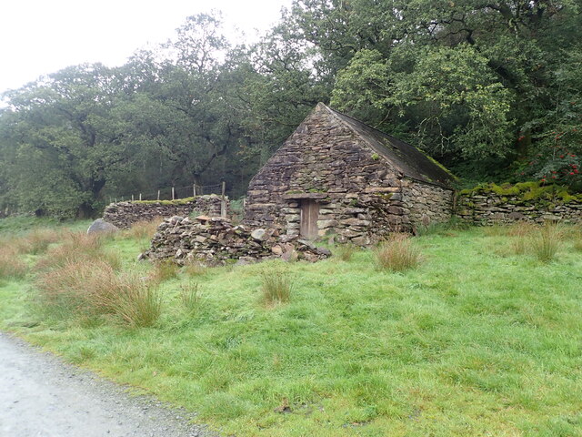
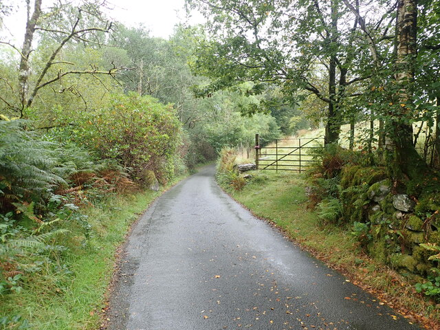
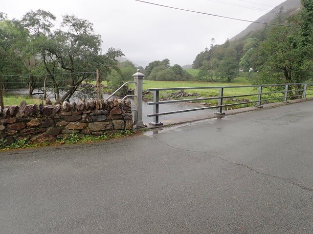
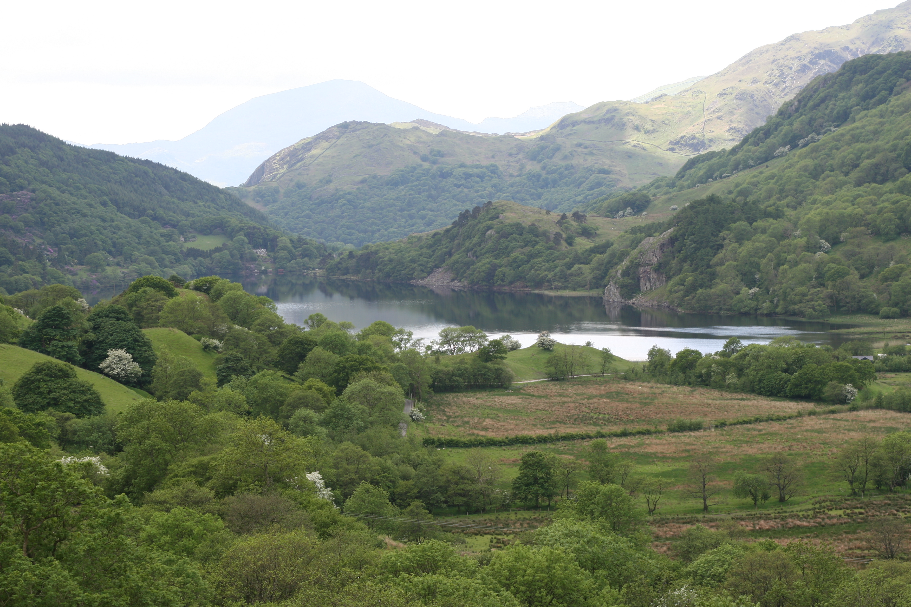
Coed yr Allt, located in Caernarfonshire, is a captivating and picturesque region known for its scenic downs and moorland. Situated in the northwestern part of Wales, this area offers an idyllic and diverse natural landscape that attracts visitors throughout the year.

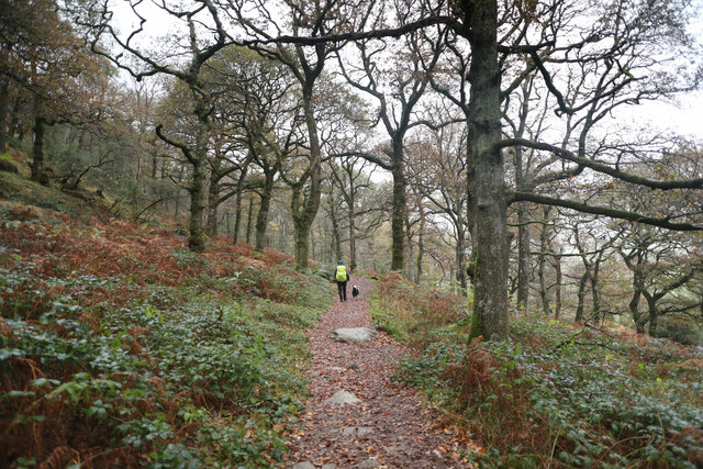
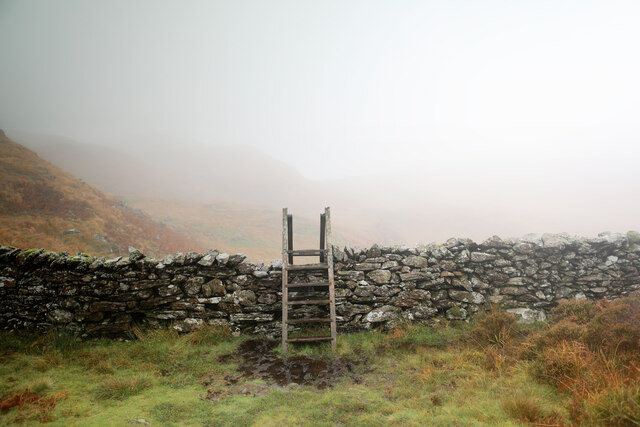
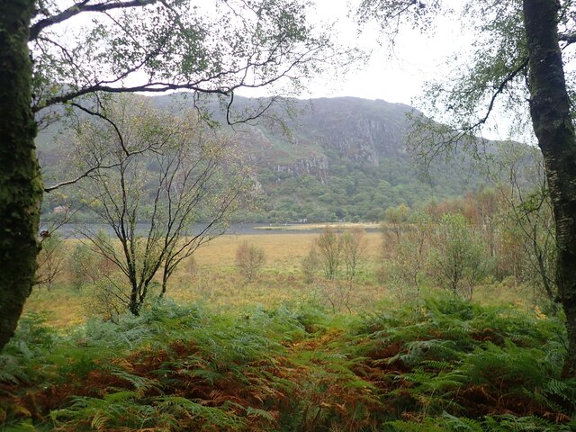
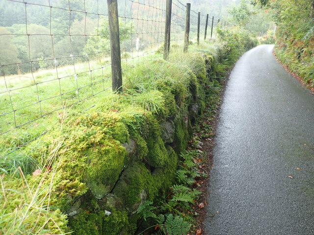
The downs of Coed yr Allt are characterized by gently rolling hills covered with lush grass and scattered with vibrant wildflowers. These downs provide a peaceful and serene atmosphere, making it an ideal location for outdoor activities such as hiking, picnicking, and birdwatching. The panoramic views from the higher points of the downs are truly breathtaking, showcasing the stunning beauty of the surrounding countryside.

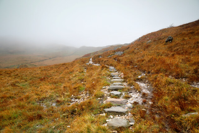
The moorland in Coed yr Allt is another prominent feature of the region. Dense heather and gorse cover the undulating terrain, creating a rich tapestry of colors throughout the year. Moorland birds such as curlews, lapwings, and merlins can often be spotted in this area, adding to the area's natural charm.

Coed yr Allt is also home to a variety of wildlife, including red squirrels, foxes, and rabbits. These creatures thrive in the diverse habitats offered by the downs and moorland, adding an element of excitement for nature enthusiasts.

Overall, Coed yr Allt in Caernarfonshire is a captivating landscape that offers a blend of downs and moorland. Its diverse flora and fauna, panoramic views, and tranquil atmosphere make it a must-visit destination for nature lovers and those seeking a peaceful retreat in the heart of Wales.

If you have any feedback on the listing, please let us know in the comments section below.
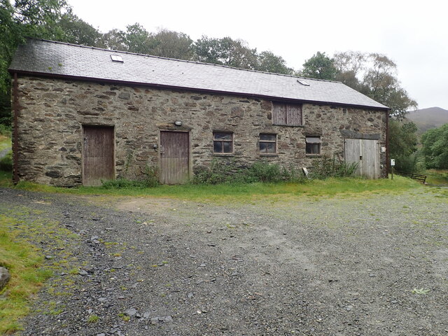
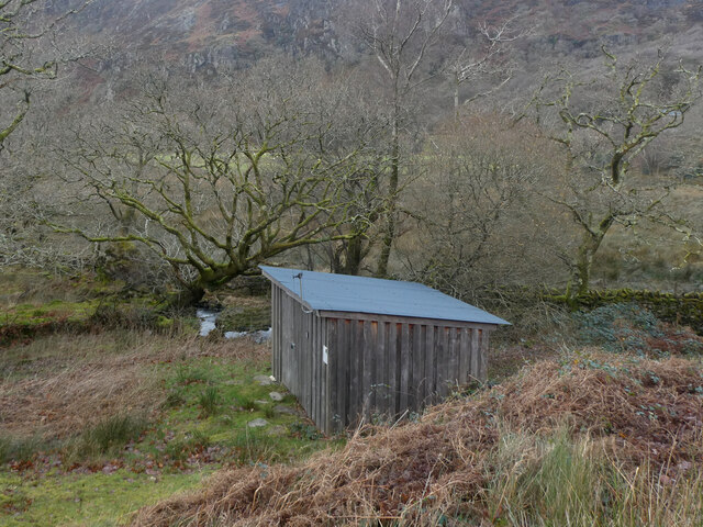
Coed yr Allt Images

Images are sourced within 2km of 53.045651/-4.0494658 or Grid Reference SH6251. Thanks to Geograph Open Source API. All images are credited.

Barn at Llyndy Isaf
Barn at Llyndy Isaf
Gorsaf drydan-dwr Llyndy Isaf / Llyndy Isaf Hydro-electric power station
Slate slab bridge on Afon Cwm Llan This bridge was built by miners to provide a short cut to the copper mines on slopes of Lliwedd.
Slate slab bridge on Afon Cwm Llan
This bridge was built by miners to provide a short cut to the copper mines on slopes of Lliwedd.
Waterfall on Afon Cwm Llan Afon Cwm Llan is a spate river.
Waterfall on Afon Cwm Llan
Afon Cwm Llan is a spate river.
Rhaeadr Cwm Llan waterfall
Cwm Llan waterfall in full spate
Ruined copper mine buildings near Plas Cwm Llan
The start of the Watkin path in Parc Hafod-y-llan From the road by the confluence of the Afon Llynedno with the Afon Glaslyn, the Watkin path is one of the classic routes up Snowdon. With cloudbase barely above the treetops, that's not an ideal destination for a day like this, but the track also gives access to various lower-level rooutes and industrial remains, so was far from deserted. The woodland is moderately natural, no plantation conifers, but plenty of invasive weed sycamore which no-one seems to be seeking to exterminate.
The start of the Watkin path in Parc Hafod-y-llan
From the road by the confluence of the Afon Llynedno with the Afon Glaslyn, the Watkin path is one of the classic routes up Snowdon. With cloudbase barely above the treetops, that's not an ideal destination for a day like this, but the track also gives access to various lower-level rooutes and industrial remains, so was far from deserted. The woodland is moderately natural, no plantation conifers, but plenty of invasive weed sycamore which no-one seems to be seeking to exterminate.
Hawthorns by the route to Cwm Llan Hawthorns stand out against the low contrast background of Cwm Llan in low cloud on a dreich November day. The Watkin path heads up there past the Afon Cwm Llan waterfalls, and straight into the clouds that are starting to bring the level up. The weather might mean a less crowded ascent to Snowdon, but the views would hardly be the most rewarding, so this was a lower-level walk aiming to stay below cloudbase and return to Llyn Dinas via a permissive path to Craflwyn.
Hawthorns by the route to Cwm Llan
Hawthorns stand out against the low contrast background of Cwm Llan in low cloud on a dreich November day. The Watkin path heads up there past the Afon Cwm Llan waterfalls, and straight into the clouds that are starting to bring the level up. The weather might mean a less crowded ascent to Snowdon, but the views would hardly be the most rewarding, so this was a lower-level walk aiming to stay below cloudbase and return to Llyn Dinas via a permissive path to Craflwyn.
Permissive path to Cwm y Bleiddiaid mines Leaving the Watkin path up Snowdon just below the point where it crosses an old mineral working incline, this path makes its way across bleak and soggy hillside above the Afon Gorsen via a (long) series of well-placed stepping stones through the most vulnerable bits of wetland. It eventually reaches a more substantial path in Cwm y Bleiddiaid, where there are more old mine workings, and then a choice of two routes down to Craflwyn, but no direct descent to the road near Llyn Dinas.
Permissive path to Cwm y Bleiddiaid mines
Leaving the Watkin path up Snowdon just below the point where it crosses an old mineral working incline, this path makes its way across bleak and soggy hillside above the Afon Gorsen via a (long) series of well-placed stepping stones through the most vulnerable bits of wetland. It eventually reaches a more substantial path in Cwm y Bleiddiaid, where there are more old mine workings, and then a choice of two routes down to Craflwyn, but no direct descent to the road near Llyn Dinas.
Stile to Afon Gorsen catchment The wall closely follows the limits of the catchment of the Afon Gorsen as it drains towards the Afon Glaslyn. The permissive footpath which crosses it by this stile comes from Craflwyn (by either of two routes to Cwm y Bleiddiaid) and climbs to cross a spur just behind the photographer. Over the wall, the path stays on the SE-facing slopes above the Gorsen, traversing to reach an area which drains to the Afon Cwm Llan, then descends to the Watkin path. Fortunately, in weather like this, the path is very clear on the ground all the way, and crosses various very boggy bits by a long series of well-placed stepping stones. I was still glad to be in wellies, though...
Stile to Afon Gorsen catchment
The wall closely follows the limits of the catchment of the Afon Gorsen as it drains towards the Afon Glaslyn. The permissive footpath which crosses it by this stile comes from Craflwyn (by either of two routes to Cwm y Bleiddiaid) and climbs to cross a spur just behind the photographer. Over the wall, the path stays on the SE-facing slopes above the Gorsen, traversing to reach an area which drains to the Afon Cwm Llan, then descends to the Watkin path. Fortunately, in weather like this, the path is very clear on the ground all the way, and crosses various very boggy bits by a long series of well-placed stepping stones. I was still glad to be in wellies, though...
A spectacular viewpoint Bwlch Cwm Llan gives a good view into Cwm Llan. The Watkin Path to Yr Wyddfa passes through the quarries left of centre - it can just be seen.
A spectacular viewpoint
Bwlch Cwm Llan gives a good view into Cwm Llan. The Watkin Path to Yr Wyddfa passes through the quarries left of centre - it can just be seen.
Y Lliwedd from Allt Maenderyn
View across Llyn Dinas Towards the cliffs of Craig y Llyn on the southern slopes of Snowdon
View across Llyn Dinas
Towards the cliffs of Craig y Llyn on the southern slopes of Snowdon
Old stone farm building near Llyndy Isaf Still in pretty good condition, with a sound roof
Old stone farm building near Llyndy Isaf
Still in pretty good condition, with a sound roof
Minor road heading up from Bethania, at the northern end of Llyn Dinas Moss-covered dry stone wall on the left
Minor road heading up from Bethania, at the northern end of Llyn Dinas
Moss-covered dry stone wall on the left
Minor road near Hafod Tan-y-Graig
Bridge over the River Glaslyn at Bethania
Show me another place!

Coed yr Allt is located at Grid Ref: SH6251 (Lat: 53.045651, Lng: -4.0494658)

Unitary Authority: Gwynedd

Police Authority: North Wales

What 3 Words

///worlds.thus.shaver. Near Blaenau-Ffestiniog, Gwynedd

Nearby Locations

Coed yr Allt Hafod y Llan

Related Wikis

Nant Gwynant

Nant Gwynant (also spelt Nantgwynant) is a valley in northern Wales. The A498 road descends 600 feet (180 m) into the valley in about two miles (3 km)...

Llyn Gwynant

Llyn Gwynant is a lake in Snowdonia, Wales. Llyn Gwynant lies on the River Glaslyn, in the Nant Gwynant valley, and is about 1ΒΌ miles (2 km) north east...

Plas Gwynant

Plas Gwynant is an educational resort in Snowdonia, Wales. This country estate also includes a woodland and riverside walks, as well as a parkland and...

Lliwedd Bach

Lliwedd Bach is a top of Y Lliwedd in the Snowdonia National Park, North Wales. It is the last "top" on the main ridge of Y Lliwedd, the other being Y...

Nearby Amenities

Located within 500m of 53.045651,-4.0494658
Source: npe
Lat/Long: 53.0428046/-4.0528248
Source: npe
Lat/Long: 53.0428038/-4.0539842
Source: npe
Lat/Long: 53.0447406/-4.0558071
Cwm Llan
Intermittent: no
Waterway: waterfall
Lat/Long: 53.0442861/-4.0551775
Ford: yes
Lat/Long: 53.041931/-4.045826
Information: board
Tourism: information
Lat/Long: 53.0441996/-4.0564899
Toilets
Access: customers
Fee: no
Lat/Long: 53.0415886/-4.0465222
Shower
Access: customers
Fee: no
Lat/Long: 53.0415806/-4.0465627
Campsite: reception
Note: self check-in
Lat/Long: 53.0415922/-4.0464348
Intermittent: no
Waterway: waterfall
Lat/Long: 53.0422215/-4.0494609
Barrier: stile
Lat/Long: 53.0444753/-4.0557045
Barrier: stile
Lat/Long: 53.0448946/-4.0554685
Line Management: split
Power: pole
Lat/Long: 53.0416759/-4.0474232
Power: pole
Lat/Long: 53.0419468/-4.0468197
Line Management: transition
Location Transition: yes
Power: pole
Lat/Long: 53.0420508/-4.0465582
Recycling
Recycling Waste: yes
Recycling Type: container
Lat/Long: 53.0417251/-4.0464154
Drinking Water
Lat/Long: 53.0416001/-4.0464922
Note: this position is approximate
Power: pole
Lat/Long: 53.0412348/-4.0483734
Castell
Place: locality
Lat/Long: 53.0414249/-4.0506745
Ford: yes
Lat/Long: 53.0421122/-4.0531087
Ford: yes
Lat/Long: 53.0421814/-4.0541979
The data included in this document is from www.openstreetmap.org. The data is made available under ODbL.

Have you been to Coed yr Allt?

Leave your review of Coed yr Allt below (or comments, questions and feedback).