Ffynnon Tshow

Heritage Site in Brecknockshire

Wales

Ffynnon Tshow

Cwmyoy direction sign, Monmouthshire Viewed across the unclassified road from Llanvihangel Crucorney to Llanthony and Hay-on-Wye. The black arrow on the direction sign points towards this <a title="https://www.geograph.org.uk/photo/7175568" href="https://www.geograph.org.uk/photo/7175568">Link</a> road. A National Cycle Network Route 42 direction sign is also in view.
Cwmyoy direction sign, Monmouthshire Credit: Jaggery

The requested URL returned error: 429 Too Many Requests

If you have any feedback on the listing, please let us know in the comments section below.

Ffynnon Tshow Images

Images are sourced within 2km of 51.897/-3.053 or Grid Reference SO2722. Thanks to Geograph Open Source API. All images are credited.

Cwmyoy direction sign, Monmouthshire Viewed across the unclassified road from Llanvihangel Crucorney to Llanthony and Hay-on-Wye. The black arrow on the direction sign points towards this <a title="https://www.geograph.org.uk/photo/7175568" href="https://www.geograph.org.uk/photo/7175568">Link</a> road. A National Cycle Network Route 42 direction sign is also in view.
Cwmyoy direction sign, Monmouthshire
Viewed across the unclassified road from Llanvihangel Crucorney to Llanthony and Hay-on-Wye. The black arrow on the direction sign points towards this Link road. A National Cycle Network Route 42 direction sign is also in view.
Descent towards Cwmyoy, Monmouthshire Viewed from the unclassified road from Llanvihangel Crucorney to Llanthony and Hay-on-Wye. Ahead for the River Honddu and Cwmyoy (Cwmiou in Welsh). <a title="https://www.geograph.org.uk/photo/4516695" href="https://www.geograph.org.uk/photo/4516695">Link</a>
Descent towards Cwmyoy, Monmouthshire
Viewed from the unclassified road from Llanvihangel Crucorney to Llanthony and Hay-on-Wye. Ahead for the River Honddu and Cwmyoy (Cwmiou in Welsh). Link
Unclassified road towards Llanthony Ahead for Llanthony and Hay-on-Wye. Behind the camera for Llanvihangel Crucorney and Abergavenny. The broken white lines on the right are at edge of this <a title="https://www.geograph.org.uk/photo/7175568" href="https://www.geograph.org.uk/photo/7175568">Link</a> road descending towards Cwmyoy (Cwmiou in Welsh).
Unclassified road towards Llanthony
Ahead for Llanthony and Hay-on-Wye. Behind the camera for Llanvihangel Crucorney and Abergavenny. The broken white lines on the right are at edge of this Link road descending towards Cwmyoy (Cwmiou in Welsh).
Weight limit sign near Cwmyoy, Monmouthshire The sign at the top of this <a title="https://www.geograph.org.uk/photo/7175568" href="https://www.geograph.org.uk/photo/7175568">Link</a> descent towards the River Honddu and Cwmyoy shows "Weight limit 3 tonnes ¼ mile ahead".
Weight limit sign near Cwmyoy, Monmouthshire
The sign at the top of this Link descent towards the River Honddu and Cwmyoy shows "Weight limit 3 tonnes ¼ mile ahead".
Towards a bend in the road near Cwmyoy, Monmouthshire Ahead for Llanvihangel Crucorney and Abergavenny. 
Behind the camera for Llanthony and Hay-on-Wye.
Towards a bend in the road near Cwmyoy, Monmouthshire
Ahead for Llanvihangel Crucorney and Abergavenny. Behind the camera for Llanthony and Hay-on-Wye.
Field and wooded hillside near Cwmyoy, Monmouthshire Behind the camera for this <a title="https://www.geograph.org.uk/photo/7175568" href="https://www.geograph.org.uk/photo/7175568">Link</a> road descending towards the River Honddu and Cwmyoy (Cwmiou in Welsh).
Field and wooded hillside near Cwmyoy, Monmouthshire
Behind the camera for this Link road descending towards the River Honddu and Cwmyoy (Cwmiou in Welsh).
Road bridge over Grwyne Fawr near Forest Coal Pit, Monmouthshire Grwyne Fawr is a tributary of the River Usk, into which it flows at  Glangrwyney in Powys.
Road bridge over Grwyne Fawr near Forest Coal Pit, Monmouthshire
Grwyne Fawr is a tributary of the River Usk, into which it flows at Glangrwyney in Powys.
Downstream along Grwyne Fawr near Forest Coal Pit, Monmouthshire A tributary of the River Usk viewed from this <a title="https://www.geograph.org.uk/photo/7180182" href="https://www.geograph.org.uk/photo/7180182">Link</a> road bridge.
Downstream along Grwyne Fawr near Forest Coal Pit, Monmouthshire
A tributary of the River Usk viewed from this Link road bridge.
Upstream along Grwyne Fawr near Forest Coal Pit, Monmouthshire A tributary of the River Usk viewed from this <a title="https://www.geograph.org.uk/photo/7180182" href="https://www.geograph.org.uk/photo/7180182">Link</a> road bridge.
Upstream along Grwyne Fawr near Forest Coal Pit, Monmouthshire
A tributary of the River Usk viewed from this Link road bridge.
Yellow notice on a pole near Forest Coal Pit, Monmouthshire The notice shows "Neighbourhood Watch Area" and the Welsh equivalent.
Yellow notice on a pole near Forest Coal Pit, Monmouthshire
The notice shows "Neighbourhood Watch Area" and the Welsh equivalent.
Towards the junction of five roads near Forest Coal Pit In rural Monmouthshire. A bridge <a title="https://www.geograph.org.uk/photo/7180182" href="https://www.geograph.org.uk/photo/7180182">Link</a> over the river Grwyne Fawr is behind the camera.
Towards the junction of five roads near Forest Coal Pit
In rural Monmouthshire. A bridge Link over the river Grwyne Fawr is behind the camera.
Dead-end road ascending from crossroads near Forest Coal Pit In rural Monmouthshire.
Dead-end road ascending from crossroads near Forest Coal Pit
In rural Monmouthshire.
Blue notice and red notice at a junction near Forest Coal Pit In rural Monmouthshire. The blue notice shows "Unsuitable for heavy goods vehicles" and the Welsh equivalent. The red notice shows "No Entry for M O D vehicles" and the Welsh equivalent. Ahead for Partrishow (2 miles) and Crickhowell (5).
Blue notice and red notice at a junction near Forest Coal Pit
In rural Monmouthshire. The blue notice shows "Unsuitable for heavy goods vehicles" and the Welsh equivalent. The red notice shows "No Entry for M O D vehicles" and the Welsh equivalent. Ahead for Partrishow (2 miles) and Crickhowell (5).
Postbox and phonebox near Forest Coal Pit, Monmouthshire Interestingly located - there are no houses nearby in May 2022. The phonebox has a grey undercoat with flecks of red at the base.
Postbox and phonebox near Forest Coal Pit, Monmouthshire
Interestingly located - there are no houses nearby in May 2022. The phonebox has a grey undercoat with flecks of red at the base.
Queen Elizabeth II postbox near Forest Coal Pit Located here <a title="https://www.geograph.org.uk/photo/7183905" href="https://www.geograph.org.uk/photo/7183905">Link</a> at the edge of a field in rural Monmouthshire.
Queen Elizabeth II postbox near Forest Coal Pit
Located here Link at the edge of a field in rural Monmouthshire.
Grey phonebox in rural Monmouthshire The box located here <a title="https://www.geograph.org.uk/photo/7183905" href="https://www.geograph.org.uk/photo/7183905">Link</a> is grey with dabs of red in May 2022. 
A BT notice <a title="https://www.geograph.org.uk/photo/7183914" href="https://www.geograph.org.uk/photo/7183914">Link</a> inside the box shows
"We're thinking about removing this payphone".
Grey phonebox in rural Monmouthshire
The box located here Link is grey with dabs of red in May 2022. A BT notice Link inside the box shows "We're thinking about removing this payphone".
Inside a grey phonebox in rural Monmouthshire In May 2022 a BT notice in this <a title="https://www.geograph.org.uk/photo/7183912" href="https://www.geograph.org.uk/photo/7183912">Link</a> grey phonebox shows 
"We're thinking about removing this payphone".
Inside a grey phonebox in rural Monmouthshire
In May 2022 a BT notice in this Link grey phonebox shows "We're thinking about removing this payphone".
Grwyne Fawr Reservoir direction and distance sign 7 miles from Grwyne Fawr Reservoir <a title="https://www.geograph.org.uk/photo/405147" href="https://www.geograph.org.uk/photo/405147">Link</a>
Grwyne Fawr Reservoir direction and distance sign
7 miles from Grwyne Fawr Reservoir Link
Show me another place!

Ffynnon Tshow is located at Grid Ref: SO2722 (Lat: 51.897, Lng: -3.053)

Unitary Authority: Powys

Police Authority: Dyfed Powys

What 3 Words

///cursing.megawatt.scope. Near Crickhowell, Powys

Nearby Locations

Ffynnon Tshow Partrishow

Related Wikis

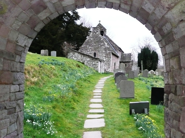
St Issui's Church, Partrishow

The Church of St Issui, Partrishow, Powys, Wales, is a Grade I listed parish church dating from 1060. The existing building was mainly constructed in the...
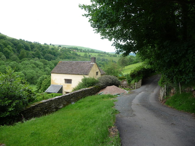
Partrishow

Partrishow, also known as Patricio, Patrishow, or by its Welsh names Merthyr Isw and Llanisw, is a small village and historic parish in the county of Powys...

Tabernacle Baptist Chapel, Cwmyoy

The Tabernacle Baptist Chapel, Ffwthog, near Cwmyoy, Monmouthshire is a Baptist chapel, with attached manse, dating from 1837. Largely unaltered externally...

Ty-mawr Farmhouse, Cwmyoy

Ty-mawr Farmhouse, Ffwthog, Cwmyoy, Monmouthshire, is a farmhouse dating from the early 16th century, which was extended in the 17th century and then reduced...

Nearby Amenities

Located within 500m of 51.897,-3.053
Barrier: lych_gate
Lat/Long: 51.8957227/-3.0500897
Barrier: cattle_grid
Lat/Long: 51.8970984/-3.0557741
Fixme: continue
Lat/Long: 51.8968488/-3.0484673
Barrier: kissing_gate
Lat/Long: 51.8957435/-3.0490723
Entrance: yes
Lat/Long: 51.8957211/-3.0493491
The data included in this document is from www.openstreetmap.org. The data is made available under ODbL.

Have you been to Ffynnon Tshow?

Leave your review of Ffynnon Tshow below (or comments, questions and feedback).