Achnacloich

Settlement in Inverness-shire

Scotland

Achnacloich

House at Tarscabhaig A house with a beautiful situation and a fine view to the south.
House at Tarscabhaig Credit: Anne Burgess

Achnacloich is a small hamlet located in the county of Inverness-shire, Scotland. Situated in the Scottish Highlands, it lies approximately 12 miles northwest of the town of Fort William. The name "Achnacloich" is derived from the Gaelic language, meaning "field of stones."

This rural settlement is nestled in a picturesque valley, surrounded by stunning mountain landscapes and verdant forests. It is known for its natural beauty and tranquil atmosphere, making it a popular destination for nature enthusiasts and outdoor adventurers. The nearby Loch Eil provides opportunities for fishing and boating, while the surrounding hills offer excellent hiking and mountain biking trails.

Achnacloich is a close-knit community, with a small population primarily engaged in farming and other agricultural activities. The hamlet features a handful of traditional stone cottages, some of which date back several centuries, adding to its charm and historical appeal.

While Achnacloich itself does not have many amenities, the town of Fort William is within easy reach, offering a range of services, shops, and restaurants. Visitors to Achnacloich can also explore nearby attractions such as the iconic Ben Nevis, the highest mountain in the British Isles, and the scenic Glenfinnan Viaduct, famous for its appearance in the Harry Potter films.

Overall, Achnacloich is a serene and idyllic location, offering a peaceful retreat for those seeking a break from the hustle and bustle of city life and a chance to immerse themselves in the stunning natural beauty of the Scottish Highlands.

If you have any feedback on the listing, please let us know in the comments section below.
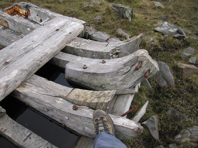
Achnacloich Images

Images are sourced within 2km of 57.107691/-5.984965 or Grid Reference NG5808. Thanks to Geograph Open Source API. All images are credited.

House at Tarscabhaig A house with a beautiful situation and a fine view to the south.
House at Tarscabhaig
A house with a beautiful situation and a fine view to the south.
Looking towards Sithean Mòr This little glen above Achnacloich is on the northern slope of Sithean Mòr, which is in the next square.
Looking towards Sithean Mòr
This little glen above Achnacloich is on the northern slope of Sithean Mòr, which is in the next square.
Bàgh Tharsgabhaig The southern beach in Tarskavaig Bay (near Achnacloich) at low water.
The Cuillin is covered by cloud, but Blabheinn is attempting to make an appearance (centre). Belig is clear to the right.
Bàgh Tharsgabhaig
The southern beach in Tarskavaig Bay (near Achnacloich) at low water. The Cuillin is covered by cloud, but Blabheinn is attempting to make an appearance (centre). Belig is clear to the right.
Houses in Achnacloich A small settlement above the west coast of the Sleat peninsula.
Houses in Achnacloich
A small settlement above the west coast of the Sleat peninsula.
Moorland on Sleat A shallow glen drains a tract of moorland into the Gillean Burn.
Moorland on Sleat
A shallow glen drains a tract of moorland into the Gillean Burn.
Gillean Burn You can't actually see the burn that drains this ground, but it flows through the gully in the distance.
Gillean Burn
You can't actually see the burn that drains this ground, but it flows through the gully in the distance.
Sleat Scrubland Scrubby vegetation beside the road to Tarscabhaig.
Sleat Scrubland
Scrubby vegetation beside the road to Tarscabhaig.
Beside the lane to Tarskavaig In the middle of the Sleat peninsula.
Beside the lane to Tarskavaig
In the middle of the Sleat peninsula.
Tarscavaig - 1980 Tarscavaig, Isle of Skye.
Tarskavaig is a crofting village on the West coast of Sleat on the Isle of Skye in Scotland. It sits in a glen which meets Tarskavaig Bay and lies opposite the Isles of Eigg, Rum and Canna. 
It is often said that Tarskavaig has the best view of the Cuillin in Skye.
Tarscavaig - 1980
Tarscavaig, Isle of Skye. Tarskavaig is a crofting village on the West coast of Sleat on the Isle of Skye in Scotland. It sits in a glen which meets Tarskavaig Bay and lies opposite the Isles of Eigg, Rum and Canna. It is often said that Tarskavaig has the best view of the Cuillin in Skye.
Beach at Gillean A view south over autumn-coloured moorland from the unclassified road to Tarskavaig.
Beach at Gillean
A view south over autumn-coloured moorland from the unclassified road to Tarskavaig.
Tarskavaig Bay An autumn view to compare to John Allan's springtime photograph taken from the same spot. 
(<a href="https://www.geograph.org.uk/photo/816610">NG5809 : Tarskavaig Bay</a>).
Tarskavaig Bay
An autumn view to compare to John Allan's springtime photograph taken from the same spot. (NG5809 : Tarskavaig Bay).
Tarskavaig Bay Tarskavaig Bay, Isle of Skye, July 2001 with Tarskavaig Point in the foreground. In the distance can be seen the Cuillin Hills.
Tarskavaig Bay
Tarskavaig Bay, Isle of Skye, July 2001 with Tarskavaig Point in the foreground. In the distance can be seen the Cuillin Hills.
Disused church at Tarskavaig Notice how the roof of the side building has collapsed compared to this photo in 2006 <a title="https://www.geograph.org.uk/photo/173960" href="https://www.geograph.org.uk/photo/173960">Link</a>
Disused church at Tarskavaig
Notice how the roof of the side building has collapsed compared to this photo in 2006 Link
Old boat hull It's hard to visualise what size this boat must have been, but my boot (for scale) indicates that it was not a small rowing boat.
Old boat hull
It's hard to visualise what size this boat must have been, but my boot (for scale) indicates that it was not a small rowing boat.
Tarskavaig Free Church Tarskavaig Free church and school, built circa 1860, and believed to have been abandoned circa 1960.
Tarskavaig Free Church
Tarskavaig Free church and school, built circa 1860, and believed to have been abandoned circa 1960.
Tarskavaig Free Church - Pier Pier was built circa 1846/7 to provide assistance during a period of extreme hardship (Potato Blight).  The crofters were apparently given a bowl of meal for a day's work on the pier.
Tarskavaig Free Church - Pier
Pier was built circa 1846/7 to provide assistance during a period of extreme hardship (Potato Blight). The crofters were apparently given a bowl of meal for a day's work on the pier.
Descending from Loch Dhùghaill On the Sleat loop road, heading down the glen to meet the west coast at Gillean.
Descending from Loch Dhùghaill
On the Sleat loop road, heading down the glen to meet the west coast at Gillean.
Tarskavaig church and schoolhouse Located beyond the end of the current road, the 19th century church is disused.
Tarskavaig church and schoolhouse
Located beyond the end of the current road, the 19th century church is disused.
Show me another place!

Achnacloich is located at Grid Ref: NG5808 (Lat: 57.107691, Lng: -5.984965)

Unitary Authority: Highland

Police Authority: Highlands and Islands

Also known as: Ach na Cloiche

What 3 Words

///crashing.health.script. Near Armadale, Highland

Nearby Locations

Ach na Cloiche Achnacloich

Related Wikis

Tarskavaig

Tarskavaig (Tarsgabhaig in Scottish Gaelic) is a crofting village on the west coast of Sleat on the Isle of Skye in Scotland. It sits in a glen which meets...

Sleat

Sleat is a peninsula and civil parish on the island of Skye in the Highland council area of Scotland, known as "the garden of Skye". It is the home of...
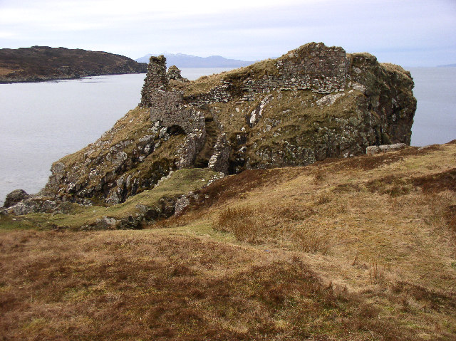
Dunscaith Castle

Dunscaith Castle also known as Dun Scaich, Dun Sgathaich Castle and Tokavaig, is a ruined castle on the coast of the Isle of Skye, in the north-west of...
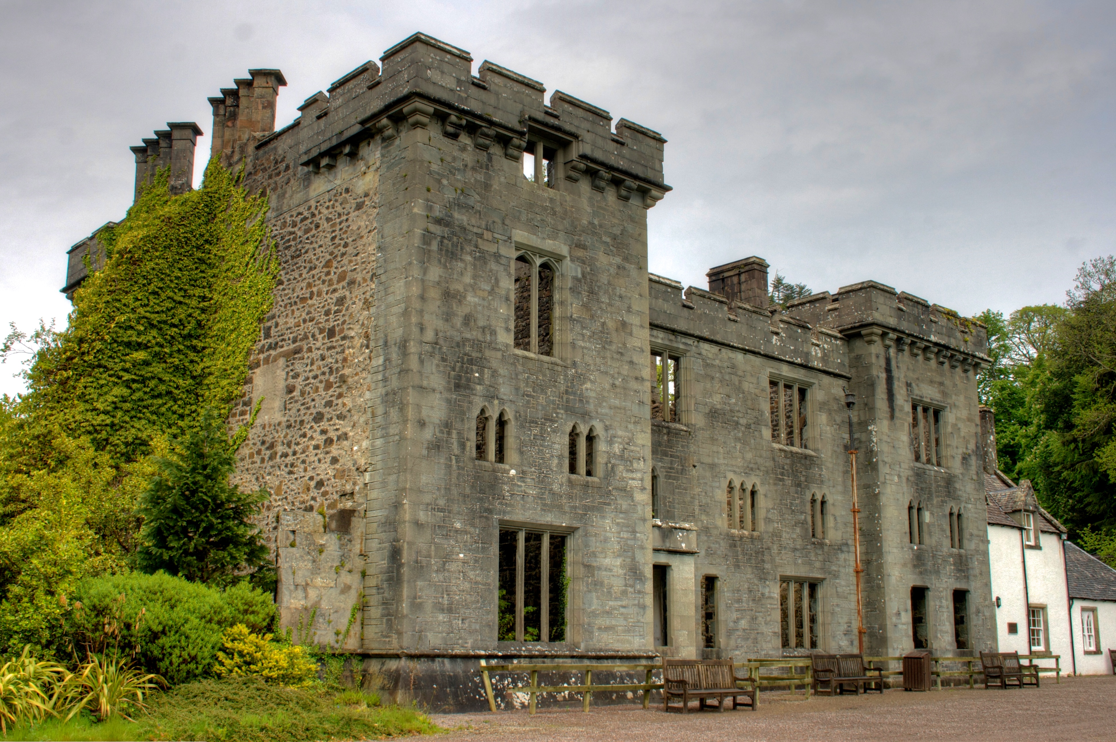
Armadale Castle

Armadale Castle is a ruined country house in Armadale, Skye, former home of the MacDonalds. A mansion house was first built here around 1790, facing south...

Nearby Amenities

Located within 500m of 57.107691,-5.984965
Post Box
Source: survey
Lat/Long: 57.107689/-5.9846154
Power: pole
Lat/Long: 57.111576/-5.9822702
Power: pole
Lat/Long: 57.1107997/-5.9815367
Power: pole
Lat/Long: 57.1099469/-5.9807266
Power: pole
Lat/Long: 57.1091618/-5.9799877
Power: pole
Lat/Long: 57.1085136/-5.979356
Power: pole
Lat/Long: 57.1078727/-5.9787472
Power: pole
Lat/Long: 57.1072522/-5.9781584
Achnacloich
Alt Name En: Stonefield
Name En: Achnacloich
Name Gd: Achadh na Cloiche
Place: hamlet
Population: 22
Lat/Long: 57.1069342/-5.9798119
Gillean
Alt Name: Gillen
Name Gd: Gillean
Place: isolated_dwelling
Lat/Long: 57.1063399/-5.9847901
Power: pole
Lat/Long: 57.1058532/-5.9775067
Power: pole
Lat/Long: 57.1062555/-5.9771353
Power: pole
Lat/Long: 57.1084287/-5.9812538
Power: pole
Lat/Long: 57.1078564/-5.9810364
Power: pole
Lat/Long: 57.1076143/-5.9826206
Power: pole
Lat/Long: 57.1070076/-5.983603
The data included in this document is from www.openstreetmap.org. The data is made available under ODbL.

Have you been to Achnacloich?

Leave your review of Achnacloich below (or comments, questions and feedback).