Eashing Br

Heritage Site in Surrey

England

Eashing Br

Barn at Oxenford Grange It was built in 1843 by Augustus Welby Northmore Pugin in Medieval Gothic style of sandstone rubble with ashlar dressings. It has a plain tiled roof, part restored, with ridge cresting and gable end pinnacles. It is rectangular, with pentice roofed aisle extensions to side. There are five bays with gabled, opposing, entrances to centre, offset flanking buttresses and octagonal gable finial. There are rectangular breathers to both and sides, three to either side alternating with buttresses. There are double doors to centre on both sides with stable doors to side. Interior - main roof trusses on corbels with cross braced roof <span class="nowrap"><a title="https://www.britishlistedbuildings.co.uk/101334359" rel="nofollow ugc noopener" href="https://www.britishlistedbuildings.co.uk/101334359">Link</a><img style="margin-left:2px;" alt="External link" title="External link - shift click to open in new window" src="https://s1.geograph.org.uk/img/external.png" width="10" height="10"/></span>
Barn at Oxenford Grange Credit: John Baker

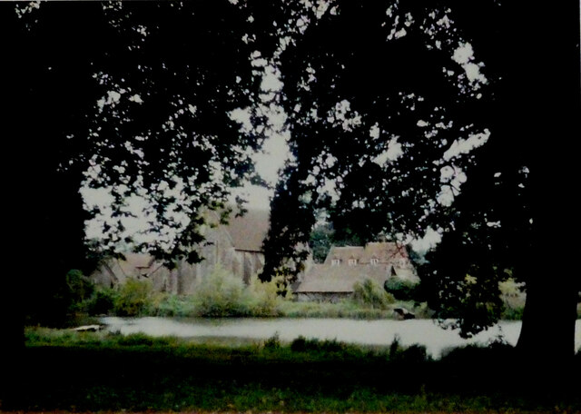
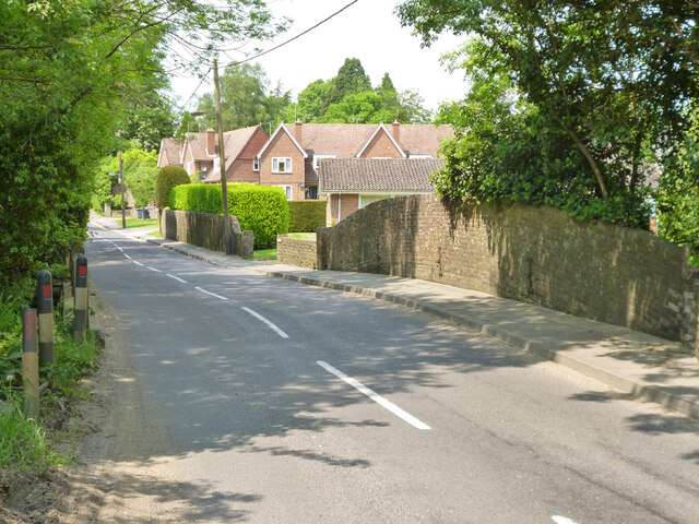
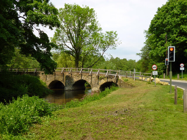
Eashing Bridge, located in Surrey, England, is a historic structure that has stood the test of time as a significant heritage site. Spanning the River Wey, this iconic bridge is situated in the village of Eashing, just a few miles southwest of Godalming.

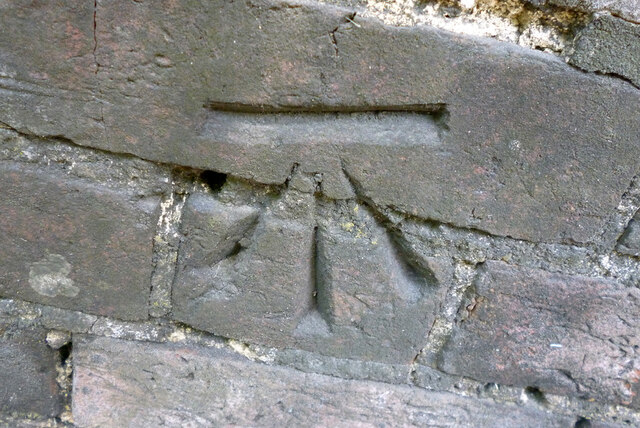
The bridge, constructed in the 18th century, is renowned for its architectural beauty and historical importance. It is a Grade I listed structure, recognized for its outstanding significance. The bridge features three elegant arches, built using local sandstone, which exude a sense of grandeur and charm.

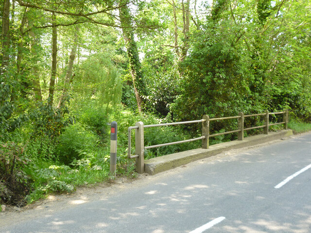
Eashing Bridge played a crucial role in the transportation network of the region, providing a vital link for local communities. In the past, it facilitated the movement of goods and people, serving as a key crossing point over the river. The bridge's sturdy construction allowed it to withstand the test of time, enduring floods and heavy traffic for centuries.

Visiting Eashing Bridge today offers a glimpse into the past, allowing visitors to appreciate its architectural beauty and historical significance. The bridge's idyllic location, surrounded by picturesque countryside, makes it a popular spot for photographers and nature enthusiasts alike.

Eashing Bridge serves as a reminder of the region's rich history and the importance of preserving architectural heritage. It continues to be a beloved landmark not only for locals but also for those interested in exploring the historical gems of Surrey.

If you have any feedback on the listing, please let us know in the comments section below.

Eashing Br Images

Images are sourced within 2km of 51.182/-0.648 or Grid Reference SU9443. Thanks to Geograph Open Source API. All images are credited.

Barn at Oxenford Grange It was built in 1843 by Augustus Welby Northmore Pugin in Medieval Gothic style of sandstone rubble with ashlar dressings. It has a plain tiled roof, part restored, with ridge cresting and gable end pinnacles. It is rectangular, with pentice roofed aisle extensions to side. There are five bays with gabled, opposing, entrances to centre, offset flanking buttresses and octagonal gable finial. There are rectangular breathers to both and sides, three to either side alternating with buttresses. There are double doors to centre on both sides with stable doors to side. Interior - main roof trusses on corbels with cross braced roof <span class="nowrap"><a title="https://www.britishlistedbuildings.co.uk/101334359" rel="nofollow ugc noopener" href="https://www.britishlistedbuildings.co.uk/101334359">Link</a><img style="margin-left:2px;" alt="External link" title="External link - shift click to open in new window" src="https://s1.geograph.org.uk/img/external.png" width="10" height="10"/></span>
Barn at Oxenford Grange
It was built in 1843 by Augustus Welby Northmore Pugin in Medieval Gothic style of sandstone rubble with ashlar dressings. It has a plain tiled roof, part restored, with ridge cresting and gable end pinnacles. It is rectangular, with pentice roofed aisle extensions to side. There are five bays with gabled, opposing, entrances to centre, offset flanking buttresses and octagonal gable finial. There are rectangular breathers to both and sides, three to either side alternating with buttresses. There are double doors to centre on both sides with stable doors to side. Interior - main roof trusses on corbels with cross braced roof LinkExternal link
Old Milestone, was on the A3100 (was A3), Ockford Road The milestone was located on the narrow strip of tarmac between road and stone wall, on the East side of the road, opposite no. 108. Parish of Godalming (Waverley district). Carved stone post, Guildford facets design, erected by the Kingston & Sheetbridge, 1st District trust in the 18th century. 

Inscription was unreadable.

The milestone was destroyed by a lorry sometime before 2005. The image was taken before 2001.

Milestone Society National ID: SY_LP32
Old Milestone, was on the A3100 (was A3), Ockford Road
The milestone was located on the narrow strip of tarmac between road and stone wall, on the East side of the road, opposite no. 108. Parish of Godalming (Waverley district). Carved stone post, Guildford facets design, erected by the Kingston & Sheetbridge, 1st District trust in the 18th century. Inscription was unreadable. The milestone was destroyed by a lorry sometime before 2005. The image was taken before 2001. Milestone Society National ID: SY_LP32
Car Wash in Portsmouth Road Fond memories of that Rose Royce song: was it really 1976? However, in the 21st Century, if you get your car washed for a pittance it could well be your car washers are being exploited. Here is a link to help identify an unethical operation <span class="nowrap"><a title="https://dropless.co.uk/blog/how-to-spot-a-mistreated-car-wash-worker/" rel="nofollow ugc noopener" href="https://dropless.co.uk/blog/how-to-spot-a-mistreated-car-wash-worker/">Link</a><img style="margin-left:2px;" alt="External link" title="External link - shift click to open in new window" src="https://s1.geograph.org.uk/img/external.png" width="10" height="10"/></span>
Car Wash in Portsmouth Road
Fond memories of that Rose Royce song: was it really 1976? However, in the 21st Century, if you get your car washed for a pittance it could well be your car washers are being exploited. Here is a link to help identify an unethical operation LinkExternal link
Chippie in Portsmouth Road Fish and chip shops are a great British institution. In the 16th century Iberian refugees in London began selling white fish fried in a thin coat of flour. Friday became a particularly busy day as both Jews and Catholics wanted cooked fish that day. A hundred years later, Hugenots brought their fondness for fried potato to the capital. Joseph Malin opened the first chippy in Bethnal Green during the 1860s. Today there are more than 10,000 in England alone.
Chippie in Portsmouth Road
Fish and chip shops are a great British institution. In the 16th century Iberian refugees in London began selling white fish fried in a thin coat of flour. Friday became a particularly busy day as both Jews and Catholics wanted cooked fish that day. A hundred years later, Hugenots brought their fondness for fried potato to the capital. Joseph Malin opened the first chippy in Bethnal Green during the 1860s. Today there are more than 10,000 in England alone.
Bus stop at the junction of Guildford and Portsmouth Roads Bus stops range from a simple sign with the number of the bus and the company operating the service to elaborate structures that have an architectural pedigree all of their own. These days they are often linked via computer to the bus and the depot and display the waiting time in minutes.
Bus stop at the junction of Guildford and Portsmouth Roads
Bus stops range from a simple sign with the number of the bus and the company operating the service to elaborate structures that have an architectural pedigree all of their own. These days they are often linked via computer to the bus and the depot and display the waiting time in minutes.
Milford - war memorial By St. John's church on Church Road.
Milford - war memorial
By St. John's church on Church Road.
Tomb, St. John's churchyard, Milford Several Webbs.
Tomb, St. John's churchyard, Milford
Several Webbs.
St. John's church, Milford
Milford Club, Church Road CIU affiliated.
Milford Club, Church Road
CIU affiliated.
Cut mark on Station Lane bridge over River Ock East parapet south end, 50.025 m above datum.
Cut mark on Station Lane bridge over River Ock
East parapet south end, 50.025 m above datum.
East parapet, Station Lane bridge over River Ock The other side of the road is just railings, suggesting the road has been widened.
East parapet, Station Lane bridge over River Ock
The other side of the road is just railings, suggesting the road has been widened.
Railings, west side of Church Lane bridge over River Ock The other side has an elderly brick parapet.
Railings, west side of Church Lane bridge over River Ock
The other side has an elderly brick parapet.
Signs, Secretts Farm Shop and Country Delicatessen
Milford Pharmacy On Portsmouth Road.
Milford Pharmacy
On Portsmouth Road.
St. Joseph's Catholic Church, Milford
Bridleway 124, Shackleford From Eashing Lane towards the A283.
Bridleway 124, Shackleford
From Eashing Lane towards the A283.
Bridleway 124 Shackleford leaves Eashing Lane
One of Eashing Bridges There are two 13th century bridges over the two routes of the River Wey here, with a causeway between them. Together they are a grade I listed building and scheduled Ancient Monument. This is the eastern bridge of three arches, the other has four.
One of Eashing Bridges
There are two 13th century bridges over the two routes of the River Wey here, with a causeway between them. Together they are a grade I listed building and scheduled Ancient Monument. This is the eastern bridge of three arches, the other has four.
Show me another place!

Eashing Br is located at Grid Ref: SU9443 (Lat: 51.182, Lng: -0.648)

Police Authority: Surrey

What 3 Words

///staple.stammer.applied. Near Milford, Surrey

Related Wikis

Charterhouse to Eashing

Charterhouse to Eashing is a 68.4-hectare (169-acre) biological Site of Special Scientific Interest west of Godalming in Surrey.This is a steep valley...
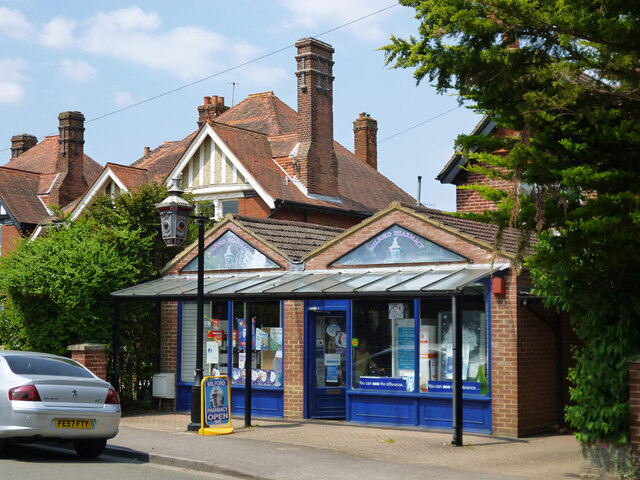
Milford, Surrey

Milford is a village in the civil parish of Witley south west of Godalming in Surrey, England that was a small village in the early medieval period — it...

Oxenford Farm

Oxenford Farm is a former abbey farm, a dependency of Waverley Abbey in the civil parish of Witley, Surrey, England, with several listed buildings around...

Aaron's Hill, Surrey

Aaron's Hill is a suburb of Godalming in Surrey, England. It is named after the hill it sits on and has a road named after it. Aaron's Hill is adjacent...

Nearby Amenities

Located within 500m of 51.182,-0.648
Motorway Junction
Milford Junction
Lat/Long: 51.1829156/-0.6509378
Power: pole
Lat/Long: 51.1808829/-0.6483931
Eashing House
Building: yes
Source: npe
Lat/Long: 51.1824964/-0.6440088
Burh of Eashing
Historic: archaeological_site
Lat/Long: 51.1845585/-0.6451628
Power: pole
Lat/Long: 51.1791627/-0.6481868
Power: pole
Lat/Long: 51.1787015/-0.6466176
Power: pole
Lat/Long: 51.1787864/-0.6465063
Power: pole
Lat/Long: 51.1788402/-0.6464285
Power: pole
Lat/Long: 51.1794405/-0.6470025
Power: pole
Lat/Long: 51.1807604/-0.6543598
Power: pole
Lat/Long: 51.1804342/-0.6529838
Power: pole
Lat/Long: 51.1799718/-0.6512591
The data included in this document is from www.openstreetmap.org. The data is made available under ODbL.

Have you been to Eashing Br?

Leave your review of Eashing Br below (or comments, questions and feedback).