Dunstrone

Heritage Site in Buteshire

Scotland

Dunstrone

St Blane's Church A view across the churchyard to the medieval Church of St Blane in the south of the Isle of Bute.

This photograph was taken during the Coronavirus (COVID-19) pandemic of 2020/21.
St Blane's Church Credit: James T M Towill

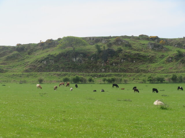
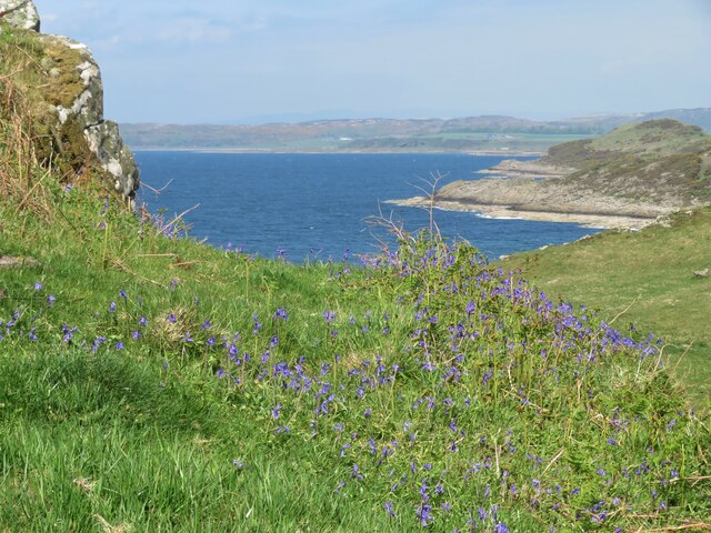
Dunstrone, located in the county of Buteshire, Scotland, is a renowned heritage site that holds historical significance for the region. Situated on a rocky promontory overlooking the Firth of Clyde, this ancient fortress has a rich and fascinating history.

The origins of Dunstrone can be traced back to the Iron Age, with evidence of settlement dating as far back as 500 BC. It is believed that the site was initially used as a hillfort, offering strategic advantages for defense against potential invaders. Over the centuries, Dunstrone underwent several transformations, with each successive civilization leaving its mark on the site.

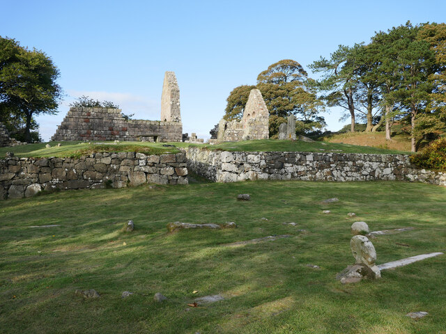
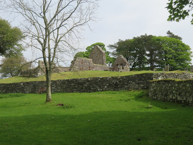
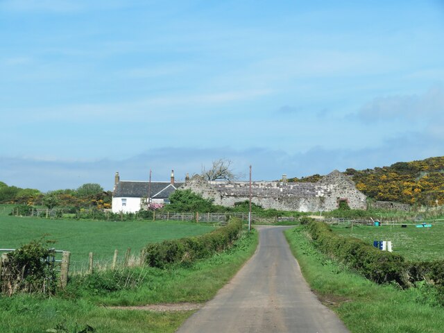
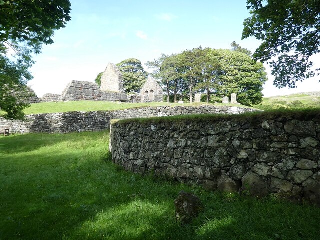
The most prominent feature of Dunstrone is its impressive stone fortifications, which were built during the medieval period. The fortress was strategically positioned to control access to the Clyde estuary, and it played a crucial role in defending the region against Viking raids. The imposing walls, towers, and gatehouses that remain today are a testament to the architectural prowess of the time.

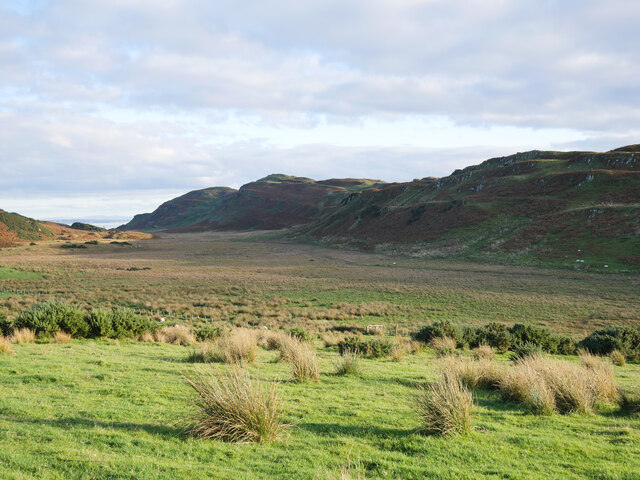
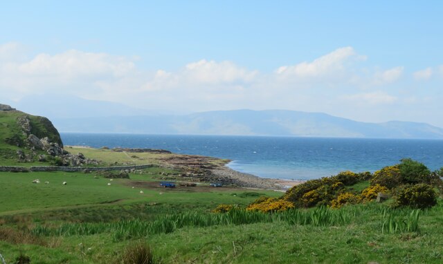
Visitors to Dunstrone can explore the ruins of the fortress and experience a glimpse of its turbulent past. The site offers breathtaking views of the surrounding landscape, including the nearby Isle of Arran and Ailsa Craig. Information boards and guided tours provide visitors with fascinating insights into the history and significance of Dunstrone.

Dunstrone is a cherished heritage site, attracting history enthusiasts, archaeologists, and tourists alike. Its enduring presence serves as a reminder of the region's rich cultural and historical heritage, making it an essential destination for those interested in Scotland's past.

If you have any feedback on the listing, please let us know in the comments section below.

Dunstrone Images

Images are sourced within 2km of 55.747/-5.052 or Grid Reference NS0854. Thanks to Geograph Open Source API. All images are credited.
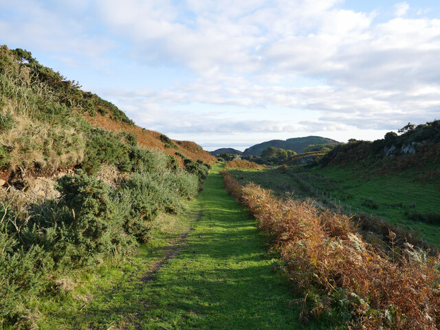
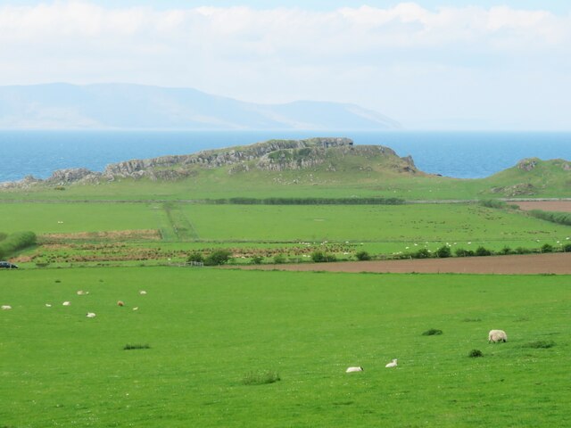
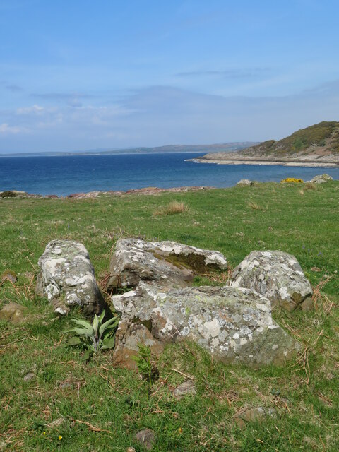
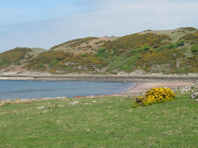
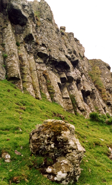
St Blane's Church A view across the churchyard to the medieval Church of St Blane in the south of the Isle of Bute.

This photograph was taken during the Coronavirus (COVID-19) pandemic of 2020/21.
St Blane's Church
A view across the churchyard to the medieval Church of St Blane in the south of the Isle of Bute. This photograph was taken during the Coronavirus (COVID-19) pandemic of 2020/21.
West Island Way above St Blane's Church This section of the West Island Way utilises an old farm track.  

This photograph was taken during the Coronavirus (COVID-19) pandemic of 2020/21.
West Island Way above St Blane's Church
This section of the West Island Way utilises an old farm track. This photograph was taken during the Coronavirus (COVID-19) pandemic of 2020/21.
View to Branzet Moss A view to Branzet Moss, and beyond Glen Callum, from the West Island Way.

This photograph was taken during the Coronavirus (COVID-19) pandemic of 2020/21.
View to Branzet Moss
A view to Branzet Moss, and beyond Glen Callum, from the West Island Way. This photograph was taken during the Coronavirus (COVID-19) pandemic of 2020/21.
The Kingarth Hotel If you are looking for a drink and some food at the southern end of Bute, then this is your choice.
The Kingarth Hotel
If you are looking for a drink and some food at the southern end of Bute, then this is your choice.
St Blane's monastic site and church What a fascinating site this is. Remains of a very early 6th century monastic site with a medieval church within its boundary. Here one can see very ancient walls with the 12thC church on the higher ground.
St Blane's monastic site and church
What a fascinating site this is. Remains of a very early 6th century monastic site with a medieval church within its boundary. Here one can see very ancient walls with the 12thC church on the higher ground.
Ancient well at monastic site Fresh water would have been a priority for the monks at the 6thC monastery here.
Ancient well at monastic site
Fresh water would have been a priority for the monks at the 6thC monastery here.
St Blane's church The ruins of the 12thC church set within the walls of the 6thC monastic site. The original monastery was destroyed by Viking raiders in the 8thC, but by 1200 that had accepted Christianity and had this church constructed. One might describe the chancel arch as 'Norman' in style, although the Normans never reached this far north.
St Blane's church
The ruins of the 12thC church set within the walls of the 6thC monastic site. The original monastery was destroyed by Viking raiders in the 8thC, but by 1200 that had accepted Christianity and had this church constructed. One might describe the chancel arch as 'Norman' in style, although the Normans never reached this far north.
Fields below St Blane's church A scattering of sheep across the field that borders the road. Ahead is the rocky headland of Dunagoil, site of a prehistoric vitrified fort.
Fields below St Blane's church
A scattering of sheep across the field that borders the road. Ahead is the rocky headland of Dunagoil, site of a prehistoric vitrified fort.
St Blane's monastic site towards St Blane's Hill Looking south from within the old monastic site towards the 123m high St Blane's Hill, most of which is composed of volcanic rocks from the carboniferous period.
St Blane's monastic site towards St Blane's Hill
Looking south from within the old monastic site towards the 123m high St Blane's Hill, most of which is composed of volcanic rocks from the carboniferous period.
Contented cattle - and a few sheep Cattle and sheep on pasture land at Garrochty Farm.
Contented cattle - and a few sheep
Cattle and sheep on pasture land at Garrochty Farm.
Burial chamber at Dunagoil This was the one item marked on the OS map that was relatively easy to find, although it is hardly a large round or long barrow. I'd describe this as a cist as it is rather small, and if it once contained a body, then it would have been in a curled position.
Burial chamber at Dunagoil
This was the one item marked on the OS map that was relatively easy to find, although it is hardly a large round or long barrow. I'd describe this as a cist as it is rather small, and if it once contained a body, then it would have been in a curled position.
Dunagoil Bay A view of the bay and part of the Dunagoil headland. The northern hills of Arran are visible in the distance.
Dunagoil Bay
A view of the bay and part of the Dunagoil headland. The northern hills of Arran are visible in the distance.
Dunagoil Bay and beach On a whirlwind tour of Bute, this struck me as the nicest sandy beach on the island. A quiet bay with a view across to Arran.
Dunagoil Bay and beach
On a whirlwind tour of Bute, this struck me as the nicest sandy beach on the island. A quiet bay with a view across to Arran.
Bluebells above the bay Bluebells above Dunagoil Bay with a view along the south west coast of the island.
Bluebells above the bay
Bluebells above Dunagoil Bay with a view along the south west coast of the island.
Track to Dunagoil Headland composed of volcanic rocks overlooking a fine sandy bay [off photo to the right]. There's traces of a vitrified fort on the highest part of the hill, a burial cist below, a couple of interesting caves, plus some items that this contributor couldn't find, such as cup marked stones and St Blane's Stone.
Track to Dunagoil
Headland composed of volcanic rocks overlooking a fine sandy bay [off photo to the right]. There's traces of a vitrified fort on the highest part of the hill, a burial cist below, a couple of interesting caves, plus some items that this contributor couldn't find, such as cup marked stones and St Blane's Stone.
Plan Road to Lubas Farm The farm appears to have a well cared for farmhouse, but some slightly decayed barns.
Plan Road to Lubas Farm
The farm appears to have a well cared for farmhouse, but some slightly decayed barns.
The three remaining stones at Kingarth Stone Circle Recently cleared forestry has revealed these stones which are all that remain of a presumed circle. One is now propped up using a metal bar, whilst the furthest one has a very 'knobbly' conglomerate surface.
The three remaining stones at Kingarth Stone Circle
Recently cleared forestry has revealed these stones which are all that remain of a presumed circle. One is now propped up using a metal bar, whilst the furthest one has a very 'knobbly' conglomerate surface.
Bute - St Blane's - Former monastery and church  A view of the ruins of St Blane's monastery and church as seen when approaching from the south.
See shared description below:
Bute - St Blane's - Former monastery and church
A view of the ruins of St Blane's monastery and church as seen when approaching from the south. See shared description below:
Show me another place!

Dunstrone is located at Grid Ref: NS0854 (Lat: 55.747, Lng: -5.052)

Unitary Authority: Argyll and Bute

Police Authority: Argyll and West Dunbartonshire

What 3 Words

///cult.opponent.soggy. Near Millport, North Ayrshire

Related Wikis

Dunagoil

Dunagoil is a vitrified fort or dun on the Isle of Bute – an Iron Age hill fort whose ramparts have been melted by intense heat. It stands on a volcanic...
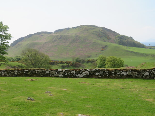
Kilchattan Bay

Kilchattan Bay is a village on the Isle of Bute, Scotland. It lies on the island's southern end, along the coast road at the foot of a steep hill called...

Strathclyde

Strathclyde (Ystrad Clud in Northern Brittonic; Srath Chluaidh [s̪t̪ɾa ˈxl̪ˠɯi] in Gaelic, meaning 'strath [valley] of the River Clyde') was one of nine...
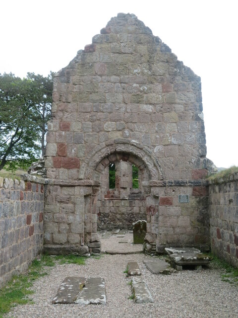
Kingarth

Kingarth (Old Irish: Cenn Garad; Scottish Gaelic: Ceann a' Gharaidh) is a historic village and parish on the Isle of Bute, off the coast of south-western...

Nearby Amenities

Located within 500m of 55.747,-5.052
Power: pole
Lat/Long: 55.7446637/-5.045187
Power: pole
Lat/Long: 55.7462746/-5.0457498
Power: pole
Lat/Long: 55.7470975/-5.0487508
Power: pole
Lat/Long: 55.7481866/-5.0462714
Power: pole
Lat/Long: 55.7478301/-5.0452007
Power: pole
Lat/Long: 55.7475704/-5.0461033
Power: pole
Lat/Long: 55.7454638/-5.0454665
Power: pole
Lat/Long: 55.7490668/-5.0464572
Power: pole
Lat/Long: 55.7498996/-5.0466407
Power: pole
Lat/Long: 55.7468794/-5.0479553
Power: pole
Lat/Long: 55.7465899/-5.0468997
The data included in this document is from www.openstreetmap.org. The data is made available under ODbL.

Have you been to Dunstrone ?

Leave your review of Dunstrone below (or comments, questions and feedback).